Advisory Archive
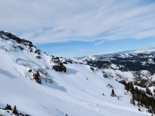
This morning the mountains have 1-2” of new snow except for the Bridger Range which received no new snow. Temperatures are high teens to mid-20s F and wind is west to northwest at 10-20 mph. Today, temperatures will reach high 20s to mid-30s F with west-northwest wind at 15-20 mph. Skies are partly sunny this morning and clouds will increase this afternoon with light snow showers. The mountains will get a trace or 1” by tomorrow with a few more inches through Wednesday.


This morning there is no new snow. Temperatures are high teens to mid-20s F. Wind is 5-15 mph out of the southwest-southeast, and north near Cooke City. Today temperatures will reach mid-30s F under mostly clear skies and wind will be west-southwest at 0-10 mph. Clouds will increase late this afternoon and bring 1-2” of new snow overnight with scattered snow showers expected tomorrow.


Since yesterday morning a trace to one inch of snow fell across the forecast area. At 5 a.m. temps range from the single digits to low teens F under clear skies. Winds are blowing 5-10 mph out of the east-northeast. Today, a ridge of high pressure will produce sunny skies and temps in the 30’s F. Winds will remain light out of the east-northeast. No snow is expected over the next 24 hours.
Since yesterday morning the mountains around Bozeman and Big Sky picked up 3-5” of new snow. The mountains near West Yellowstone and Cooke City squeezed out 1-2”. At 5 a.m. snow is diminishing and temps are in the upper teens to low 20’s F. Winds are blowing 5-15 mph out of the west-southwest. Today, skies will be mostly cloudy during the morning hours with snow flurries possible. Skies begin to clear by early afternoon and temps warm into the upper 20’s to low 30’s. Winds remain light to moderate out of the west-southwest. High pressure is in the forecast and tomorrow looks to be a nice sunny day.
Yesterday 2” of snow fell in the Bridger Range and a trace to 1” in Hyalite and Big Sky. Winds blew westerly at 20-30 mph, but lessened to 10-15 mph overnight. At 5 a.m. wind directions are scattered: northeast in the Bridger Range, west at Big Sky and south in the southern ranges. Snowfall will start this morning and drop 2-4” by tomorrow and favor the northern areas. Temperatures will remain in the 20s and winds will shift southwest at 15-25 mph, except in the Bridger Range where they will remain northeast.


At 5 a.m. the Bridger Range picked up 2” of snow with a trace to 1” falling everywhere else. Mountain temperatures are in the mid to high 20s with ridgetop winds blowing west to southwest at 10-20 mph and gusting to 30 mph. Today will be a mixed bag of cloudy skies interspersed with drizzle and scattered snow. The storm intensifies tonight and by morning I expect 2-4” of snow in the mountains with more falling tomorrow.
This morning temperatures are in the 20s F and there is no new snow. Winds are south and west at 10-20 mph with gusts of 25-35 mph. Today temperatures will reach the high 30s F and into the 40s F. Cloud cover will increase through the day. Winds will be 15-25 mph out of the south and southwest. Snow flurries tonight won’t bring significant accumulation.


Last night the mountains near Cooke City received 6” of snow, 2-3” fell near Big Sky and Hyalite, and a trace to 1” fell in the Bridger Range and near West Yellowstone. This morning temperatures range from high teens to high 20s F under mostly cloudy skies, and wind is southwest at 5-15 mph. Today temperatures will reach high 30s F with increasing sun. This afternoon southwest wind will increase to 10-25 mph. The next chance for snow is Tuesday night through Thursday.


Since yesterday morning the mountains have no new snow. This morning temperatures range from high 20s F in the Bridger Range to teens F near Cooke City, and mid-20s F elsewhere. Wind is 5-15 mph out of the east to northeast. Today wind will be 5-15 mph out of the east-southeast. Temperatures will reach high 30s F with increasing clouds and light snow and rain this afternoon. By tomorrow 1-3” of snow is possible in the southern mountains with 1” possible near Bozeman.

Yesterday, a fast moving squall dropped a trace to 1” of snow in the mountains south of Bozeman. This morning, skies are partly cloudy and temps range from the upper 20’s to low 30’s F. Winds are blowing 10-20 out of the west-southwest. Today, skies remain partly to mostly cloudy and a few snow showers are possible in the southern mountains. Highs today warm into the low to mid 30’s F and winds remain light to moderate out of the west-southwest. Another inch or two is possible by tomorrow morning in the mountains south of Bozeman.