Good morning. This is Alex Marienthal with the Gallatin National Forest Avalanche Forecast issued on Sunday, March 31st at 6:45 a.m. Today's forecast is sponsored Grizzly Outfitters and the Friends of the Avalanche Center. This forecast does not apply to operating ski areas.
This morning there is no new snow. Temperatures are high teens to mid-20s F. Wind is 5-15 mph out of the southwest-southeast, and north near Cooke City. Today temperatures will reach mid-30s F under mostly clear skies and wind will be west-southwest at 0-10 mph. Clouds will increase late this afternoon and bring 1-2” of new snow overnight with scattered snow showers expected tomorrow.

All Regions
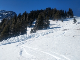
The 3-6” of new snow that fell on Friday creates isolated avalanche hazards today, and avalanches sliding deeper than the new snow are unlikely (video, photo). Yesterday in Hyalite and the Bridger Range skiers triggered wet and dry loose snow avalanches (photo). In the northern Bridger Range a snowmobiler triggered a small wind slab on a north facing slope (photo). Today be alert for similar types of slides where the snow surface is dry, such as high elevation north and east facing slopes. These slides are likely not large enough to bury a person, but have high consequences if they push you over rocks, cliffs or into trees. Assess terrain you plan to ride for consequences of being caught in even a small slide.
On slopes that receive direct sun there is a frozen crust this morning, which makes avalanches unlikely. When this crust melts small wet loose slides are possible. I expect relatively cool temperatures today to minimize wet snow avalanche activity, but if you travel in steep terrain monitor the snow surface to assess wet snow avalanche potential. Watch Eric’s video from Beehive yesterday where he saw the new snow quickly become wet and cohesive. Today if the crust on the surface melts and you see roller-balls and pinwheels of snow, find slopes with colder dry snow or lower angle terrain (photo). If you see these signs also be cautious of steep, rocky terrain above you where natural loose snow slides could start (photo), and minimize time on slopes below large cornices (photo, photo).
Today the snowpack is generally stable, isolated instabilities are confined to the upper 3-6” of the snowpack, and avalanche danger is LOW.
If you get out and have any avalanche or snowpack observations to share, contact us via our website, email (mtavalanche@gmail.com), phone (406-587-6984), or Instagram (#gnfacobs).
Upcoming Avalanche Education and Events
Spring is here and wet snow avalanches are becoming a daily concern. Anticipate decreasing stability while forming a travel plan. This article from Backcountry Magazine highlights some things look for that indicate when it is time to turn around.