
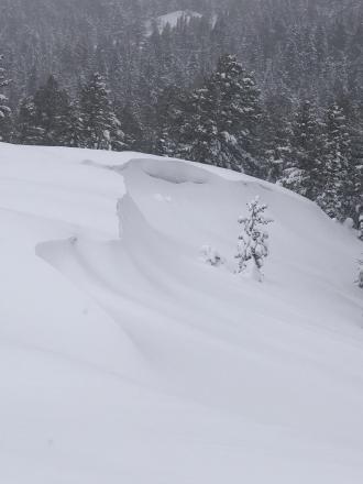
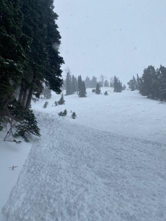
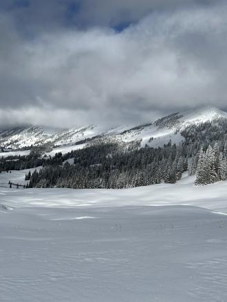
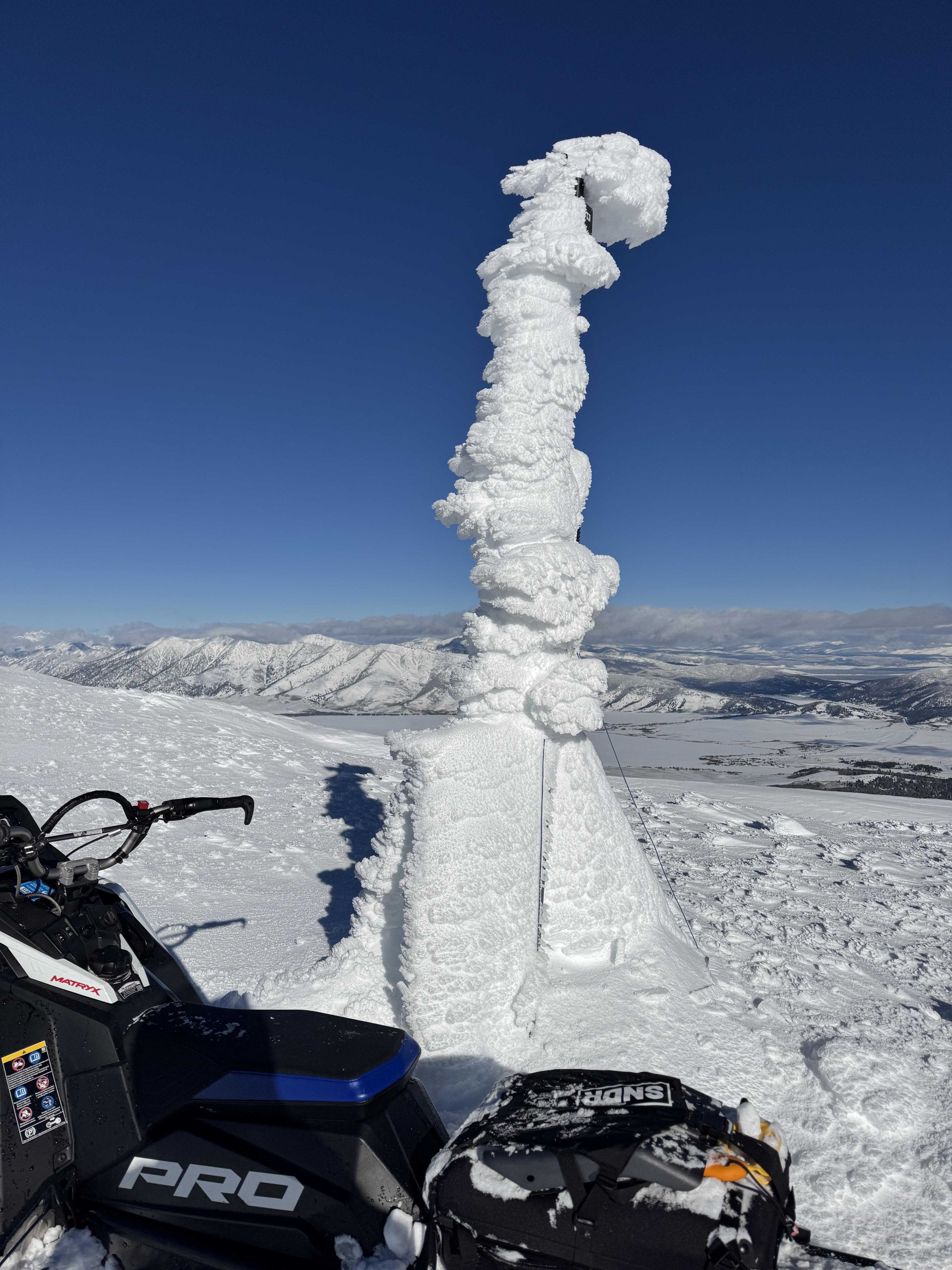
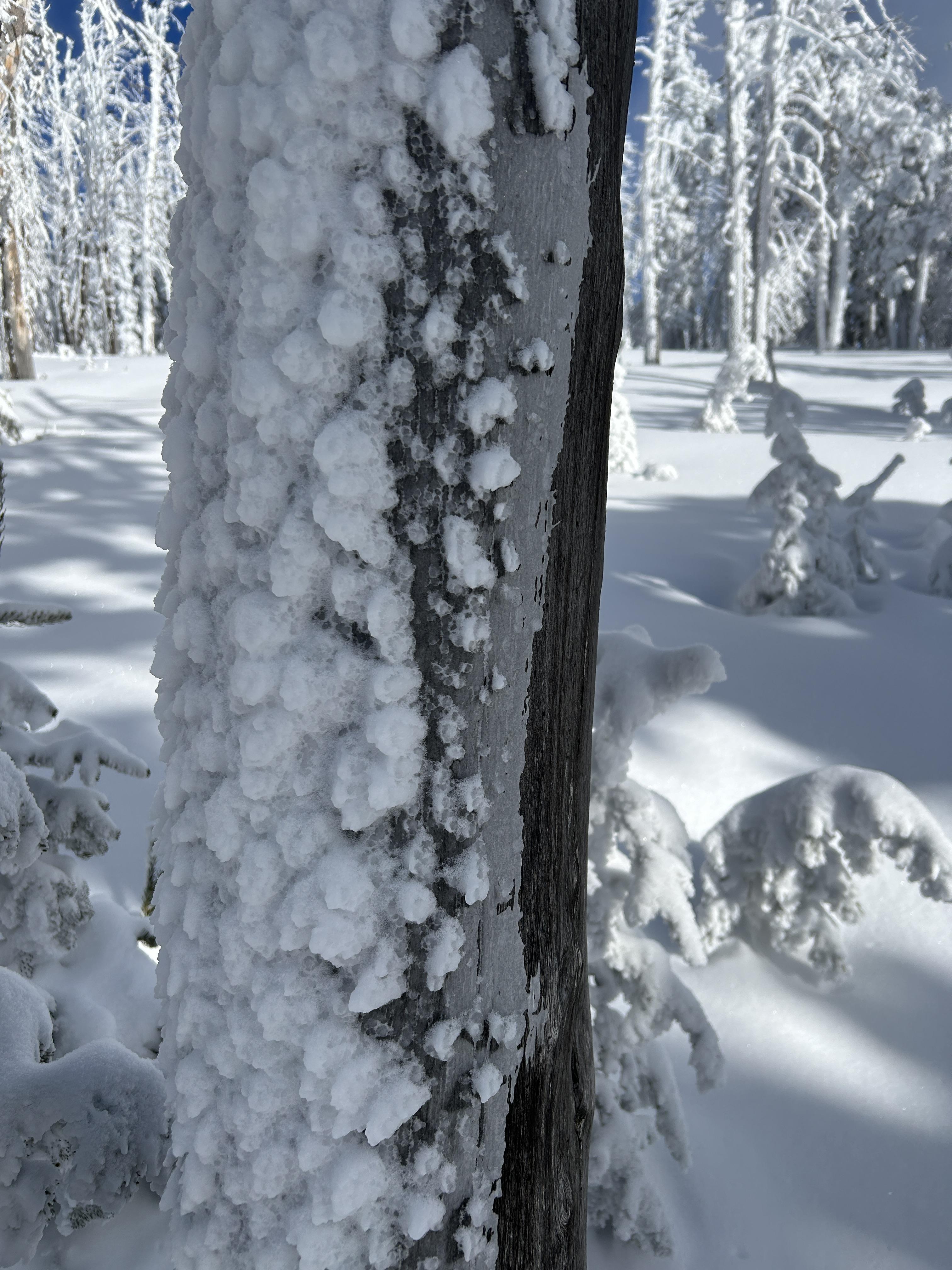
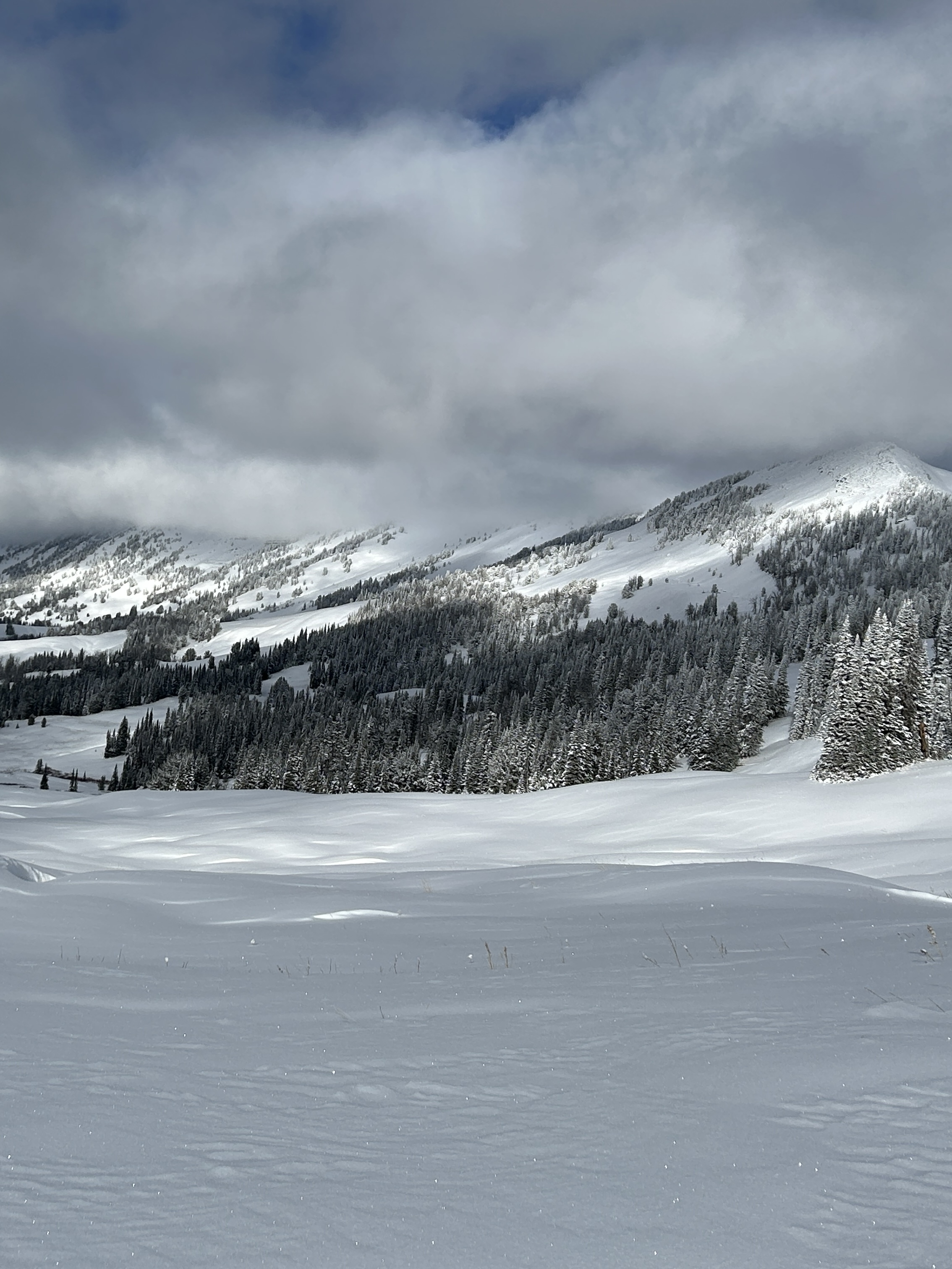
All elevations in Island Park experienced heavy snowfall combined with high winds,this made for unstable wind slabs and cornices. Photo: K Allred
Trip Planning for Island Park

Primary Problem: Wind Slab
Bottom Line: The primary avalanche concern is wind slab avalanches where yesterday’s strong wind drifted recent snow into slabs up to a couple feet thick. These slabs are possible for a person to trigger today. Avoid steep, recently wind-loaded terrain, typically found near ridgelines, identifiable by cornices above or a textured or rounded snow surface. Near West Yellowstone, weak layers buried in late January continue to result in persistent slab avalanches up to 4 feet deep. These slides have not been huge, but large enough to be deadly, especially in much of the terrain where they have occurred, with trees or depressions at the bottom where snow can pile up deep.Past 5 Days
Wed Mar 19

Considerable
Considerable
Thu Mar 20
Considerable
Considerable
Fri Mar 21
Considerable
Considerable
Sat Mar 22
Considerable
Considerable
Sun Mar 23

Moderate
Moderate
Relevant Avalanche Activity
Island Park
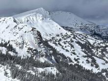
CENTENNIAL RANGE
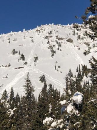
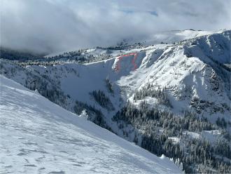
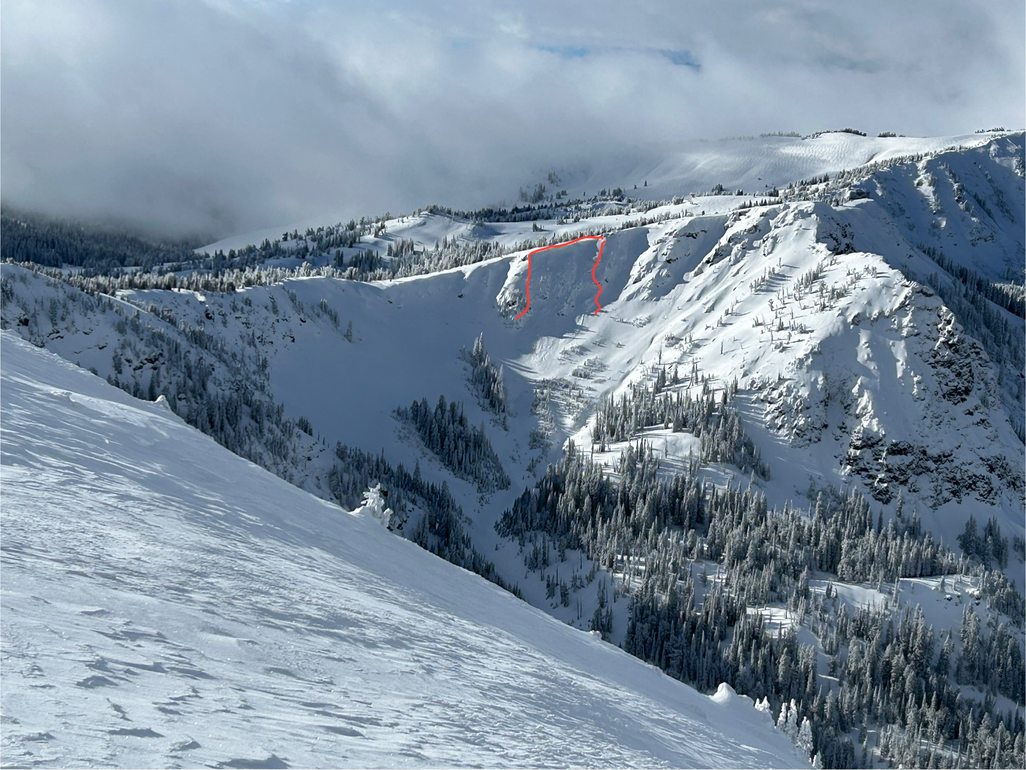
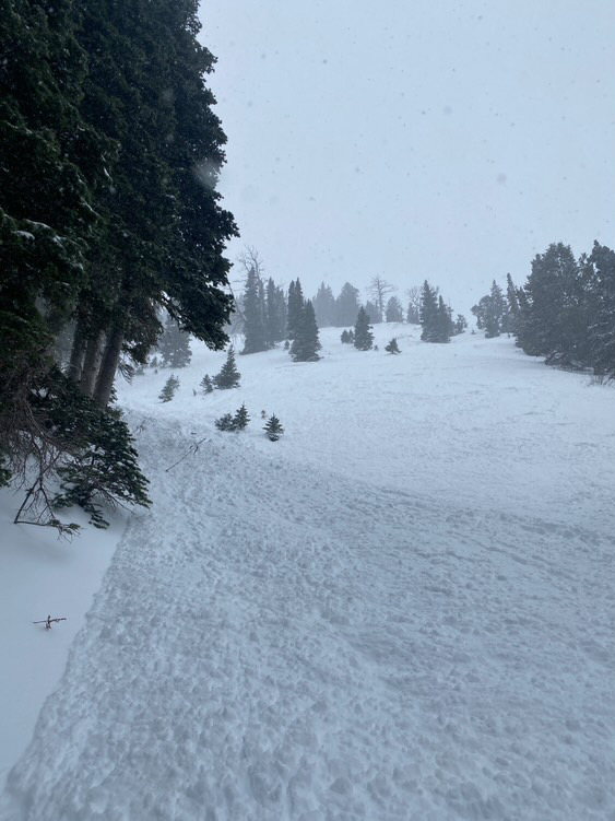
Island Park soft slabs
CENTENNIAL RANGE
SS-N-R1-D2-I
Elevation: 8,800
Aspect: N
Coordinates: 44.5602, -111.4630
Caught: 0 ; Buried: 0
More Avalanche Details
SS-N-R1-D2-I
Elevation: 8,800
Aspect: N
Coordinates: 44.5602, -111.4630
Caught: 0 ; Buried: 0
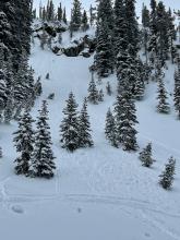
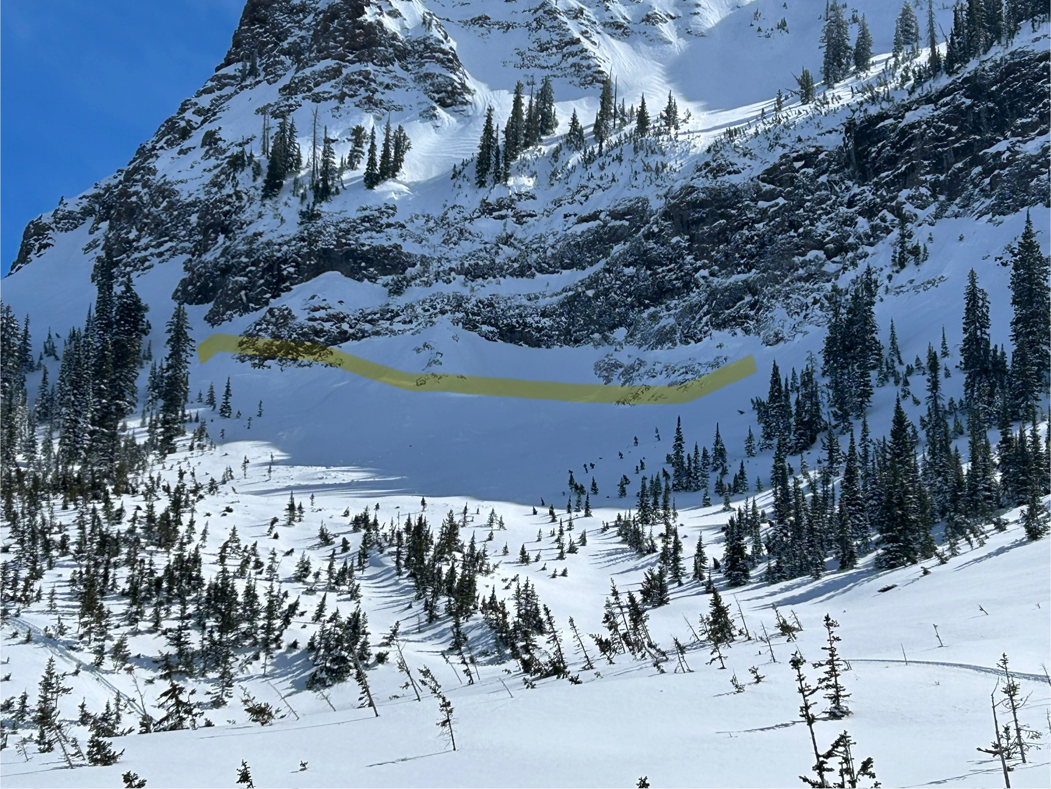
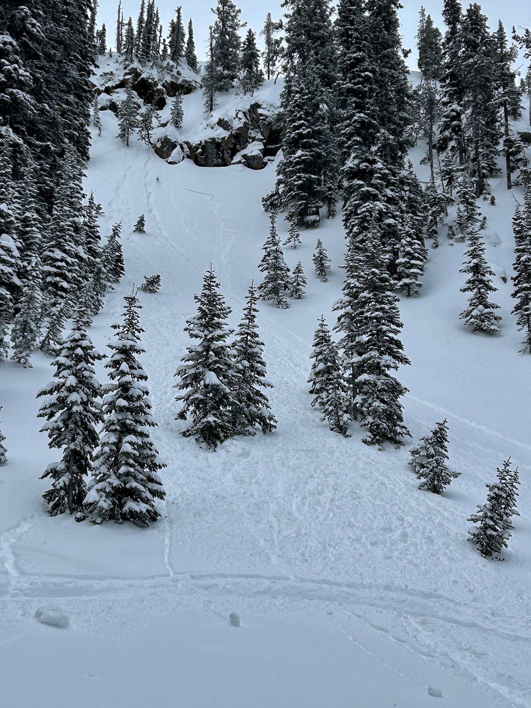
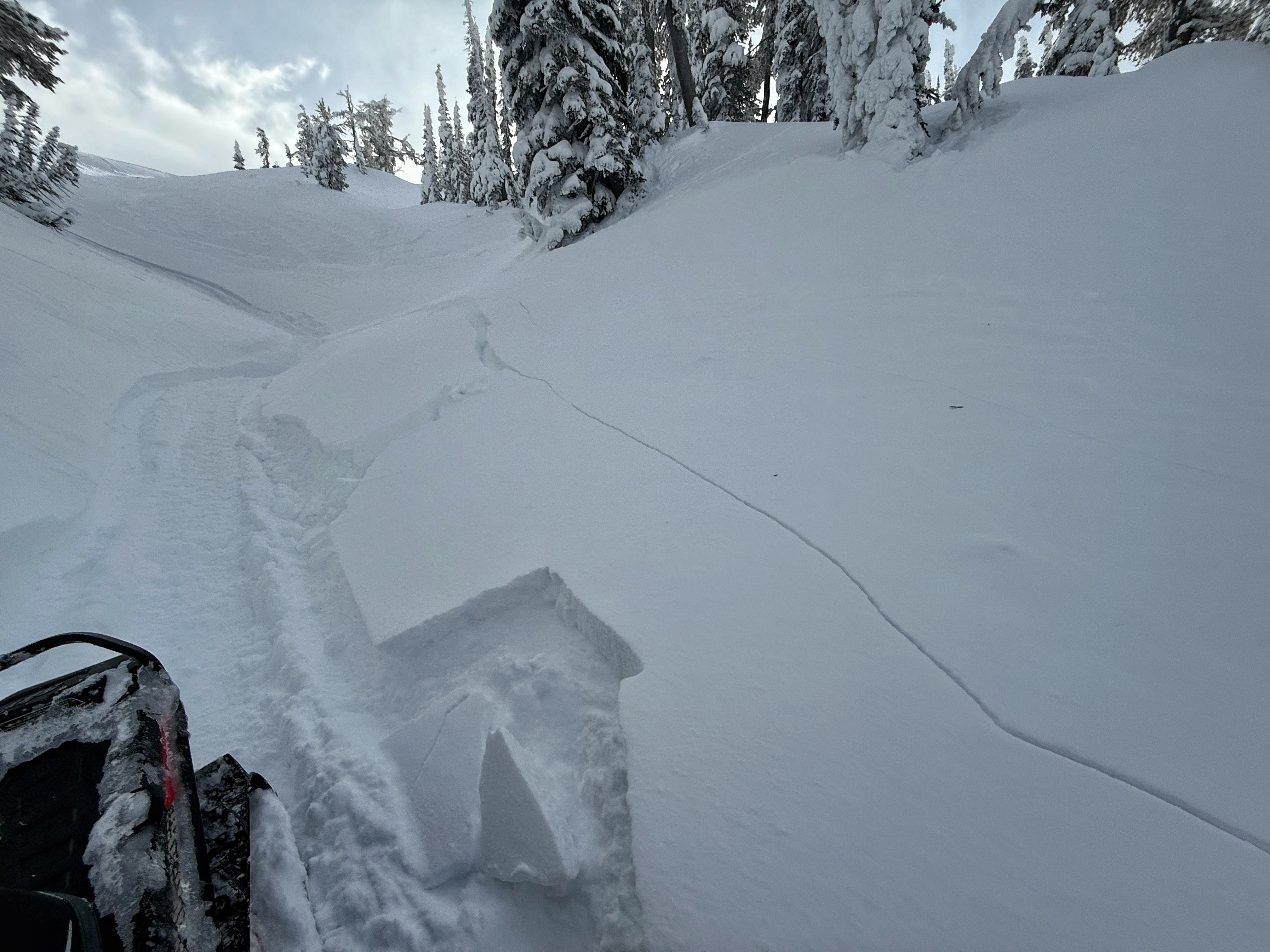
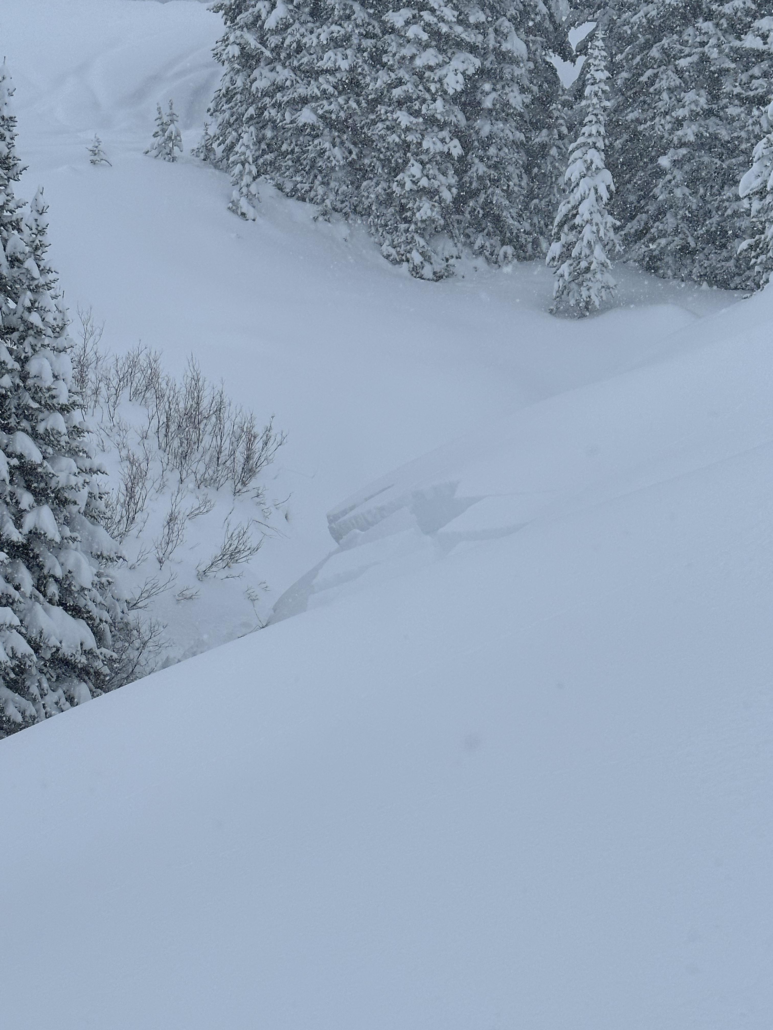
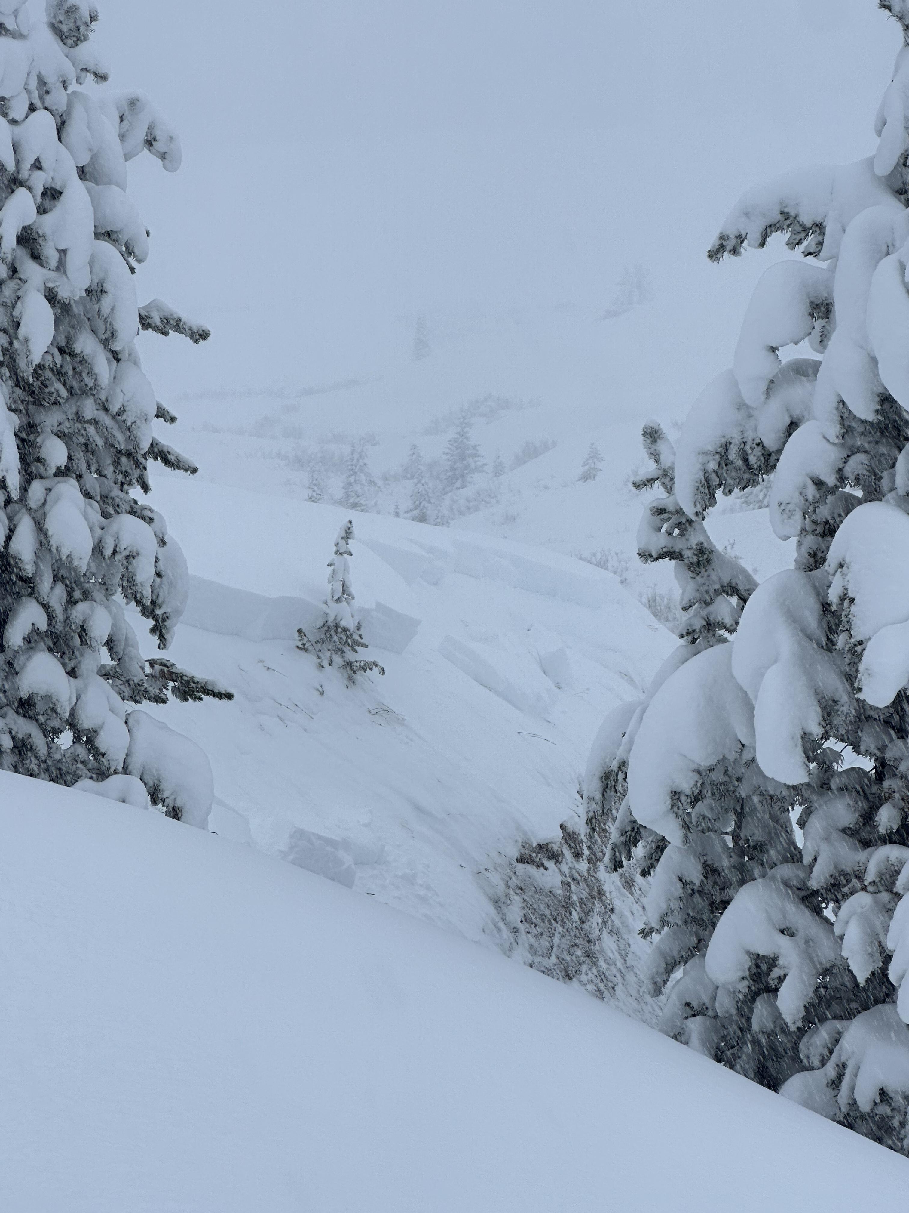
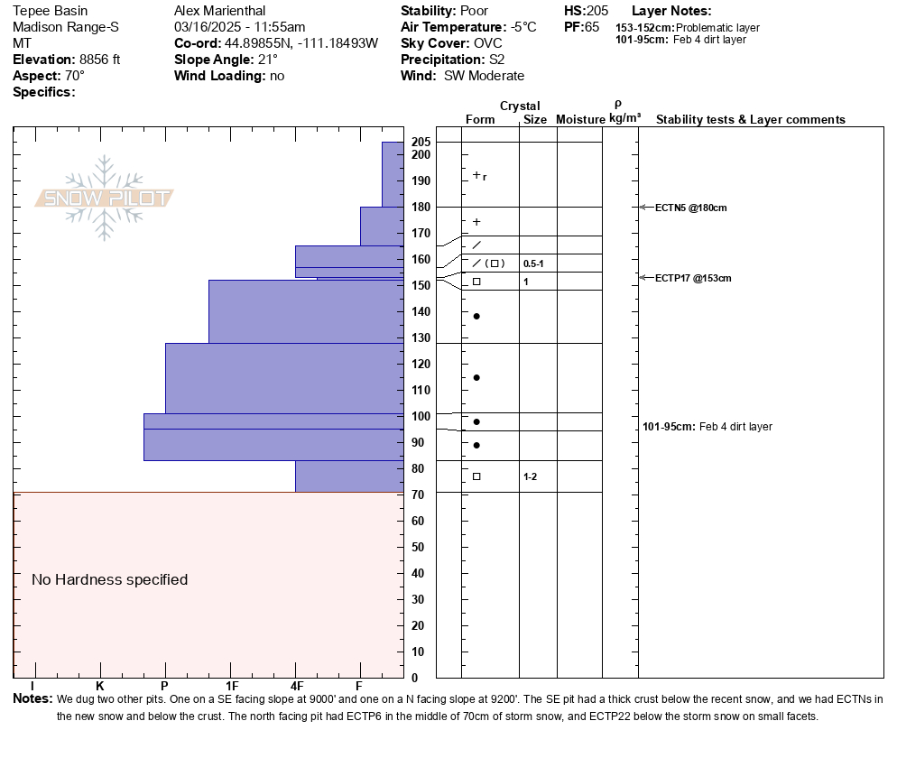
We observed two very recent natural storm slab avalanches about a 1.5 feet deep. One of them entrained a significant amount of snow an ran a long ways.
More Avalanche Details
Relevant Photos
Displaying 1 - 40
-
-

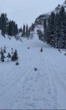
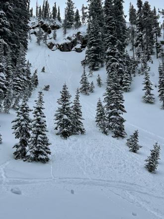
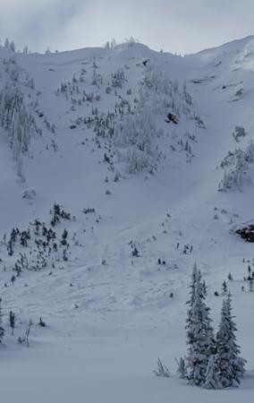
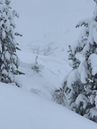
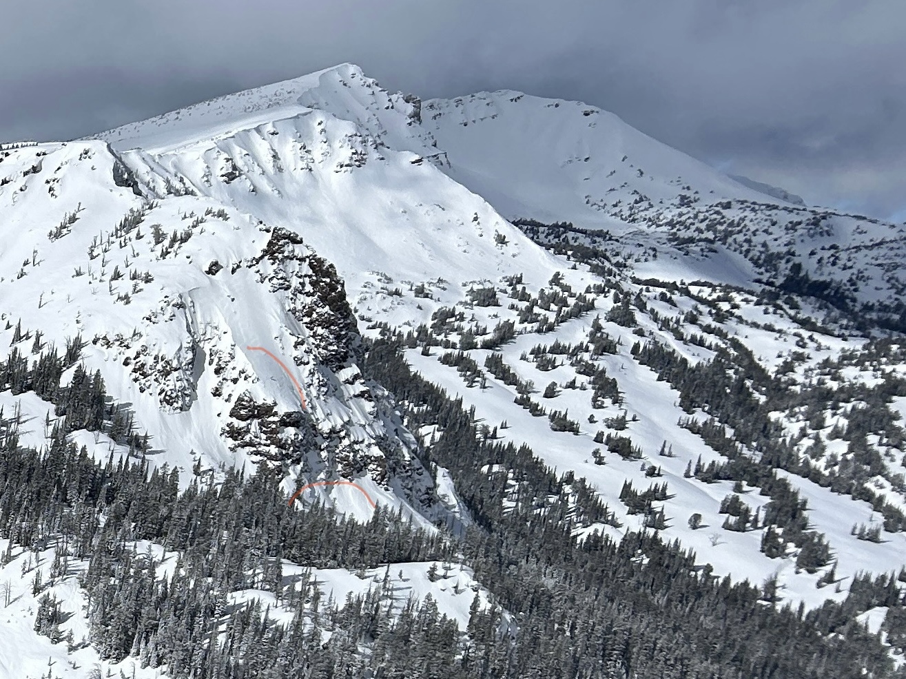
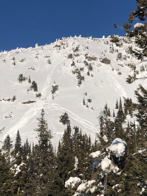
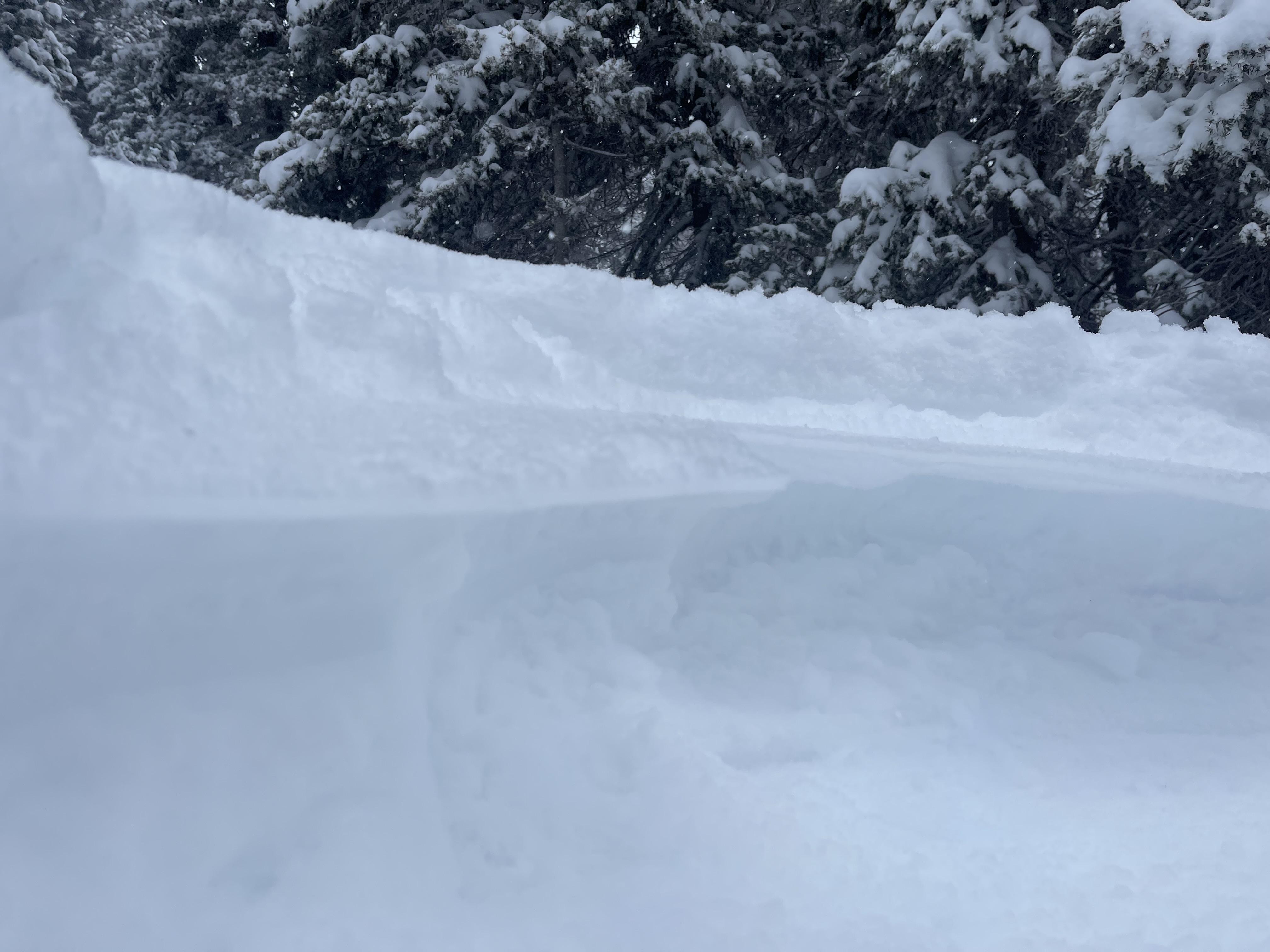
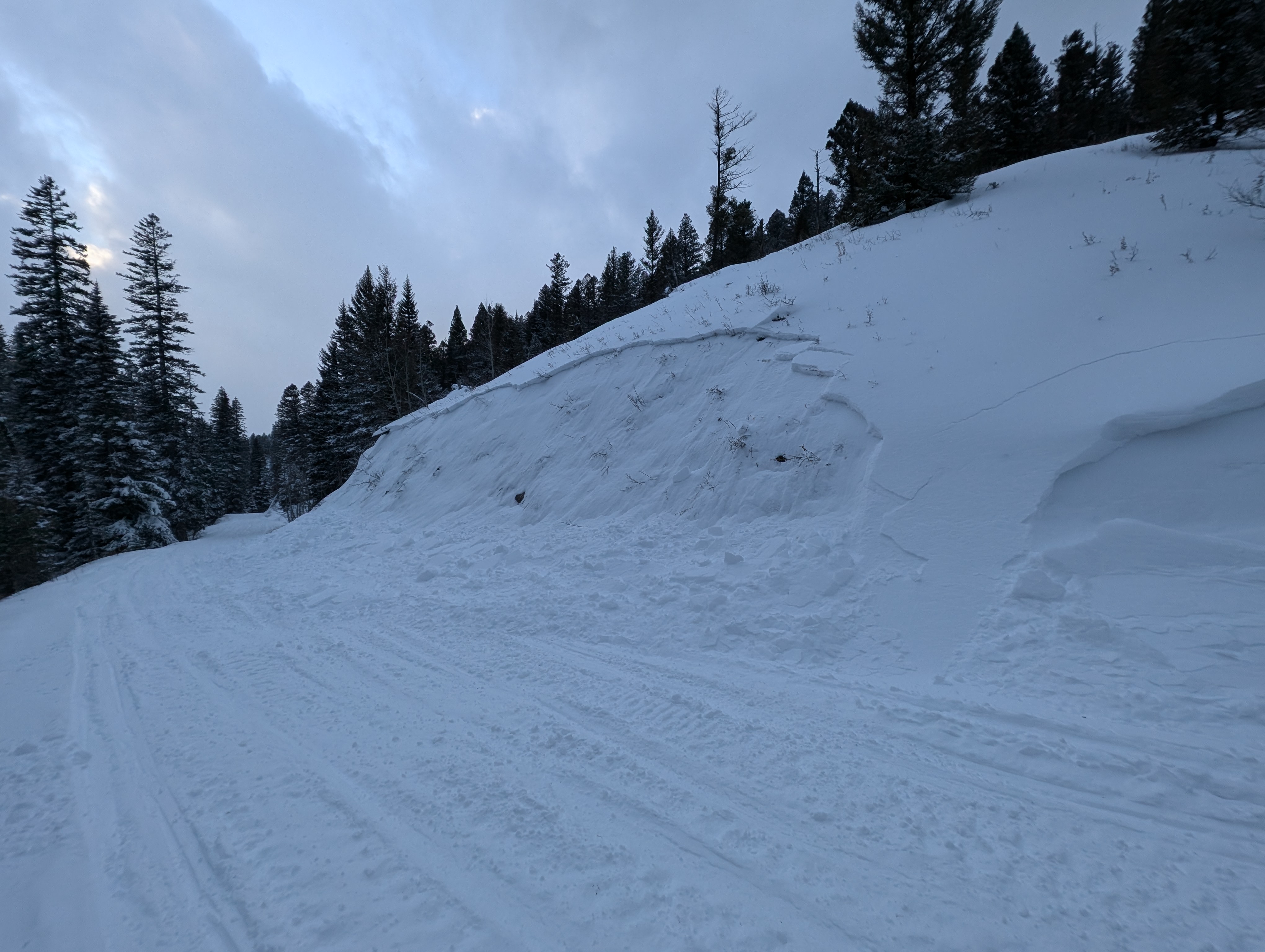
We saw a handful of avalanches above treeline terrain that seemed to be wind slabs. However wind and snow had obscured them and I suspect there had been a lot more.
-

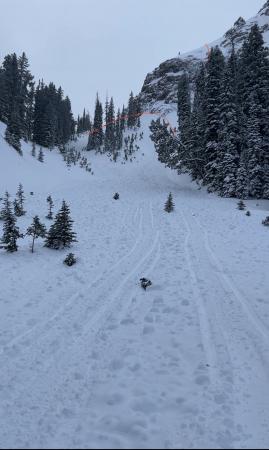
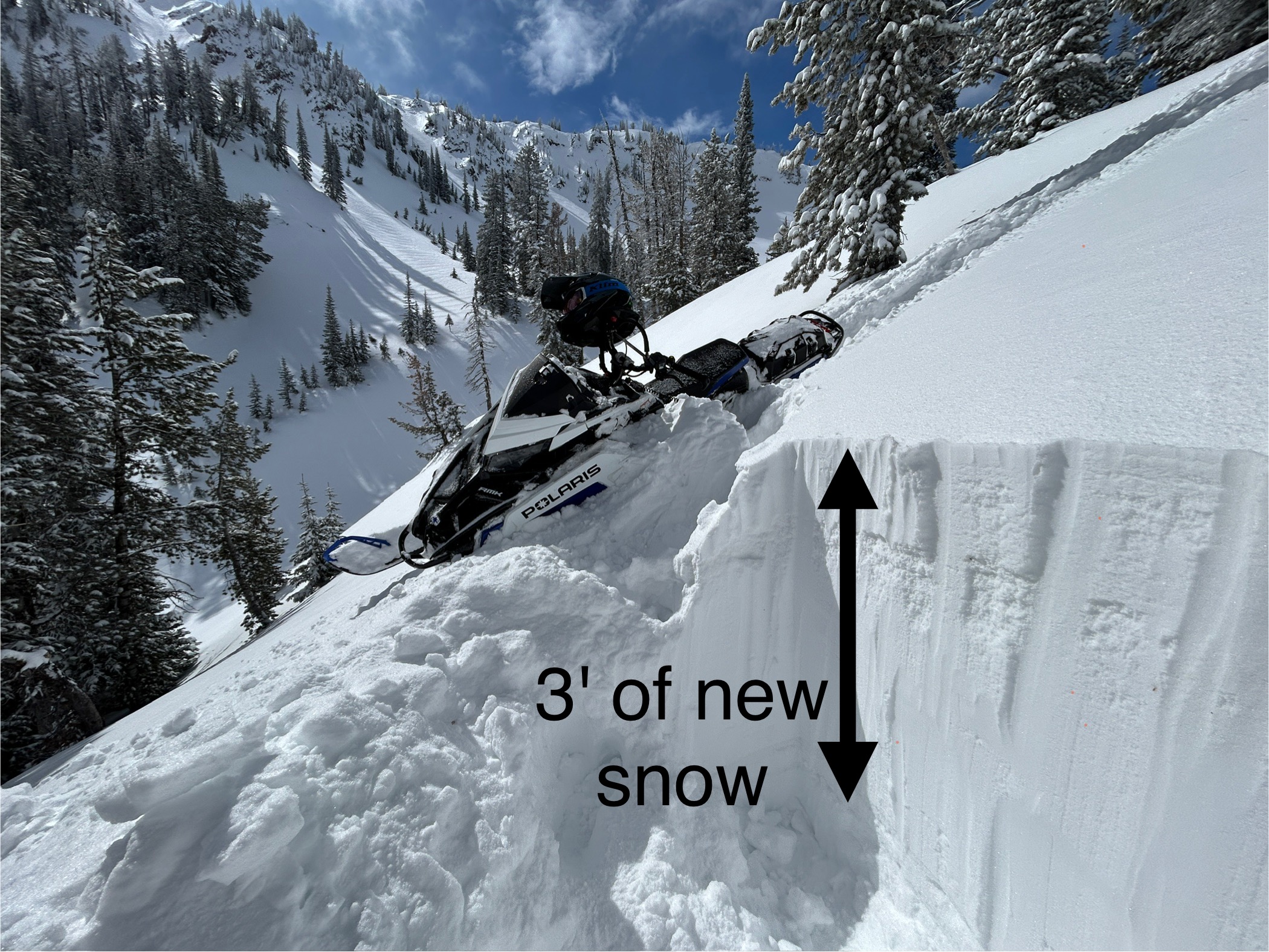
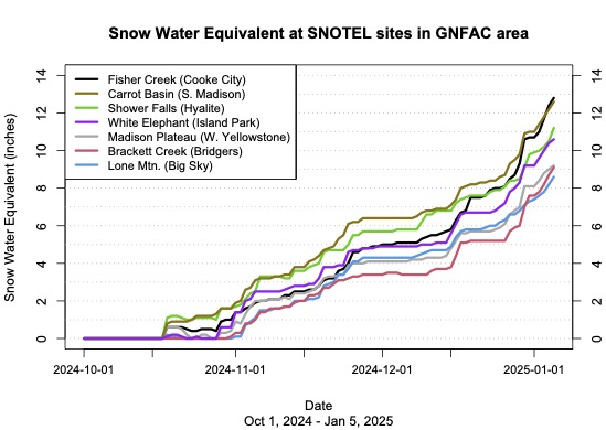
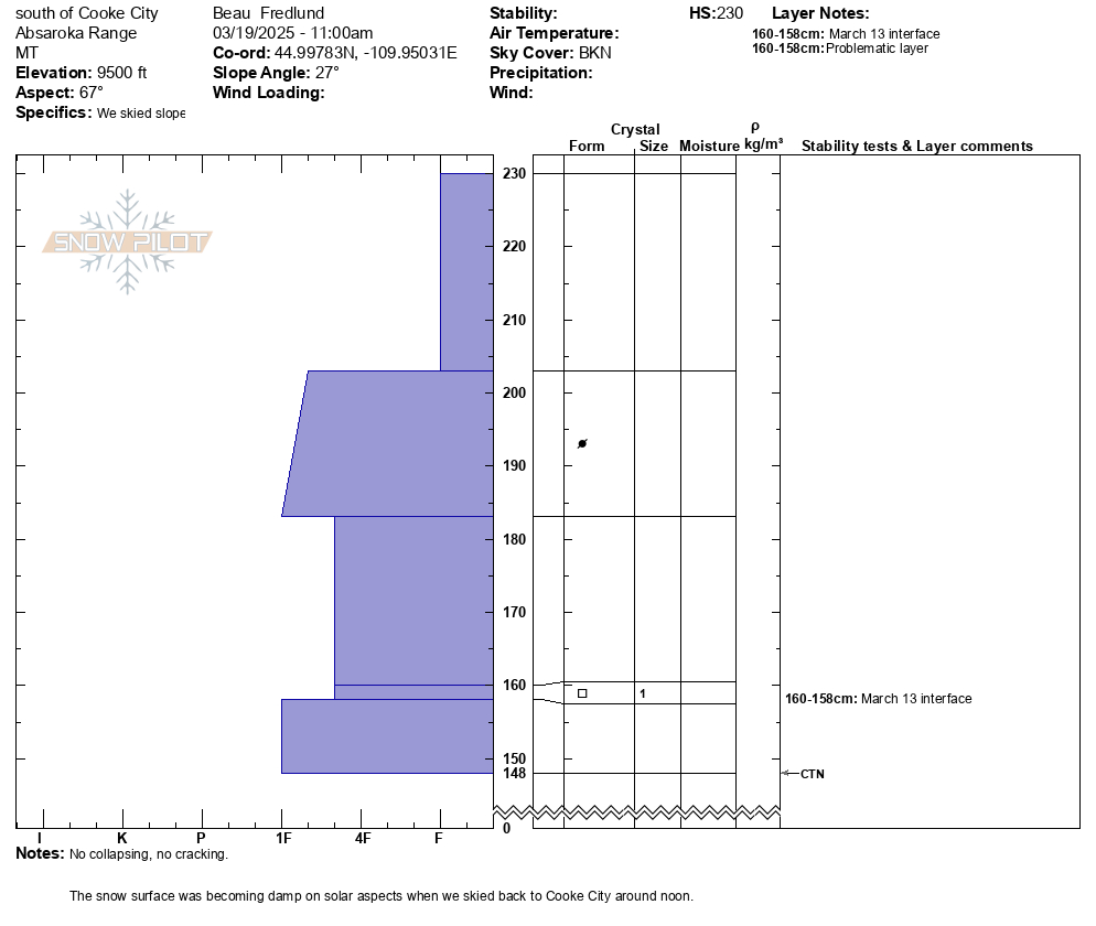
In the last five days, this area has received snowfall containing 4.5-5.3 inches of water which has settled to about 3 feet of new snow.
-

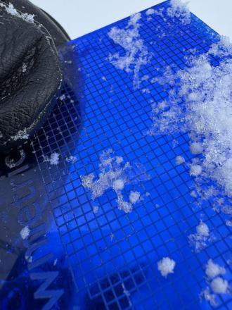
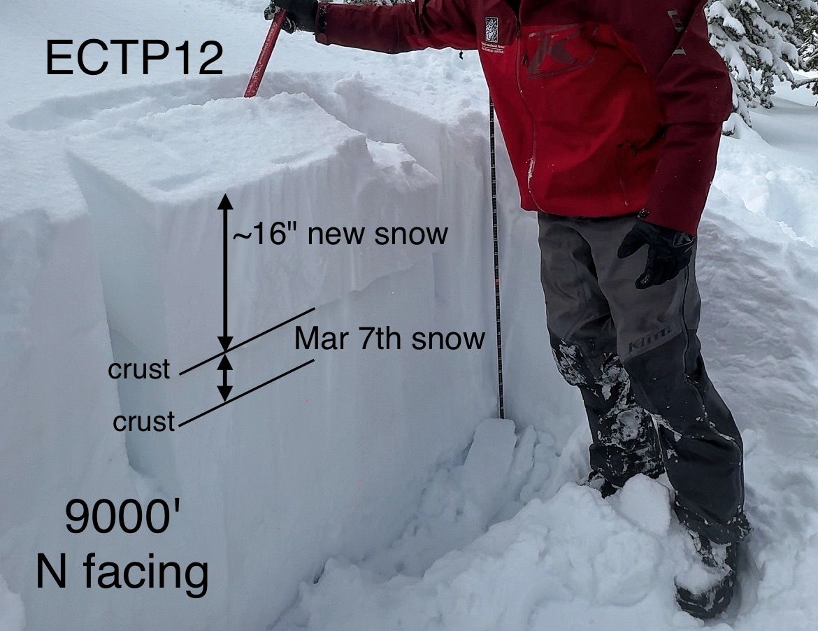
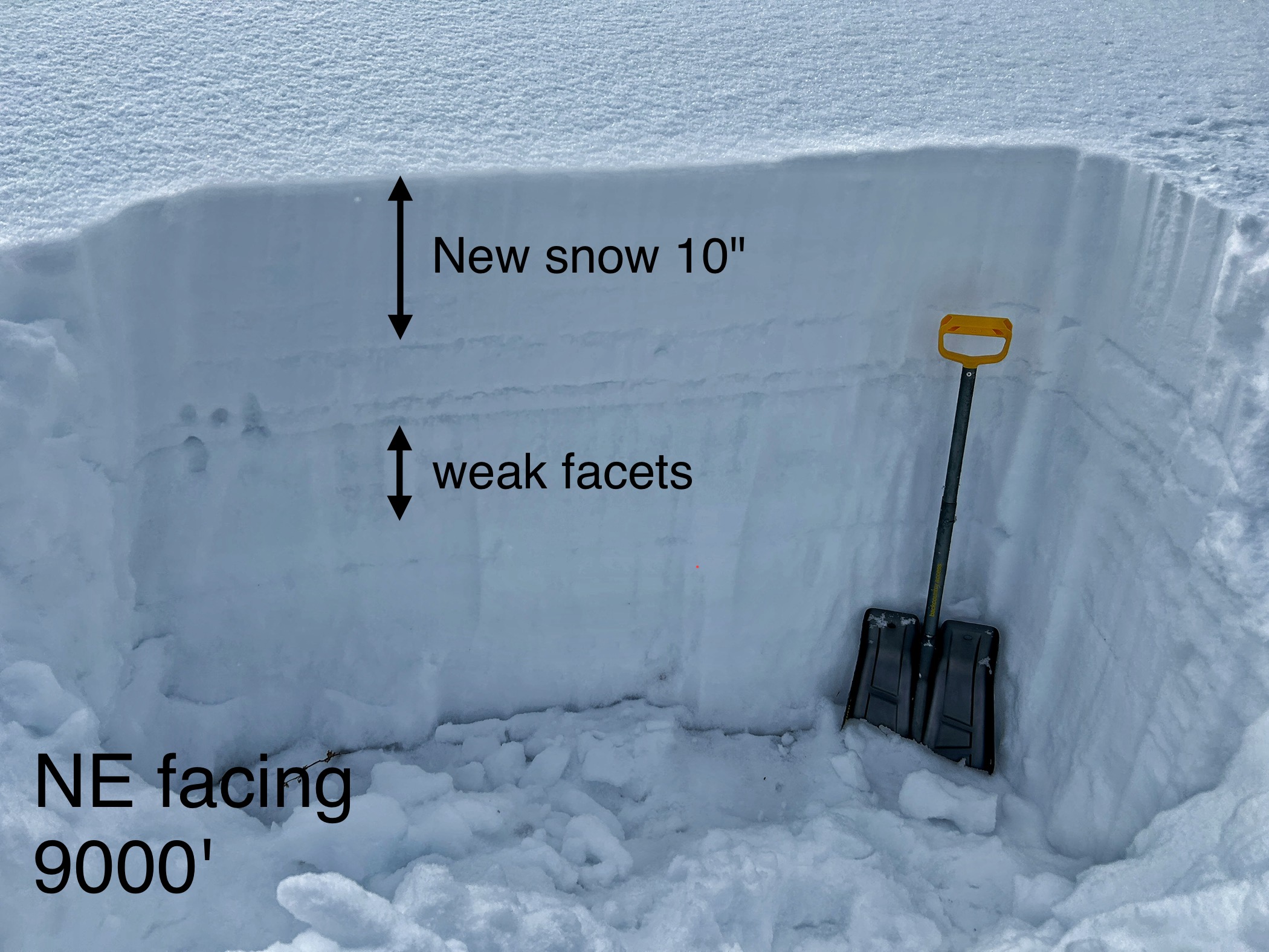
Stability tests continually fractured on old, broken snowflakes just under a crust under the new snow about 16" deep
-
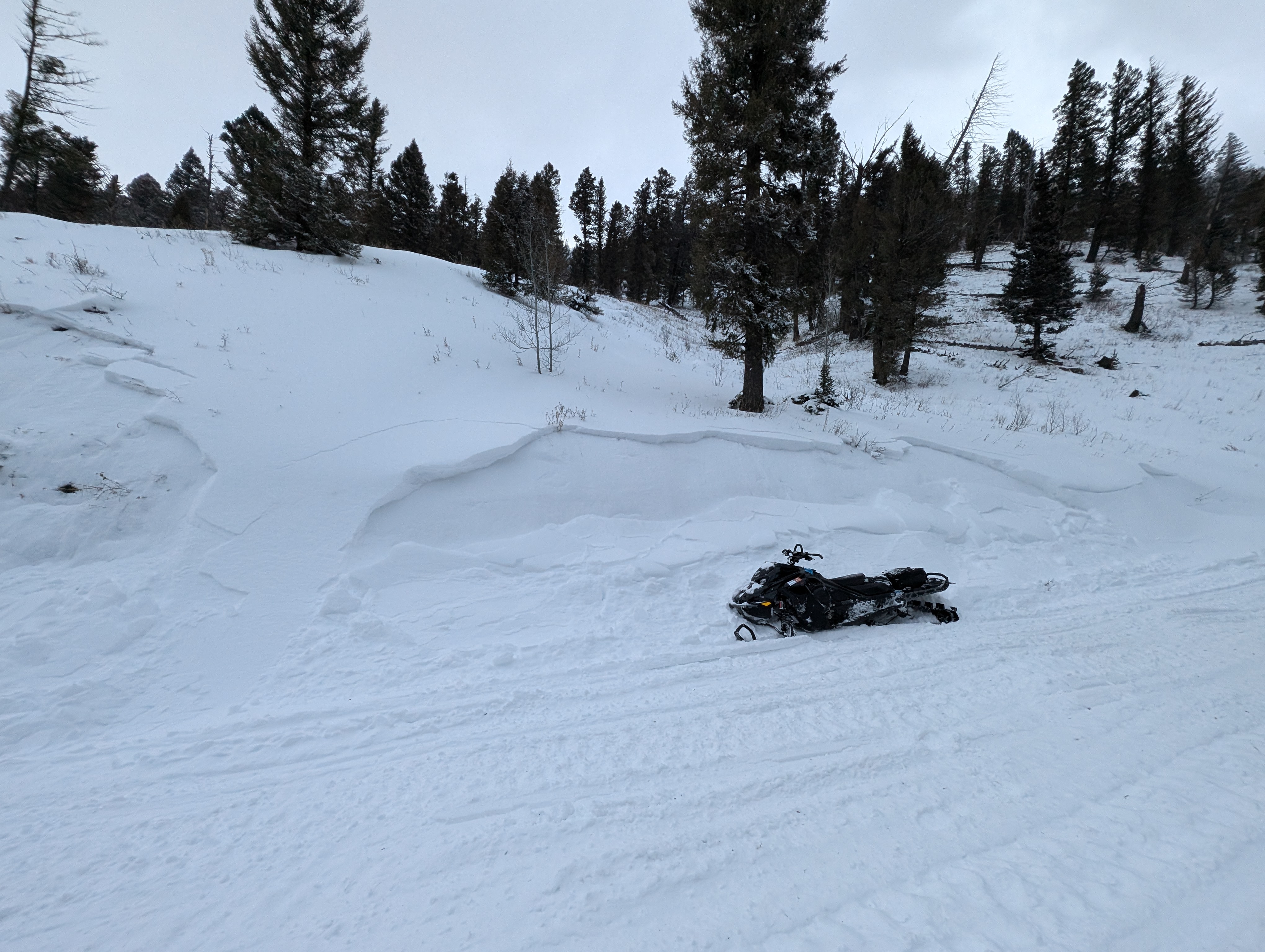
Small natural storm slab
-
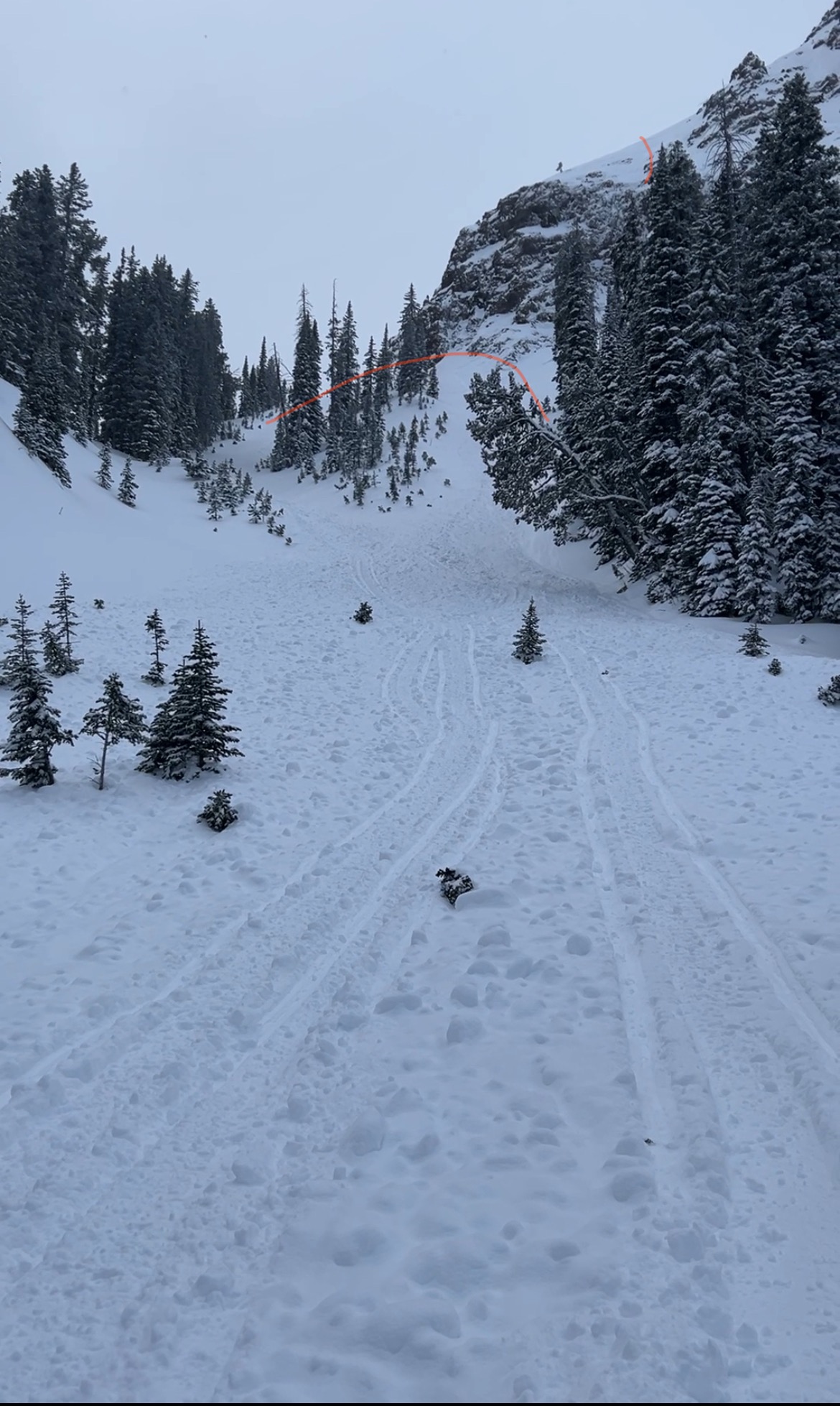
This avalanche started on a slope above the rocks where there was more wind and then triggered another storm slab in the trees. It created a significant debris pile.
-
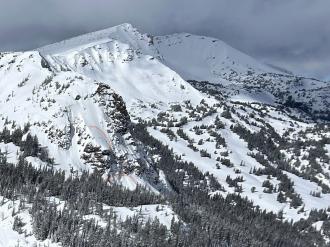
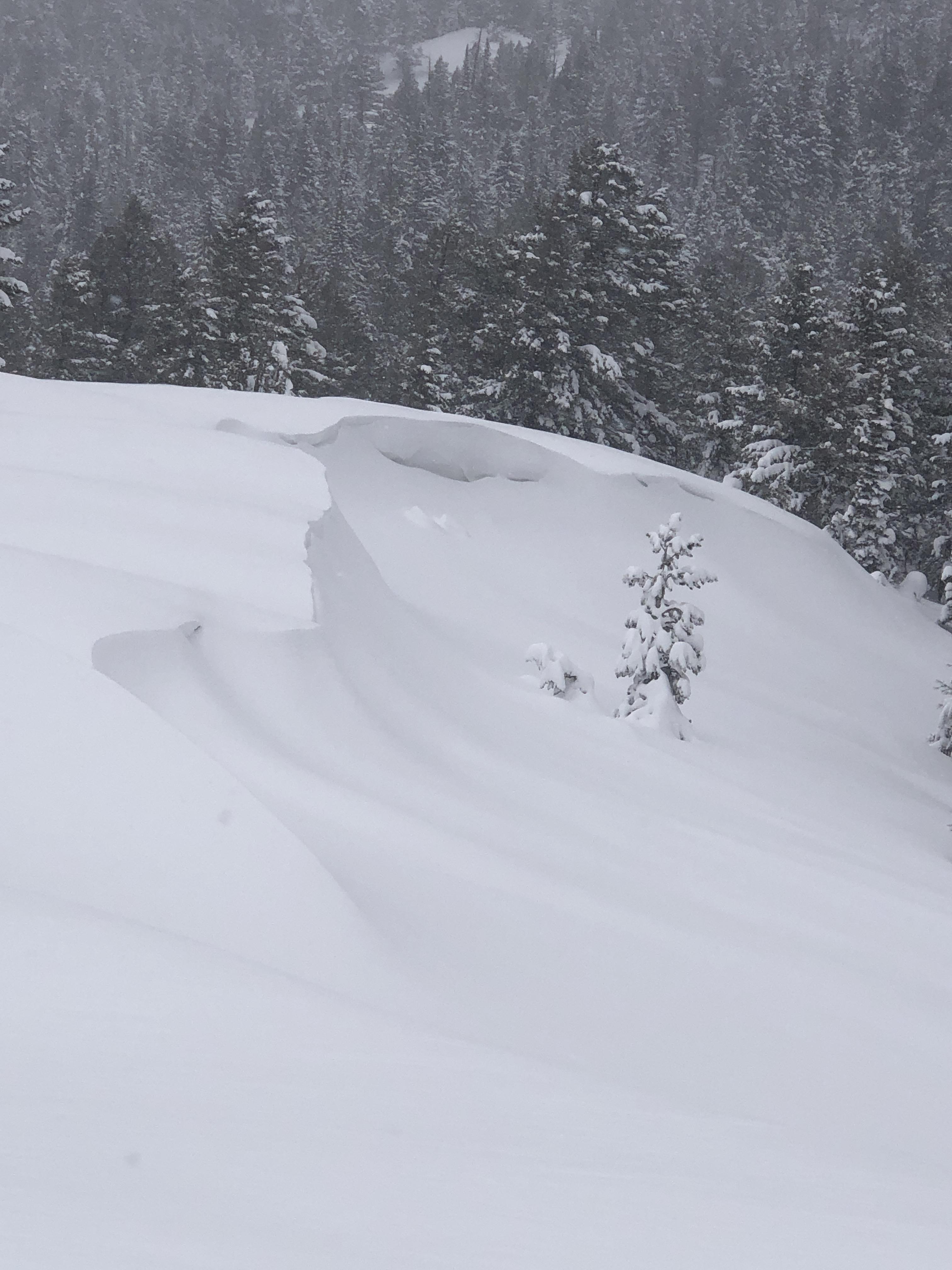
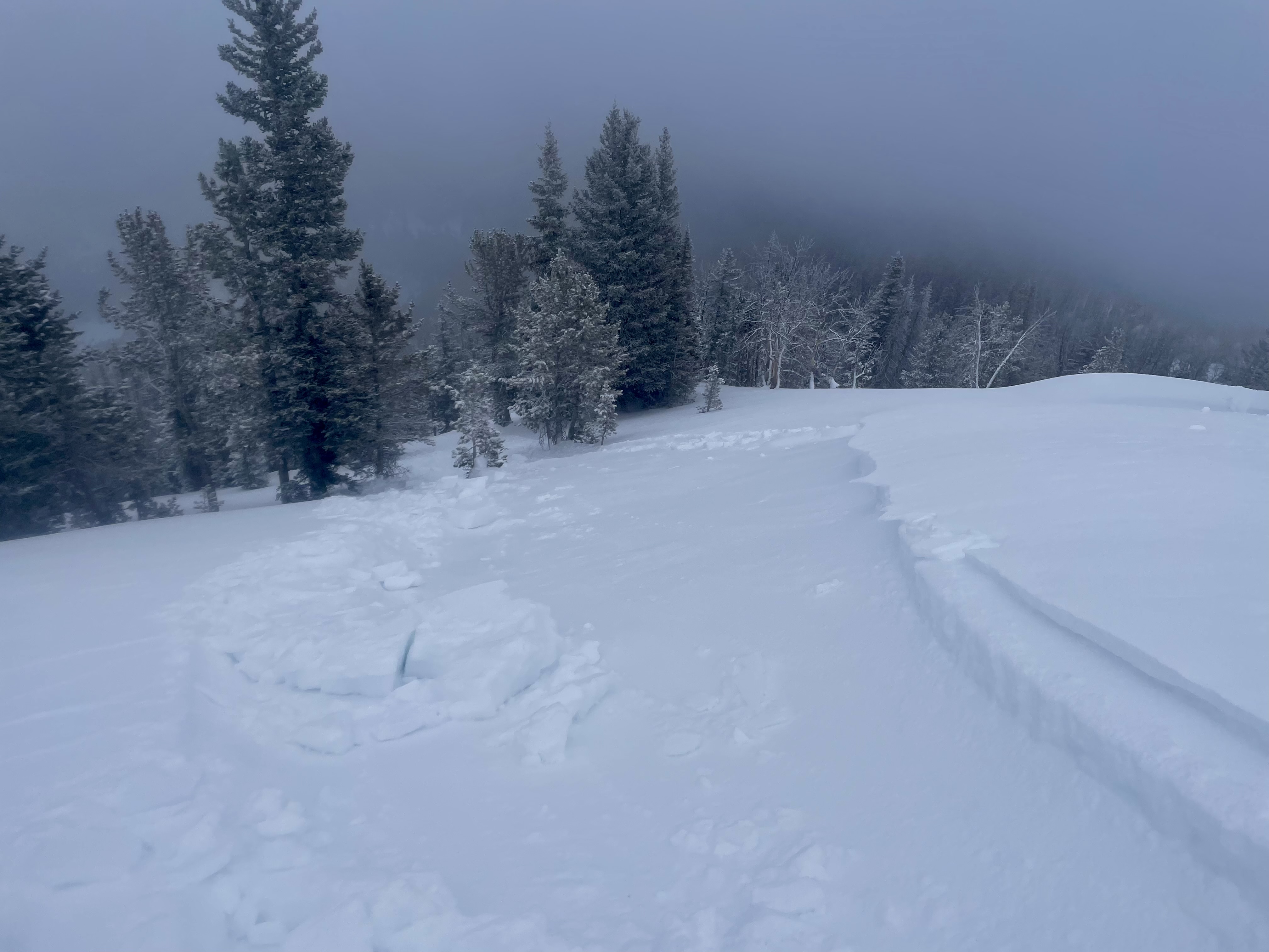
Light red lines indicate crown faces of this natural avalanche. It likely started as a wind slab/storm slab above the rocks, then dropped down onto the slope below triggering a storm slab avalanche that entrained a significant amount of snow and created a big debris pile.
-
Two Point release avalanches on south slope of Two Top. 1/30/25. Photo: K. Allred
-
Wide spread layer of Surface Hoar mid and upper elevations Two Top area
-
Shooting crack in a fresh wind slab near Mt Jefferson
-
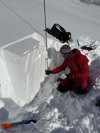
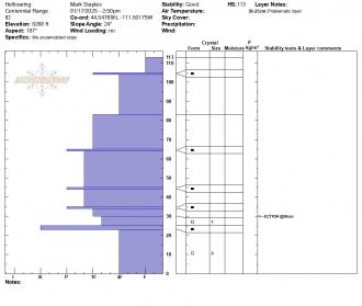
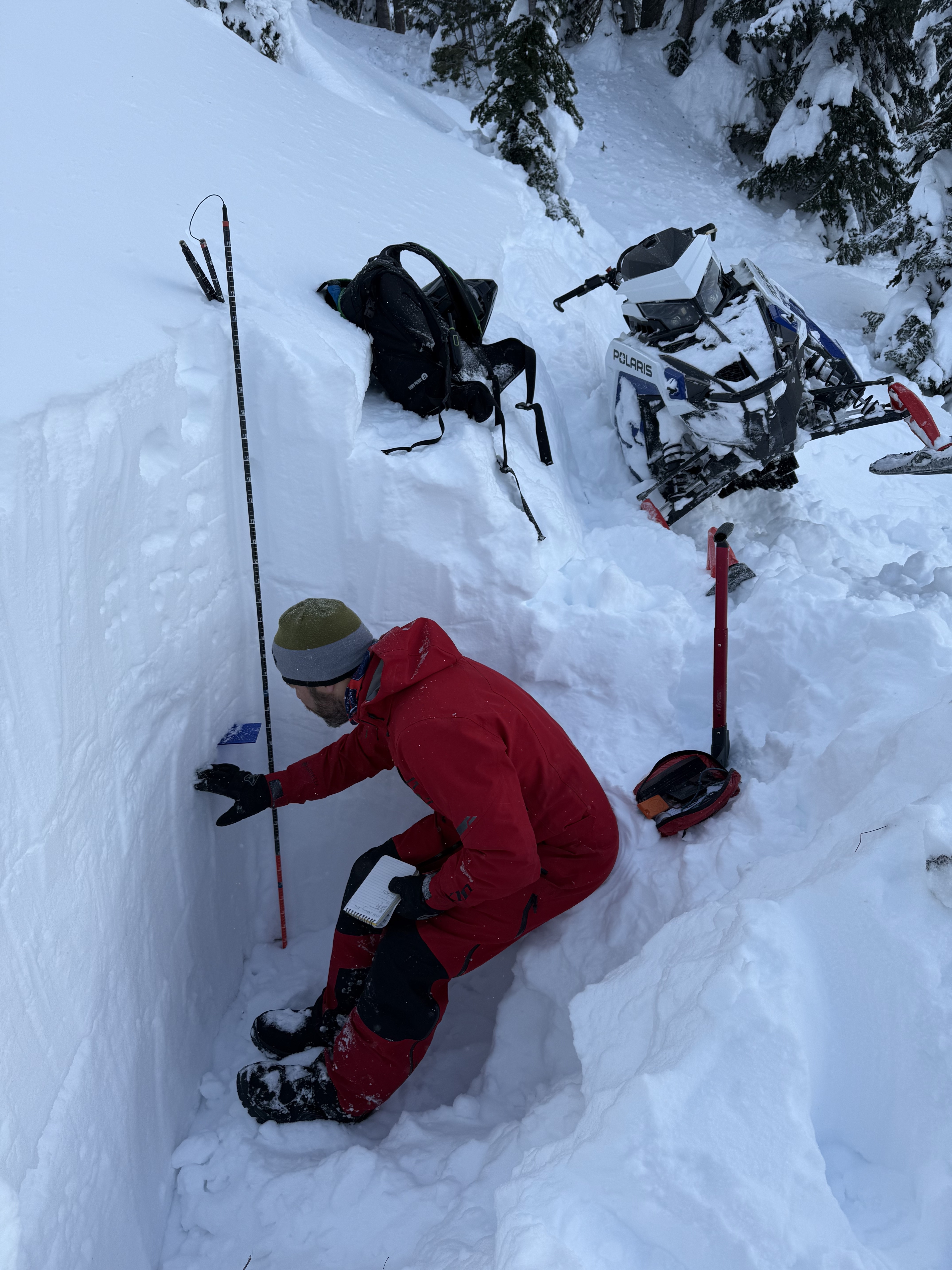
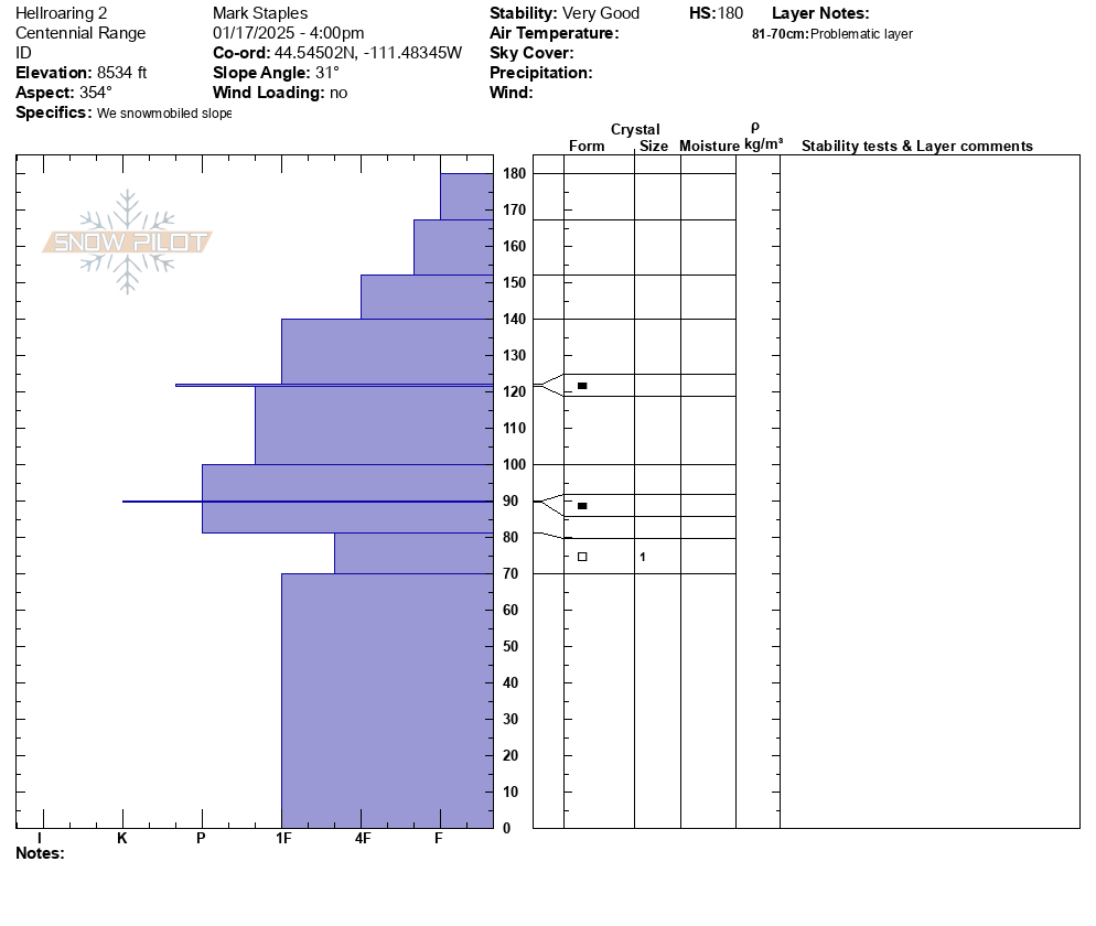
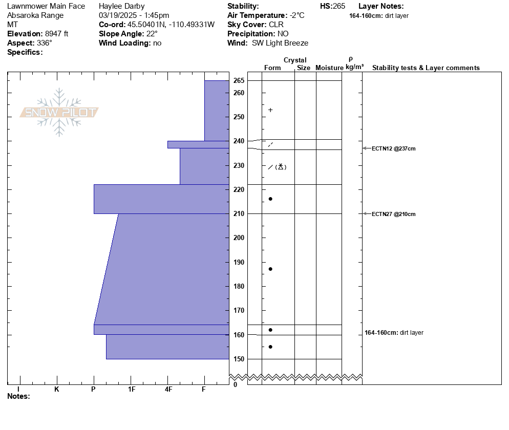
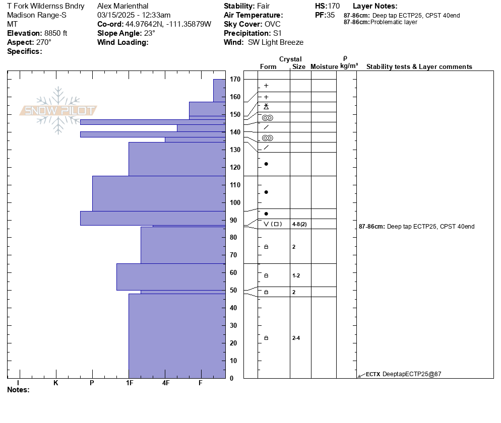
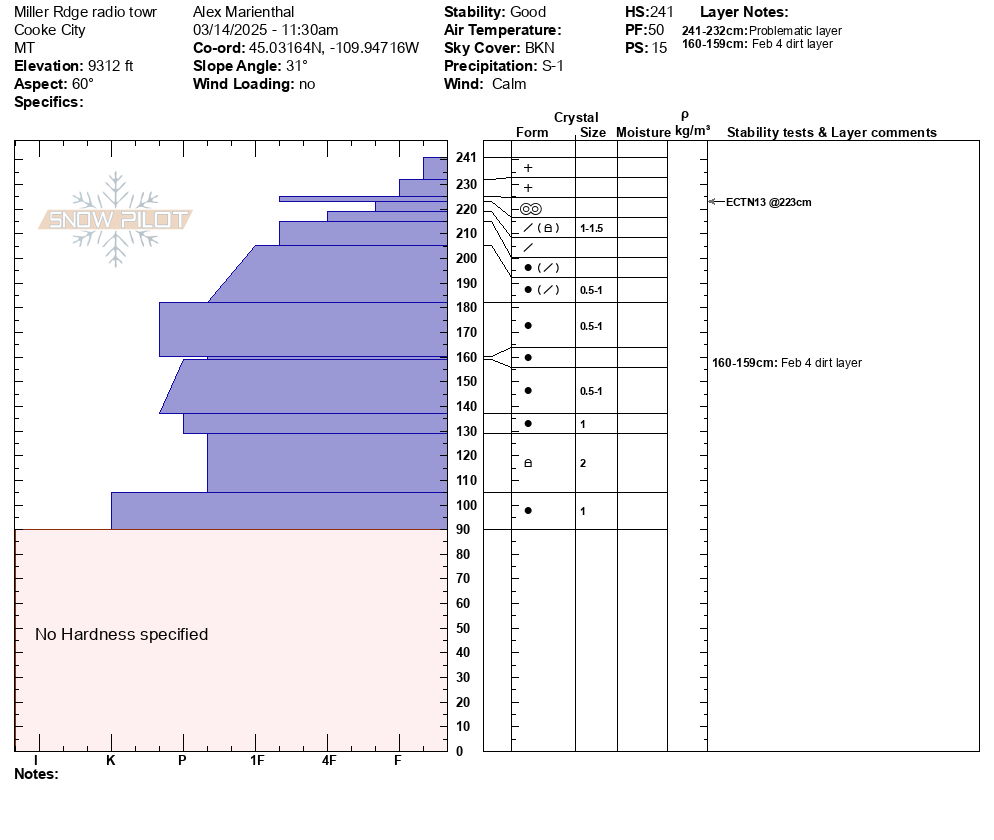
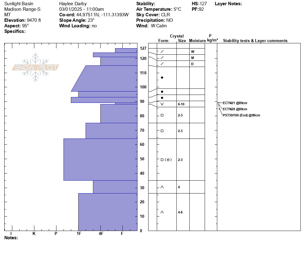
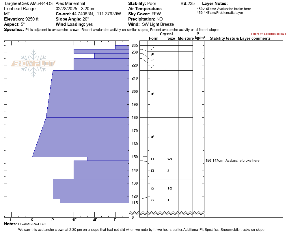
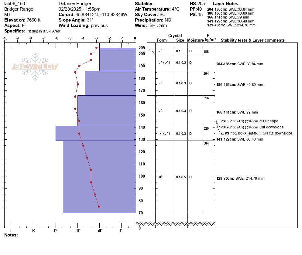
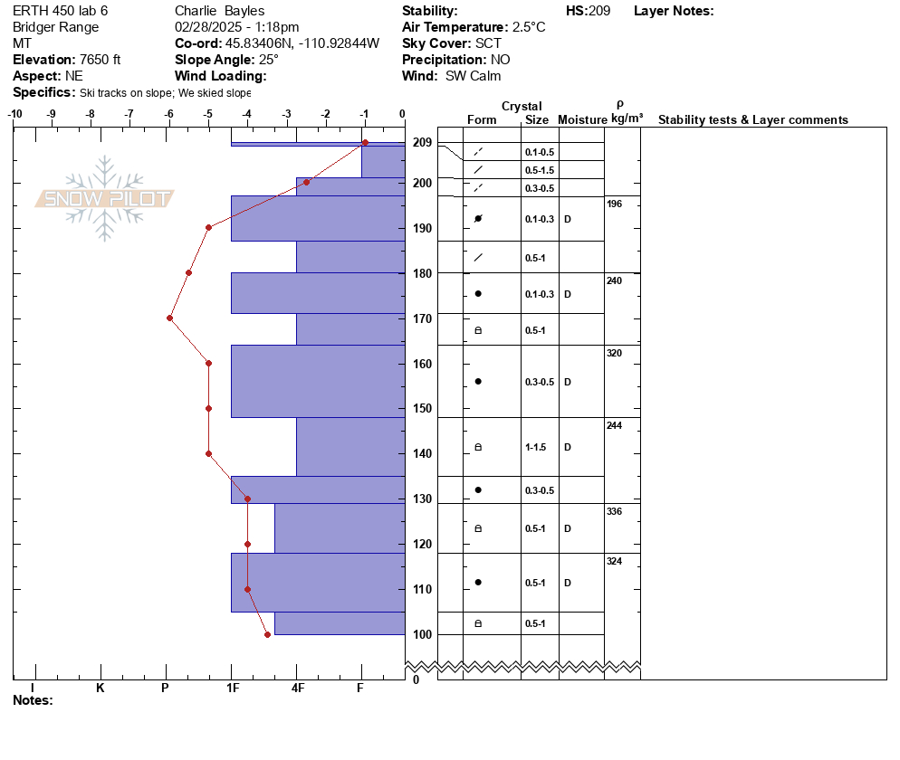
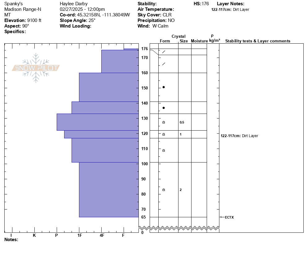
North facing pit in Hellroaring Creek, Centennials
-

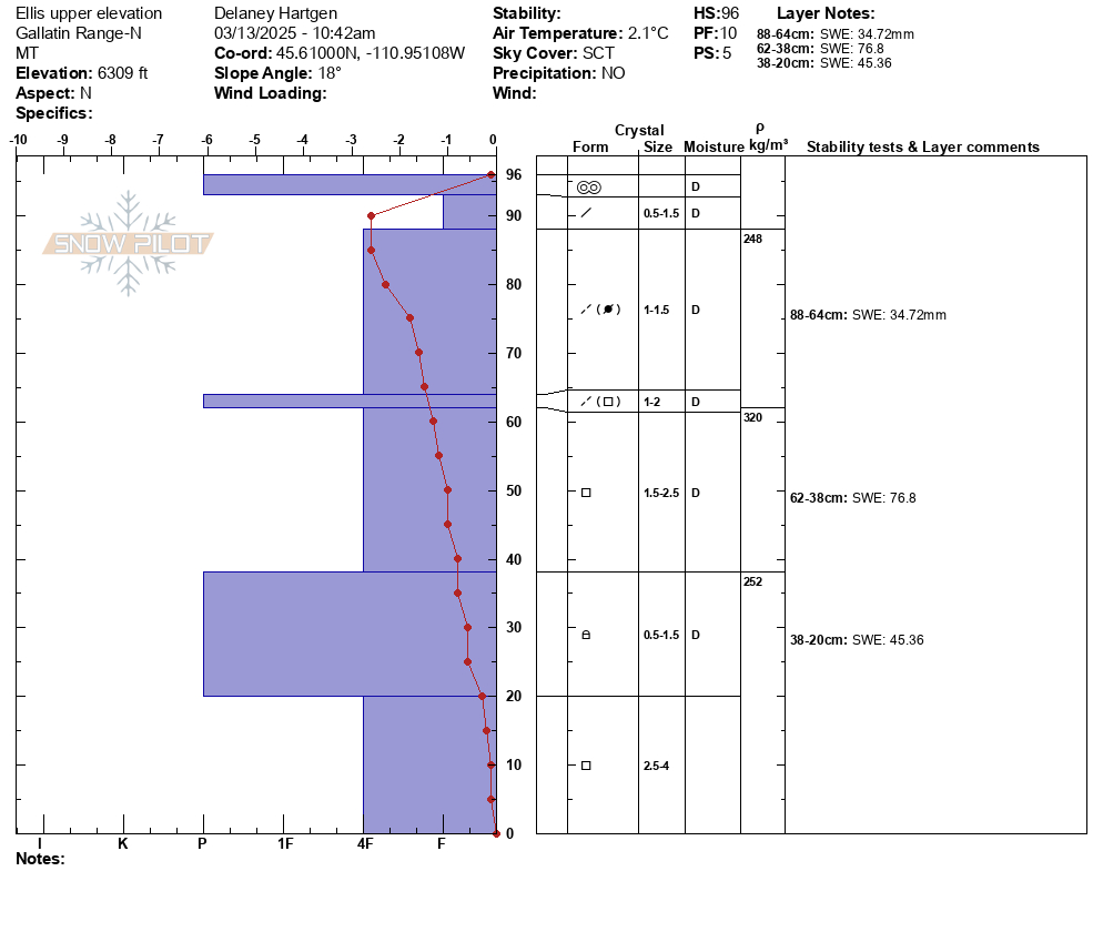
North facing snow profile Hellroaring Creek, Centennials
-
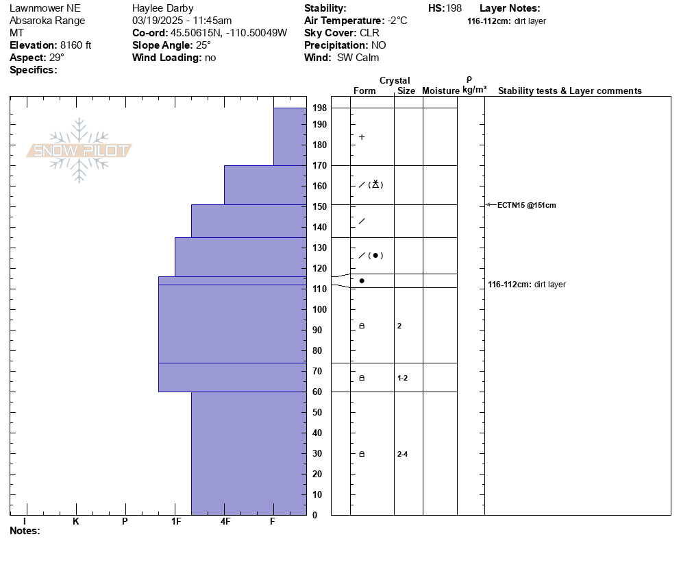
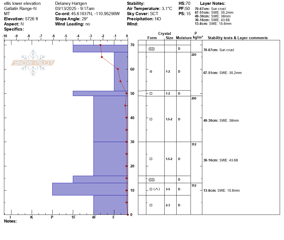
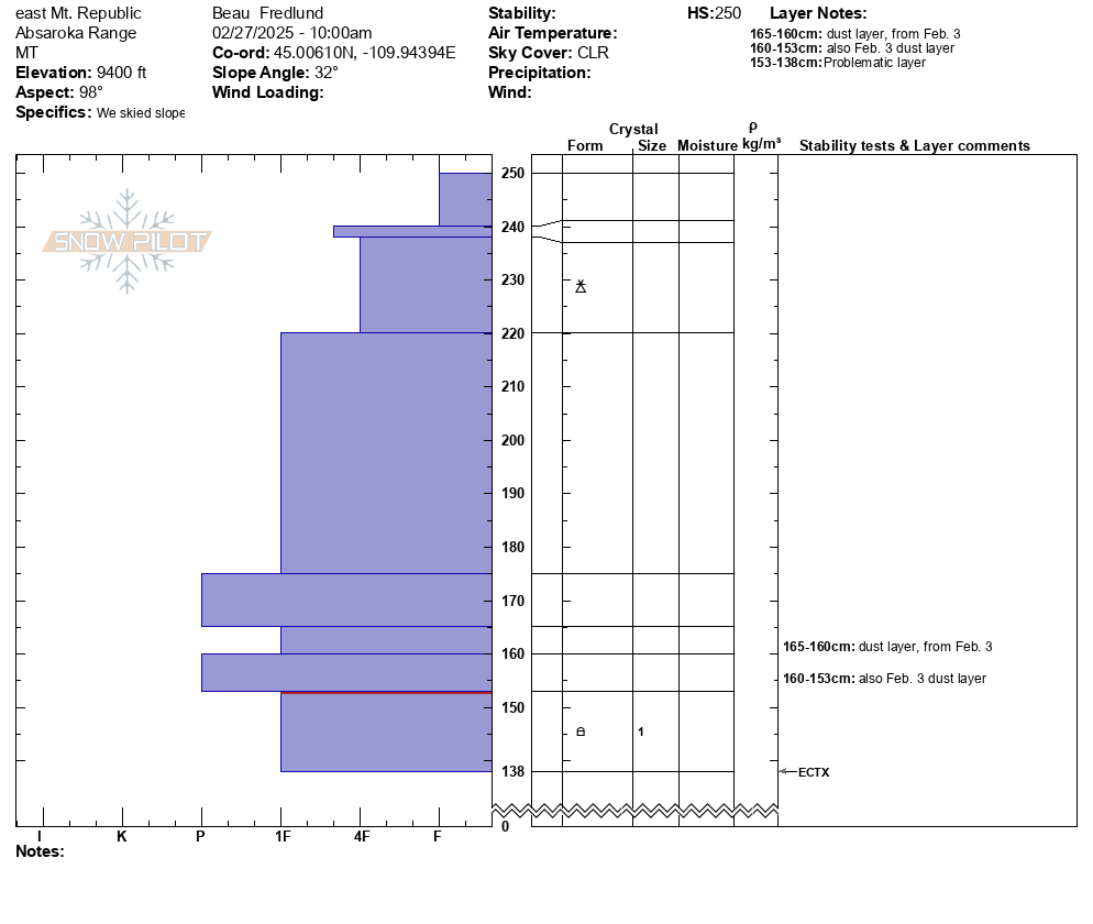
South facing snowpit Hellroaring creek, Centennials
-
S facing snow profile from Hellroaring Creek in Centennials
-

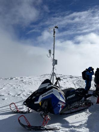
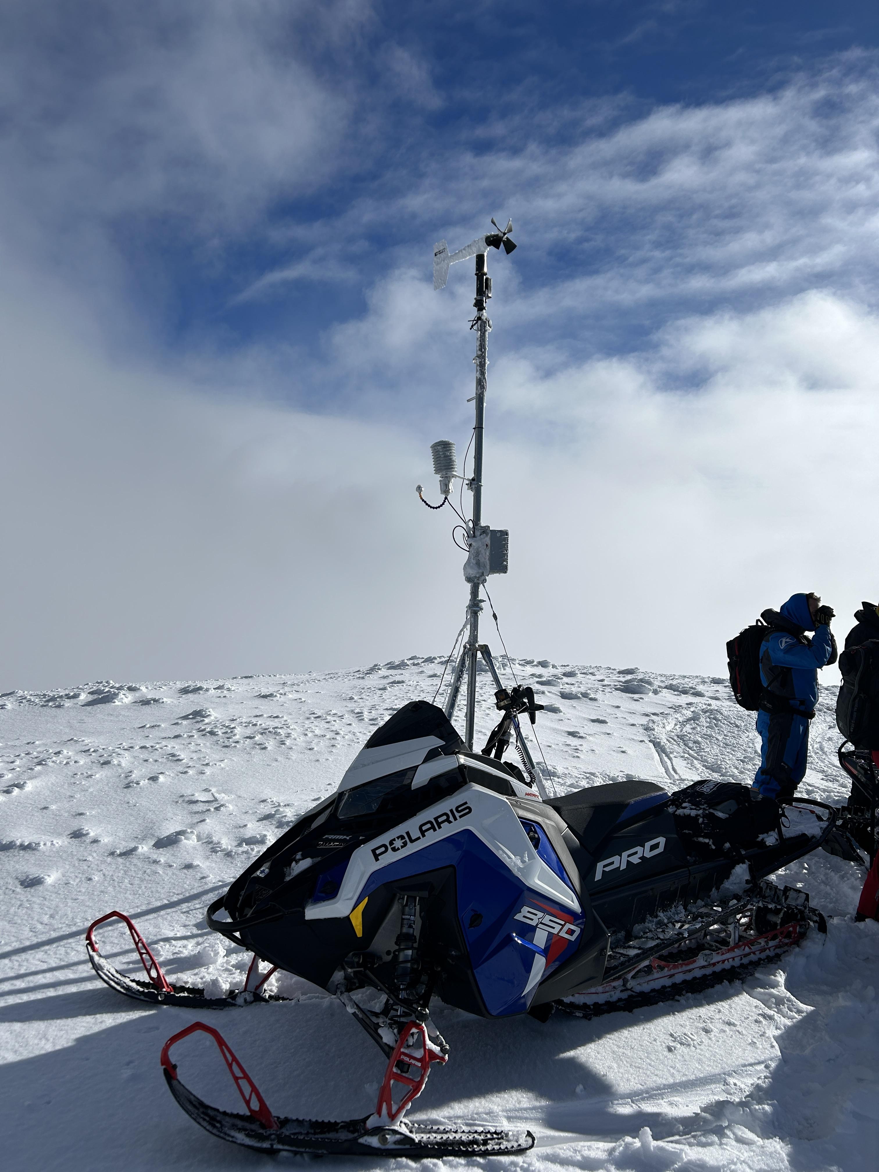
The GNFAC weather station at the top of Sawtelle provides wind, temperature and relative humidity information for forecasting (when it's not covered in a foot of rime ice. Photo: GNFAC
-
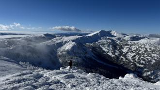
Photo: GNFAC
-

From the top of Sawtelle. Photo: GNFAC
-
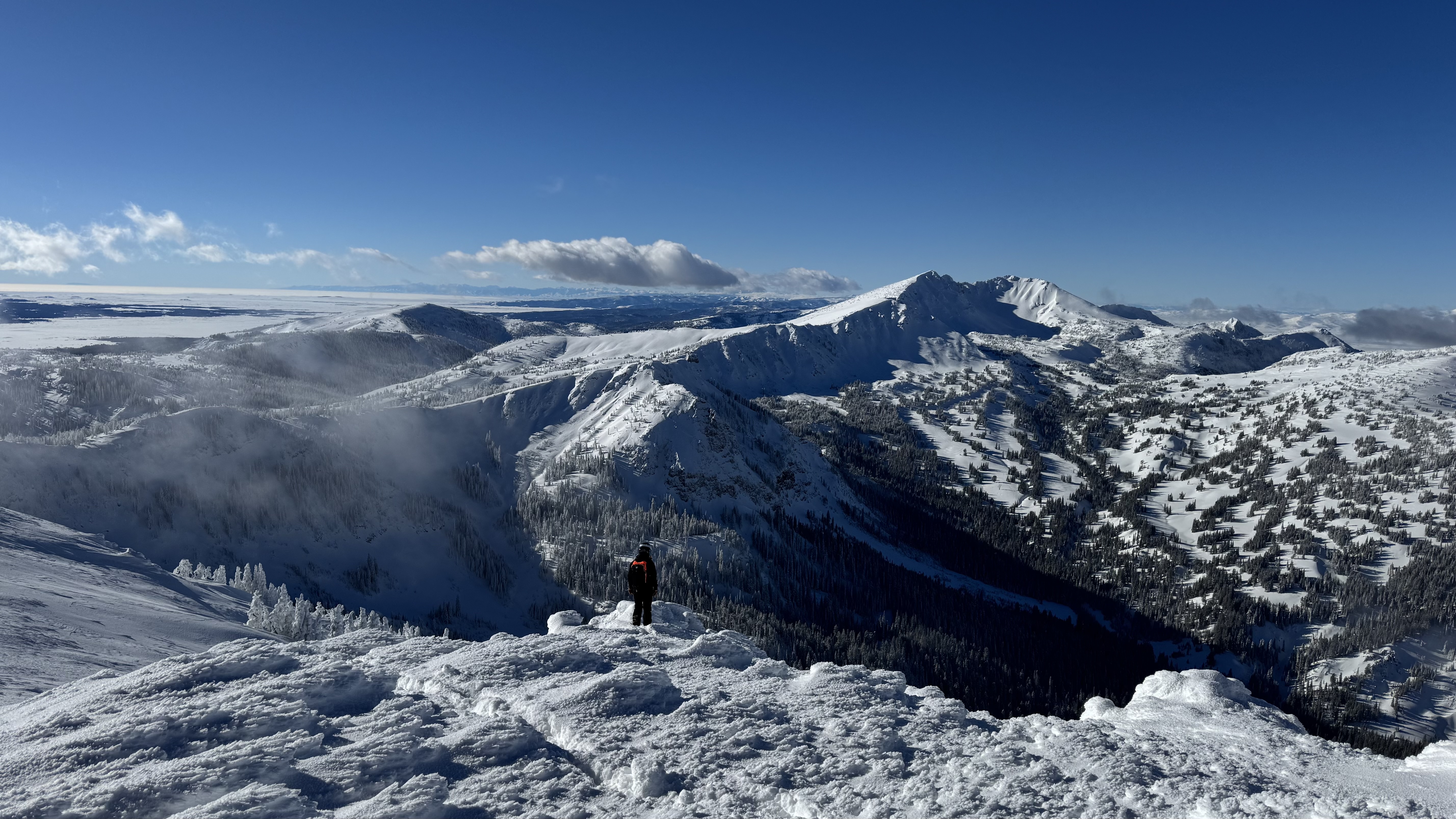
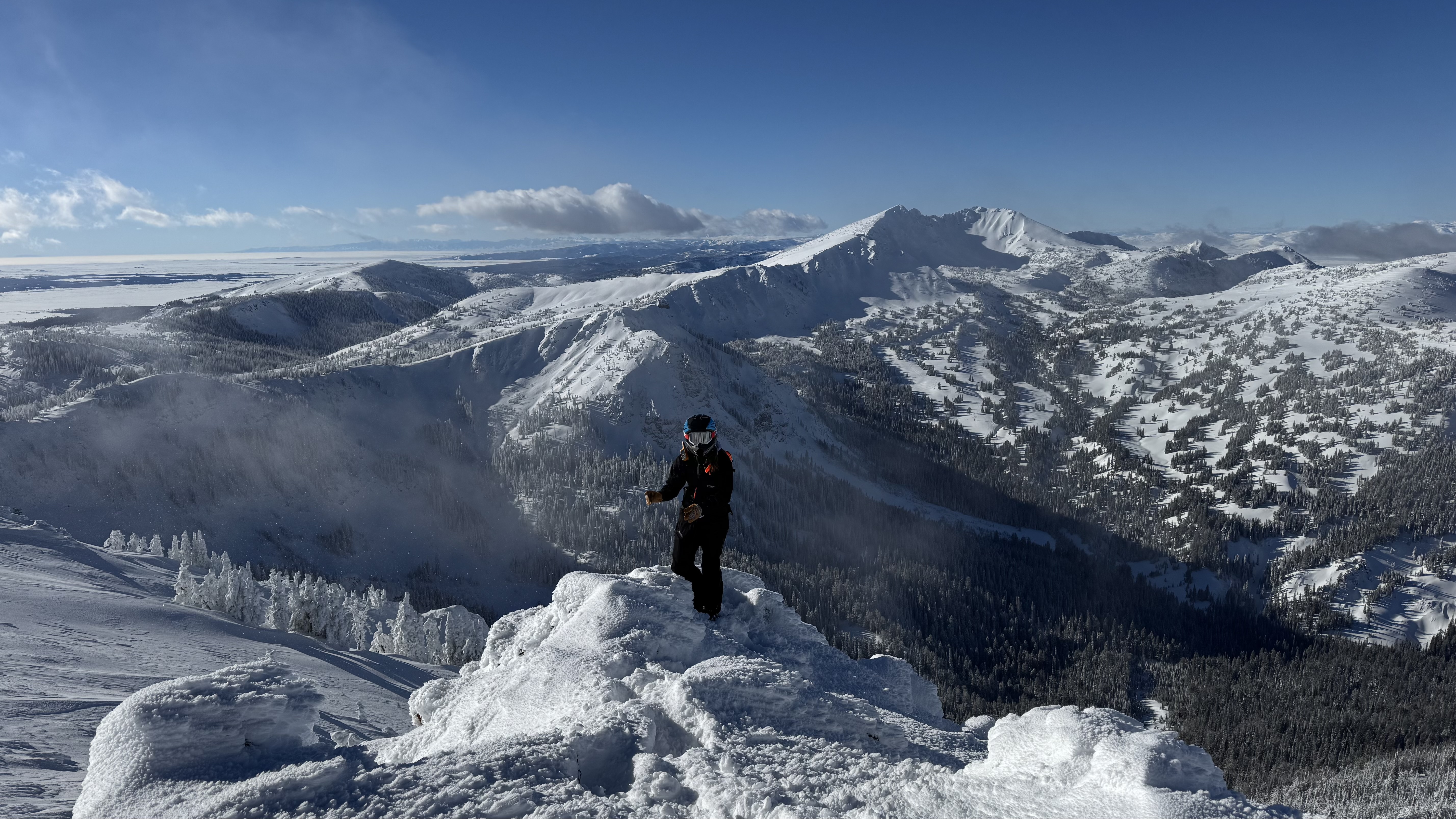
Riders in the Centennial Mountains experienced almost constant whumphing at higher elevation and saw a couple of days old avalanche on a windl-oaded east north east facing slope. Photo: R. Gravett
-
-
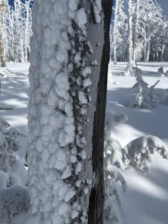
Ice crust on trees from freezing rain last Saturday Dec 28 now covered by rime ice.
-

From obs on 12/29: "On our way out near the cabin I cut a line close to a creek to see if I could trigger something."
-
From obs on 12/29: "On our way out near the cabin I cut a line close to a creek to see if I could trigger something."
-

Thick and robust ice crust layer widespread above white elephant. Photo: Ride Rasmussen Style
-

-
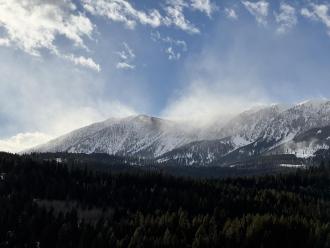
Plumes of drifting snow in the Bridger Range as strong winds blasted the mountains. Photo: GNFAC
-
De-rimed Sawtell anemometer
-
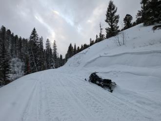
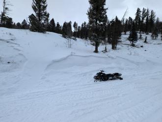
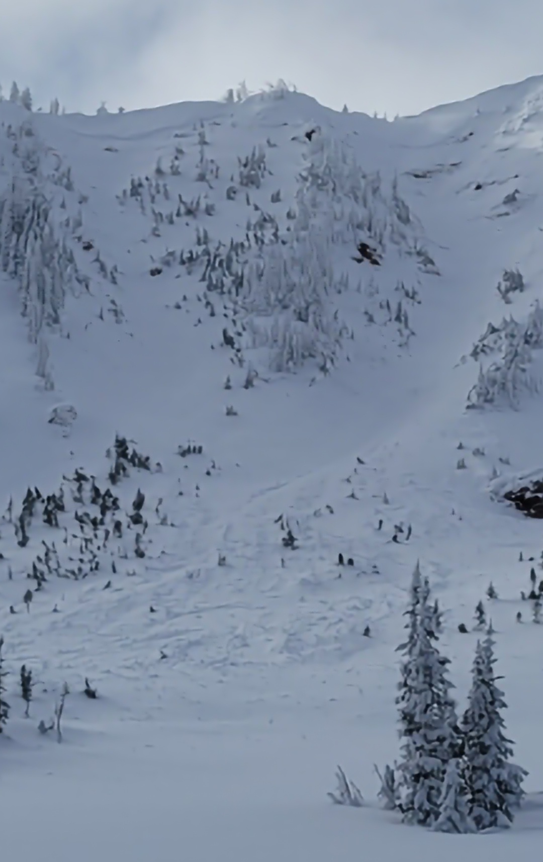
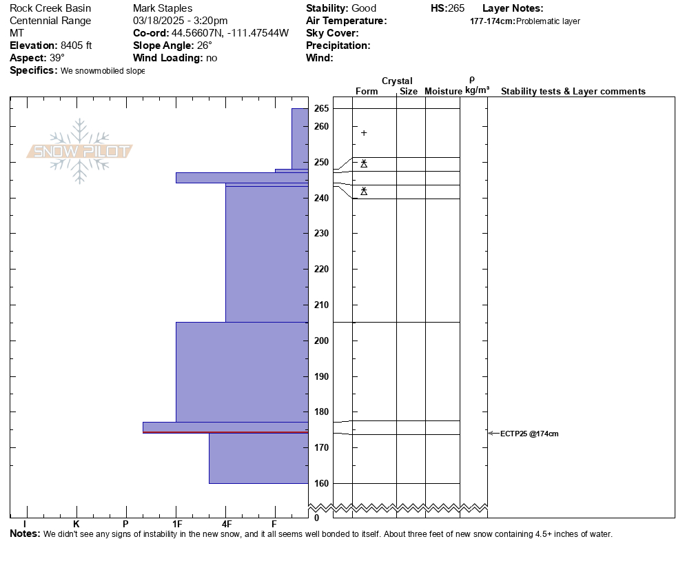
Rock Creek natural avalanche
-
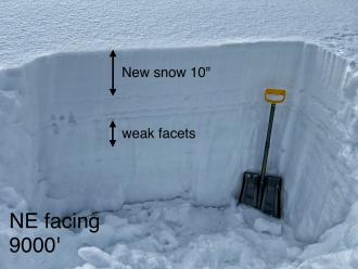
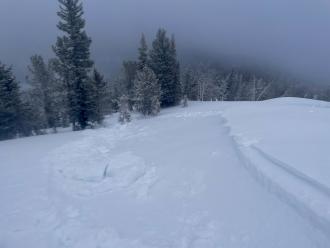
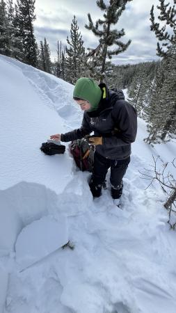
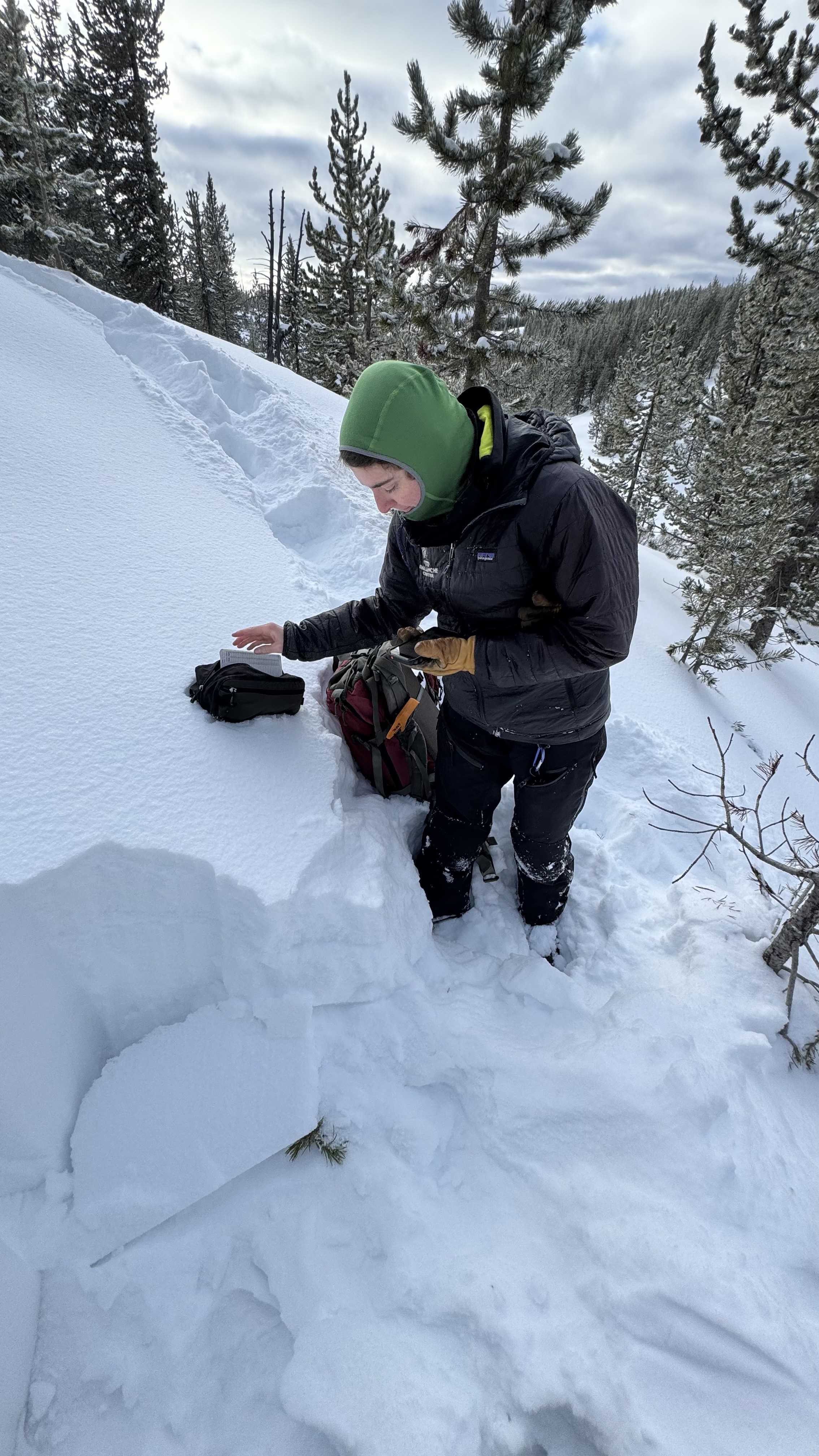
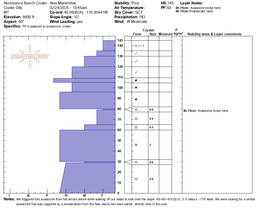
NE facing IP snowpit
-
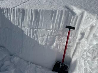
E facing IP snowpit
-
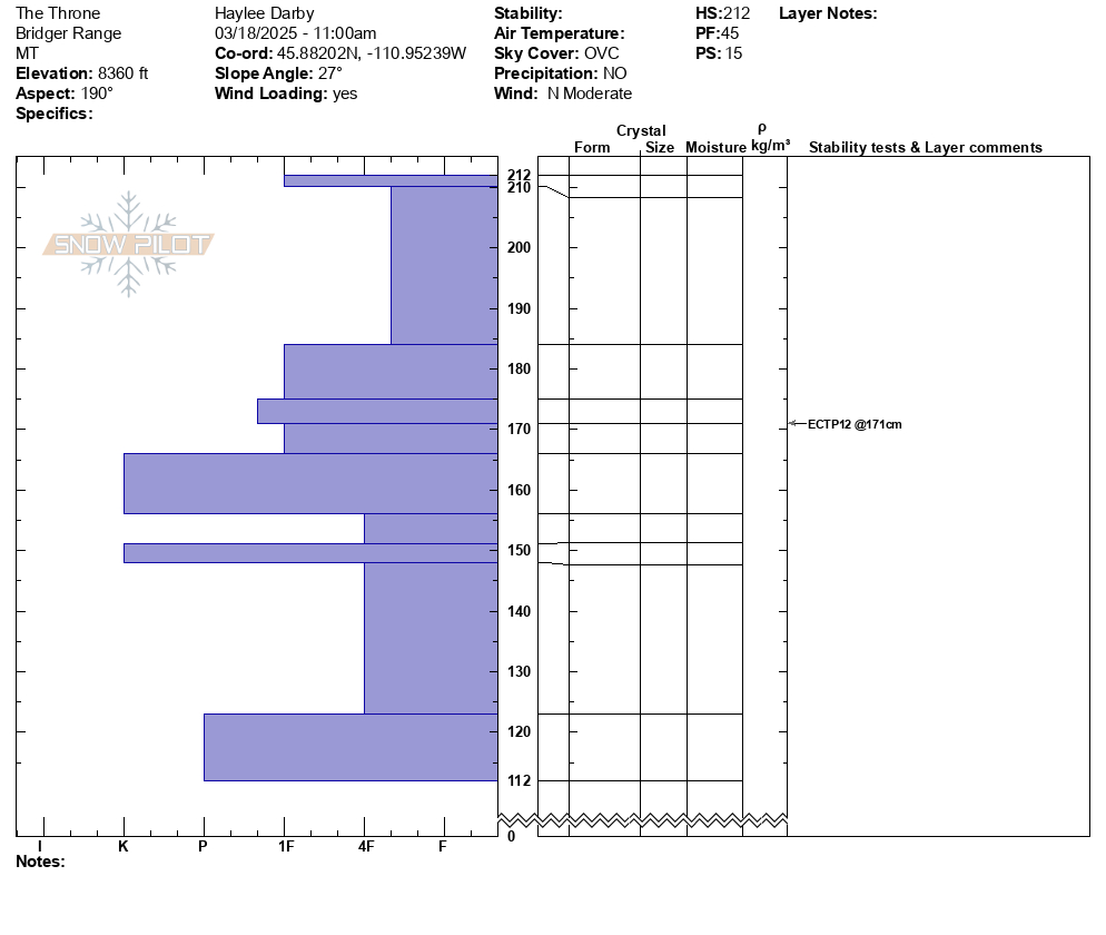
From IG: On 12/15 "Storm slab broke about 200’ above us as skinning up the hallway coming from the north side on the throne." Photo: Anonymous
-

Small windslab triggered on approach for inspection. Failure interface had 5 mm Surface Hoar. Soft slab, remote propagation onto the adjacent slope. Debris covered about half of the road bed.
Photo: J Hambelton
-
Small windslab triggered on approach for inspection. Failure interface had 5 mm Surface Hoar. Soft slab, remote propagation onto the adjacent slope. Debris covered about half of the road bed.
Photo: J Hambelton
-
Small windslab triggered on approach for inspection. Failure interface had 5 mm Surface Hoar. Soft slab, remote propagation onto the adjacent slope. Debris covered about half of the road bed.
Photo: J Hambelton
-
Gusty winds transporting snow in Taylor Fork on Saturday. Triggered a 4-5 inch deep wind slab that propagated about 50 ft at the top of a north east facing slope at 9,500 ft.
Photo: JP
-
We are grateful for our partnership with the Friends of the Gallatin National Forest Avalanche Center. It is always a good time to get out in the field with our education coordinator, Shannon. Photo: GNFAC
-
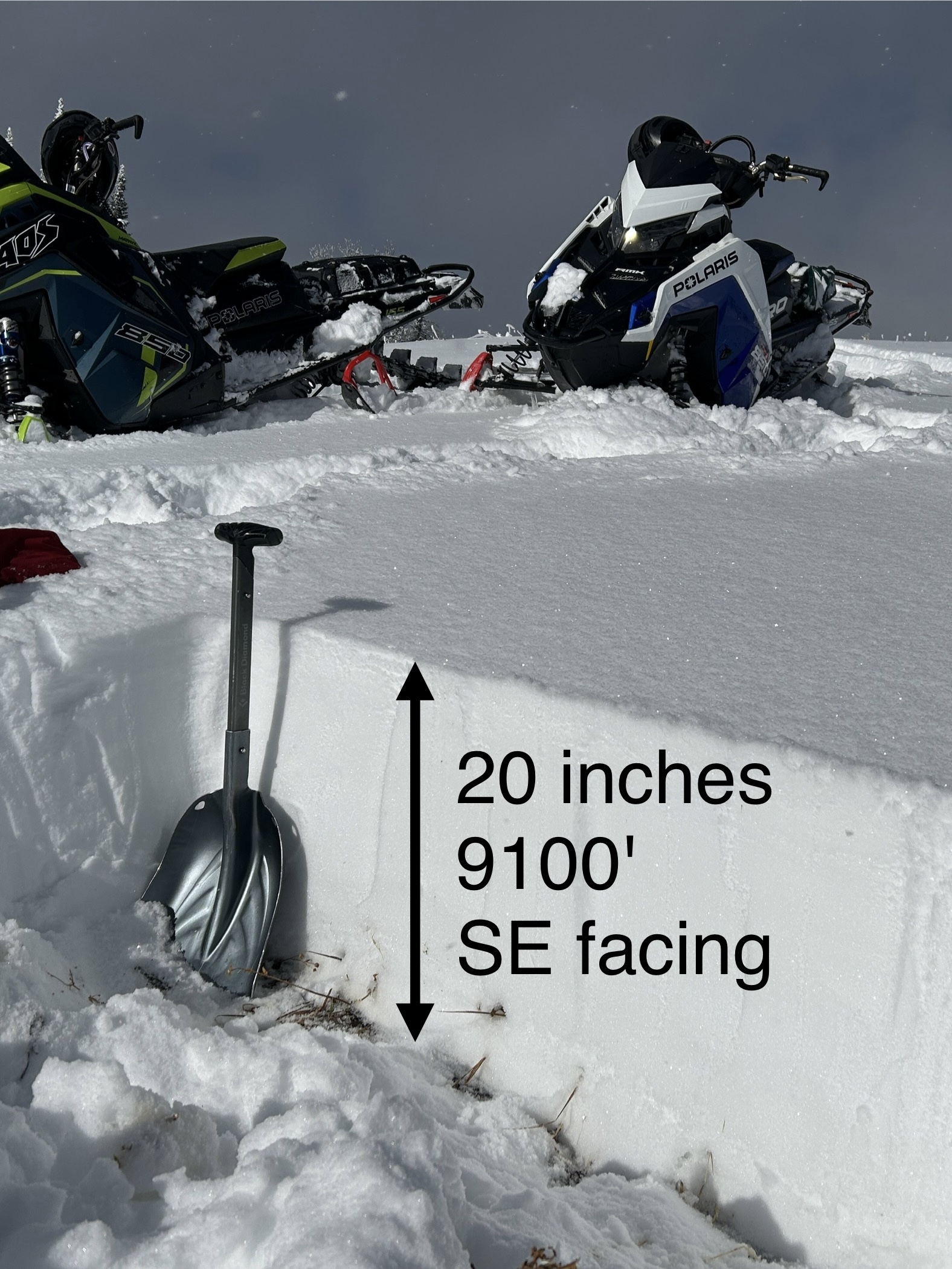
The snow depth was 60-70 cm (2-2.5 feet) at the upper elevations of the Big Springs Loop around the Black Canyon area in Island Park. Photo: GNFAC
-
Surface hoar and near surface facets are now capped by this weekend's snow. The layers are buried 2-4" deep in the Black Canyon area of Island Park. Photo: GNFAC
-
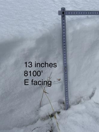
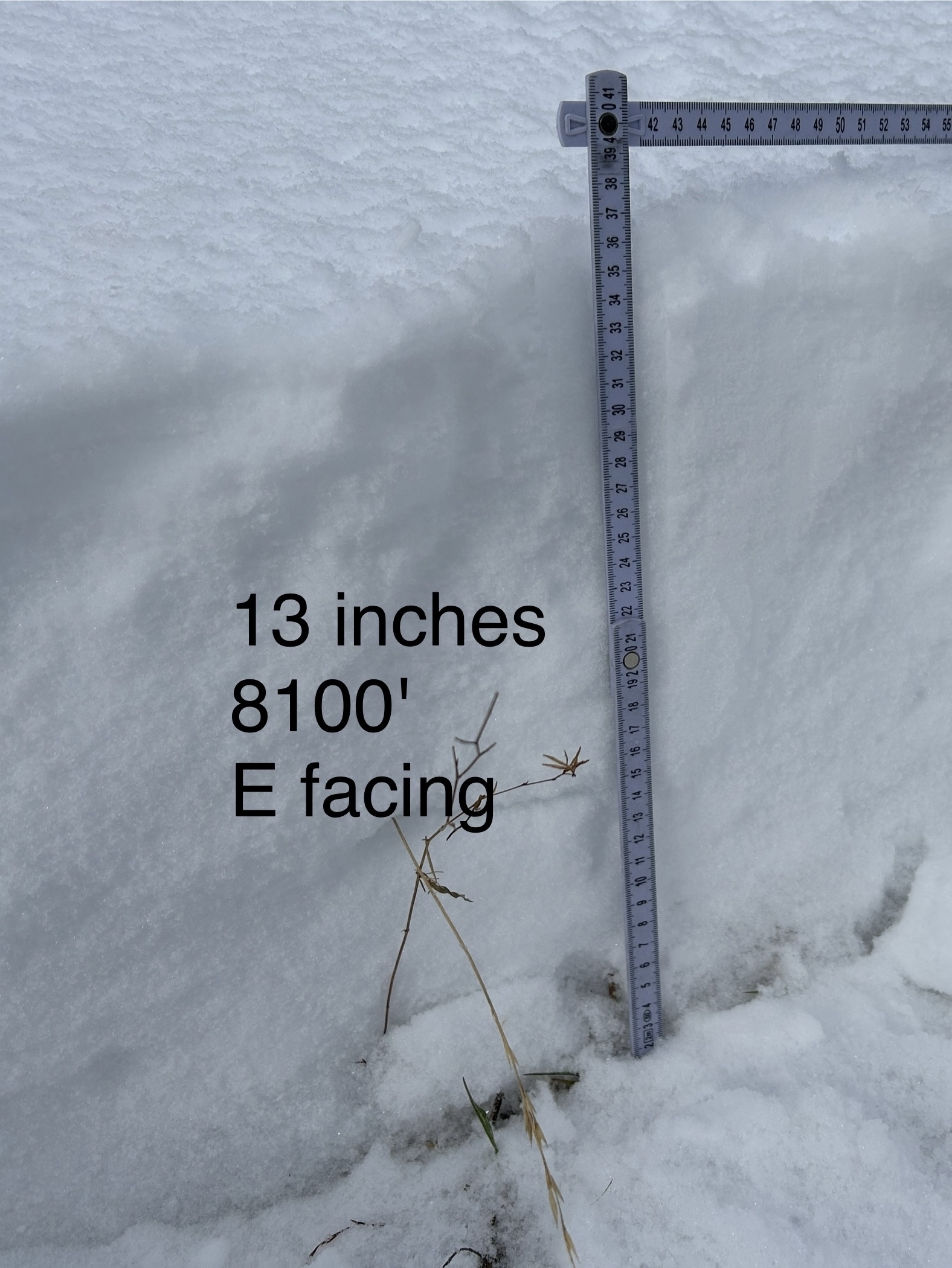
WE facing snow at 8100 ft Cabin Ck
-
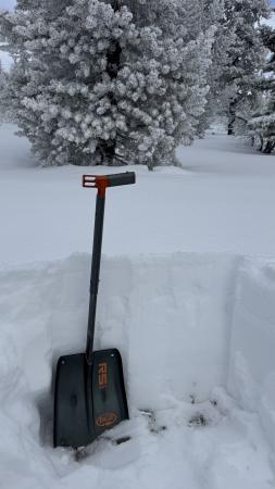
Cabin Creek snow cover
-
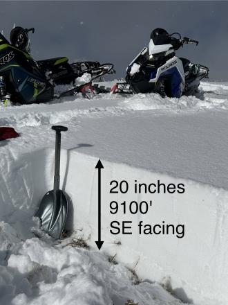
SE facing snow Cabin Creek


Videos- Island Park


Weather Stations- Island Park
Weather Forecast Island Park
Extended Forecast for10 Miles ESE Lakeview MT
Overnight

Low: 31 °F
Chance Snow
Monday

High: 37 °F
Chance
Rain/SnowMonday Night
Low: 25 °F
Slight Chance
Rain then
Mostly CloudyTuesday

High: 40 °F
Mostly Sunny
Tuesday Night

Low: 26 °F
Partly Cloudy
Wednesday
High: 47 °F
Mostly Sunny
Wednesday Night
Low: 32 °F
Partly Cloudy
Thursday
High: 46 °F
Partly Sunny
then Chance
Rain and
BreezyThursday Night
Low: 28 °F
Rain/Snow
Likely then
Snow Likely