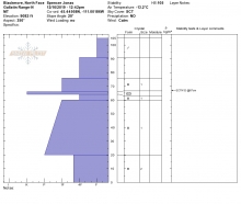
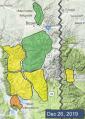
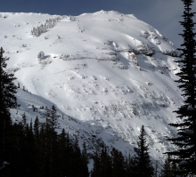
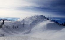
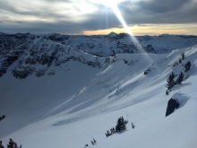
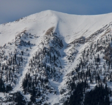
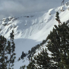
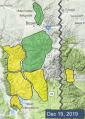
Advisory Archive
In the last 24 hours 1-2 inches has fallen in the northern mountains. This morning lingering showers will give way to clearing skies. Temperatures are in the high single digits to low teens and wind is gentle at 5-10 mph, mostly from the southwest. Temperatures will remain cool and wind light. More snow is expected late Friday that will continue through the weekend.


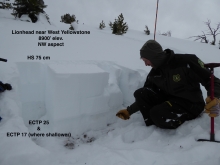
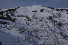
This morning we all know who has been naughty and nice. Me, I saw black coal dust rimming my stocking so I ignored it, a tactic of the naughty. Folks around West Yellowstone have been nice and they were rewarded with 8-12” of new snow since yesterday morning. The Taylor Fork received 7”, Big Sky and Cooke City 4-5” and the mountains around Bozeman 2”. Winds are from the west to southwest and have lessened to 10-20 mph from yesterday’s 40 mph gusts. Mountain temperatures are 15-20 F. Today will be cloudy, temperatures will rise into the mid-20s, wind will remain the same and scattered snowfall will drop a trace to an inch.


In the past 24 hours, mountain temperatures were in the 20s to 30s F and winds averaged 10-20 mph from the southwest to southeast. The mountains around Big Sky and West Yellowstone picked up 1-2” of snow with the remainder of our area staying dry. Snow today will favor the southern ranges. The mountains around West Yellowstone will get 6-10” of new snow and other areas will get 1-3”. Temperatures will be in the 30s F and winds will be 15-30 mph from the south.
Yesterday's extreme south-southwest winds decreased overnight to 15-30 mph with gusts of 40-50 mph. This morning there is no new snow. Temperatures are high 20s to mid-30s F and will remain in that range today. Wind will be southwest at 15-30 mph. Snow will arrive tonight near West Yellowstone, Cooke City and south of Big Sky, and tomorrow morning near Bozeman and Big sky. By morning the mountains near West Yellowstone will get 2-4” of snow with 8-12” possible through tomorrow. Elsewhere will get 2-3”.

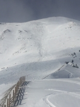
Yesterday through last night wind was strong to extreme out of the southwest. Average speeds were 20-40 mph with gusts to 75 mph in Hyalite and 83 mph at Big Sky. This morning wind is south-southwest at 15-25 mph with gusts of 30-45 mph. There is no new snow and temperatures are high 20s to mid-30s F. Today temperatures will remain seasonably warm in the high 20s to high 30s F and strong southwest wind will continue at 25-45 mph. The next chance for snow is late Tuesday.


Two inches of snow fell overnight near Cooke City. The rest of southwest Montana stayed dry. This morning temperatures are in the 20s to low 30s F with strong south and west winds. Breezy conditions will continue through the day with mostly clear skies and mountain temperatures rising into the 30s and potentially low 40s F.


This morning there is a dusting of new snow around West Yellowstone and Cooke City with none across the rest of the advisory area. Moderate southwest winds are gusting up to 50 mph and temperatures are in the teens to high 20s F. Expect continued windy conditions and mostly cloudy skies today with temperatures rising into the high 20s and low 30s F. Brief snow showers are possible but there will be no significant accumulations.
At 5 a.m. there’s no new snow, just strong southwest wind gusting to 45 mph and temperatures in the mid-teens F. Today will remain windy and become cloudy as temperatures rise into the high 20s F. Tonight 1-2” will fall around West Yellowstone and Cooke City with a dusting everywhere else.


This morning temperatures are in the teens to low 20s F, winds are 15-30 mph from the south to west, and there is no new snow. Today will be partly cloudy with temperatures reaching the upper 20s to mid-30s F, and ridgetop winds will be 20-35 mph from the south. There is a chance for a trace to 1” of snow on Thursday near West Yellowstone and Cooke City, but the rest of us will be waiting until early next week to see what Santa brings.

35 mph winds blew from the west in the Bridger Range for the last 24 hours with gusts into the 40s mph. Elsewhere, 10-25 mph west winds were calm by comparison. Temperatures across the advisory area were in the single digits to low teens F and there was no new snow. Today, moderate to strong south to southwest winds will blow 15-30 mph, skies will be mostly clear, and temperatures will warm into the 20s F.