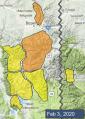
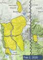
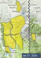
Advisory Archive
Temperatures this morning are in the single digits above and below zero F and there is no new snow. East winds shifted through the northern half of the compass and are currently 5-15 mph from the west Bozeman to Big Sky and from the north in the mountains near West Yellowstone and Cooke City. Today, temperatures will rise to the upper single digits to mid-teens F, winds will blow from the west to southwest at 10-20 mph, and the mountains will get a trace of snow tonight.


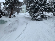
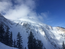
Snow started yesterday morning and dropped 14” in the Bridger Range and 7-10” elsewhere. Overnight, wind shifted east-northeast at 5-15 mph with gusts of 20-30 mph. In the Bridger Range east wind is 15-25 mph with gusts to 50 mph. This morning temperatures are single digits to low teens F and today will reach mid-teens F. Wind will remain 15-30 mph out of the east-northeast and decrease to 5-15 mph this afternoon. Snow showers taper with a couple more inches this morning followed by partly sunny skies this afternoon.


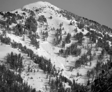
Yesterday afternoon at the summit of Big Sky southwest wind was 40-80 mph with maximum gusts to 155 mph. For the last 24 hours throughout the forecast area southwest winds averaged 15-50 mph with gusts of 50-80+ mph. This morning snow is starting to fall and there is 2-3” in the Bridger Range and zero to a trace elsewhere. Temperatures are high teens to low 30s F. Today temperatures will drop to teens to mid-20s F with wind shifting northwest-north at 5-25 mph. Snow showers are expected through today with 6-10” possible by this evening and 3-7” more overnight.


Yesterday, an inch of snow fell near Cooke City, with no accumulations in the rest of our advisory area. This morning temperatures are in the 20s and 30s F. Winds are 15-35 mph out of the southwest and west with gusts as high as 60 mph. Temperatures will be unseasonably warm today, rising into the 30s and even the high-40s F in spots. Winds will be southwesterly at 30-40 mph with strong gusts. A cold front tonight will bring snow and colder temperatures. A few inches are possible by tomorrow morning. Heavy snowfall will continue through the day tomorrow.
This morning there is no new snow. Mountain temperatures are in the 20s and 30s F near Bozeman and Big Sky and single digits to teens F near West Yellowstone and Cooke City. Winds are 15-30 mph out of the west. Temperatures will rise into the high 20s to mid-30s F today. Winds will be southwesterly at 20-30 mph. Intermittent snow showers today won’t leave much accumulation. More substantial snowfall is expected Saturday night and into Sunday.

At 5 a.m. the mountains picked up 1-2” overnight with temperatures in the high teens and westerly winds averaging 15 mph and gusting to 35 mph. Skies will clear by this afternoon as winds taper and temperatures rise to the mid-30s. Clouds will roll in tonight and a small shot of snow is expected tomorrow.


Yesterday’s snowfall favored the mountains from Big Sky through West Yellowstone with 4-6” of new snow. Other areas received 1-3”. Light winds blew 5-15 mph moving from southwest to northwest through the day and temperatures peaked in the low to mid-20s F. Clouds will dissipate today with light winds blowing 5-10 mph from the northwest and high temperatures in the 20s F. Tonight, winds will shift to the west at 10-20 mph, and another round of snow arrives with 3-5” falling in the mountains by morning.

Yesterday afternoon the mountains around Big Sky picked up a quick 2” of snow while the rest of the area remained dry. Winds were 5-15 mph from the south through west and mountain temperatures are in the low to mid-teens F. Snow will start falling near West Yellowstone this morning and spread across the advisory area this afternoon. The mountains near West Yellowstone will receive 5-8” of snow by morning with other areas getting 3-5”. Today, temperatures will be in the 20s F and winds will be 10-25 mph from the south to southwest.


Last night snow totaled 5” in the Bridger Range, 3-4” near West Yellowstone and Cooke City, and 2” in Big Sky and Hyalite. This morning wind is westerly at 5-10 mph with gusts of 15-25 mph. Temperatures are high teens to high 20s F. Today temperatures will be 20s to low 30s F with west-northwest wind at 15-25 mph. Snow tapers off this morning with light showers possible today and more snow expected late Tuesday.


Since yesterday the mountains near Cooke City got 3” of snow, near West Yellowstone got 1” and elsewhere got zero. This morning temperatures are high teens to mid-20s F and wind is westerly at 5-20 mph. Today temperatures will be high 20s to low 30s F with west wind at 5-20 mph. Snow is expected this afternoon near West Yellowstone and throughout the forecast area tonight. By morning the mountains will have 3-7” of new snow.