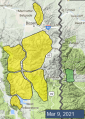
Advisory Archive
Under clear skies mountain temperatures are in the high teens to low 20s F this morning. Wind is light at 1-10 mph out of the southeast. Today will be sunny with mountain temperatures hitting the high 40s F, our warmest day yet. Temperatures will drop into the 20s tonight with an even warmer day tomorrow.


Mountain temperatures are in the upper teens to low-20s F with 5-10 mph winds from the north to west and there is no new snow. Highs today will be in the 30s F with 5-10 mph north to northeast winds and the next chance for precipitation is Friday night.


This morning winds are from the west to southwest at 5-10 mph, mountain temperatures are in the upper 20s F and there is no new snow. Today, temperatures will climb into the upper 30s to lower 40s F, winds will be 5-10 from the west shifting to the north, clouds will increase, and by morning Cooke City will get 1-2” of new snow with a trace through the remainder of the advisory area.
Since yesterday morning wind has been east-northeast at 5-15 mph with gusts to 30 mph, and in the Bridger Range speeds were 20-30 mph with gusts of 40-50 mph. This morning there is no new snow and temperatures are low to mid-20s F. Today, skies will be mostly clear with temperatures reaching high 30s to low 40s F. Wind will be east-southeast at 5-15 mph with higher speeds continuing in the Bridgers. The next chance for snow is late tomorrow and Tuesday.


We’ve got another beautiful spring day in store. There is no new snow this morning. Skies are clear, winds are light, and temperatures are in the teens and 20s F. Temperatures will rise around 5 degrees higher than yesterday, into the 30s and low 40s F. North and east winds will increase this afternoon, gusting up to 30 mph. The next chance for precipitation is Monday.

There is no new snow this morning. Winds are light and temperatures are in the single digits and teens F. Temperatures will rise quickly this morning into the 30s F under sunny skies with continued light west winds. Warm and dry weather will prevail through the weekend.

In the last 24 hours, the Big Sky area got a dusting of snow and Cooke City got an inch. Wind is remarkably calm with temperatures of 5-10 F under mostly clear skies. Today will be sunny with light west to north breezes and temperatures rising into the high thirties. Temperatures will warm through the weekend and no snow is expected until early next week.

Mountain temperatures are in the low to mid-teens F with 5-10 mph winds from the west to north and the mountains received 2-3” of snow yesterday. Today, high temperatures will be in the upper 20s F with 5-10 mph winds from the northwest to northeast. Light snow will deliver 2-4” in the mountains near Cooke City and south of Big Sky and 1-2” in the northern ranges.


Snow returned yesterday with 6” new near West Yellowstone and 2-4” near Bozeman, Big Sky, and Cooke City. Precipitation likely began as rain south of Big Sky. Winds are 10-20 mph from the southwest to northwest, and temperatures are in the teens to low-20s F. The mountains will get a trace to 1” more snow this morning with a bit more near Cooke City. Winds will be 10-20 mph from the southwest to northwest and temperatures will be in the 20s to low-30s F.

This morning the mountains have no new snow, temperatures are high teens to mid-20s F and wind is southerly at 5-15 mph with gusts to 20 mph. Today will be mostly cloudy with temperatures reaching high 30s to low 40s F and east to southeast wind at 10-25 mph. Light snow and some rain are possible this afternoon and tonight with 1-3” of snow possible by morning.