Advisory Archive
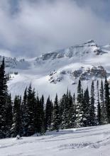
Yesterday morning the mountains around Bozeman and Big Sky picked up 1-2” of snow. Wind is west to southwest at 15-25 mph, except in the Bridger Range where it is gusting to 40 mph. Mountain temperatures are in the single digits F and will rise into the teens. Today will become mostly cloudy with snow showers and wind kicking in later this afternoon through Friday. Wind will be west to southwest at 20-35 mph and by morning 2-3” will have fallen.


At 5 a.m. the Bridger Range got 4” overnight. In the last 24 hours 1-2” fell elsewhere except Lionhead. Wind has lessened to 10-15 mph from the W to SW with gusts to 25 mph. Mountain temperatures are in the single digits and will warm into the high teens with westerly wind at 10-20 mph. Scattered snow today will add 2-3” by late afternoon. Looking ahead, Thursday and Friday will be snowy and windy.


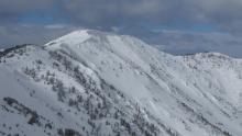

Winds are blowing 20-30 mph from the west to southwest gusting to 75 mph except in the Taylor Fork and West Yellowstone where they are 15-20 mph with gusts around 40 mph. Temperatures are in the mid-teens to mid-20s F. The Bridger Range and the mountains around Cooke City received 8-11” of new snow with 1-3” everywhere else. High temperatures will be in the low to mid-20s F and will drop through the day. West winds will be 25-35 mph and Cooke City will get another 3-5” of snow with 1-2” in the mountains around Bozeman, Big Sky, and West Yellowstone.

Strong winds in the northern ranges are blowing 25-30 mph from the west gusting to 70 mph. In the southern ranges, the wind is 10-20 mph from the southwest. Temperatures are in the mid-teens to mid-20s F, and the mountains south of Big Sky and near Cooke City received 2-4” of new snow.
Temperatures will climb into the 30s today in the northern ranges and into the 20s in the southern ranges. Strong winds will continue blowing 25-35 mph from the west to southwest and there will be 8-10” of new snow in Cooke City, 2-4” in Big Sky and West Yellowstone, and a trace to 2” in the Bridger Range.

Yesterday the mountains received 2-3” of low-density snow with light west-northwest wind. Overnight, wind shifted west-southwest and increased to 20-30 mph with gusts of 40-55 mph. This morning temperatures are single digits to teens F. Today temperatures will reach mid-20s F and wind will be westerly at 20-35 mph. Light snow showers will drop 1-3” near Cooke City by tomorrow morning with a trace to an inch elsewhere.


Since yesterday morning the mountains near West Yellowstone and Cooke City got 3-4” of snow, and elsewhere got 1-2”. Yesterday wind was west-southwest at 10-20 mph with gusts of 30-40 mph. This morning wind is 5-10 mph with gusts of 15-20 mph, and temperatures are teens to low 20s F. Today temperatures will be high teens to mid-20s F. Wind will shift to the northwest at 5-15 mph with gusts to 25 mph, then will increase tonight. Light, scattered snow showers today will drop 1-2” in the southern half of our advisory area with less than inch near Bozeman.


One to 3” of new snow fell overnight across most of the advisory area, with the area south of Big Sky picking up 5-6”. Winds around Bozeman and Big Sky are 25-30 mph out of the south and west, with 40-50 mph gusts. Winds are a bit lighter near West Yellowstone and Cooke City. Temperatures this morning are in the single digits and teens F and will rise into the teens and low 20s F today. Winds will continue out of the south and west, with the peak gusts moderating a little. Periods of snowfall today and tonight will deposit 2-4” by tomorrow morning around Bozeman and Big Sky and 4-8” near West Yellowstone and Cooke City.
In the last 24 hours the mountains around Bozeman and Big Sky picked up 4-5”, most of it falling last night while everywhere else remained dry. Temperatures are in the low single digits F and wind is light at 10-20 mph out of the west to northwest. Today will become partly cloudy and mountain temperatures will rise into the low 20s F. A southwest flow will drop 1-2” in the mountains tonight with light snowfall continuing Friday and Saturday.

At 5 a.m. it is still snowing, but will taper off today. In the last 24 hours 8-12” fell in the Bridger, northern Gallatin and northern Madison Ranges and 2-4” everywhere else. With temperatures in the single digits wind is from the west to northwest at 15 mph with gusts of 25-30 mph. Wind will continue today and snowfall will end this morning with another 3-5” expected around Bozeman and Big Sky and 2-3” around West Yellowstone and Cooke City.


This morning mountain temperatures are in the mid-teens F with 10-20 mph winds from the west. The Bridger Range through the Southern Madison and South Gallatin Ranges received 8-12” of new snow, and the mountains around West Yellowstone and Cooke City received 4-5”. Temperatures today will rise to the low to mid-20s F with 10-20 mph winds from the west to northwest. By morning the mountains around Bozeman and Big Sky will have 5-8” of new snow and West Yellowstone and Cooke City will see 2-3”.