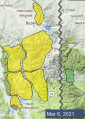
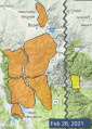
Advisory Archive

Last night the Bridger Range got 4” of snow, Big Sky got 1” and elsewhere got none. This morning, under mostly cloudy skies, temperatures are teens to mid-20s F and wind is southwest at 10-15 mph with gusts of 25-35 mph. Skies will become mostly sunny this afternoon with temperatures reaching high 30s F and southwest wind at 10-25 mph. The next chance for snow is Monday night.

Mostly clear skies this morning will cloud over this afternoon as some light precipitation falls. Mountain temperatures are in the 20s and 30s F this morning and will rise into the 30s and 40s F. Hopefully this afternoon’s precipitation will be entirely snow, but it might start with a little bit of rain at lower elevations. Winds are 10-20 mph out of the south with gusts of 30 mph (55 mph in Hyalite). Similar winds will continue today. Expect only a light dusting of snow by tomorrow morning.


There is no new snow to report. This morning, skies are clear and temperatures are in the mid-20s F with winds averaging 5-15 mph and gusts of 20 mph out of the south and west. Another mild spring day is in store with mountain temperatures rising into the 40s, light winds, and sunny skies.


Under clear skies at 5 a.m., temperatures are in the mid-20s F with wind averaging 5-10 mph and gusts of 20 mph out of the W-SW in the north and E-SE in the south. Today will be sunny, wind will remain light and mountain temperatures will reach the low 40s, a few degrees warmer than yesterday. No snow is forecasted making this our 5th day in a row without precipitation, the driest span since we started daily forecasts on December 12.

This morning under clear skies, temperatures are 20F with west to southwest wind at 15-30 mph. Skies will stay clear, wind will remain the same and mountain temperatures will rise to 40F. There is no snow forecasted in the next 5 days, just sun and a taste of spring, so lather on SPF50 as Baz Luhrmann recommends in his classic song, Everybody’s Free to Wear Sunscreen.
This morning, mountain temperatures are in the teens to low 20s F, there is no new snow, and winds are 10-20 mph from the west to southwest except in the Hyalite area where they are 25-30 mph. Today, temperatures will rise to the upper 20s to low 30s F under mostly sunny skies and the wind will blow 10-20 mph from the southwest.


Yesterday, westerly wind gusted 30-50 mph near Bozeman, Big Sky and Cooke City. This morning there is no new snow and temperatures are single digits to mid-teens F. Today, wind will be west-southwest at 5-15 mph with gusts to 20 mph, and temperatures will rise to high 20s to low 30s F under mostly clear skies.
Since yesterday morning the mountains near Bozeman and Big Sky got 2-3” of light new snow, and elsewhere got none. This morning wind is westerly at 15-25 mph with gusts to 30 mph, and up to 50 mph in the Bridger Range. Temperatures are single digits above and below zero F. Today, under partly cloudy skies, temperatures will reach low 20s F and wind will be west-northwest at 10-20 mph with gusts to 30 mph. This week will be warm and mostly clear with no snow until next weekend.


In the last 24 hours, it snowed 10” near West Yellowstone, 7” in the Bridger Range, and 3-4” across the rest of the advisory area. Winds are westerly at 10-15 mph with gusts of 25 mph. Moderate westerly winds will continue today. Temperatures are in the single digits and teens F this morning and will rise into the teens F this afternoon. Light snowfall today won’t bring much accumulation.

This morning there are 2-5” of new snow around Big Sky, West Yellowstone, and Cooke City while the mountains near Bozeman stayed dry. Winds are 15-25 mph out of the south and west, with gusts of 40-50 mph. Similar winds will continue today, with peak gusts maybe backing off a little bit. Temperatures are in the single digits and teens F and will rise into the teens and low 20s F. Snowfall today and tonight will bring 2-4” by tomorrow morning.