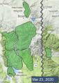
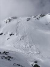
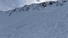
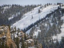
Advisory Archive
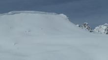
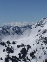
In the last 24 hours, the mountains around Big Sky and Cooke City received 10-12” of new snow, the Bridger, Southern Madison, and Gallatin Ranges received 6-8”, and the mountains around West Yellowstone received 3-5”. Winds were from the southwest to west at 15-25 mph with gusts in the 40s mph before dying down last night except in the Bridger Range which had light wind blowing 5 mph from the west. This morning mountain temperatures are in the teens to low 20s F.
Today, mountain temperatures will be in the 20s F with west to southwest winds at 5-15 mph. Snow will pick up again this afternoon with the Gallatin and Madison Ranges and Cooke City getting 6-8”, the Bridger Range 3-5” and West Yellowstone 2-3”.


This morning the mountains received 1-3” of new snow with temperatures in the 20s F. The winds are blowing 10-20 mph with gusts around 40 mph from the west to southwest. Snow will continue today and tonight with 4-6” in the mountains near Bozeman, Big Sky and Cooke City and 2-4” near West Yellowstone by morning. Winds will be 15-25 mph from the west to the southwest before dying down this evening and temperatures will be in the upper 20s to mid-30s F.

Yesterday morning the mountains got 1-2” of snow. Wind has been west-southwest at 15-30 mph. This morning temperatures are teens to 20s F. Today, temperatures will reach high 20s to high 30s F with west-southwest wind increasing to 20-35 mph. Clouds will increase this afternoon and 1-2” of snow will fall overnight with light snowfall expected through Wednesday.

A brief snow squall this morning could drop 1-2” in the mountains. Temperatures are teens to 20s F and wind is west to northwest at 5-20 mph with gusts to 35 mph. Skies will gradually clear this afternoon with temperatures in the 20s to low 30s F and west wind at 5-20 mph. No snow is expected overnight.

It’s going to be another pleasant spring day. There is no new snow this morning. Temperatures are in the teens and 20s F and will rise into the 30s F. Winds out of the west at 5-15 mph will continue through the day. It will start out sunny with increasing clouds this afternoon and the possibility of light snow tonight. Only expect a trace to 2” by tomorrow morning.

There is no new snow to report this morning. Temperatures are in the teens F and will rise into the 30s F. Winds this morning are 5-15 mph out of the west to southeast. Light southwesterly winds will continue today. Clouds will break up this morning allowing the sun to poke through, but a few snow flurries are also possible. No significant accumulations are expected.

Yesterday, Cooke City picked up 5” of snow while everywhere else got a trace to 1”. Wind is light from the west to north and temperatures at 5 a.m. are 20F under cloudy skies. Temperatures will not rise more than a few degrees above freezing and skies will be mostly cloudy, except Cooke City which may get sun. There may be a few lingering snow showers this morning, but no accumulation is expected. The next few days will be sunny and warm.

Last night the northern Gallatin Range picked up 3” while the mountains around West Yellowstone got 1” and Cooke City 2”. This morning, under mostly cloudy skies, mountain temperatures are 20F and wind is south to southwest at 10-20 mph. Scattered snowfall today and tonight will drop 1-2” of snow with wind remaining southerly and light. Temperatures may rise above freezing and skies will be partly to mostly cloudy with sun poking through at times.

In the last 24 hours, the mountains around West Yellowstone got an inch of new snow with none for the other ranges. Winds were light at 5-15 mph from the west to southwest and this morning, temperatures are in the 20s F. Clouds will increase this afternoon with 1-2” of new snow in the mountains around West Yellowstone and Cooke City and a trace to 1” in the northern ranges by morning. Mountain temperatures will be in the mid to upper 30s and winds will be west to southwest at 5-15 mph.


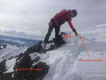
At the end of the storm yesterday the mountains received 4-6” near West Yellowstone, Big Sky and Cooke City with 2” in Hyalite and the Bridger Range. Yesterday wind was southwest-west at 5-15 mph with gusts to 30 mph. This morning temperatures are teens to low 20s F and wind is 0-10 mph out of the west-southwest. Today, wind will shift west-northwest at 5-10 mph with temperatures reaching high 20s to low 30s F. Skies will clear near Bozeman and Big Sky with cloud cover more likely to the south, and no snow expected.