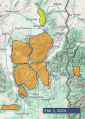
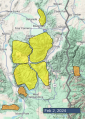
Advisory Archive

There are 3-5” of new snow near Bozeman and 1-2” across the rest of the advisory area. Mountain temperatures are in the single digits and teens F this morning. Winds are 5-10 mph from the west and north. Today, temperatures will rise into the high teens and 20s F under mostly sunny skies with 5-15 mph winds out of the west and northwest. No new snow is expected today.


There are 3-6” of low density new snow around Big Sky, West Yellowstone, Island Park and Cooke City with 1-2” around Bozeman. Mountain temperatures are in the teens F this morning with 5-15 mph winds from the southwest to northwest. Today, temperatures rise into the high teens and 20s F with 5-15 mph winds shifting more northerly by this afternoon. Snowfall today and tonight will add up to 2-4” by tomorrow morning.


Mountain temperatures are in the teens F this morning with 5-15 mph winds from the southwest to northwest. The mountains received 1-3” of new snow. Today, temperatures will be in the 20s F with 5-15 mph winds from the west to southwest, and the mountains will pick up an additional 1-3” of snow by tomorrow morning.


In the last 24 hours, Island Park picked up 12” of new snow, West Yellowstone to Big Sky got 6”, Bracket Creek SNOTEL in the Bridger Range received 4”, Cooke City 3”, and Hyalite 2”. Wind is E-SE at 10-15 mph with gusts of 30 mph, except Sawtelle Peak which has gusts of 54 mph. Temperatures are in the low 20s and snow will fall today and tonight. Wind will shift NW-SW at 15-20 mph. By tomorrow morning 6” will accumulate around West Yellowstone and Island Park with 2-3” everywhere else.

In the last 24 hours, 1” of new snow fell around Big Sky, 2” in the southern Gallatin and Madison Ranges and 4-6” around West Yellowstone and Island Park. Temperatures at 6 a.m. are in the 20s F with SW-SE wind at 10-15 mph, gusting to 30 mph. It will snow today and the wind will remain steady. By morning, West Yellowstone and Island Park will have 6-8” of new snow with 1-3” everywhere else.


Yesterday the mountains near Island Park received 3-5” of new snow and 1-2” fell elsewhere. Overnight, wind increased out of the south-southwest at 15-35 mph with gusts of 35-68 mph. Wind will continue from the south-southwest at 10-20 mph with gusts to 35 mph. Temperatures are teens to mid-20s F this morning, and today will reach high 20s to mid-30s F. Snow is falling near West Yellowstone and Island Park and will continue through today. By tomorrow morning the mountains near Bozeman, Big Sky and Cooke City might get 1-3”. Near West Yellowstone 4-8” are possible with 10-16” near Island Park.


Since yesterday morning the mountains received 3-6” of new snow. Wind has been 5-15 mph out of various directions, ranging from northwest to west to southeast. Temperatures are teens to mid-20s F this morning, and today will reach mid to high 20s F. Wind will be 5-10 mph from the southeast to southwest, and this evening will increase to 10-20 mph from the southwest. Snowfall will taper this morning with another 2-4” possible near West Yellowstone and Island Park and 1-2” elsewhere. Another round of snow will arrive early tomorrow morning.

It’s starting to snow. Only a trace up to two inches have fallen so far, but it’s supposed to keep snowing today. By nightfall two to five more inches will fall. Temperatures are in the 20s F and low 30s F. Temperatures today won’t rise much, they may even drop a few degrees through the day. Winds are light at 5-10 mph out of the southwest to west this morning and will continue similarly today. Another couple inches of snowfall tonight will bring snow total up to 4-8” by tomorrow morning.
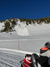
Mountain temperatures are a few degrees above or below freezing this morning under cloudy skies. Winds are 10-20 mph out of the southwest to southeast, with gusts of 30-50 mph. High temperatures today will reach the 40s F in the Bridger Range and 30s F elsewhere. Winds will diminish a little today and stay generally southerly. There has been no precipitation yet, but it is expected to start snowing today in the southern regions and everywhere else by tonight. Expect a trace to 3 inches by daybreak tomorrow, with snowfall continuing through the weekend.

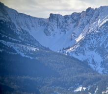
Clear skies and warm weather will continue today. Last night did not freeze in the Bridger Range, but Hyalite and Big Sky did, barely. Wind out of the west to southwest is averaging 15-25 mph with gusts of 48 mph. Daytime temperatures will reach into the mid to upper 40s F in the north and mid to upper 30s in the south. No new snow is expected overnight, but this weekend Winter will return after her quick beach vacation to Cabo.