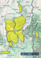
Advisory Archive
Mountain temperatures are in the teens F this morning with 5-20 mph winds from the west to southwest. There is no new snow. Today, temperatures will be in the 20s to around 30 degrees F, with winds from the west to the south at 5-15 mph. The next chance for snow is Friday into the weekend.


This morning, temperatures are in the teens to around 20 degrees F with 5-15 mph winds from the west to southwest. There is no new snow. Today, temperatures will be in the 20s F with 5-15 mph winds from the west to southwest and partly sunny skies. The next chance for snow is toward the end of the week.


This morning there is no new snow, temperatures are 20s to low-30s F, and wind is out of the southwest at 5-25 mph with gusts of 10-35 mph. Today, temperatures will reach high 20s to mid-30s F, and wind will be out of the west-southwest at 5-15 mph. No snow is expected until next year, but fingers are crossed for a storm in the forecast next weekend to bring some decent accumulation.
This morning there is no new snow, temperatures are mid-20s to mid-30s F, and wind is out of the southwest-west at 5-15 mph with gusts of 10-25 mph. Today, temperatures will reach mid to high 30s F, and wind will be out of the south-west at 5-15 mph. No snow is expected until later next week.

Temperatures this morning are in the teens and 20s F with a slight inversion. Winds are 5-15 mph with gusts of 15-25 mph out of the south and west. There is no new snow. Any clouds this morning will quickly dissipate, becoming mostly sunny by the afternoon. High temperatures will be in the high 20s and 30s F. Winds will remain light and southwesterly. No new snow is expected through the weekend.


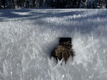
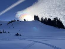
There is no new snow, just an inversion of warm mountain temperatures reading 30-34 F at 9,000 feet in the Madison, Gallatin and Bridger Ranges. Wind is west at 10-20 mph with gusts of 30 mph. Skies will be cloudy for most of the day and clear late this afternoon. No snow is expected and west wind will increase to 20-40 mph. Seeing above-freezing mountain temperatures the last week of December in the middle of the night is…unsettling.


At 5 a.m. under clear skies, there’s no new snow to report. Mountain temperatures are 15-20 F and ridgetop wind is west to north at 10-20 mph with gusts of 30 mph. Today will be sunny with temperatures reaching the high 20s F as wind turns southwest at 10-20 mph. Our next potential snowfall is not until the middle of next week.


Mountain temperatures are in the teens to 20s F this morning, except on the Madison Plateau, where it is -6 F. Winds are 5-15 mph from the west to northwest, and there is no new snow. Today, temperatures will be in the 20s F with 5-15 mph winds from the west to southwest. We will likely see snowflakes in the sky this afternoon into evening, but no measurable accumulation.


Mountain temperatures are in the single digits to teens F with 5-15 mph winds from the west to the north except in the Bridger Range, where they are 25-30 mph. There is no new snow. Today, temperatures will be in the 20s F with 5-15 mph winds from the west to the north. We may see a few flurries tomorrow.
Yesterday the Bridger Range got 6” of new snow and 2-4” fell elsewhere. West-northwest wind averaged 15-25 mph with gusts of 35-45 mph yesterday, and this morning wind has tapered to 5-15 mph. Temperatures are single digits to teens F. Today temperatures will reach high teens F and wind will be westerly at 5-10 mph. The next chance for a little snow is Tuesday.