Advisory Archive
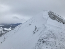
The mountains got a trace of snow this morning and temperatures are in the teens to low 20s F. Wind overnight was northwest at 10-20 mph, and 25-30 mph near Cooke City. Today, wind is north to east at 5-15 mph with temperatures reaching high 20s F. Skies will clear this afternoon and no snow is expected over the next 24 hours.


The storm ended yesterday morning with an additional 1-2” of snow in the mountains near Big Sky, Bozeman and Cooke City, and zero near West Yellowstone. This morning, temperatures are teens to mid-20s F and westerly wind is 10-20 mph with gusts of 25-30 mph. In the Bridger Range, wind overnight was 30-35 mph. Today, temperatures will reach high 20s F and wind will be west-northwest at 15-20 mph. An inch or two of new snow is possible near Bozeman and Cooke City early tomorrow morning.


Since yesterday morning the Bridger Range got 12” of new snow, the mountains near Cooke City, Big Sky and Hyalite got 3-4” with 1” near West Yellowstone. Wind overnight was westerly at 15-25 mph with gusts of 30-40 mph. Temperatures this morning are high teens to mid-20s F and will be mid to high 20s F today. Wind will be west-northwest at 20-30 mph. Snowfall will continue this morning with another 1-3” possible.


At 5 a.m. the mountains around West Yellowstone and Cooke City have 8-10” of new snow, while the mountains around Bozeman and Big Sky have 4-6”. Snow showers continue to linger in the mountains, but additional accumulation is not expected today. Currently, temps range from the teens to mid-20”s F and winds are blowing 20-40 out of the west. Today, skies will remain mostly cloudy and temps will warm into the mid to upper 20’s. Winds will decrease as the day progresses, but will continue to blow 10-25 mph out of the west. A weak ridge of high pressure builds over the region this evening producing generally dry conditions for the weekend.

Since yesterday morning, most mountain locations picked up 6-10” of new snow. Snow tapered off overnight and currently no snow is falling in the advisory area. At 5 a.m. temperatures range from the single digits to mid-teens F and winds are blowing 15-30 mph out of the W-SW. Today, temps will warm into the mid to upper 20’s F and winds will increase with gust upwards of 40 mph. Snow develops during the afternoon hours and continues overnight. The mountains south of Bozeman will pick up 6-8” by tomorrow morning while the northern ranges will see 4-6”.
At 5 a.m. Cooke City, Lionhead and the Yellowstone Club have 10-12” of new snow, while other areas have 6-7”, except Hyalite, which is has 2”. Another 3-6” will fall before the storm dissipates mid-morning. Mountain temperatures are in the mid to high 20’s, but below freezing (rain) in some valleys. Winds are averaging 20 mph with gusts of 30-40 mph out of the SW-W. Winds will decrease and shift westerly when the storm ends.
At 5 a.m. mountain temperatures are in the 20s with southwest winds (west in the Bridger Range) averaging 10-20 mph, gusting 35-45 mph. Today, a moist southwest flow will bring snow and winds of 20-30 mph with mountain temperatures hovering near 20F. The storm will arrive this morning around Lionhead and slowly move north throughout the day. By tomorrow morning the mountains around West Yellowstone will have 6-8” of new snow with 4-6” elsewhere.


Since yesterday the mountains near Cooke City got 2” of snow and elsewhere got none. Wind has been southwest at 10-20 mph and temperatures this morning are teens F in the southern ranges and high 20s F in the northern ranges. Today, temperatures will reach high 20s to mid-30s F with west-southwest wind at 15-25 mph. Tonight, snow showers will drop 1-2” in the southern ranges with more snow for the entire area tomorrow through Thursday.

The mountains got 1-3” of snow yesterday. Wind overnight was westerly at 15-25 mph with gusts of 30-40 mph. Temperatures this morning are teens to low 20s F and will reach highs 20s to low 30s F today. Wind will be west-southwest at 15-25 mph. Tonight the mountains near Big Sky and Cooke City could get 2-3” of snow with a trace to 1” elsewhere.
Overnight a trace to 1” of snow fell in the mountains south of Bozeman. At 5 a.m. temps are in the upper 20’s to low 30’s F and winds are blowing 10-20 mph out of the west with ridgetop gusts pushing 30 mph. Today, light snow showers will continue to impact the southern mountains including Big Sky, where an additional 1-3” is possible by this evening. Temps today will warm slightly and winds will continue to blow 10-20 mph out of the west. The weak weather disturbance moves out of the area tonight and no snow is expected tomorrow.
