Advisory Archive
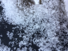
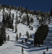
At 5 a.m. the mountains have picked up 2-3” of new snow. Currently, it’s still snowing lightly and temperatures are in the teens to low 20’s F. Winds are blowing 5-15 mph out of the west. Today, snow will continue through the morning hours and the mountains will pick up an additional 1-3” by this afternoon. Skies begin to clear later in the day and temps will warm into the 20’s F. Winds will continue to blow 5-15 mph out of the west. No snow is expected tonight through tomorrow.

The mountains did not get any snow since yesterday morning. Wind has been out of the west-northwest in the northern ranges and Cooke City, and out of the west-southwest near West Yellowstone, with speeds of 15-25 mph and gusts to 40 mph. Temperatures this morning are single digits to teens F in the southern ranges, and high 20s F near Bozeman and Big Sky. Today, temperatures will be high 20s to mid-30s F with west-northwest wind at 20-30 mph. A cold front tonight will bring temperatures in the low teens F, and the mountains will get 3-5” of snow by morning with another 3-5” through tomorrow.

Over the past 24 hours the mountains picked up 1-2” of new snow. At 5 a.m. snow has moved out of the region and skies have become partly cloudy. Temperatures are in the teens to low 20’s F and winds are blowing 10-20 mph out of the W-NW. Today, a weak ridge of high pressure builds over the area producing clear skies and fairly calm conditions. Temperatures will warm into the mid to upper 20’s and winds will remain light to moderate out of the W-NW. No snow is expected over the next 24 hours, but there will be an increasing chance of snow Friday night into Saturday.
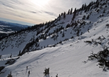
At 5 a.m. under clear skies there’s no new snow, mountain temperatures are in the mid-20s and winds are blowing W-NW at 20-30 mph. It’s been eight days since snow fell in the northern ranges and five days in the south, but that’s about to change. A fast moving snow storm around noon will freshen up the mountains with 2-3” of snow by tonight. Winds will remain out of the W-NW at 20 mph with gusts of 40 mph during the storm. Clear weather returns tomorrow with more snow showers on Friday.
We are hostages under an oppressive regime of high pressure. There’s no new snow, winds are west at 10-20 mph and an inversion has created above freezing temperatures at the ridgetops and low 20s in the valleys. West Yellowstone and Cooke City have been spared the inversion, but will not escape the warm temperatures which will reach the low 40s everywhere. A slow change back to winter begins on Friday, so don’t despair.
Under clear skies this morning, temperatures are high 20s to low 30s F near ridgelines and 10-15 degrees colder in valleys. Wind is west-northwest at 15-25 mph in the northern ranges and Cooke City, and 5-15 mph elsewhere. Dry conditions will prevail today under mostly sunny skies. Temperatures will be 30s to low 40s F with west-northwest wind at 10-25 mph. There is a small chance for snow showers near Big Sky and Cooke City on Wednesday, and a better chance for snow for the entire advisory area Friday night through the weekend.
This morning, temperatures are high 20s to low 30s F in the mountains and 5-10 degrees colder in the valleys. Wind is west-northwest at 15-25 mph with gusts near Bozeman and Big Sky up to 35 mph. Today, temperatures will reach the high 30s to low 40s F, and wind will be west-northwest at 15-25 mph near Bozeman and 5-15 mph elsewhere. A strong ridge of high pressure continues to block precipitation this week. Late this week, a shift to cooler, unsettled weather will bring a chance for snow next weekend.


A stagnant weather pattern is creating strong temperature inversions. This morning, valley temperatures are 10-20 degrees colder than the mountains. A 5 a.m. mountain temps range from the mid-20’s to low 30’s F under clear skies. Winds are blowing 10-25 mph out of the W-NW with ridgetop gusts pushing 30 mph. Today, high pressure remains parked over the area producing sunny skies and relatively calm conditions. This calm and clear weather pattern will exist through the weekend.
Overnight the mountains around Cooke City picked up a trace to 1” of new snow, while rest of the advisory area remained dry. This morning temps range from the teens to upper 20’s F under mostly clear skies. Winds are blowing 15-30 mph out of the W-NW with the exception of the Bridger Range where they’re blowing out of W-SW. Today, temps will warm into the upper 20’s to low 30’s F under sunny skies. Winds will remain light to moderate out of the W-NW. The dominating ridge of high pressure parked over the area will produce a benign weather pattern through the foreseeable future.


Overnight the mountains around Cooke City picked up 2” of new snow while the mountains around West Yellowstone picked up a trace to 1”. At 5 a.m. temps range from the teens to low 20’s F and winds are blowing 10-25 mph out of the W-NW. Today, skies will be mostly clear and temps will warm into the mid to upper 20’s F. Winds will continue to blow 10-25 mph out of the W-NW. A strong ridge of high pressure builds over the area starting today producing clear skies and dry weather for the extended forecast.