Advisory Archive
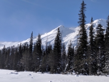
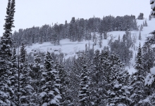
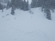
Since yesterday morning the mountains got a trace to 1” of low density snow. Temperatures this morning are single digits below and above zero F, and wind is west to southwest at 15-20 mph with gusts of 30-40 mph. Today, temperatures will be in the teens F with west-southwest wind at 20-30 mph. Snow showers through tonight will drop 1-2” in the mountains near Bozeman and Big Sky, and 3-5” near West Yellowstone and Cooke City. Another equal or greater amount of snow is expected Sunday night.


Over the past 24 hours the mountains near Big Sky picked up a trace to 1” of new snow. This morning, temps range from the single digits above or below zero F under mostly clear skies. Winds are light to moderate out of the S-SW. Today, clear and calm conditions will persist and highs will warm into the teens F. There is a slight chance for snow showers tonight and the mountains could see a trace to 2” by tomorrow morning.
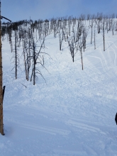
Since yesterday morning the mountains south of Bozeman picked up 1-2” of new snow. At 5 a.m. temps are in the single digits above or below zero F under mostly cloudy skies. Winds are blowing 10-20 mph out of the W-SW. Today, highs will warm into the teens F and winds will remain light to moderate out of W-SW. There is a slight chance for snow showers in the mountains near West Yellowstone and Cooke City later today. Accumulations of 1-2” are possible in these areas by tomorrow morning.
Under partly cloudy skies, mountain temperatures are -5F to -10F with winds averaging 10-20 mph and gusting to 25 mph out of the W-SW and SE around Cooke City. Overnight a trace to 1” of snow fell in the southern mountains and Cooke City. Today will remain partly cloudy, temperatures will rise into the high single digits and drop to zero tonight as winds decrease to 10-20 mph from the W-SW. The southern ranges and Cooke City may get an inch of snow later today.
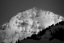
Mountain temperatures at 5 a.m. are -15F. In the northern mountains winds are W-NW at 15-25 mph, and 10-20 mph out of the N around West Yellowstone and SE in Cooke City. Skies will be sunny today and winds will become light and turn S-SW. Temperatures will rise into the low single digits and fall to negative single digits this evening. Clouds will increase tonight and a trace to 1” of snow may fall around West Yellowstone and Cooke City.
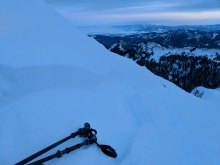
Cover up to avoid the cold burn of frostbite. A temperature of -15F with 20 mph wind equals a minus 42F wind chill.


The mountains near Bozeman and Big Sky got 2-4” of snow yesterday morning and 1” of snow overnight. Near West Yellowstone and Cooke City got 5-7”. Temperatures this morning are teens to single digits below zero F. Wind is south-southwest in Hyalite and Big Sky, and is easterly elsewhere at 5-15 mph and 25-35 mph in the Bridger Range. Today, temperatures will reach single digits above and below zero F, wind will be east-northerly at 5-15 mph, and light snow will dust the mountains with 1-2”.
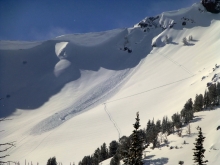
Since yesterday morning the mountains near Cooke City got 14” of new snow. Near Big Sky, Hyalite, and West Yellowstone got 7-10”, and the Bridger Range got 4”. Wind was southwest at 25-40 mph with gusts of 60-80 mph yesterday, and decreased to 20-30 mph out of the west this morning. Temperatures this morning are teens F and will drop to single digits and negatives F through the day. This afternoon, wind will shift east at 5-15 mph. Continued snow showers through tonight will drop 3-6” in most locations with 8-12” near Cooke City by morning.

Since yesterday morning the mountains picked up 5-8” of new snow. At 5 a.m. temps are in the teens F and winds are blowing 15-30 mph out of the west with ridgetop gusts in Hyalite and Taylor Fork breaking 40 mph. Today, strong winds will continue as another storm system approaches from the north. The southern mountains will see 2-4” by this afternoon while the northern ranges will pick up 1-3”. Heavier snow impacts the area tonight. The mountains south of Bozeman will see an additional 5-8” by tomorrow morning while the mountains around Bozeman will see 3-5”. Highs today will warm into the upper teens to mid-20’s F and winds will continue to blow 15-35 mph out of the west-northwest.

Over the past 24 hours, 1-3” of snow fell across the advisory area. This morning temps are in the single digits under partly cloudy skies and winds are blowing 15-35 mph out of the W-SW. Today, light snow will develop over the mountains and 1-3” is possible by this afternoon. A heavier shot of snow impacts the area tonight. The mountains will likely see an additional 2-4” by tomorrow morning. Winds will remain moderate to strong out the W-SW, but will shift to a more NW direction this evening. Temps will warm into the upper teens to mid-20’s under mostly cloudy skies.


Overnight the mountains around Bozeman picked up 4-5” of new snow while the mountains around Big Sky, West Yellowstone and Cooke City picked up 6-8”. This morning snow has mostly exited the area and temps are in the single digits to low teens F under partly to mostly cloudy skies. Winds are blowing 15-25 mph out of the west with ridgetop gusts near Big Sky and Cooke City breaking 30 mph. Today, lingering snow showers could deposit an additional to 1-2”, mainly in the southern mountains. Skies become partly cloudy by this afternoon and no snow is expected tonight. Temps warm today into the teens to low 20’s F and moderate winds will continue out of the west.