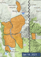
Advisory Archive
Last night snow showers delivered 3-4” to the mountains near Bozeman with 1-2” elsewhere. This morning, temperatures are teens to low 20s F and wind is west-northwest at 10-15 mph with gusts to 30 mph. Today under partly cloudy skies, temperatures will be in the 20s F and wind will be west-northwest at 10-15 mph with gusts to 25 mph. Snow showers tomorrow will deliver less than an inch by morning, and heavy snowfall is expected late tomorrow into Monday.


At 5 a.m. under clear skies there is no new snow. Mountain temperatures are in the high teens F and wind is west to northwest at 20-25 mph with gusts of 50 mph in the Bridger Range. Clouds will increase and temperatures will reach the upper 20s F as winds shift NW at 20-30 mph. Snowfall tonight will drop 2-3” in the mountains with another storm predicted Sunday night and Monday.
In the last 24 hours the mountains around Cooke City got 10” of new snow, 3-4” around West Yellowstone, and 2” outside Bozeman and Big Sky. West wind was vicious yesterday and hit 70-90 mph at the ridgeptops at all our stations. These lessened overnight and now average 15-20 mph with gusts of 40-50 mph. Today will be clear skies, no snow and west wind at 15-25 mph. Temperatures this morning are 10-15F and will warm into the mid 20s this afternoon.


Bozeman’s mountains received 1” of new snow in the last 24 hours. Cooke City, Big Sky and West Yellowstone received 2-5” of snow with the Taylor Fork coming out on top. Winds in the Southern Madison and Gallatin Ranges through the Bridger Range are blowing 20-30 mph from the west to southwest. Winds in West Yellowstone and Cooke City are 5-10 mph from the southwest. Mountain temperatures are in the 30s F in the northern ranges and 20s F in the southern ranges.
Today, winds will be 30-40 mph in the northern ranges and 20-30 mph in the southern ranges from the southwest. Freezing levels start the day at 5000’ near West Yellowstone and 7000’ in the Bridger Range before dropping this afternoon. The mountains near Bozeman and Big Sky will get 1-3” of snow, 3-4” in West Yellowstone and 4-6” in Cooke City by morning.


Mountain temperatures this morning are in the teens to mid-20s F with 15-25 mph wind from the southwest to northwest and there is no new snow. Clouds will increase through the day with temperatures reaching the 20s F in the southern ranges and 30s F in the northern ranges. The wind will blow 15-25 mph from the southwest and we will have a trace to 1” of new snow by morning.

This morning there is no new snow. Wind is northwest-southwest at 5-15 mph with gusts to 25 mph, and temperatures are teens to low 20s F. Today, wind will be westerly at 10-20 mph, and temperatures will reach high 20s to low 30s F. The next chance for snow is late Tuesday night through Wednesday.


This morning there is no new snow. Wind is west-southwest at 5-15 mph with gusts to 25 mph, and temperatures are teens F. Today, wind will be westerly at 10-20 mph and shift north this afternoon, and temperatures will reach mid to high 20s F. The next chance for snow is Tuesday night and Wednesday.
There is no new snow. Winds shifted yesterday from the south to north and northeast at 5-15 mph. Winds in Bridger Range are westerly with gusts to 20 mph. Temperatures this morning are in the single digits and low teens F. Winds will remain generally light and northerly today. Temperatures will rise into the mid-20s F. No snow is in the forecast until the middle of next week.

Since yesterday morning, 6” of new snow fell in the Bridger Range, 3-4” in Hyalite and around Big Sky, and 1” near West Yellowstone and Cooke City. Winds are light out of the west and northwest, with gusts to 25 mph in the Bridger Range. Temperatures this morning are in the teens to mid-20s F. Winds will remain light today shifting to the south and southeast. Clouds will dissipate this morning leaving mostly sunny skies this afternoon. High temperatures will be in the 20s and low 30s F. No new snow is expected through the weekend.


At 6 a.m. it is snowing and 1-2 inches has fallen in Taylor Fork, Big Sky and Bridger Range. Winds are SW at 10-20 mph with gusts of 30 mph and temperatures are in the high teens to low 20s F. Today, winds will remain moderate from the SW and 2-4” of snow will fall in the north and 1-2” around West Yellowstone and Cooke City. Temperatures will reach the high 20sF and skies will clear overnight.