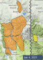
Advisory Archive
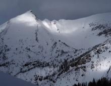
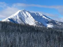
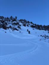
Yesterday morning the Lionhead area and Cooke City picked up an additional inch of snow as the snowstorm exited. This morning skies are partly cloudy with mountain temperatures in the mid-teens F. Winds are averaging 15-20 mph with gusts of 35 mph. Today, temperatures will rise into the 20s F under mostly sunny skies with wind speeds decreasing this afternoon to 10-20 mph. No new snow is expected until tomorrow morning.
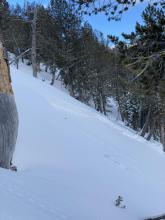
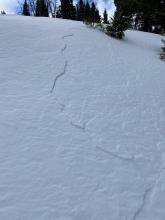
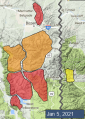
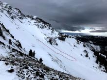
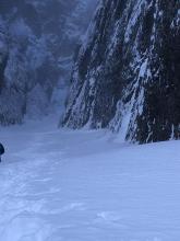
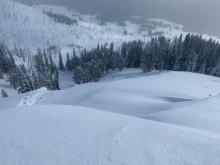
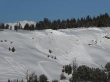
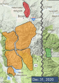
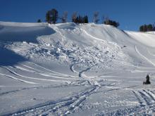
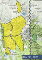
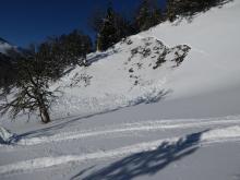
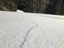
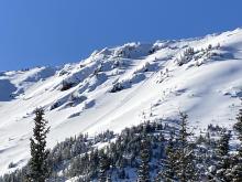
Last night I added 11 entries to our Avalanche Activity list. Natural and human triggered slides, and red flags of collapses and cracking were littered throughout southwest Montana. Check these out along with our videos leading up to yesterday’s Avalanche Warning to get an understanding of the snowpack structure and instability.


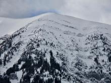
The Bridger, Madison, Southern Gallatin, Lionhead and Centennial Ranges received 8-10” of new snow, Cooke City got 6” and the Northern Gallatin Range received 4.” Winds are 15-30 mph from the west to south and temperatures are in the low 20s F. Snow will continue into the morning with the southern ranges picking up 2-3” and 1-2” in the northern areas. The wind will blow 15-20 mph from the west to southwest and temperatures will be in the 20s F.


Yesterday the mountains near Big Sky, West Yellowstone and Cooke City got 2-4” of snow and less than an inch fell near Bozeman. Strong southwest wind continued through last night at 15-25 mph with gusts of 30-40 mph. This morning temperatures are high teens to 20s F. Today, temperatures will rise to high 20s to low 30s F with westerly wind at 15-30 mph. Snow is expected this afternoon and tonight. By tomorrow morning 5-8” of new snow is possible near West Yellowstone with 3-6” elsewhere.


Since yesterday morning the mountains got 1-3” of new snow. This morning, temperatures are teens to low 20s F and southwest wind is 15-25 mph with gusts of 30-50 mph. Strong southwest-west wind will continue today with gusts over 40-50 mph. Snow showers will favor the southern half of our advisory area this afternoon with more snow expected tomorrow. By tomorrow morning, 5-7” of new snow is possible near West Yellowstone with 3-5” near Cooke City and 1-3” elsewhere.

One to 2” of new snow fell overnight. Winds are southwesterly at 10-20 mph with gusts up to 35 mph. Temperatures are in the high single digits to low 20s F. Winds will continue to blow out of the southwest at 10-20 mph with stronger gusts. Temperatures will rise into the 20s and low-30s F. Light snowfall today and tonight will leave a trace to 2” by tomorrow morning. A stronger pulse of moisture tomorrow will favor the southern areas.

As snowfall finished up yesterday morning, the Lionhead area picked up an additional 3” of new snow and a trace to 1” fell elsewhere. Winds are 10-20 mph out of the west across most of the advisory area, with 25 mph steady winds and 40 mph gusts in the Bridger Range this morning. Skies are partly cloudy with temperatures in the mid-teens and 20s F. Winds will continue to blow out of the west at 10-20 mph, with stronger gusts in the Bridgers. Temperatures will rise into the mid-20s and low-30s F. Light snowfall tonight will bring a trace to an inch of new snow by tomorrow morning.

Hallelujah. Last night it finally snowed. At 6 a.m. the Bridger Range has 5”, the mountains from Bozeman to West Yellowstone have 2-3” and Cooke City got 1-2”. Winds are west to southwest averaging 15-20 mph and gusting to 35 mph. Skies are cloudy and temperatures are in the mid-teens. Scattered snowfall this morning will drop another 1-2” before skies clear. Ridgetop winds will continue to blow west to southwest at 20-35 mph and temperatures will rise into the low 20s.

Under clear skies there is no new snow to report, but that will change today. Clouds will increase and winds will too. Currently west winds are blowing 15-20 mph with temperatures in the low teens. This afternoon west wind will be gusty at 30-40 mph from the west with temperatures reaching the low 20s. Scattered snowfall today and tonight will drop 1-3” by morning with the storm exiting later tomorrow.

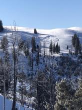
Mountain temperatures are in the teens this morning with 10-15 MPH winds from the west to northwest and there was no new snow in the last 24-hours. Today, skies will be mostly sunny with 5-15 MPH winds from the west to northwest and temperatures around 20 F. Our next chance for snow arrives tomorrow.


With no new snow in the last 24-hours, mountain winds are blowing 5-15 MPH from the west and temperatures in the single digits to low teens F. Today, under sunny skies, temperatures will rise into the upper teens F and the wind will blow 5-10 MPH from the north.