Snow Observations List
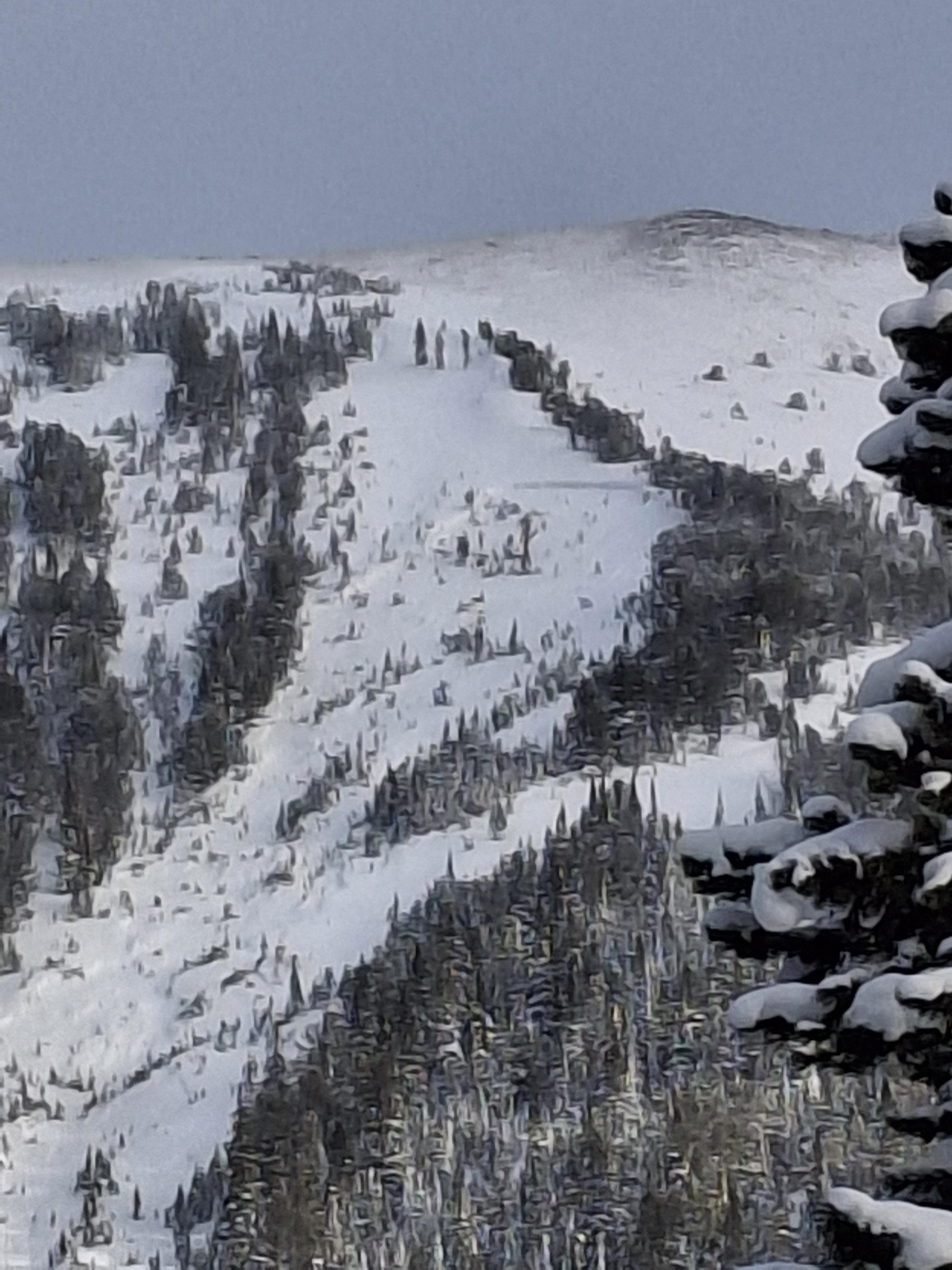
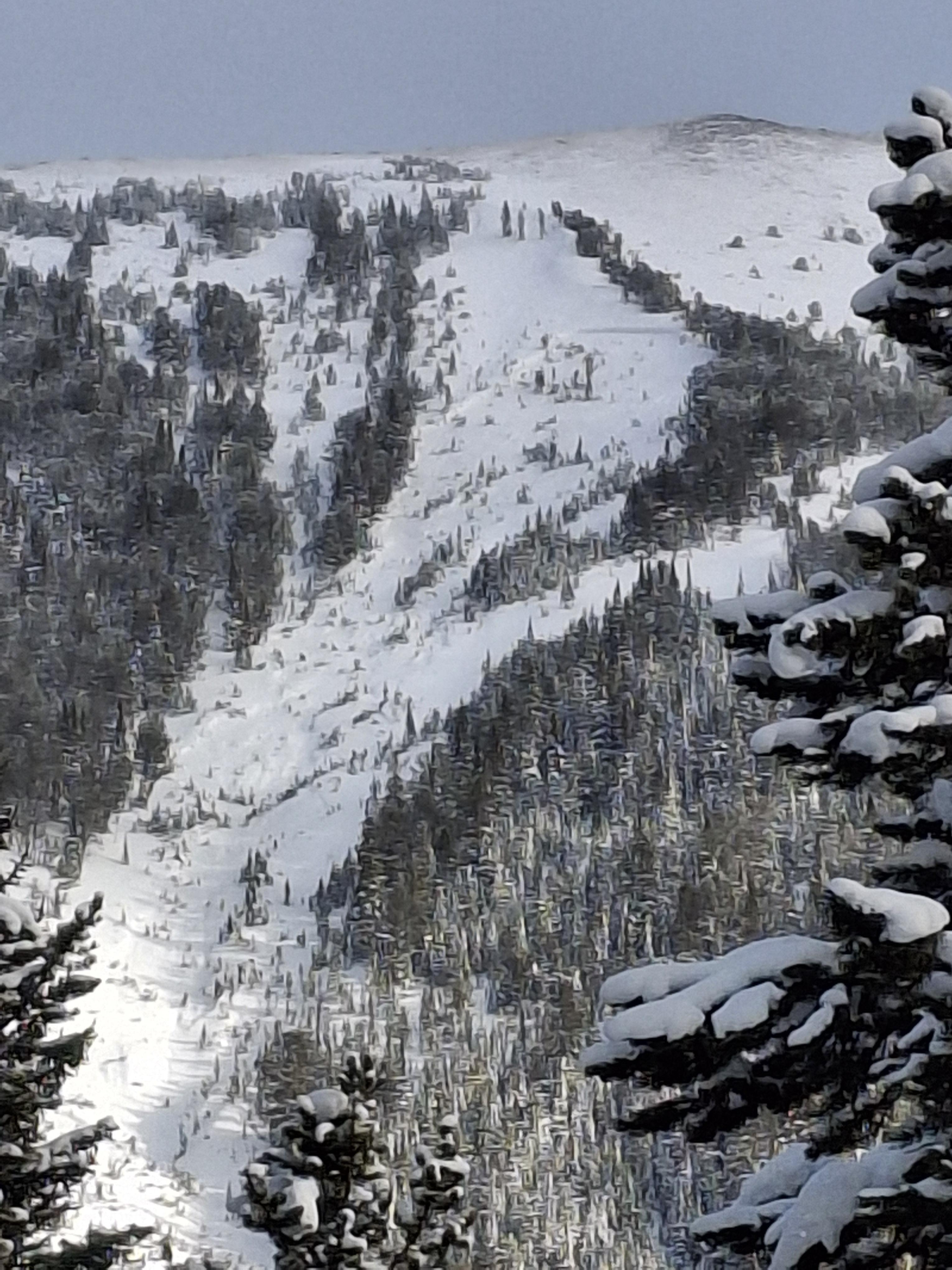
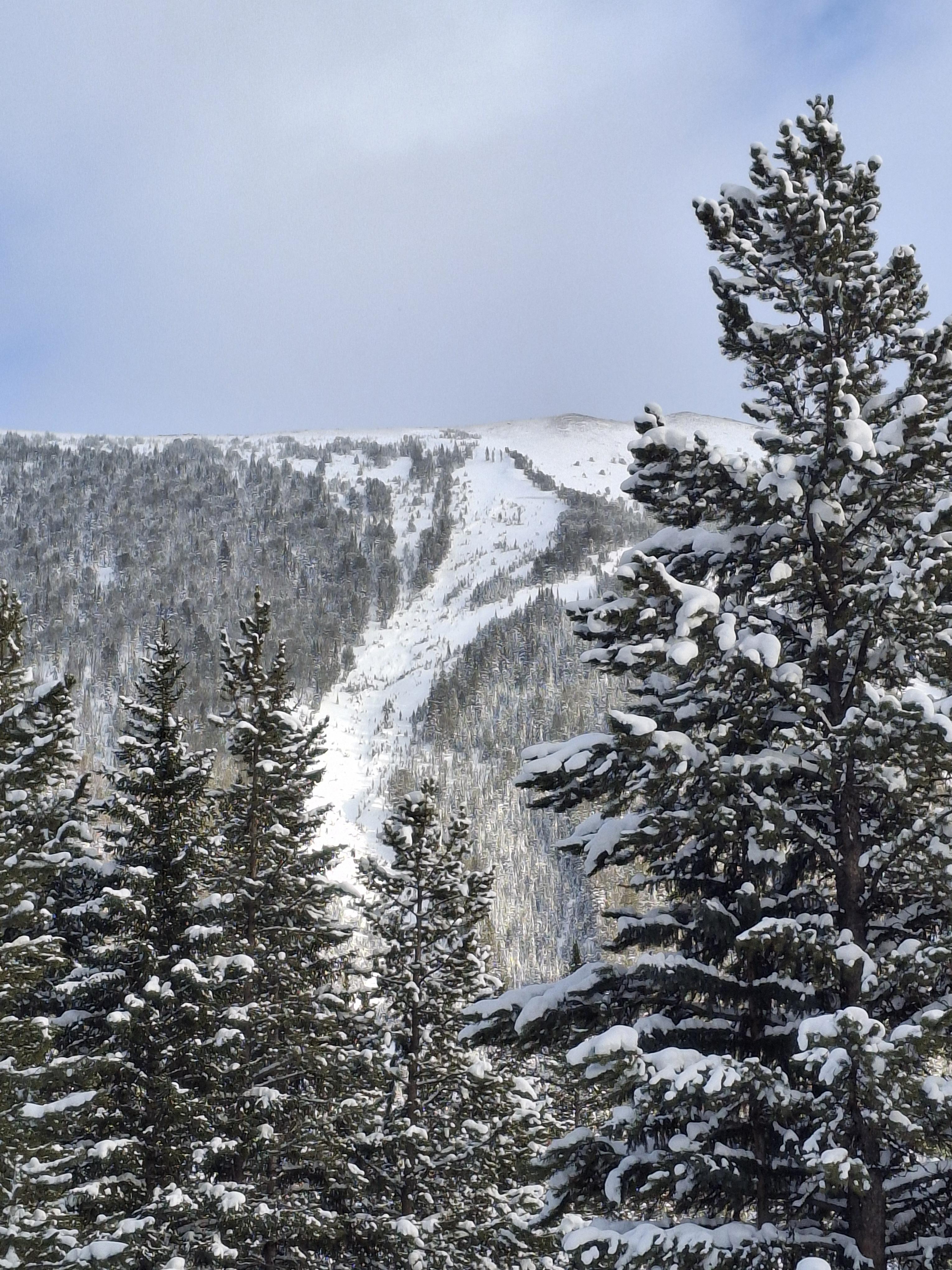
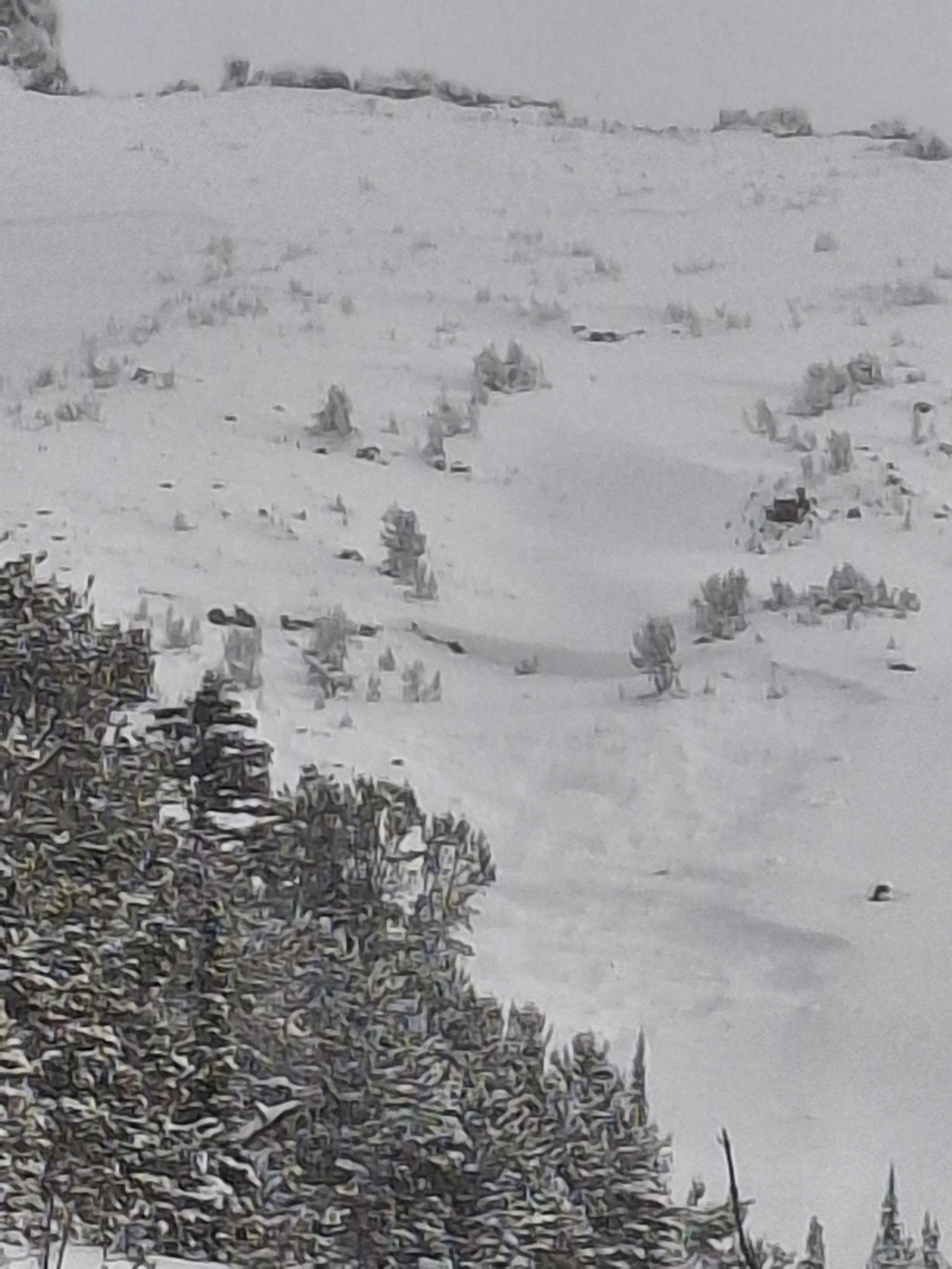
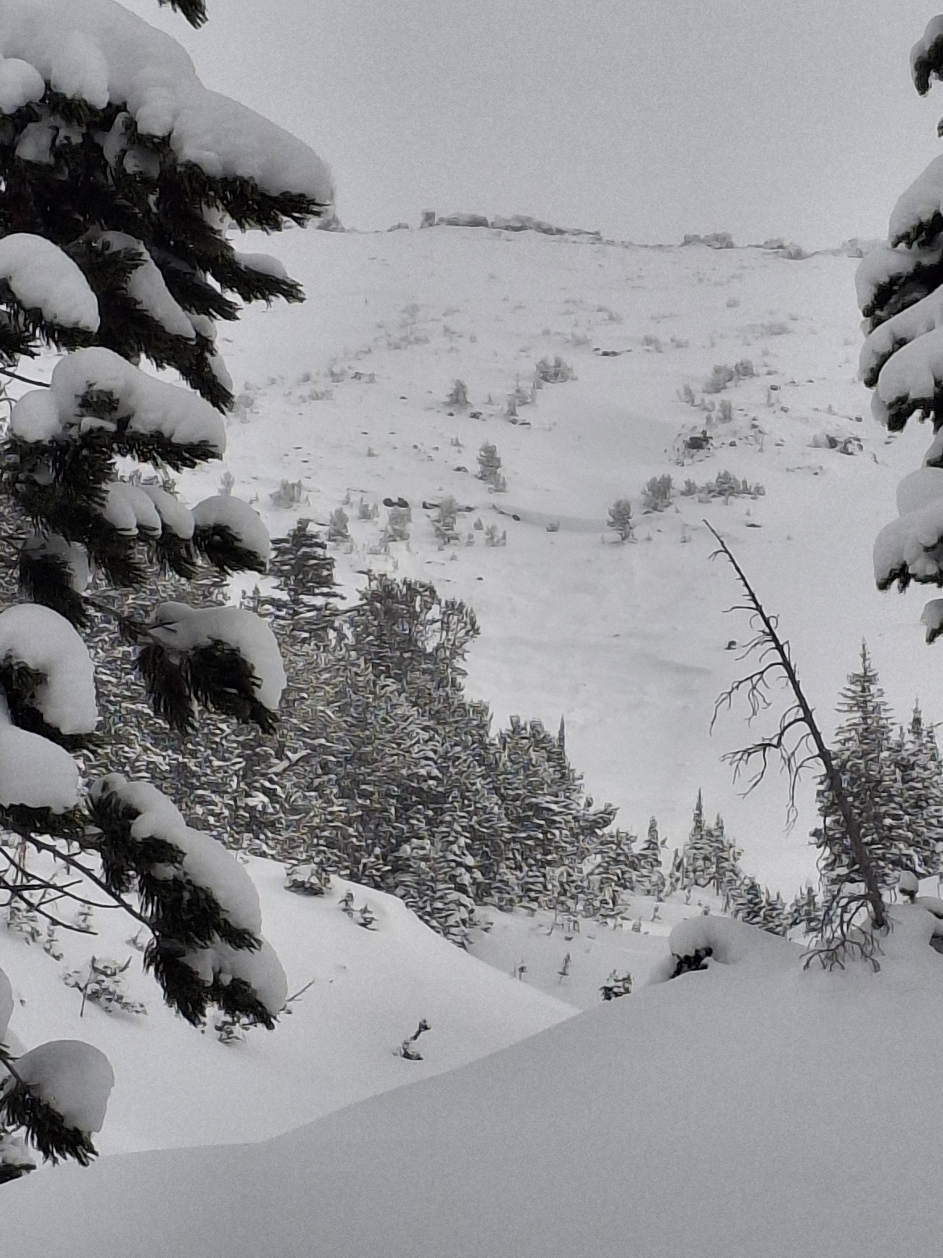
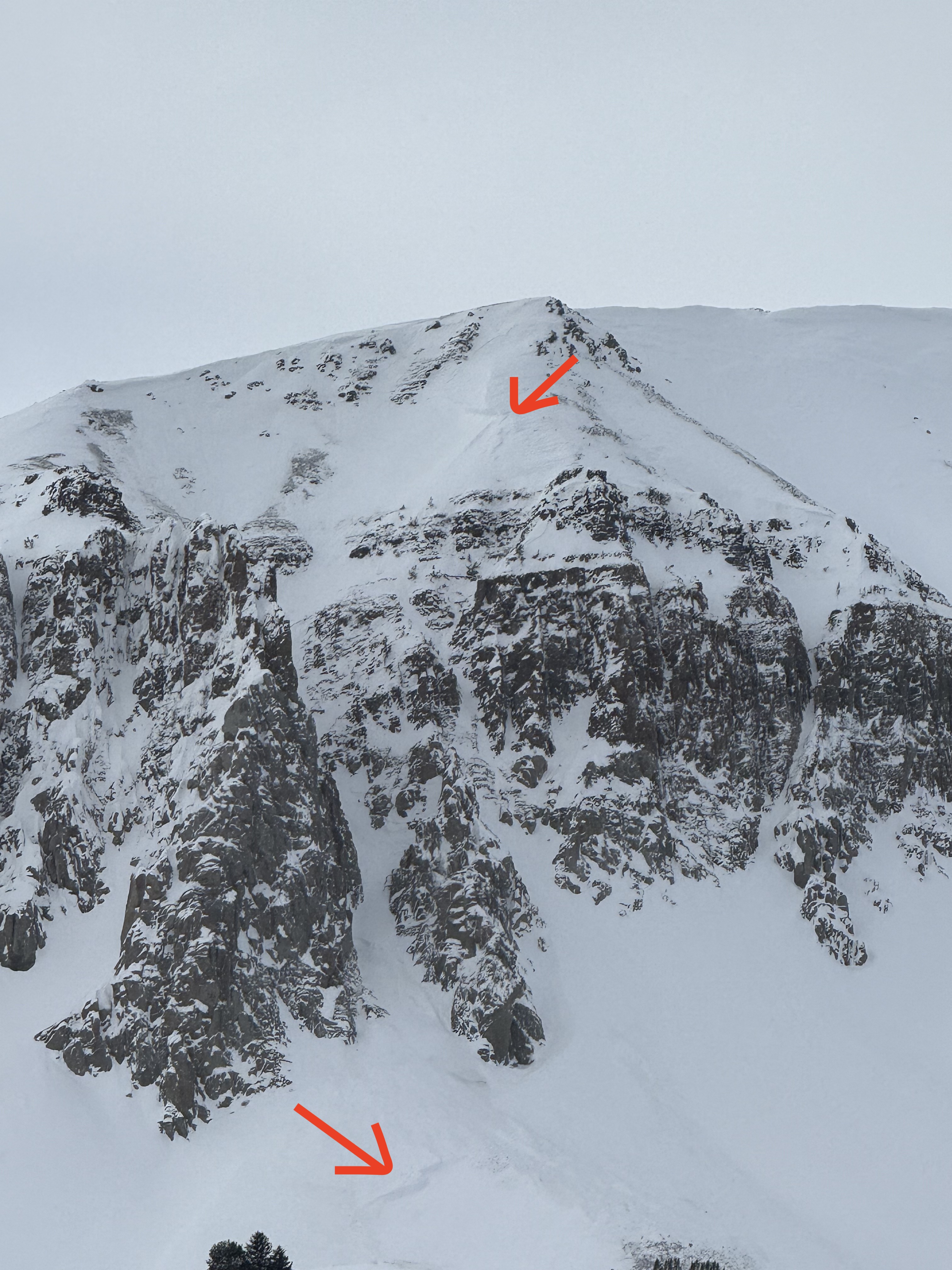
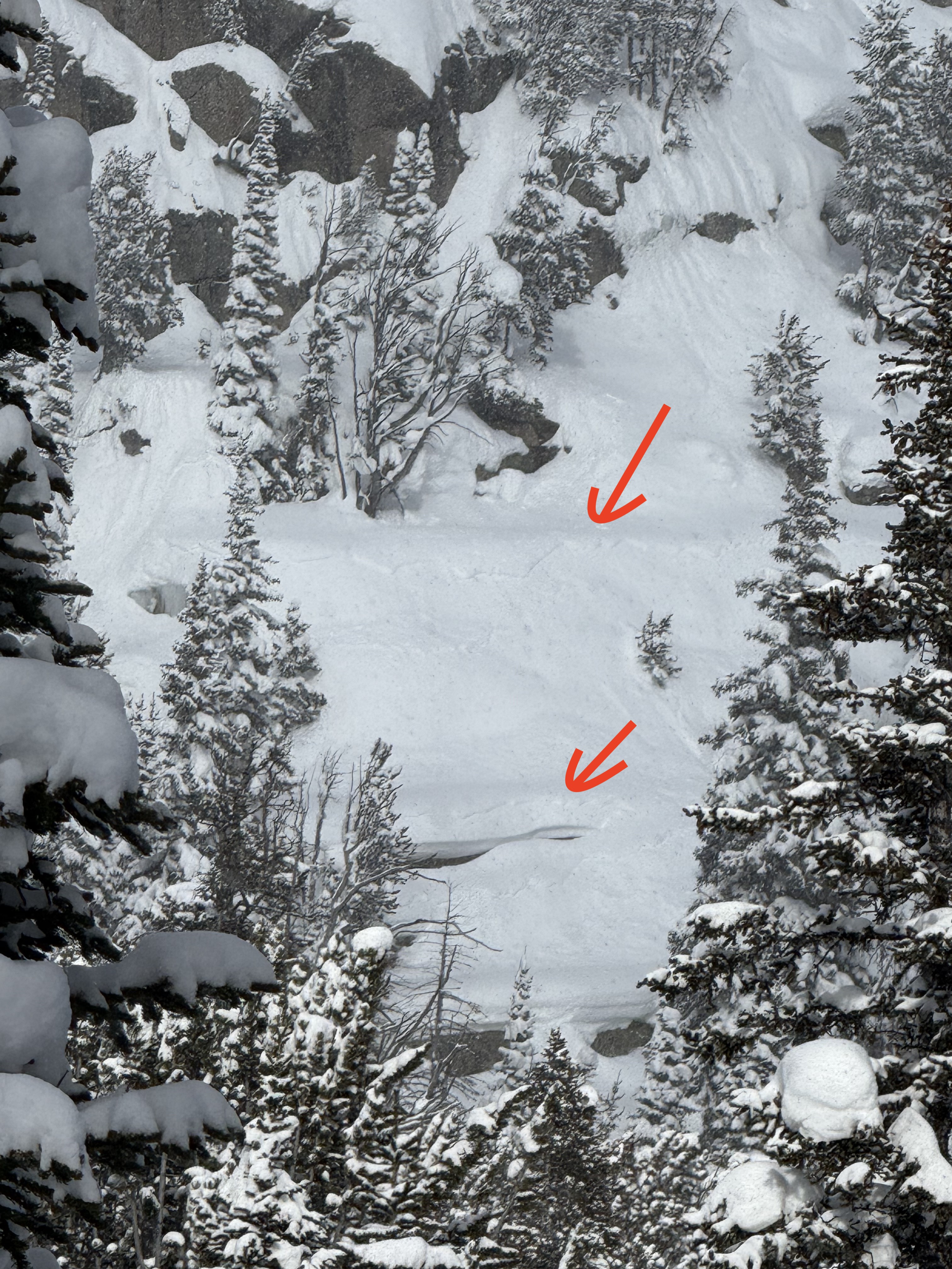
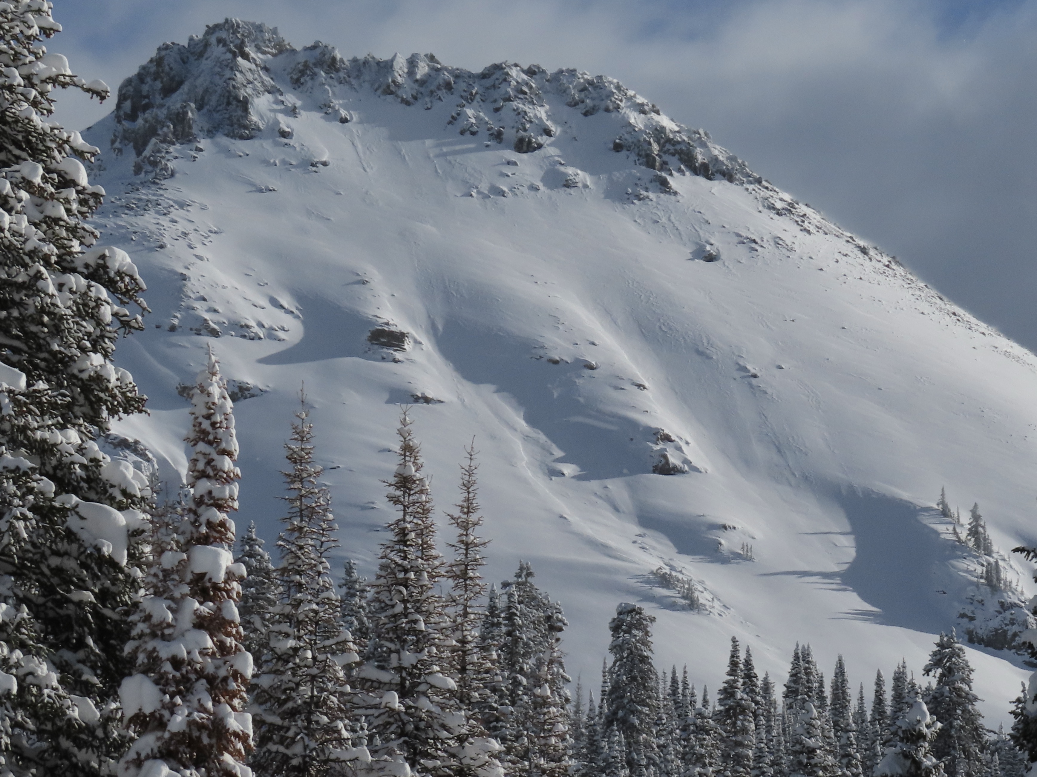
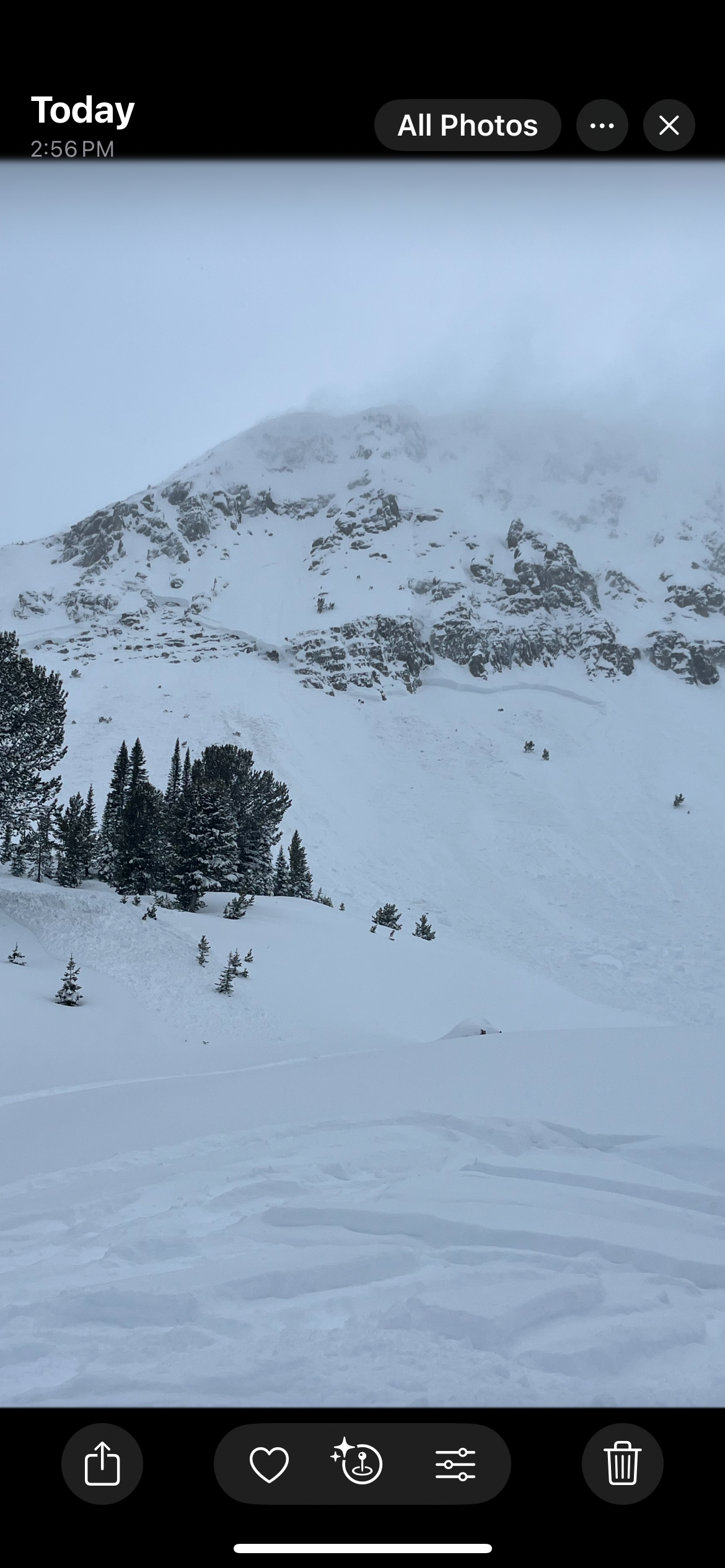
Spotted another natural avalanche today on Woody Ridge north of the "KNBs." Northwest facing slope, crown elevation approx 9600'. Ran 1000 to 1200'. Unsure of when it went, we did not notice it this morning only this afternoon on the hike out.
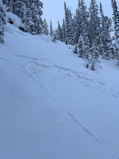
Full Snow Observation ReportOn 1/12 observed a D .5 soft slab near Long Lake above the snowmobile trail. Also saw some small dry loose activity on E facing terrain in Zimmer Creek.
Full Snow Observation ReportObserved a large avalanche on a west facing slope approx 10000ft, with a higher crown at 10200'. Crown depth 4-6'. HS-Ns-D2-R2-O . Ran 1000ft and into terrain I had previously considered safe.
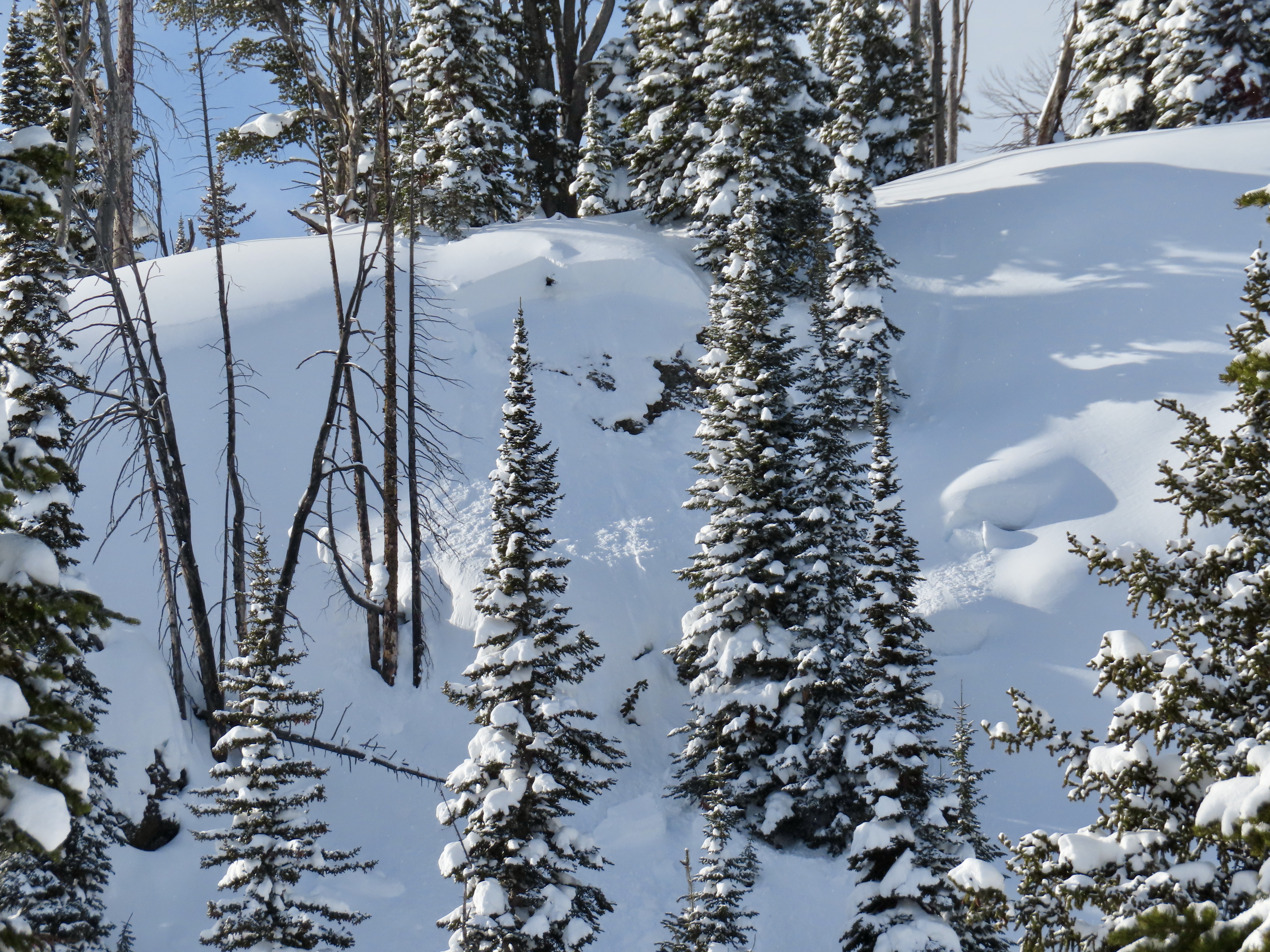
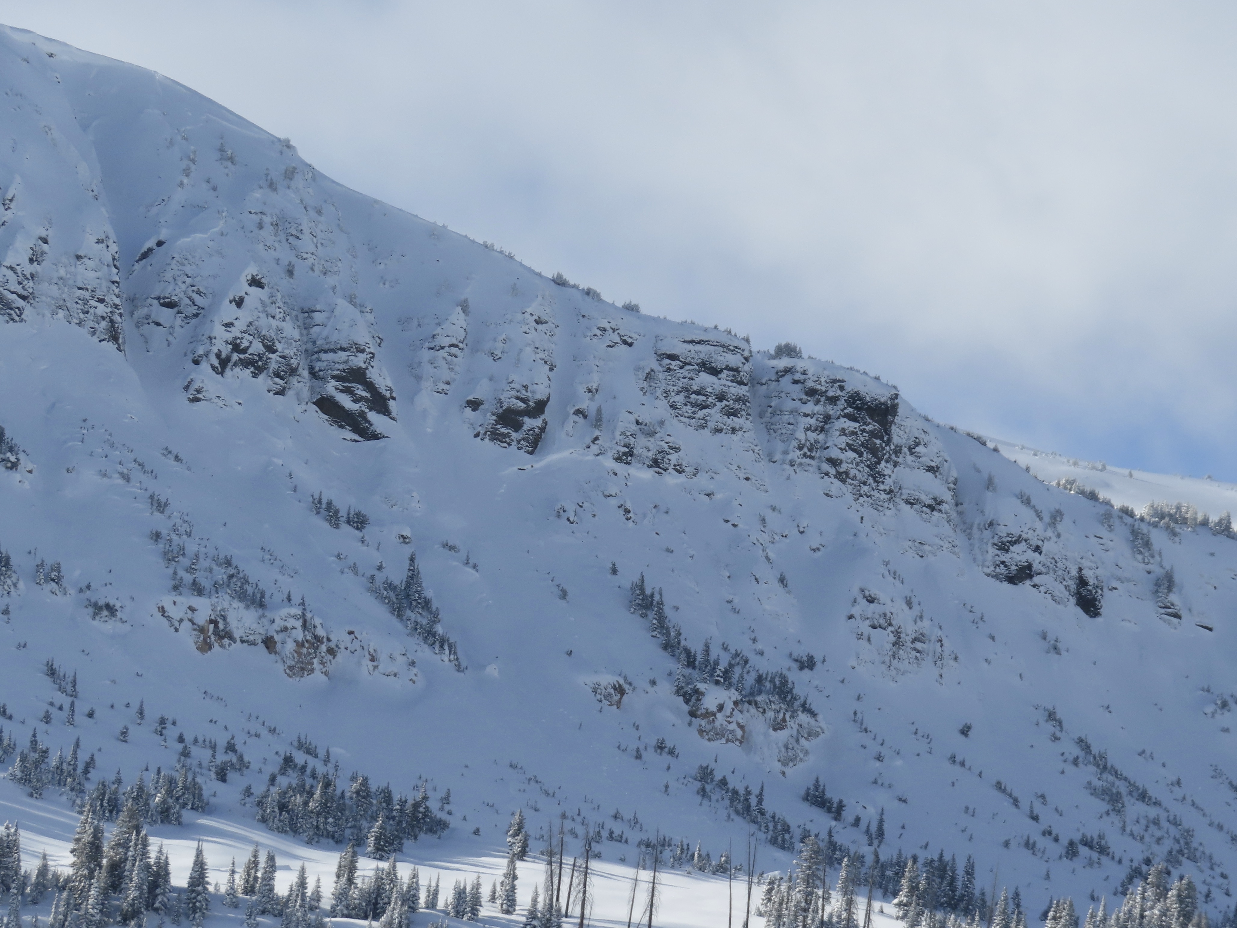
Full Snow Observation ReportA few dry loose avalanches on Climax, plus two small crowns. One was older and drifted in. The other was a small, recent wind slab.
Full Snow Observation ReportOvernight it snowed 8 inches of low density at the yurt, and an additional 3 inches today.
No avalanches or cr, co observed. Wind loading observed multiple aspects NTL.
Full Snow Observation Report
The main story from today was increased wind this morning and intermittently throughout the day. The moderate winds were actively blowing snow out of trees and over ridgelines, drifting snow into thick deposits, and there was evidence that wind had been active at high elevations (>9500'?) the last couple days. Today, winds strong enough to move snow started to reach all elevations. On Henderson bench we noted many thick, dense drifts while riding, and could see the snow surface textured from the wind up higher.
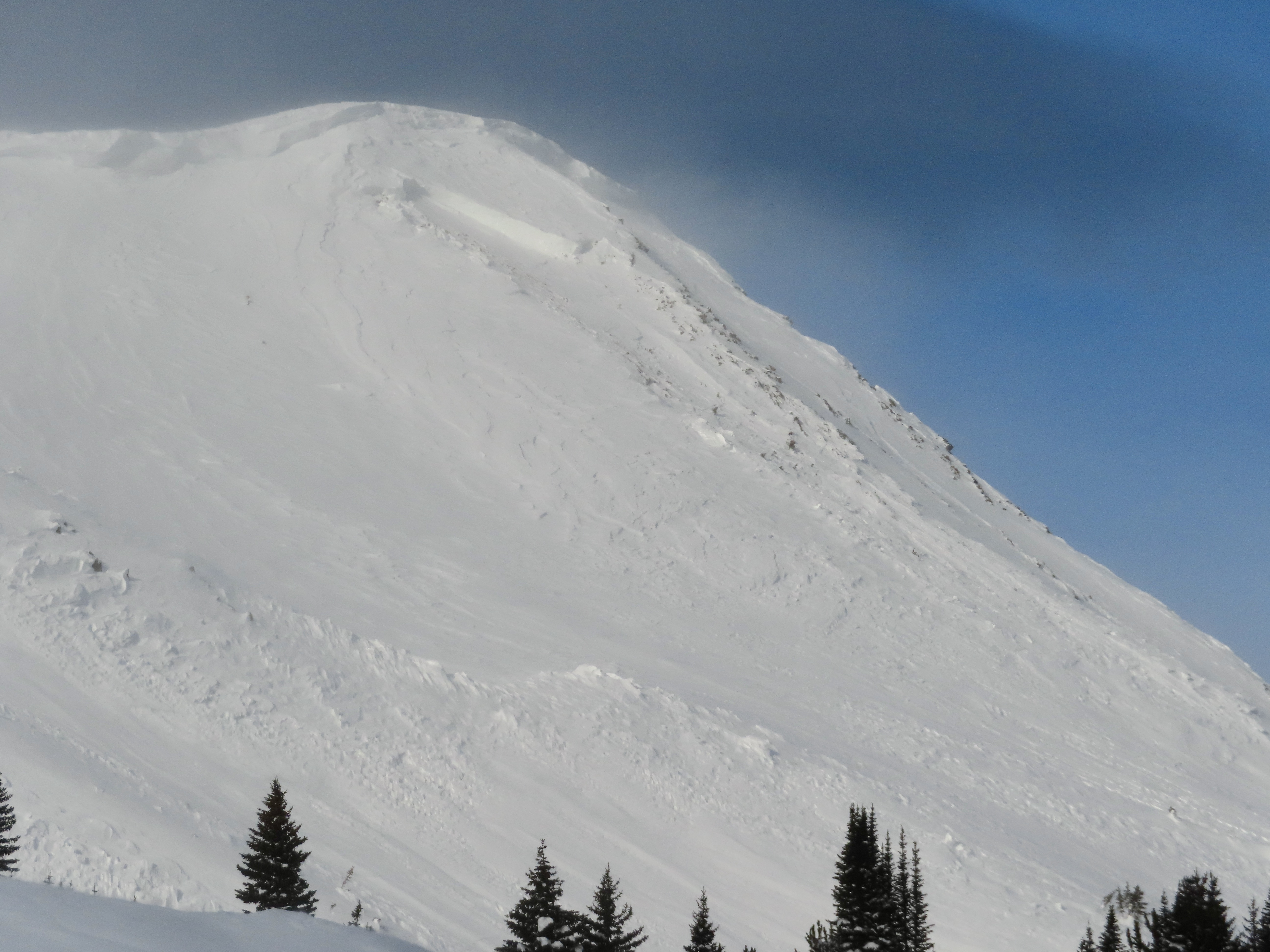
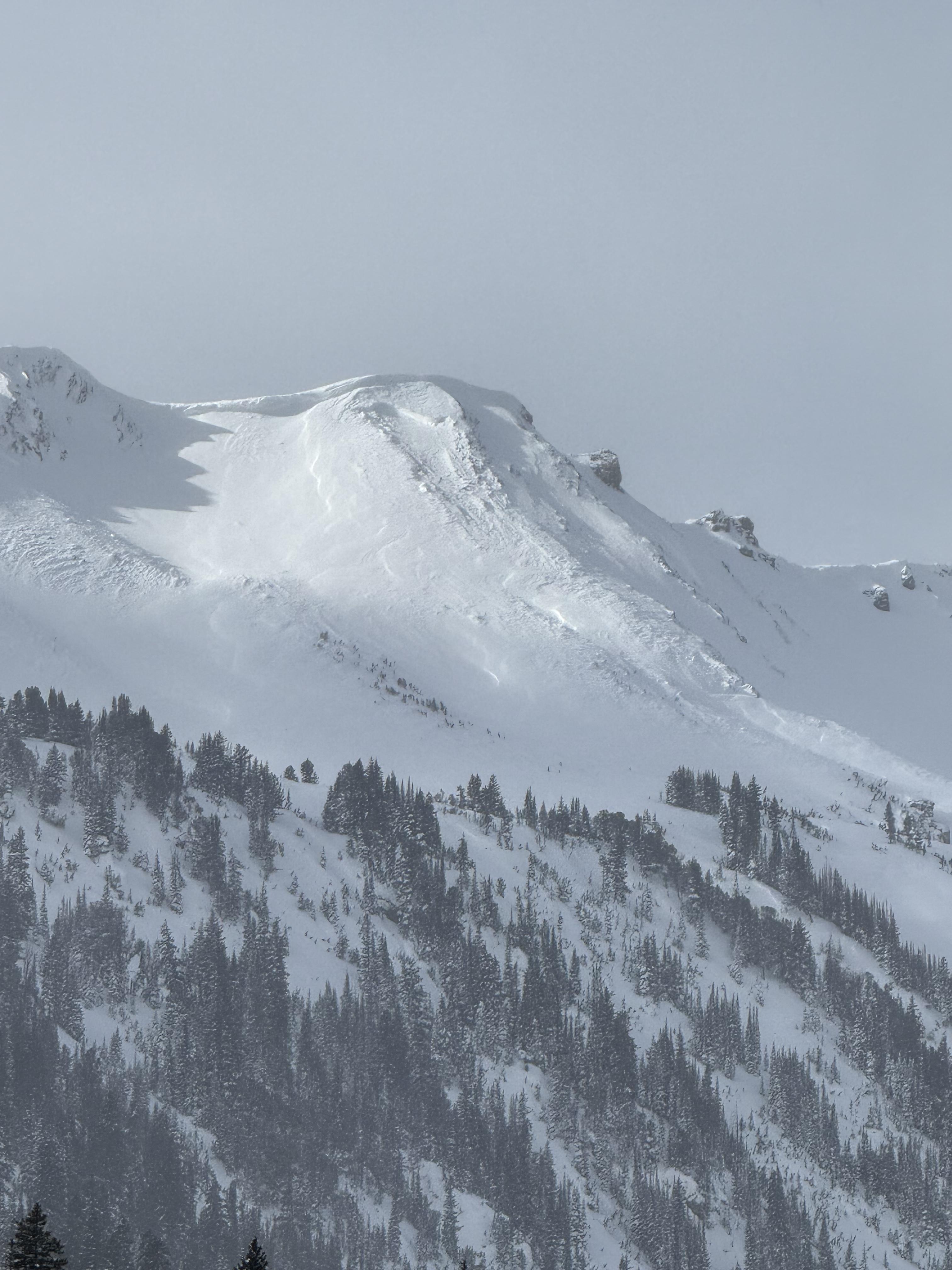
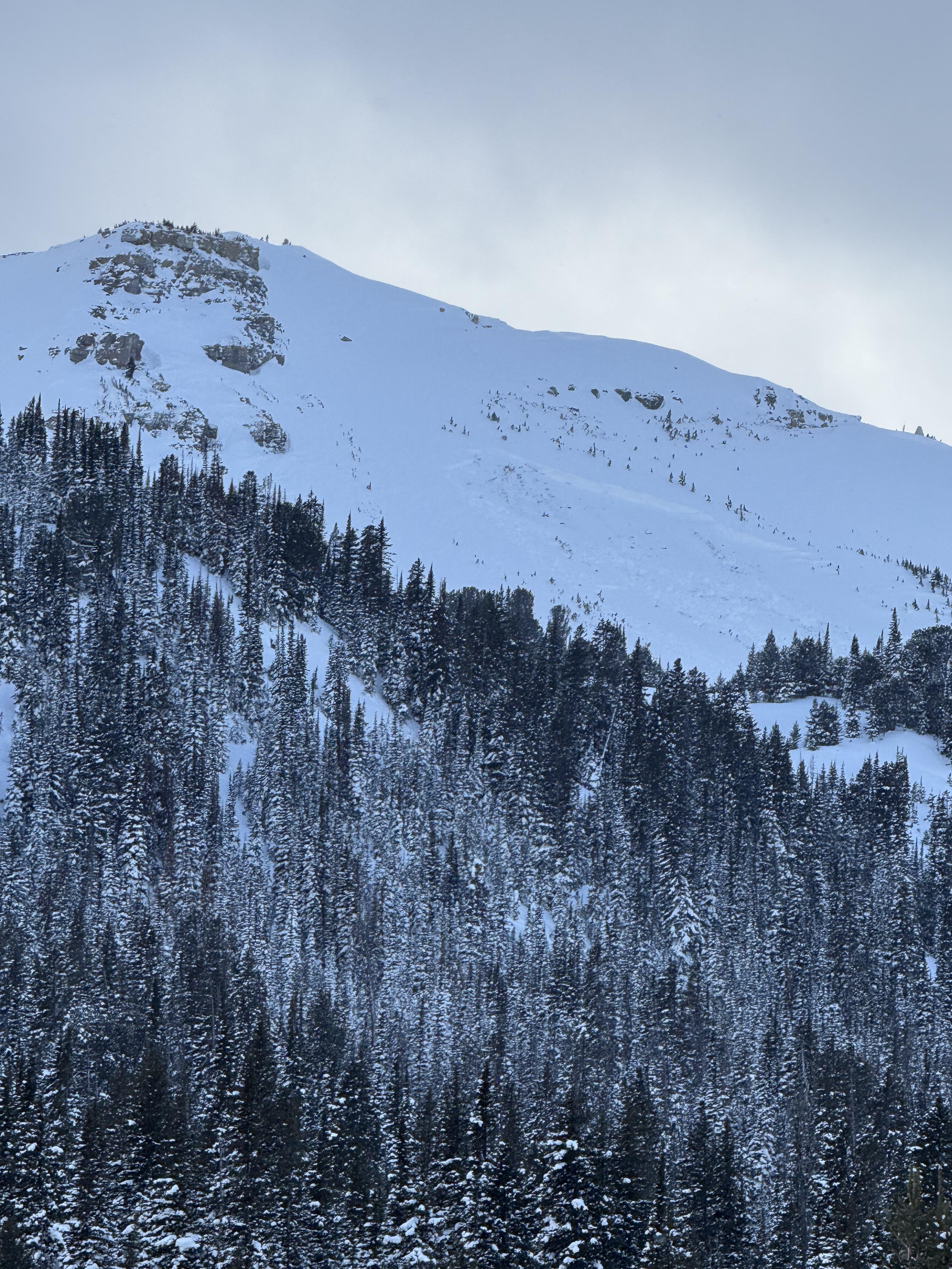
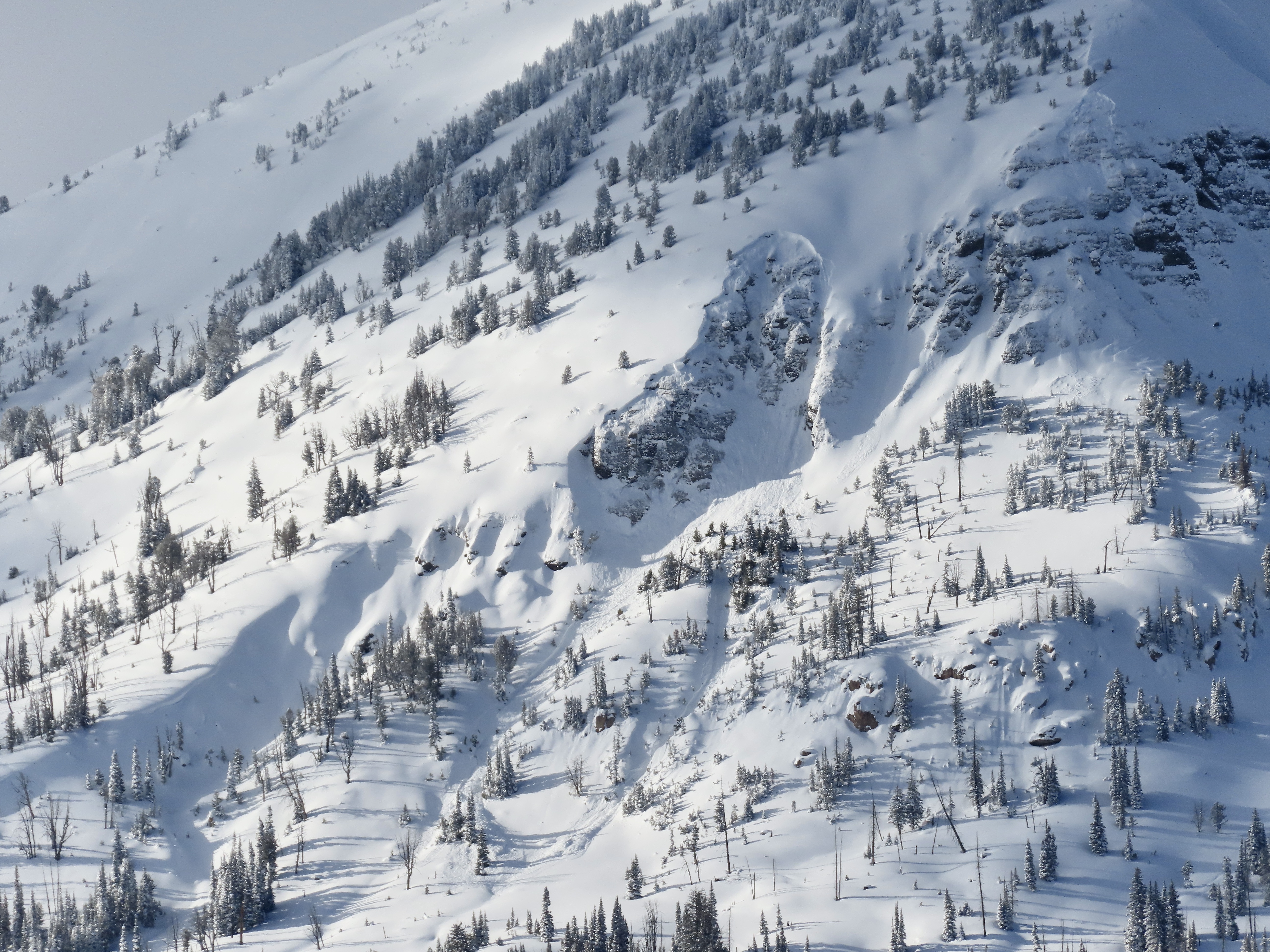
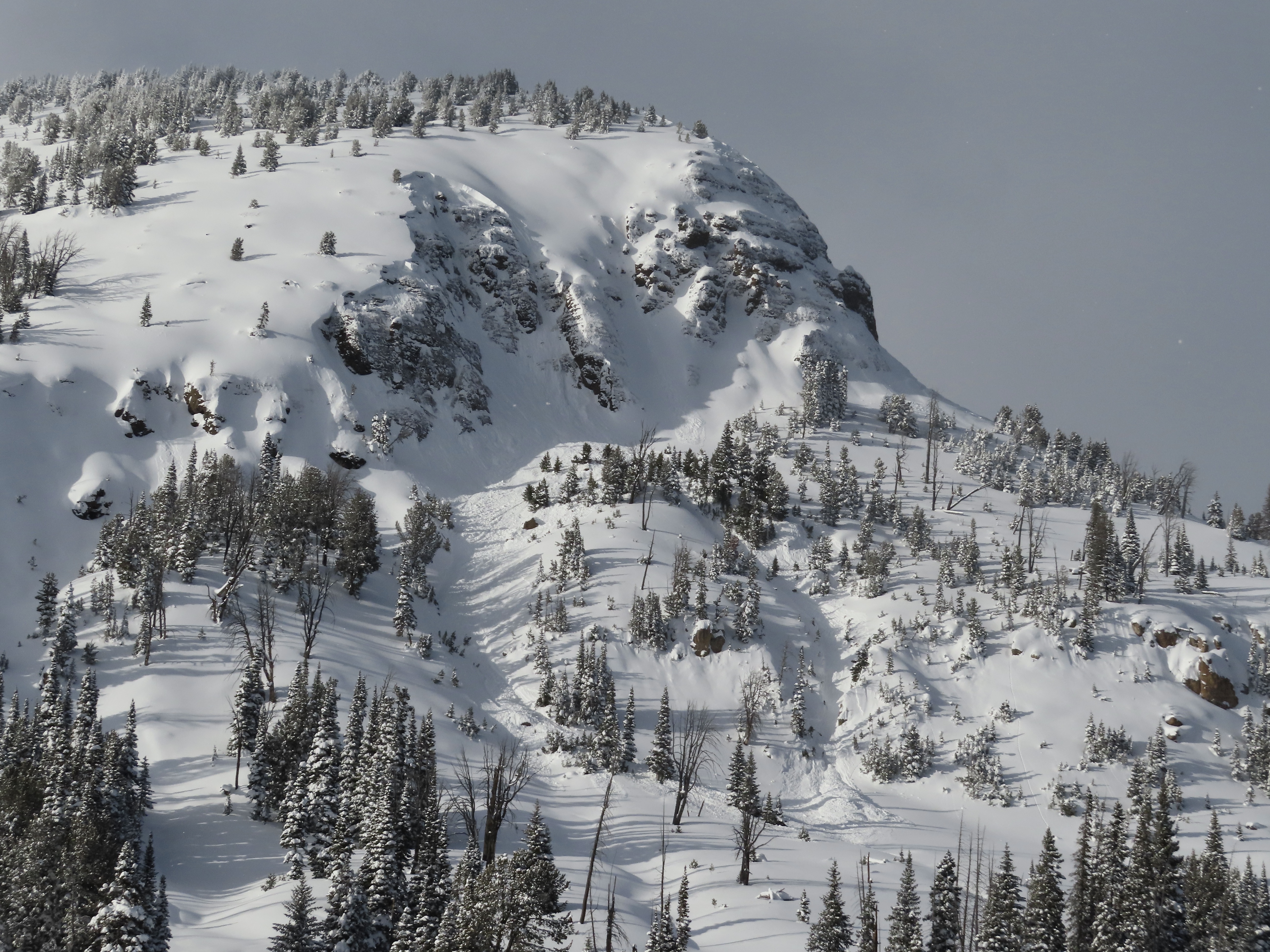
We looked at two 4-6' deep persistent slab avalanches that were reported yesterday on the east side of Henderson Mtn., which likely happened yesterday. Wind-loading was the likely trigger. There were not tracks near the larger one above the bench, where riders could easily get to, but they could have been filled in. The other slide was below the highest point below a cornice and likely natural. Both looked like they broke on facets at the bottom of the snowpack.
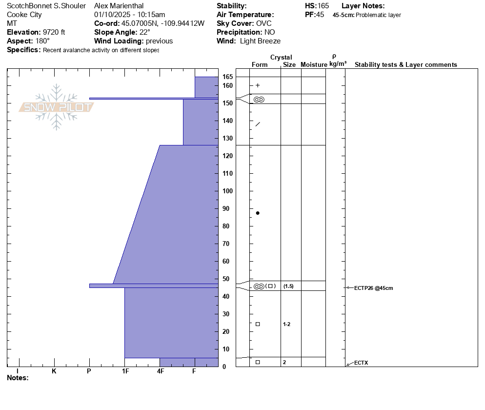
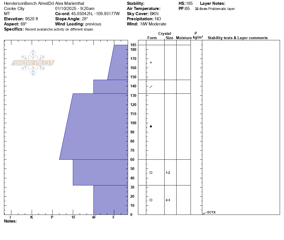
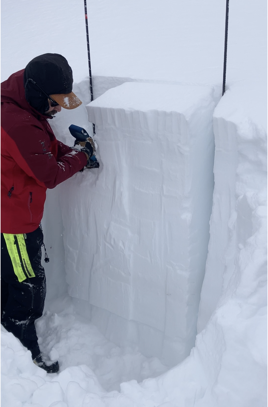
We dug a pit on Henderson Bench on a northeast facing slope, and one on Scotch Bonnet on a south facing slope (profiles attached). Both showed a 4' thick strong slab on weaker, faceted snow at the base. The weak layers are not terribly weak and didn't produce concerning test scores, so they may get better when they get a break from snowfall and wind-loading, but for now recent avalanches show these layers are weak enough and will produce more big avalanches as snowfall and wind continue.
Recent avalanches are clear evidence that the weak layers 1-2 feet above the ground are close to their breaking point. Continued snow and wind this weekend will make more of these big avalanches likely. Fresh drifts are also large due to all the recent snow that is being easily transported into slabs, and pose a significant hazard on their own.
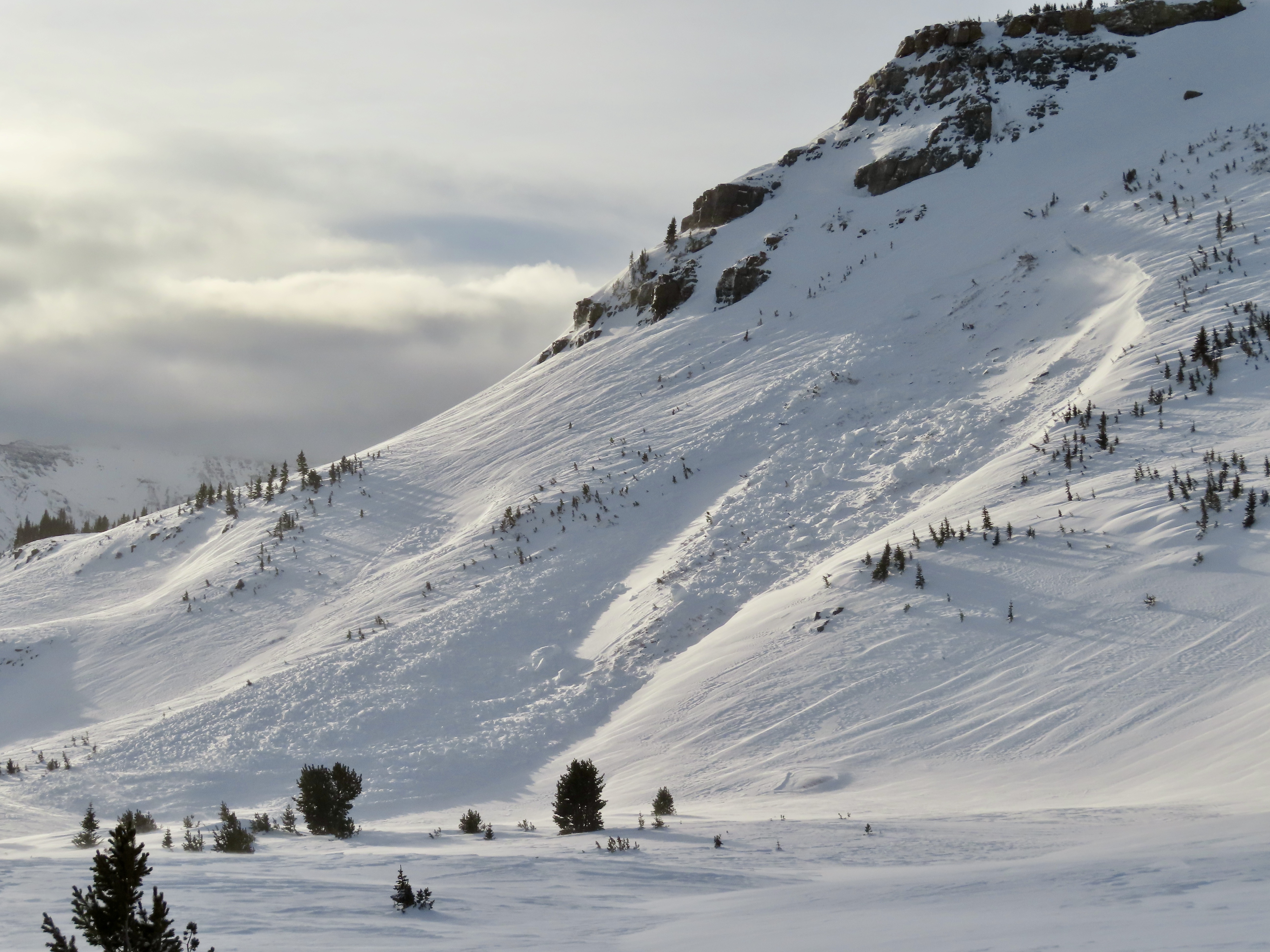
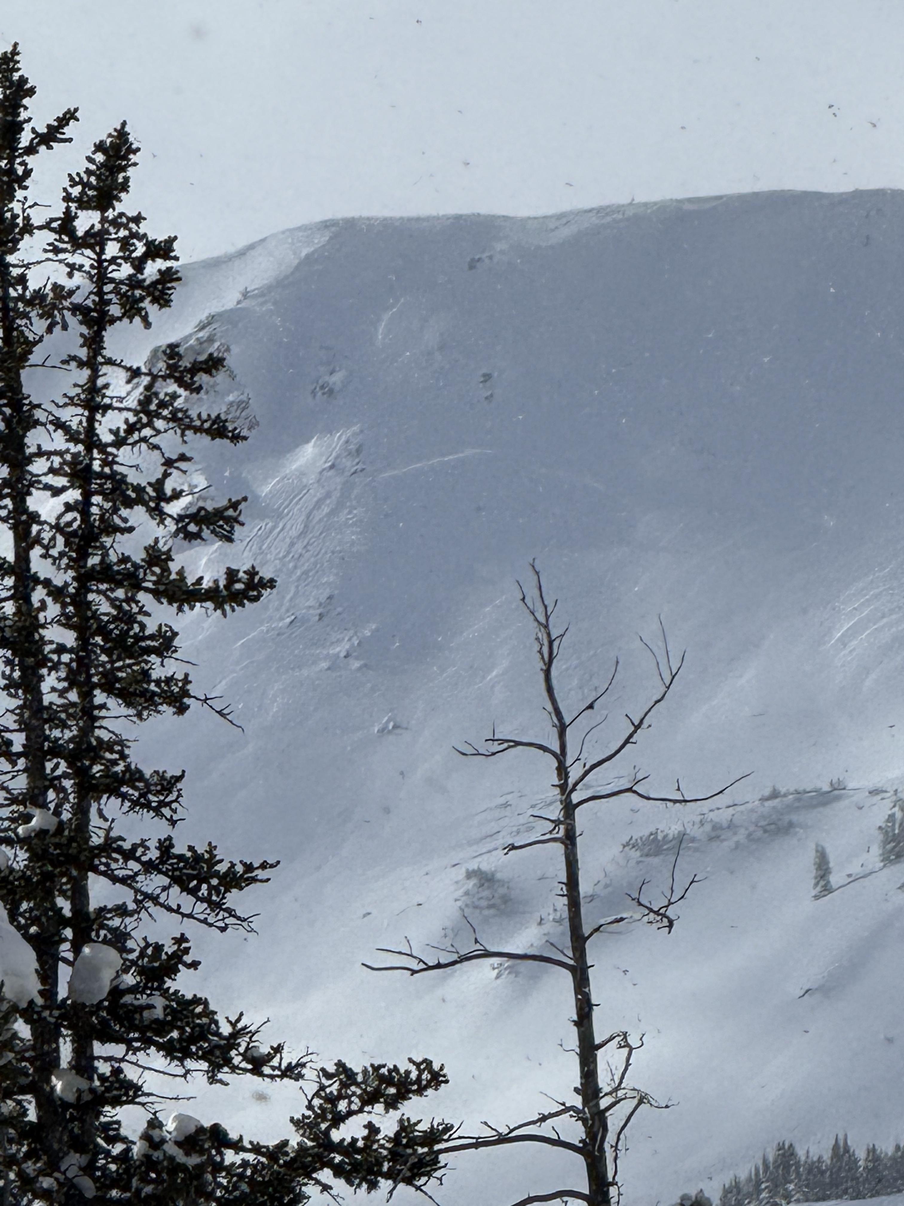
Full Snow Observation ReportWent snowmobiling north of Cooke City today near Round Lake. I saw about 20cm of new snow. I also saw some avalanches. There were a couple on E Henderson, one that I think happened today, a few on E Sheep Mountain, some shallower avalanches, and plenty of loose dry snow moving around in the steeps. Here are some photos. Some looked like they were from today, some are older. Lots of evidence of wind from the past day or so.
Full Snow Observation ReportIan and I rode north of Cooke City, had good visibility, and saw terrain from Daisy Pass to Mt. Abundance back to Lulu Pass, around the south side of Scotch Bonnet, then back around the north side of Sheep Mtn. to Round Lake.
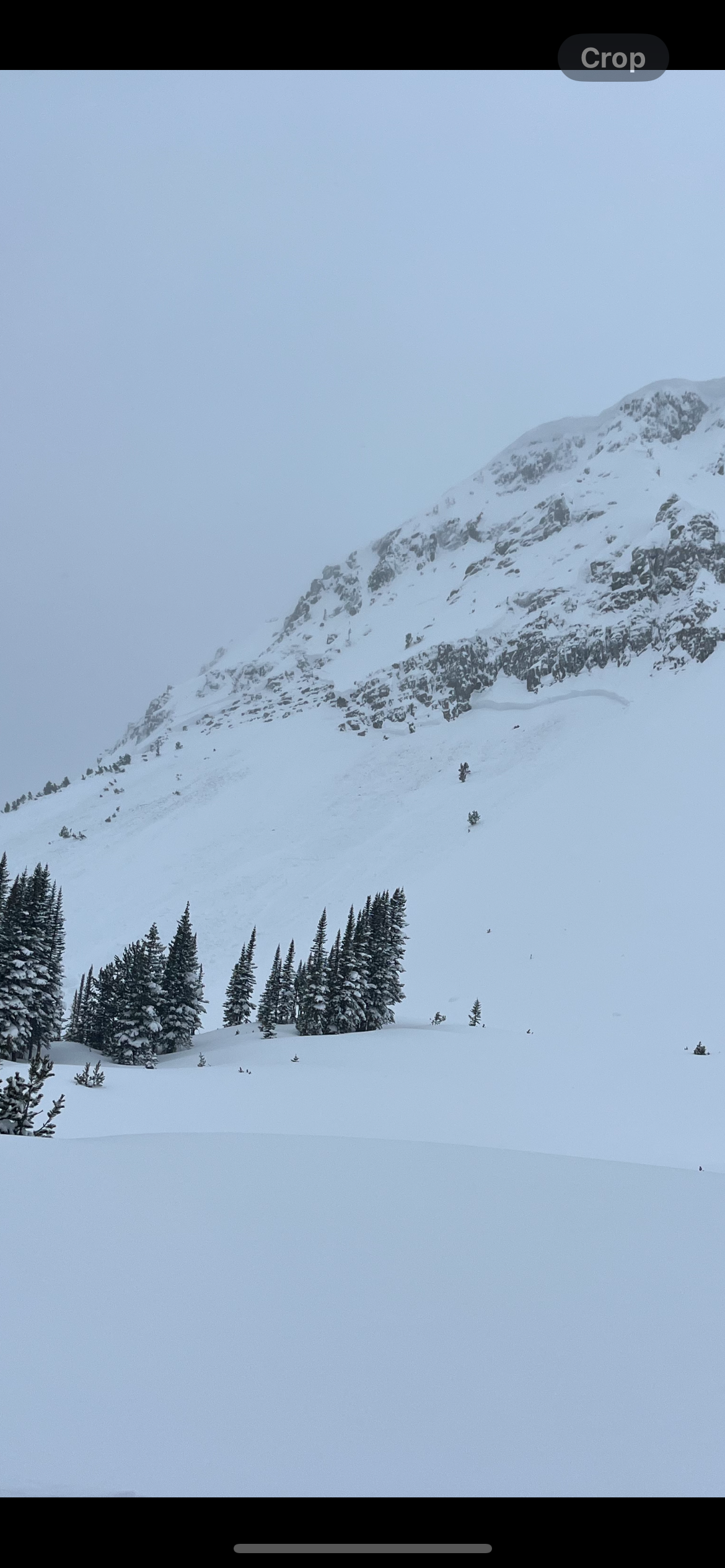
We saw many avalanches of various types and ages. Some occurred today and within the last 24 hours and some were up to a week old. Avalanche types ranged from 3-6' deep and broke on weak layers near the bottom of the snowpack to shallow soft, fresh wind slabs, and we saw one 3-4' deep slide that looked like it broke within recent new and wind-drifted snow (photo attached, north end of Henderson).
The most notable avalanches were 2-3 slides that happened today:
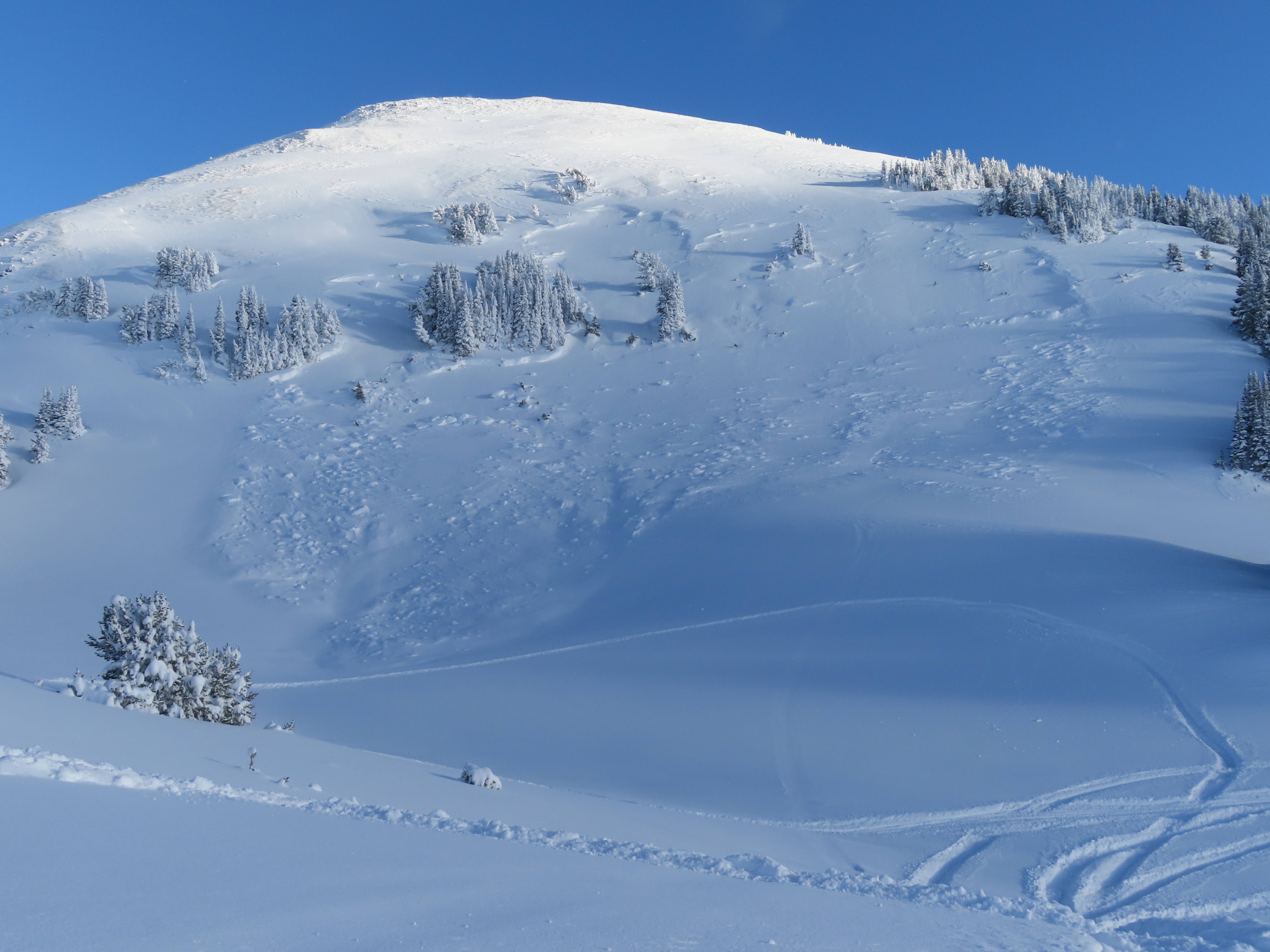
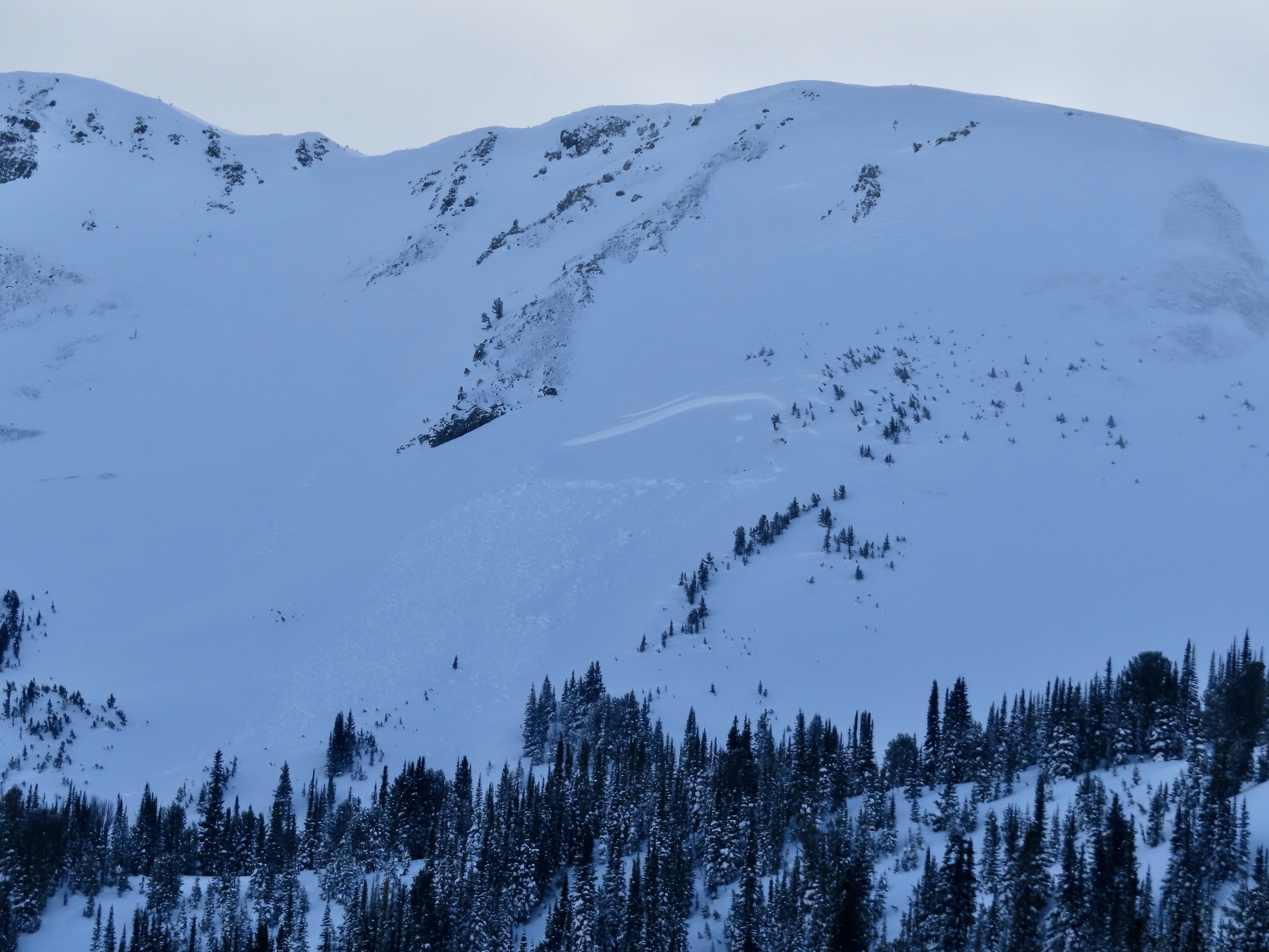
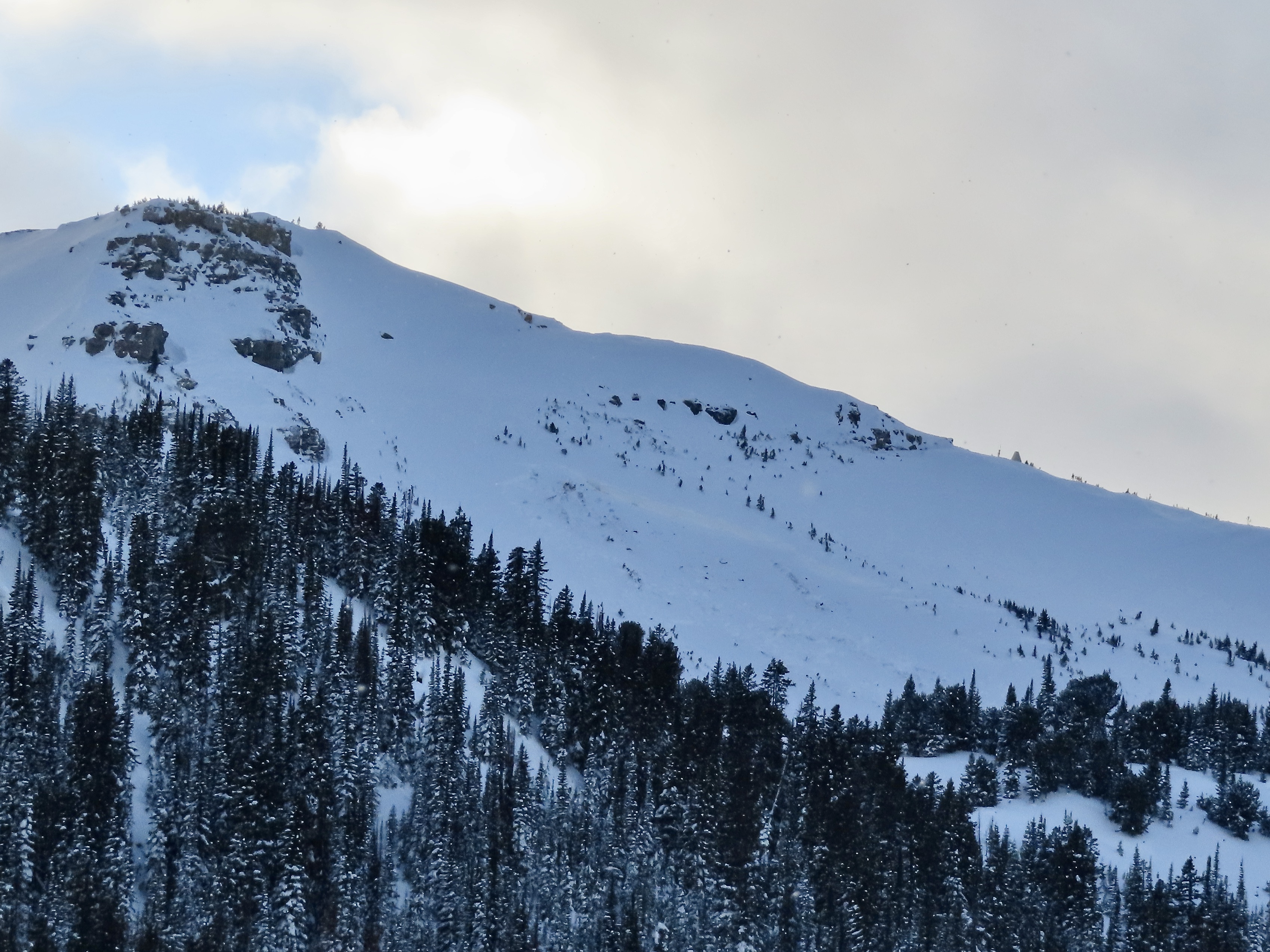
1) When we rode away from our snowpit on Mt. Abundance we saw a fresh 3'deep x 10' wide slide that we might have remote triggered from the flat ridge above (photo attached). 2) About 45 minutes later, from a couple miles away, we saw a 4-6' deep avalanche that happened since we had been there, about 1000' up the ridge from our snowpit (photo). This slide was either natural or remote triggered by riders about 1000' away who were there after we were. 3) An avalanche on the south end of Henderson Bench that looked fresh and someone else thought happened today. This one was 6' deep and broke at the bottom of the snowpack.
There was also a very large avalanche on the north side of Fisher Mtn. that happened at some time in the last week (could have been 48 hours to a week old), regardless of timing, this slide further shows the deeper weak layers are a real problem as snowfall continues to adds weight to the snowpack.
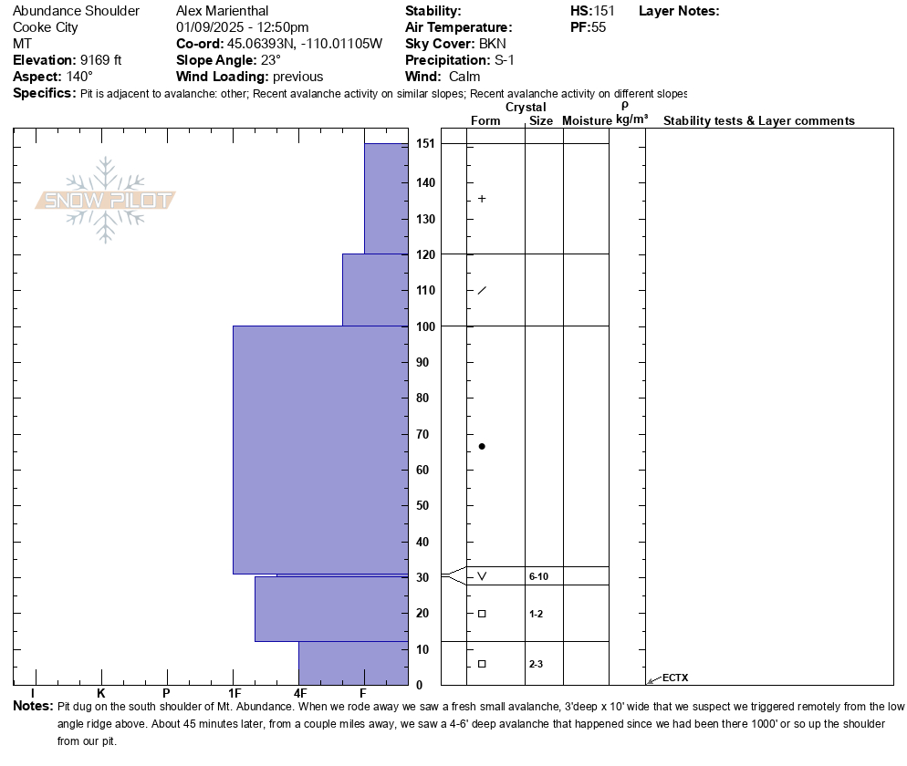
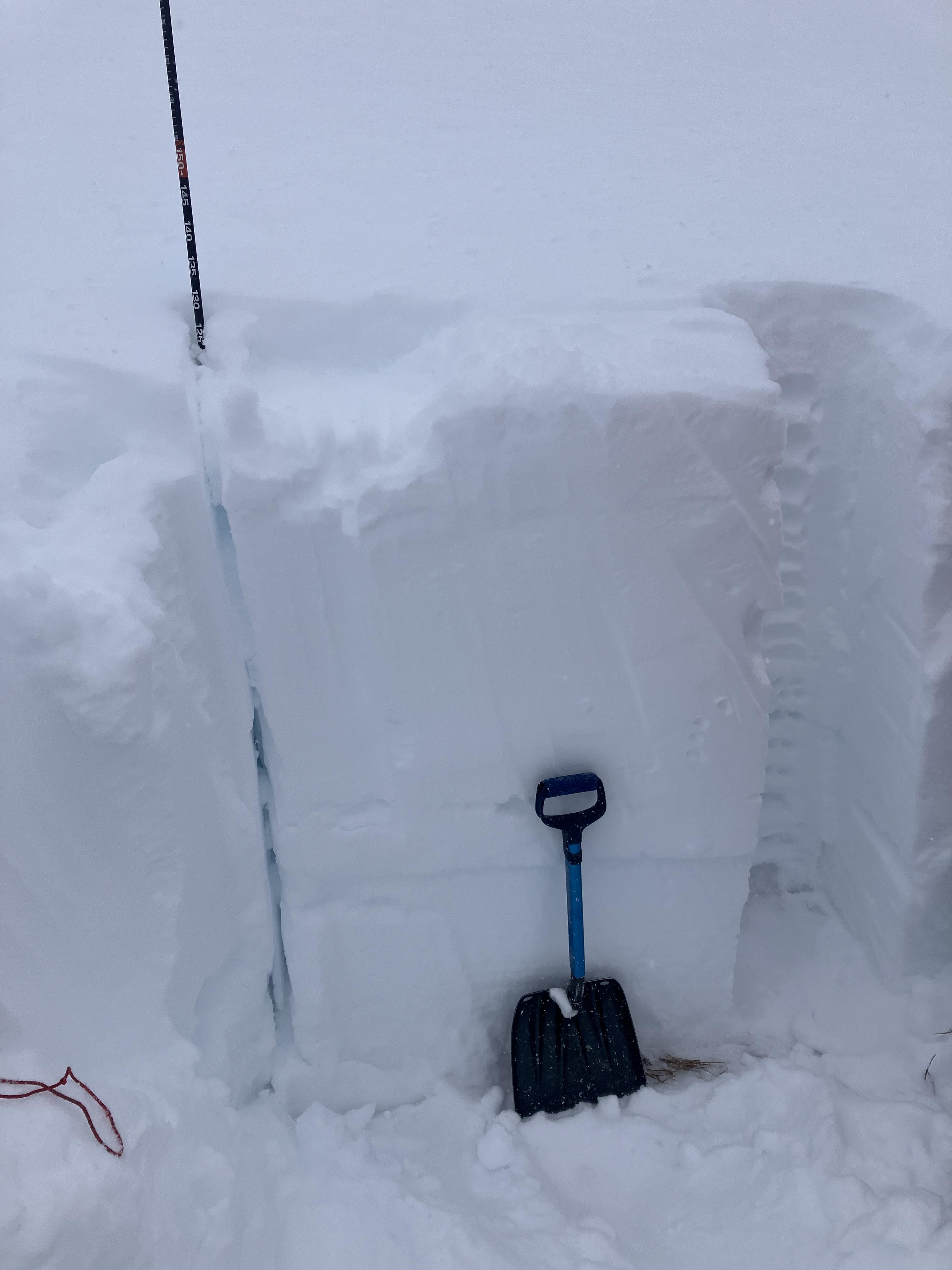
Our snowpit produced an ECTX and had 4' of snow above a layer of surface hoar buried one foot off the ground with facets below.
Full Snow Observation ReportToured up the Boundary of Yellowstone Park today. Performed stability tests on two different aspects at two different elevations and these were our results.
- 9100', South aspect, 120HS, Rounded FC at base. Recent storm interface found small .5mm FC 40cm down but no test results on that layer. ECTX
- 9800', West aspect, Hs190cm, ECTX, LOC 110cm down, old MFcr/Facet Layer
No recent avalanche activity seen. One large collapse near a ridge line with thin snowpack (<70cm)
Deep Slab on Northern aspects still a player. Rounding Basal Facets found on South and West aspects
Full Snow Observation ReportSkied south of Cooke today and noticed a large natural avalanche just north of the South Siren. N-R2-D2.5-O. It wasn't fresh and likely ran during the last storm cycle.
We dug on an east aspect at 9800', ECTX, HS150. No cr, co.
Full Snow Observation Report
Skied north of Cooke today. The light wasn't great, but I think there is an older avalanche on the east face of Miller Ridge in steep terrain. Could barely make out a crown line near the ridge and old debris on the apron. Maybe it ran 3-5 days ago? No cr, co and the winds were light out of the W-NW, moderate at ridge tops. We picked up 8cm of low density new snow overnight, plus an additional 1cm throughout the day today.
Full Snow Observation ReportJust wanted to send in a quick ob about snowfall.. in the last 24 hours at the Roost it snowed about 4 inches despite Fisher recording 0 inches of SWE
Full Snow Observation ReportToday, during a level 1 avalanche course north of Cooke City, we did a total of 7 ECTs north of Companion Lake. We did 4 ECTs at 9640ft, two on a NW aspect and two on a SE aspect. These were all ECTNs in the mid 20s. We did 3 more ECTs on a north facing slope at 9380ft. Here we got two ECTXs and one ECTN 25. The buried surface hoar layer from early December was visible in every pit, ranging from 90 cm to 105 cm deep. The deepest snow we found was 185cm.
Full Snow Observation Report3-4 foot crown about 100 yards wide on East face of sheep mountain.
Full Snow Observation ReportWe rode over Daisy Pass and out to Abundance, then around Fisher and behind Scotch Bonnet, and back to Lulu Road. Visability was marginal with overcast skies and light snowfall in and out through the day. Wind was light to moderate with moderate gusts. Moving some snow from trees and along the surface, stiffening slabs. Snowfall rates picked up this evening.
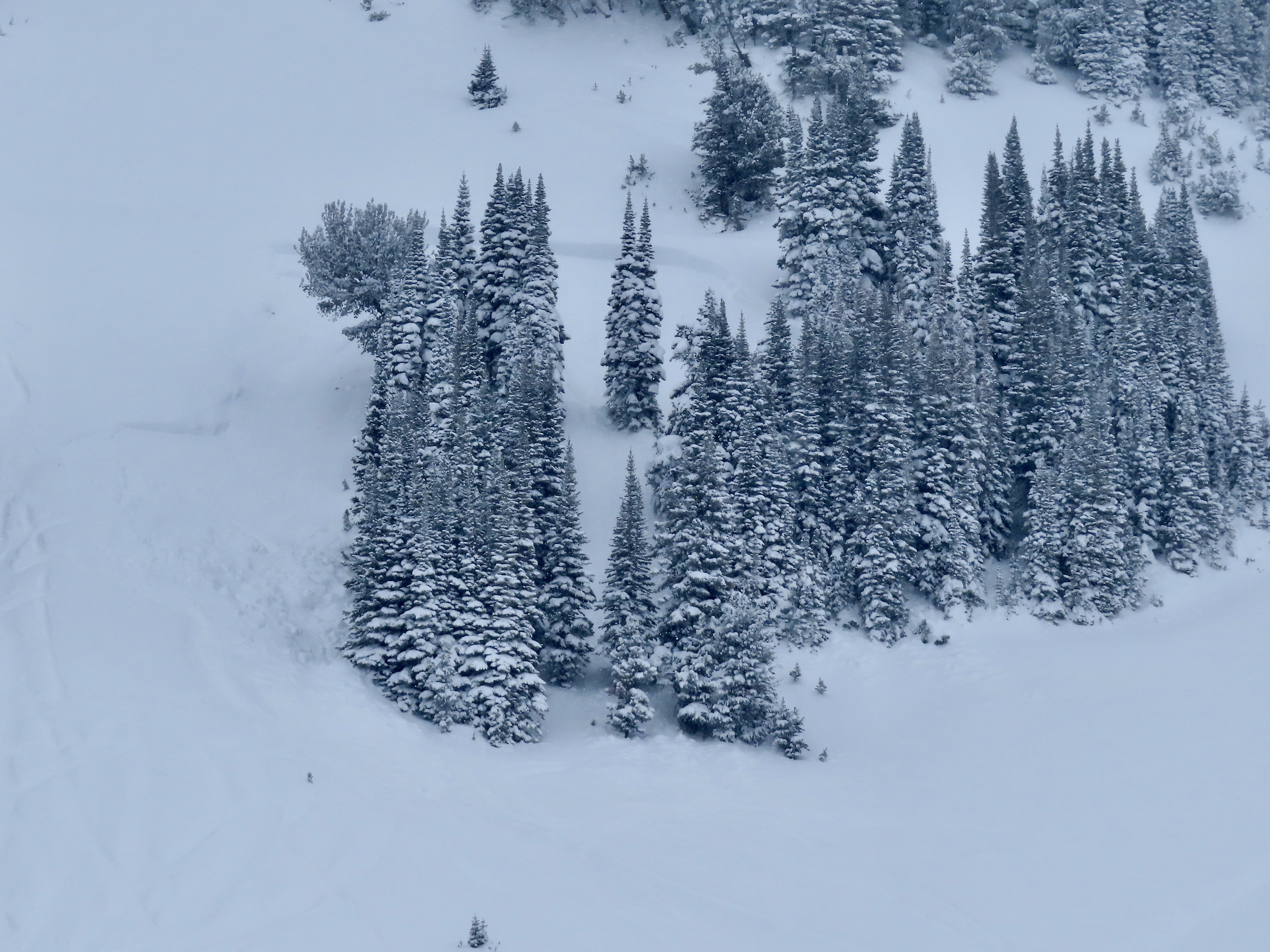
We saw three avalanches just north of Daisy Pass and one on Henderson Mtn. The one on Henderson was difficult to see the crown, but we could see the debris. Two of the slides north of Daisy were 2-3' deep and 100-150' wide and ran into thick stands of trees, looked like thick soft slabs/drifts of recent snowfall. The other slide was 1-2' deep and 300-500' wide, soft slab of recent snow.
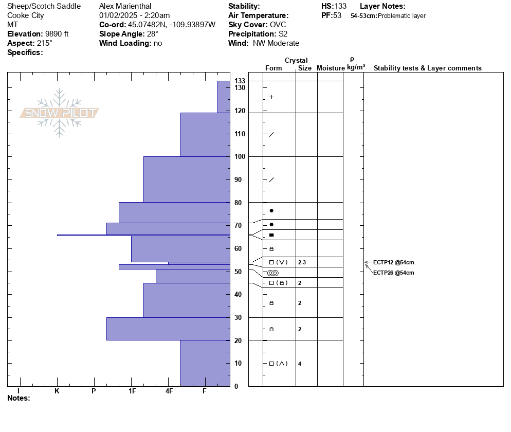
We dug a pit between Scotch Bonnet and Sheep Mtn. on a sw facing slope at 9,800'. HS was 135cm (4feet). We had ECTP12 and ECTP26, both on a layer at similar height as the surface hoar has been found (1.5-2 feet above the ground). The weak layer was mostly 2-3mm facets w/ small cups and some signs of surface hoar on top of a melt-freeze crust.
With a lot of recent new snow and more on the way, plus recent avalanches and poor snow structure, I expect avalanches will continue through the weekend. Choose routes that avoid travel on and below slopes steeper than 30 degrees.
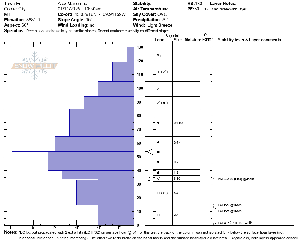
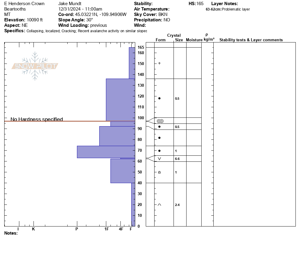
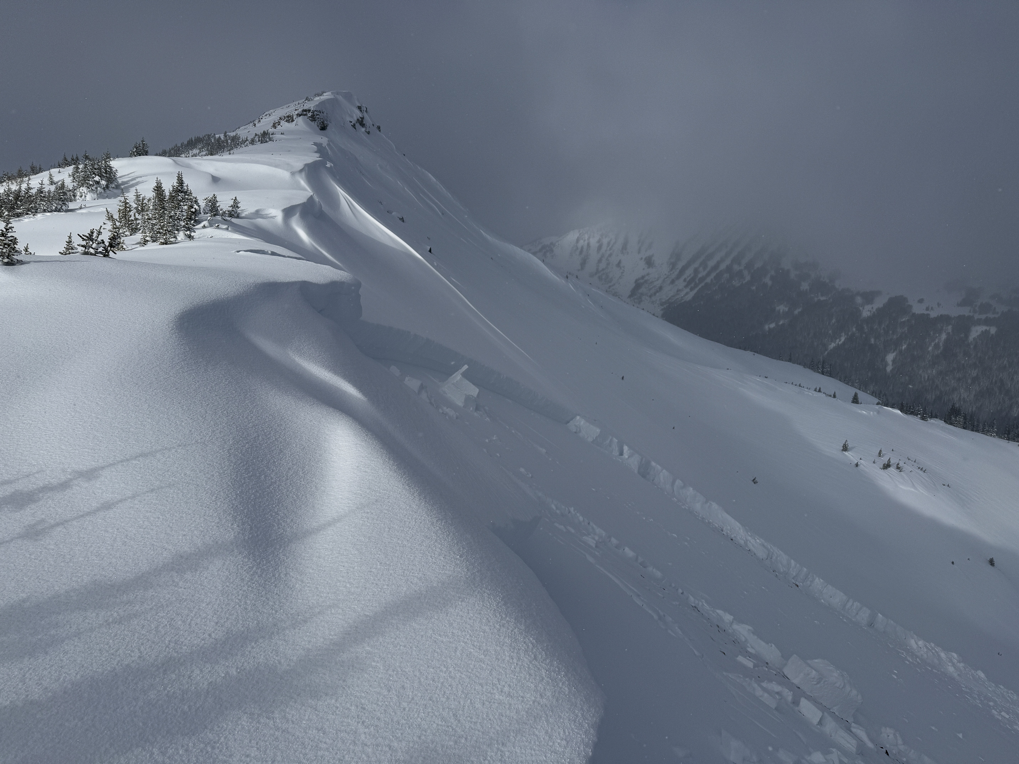
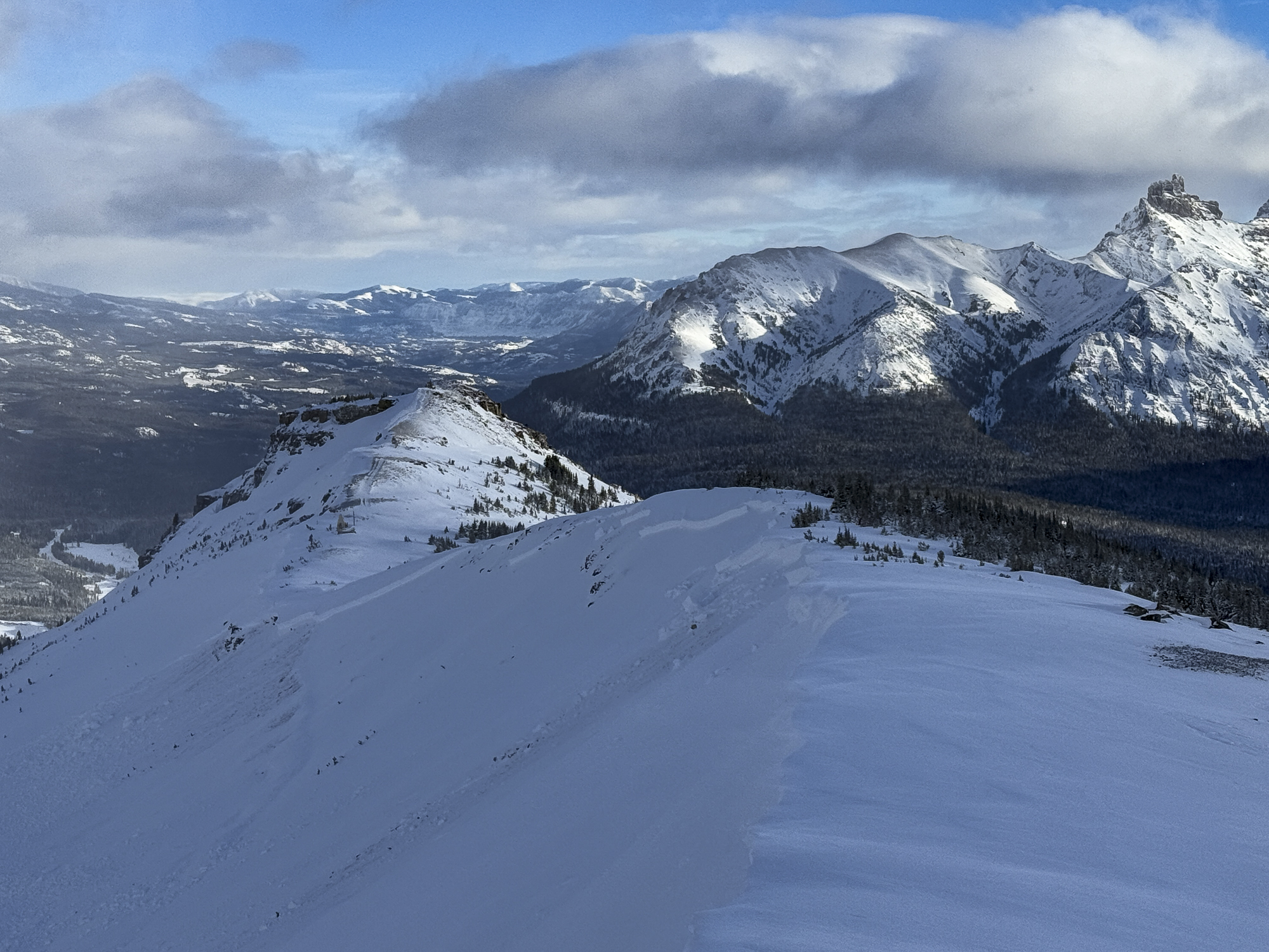
Full Snow Observation ReportFrom email: "We popped over to the recent avalanche on the east side and got a crown profile. Avalanche is NE facing, 10090. HS-N-D2-R4-O
Crown is 105 cm deep, breaking on surface hoar. Details are in attached profile
Something noteworthy.. the slope angle at the crown is 30.1 degrees."
Full Snow Observation ReportWe were ski touring on the SW side of Mt. Henderson today, and noticed a large (natural?) avalanche on the NE aspect of Henderson. First observed at around 1:15pm. It appeared to be very fresh, possibly from a remote trigger this morning.
2 photos attached. A NE aspect, around 10,000'.
It looked to be 4-6' deep and about 500' wide. And it failed on snow at/ near the ground.
Weather: today alternated between heavy snowfall, and patches of sunshine. Temps in the low/ mid 20's F, and calm winds. A very nice day for ski touring.
No other avalanche activity observed in Miller Creek.
We experienced a couple of large collapses on westerly aspects/ in wind affected terrain around 10,000'.
Full Snow Observation ReportFrom email: "Skied in Sheep Creek today. Still a little lean. Surprised to only see one D1R1 soft Slab on steep north facing slope. No other avalanche activity seen on Miller Mountain, Mineral, Sunset and Republic Mountain. No cr/co."
Full Snow Observation ReportAbout 2 feet of new snow since Friday, 10 inches of that were today.
Couple collapses... Most aspects. No avalanches observed but visibility has been very low
We dug snowpits on Saturday. SW facing, 9700 ft. Average HS 120. Several ECTNs 30 down. No propagation. Snow above the 12/21 sun crust is F hard
Also dug a pit today.... NW facing, 9200 ft. HS 125. ECTN12 35 down x2. There is also a thin crust 45 cm down in this pit. 4f snow above.
Full Snow Observation Report
