Advisory Archive

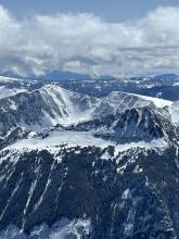
Generally dry conditions with daily temperatures peaking in the 30s and 40s persisted this week with moderate to strong winds gusting into the 50s and 60s mph from the west to southwest. The dry spell was briefly interrupted by 1-2” of snow on Sunday, November 12, in the southern regions of the forecast area. Daily high temperatures in the mountains will cool to the 20s and 30s by Sunday with chances of snowfall Sunday and in the middle of next week, giving us hope that the extended fall will eventually move on

Earlier in the week, while it was raining in the valleys snow was falling on the high peaks (0.8-1.8” of snow water equivalent, likely 1-2 ft of new snow up high). It’s been dry the last couple days. Winds have been strong and generally westerly, with periods of sustained 30 mph winds and gusts into the 60s mph. Dry conditions are forecasted to continue through the coming week. High temperatures in the mountains will be in the 30s and 40s F with lows in the 20s and 30s F. Winds will be moderate to strong and generally westerly.

Since yesterday morning, many higher elevation areas received 3-6” of new snow (0.2-0.7” of snow water equivalent) while the Big Sky area got only 1” of snow and rain fell at lower elevations (Weather and Avalanche Log). Winds have been strong out of the west. This morning temperatures are hovering around freezing. High temperatures in the mountains will generally be in the 30s F with lows in the 20s F over the next few days. A few inches of snow is expected at higher elevations Saturday with valley rain and another round of precipitation expected early next week.

Since Tuesday night the mountains received 6-14” of snow (0.7-2.4” of snow water equivalent) with the most near Cooke City, West Yellowstone, and Island Park (Weather and Avalanche Log). Wind has been westerly at 5-15 mph with gusts of 25-35 mph for the last 48 hours. This morning temperatures are low teens F, and today will reach low teens and low 20s F. Light snowfall will continue today with 2-5” possible before skies clear late tomorrow. The start of next week will be mostly clear with high temperatures in the low 20s to low 30s F. The next chance for snow is next Thursday or Friday.


The National Weather Service has issued winter storm warnings throughout our forecast area, with heavy snow at times tonight through Thursday. Temperatures will drop to single digits and teens F by Thursday, and over a foot of snow is possible in most mountain ranges.
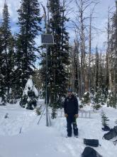
For current weather data check our weather stations in Cooke City, Hyalite, Lionhead and Sawtelle Peak, as well as Bridger Bowl’s weather stations, and SNOTEL sites throughout our advisory area. We will update the Weather and Avalanche Log daily and issue pre-season bulletins as needed.
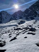

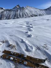
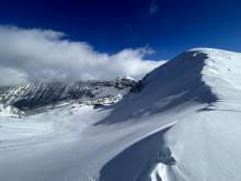
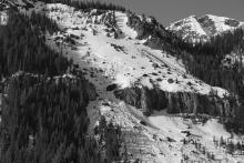
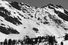
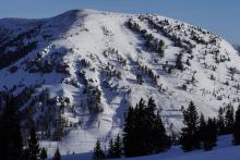
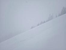
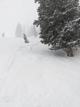
Spring weather can be highly variable and create a mix of avalanche problems to watch for. Snow conditions and snow stability can change drastically from day to day or hour to hour. Anticipate rapid change and plan accordingly. Plenty of snowfall over the winter with more spring snow to come makes avalanches possible into summer.


On Thursday, the mountains received 1-5” of snow, favoring Hyalite Canyon and the areas near West Yellowstone and Cooke City. On Friday morning, temperatures are in the teens to 20s F, and winds are 10-20 mph from the west to northwest.
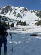
On Friday, mountain temperatures will push into the 40s F under sunny skies. Sun will persist, and temperatures will be in the 50s and 60s F through the weekend. Nighttime temperatures will largely stay above freezing except for the West Yellowstone and Cooke City areas. Winds will be 5-15 mph from the northwest to southwest. There will be no precipitation until early next week when the chance of rain and high-elevation snow showers arrives Monday night.

The recent storm ended late Friday with a total of 36-44” in the Bridger Range, 16-24” in the Madison and Gallatin ranges, and 9-12” near Cooke City and West Yellowstone. Over the weekend wind was west-southwest at 5-20 mph with gusts of 25-35 mph. Temperatures reached high 20s to low 30s F with partly cloudy skies becoming sunny yesterday. Today, wind will be west-southwest at 5-15 mph, temperatures will reach high 30s to low 40s F, and clouds will increase bringing rain in the valleys and snow in the mountains. By tomorrow morning the Bridger Range could have 4-8” of new snow with 2-4” elsewhere.
The middle of the week will be sunny with temperatures reaching mid-40s F during the day and dropping to high 20s and low 30s F overnight. Another chance of snow arrives Thursday with westerly wind increasing to 15-25 mph.

Since Tuesday evening the Bridger Range received 32-40” of snow, near Big Sky and Hyalite got 10-12”, and since Monday the mountains near West Yellowstone and Cooke City got 6-9”. Wind has been westerly at 5-20 mph with gusts of 15-30 mph. This morning temperatures are single digits to teens F. The next few days forecast is cold and generally snowy with temperatures reaching high 20s to low 30s F through Saturday, then mid-40s on Sunday. Wind will be 15-25 mph out of the west. The mountains near Bozeman and Big Sky are favored for snowfall with 3-5” possible today and 3-7” tomorrow through Saturday. Near Cooke City could receive 3-7” through Saturday and near West Yellowstone might see 2-4”.
This weekend, daytime temperatures climbed above freezing during the day with 5-20 mph winds from the southwest to the northwest. There was no new snow. Last night was the lightest freeze of the weekend, with temperatures in the upper 20s to low 30s F.
Monday will be the warmest day of the week, with temperatures in the 40s F under partly cloudy skies. Cloud cover will increase as the day progresses, and light snow begins Monday night. Snow and cooler temperatures will continue from Tuesday through Friday. The first pulse of snowfall will bring 5-6” to the Big Sky area, 4-5” to the mountains around Bozeman, and 2-4” near West Yellowstone and Cooke City by Wednesday morning.