Advisory Archive
Mountain temperatures are in the 20s to 30s F with 15-30 mph winds from the west to southwest. Snow began this morning with 1-3” in the mountains around Big Sky, West Yellowstone, Island Park and Cooke City. Today, high temperatures will be in the 20s to mid-30s F with 15-25 mph winds from the west to southwest. The mountains around West Yellowstone, Island Park and Cooke City will receive 8-10” of snow by tomorrow morning, with 4-6” in the mountains around Big Sky and Bozeman.


Since yesterday morning the mountains got 3” of snow near Cooke City, West Yellowstone and Island Park with 1-2” near Bozeman and Big Sky. Wind has been out of the west at 15-30 mph with gusts of 40-60 mph. Temperatures are 20s to low 30s F this morning. Today, temperatures will reach mid-30s F, wind will be out of the west at 15-25 mph with gusts to 45 mph, and 1-2” of snow is possible. The next couple days will be partly cloudy to mostly sunny with daytime temperatures reaching mid-30s to low 40s F and overnight temperatures in the mid-20s F. Colder temperatures and snow are expected late Wednesday night through next weekend.

Since snowfall began on Friday the mountains received 12-14” of low density snow near Cooke City, Big Sky, West Yellowstone and Island Park, and 3-6” in the Bridger Range and Hyalite. Wind has been out of the west at 10-25 mph with gusts of 40-60 mph. Temperatures are single digits to teens F this morning. Today, temperatures will reach mid-20s to low-30s F, wind will be westerly and increase this afternoon to 25 mph with gusts of 40-50 mph.
Snow showers will continue through tomorrow and will favor the mountains near Cooke City with 5-8”, and 1-3” elsewhere. Tuesday through Wednesday, daytime temperatures will reach mid-30s to low 40s F under partly sunny skies. Late Wednesday into Thursday temperatures will return to 20s to low 30s F with snow possible through next weekend.


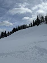
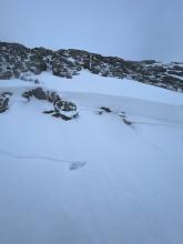
Finally, it is snowing. Mountain temperatures are in the single digits to 20 degrees F with 5-15 mph winds from the west. The mountains around Bozeman, Big Sky and West Yellowstone have received 1-2” of snow as of Friday morning, with no measurable snow in Island Park and Cooke City yet.
This weekend, high temperatures will begin in the teens to mid-20s F and slowly creep up to the 20s to high 30s F by Sunday. Winds will peak Saturday into Saturday night, blowing from the west to southwest at 20-35 mph. By the end of the weekend, the mountain around Bozeman and Big Sky will get around 6” of snow with 10-12” in West Yellowstone and Island Park and 10-20” in Cooke City.


Since 5 a.m. yesterday, up to 1” fell in the northern ranges and 2-4” from Big Sky to West Yellowstone and Island Park. Cooke City and Hyalite got missed. Northeast to east wind is averaging 10-30 mph with gusts of almost 80 mph on Sawtelle Peak. Temperatures are in the single digits F. Today, mountain temperatures will rise into the teens under clearing skies with an east wind at 10-30 mph. Sunny skies and seasonal temperatures are forecasted through next week.

Last night 4” fell up Hyalite and 1-2” around Big Sky and Bridger ski areas. Wind is north to northeast at 5-15 mph with mountain temperatures near 20F. Three days ago the mountains received 2-3”, which is outlined in our daily log. Another inch may fall today before sunny skies and high pressure return tomorrow into mid-week. We are patiently waiting for the ember of winter to be blown into a full flame.


Generally dry conditions with daily temperatures peaking in the 30s and 40s persisted this week with moderate to strong winds gusting into the 50s and 60s mph from the west to southwest. The dry spell was briefly interrupted by 1-2” of snow on Sunday, November 12, in the southern regions of the forecast area. Daily high temperatures in the mountains will cool to the 20s and 30s by Sunday with chances of snowfall Sunday and in the middle of next week, giving us hope that the extended fall will eventually move on

Earlier in the week, while it was raining in the valleys snow was falling on the high peaks (0.8-1.8” of snow water equivalent, likely 1-2 ft of new snow up high). It’s been dry the last couple days. Winds have been strong and generally westerly, with periods of sustained 30 mph winds and gusts into the 60s mph. Dry conditions are forecasted to continue through the coming week. High temperatures in the mountains will be in the 30s and 40s F with lows in the 20s and 30s F. Winds will be moderate to strong and generally westerly.

Since yesterday morning, many higher elevation areas received 3-6” of new snow (0.2-0.7” of snow water equivalent) while the Big Sky area got only 1” of snow and rain fell at lower elevations (Weather and Avalanche Log). Winds have been strong out of the west. This morning temperatures are hovering around freezing. High temperatures in the mountains will generally be in the 30s F with lows in the 20s F over the next few days. A few inches of snow is expected at higher elevations Saturday with valley rain and another round of precipitation expected early next week.


Since Tuesday night the mountains received 6-14” of snow (0.7-2.4” of snow water equivalent) with the most near Cooke City, West Yellowstone, and Island Park (Weather and Avalanche Log). Wind has been westerly at 5-15 mph with gusts of 25-35 mph for the last 48 hours. This morning temperatures are low teens F, and today will reach low teens and low 20s F. Light snowfall will continue today with 2-5” possible before skies clear late tomorrow. The start of next week will be mostly clear with high temperatures in the low 20s to low 30s F. The next chance for snow is next Thursday or Friday.