Good Morning. This is Doug Chabot with the Gallatin National Forest Avalanche Advisory issued on Friday, April 6th at 6:45 a.m. Today’s advisory is sponsored by Grizzly Outfitters in partnership with Friends of the Avalanche Center. This advisory does not apply to operating ski areas.
Has anyone seen Spring? She’s late for her shift and I’m not happy about it, and neither is winter who is covering for her. In the last 24 hours our forecast area picked up 6-8” of snow. Winds are 10-25 mph out of the W-SW, except in the Bridger Range where a cold east wind is blowing. Temperatures are 2F on the Bridger Ridge and 20-30F most other places. Another inch of snow may fall this morning, then skies will be mostly cloudy and winds will shift E-SE at 10-20 mph in most areas.

It has snowed every day for the last 10 in the Bridger Range with the last 48 hours getting 15” of dense snow (15%) measuring 2.1” of snow water equivalent. Eric visited the Throne in the Bridger Range, north of the ski area and said, “It’s important to remember that rapid and heavy loads create unstable conditions no matter how strong the snowpack.” He should know, because he unexpectedly triggered a large avalanche from 30’ away, aka “remote trigger”. It failed on an ice crust on a SE facing slope. It broke 18-20” deep and ran 200’ wide and 5-600’ vertical distance. It surprised him. He and his partner saw no signs of instability in his snowpit tests nor any other red flags as they skied. Although rare, this happens, which is why we travel one a time, go with partners and carry rescue gear. Sometimes we assess incorrectly and our safety protocols are the only thing separating a good story from a tragedy. Here is his video and a photo from the slide.
Instabilities will likely remain in the new snow, especially if it is snow is piled on top of an ice crust.
- Recent snow? Yup.
- Winds? Yup.
- Avalanches? Yup.
New snow, strong winds at all elevations and directions, and recent avalanches point to a CONSIDERABLE avalanche danger on all slopes today.
In the last 48 hours 6-11” of snow has fallen from Bozeman to West Yellowstone and Cooke City roughly amounting to 1” of snow water equivalent. Winds are blowing moderate out of the W-SW, loading slopes and creating instability. This new, windblown snow is our main avalanche concern. I rode into Carrot Basin on Wednesday and found wind-loaded slopes and cornices had my attention (video, photo). The snowpack lacks buried weak layers and deep avalanches are unlikely, but as Eric found out yesterday sometimes the snowpack can surprise us. I recommend avoiding wind-loaded terrain. Today, winds will shift easterly and wind-loading patterns will shift with it. Dig a couple feet deep and test the new snow to see how it is bonding to the old surface. If the new snow is sitting on an ice crust its ability to slide may be enhanced. For today, the avalanche danger is rated CONSIDERABLE on all wind-loaded slopes and MODERATE on slopes without a wind-load.
If you get out and have any avalanche or snowpack observations to share, drop a line via our website, email (mtavalanche@gmail.com), phone (406-587-6984), or Instagram (#gnfacobs).
Info and Announcements
Our last daily advisory will be this Sunday, April 8th. Afterward, we will issue weather and snowpack updates on Monday and Friday mornings for most of April.
Hyalite Canyon road is closed to vehicles and reopens May 16th.
Send us your observations on Instagram! #gnfacobs
Posting your snowpack and avalanche observations on Instagram (#gnfacobs) is a great way to share information with us and everyone else this spring.
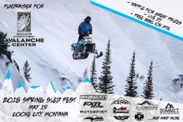
Sledders, mark your calendar for May 19, the 2nd Annual Sled Fest in Cooke City. It’s a fundraiser for the Friends of the Avalanche Center and there will be a DJ, raffle prizes and BBQ on the mountain.