Good Morning. This is Alex Marienthal with the Gallatin National Forest Avalanche Advisory issued on Saturday, April 7th at 7:00 a.m. Today’s advisory is sponsored by Spark R&D and Bridger Bowl. This advisory does not apply to operating ski areas. Tomorrow will be our last daily advisory of the season.
The battle between spring and winter is fierce today, and the resulting weather outlook isn’t pretty. The mountains got 1-2” of new snow as the storm tapered yesterday morning. This morning, temperatures are 20s F and wind is westerly at 5-15 mph with gusts to 20 mph. Today, south-southwest wind will increase to 20-30 mph and temperatures will reach 30s to low 40s F. Light rain is expected this afternoon with a slight chance of thunder. Tonight, snow showers will total 1” near Bozeman and Big Sky with 3-5” possible near Cooke City and West Yellowstone.

Recent heavy snowfall and today’s forecast for wind, rain, and above freezing temperatures make various types of avalanches possible. Anticipate changing conditions and plan accordingly. Conservative route choices are recommended today.
WET AVALANCHES
Above freezing temperatures and rain this afternoon will decrease the strength of the snowpack and make wet snow avalanches possible. Small precipitation amounts are expected, but enough rain is possible for recent snow to become wet and non-cohesive. Mostly cloudy skies this morning will delay the onset of wet snow hazard, but any sunshine will decrease stability. Wet snow avalanches could entrain large amounts of snow and travel far distances. Avoid steep terrain and be aware of avalanche terrain above you if you see: Heavy rain, natural wet avalanches, roller balls or pin wheels indicating a moist or wet snow surface, sinking to your boot top in wet snow.
RECENT NEW SNOW AND WIND LOADED SLOPES
Avalanches breaking 1-2’ deep in the recent snow are possible to trigger. The mountains got 1-2 feet of snow on Wednesday and Thursday equal to 1-2” of snow water equivalent (SWE). On Thursday, Eric and his partner remotely triggered an avalanche on the Throne in the northern Bridger Range. It broke above an ice crust 18-20” deep, 200’ wide and ran 5-600’ vertical (video, photo). They were surprised after not seeing any red flags and getting stable results in stability tests.The snowpack lacks buried weak layers and deeper avalanches are unlikely. Dig a couple feet and test the new snow to see how it is bonding to the old surface. If the new snow is sitting on an ice crust it may slide more easily. Fresh drifts near ridgelines from moderate south-west wind today are possible to trigger. Slopes loaded from various wind directions yesterday have drifts that are less reactive today, but still deserve caution. Carefully assess terrain and snowpack today, and be cautious of wind loaded slopes.
CORNICES
Cornices along ridgelines are massive and can break under the weight of a person (photo). Warm temperatures and rain today will make them weaker and possible to break naturally, as Doug discussed in his video from Wednesday in the Taylor Fork. Stay far back from the edge of ridgelines and minimize exposure to slopes directly below cornices.
A mix of spring weather today makes various avalanche types possible and avalanche danger is MODERATE.
If you get out and have any avalanche or snowpack observations to share, drop a line via our website, email (mtavalanche@gmail.com), phone (406-587-6984), or Instagram (#gnfacobs).
Info and Announcements
Our last daily advisory will be this Sunday, April 8th. Afterward, we will issue weather and snowpack updates on Monday and Friday mornings for most of April.
Hyalite Canyon road is closed to vehicles and reopens May 16th.
Send us your observations on Instagram! #gnfacobs
Posting your snowpack and avalanche observations on Instagram (#gnfacobs) is a great way to share information with us and everyone else this spring.
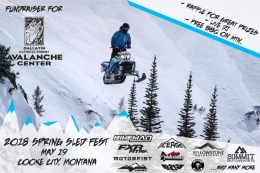
Sledders, mark your calendar for May 19, the 2nd Annual Sled Fest in Cooke City. It’s a fundraiser for the Friends of the Avalanche Center and there will be a DJ, raffle prizes and BBQ on the mountain.