Advisory Archive
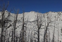
In the last 24 hours snow fell and temperatures plummeted. The northern mountains got one to two inches while three to four inches fell in the south, with closer to seven inches outside West Yellowstone. Mountain temperatures are minus 15 to 20 this morning under partly cloudy skies with light, variable winds. Temperatures will not budge much today and drop even further tonight. In the next 24 hours I do not expect any snowfall or changes in the wind. If you liked the cold snap the beginning of December you’re in for a treat; it will be even colder this time.


Overnight 1-2 inches of snow fell in most mountain locations. Snow has tapered off this morning but will pick back up this afternoon. The mountains around Bozeman and Big Sky will see 2-4 inches and the southern mountains will likely receive 4-6 inches by tomorrow morning.
Currently, temperatures are in the single digits F and winds are light out of west-southwest. Today, temps will warm into the upper teens to low twenties F under cloudy skies. Winds will continue to blow 5-15 mph out of the west-southwest. Today will be a good day to get out and enjoy the balmy weather. The mercury will plummet this evening with Tuesday/Wednesday looking to be the coldest days we’ve seen in over a month.
Over the past 24 hours no new snow has fallen. This morning temperatures are in the single digits above or below zero F. Winds are blowing 5-15 mph out of west-southwest with a few localized gusts reaching into the 20s. Today, temperatures will warm into the teens F under mostly clear skies and winds will continue to blow 5-15 mph out of the west-southwest. Clouds will gradually roll in this afternoon as another storm system approaches from the west. Light snow will start falling tomorrow morning and will continue through the day. The mountains should see 4-6 inches by Tuesday.
Since yesterday the mountains around Bozeman received 6 inches of cold smoke. The mountains near Big Sky and Cooke City received 4 inches, and the mountains near West Yellowstone received 2 inches. Temperatures this morning were near 0 F, a little below at ridgetops and a little above in valleys. Winds were blowing 10-15 mph gusting to 20 mph from the WNW with a few places seeing winds from the SW. Today temperatures will struggle to reach 10 F as cloudy skies slowly give way to a little sunshine. Fortunately winds should remain light and blow 5-10 mph mostly from the WNW with gusts of 15 mph. The next round of snow should come Monday following a decisive win by the Broncos Sunday night.


If you didn’t develop a case of powder flu yesterday, then consider calling in sick to work today. Since yesterday morning, the mountains near Cooke City and Hyalite Canyon received about 6 inches of additional snow while all other areas got 2-4 inches. Amazingly winds have not been too strong. This morning they were blowing 10 mph gusting 15-20 mph WNW in most places and coming from the SW in a few others. Temperatures this morning were in the low teens F.
Today winds may increase a little and blow 10-15 mph gusting to 25 mph from the WNW. Temperatures will struggle to climb out of the teens F as a cold air mass descends over the area with very cold temperatures expected tonight and tomorrow. More snow should come late this afternoon and deposit 4-6 inches in the mountains near Bozeman, Big Sky, and Cooke City and about 2 inches near West Yellowstone.

Since yesterday morning 8-12 inches of dense snow fell throughout the advisory area. Overnight winds were blowing 25 mph gusting to 40 mph from the W and SW. This morning temperatures were in the high teens and low 20s F, and winds in most places had shifted to the NW and eased a little. As a cold front descends from the north today, temperatures should drop and winds should calm even more. The cold air and calm winds had already reached the Bridger Range at 5 a.m. Today another 3-4 inches of snow should fall. Temperatures should drop to near 10 degrees F with winds blowing 5-10 mph gusting to 20 mph from the NW.
Knock, knock…a storm is approaching. Under cloudy skies a trace to one inch of snow has fallen in many mountain locations. The next 24 hours will be snowy and breezy. Currently mountain temperatures range from 10F in the southern areas to 20F in the north. Wind speeds are averaging 20-25 mph with gusts of 40 from the west to southwest . A moist Pacific storm is approaching from the west bringing slightly colder temperatures, steady westerly winds and much needed snowfall. By tomorrow morning I expect 8-12 inches and maybe a little more in our southern areas. Just to be safe, you might want to develop an illness today so you can call in sick tomorrow. Just saying…

Last night under clear skies mountain temperatures fell to near 0F. At 5 a.m. winds are blowing west to northwest at 15-30 mph. Today will be sunny with winds remaining westerly and temperatures rising into the teens. Clouds will form later today ahead of a snow storm scheduled to arrive tomorrow morning. The storm will begin to kick in pre-dawn and last into Thursday and looks to drop 6-10” of snow, but tune in tomorrow for an updated forecast.

Over the past 24 hours 1-2 inches of snow fell in most mountain locations. Temperatures have plummeted and are now in the single digits F. Winds are light blowing 5-15 mph out of the WNW. Today, temperatures will remain below average with highs climbing into the teens F under partly cloudy skies. Winds will continue to blow 5-15 mph out of the WNW. No accumulating snowfall is expected over the next 24 hours.
At 4 a.m. temperatures are in the 20s F and winds are blowing 15-25 out the WNW. Today, a cold front descending from Canada will deliver colder air and a chance of mountain snow. Temperatures will drop through the day and most areas should see 1-3 inches of new snow by tomorrow morning. Winds will increase briefly during the frontal passage, but will decrease by this evening. Tomorrow looks to be a cold and dry day.