Good morning. This is Doug Chabot with the Gallatin National Forest Avalanche Forecast on Wednesday, April 5th at 6:45 a.m. This information is sponsored by Archer Construction and Uphill Pursuits. This forecast does not apply to operating ski areas.
A surprise storm hit the Bridger Range yesterday morning and dropped 6” of low density snow (3%) with another 2” last night. 2” also fell in the northern Gallatin Range with only a trace elsewhere. Wind is 10-20 mph out of W-NW and skies are partly cloudy with temperatures in the single digits F. Today will warm into the 20s F with light westerly wind. Later this afternoon and tonight 1-2” may fall, mostly in the southern regions.

Although the calendar says “spring” the snowpack says “winter”. I am told spring will be here any day now, but not today. Mountain temperatures are chilly and even with the sun climbing higher in the sky, wet avalanches are not on the menu. Instead we need to keep in mind two avalanche concerns:
- Avalanches breaking in recent wind drifts 1-2 feet deep, and
- Deep slab avalanches breaking 5-6 feet deep from a weak layer that was buried in January.
Wind slabs are prevalent. Although a couple days old, slopes with the added weight from wind-loading are our #1 concern. Many avalanches from wind drifting occurred on Sunday, and Dave made a video of avalanche activity in Beaver Creek. There were also slides and whumphing reported in the Bridger Range, in Beehive Basin, and near Cooke City.
Deeper avalanches will be difficult to trigger, but they will be large and deadly. On Sunday, a few deep slab avalanches broke naturally in the Bridger Range at Ainger Lake and Cooke City. Dave and Alex were in Lionhead on Monday and saw a deep slab avalanche on Bald Peak which they chronicled in a video. Our Weather and Avalanche Log list all reported activity. With every substantial snow storm we are seeing big avalanches. Although there are not many of them, they are in every mountain range and will keep us alert well into the spring.
Typically, April is a month of increasing stability from warming temperatures, but not this year, at least not yet. A layered winter snowpack is still with us. For today, avalanches are still possible and I recommend playing on slopes sheltered from the wind. Deep avalanches, although rare, make my palms sweat. Sticking to lower angled terrain or slopes that have clean runout zones is a safer travel strategy than blind luck.
The avalanche danger on all slopes in our forecast area is rated MODERATE.
Our last daily forecast will be this Sunday, April 9. We will issue weather and avalanche observations every Monday and Friday through April. Please share avalanche, snowpack or weather observations via our website, email (mtavalanche@gmail.com), phone (406-587-6984), or Instagram (#gnfacobs).

Wind slabs are prevalent. Although a couple days old, slopes with the added weight from wind-loading are our #1 concern. Deeper avalanches will be difficult to trigger, but they will be large and deadly. With every substantial snow storm we are seeing big avalanches. Although rare, they are in every mountain range. I recommend playing on slopes sheltered from the wind and sticking to lower angled terrain or slopes that have clean runout zones.
Upcoming Avalanche Education and Events
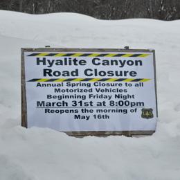
Hyalite Canyon road is closed for motorized use until May 16.