Good Morning. This is Eric Knoff with the Gallatin National Forest Avalanche Advisory issued on Friday, December 22th at 7:15 a.m. Today’s advisory is sponsored Grizzly Outfitters in partnership with the Friends of the Avalanche Center. This advisory does not apply to operating ski areas.
It’s currently dumping across the advisory area. At 5 a.m. the mountains around Bozeman and Big Sky including the southern Madison Range (Carrot Basin) have picked up 4-6” of low density snow. The mountains around West Yellowstone and Cooke City have received up 2-3”. Temps are in the single digits to low teens F and winds are blowing 10-20 mph out of the west with ridgetop gusts near Hyalite and Big Sky reaching 30 mph. Today, snow will continue with an additional 3-6” falling in the north and 2-4” in the south. Temps will warm into the mid to upper teens F and winds will remain light to moderate out of the west. Snow tapers off this evening and no real accumulation is expected tonight and tomorrow.

The Lionhead area near West Yellowstone has the shallowest and weakest snowpack in the advisory area. Heavy snow two days ago combined with more snow and wind today will create very dangerous avalanche conditions. Yesterday, snowmobile guides from Ace Powder Guides in West Yellowstone found a fragile snowpack willing to propagate fractures easily in stability tests (video). Tests were failing on a layer of facets sitting over the Thanksgiving ice crust. This facet/crust combo is the perfect recipe for avalanches on both wind loaded and non-wind loaded slopes.
As more snow and wind impact the area today, the avalanche danger will continue to rise. Given the weak snowpack structure and current loading event, Natural and human triggered avalanches will be likely on wind loaded slopes which have a HIGH avalanche danger. Non-wind loaded slopes have a CONSIDERABLE avalanche danger.

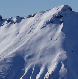
Yesterday, my partner and I were more surprised by what we didn’t see then what we saw in the Taylor Fork in the southern Madison Range. I was expecting to see natural avalanches in high elevation terrain and to get unstable results in stability tests, but we were 0-2 on these assumptions. We did observe one small natural avalanche in wind loaded terrain, but this slide was not a major red flag (photo). We did however find the layer of near surface facets under the new snow, which could become more reactive with the additional weight of today’s storm (video).
This scenario also plays true with the mountains around Bozeman, Big Sky and Cooke City. We know there is a layer of facets buried 1-2’ deep with sporadic distribution (photo, video). This layer caused cracking/collapsing and recent avalanches in the mountains around Cooke City a few days ago (photo). It has also caused signs of instability in the mountains around Bozeman and Big Sky.
As the storm continues today, human triggered avalanches will be likely on all slopes. For this reason, the avalanche danger is rated CONSIDERABLE.
If you get out and have any avalanche or snowpack observations to share, drop a line via our website, email (mtavalanche@gmail.com), phone (406-587-6984), or Instagram (#gnfacobs).
Upcoming Avalanche Education and Events
Events and Education Calendar
BOZEMAN
Jan. 12 and 13, Companion Rescue Clinic, Info and Register
Jan. 17, 18 and 20 or 21, Introduction to Avalanches w/ Field Day, Info and Register Here
Jan. 24, 25 and 27, Advanced Avalanche Workshop w. Field Day, Info and Register Here
Feb. 9 and 10, Companion Rescue Clinic, Info and Register
WEST YELLOWSTONE
Jan. 6, Avalanche Awareness, 7-8 p.m. at West Yellowstone Holiday Inn Conference Center
COOKE CITY
Today and tomorrow, Weekly Current Conditions and Avalanche Rescue, 6:30-7:30 p.m. Friday @ the Super 8, and anytime between 10-2 on Saturday @ Lulu Pass road.
Check out Chabot’s article, Being Prepared that was just published in the Chronicle’s CARVE magazine this weekend. In essence, preparation decreases the chance for negative outcomes.