Advisory Archive
Since yesterday the mountains near West Yellowstone and Cooke City received 3-5 inches of snow, near Big Sky a trace of snow, and none near Bozeman. This morning temperatures were in the high 20s and low 30s F. Winds increased overnight and were blowing 15-30 mph from the SW gusting to 40 mph. Today will be warm, windy, and snowy. High temperatures will hover around freezing, and winds will continue from the SW. By tomorrow morning 2 inches of snow should fall near Bozeman and Big Sky and 3-4 inches will fall near West Yellowstone and Cooke City.


Yesterday was sunny with light winds out of the west and today will be similar: more sun, calm winds and mountain temperatures in the upper twenties. Clouds will increase tonight from a moist southwest flow, but I’m not expecting any snowfall. By tomorrow morning the temperatures will be unseasonably warm in the valleys and below freezing in the mountains. Looking into my fuzzy crystal ball I do not see any significant snowstorms in the coming week, but then again it’s fuzzy, like my brain at 4 a.m.

The mountains picked up snow last night, mostly in the south. Cooke City got six inches, West Yellowstone has three inches and all other ranges have a trace to one inch. For the last 24 hours strong westerly winds were averaging 25-35 mph with gusts of 65 mph. Snowfall has ended, the sun will come out and winds will taper off this afternoon. Today, mountain temperatures will reach the upper 20s with clear skies through tomorrow necessitating a smear of sunscreen.


Over the past 24 hours no new snow has fallen. This morning a weak ridge of high pressure is parked over the region producing clear skies and a strong temperature inversion. Currently, mountain temperatures are 10-15 degrees F warmer than the valley. Most mountain locations are in the upper single digits to low teens F and winds are blowing 10-20 mph out of the WSW. Today, skies will start out mostly clear but will become partly to mostly cloudy by this afternoon. Temperatures will warm into the mid-20s to low 30s F and winds will steadily increase out of the WSW. A weak weather system will impact the area tonight and tomorrow producing an increased chance of snow. Cooke City will likely receive 3-5 inches by mid-day tomorrow. The mountains around West Yellowstone could see 2-4 inches with the mountains around Big Sky and Bozeman picking up 1-2 inches.
Since yesterday morning temperatures have dropped nearly thirty degrees F and a healthy dose of snow has blanketed much of the forecast area. Cooke City was the big winner with over a foot of new snow while the mountains near Bozeman picked up 6-8 inches. Farther south, Big Sky squeezed out 3-4 inches while the mountains around West Yellowstone received a trace to two inches. Currently, temperatures are in the single digits above or below zero F and winds are blowing 10-20 mph out of the west. Stronger winds are being recorded near Cooke City with gusts reaching over 30 mph. Today, temperatures will warm into the single digits to low teens F under mostly clear skies and winds will continue to blow 10-20 mph out of the west.

This morning temperatures in most areas were in the high 20s F. In the Bridger Range temperatures were in the low 30s F. Strong winds were blowing 25 mph gusting 40-50 mph from the SW. Temperatures will begin dropping today and should be in the teens F by late afternoon and even colder tonight. Snow should start falling around mid-day. By tomorrow morning most areas will receive 3-5 inches of new snow.
The temperature swings are giving me whiplash. At 5 a.m. most mountain locations were near or above freezing under mostly cloudy skies with west to southwest winds blowing 20-35 mph. Today temperatures will remain warm, clouds will increase, winds will remain the same and 1-2 inches of snow will fall in our southern mountains late tonight. An arctic cold front moves in tomorrow chilling us back into the single digits.
Early yesterday morning the snow stopped falling. Ridgetop winds blew westerly at 25-35 mph during the day and last night, lower elevation, mid-mountain winds increased from the south to 35 mph. Mountain temperatures have warmed into the upper 20s under partly cloudy skies. Today will remain partly cloudy and windy. No new snow is expected in the next 24 hours and temperatures will rise to above freezing in many areas.

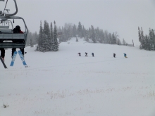
The mountains got fire hosed with snow. Estimates are 14+inches in the northern mountains, close to a foot from Big Sky to West Yellowstone and 1 ½ to 2 feet in Cooke City. Winds blew westerly at 20-40 mph, but they are increasing at the ridgetops this morning with speeds of 40-60 mph up Hyalite. The snowfall will taper off this morning as high pressure pushes in. Thanksgiving Day will be sunny with mountain temperatures in the thirties under calm skies.