Snow Observations List
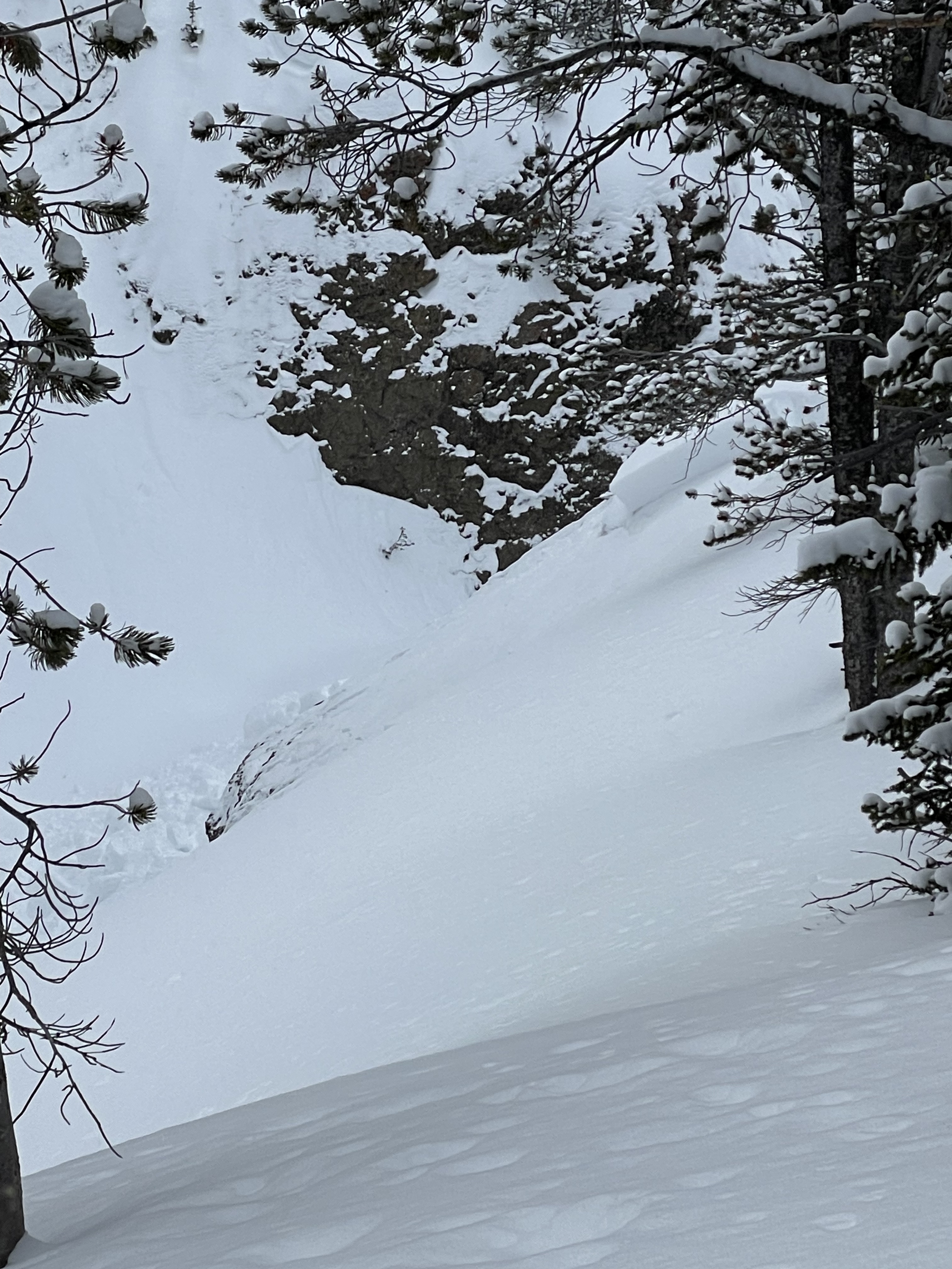
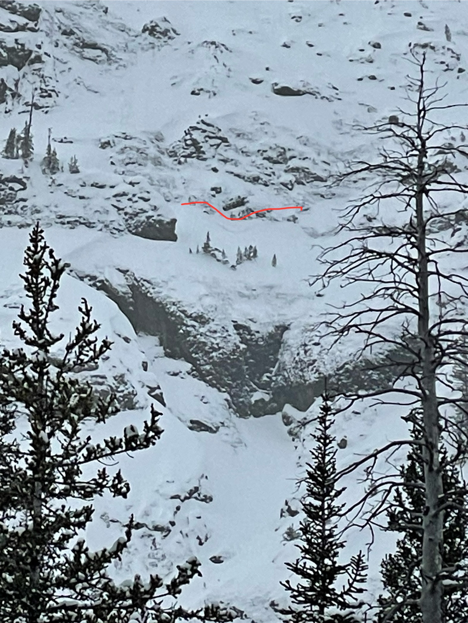
While splitboarding south of Cooke City today I remote triggered an avalanche. I stopped to transition, stepped into the snow, triggered a massive collapse and a slope about 100ft away slid. I stopped right there to dig a pit. HS 110, south facing, 9,000ft, non wind loaded slope. I got an ECTP 14 and an ECTP 13 both 60cm down, right at the top of the big ol facet layer making up the lower 50cm of the snowpack.
Other than the remote trigger, lots of small loose dry natural avalanches on all aspects, mid and upper elevations. I also saw a few small D1 natural slab avalanches in the area on east and north facing aspects, mid elevation. Hard to tell when these all happened, but I'd guess within the last 24hrs. Flat light, hard to see definition Large collapses often and throughout the whole area, on and off established skin tacks.
Full Snow Observation Report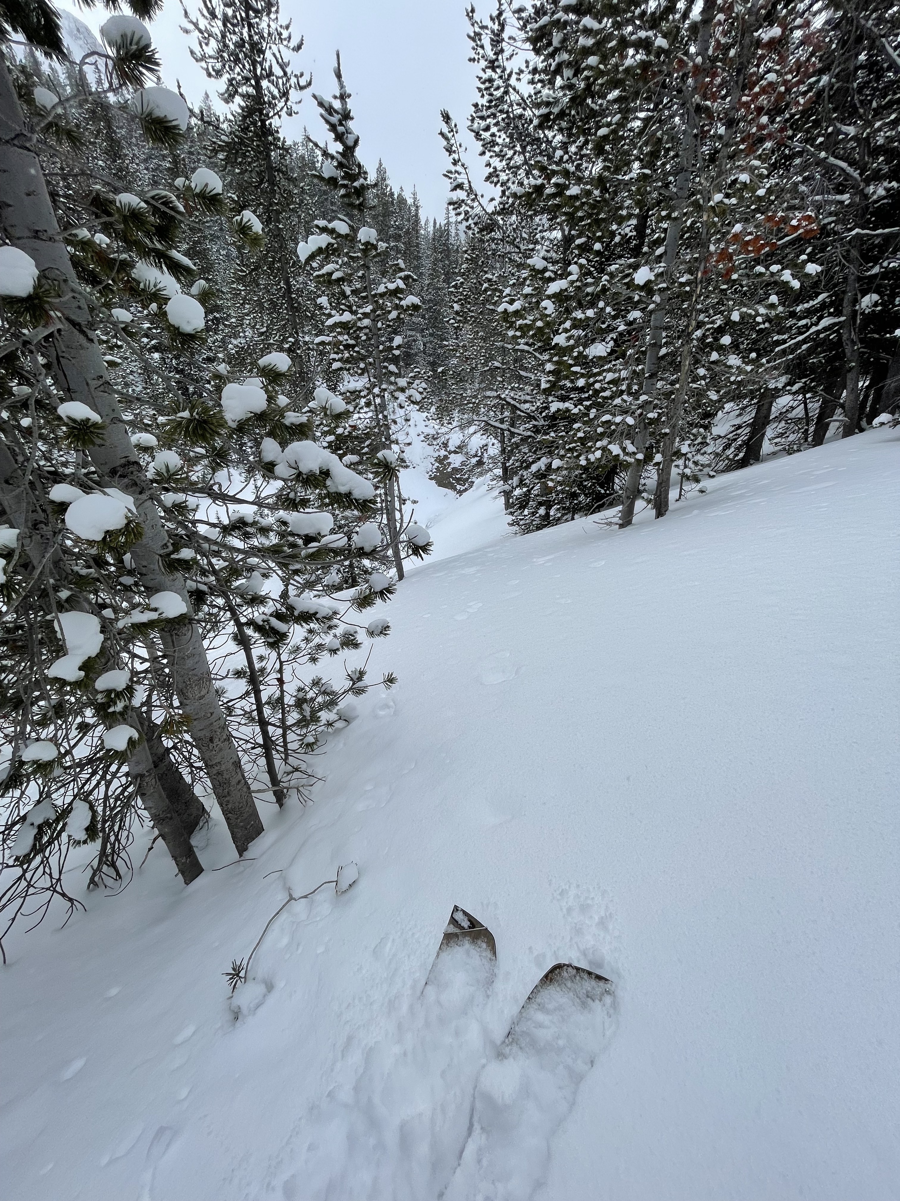
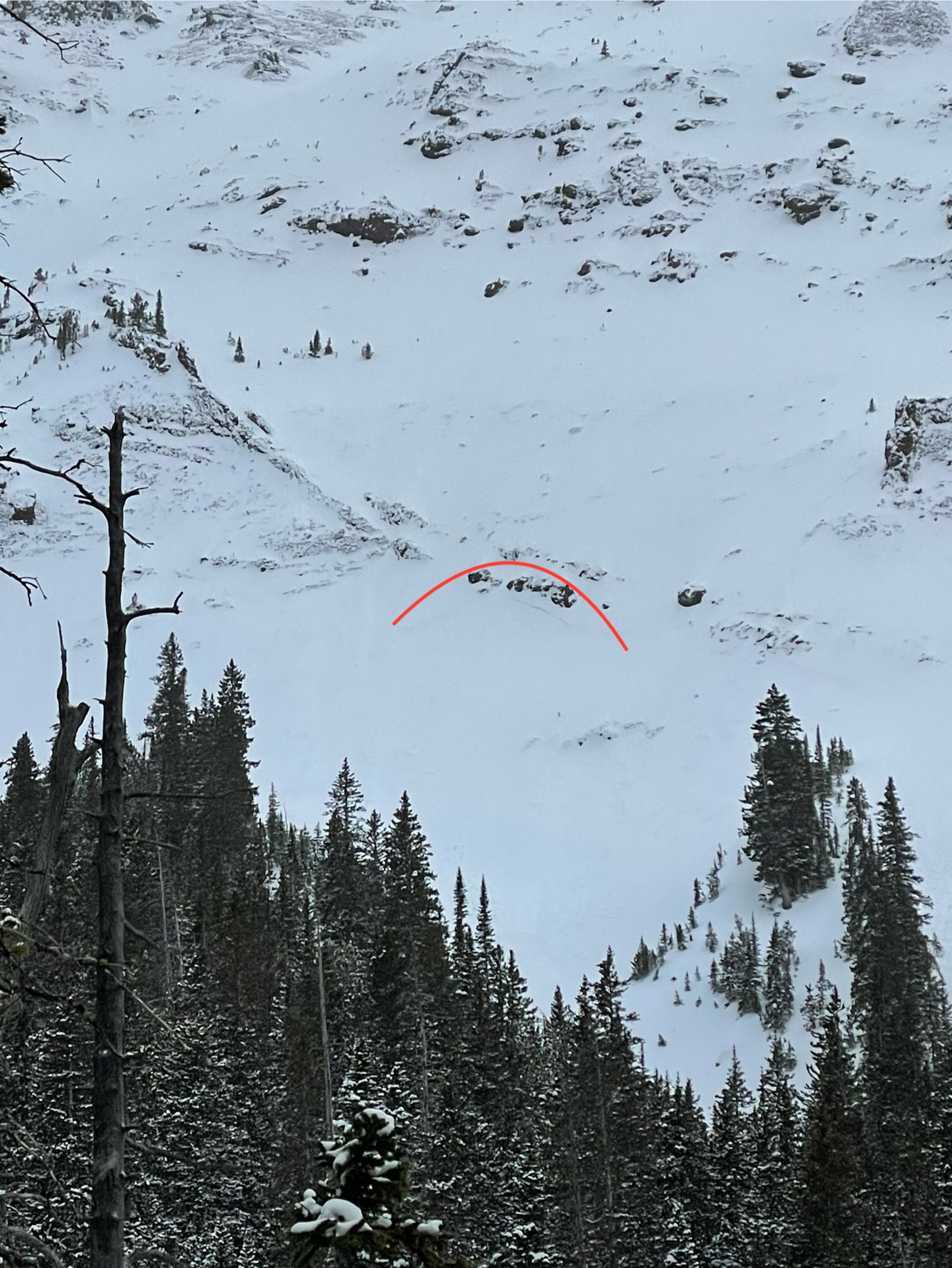
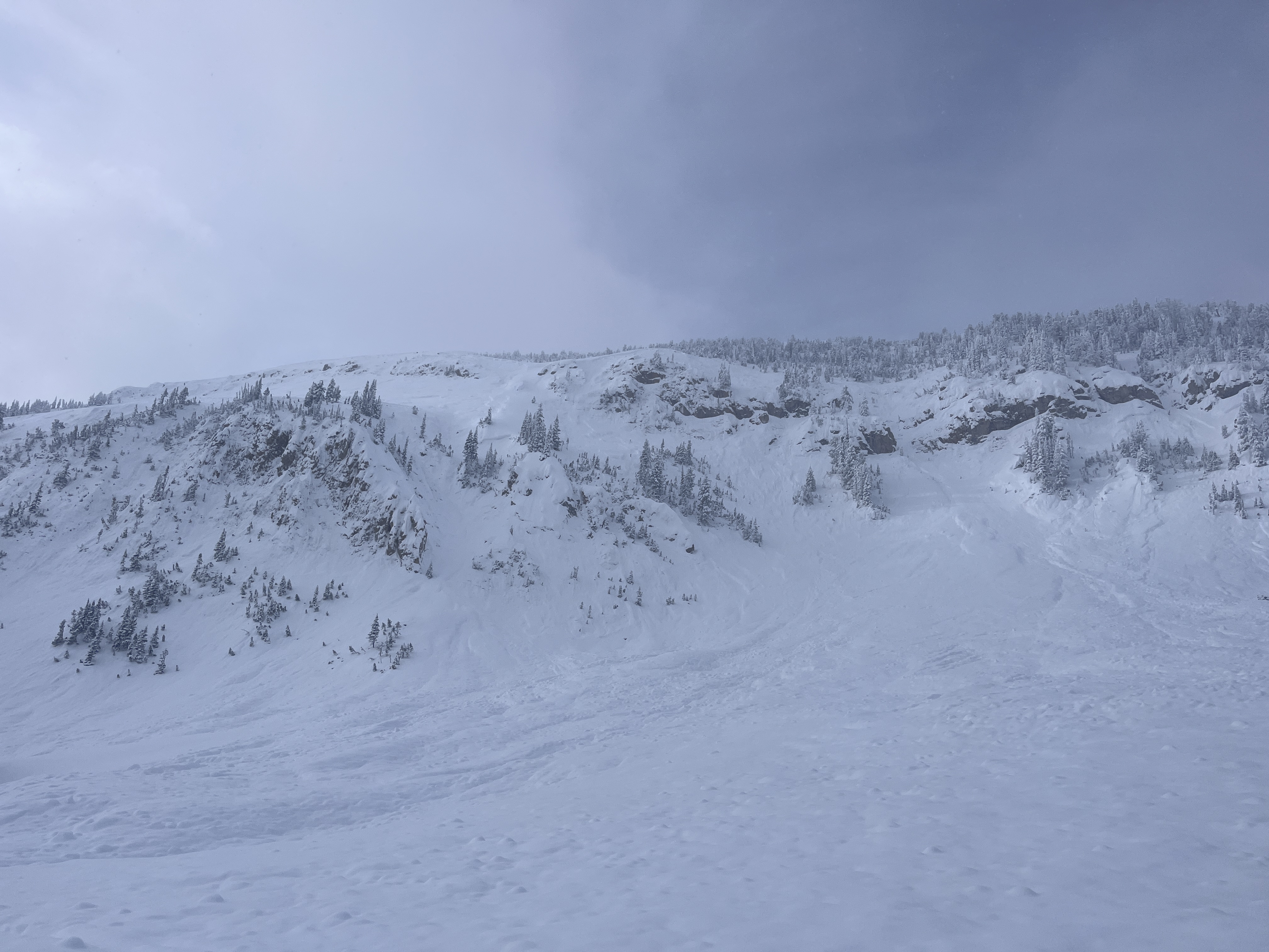
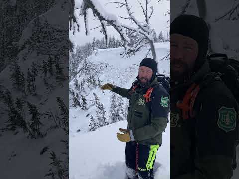
We rode into Tepee Basin and stopped at a recent rider-triggered avalanche that happened on 02/07/2024, ob and video. This avalanche was very large in size, we estimated it to be 3/4 of a mile long, 3-4' deep and ran full path the flats below. The clouds parted long enough for us to seen the entire crown from afar, it was quite continuous and connected multiple smaller avalanche paths.
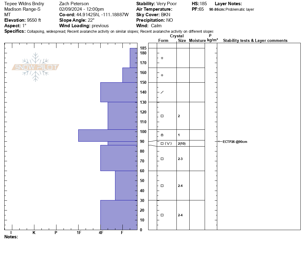
We continued riding to the wilderness boundary. While walking down to our pit side we felt as large collpase and saw snow fall from the trees around us. Our snowpit was on a N facing slope at 9500'. Here, weak snow low in the snowpack is now buried about a meter deep. We got unstable results of ECTP26. While riding away from our snowpit and stepping off snowmobiles we again triggered a large collapse. Collpasing continued as we worked through the trees.
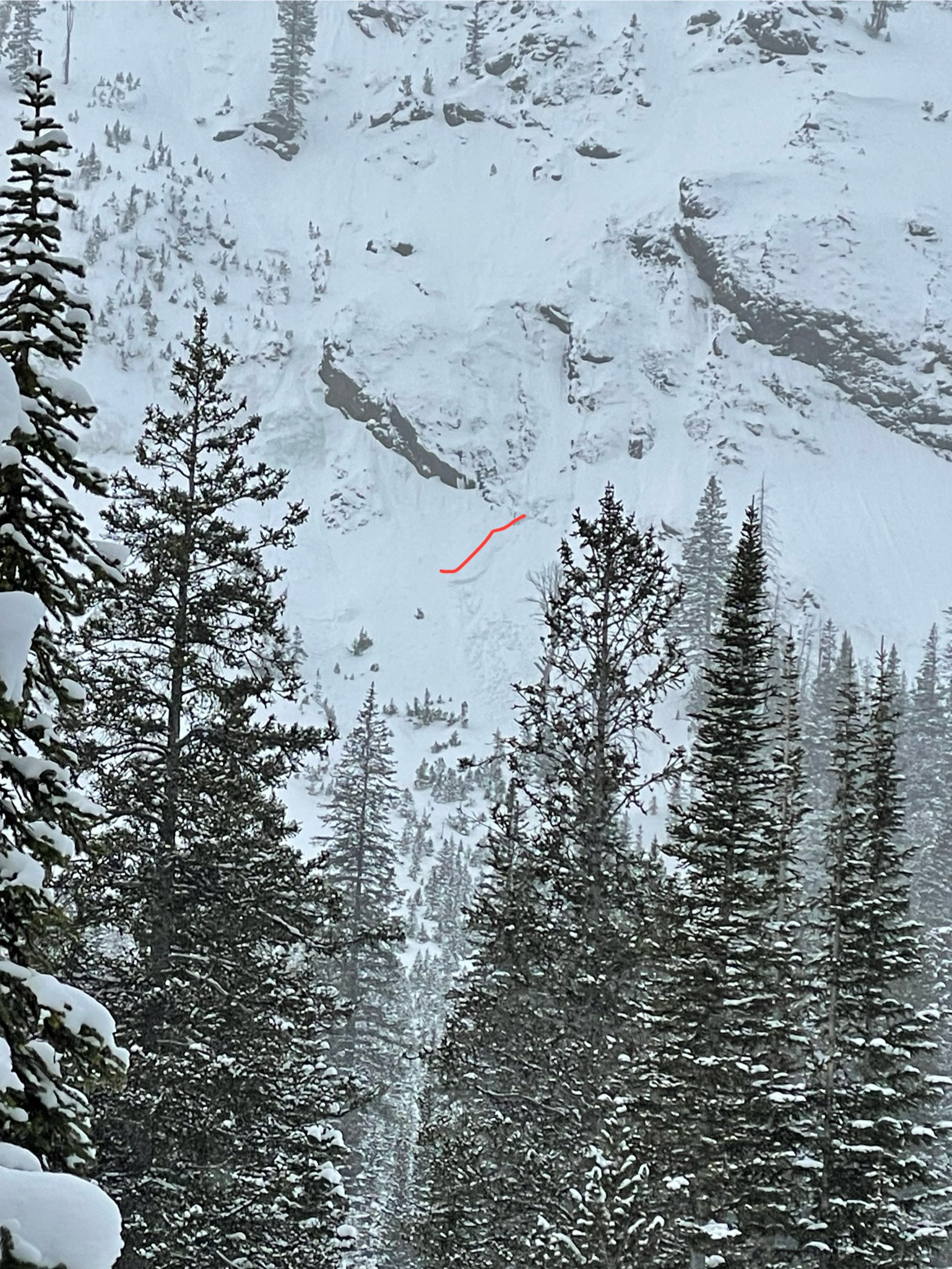
From here we rode along the wilderness boundary towards another area to look for more recent avalanche activity. While crossing a flat meadow above a steep slope the rider breaking trail triggered an avalanche from 30' away. This avalanche broke several hundred feet wide, 2-3' deep and ran full path to the valley bottom. Additionally, around the corner we saw another recent avalanche that likely occured naturally within the last few days.
Overall conditions felt very unstable today. Recent avalanches and collapsing were clear signs on instability. Even if we didn't see these signs of instability, knowing the snowpack is weak and has recently received a lot of new snow was enough information for us to plan to stay off of and out from underneath avalanche terrain today.
Full Snow Observation ReportThe buttermilk lot is plowed. And the trail to the cabin/tepee split was groomed.
Definitely felt appropriate to have a warning out today.
Went for a quick tour into wolverine bowl today. Found new snow totals of around a foot in most places and a very thin melt freeze crust from high-pressure system on all shadier aspects while sunnier aspects had more of a noticeable crust beneath the new snow. Dug a 130 cm pit adjacent to the refrigerator chutes and got a CT15 Q1 @ 99cm and CT21 Q1 @ 30cm. Shallower result failed on facets beneath the recent melt freeze while the deeper result failed on the old melt freeze interface from earlier this season. Snow was coming down heavy by the time I left the bowl and wind was calm.
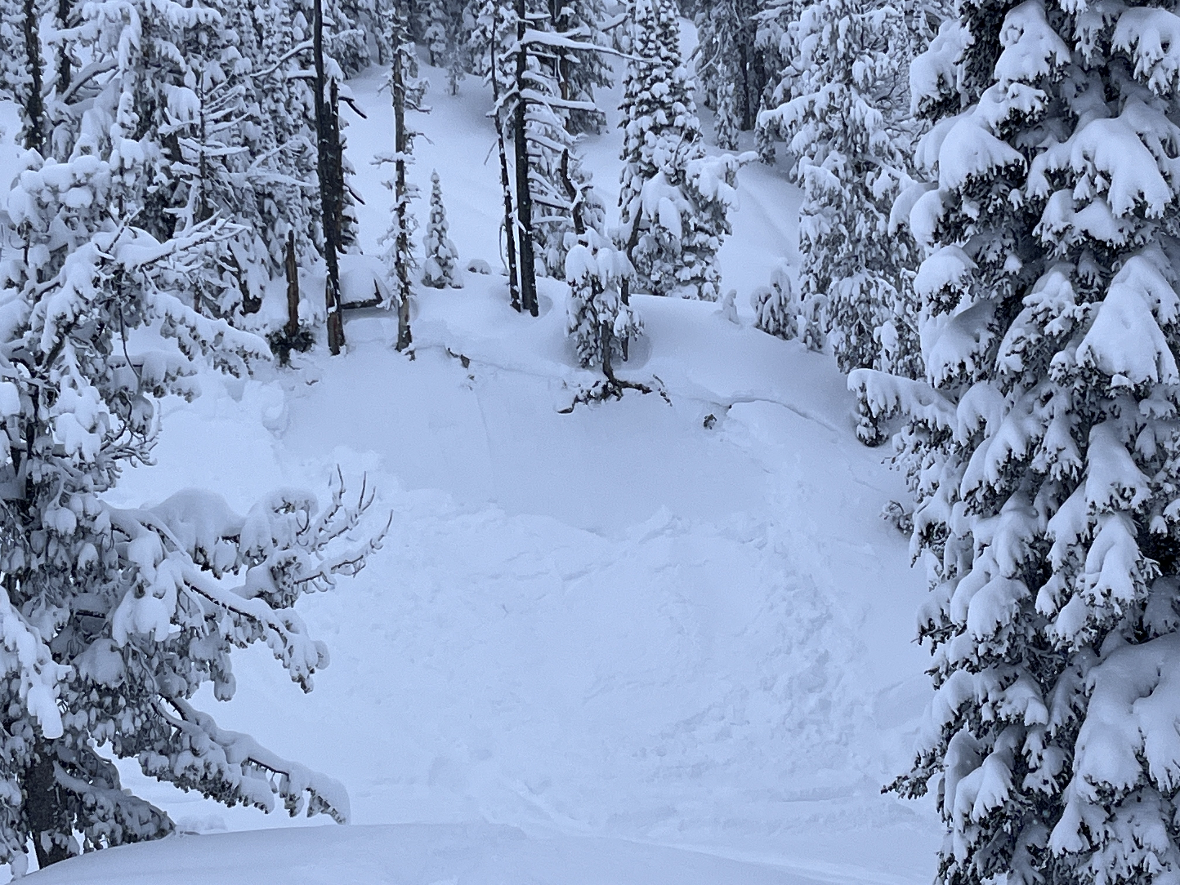
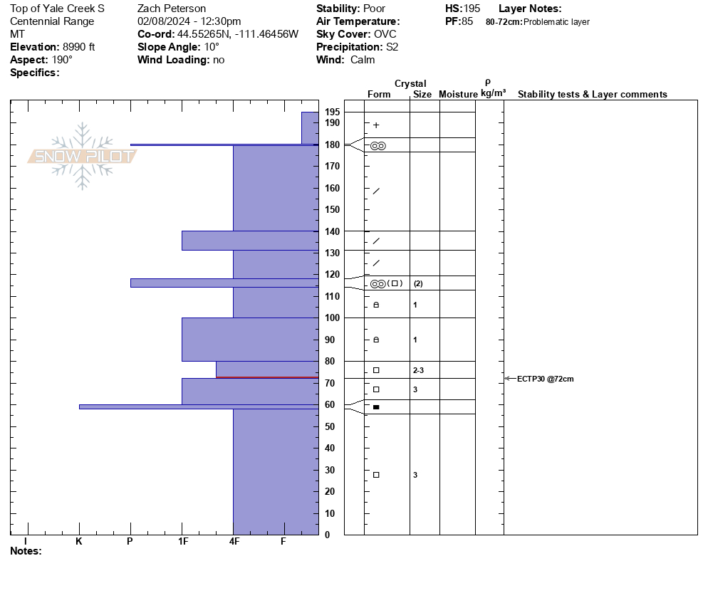
Full Snow Observation ReportWe rode into Yale Creek today. At the head of the creek, we stopped and dug on a south-facing slope at 9000'. We found 30" of new snow that has fallen over the last week on top of an already unstable snowpack. From here we continued up Yale Creek and on a small NE-facing slope, we saw an avalanche that was triggered by snowmobilers within the last couple of days. This avalanche was 2-3' deep and 100 feet wide and failed on weak faceted snow near the ground. It did not run far vertically because it was such a small slope. We dug near here on a SE facing slope and saw a similar setup as earlier with 30"+ of new snow overlaying weak snow.
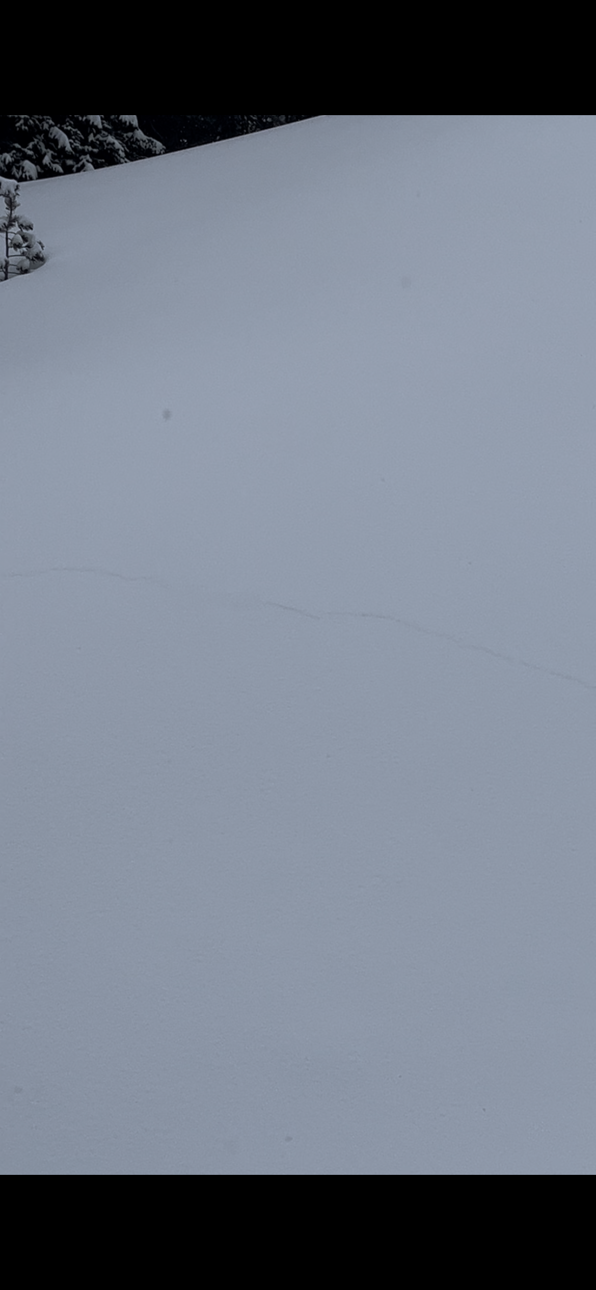
On our way out, we saw a small freshly triggered avalanche. This was in a small gully and failed on weak snow near the ground 1-2' deep. With poor visibility, we did not get an opportunity to see any avalanches on larger slopes. However, seeing avalanches on small protected slopes is a good indicator that there are likely avalanches on larger steep slopes we could not see.
Wind was calm to light out of the south and snow continued through the day, with 1-2" of snow falling while we rode.
Full Snow Observation Report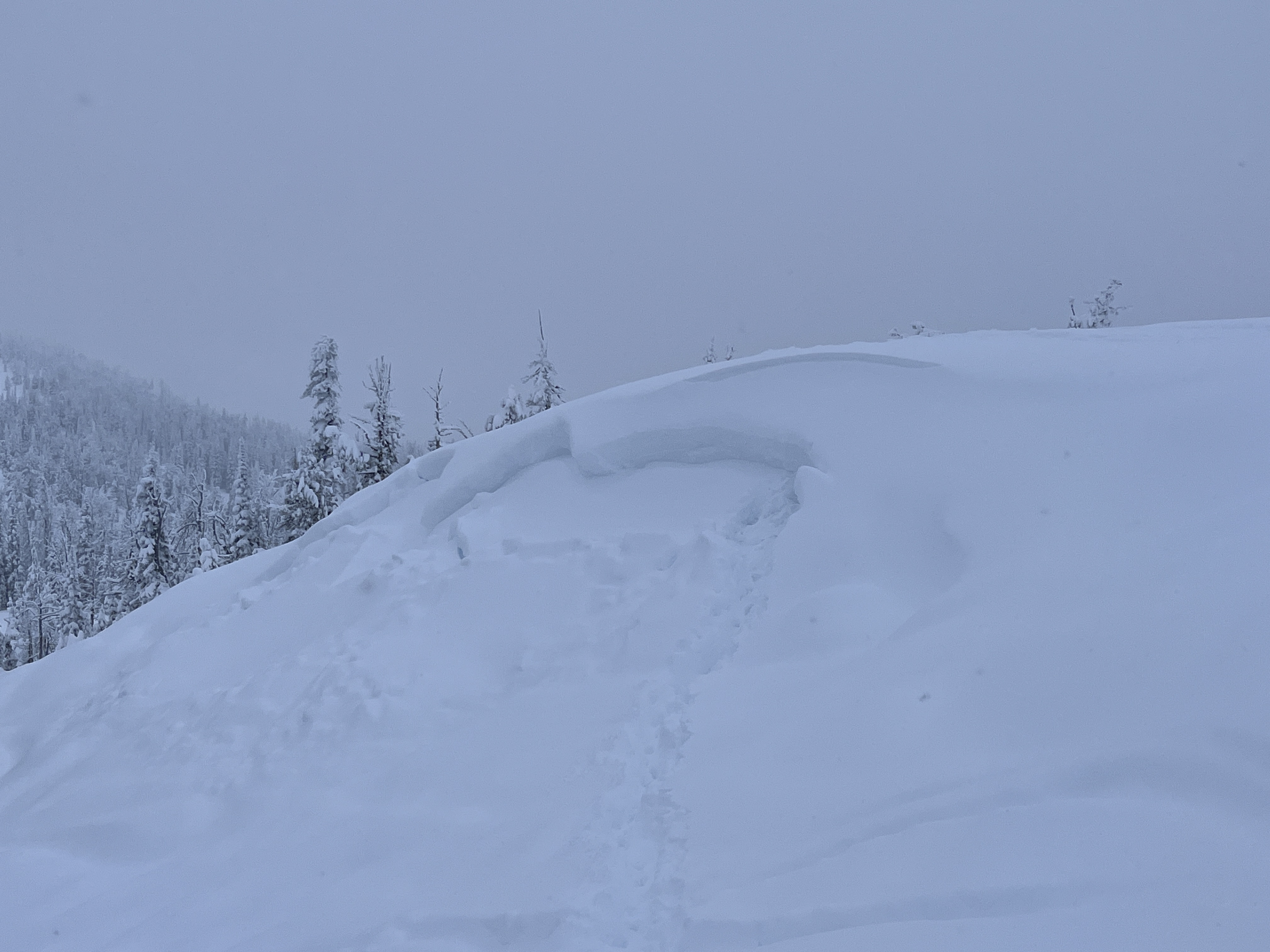

Dug a very quick pit on a SE slope at 9600ft HS 90 cm. Boot pen to the ground. SKY OVC. Wind L.
Visibility was minimal, but I observed no signs of significant, recent wind loading. With that said there is a ~5-8 cm (small) 1F wind slab under ~5cm of + at the top of the snowpack and above the Jan. crust.
ECTN26 below the Jan. crust
PST 30/100 End on 2-3mm facets down ~50cm (below the jan crust)
Where the crust exist, it may be ever so slightly harder to impact these deeper, weaker layers, but I would certainly not place any faith in it especially with spacial variability and change in aspect/elevation.
After doing the ECT and not observing any propagation. I pulled the block off with my shovel and it broke deeper (Q1/2) on the same facets I performed the PST on.
I dug in this same meadow earlier in the winter. Basal facets/ depth hoar have advanced significantly. I didn't put them on a card,but striations were visible to the naked eye.
This snowpack has a lot going on in it, but strength is certainly not one of them. Out of the entire snowpack maybe only 10-15cm of snow had hand hardness greater than 4F+.
Full Snow Observation ReportToured up bacon rind via the ridge ascent. Noted a small melt freeze crust below 7800’ with 2-3” above it. Low density snow capped a denser slab above the weak snow on the ground. signs of instability were less obvious than they have been. Still trigged several tree shaking collapses, with cracking up to 100ft above me. Riding quality was quite nice.
noted a large avalanche that broke in the E,NE bowl off Ernest Miller, appeared to be hundreds of feet wide and several feet deep.
Cracking about 20ft long observed during our tour when crossing over a gully/stream at 35 degree slope angle. Crust about 25-30 centimeters below soft snow showed instability along with the faceted base toward the bottom of the snowpack.
Full Snow Observation Report

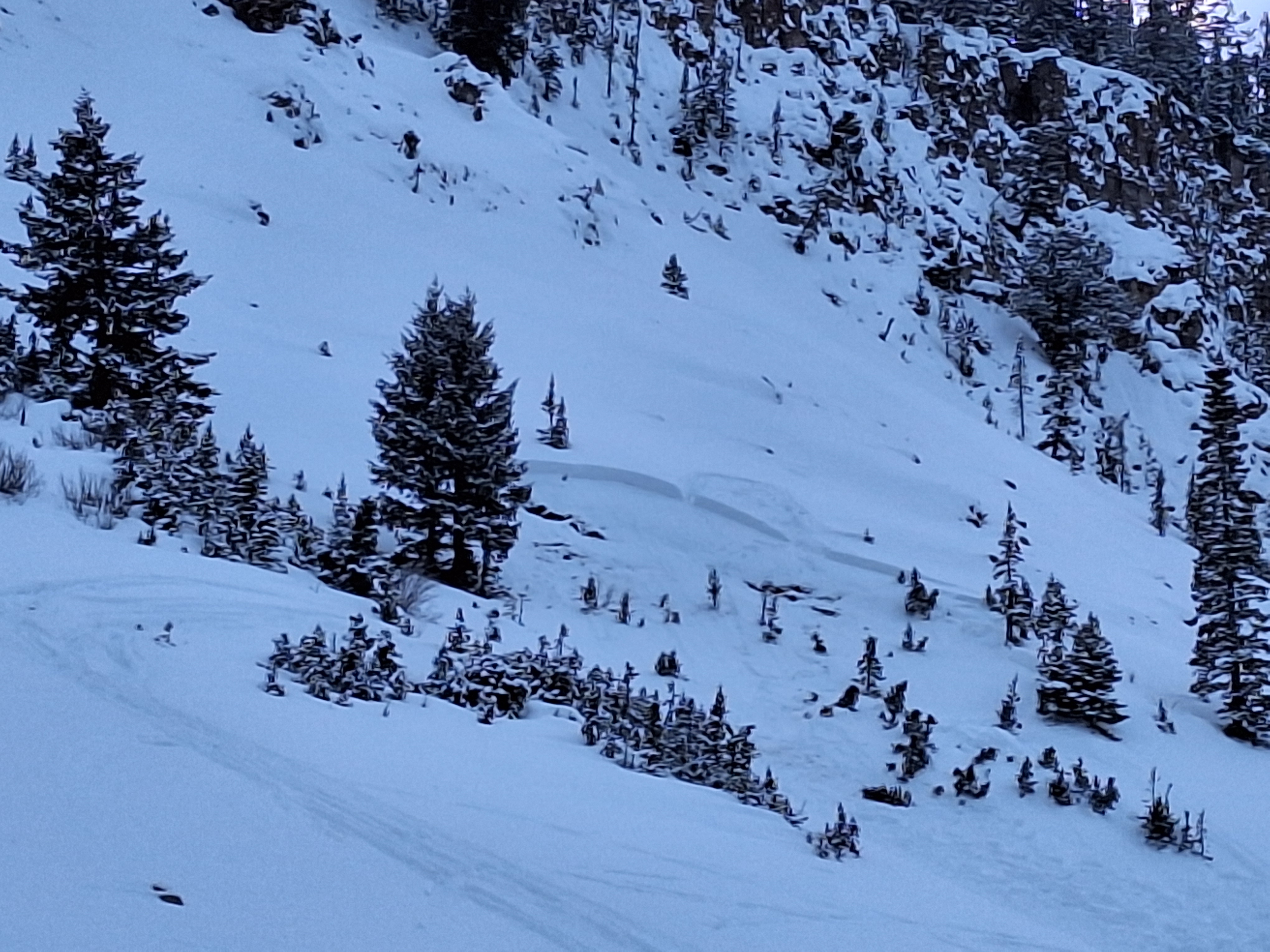
Natural avalanche on East Side of Henderson Mtn. seen late on 2/7/24. South of the two that Doug saw last week, along the ridge. Could have happened yesterday or last night. I didn’t see it yesterday when riding up and down Fisher creek, but visibility was mediocre. The debris and bed had at least some new snow on it.
Also had a large rumbling collapse near 10,000’ west facing when following one skiers old skin track. And had a few large collapses on south facing slopes between 8,000-9000’.
Full Snow Observation Report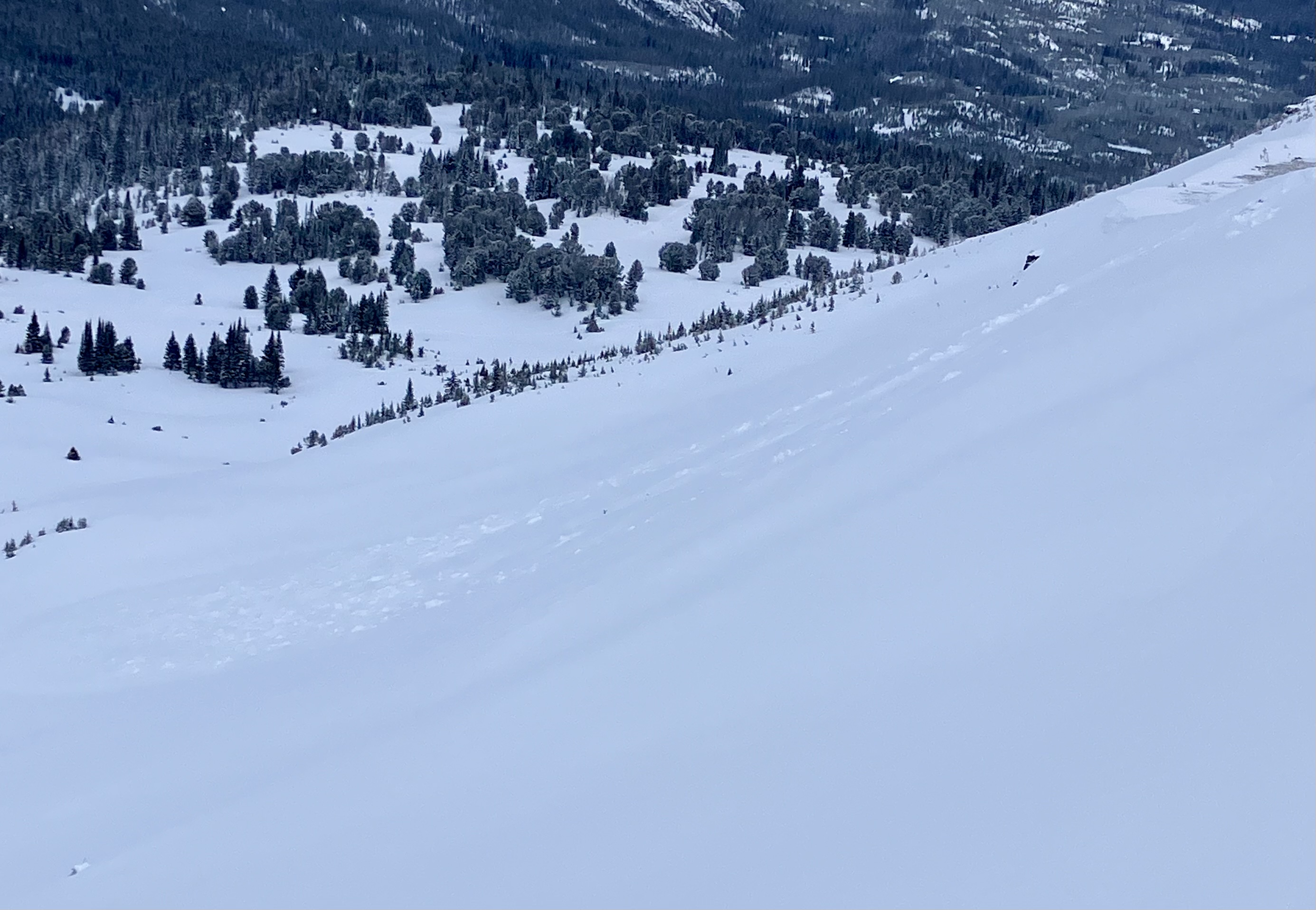
From email: "My friend and I toured in Cooke City today. We skied the low angle glades on the South side of Henderson Mountain. Breaking trail, we experienced at least 20 collapses, several of which were large enough to knock snow off the trees around us. Above 9200’ where the snowpack started to deepen, we did not get any collapses or cracking. We dug a quick pit at 9750’ on a SSE aspect. The site we dug on had been wind loaded substantially before the high pressure cycle last week. Skies were mostly cloudy with the sun poking out occasionally, light winds out of the west. Our ECT did not have propagation, but the results from our CT test were poor. Given the sketchy conditions, we stuck to low angle terrain."
Full Snow Observation Report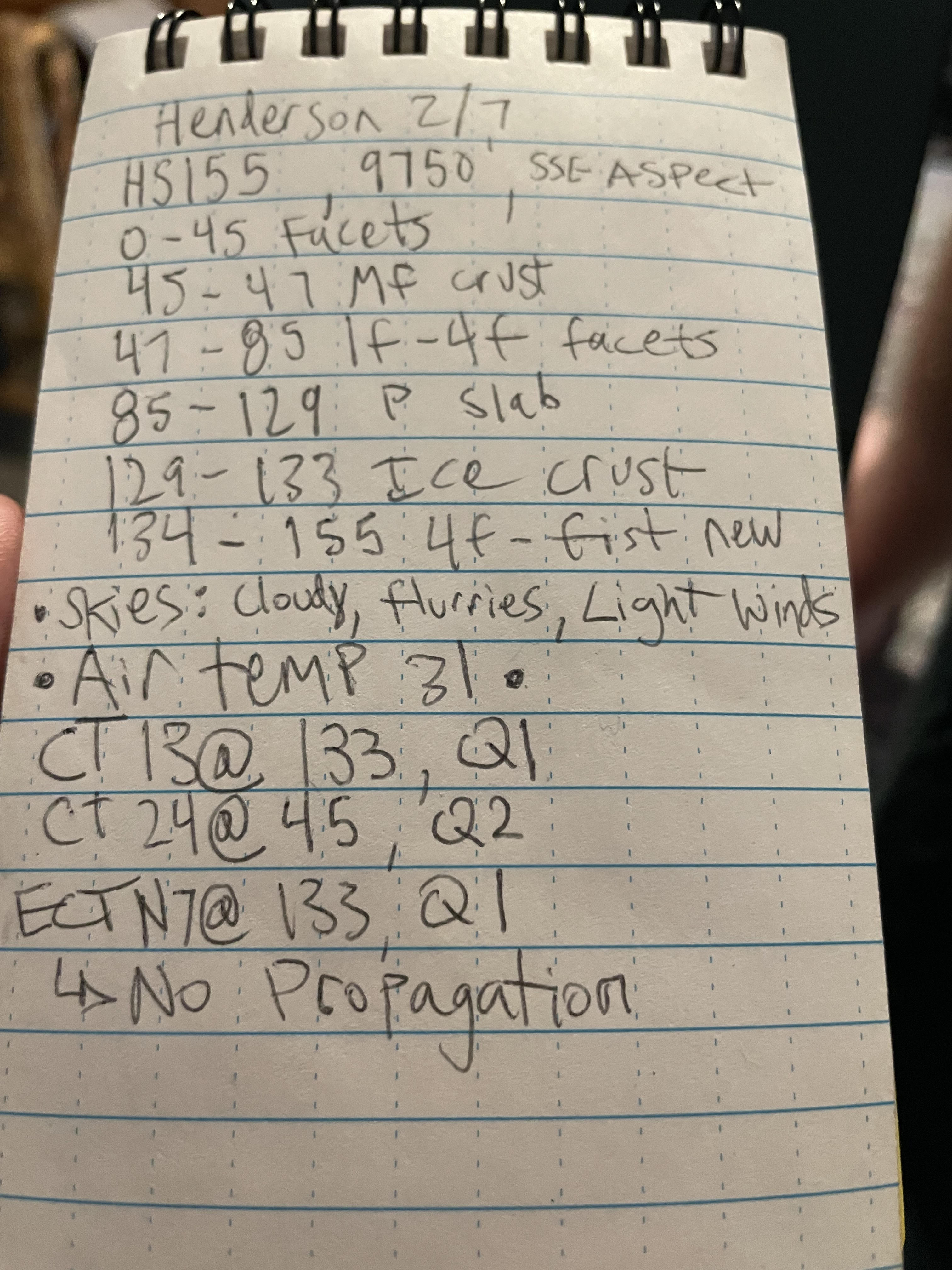
We rode into Taylor Fork today 02/07/2024. We found 12" of new snow that has fallen over the last few days. This new snow fell onto a very weak snowpack and our stability tests yielded poor results, ECTP 14 on a south-facing slope at 9200'. Southern aspects have a stout 2" crust that formed from last week's warm temperatures, over weak faceted snow. This is where we saw failure in our stability tests.
With poor visibility, we were not able to see any recent avalanche activity. However, we know the recipe is there. A uniformly weak snowpack has received a large amount of snow pushing it to the edge. Getting on or below terrain steeper than 30 degrees is not recommended.
Low clouds moved in by early afternoon and the wind was steady and moderate from the southwest. No new snow fell while we rode today.
Full Snow Observation Report
Skied a northeast face that was around 35-40 degrees at around 9000 ft. Entire slope fractured on second ski cut but did not slide. A dusting of new snow, with a good bit of powder on the ground.
Full Snow Observation ReportObserved an avalanche above Highway 212 ("the plug") just north of the Wyoming/Montana border. that appeared to be triggered by a snowmobile. It looked fresh, likely from the afternoon of 2/6/2024. Northeast facing slope, 8200'. Technically out of the advisory area.
Full Snow Observation Report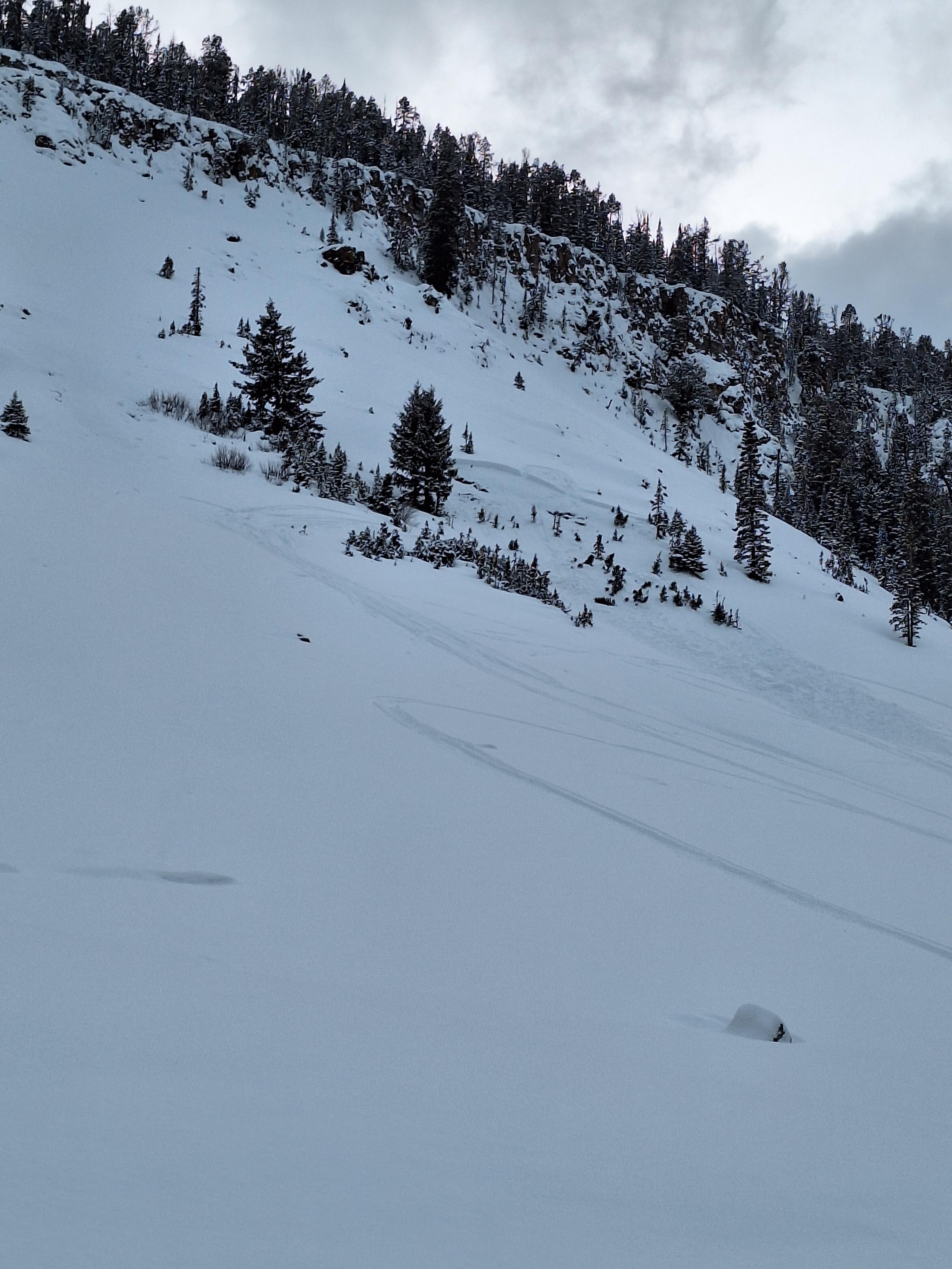
Evidence of an old natural slide on the lee side of Henderson Mountain.
No obvious signs of instability or cause for concern on the relatively mellow route up the ridge, but would definitely avoid the lee sides of that area where there was significant cornice formation.
Full Snow Observation Report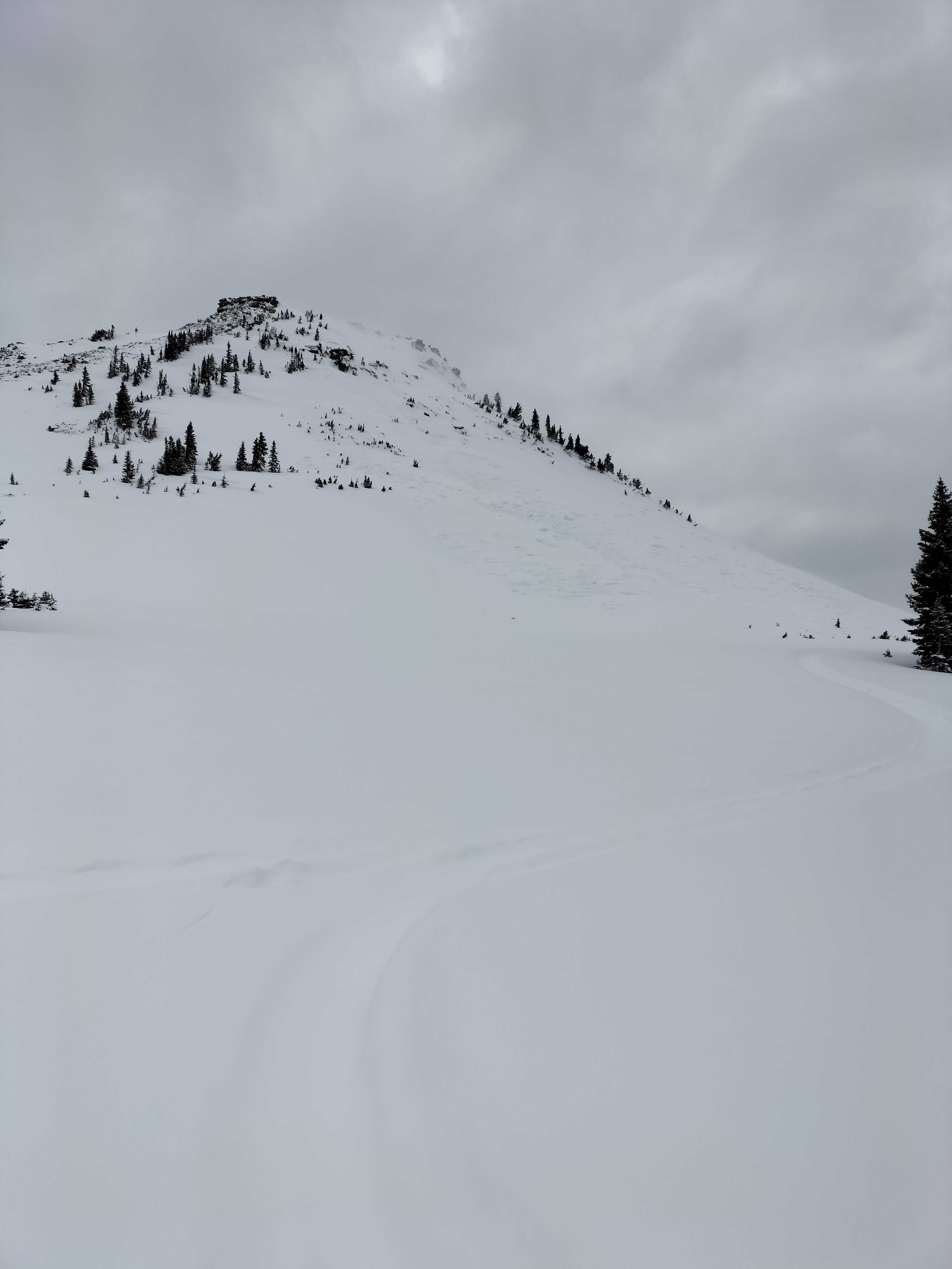
Persistent Problem visible
isolated shooting cracks and some roller balls observed
Full Snow Observation Report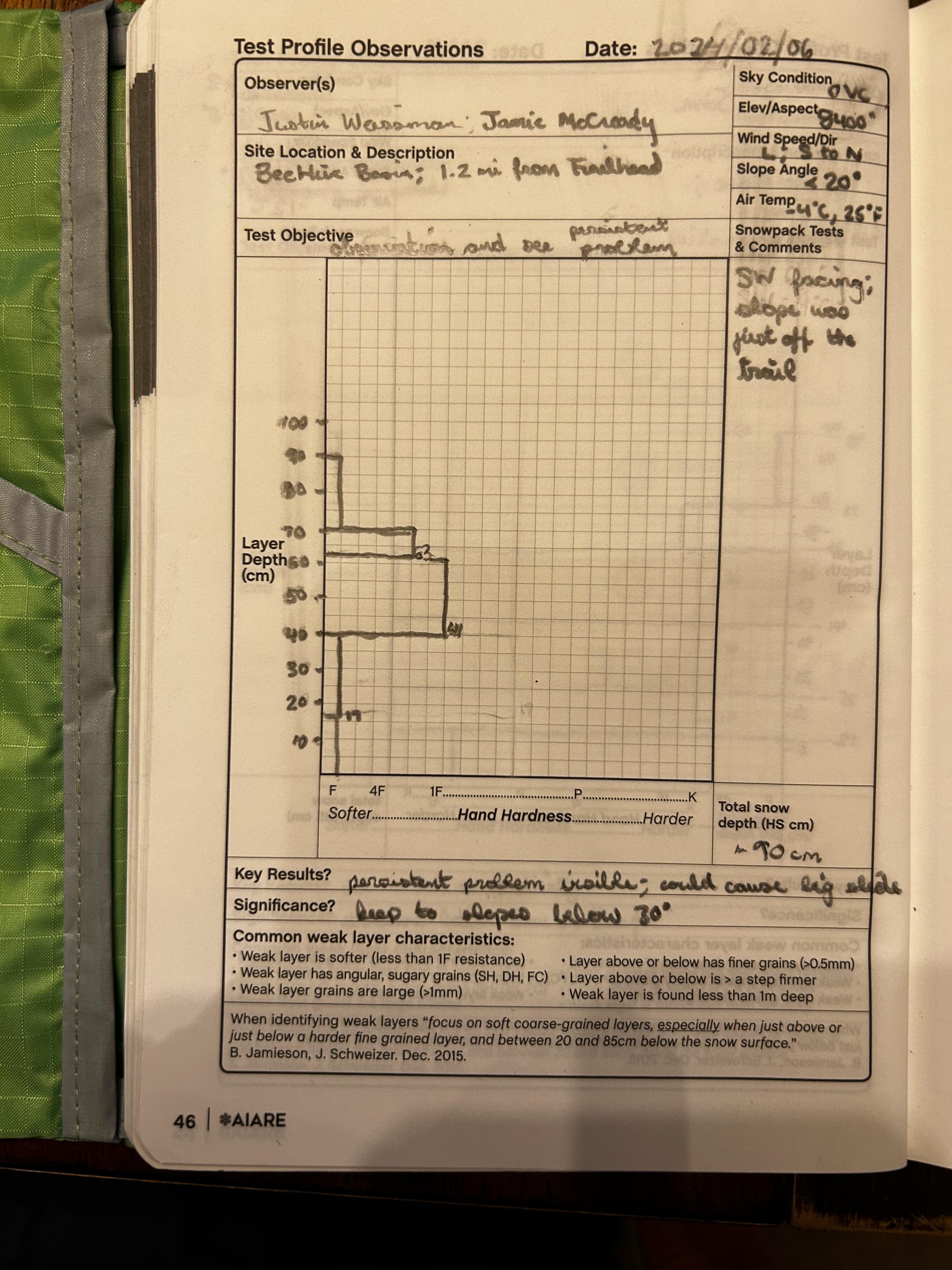

We rode South Plateau the last three days. The snow has been stable on steep slopes. We did observe a fresh powder layer of 24" with an ice layer beneath that is roughly 4" thick and faceted snow another 12" down with another ice layer. The snow has been very stable while we are riding and we have not observed any slides or had any issues.
Full Snow Observation ReportWe rode over Lulu Pass and around Fisher Peak into Abundance drainage. There was 8” of new snow that fell since Saturday, up to 12” north of Daisy. Wind was light to moderate and could see snow transport at peaks and ridgelines. Snowed most of the day with some heavy pulses, and some periods of decent visibilty.
Light was flat, but didn’t see any slab avalanches today while riding. I just spotted one small slab from town with binos on the east face of Mineral. There were a couple very small loose slides off the highest ridge of Henderson.
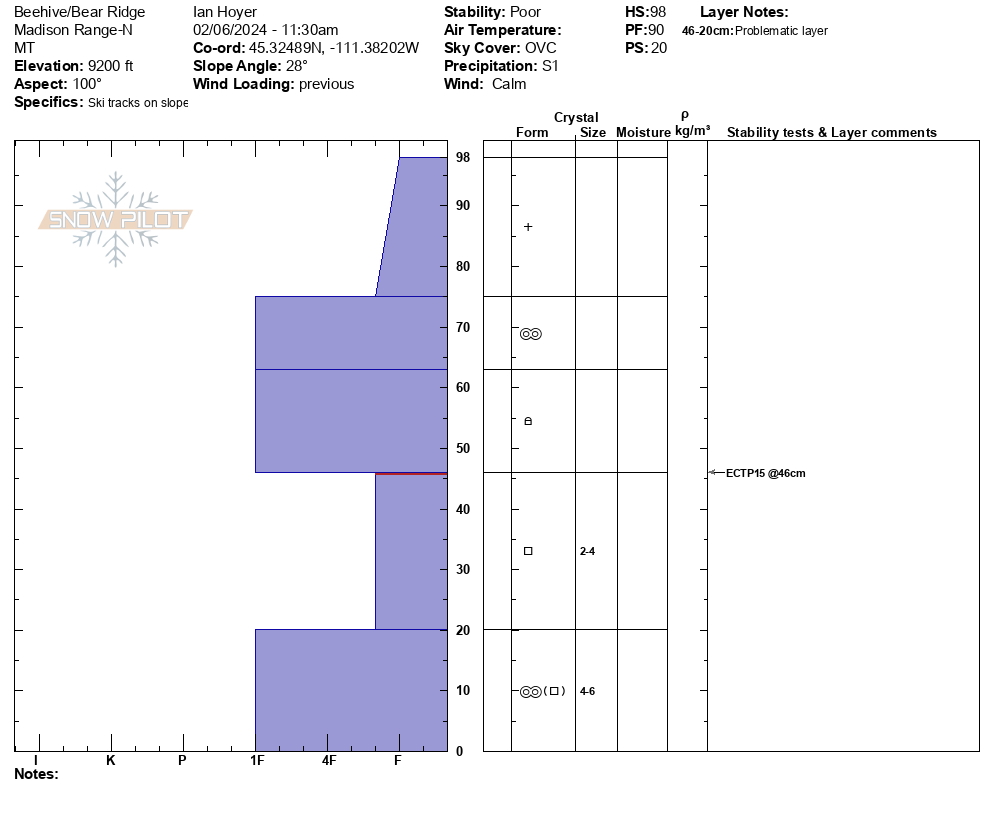
Full Snow Observation ReportWe skied into Beehive Basin. It was snowing lightly with calm wind. Skinning to Tyler's slope we could see wet avalanche debris from last week. We dug on the flank of Tyler's slope to look at the crust, but the snowpack was very thin and not representative of starting zones. The corniced ridge only had minimal new snow loading. As we skied up we had no collapsing. We dug in the trees on an east facing slope near the ridge, not far from all the holes the recent avalanche students made. We found 100cm of snow and got an ECTP15 on facets at the slab interface. A 5cm melt freeze crust is a nice marker from last week and Ian measured 1" of SWE above it, effectively doubling the slab depth/weight. We were in the fog on the ridge and could not get a look around.
Full Snow Observation ReportThe area is pretty hammered with tracks and snowpit holes. Digging near Tyler's does not seem to be representaive of anything important, so I'll probably blow that off in the future.

We rode to the the Fairy/Frazier Basin divide today to check out snow conditions and see what people had gotten up to over the weekend. The new snow had settled to about 4" or so and we did not notice any wind affect at lower elevations on the road but did find some deeper drifts hiding in the lee pockets in the meadows higher up. The climb up to the divide with Frazier only had 2-3 inches of fresh snow on it, and the saddle was nearly bare. Under the new snow there is a in places stout crust from the warmup last week (and past wind) which made for unpredictable riding. There were slick spots, breakable spots, and some fresh drifts. The ridge lines all were scoured as expected from the recent wind but we did not see any significant recent avalanche activity in the new snow, only a couple very small pockets had slid near the ridge tops and these were few and far between.
Full Snow Observation Report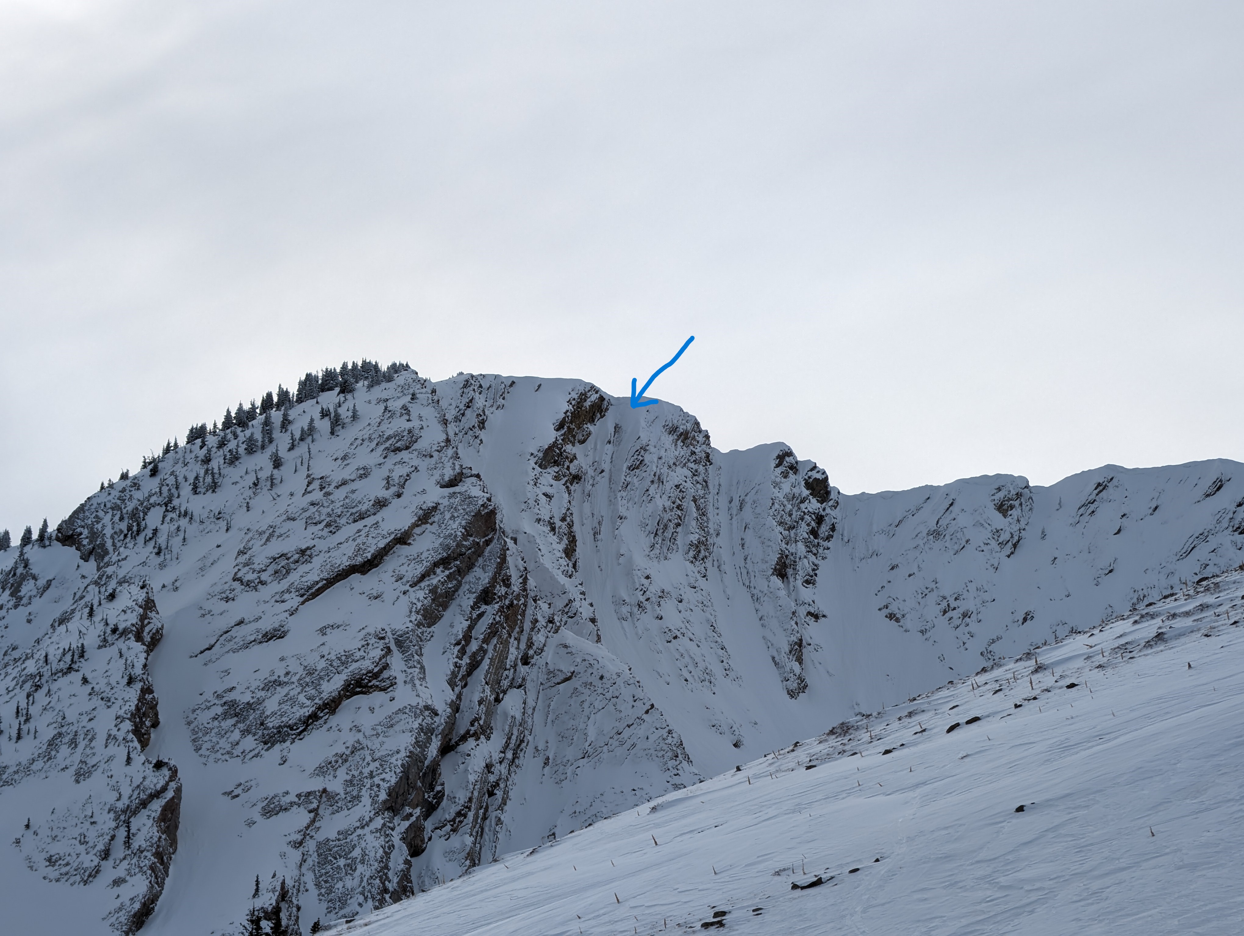
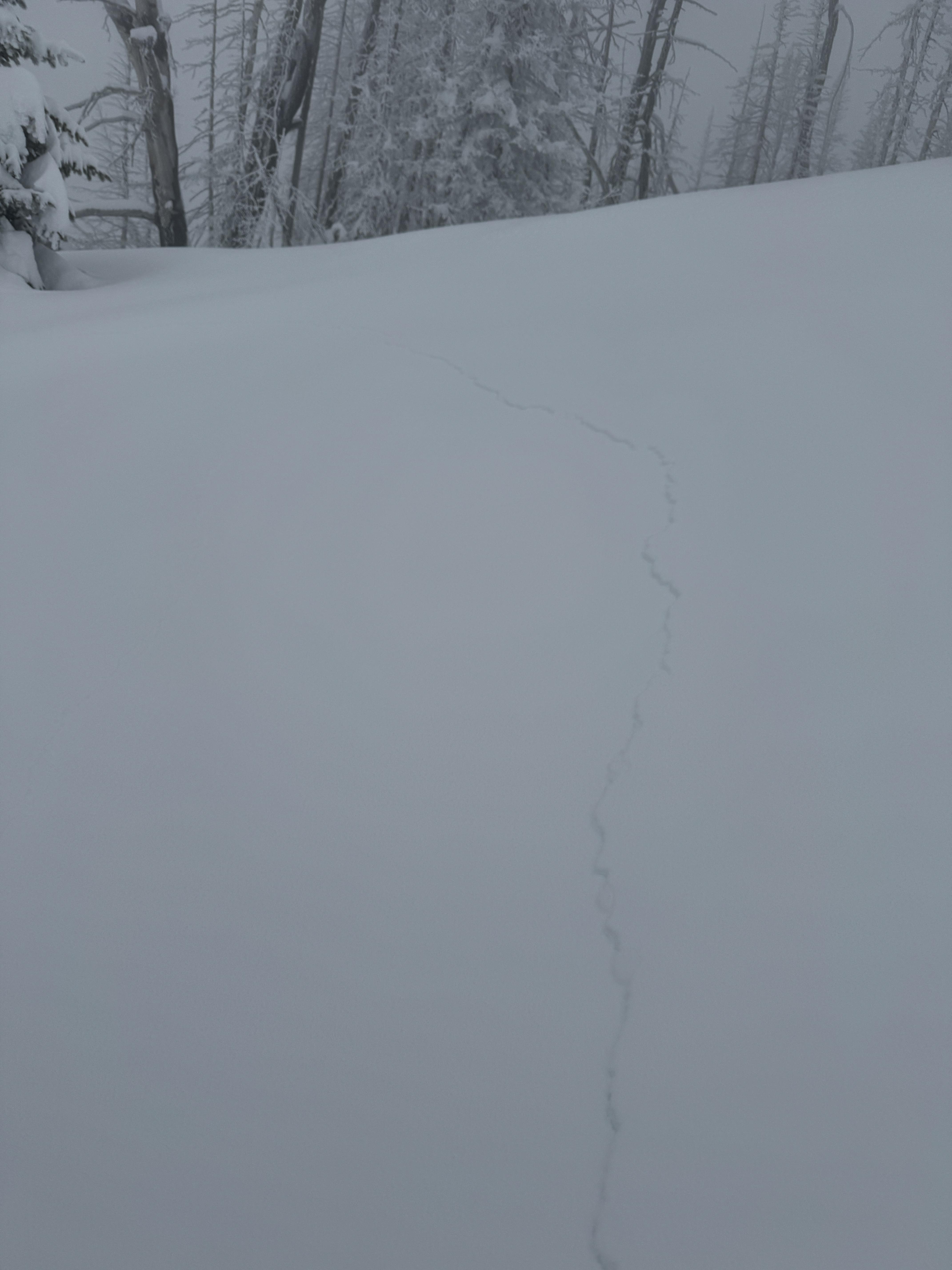
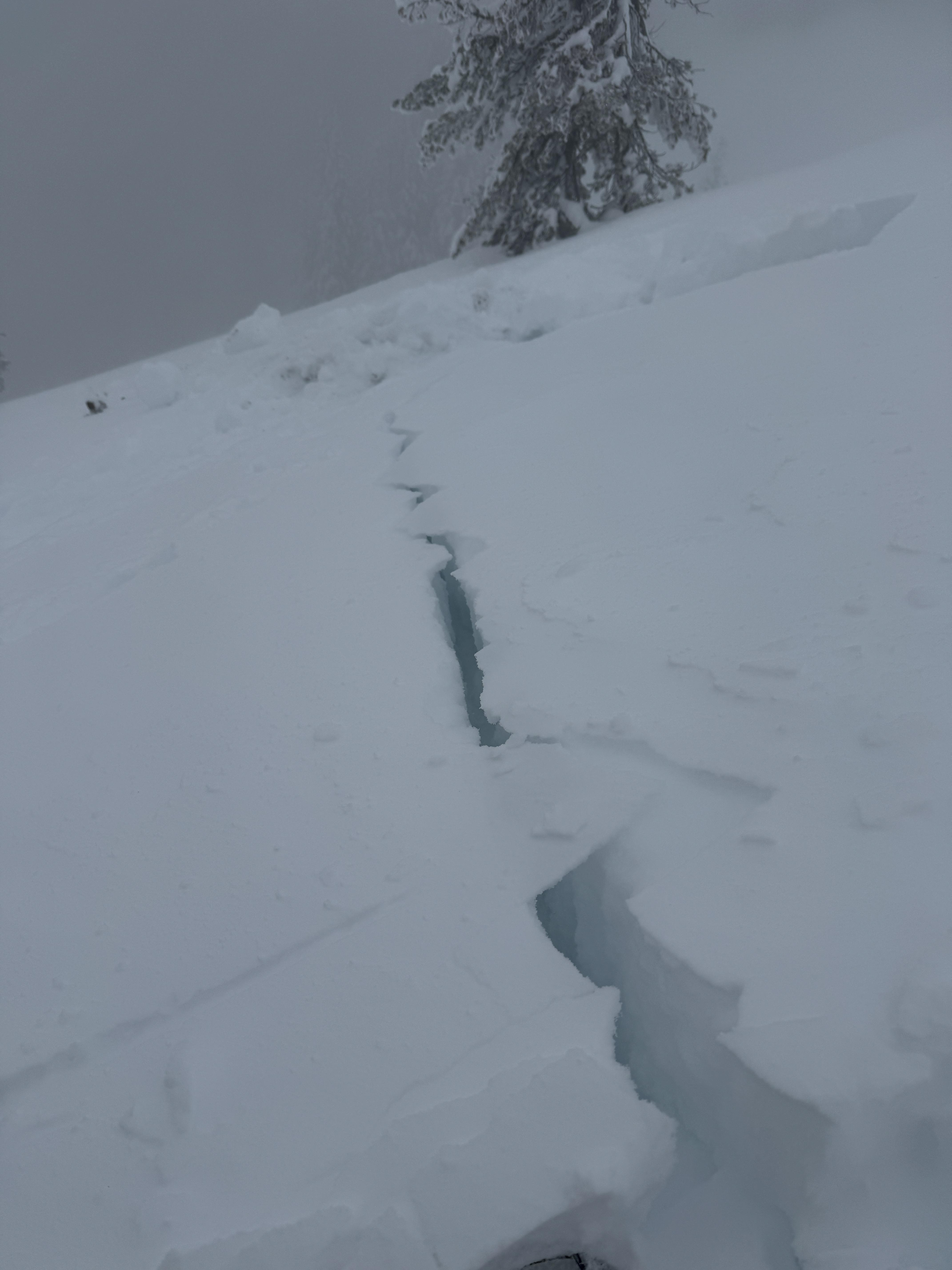
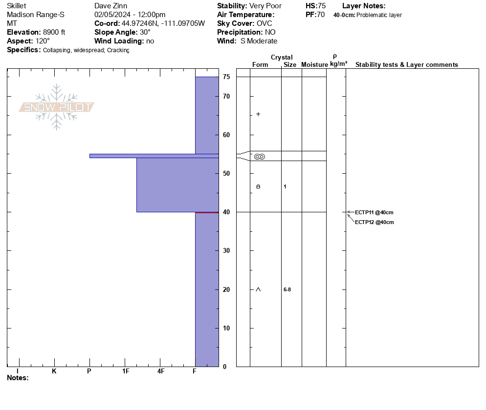
The stability at Bacon Rind was very poor, avalanches were likely, and we avoided (and strongly recommend avoiding) avalanche terrain. We triggered booming collapses and watched cracks shoot out across terrain features and snow shake off nearby trees for the entirety of our tour from the meadow near the car to the top of the Skillet. We avoided steeper meadows and gave the "Skillet" (the primary avalanche path where we were) a wide berth because we felt triggering a slide was so likely.
There was 8" of new snow. The upper half of the snowpack was a slab, and the lower half was airy depth hoar stressed to the point of failure. Snowpit results were ECTP11 and 12 failing 35cm down from the surface. As we have noted previously, do not trifle with this season's snowpack. It is exceptionally weak and will be slow to stabilize based on all evidence thus far this season.
Full Snow Observation ReportThe avalanche warning was well justified. The danger was HIGH at all elevations.
Also, Doug got us lost as we skied out, and we were simply trying to follow our skin track back to the car. We ended up traversing north from mid-elevation, crossed the skillet run out, and popped out by Gallatin River a ways from the car. In his defense, Dave could have said something but assumed that he was wrong based on Doug's expertise and happily followed along for the traverse-a-bout. Expert-Halo bias verified. Who let these guys out of the office!
DC: First "girdle traverse" of Bacon Rind!

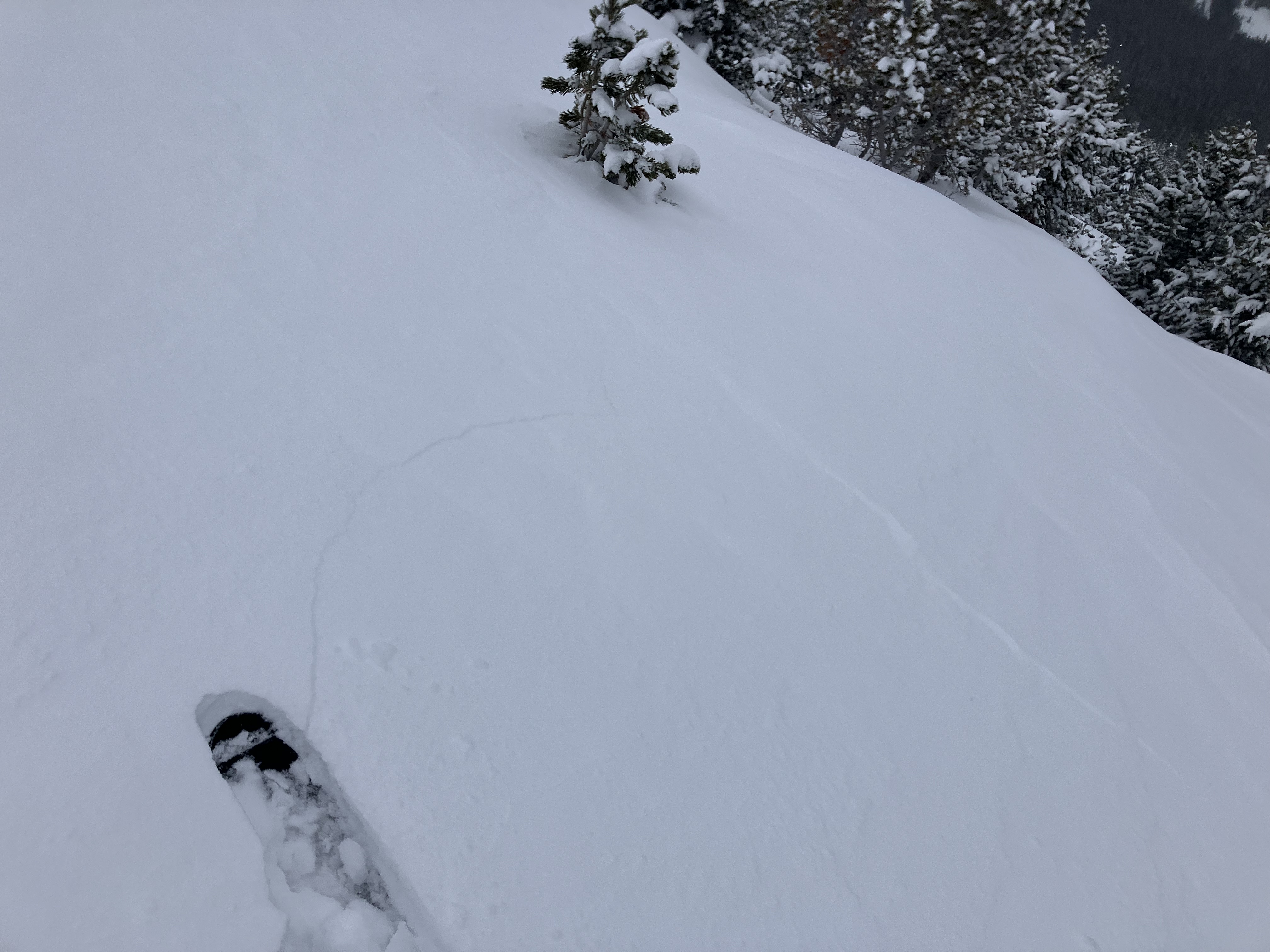
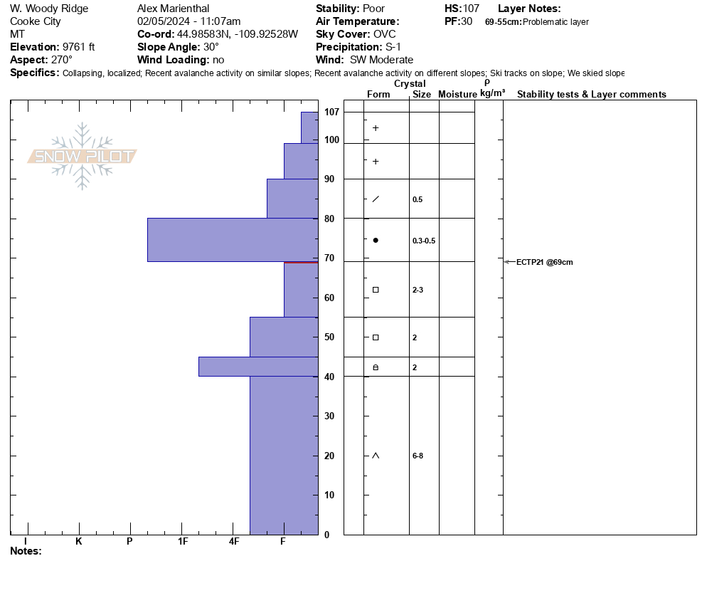
We skied south of Cooke City and dug a snowpit at 9,761' on a west facing slope. We had an ECTP21, 40 cm below the surface (16" down). There was 6-8" of new snow from the weekend above 4" of soft old snow, on top of 4" of a pencil- hard slab, then the soft sugary facets to the ground. ECT broke below the hard slab at the top of the facets (photo). I had one collapse, 10-12' wide near treeline where there was little more wind-loading/effect (photo).
The unstable test score, very poor snowpack structure, and collapse indicate a person could easily trigger a large avalanche on steep slopes.
Snowed lightly on and off all day with a couple cm accumulation. Wind was light-moderate out of the southwest with mostly overcast skies.
Full Snow Observation Report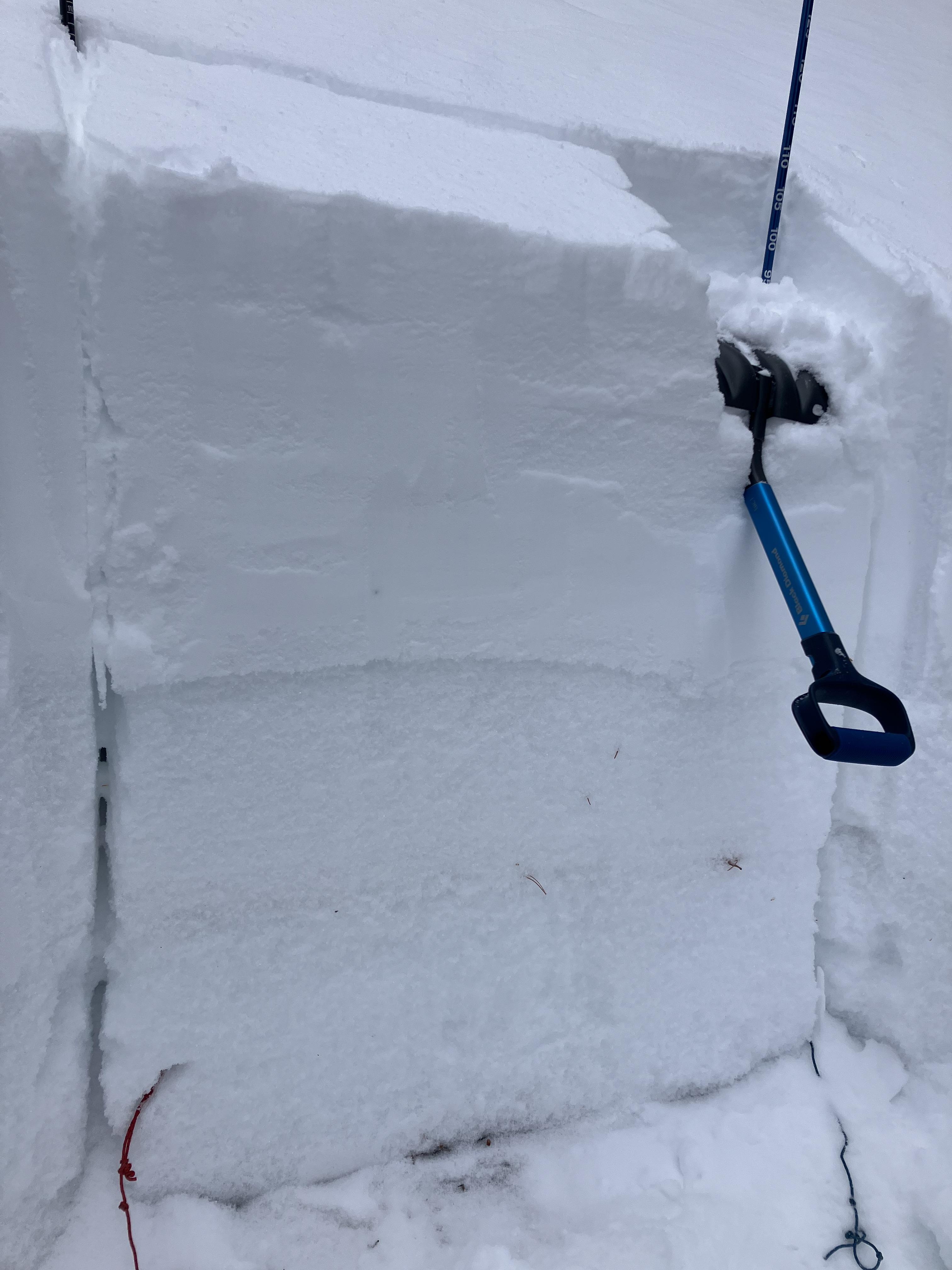
