Snow Observations List
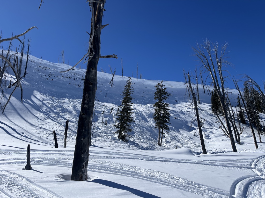
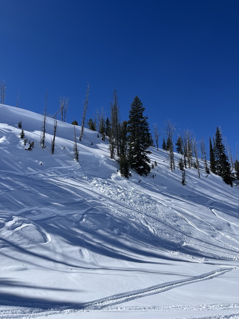
Ridge line just west of divide peak in Hyalite canyon
Full Snow Observation Report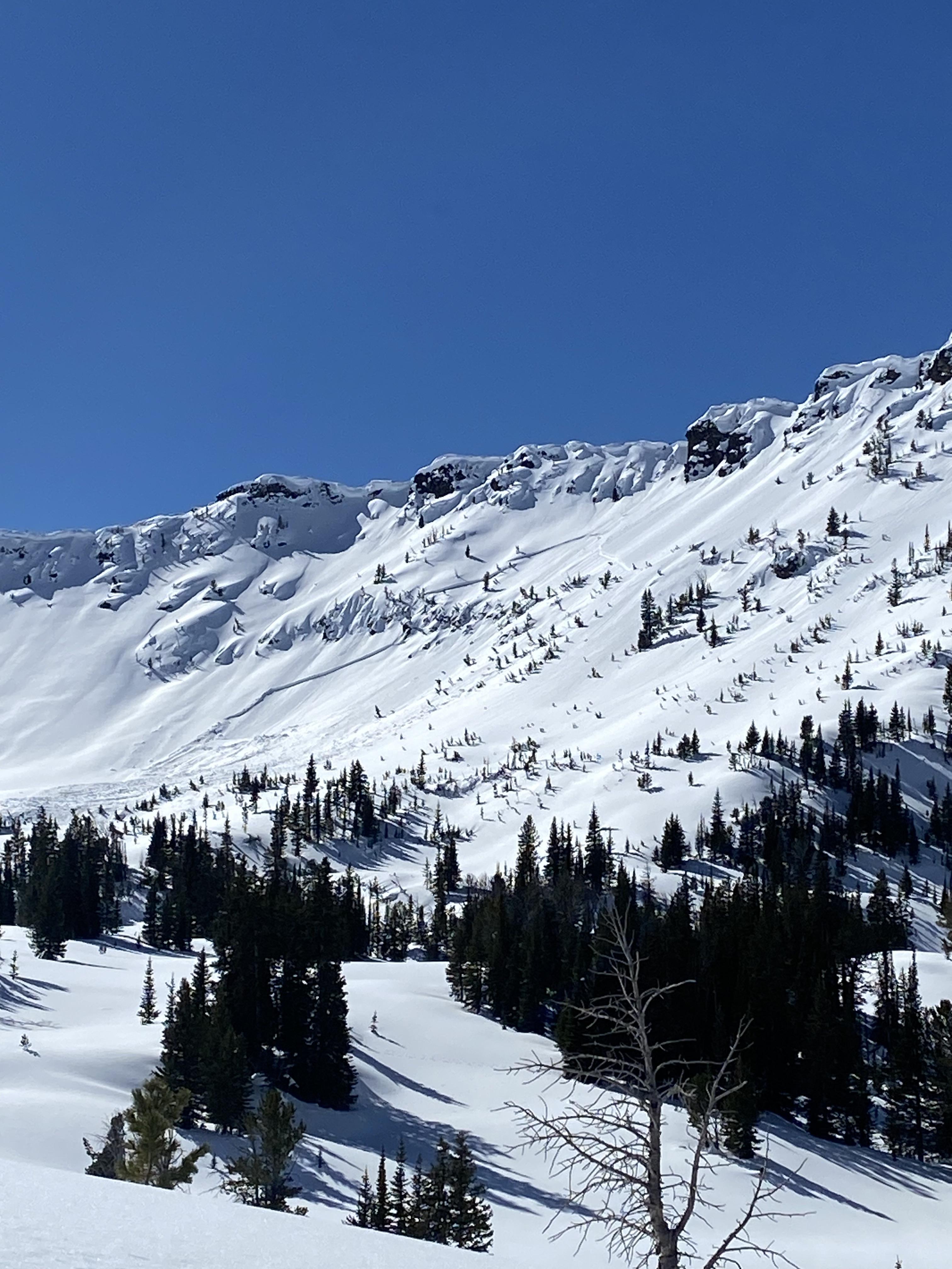
Saw a fairly fresh avalanche up Hyalite from the top of the Fat and Skinny Maids, I think that would put the avalanche in the Storm Castle Creek basin. North facing shady aspects were still cool and chalky, solar aspects were getting quite warm.
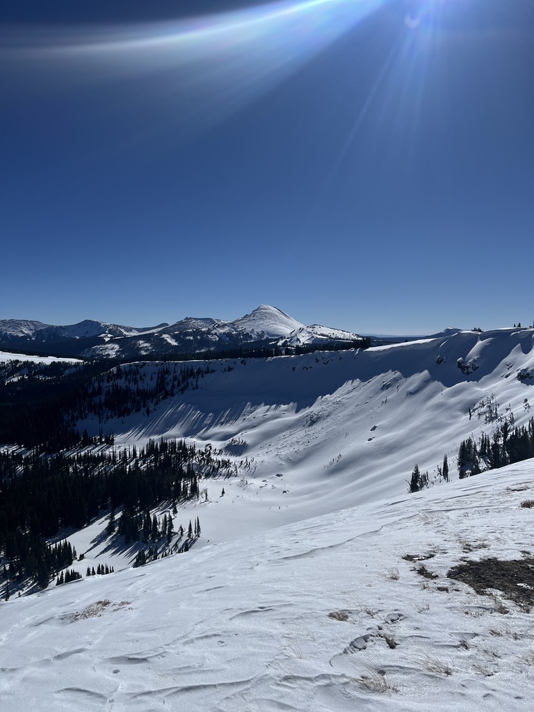
Full Snow Observation Report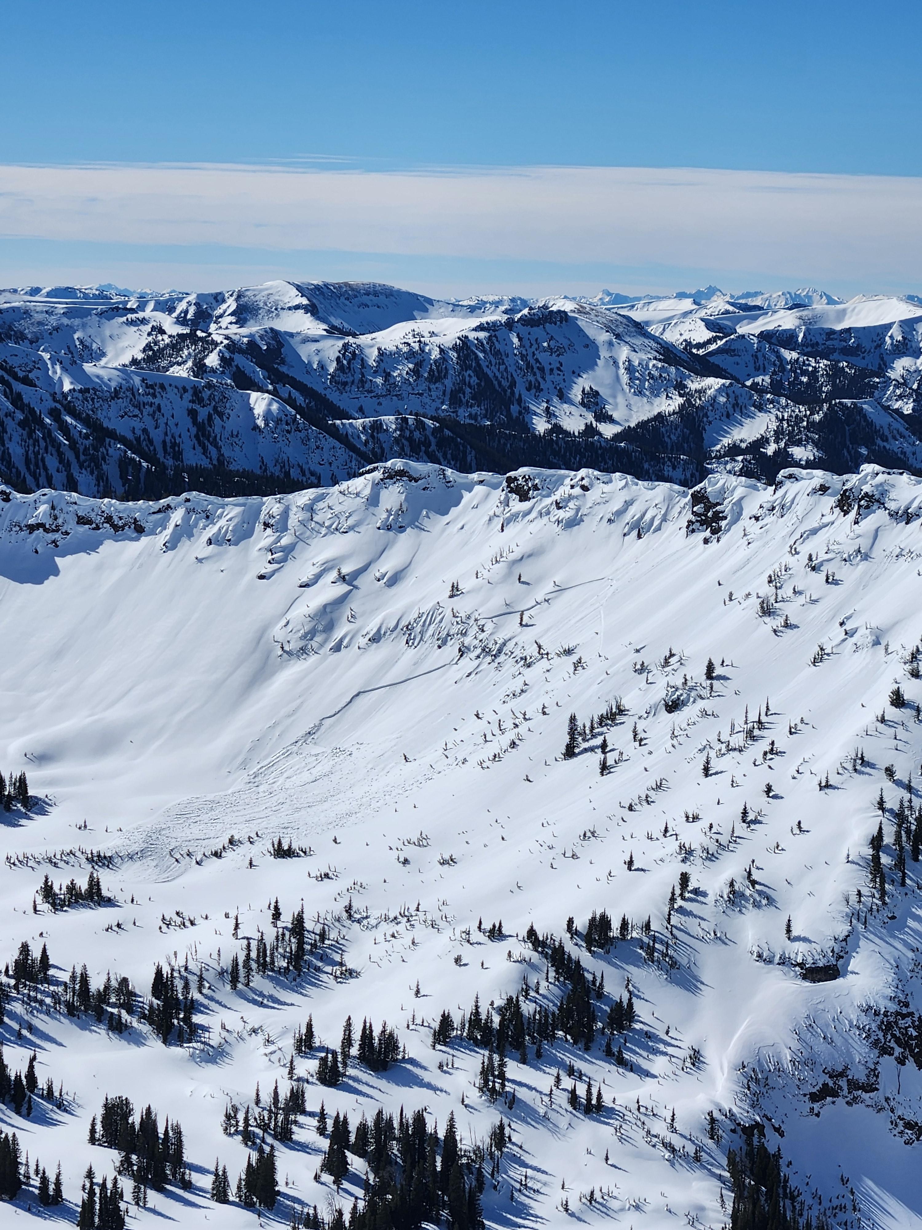
Got an early-ish start to beat the heat and was on top of Elephant Mountain by 9am this morning. Skied the southeast bowl for our first lap, which was supportable and mostly good corn skiing. It was unclear when solar aspects were going to fall apart, but I wouldn't have wanted to be skiing that bowl much later than we had. Very light wind, few clouds, and strong sun made for pretty rapid warming. The north aspect held cold snow down to 7500 ft or so, though it is quite shaded. Shout out to the party behind us up top for allowing me to engage them in meaningful communication about not skiing on top of us. That dialogue was appreciated. Lots of ski tracks in high places, pretty fun to see.
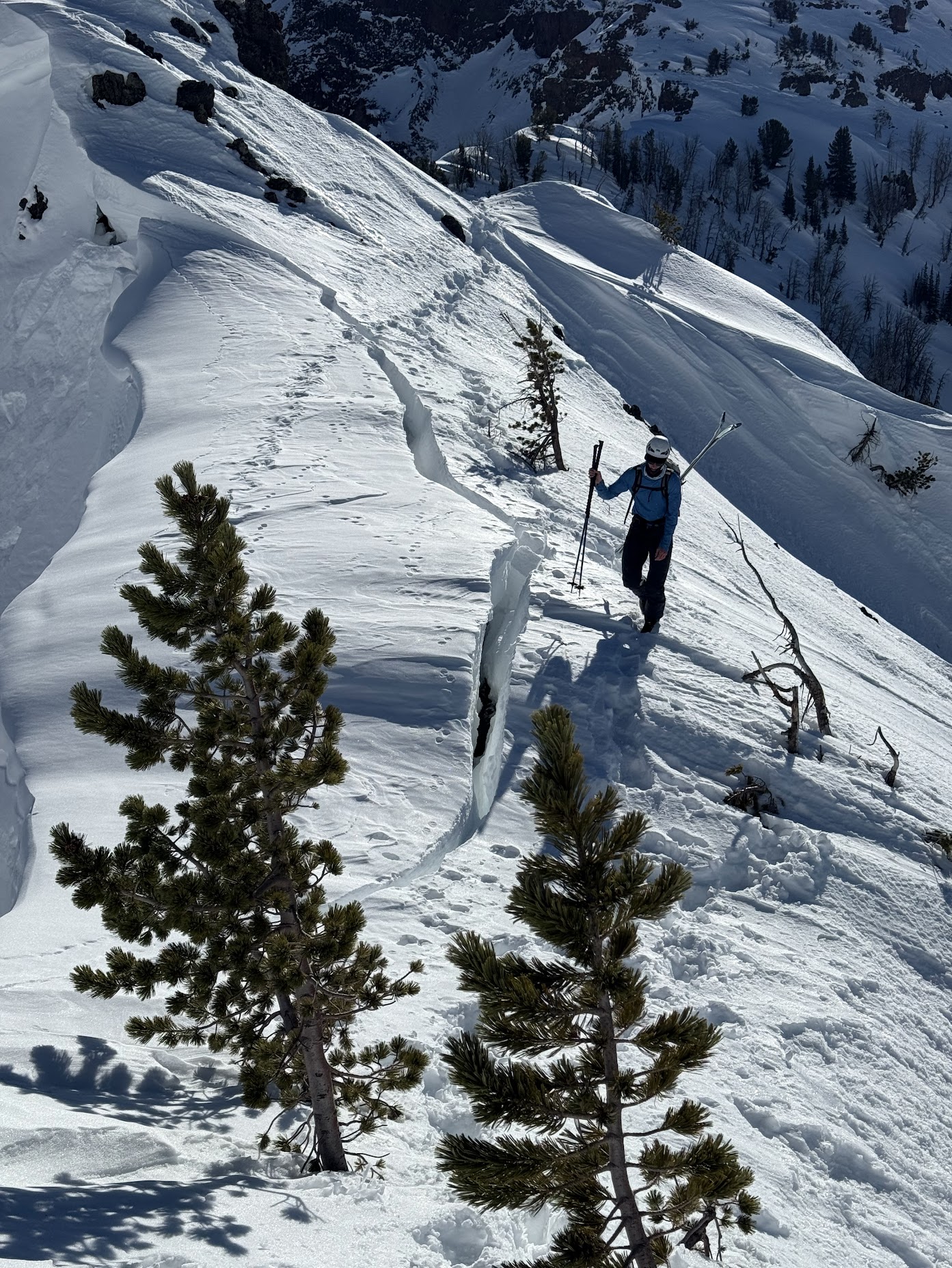
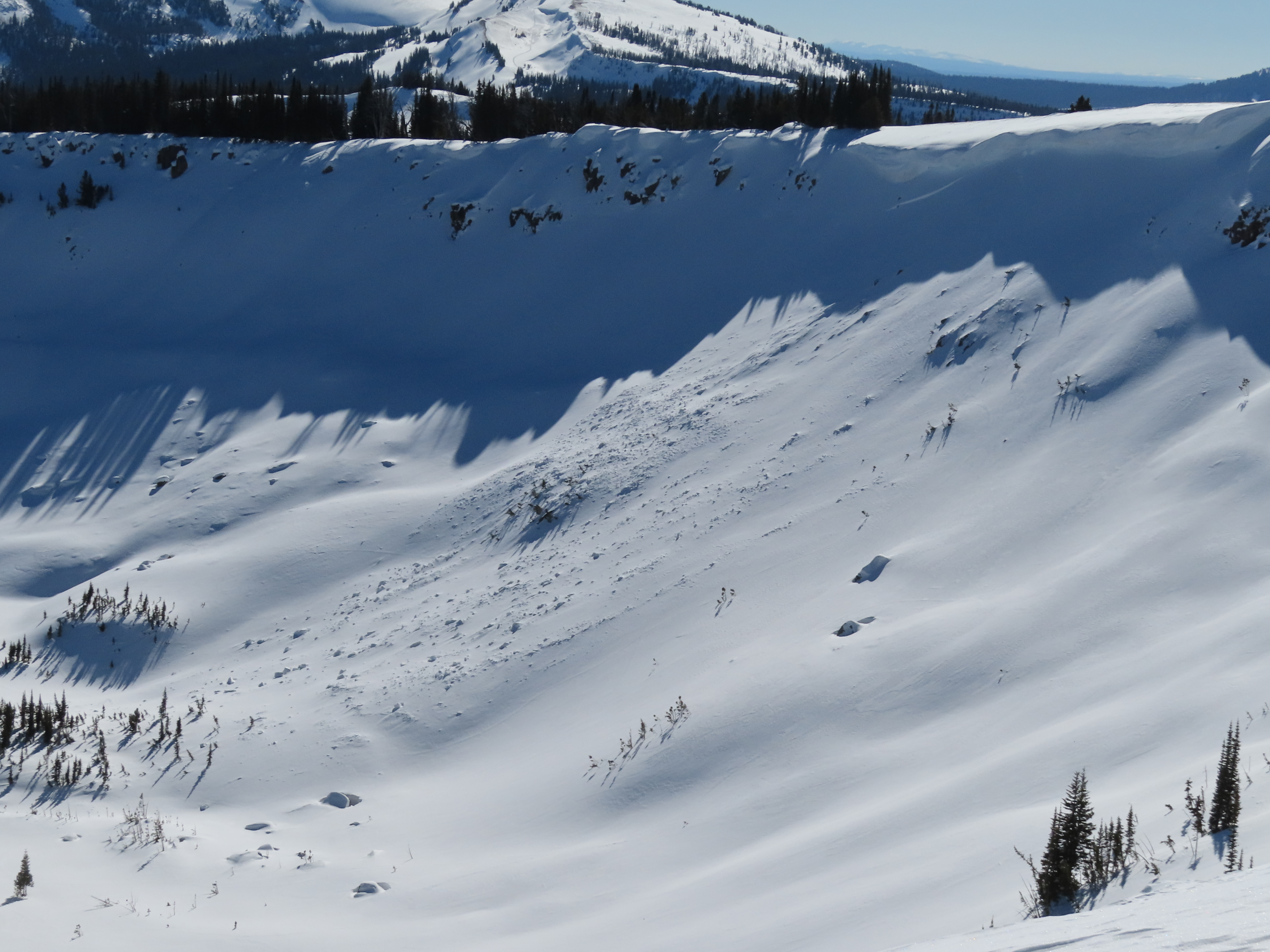
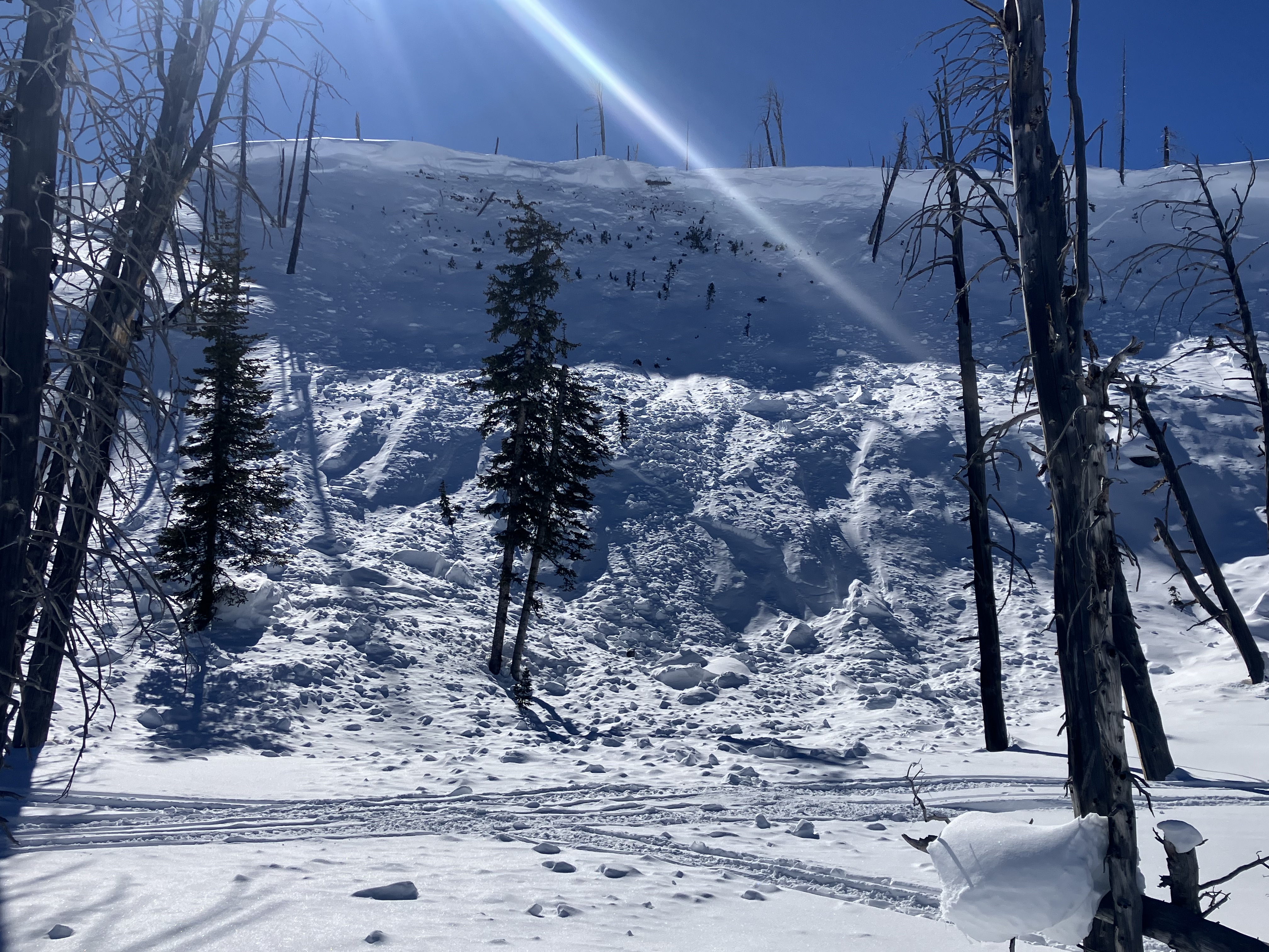
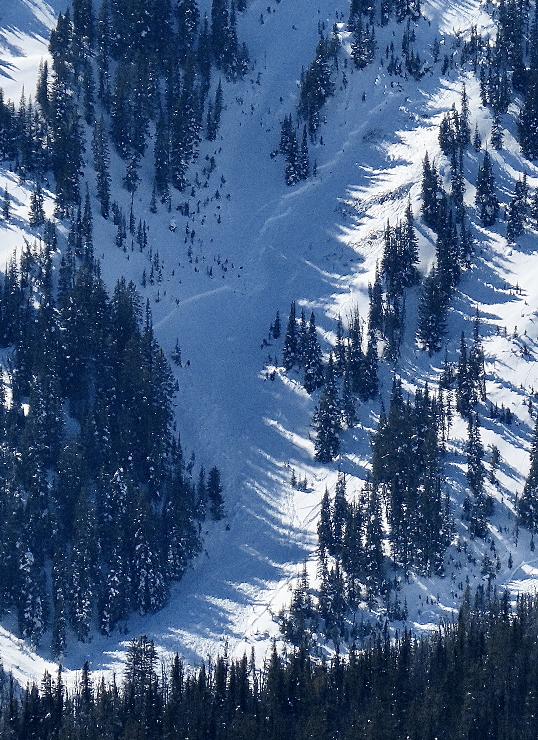
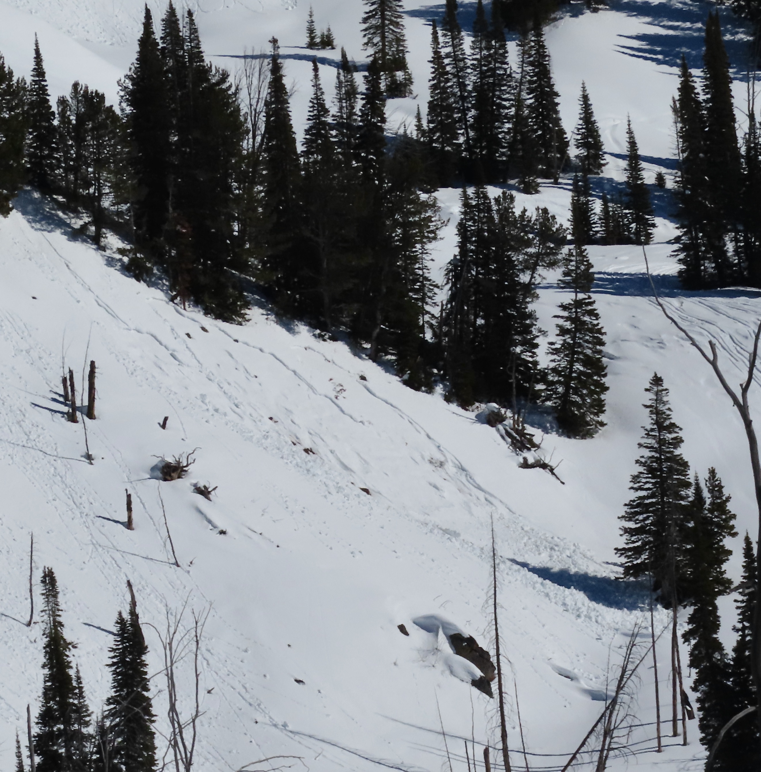
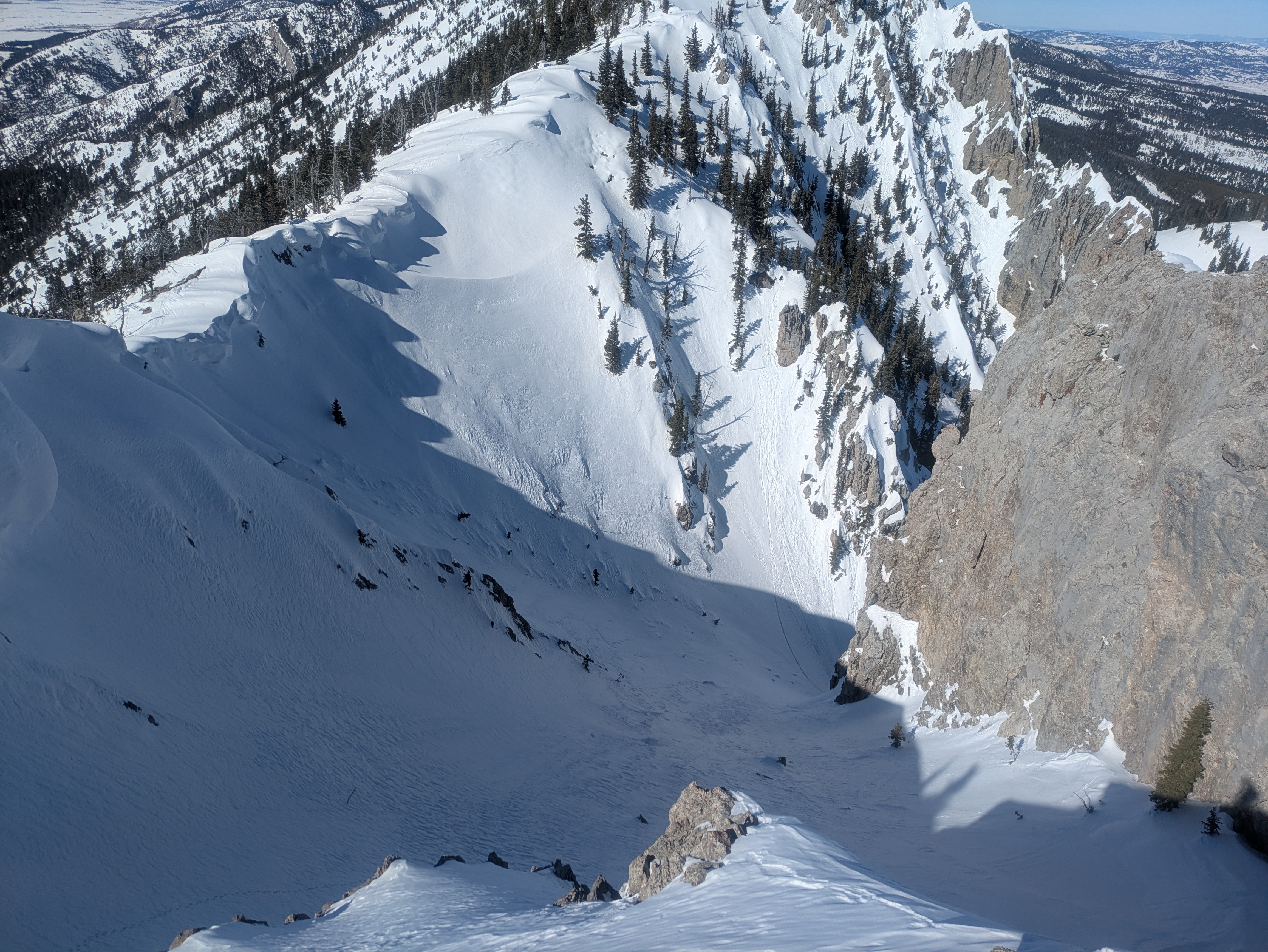
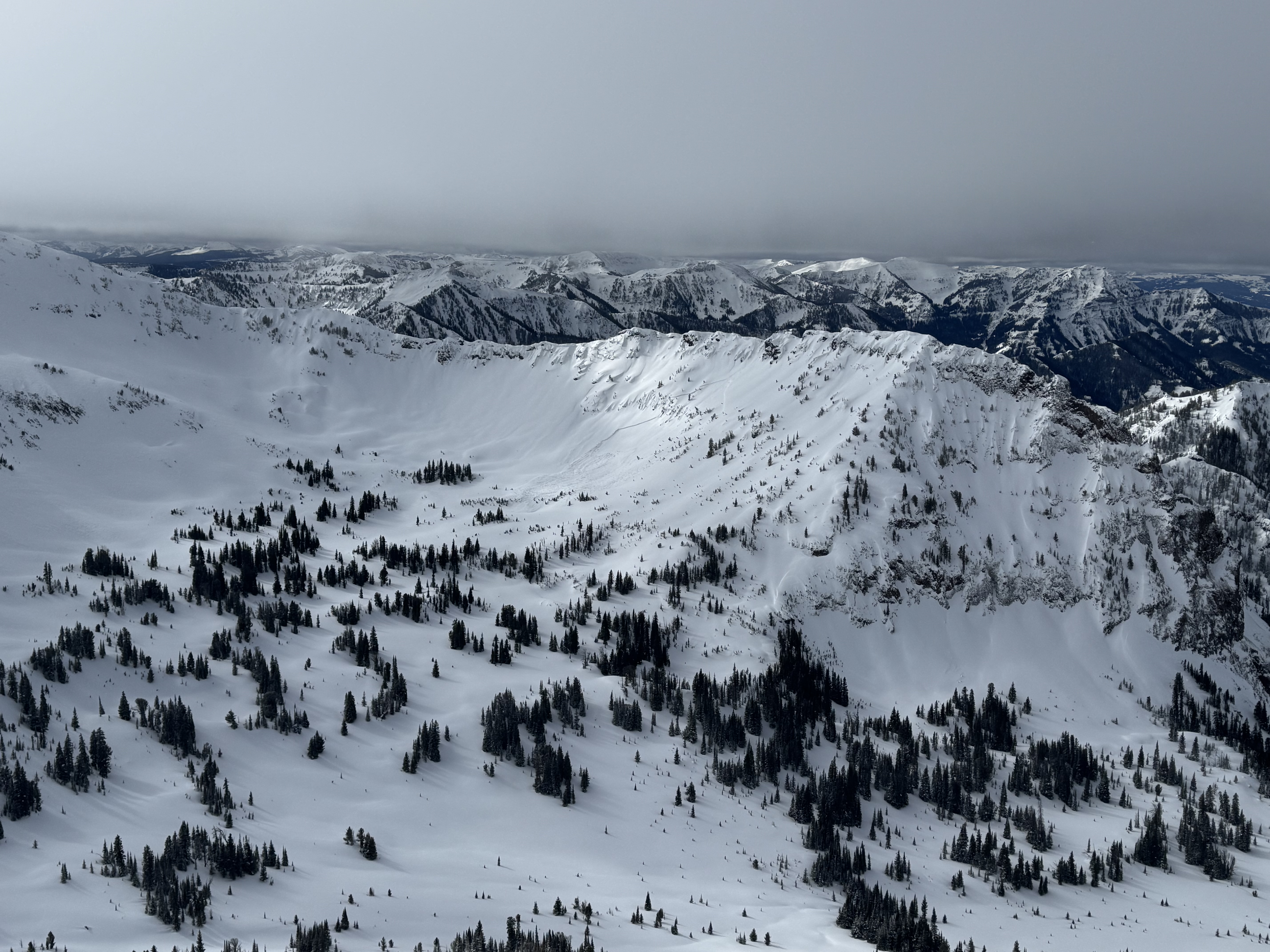
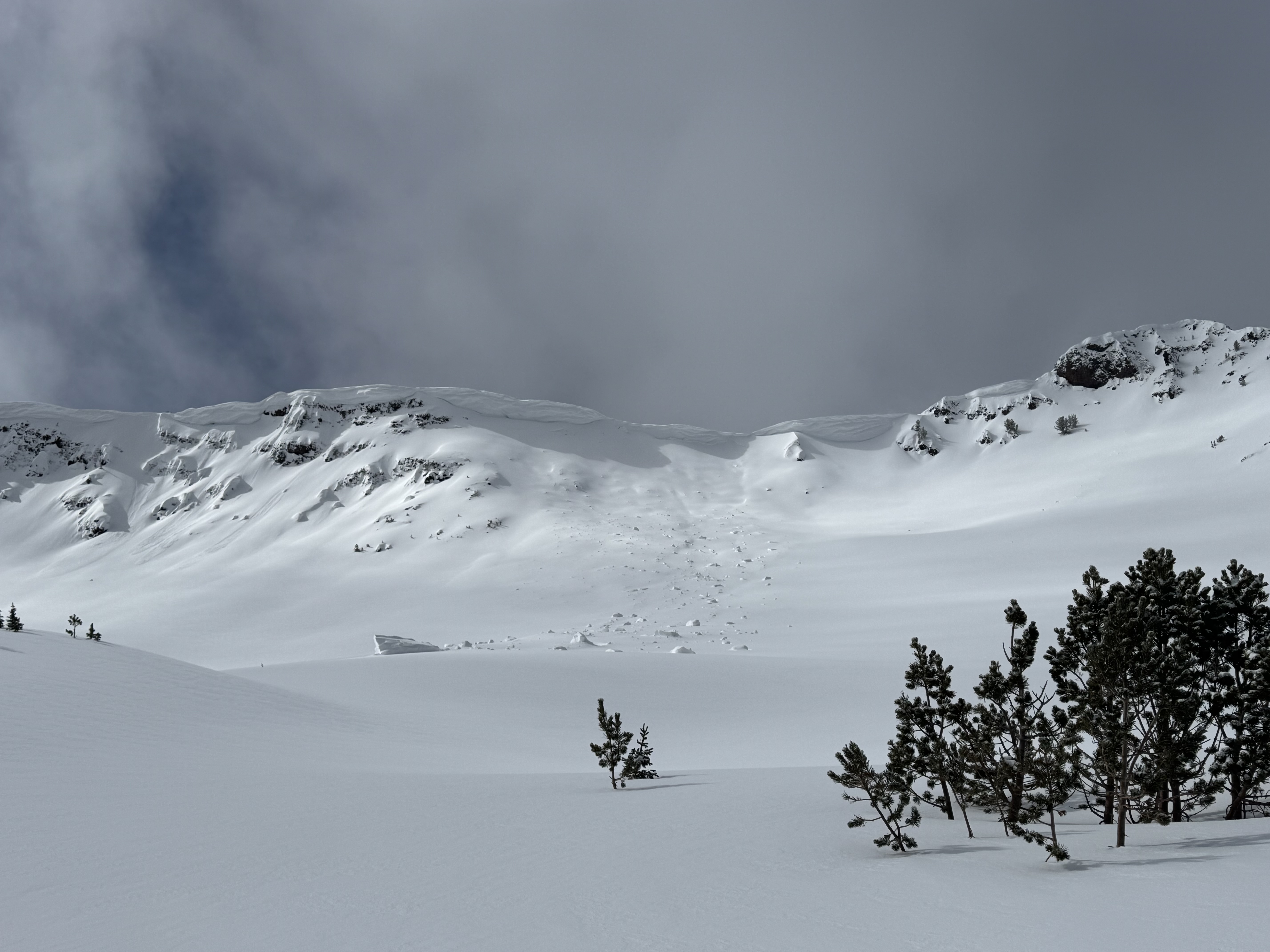
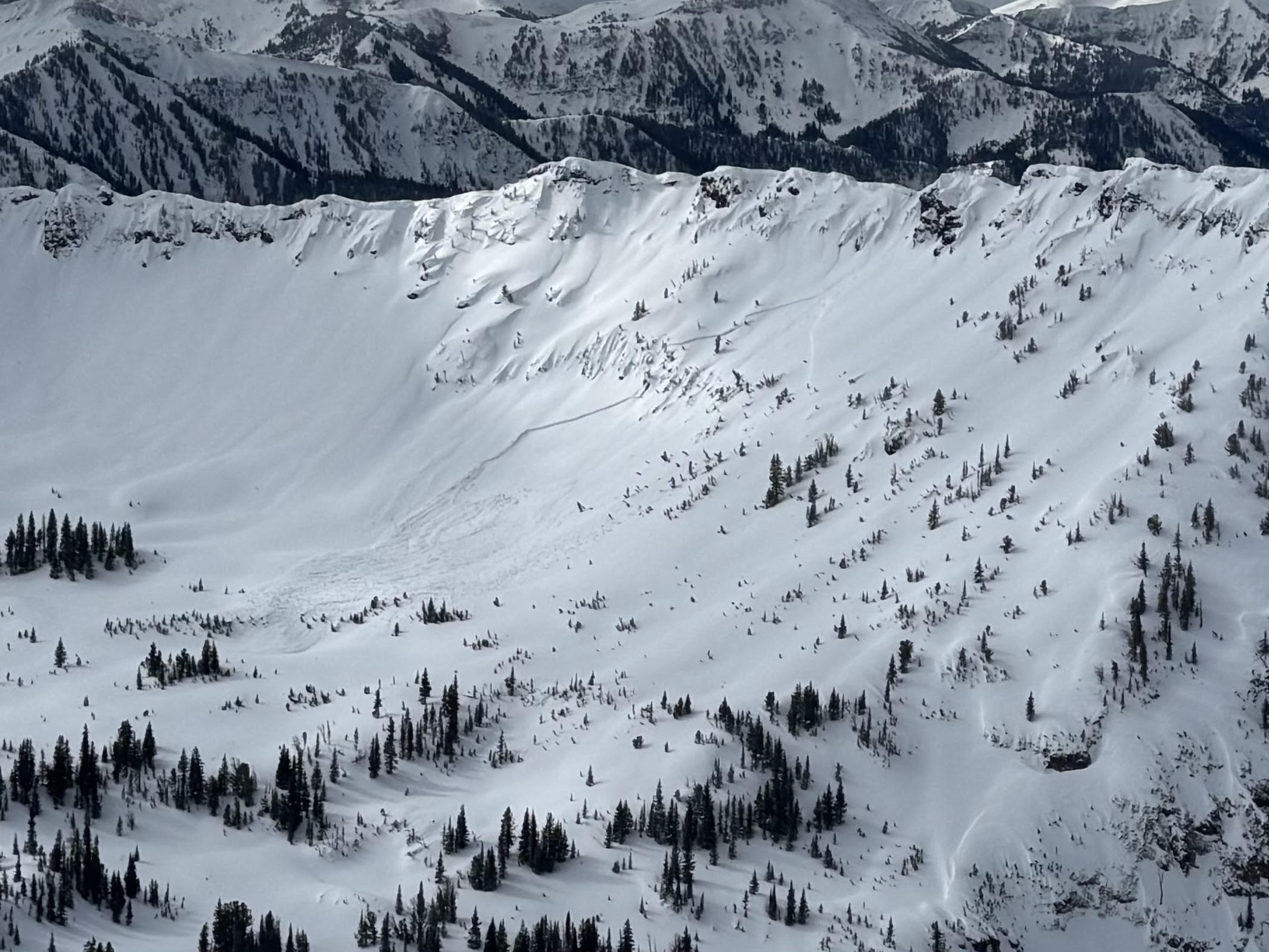
Full Snow Observation ReportPictures of two cornice triggered avalanches way up the South Cottonwood drainage that was viewed from Alex Lowe. Looks to be in the recent days, around 9,000 feet North facing.
Also a massive cornice that had cracked and was slowly making its way towards falling down. Cornice was around 50 feet long, and largely overhanging. On the standard ascent of the East Ridge of Alex Lowe, the skin track usually travels below this cornice while ascending to the ridge.
Full Snow Observation Report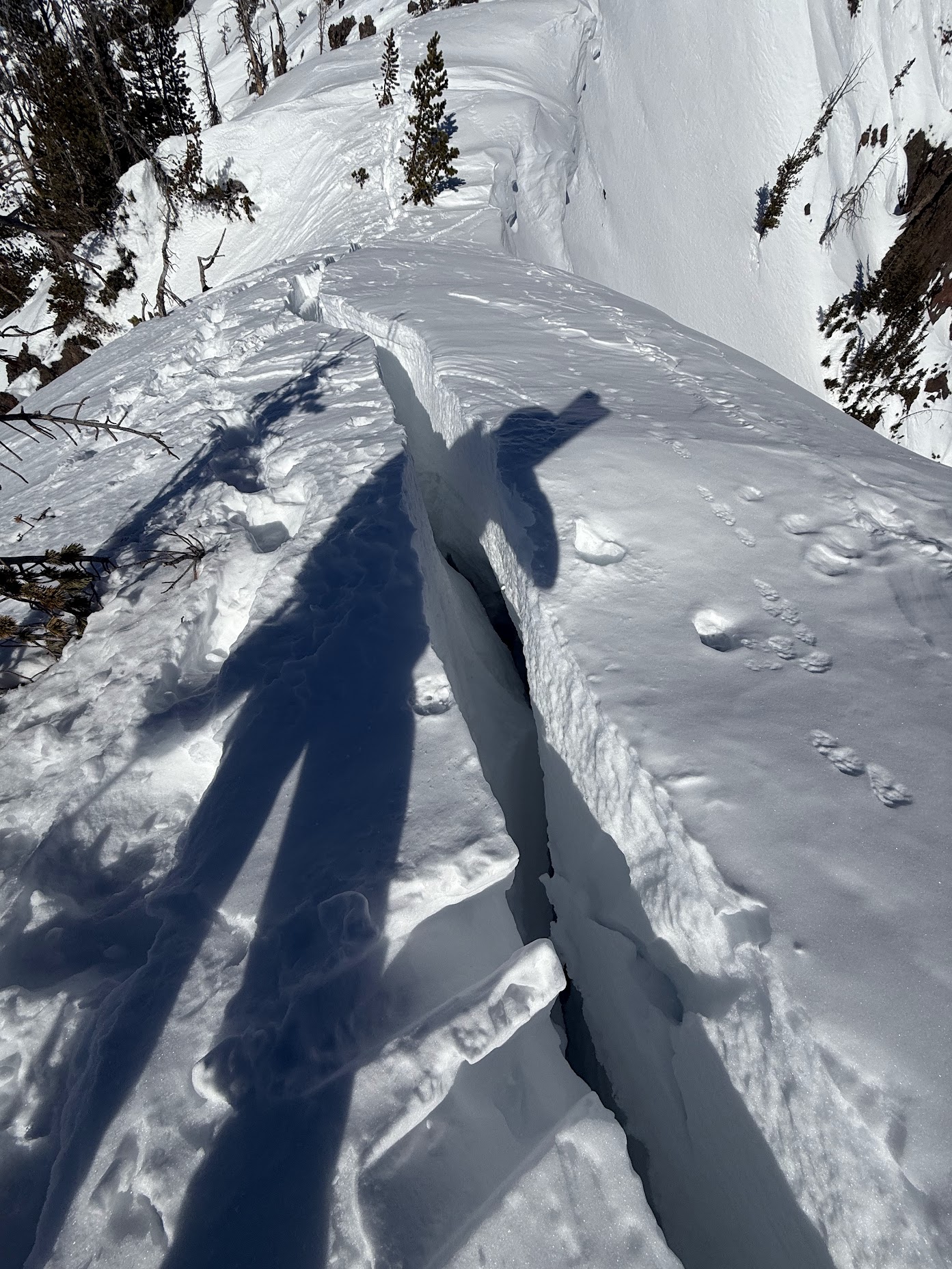
Natural point release avalanche observed from the YC. Occurred out of bounds on the South side of Pioneer Mountain.
Full Snow Observation Report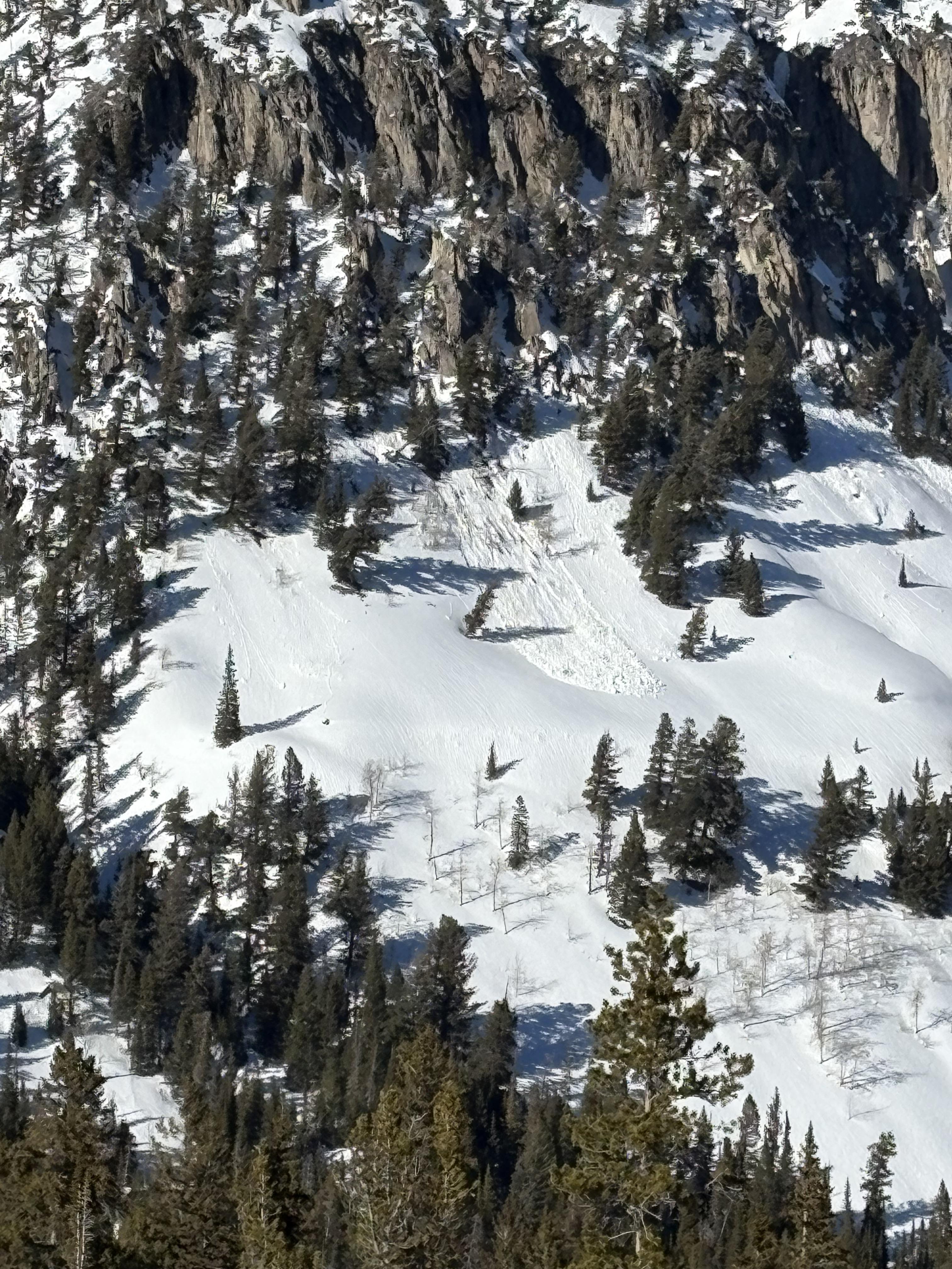
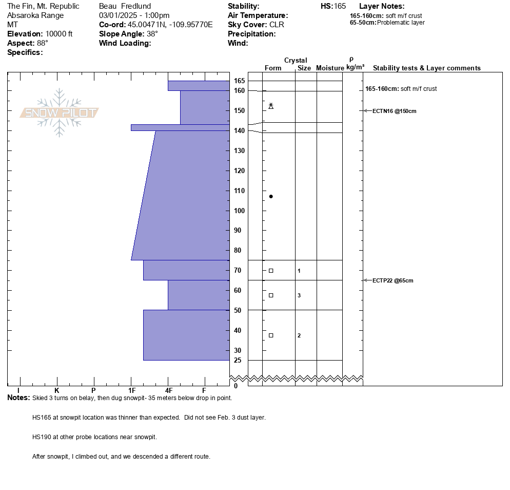
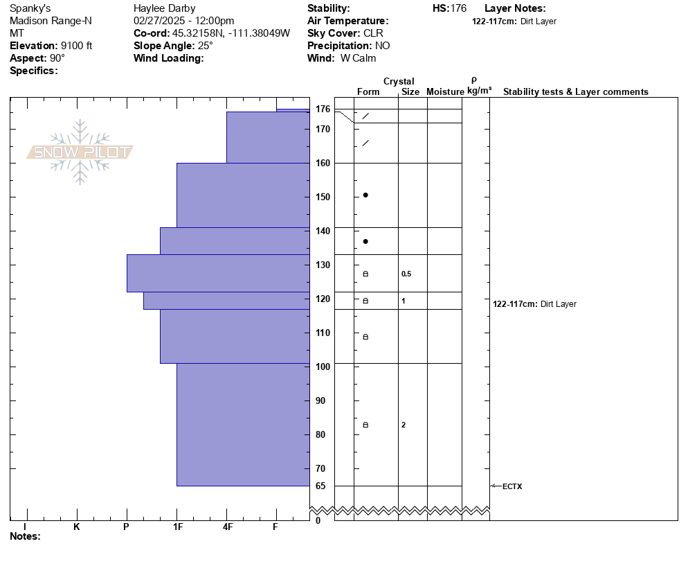
Snowpit attached from Mt. Republic today. East aspect, 10,000'.
HS 165, ECTP22 at 65.
No collapsing, no cracking, no avalanche activity to report.
40 deg F at Fisher Creek SNOTEL today (9100').
Full Snow Observation Report
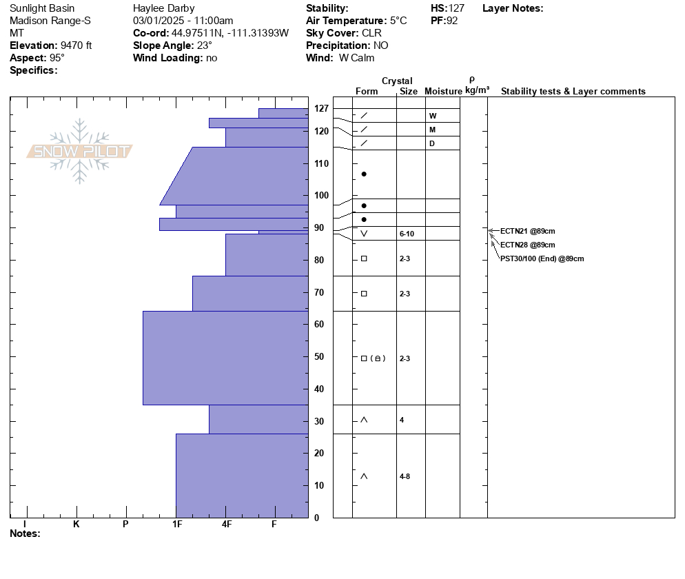
Another day of warm temps and clear skies allowed us to cover a lot of ground in the Southern Madisons. We rode into the Taylor Fork, up to the weather station, to the top of Carrot Basin, through Sage Basin, up and over into Cabin Creek, and all the way up to the head of Red Canyon.
We spotted a few old avalanches. One in Cabin Creek that was triggered two days ago by snowmobilers on a N facing aspect. At the top of Carrot Basin, we saw a small avalanche (R1-D1) on a N aspect that likely broke yesterday on buried weak layers. We also spotted one cornice-fall triggered (R2-D2) avalanche that broke earlier this week in Sage Basin and then an older wind slab in Sunlight Basin.
We dug a snowpit in Sunight Basin right next to where Alex and I dug last week. At that site on 2/21, we triggered whumpfing, shooting cracks and got propagation in our snowpit. Today we did not experience any of those signs of instability. Our snowpit showed poor structure with buried surface hoar and facets but yielded ECTN's on that weak layer.
There were a handful of small wet-loose avalanches on solar aspects that we noted throughout the day. While northerly aspects stayed cold, solar aspects became wet a couple inches down.
Despite no remarkable new avalanche activity and the stubborn reactivity in our snowpit, we remain wary of mid-elevation slopes steeper than 30 degrees. Over the last 12 days, we have received reports nearly every day of avalanches breaking on persistent weak layers buried 2-3' deep. Recent nearby avalanche activity in Teepee Basin and Lionhead is evidence that these weak layers should not be trusted quite yet.
The travel advice remains tricky, but you have a few options:
1. Before committing to steep slopes, dig down 2-3' and assess for layers of buried surface hoar and facets. Make observations as you step off your snowmobile or skis or board - are you staying on the surface or sinking all the way to the ground?
2. If you are choosing to ride steeper slopes, pick ones with less consequential terrain features like trees, cliffs or gullies.
3. The ol' reliable option: stick to riding slopes less than 30 degrees.
Full Snow Observation Report
Avalanche danger still felt MODERATE per the slew of recent PWL avalanches in this area


Kicked off a wind slab avalanche 25ft wide on the west ridge of beehive basin. The wind slab was around 8-10ft deep and the debris slid almost to the flat a few hundred feet down the slope. The slide occurred around 9100ft on the east aspect. Neither me nor my partner were carried or caught in the slide.
The windslab that broke off was about 8-10 feet tall. It was mostly a huge section of a cornice that broke and the slope it fell down onto seemed to propagate a few inches down as well. The majority of the debris was from the cornice.
Full Snow Observation ReportObserved multiple wet loose slides naturally triggering and running on south facing slopes beyond bradleys and on the south facing aspects of hourglass chute.
Full Snow Observation Report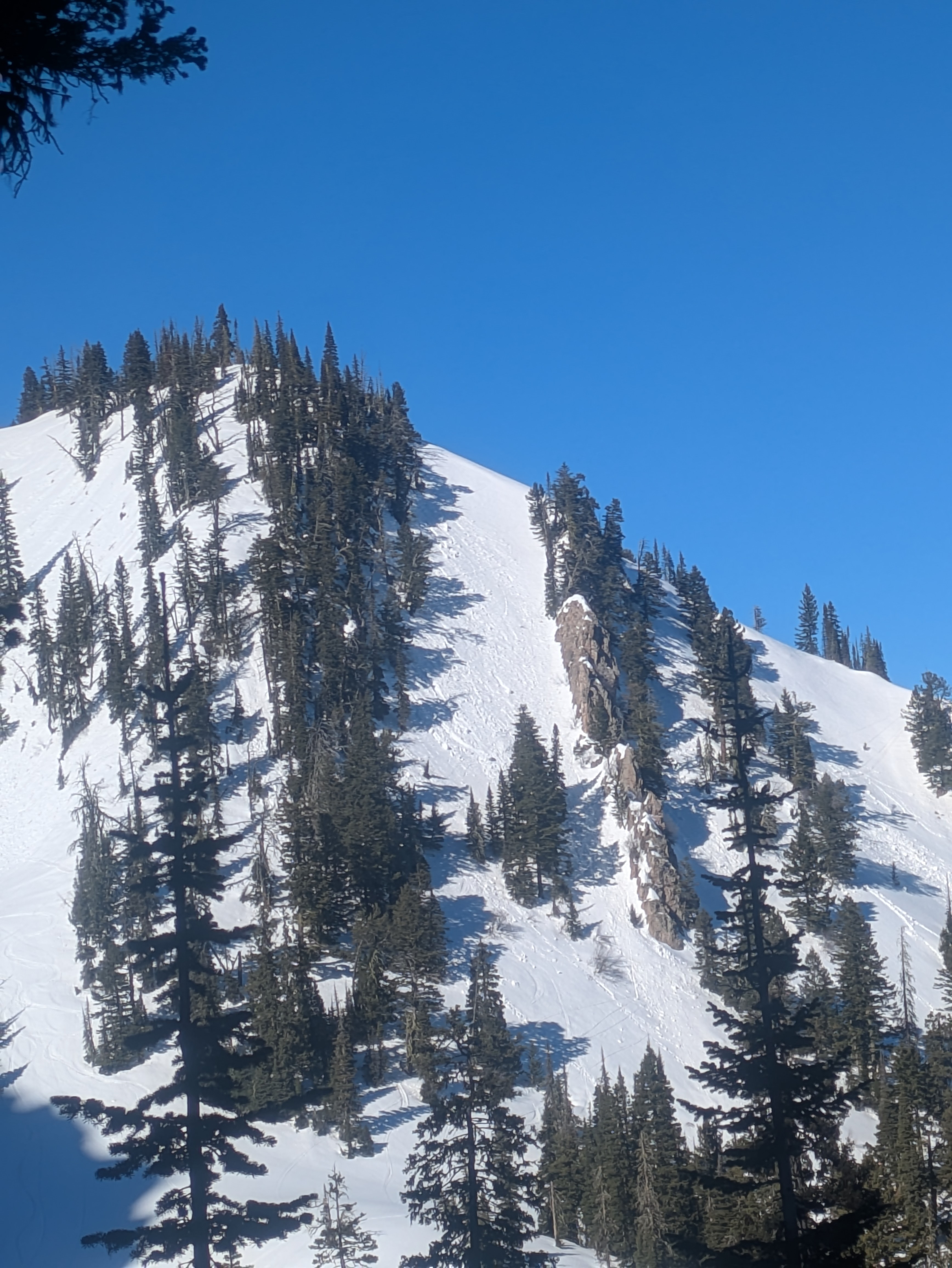
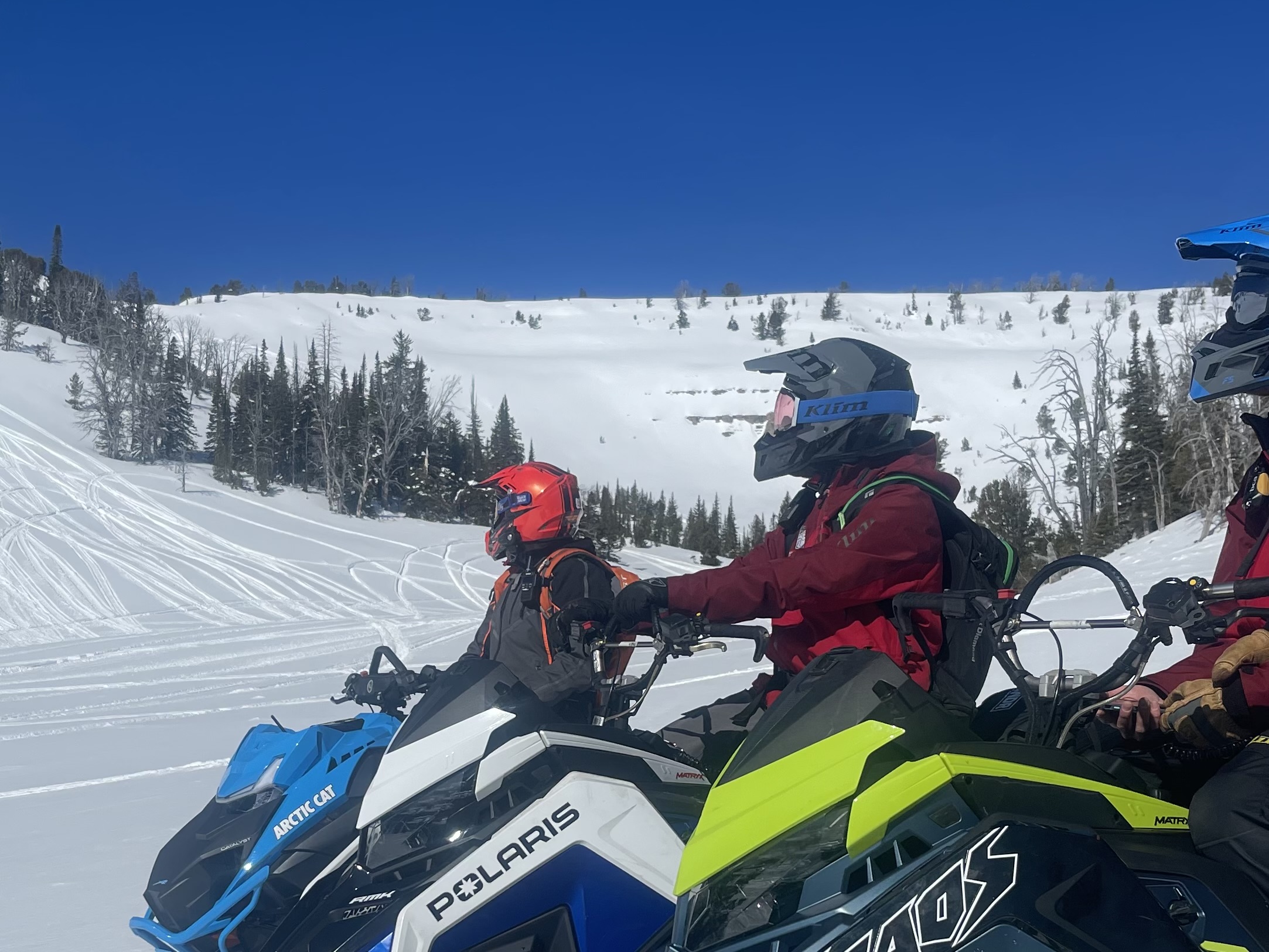
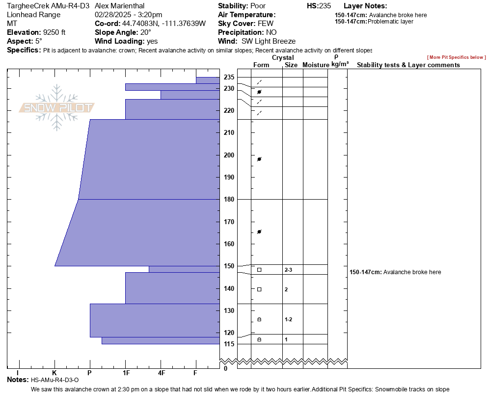
We rode throughout most of the Lionhead area looking for and assessing a weak layer from late January. This layer produced avalanches last week that we saw. It also buried a rider last Sunday in Teepee Creek. It caught a ride yesterday in Cabin Creek.
- In most of our snowpits, the layer was gaining hardness
- In most of our snowpits, the layer was either not breaking in stability tests or was very stubborn.
We were scratching our heads because the layer seemed active but we could find any evidence that it was still a major problem, UNTIL
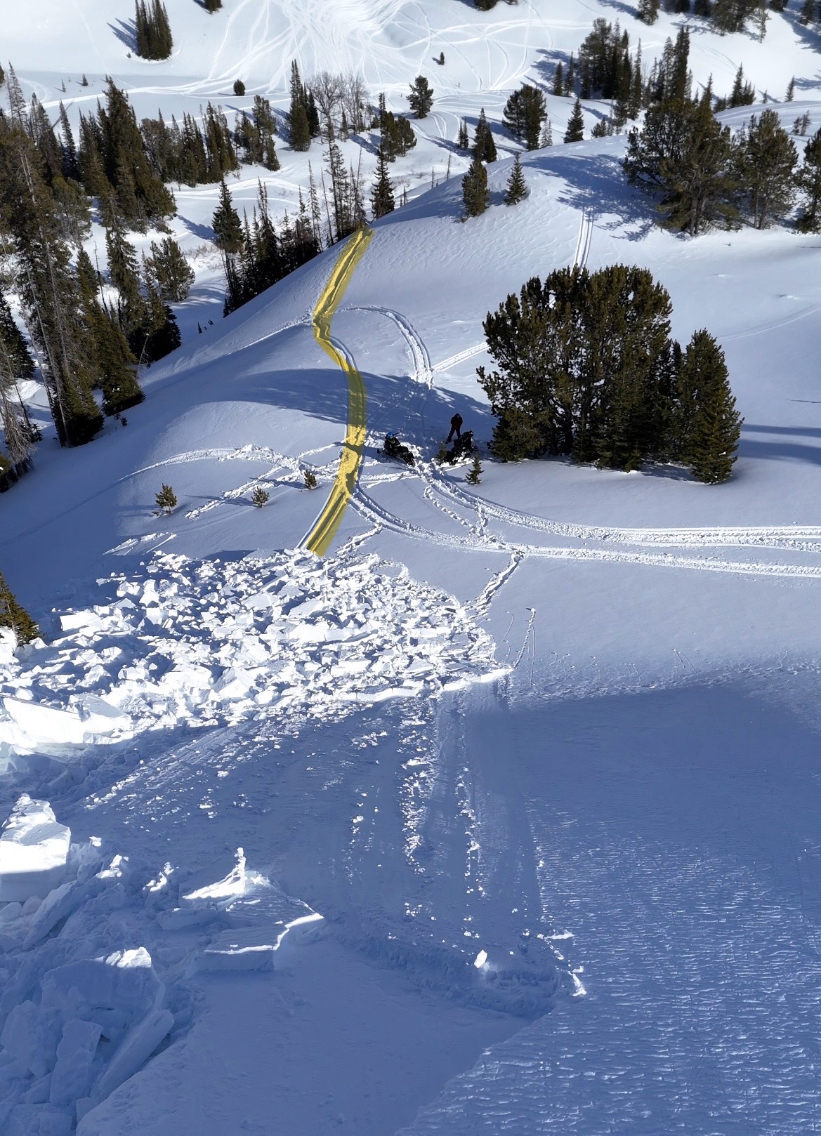
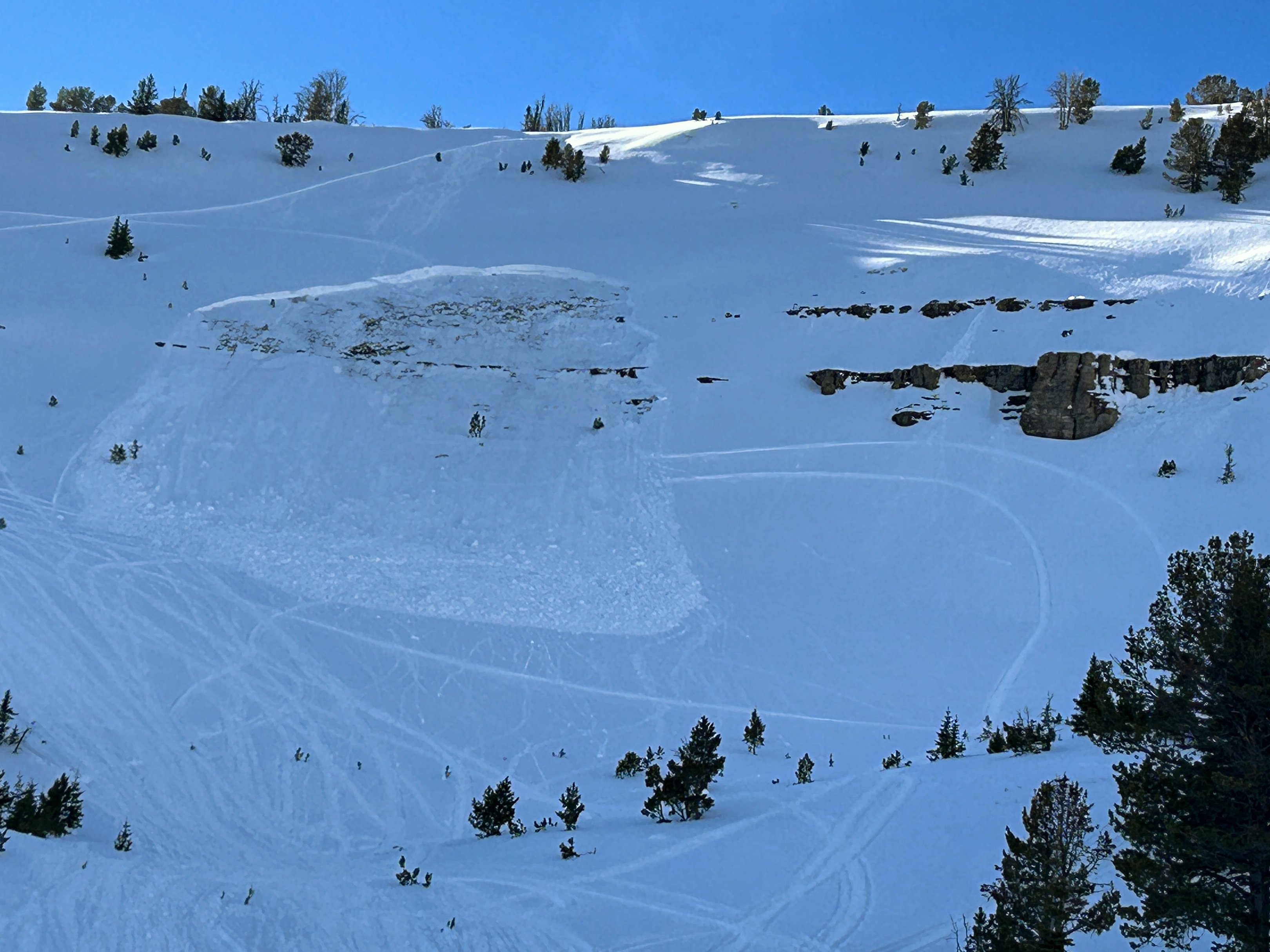
A rider triggered a huge avalanche in the uppermost reaches of Targhee creek. We discovered it on our way out. The best we could tell looking at their tracks was that they had no idea they triggered it, even though part of their tracks were swept away.
Also, on our way out we saw an avalanche in Airplane Bowl that had been triggered during the day today. This slide also broke on the persistent weak layers, 2-3' deep, 150' wide.
HERE'S THE DIMEMMA - On many slopes, the likelihood of triggering an avalanche on this weak layer is low. On some slopes, the likelihood of triggering one is high. Because the distribution of this problem is spotty, the damage is Moderate but that rating is deceiving.
HERE'S THE OTHER CHALLENGE - You won't see any obvious signs of unstable snow like cracking or collapsing. You probably won't see any red flags in a snow pit. There will be no warning until an avalanche happens.
TRAVEL ADVICE - We haven't been able to find a clear pattern for where these avalanches will happen and where they won't. It's a scary and tricky situation and these things are like booby traps. There are three options:
- Roll the dice and hope for the best, OR
- If getting onto steeper slopes, choose ones with a clean runout with no trees, rocks, or gullies and make sure your partners are watching you from a safe location, OR
- Ride only on slopes less than 30 degrees in steepness where most avalanches do not happen.
Wet snow - south facing slopes were getting very wet. We saw a few wet loose slides from yesterday near Targhee Peak. One south facing slope we crossed was wet for at least a foot or two into the snowpack.
Full Snow Observation Report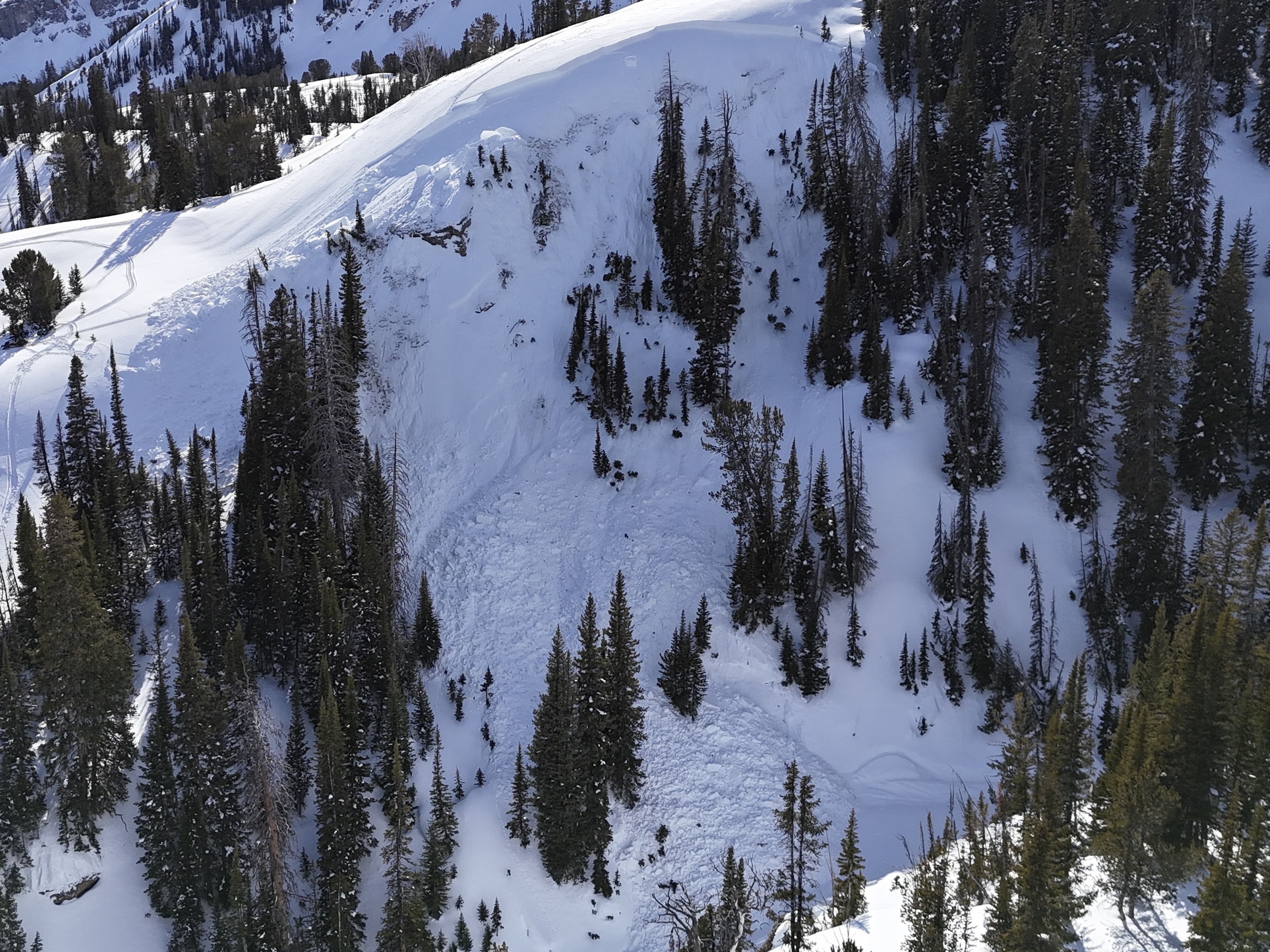

Just chiming in to report widespread wet loose activity on solar aspects between 6000 and 9500 feet in the Mill Creek area of the Absarokas - rollerballs started around 11am. Some big wet sluffs were releasing near cliff bands shortly thereafter. Felt like mid/late April.
Full Snow Observation ReportFrom IG message: "Getting word that a group triggered a decent slide today out at cabin creek. I’ll attach the coordinates to the general area, to the best of my knowledge.
44.86484, -111.22023
No burials. They were able to outride if. But thought I’d send coordinates in case you guys were gonna be in the area and wanted to check it out."
Full Snow Observation Report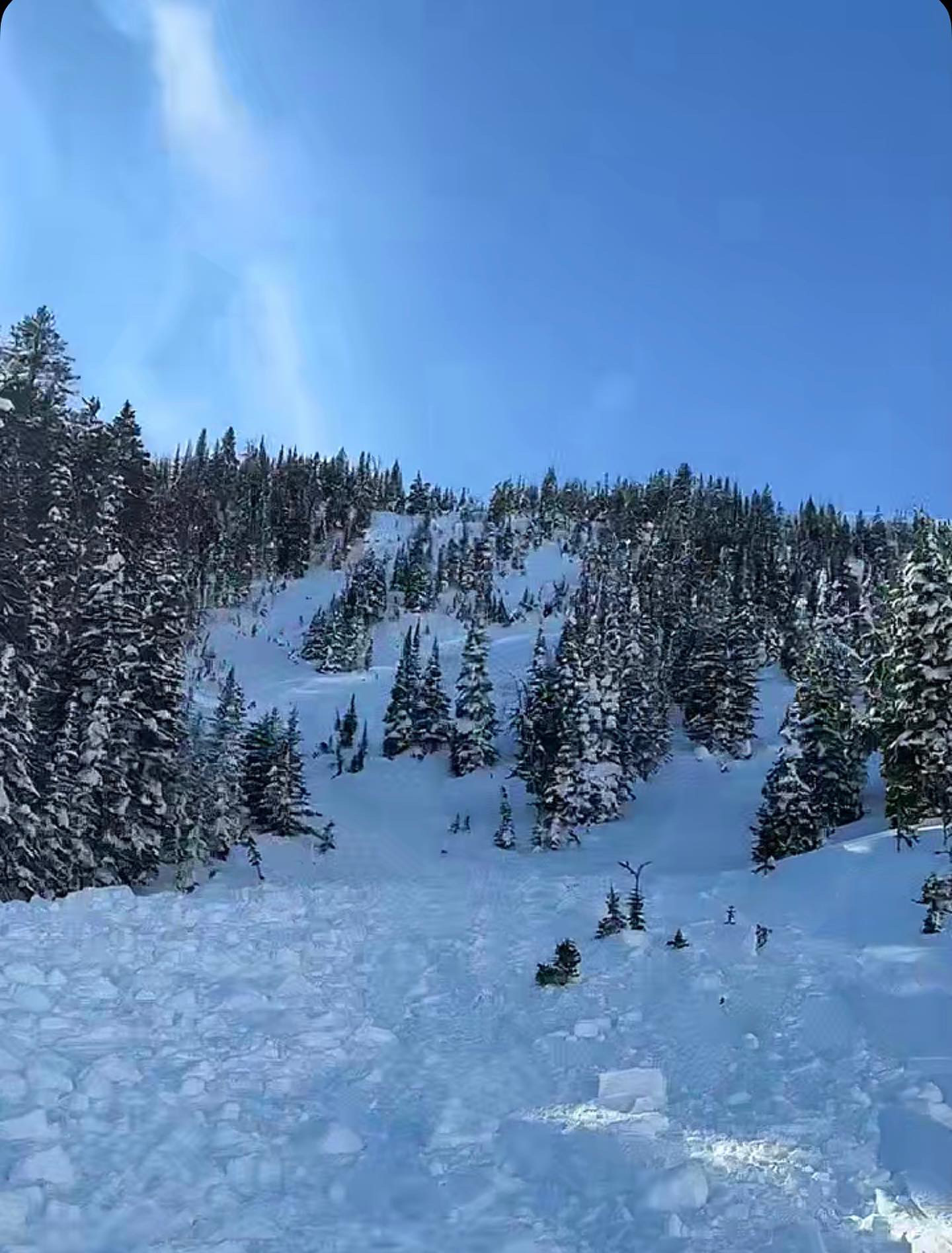

Snowpit attached from an east aspect at 9400', south of Cooke City today.
HS 250 cms, with the Feb. 3rd dust layer about 100cms from the surface. EXTX.
Below the dust layer there were 1mm rounding facets, that were 1F hard.
No avalanche activity observed, with LOTS of looking around. No collapsing, no cracking.
Temps around 40F in the valley, but minimal wet loose activity observed so far. The warmup has been gradual the last 2 days, with good freezes at night.
Also, there was a wolverine up on the mountain this morning!
Full Snow Observation Report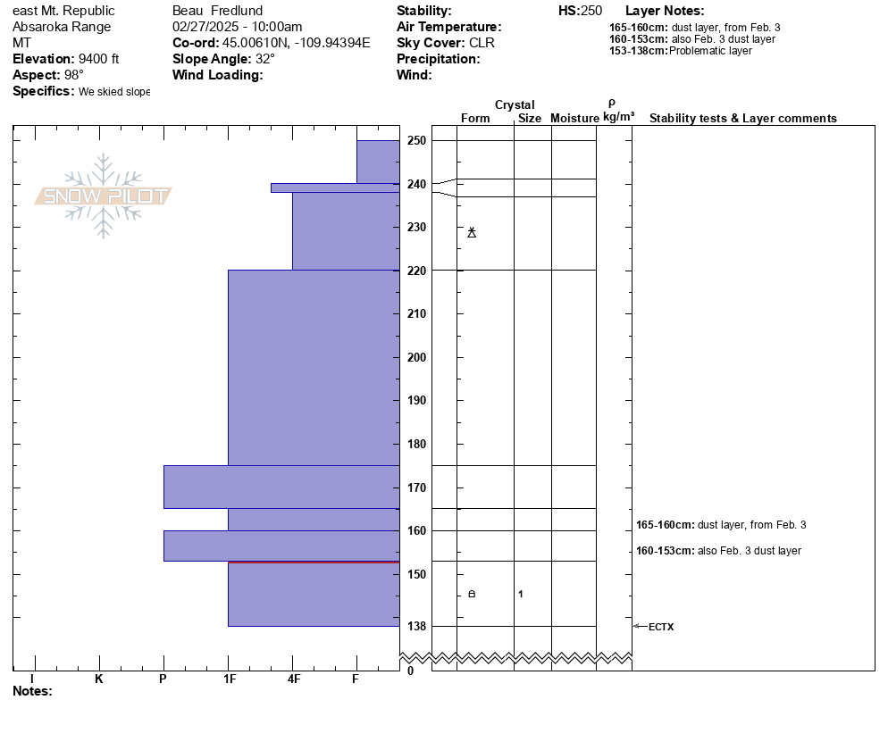
Riding in this morning, we saw this older wet slide on the Portal Creek road down low at about 6400' in elevation on a south facing slope by lots of exposed rocks. For reference, Gallatin River is 5800' in this area.
We didn't see any fresh ones on our way out at about 2:30.
The most likely places for big wet slides are slopes or areas with exposed rocks and cliffs. Generally these wet slides happen a little predictably in the afternoon as the snow gets wet. We know what time of day they'll happen, but it's hard to know exactly when they'll release, so watch out when the snow is obviously wet if traveling under slopes like this.
You don't need to worry about them in the morning, when the snow is frozen. What a nasty avalanche with sticks, rocks, and dirt in it?
Full Snow Observation Report
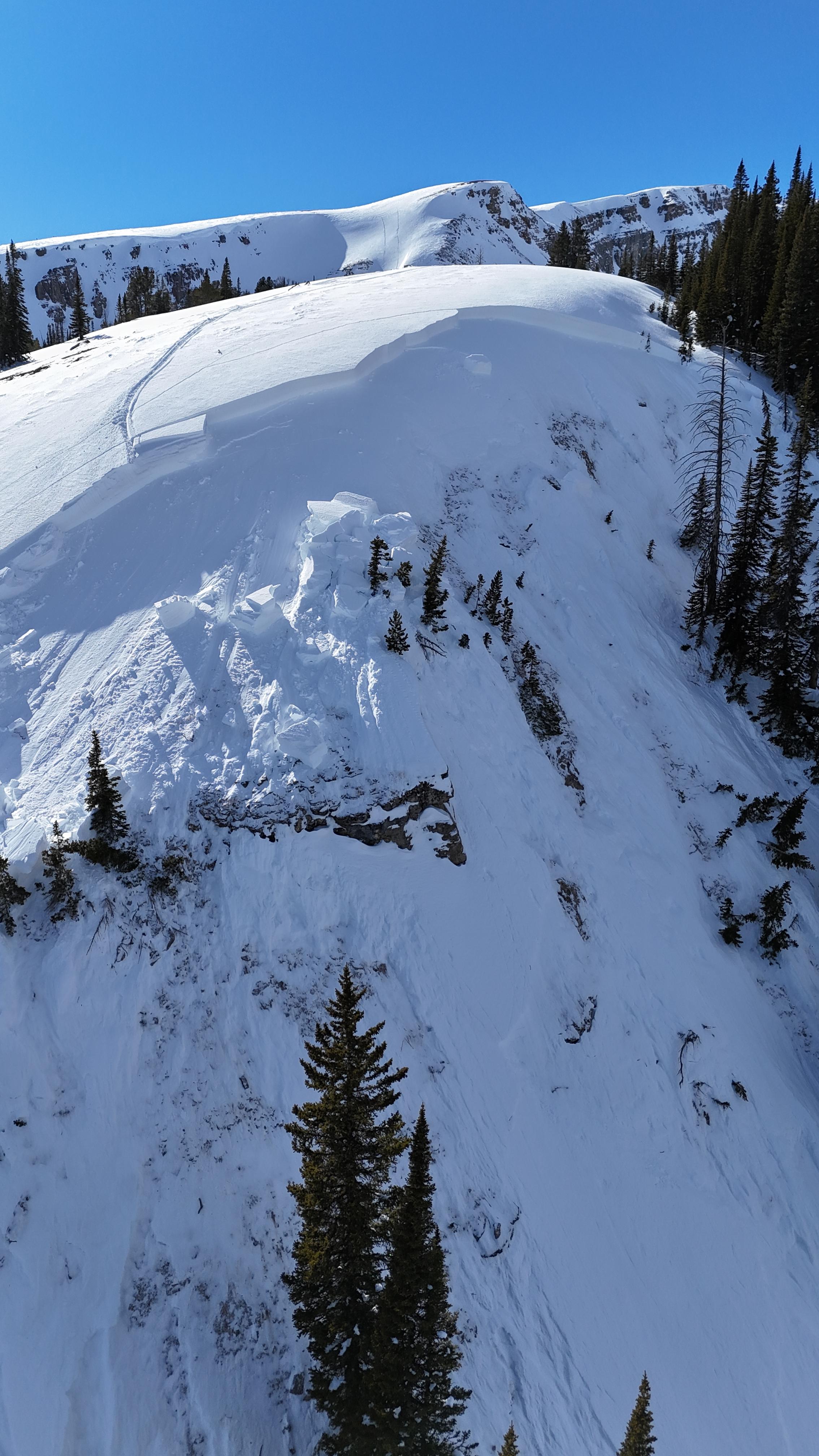
We toured up to the prayer flags on the Ridge above Beehive Basin, got a good view around the basins, dug to the south of the cornice line there, and descended the south side of Tyler's path. Clear skies, slightly above freezing temperatures, and calm wind. The surface conditions were better than I would have expected, with dry snow/ no crust on all aspects other than those tilted south-facing. The lower elevation snow in the basin was getting wet by the time we departed at 2 PM. I would expect some wet loose avalanches this afternoon. No wind loading or signs of instability observed.
Our pit showed good stability (ECTX). This fits with the pattern of avalanche activity driven by snowy and windy periods that quickly improves with milder conditions in the mountains around Bozeman and Big Sky. We are optimistic about the nice weather and generally safe conditions coming up this weekend.
Watch out for these three things and you will be looking good to get into a fair amount of fun terrain this weekend in the Bridger, Northern Madison and Northern Gallatin Ranges, and the Centennial Mountains in Island Park:
- Wind-loaded terrain where you could find lingering wind slab instability.
- Cornices: They are really big currently, and we may see a few breaking off with the warm temperatures this weekend. These can collapse much farther back from the edge than expected.
- Wet snow: With forecasts calling for above freezing temperatures under sunny skies, we expect wet loose snow avalanches to slide on sunnier (south and west) aspects. These will generally be small and involve only the recent snow, but they can still injure or buried skiers, riders and climbers in steep terrain or gullies where they can push backcountry travelers into terrain traps (trees, gullies, cliffs, rocks).
Isolated instability can have significant consequences on larger or committing terrain objectives. Stack the deck in your favor by digging down a few feet and testing the snowpack so you don't get surprised.
Full Snow Observation ReportEverything we saw was LOW danger, avalanches unlikely. Temps were warming. It will be interesting to see what the ski patrols report in terms of wet snow hazard.

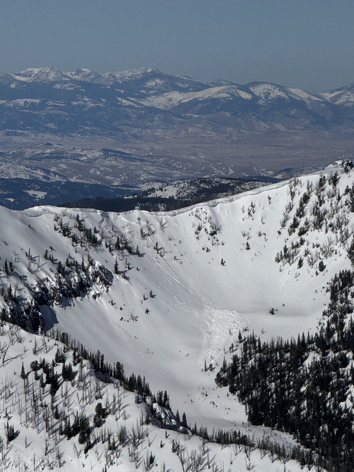
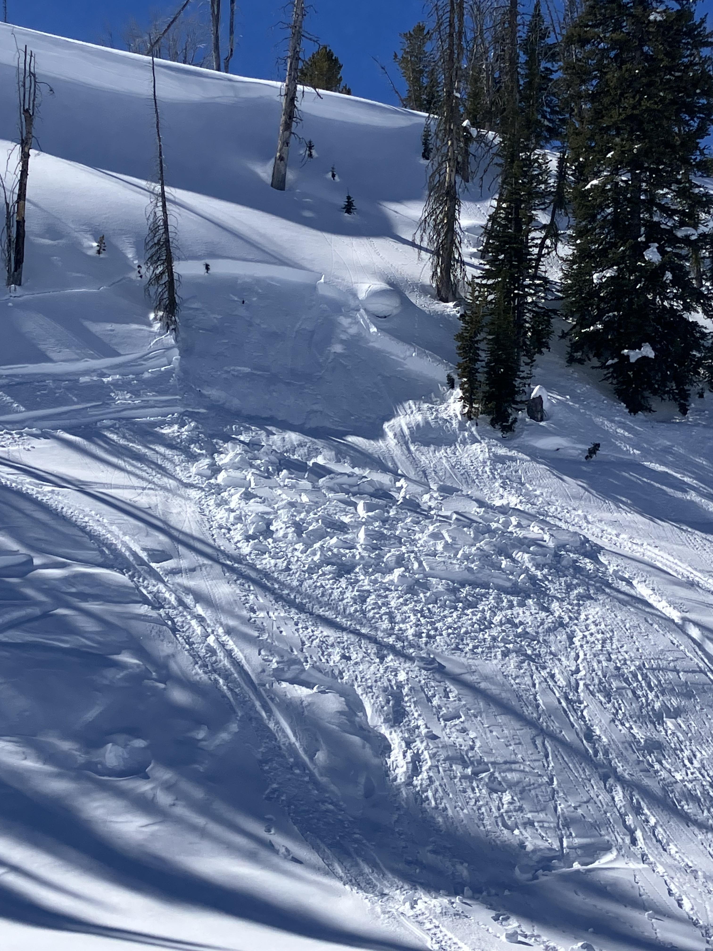
Toured much of the Hyalite zone yesterday. Winds calmed, sun came out mid day. 1” of new snow and 3” the day before. Skiing was great. Saw a couple huge cornices that had broken off. From the top of Devide peak we observed what looked like a cornice release above the headwaters of storm castle creek which triggered a slab, east facing aspect. Looked to be several feet deep and ran a long way. No other signs of instability observed. Great skiing. Solar aspects were saturated by the afternoon.
Full Snow Observation Report
Been meaning to share some recent obs from a ski trip we took into the Centennials. Overall good skiing, fairly consistent and deep coverage with height of snow ranging from 155cm to 180cm. Skied from 21 Feb to 24 Feb, light new snow on 23 Feb-24 Feb, with strange rime event happening overnight Sunday into Monday. Created a ~2mm rime layer on snow surface on most aspects and all elevations.
There was evidence of other rime events in all pits we dug, thin little ice layers (1-2mm) evenly spaced throughout the upper ~70cm of snow. Significant ice layer in all pits at ~1m from surface, from 4-6mm thick.
Pit 1, ~7700', ENE aspect, ECT 25 on rime/ice layer ~50cm from surface, Q1
Pit 2, ~8800', W aspect, ECT 23 on rime/ice layer, ~70cm from surface, Q1
Pit 3, ~8900', WSW aspect, ECT 25 on rime/ice layer, ~70 cm from surface, Q1
All failures featured dense, cohesive slab popping right off the column at failure. We kept angles shallow and had good skiing until the rime event, which created a nasty little surface crust. No evidence of old avy activity visible, but we had fairly limited visibility overall.
Full Snow Observation ReportFresh wind slab avalanche seen this afternoon, possibly rider triggered.
Full Snow Observation Report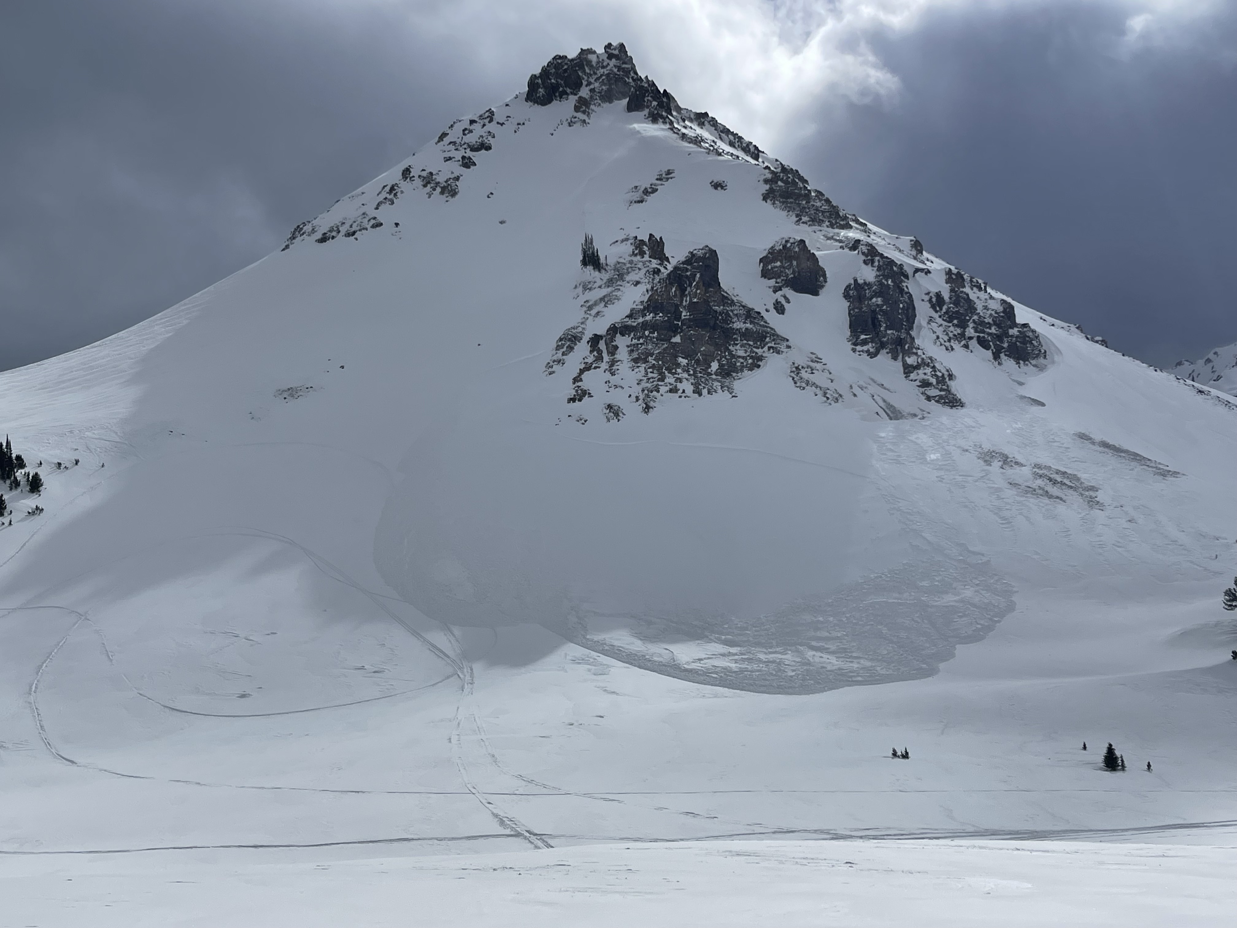
We received a call (from a third party) about a snowmobiler that was buried with their head 5 feet below the snow and their foot sticking out of the snow. Their partners saw the foot and dug them out. The riders face was blue, but quickly became responsive after a "chest thump".
They were riding on the north side of Miller Mtn. Given the widespread winds and drifting, we suspect it was likely a wind slab avalanche similar to one spotted on Crown Butte the same day.
Full Snow Observation ReportSeveral inches of dense new snow really made great skiing and riding on top of either an ice crust or firm layer of snow from recent sun and warm temps.
Winds had moved snow at upper elevations.
Total snow depth on a NE aspect was 230 cm (7.5 ft). Right side up and strong. Dust layer from Feb 4th was 70 cm deep (28 inches) with no facets under it.
The main avalanche problem seemed to be wind slabs.
Full Snow Observation Report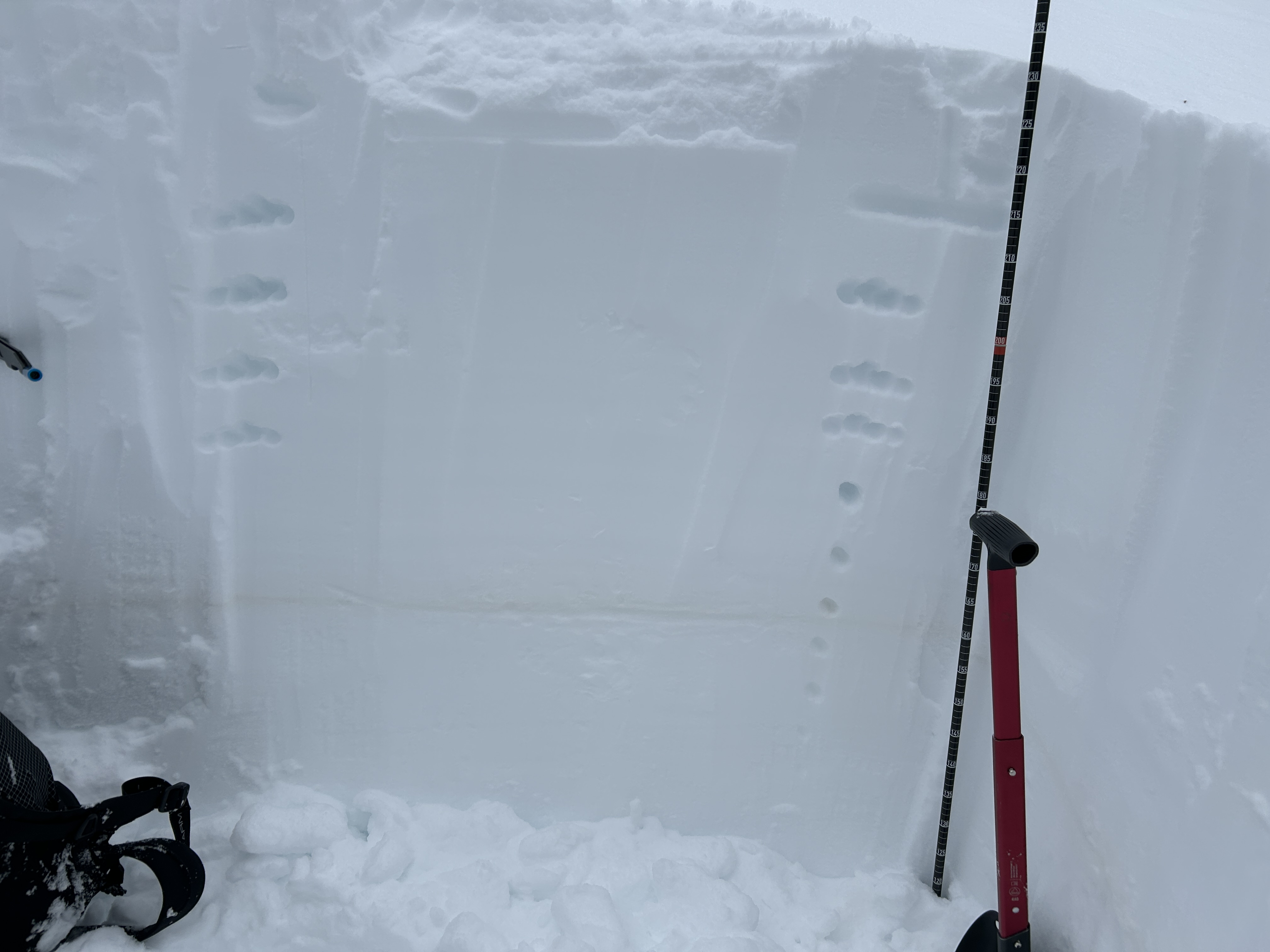
