Snow Observations List
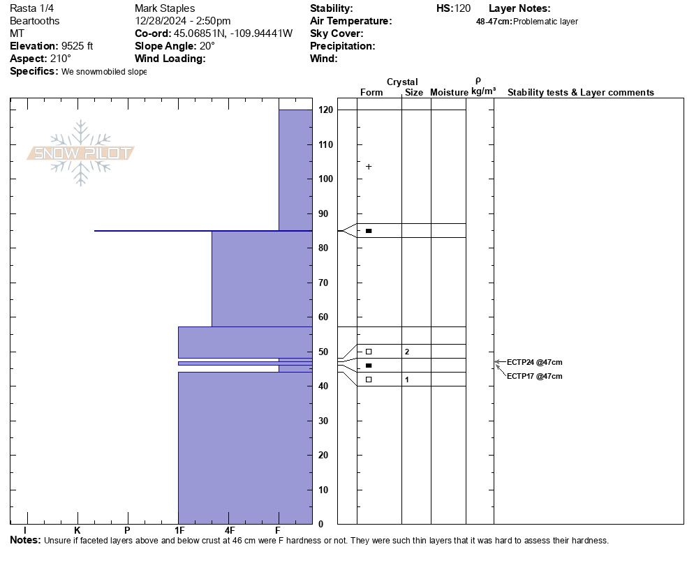
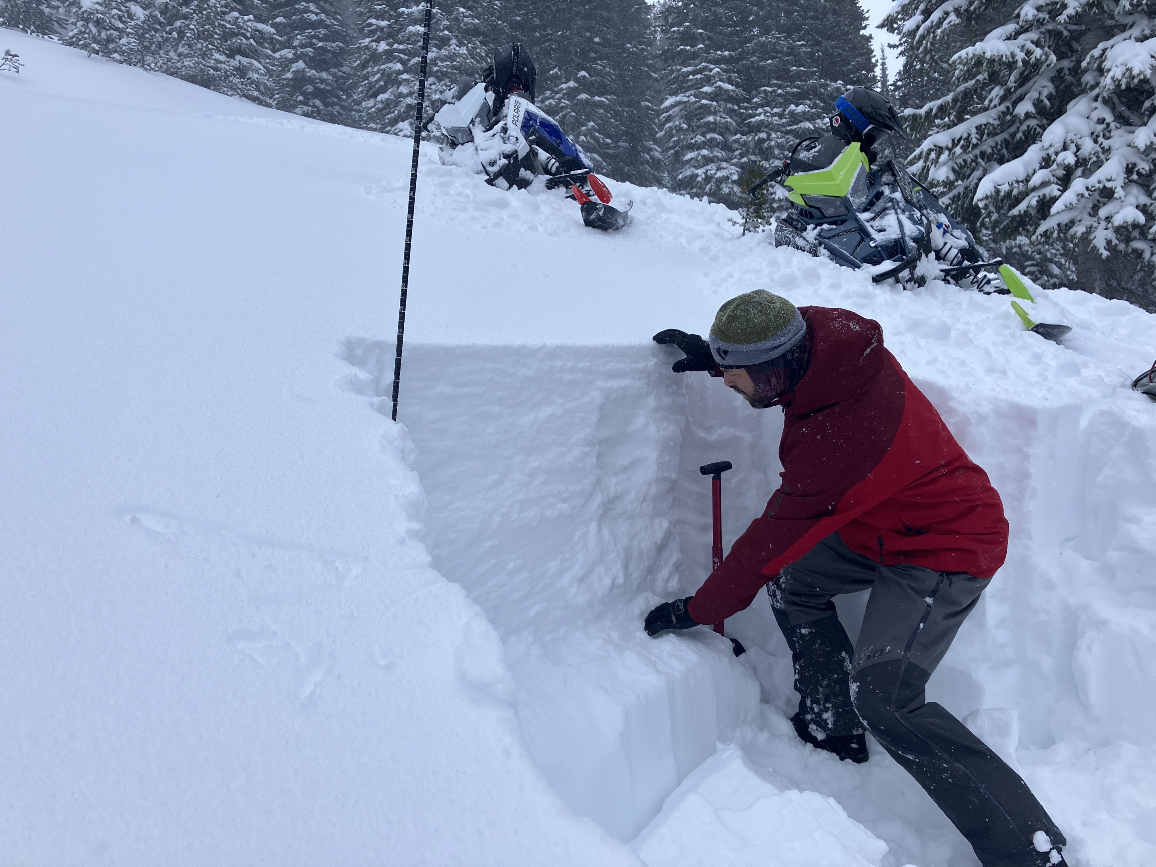
Teaching a Level 1 up at Woody Creek Cabin the past couple of days. 2-2.5' has fallen since Friday, but 11" of that snow came throughout today.
We toured up the East Side of Woody Ridge today. There was heavy snow throughout the day, steady winds (light-moderate) above the tree line all day, and low visibility. No cracking/collapsing, and no observed avalanches in the visible terrain. The skin track was completely refilled on the tour back to the cabin (within ~2 hours).
We dug below Rip Curl: NE facing aspect @ 8620'. Average HS 95-105cm. CT8 on the buried surface hoar about 2' down. ECT results: no propagation. The new snow that fell today was F-hard and unconsolidated.
Full Snow Observation ReportThis is avalanche weather - heavy snowfall and strong winds transporting snow. With this weather, it doesn't really matter what's going on in the snowpack. The loading from snowfall and strong winds will find the weakest layer in the snowpack and produce persistent slab avalanches.
Snow depths going up from Republic Creek at 8200 ft to the top of Woody Ridge at ~10,000 ft ranged from 60 cm to 120 cm. Weaker where thinner and stronger where deeper. What surprised me was that we couldn't get a single collapse/whumpf or any cracking despite our best efforts getting off the established skin track. Given the rapid loading and wind loading combined with buried facets, I expected at least on collapse. However, a lack of collapsing doesn't override all the other red flags.
The snowpack north of town and south of town seemed reasonably similiar. The biggest differences were with elevation. Generally above maybe 9000-9500 ft, the snowpack is a goof 4 feet deep.
I WON'T BE SURPRISED TO HEAR OF SOME LARGE AVALANCHES AT UPPER ELEVATIONS on peaks like Henderson, Crown Butte, etc where some slopes are being heavily wind-loaded.
Looking into the future, though, I feel optimistic. The snowpack is growing and will hopefully get stronger in the future as weak layers are insulated and buried more deeply. Yesterday north of Cooke, weak layers generally buried about 2 feet deep showed signs that they were gaining some strength and hardness. We'll see.
Full Snow Observation Report
We rode around a big chunk of the Cooke City area from the Miller Road, up to Daisy, around the backside of Fisher Mtn, into Fisher Creek, and looping around Scotch Bonnet Mtn. Ee saw no signs of instability. No cracking or collapsing. While tracks on slopes don't indicate stability, there were a lot of tracks on small test slopes, and none produced small avalanches.
In all our snowpits, the weak layers were generally 2-2.5 feet deep and I was pleasantly surprised that they seem to be gaining some hardness. It feels that the snowpack has benefited from the steady trickle of light snow in the Cooke area. It hasn't added much water weight, but the continuous light snowfall in the Cooke Area has been slowly insulating and burying the weak layers without stressing them.
Unfortunately, we could not find any buried surface hoar, but we know it's out there. We also know that other areas like slopes south of town up Republic Creek are likely much weaker.
Without a major load of snow (and water), below treeline, avalanches are still possible but don't feel too imminent. It's different story going above treeline - where avalanches have been happening, where there's lots of wind loading, and where there are lots of potential trigger points. Stay below treeline.
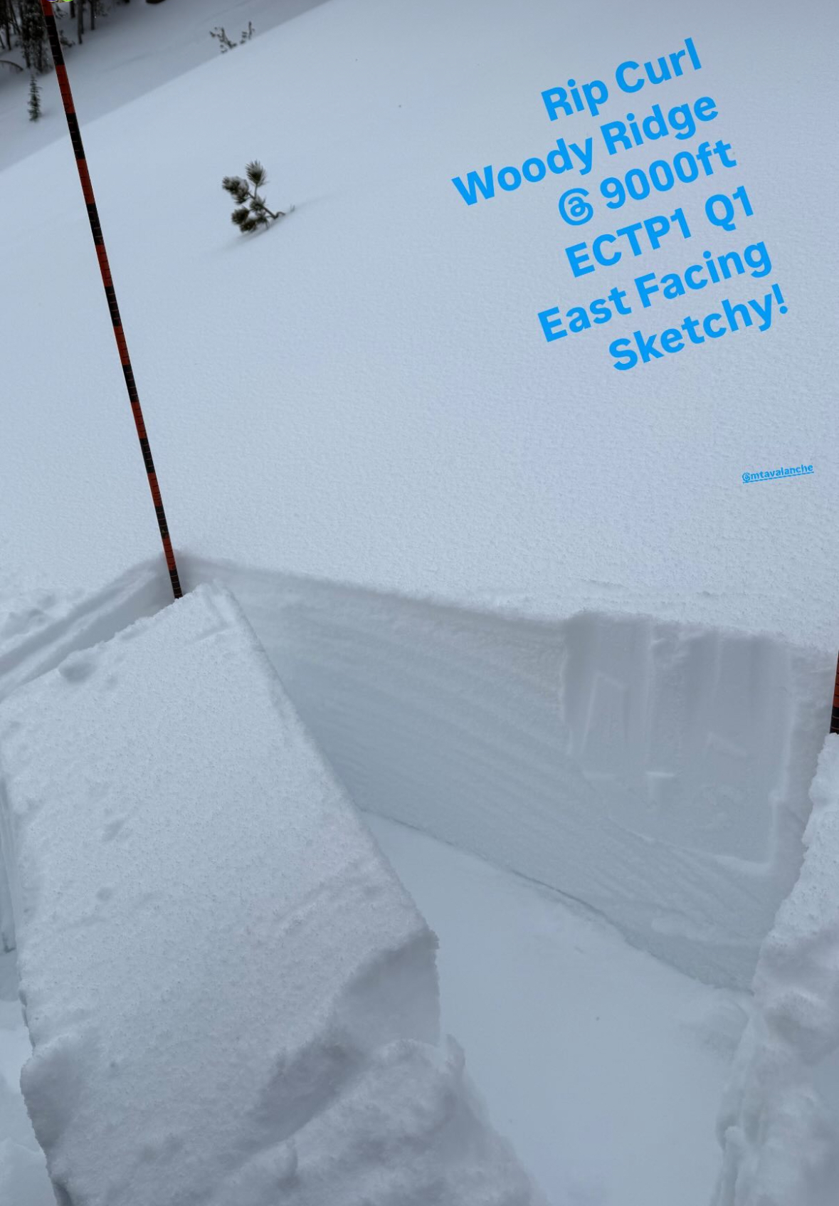
Full Snow Observation ReportFrom IG Stories: A group on the "Rip Curl" area of Woody Ridge south of Cooke City report ECTP1 test results failing on buried weak layers.
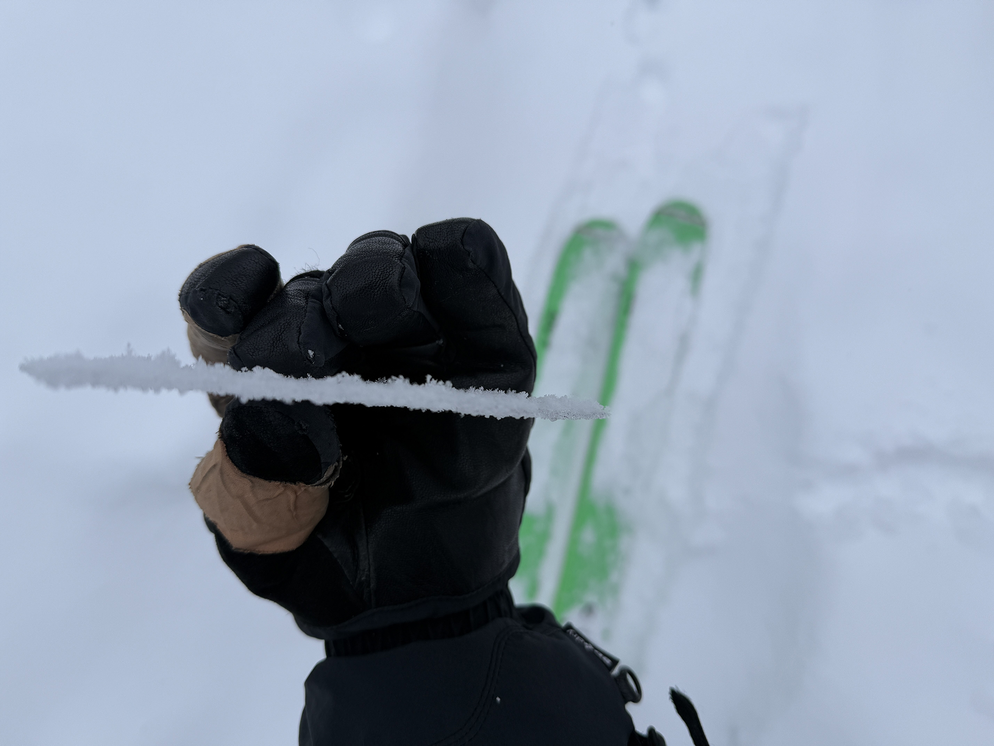
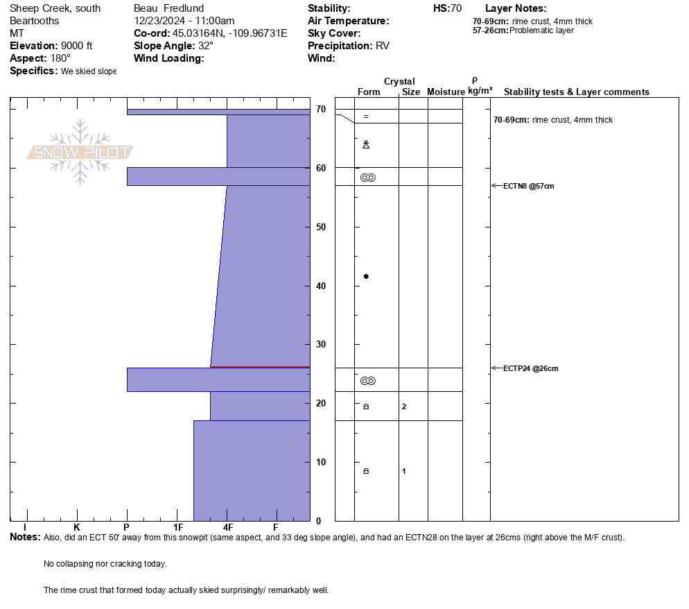
Full Snow Observation ReportWe ski toured in Sheep Creek today, north of Cooke City. Of note, a thin (4mm) rime crust was forming due to the high humidity/ quasi rain. Remarkably the rime crust skied very well.
No avalanche activity observed (low vis). No collapsing nor cracking experienced. Light winds and mild temps.
Snowpit attached from a 9000', due south aspect, 32 deg slope. HS 70, ECTP24 at 26.
Another snowpit 50' away, with the same elevation and aspect, and 33 deg steep, had a similar structure, but resulted in an ECTN28 on the same layer.
Full Snow Observation ReportSnow surface soft with ~3" of new, mod-strong SW winds at 11am
Reactive tests in snowpits with low to moderate ECTP scores. HS 105, NE aspects at 9480'.
Experienced collapsing on the north end of Rob's, likely failing on buried surface hoar that was evident in pit.
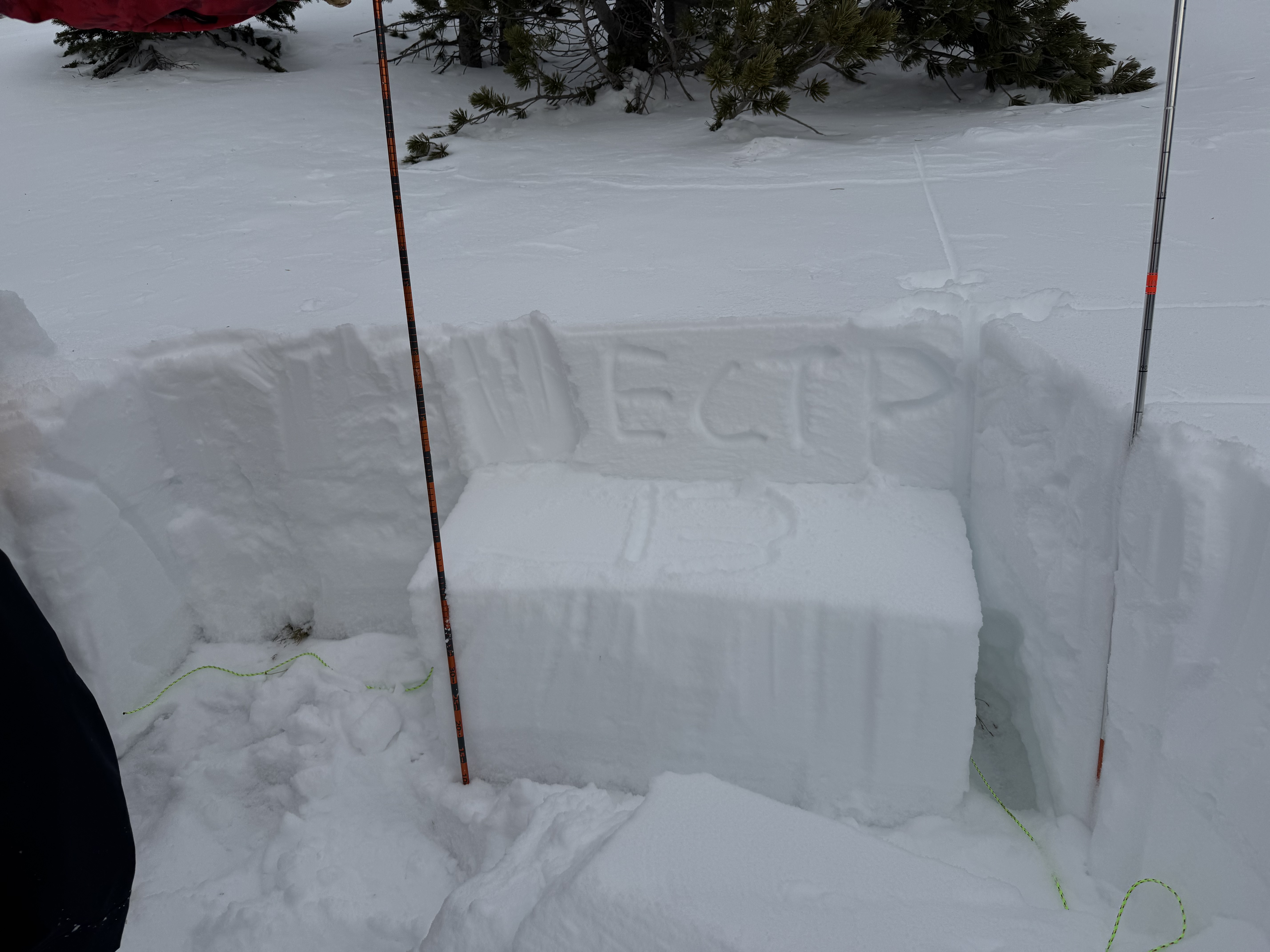
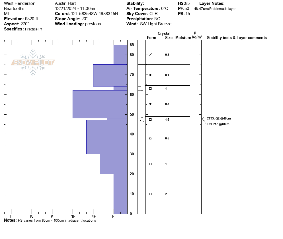
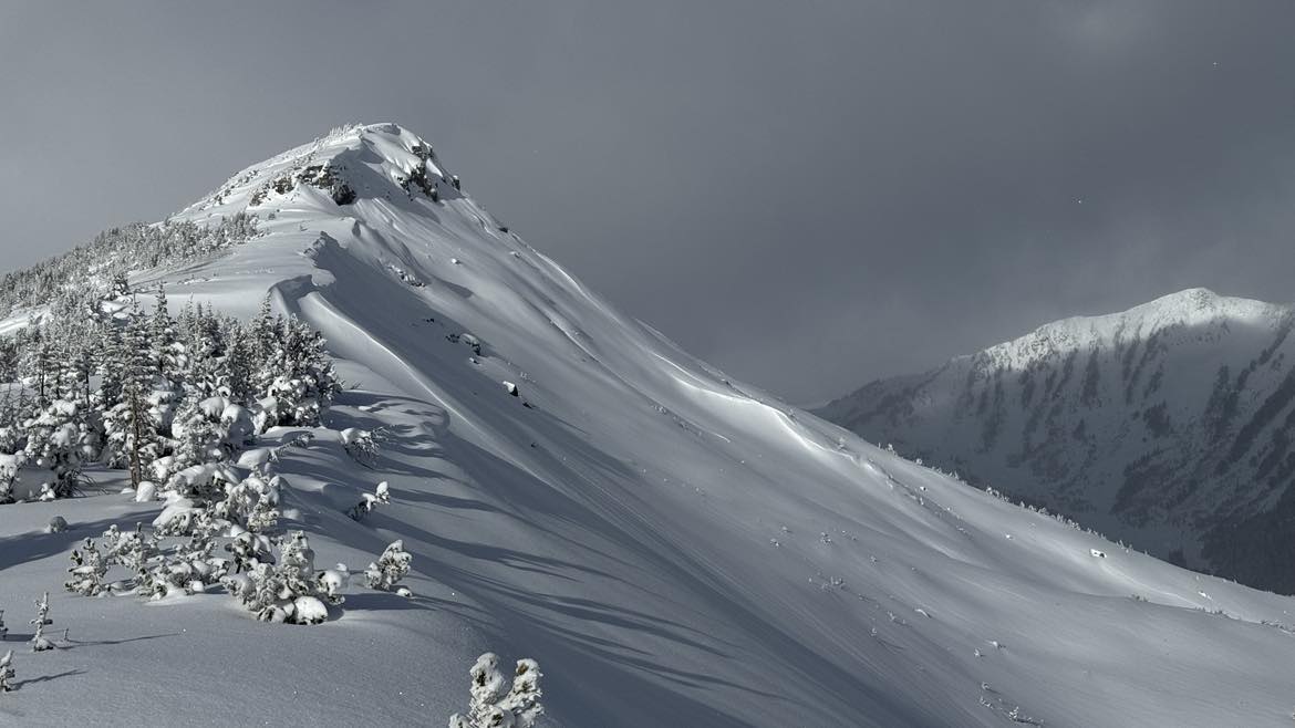
Full Snow Observation ReportWe toured above 9000' on a W to SW aspects on Henderson Mtn. We experienced several collapses and had propagation in multiple ECTs performed. HS varies between 85-105cm. Snowpilot pit is from 9820' W aspect, photo from 9940': both with ECTP results.
Snow surface variable with wind boards and radiation crusts, mixed with soft snow in shaded aspects.
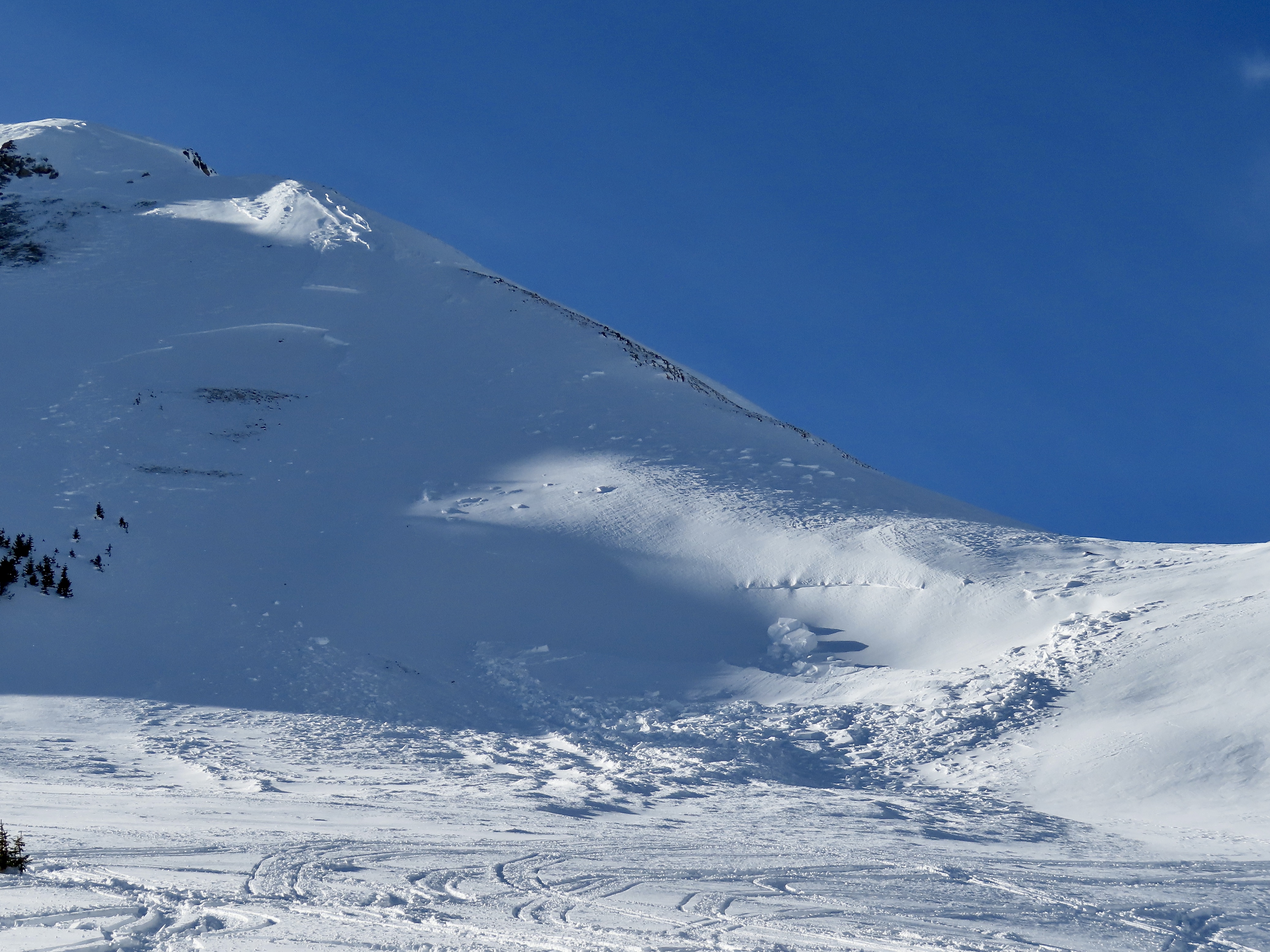
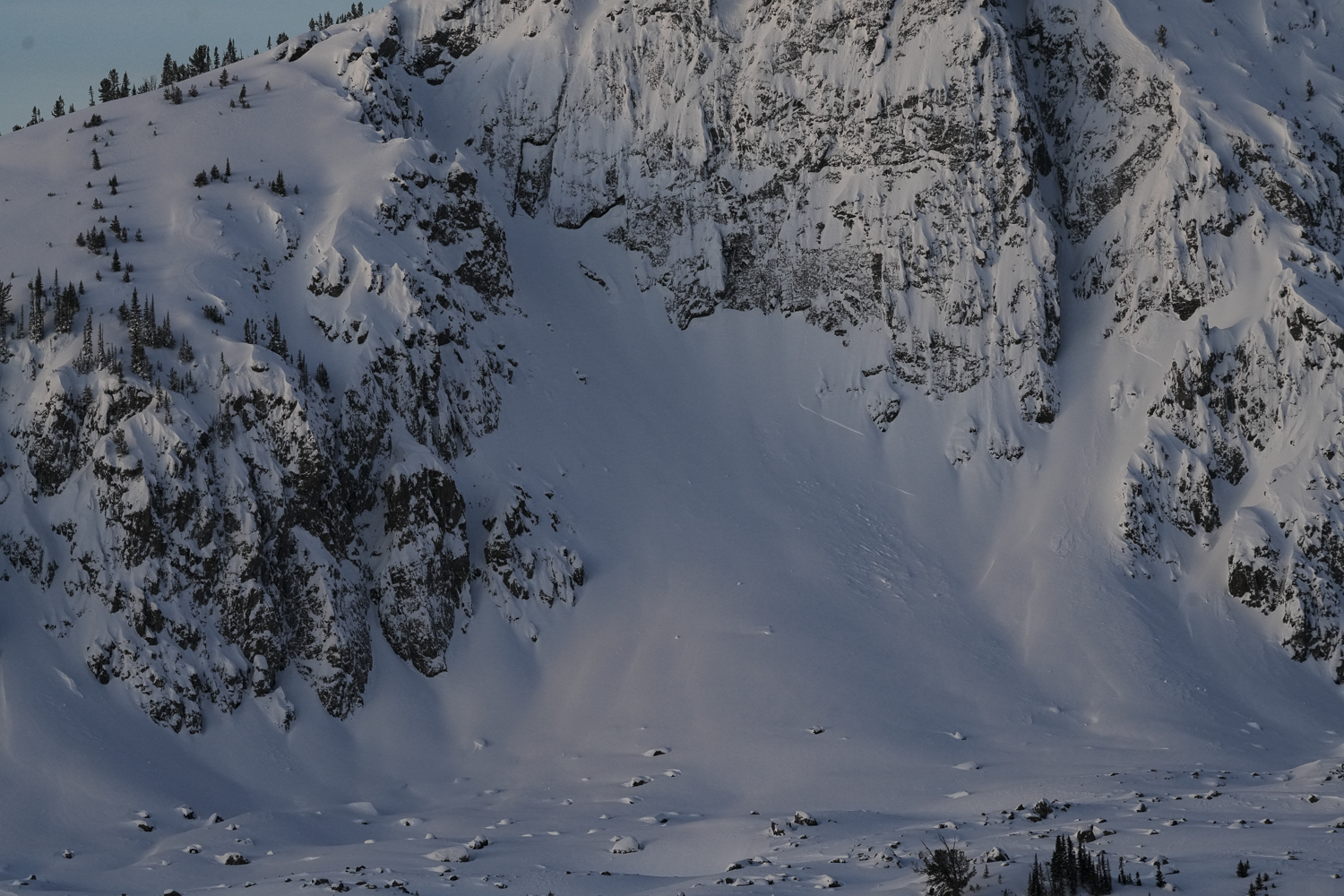
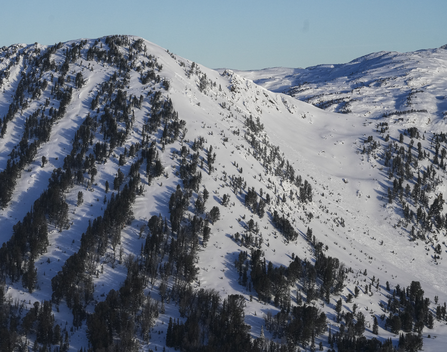
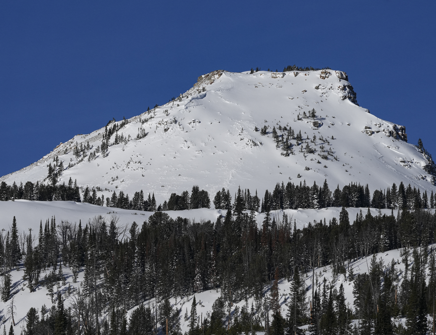
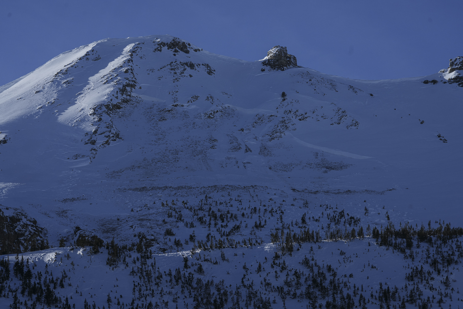
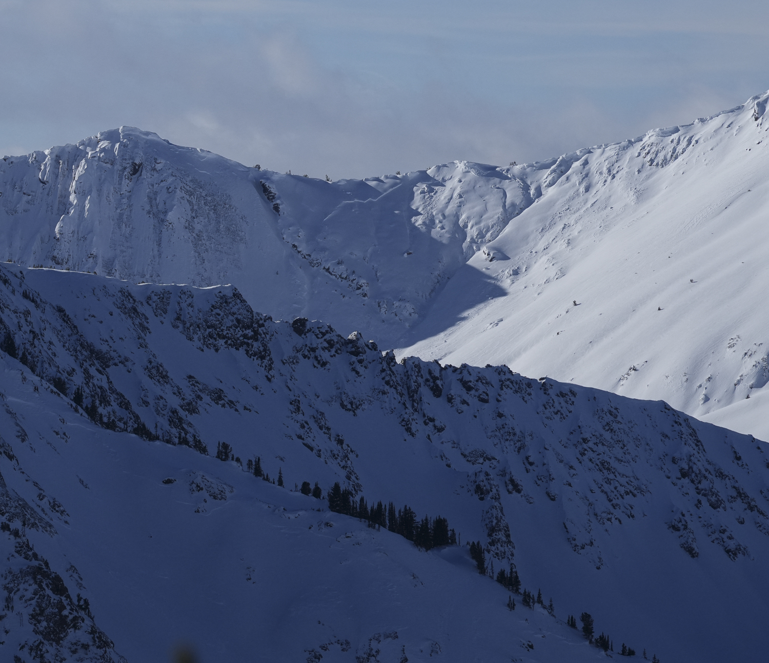
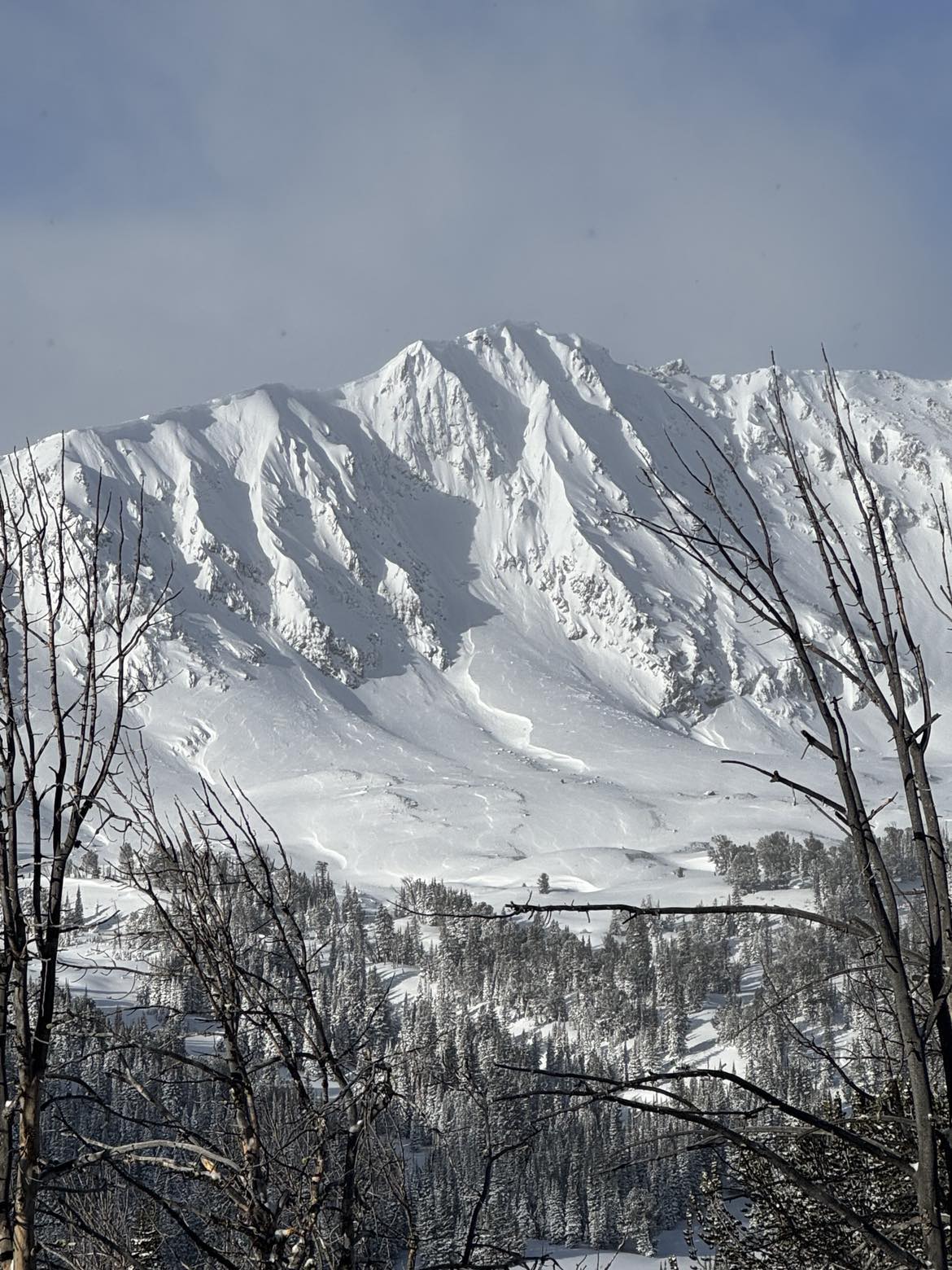
Full Snow Observation ReportWe rode out to Lulu Pass to look at the few avalanches that were reported yesterday on Henderson and Fisher Mtn. Today we did not see any avalanches that weren't previously reported, other than one small, but thick wind slab on south facing slope of Scotch Bonnet (photo). At least the avalanche on Fisher and one on Henderson broke near the ground (pics attached). Some slides were heavily refilled by drifted snow, so it was hard to tell how deep they broke.
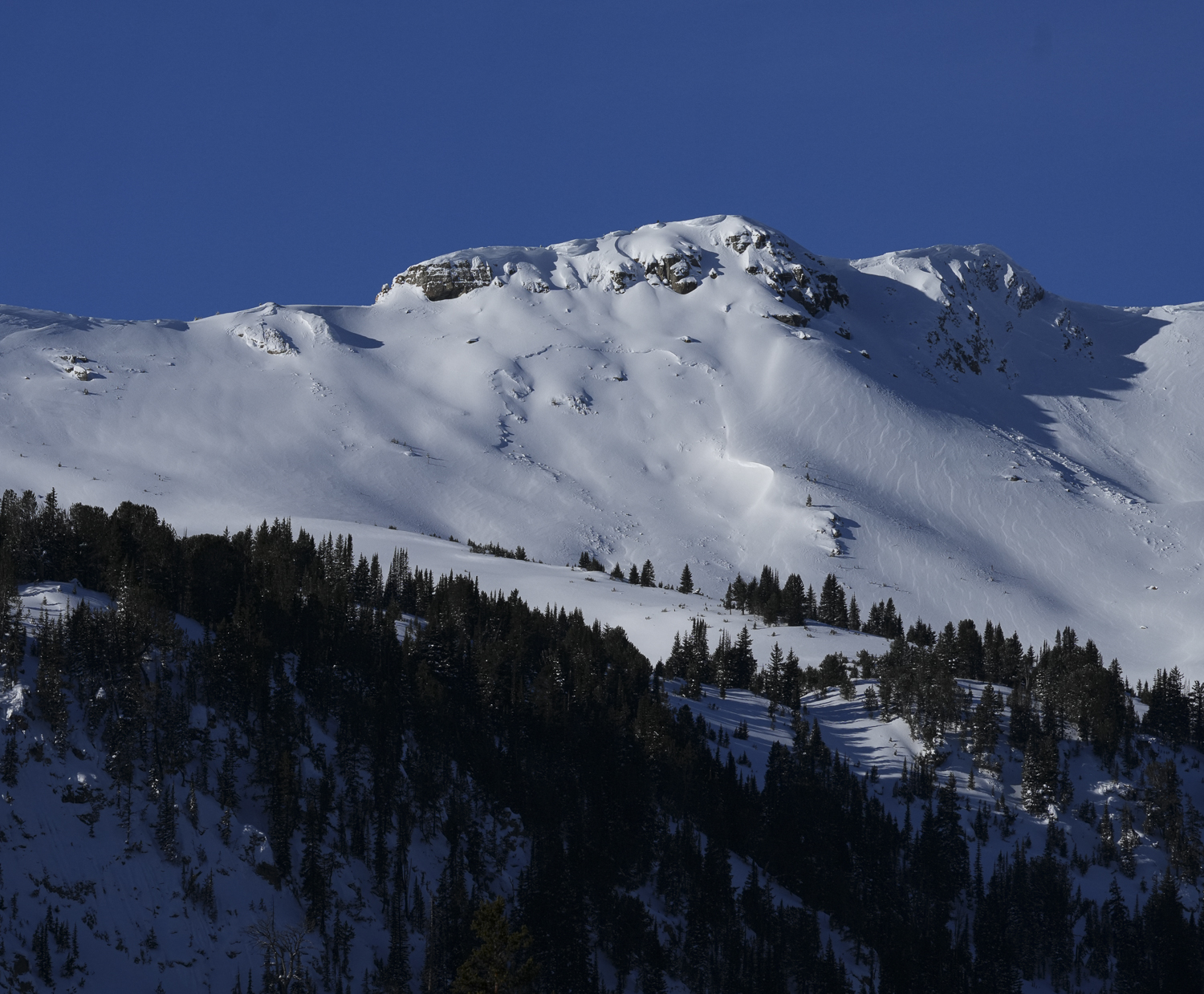
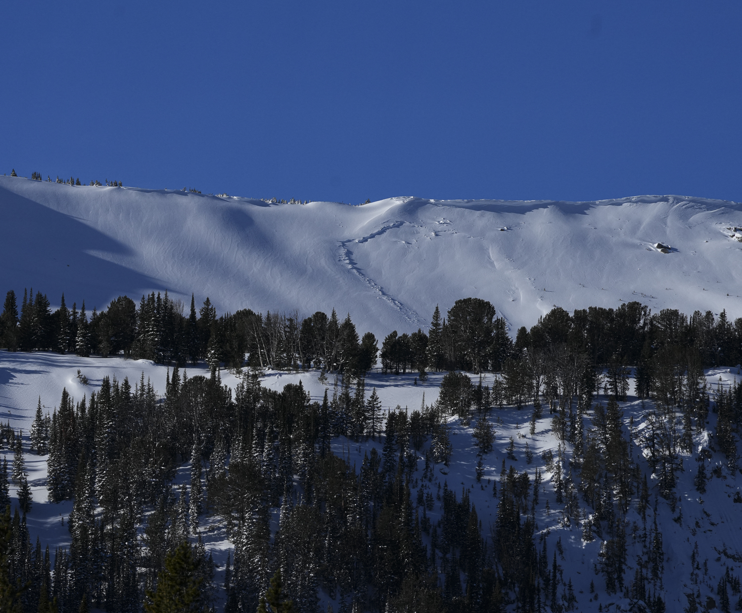
Yesterday I saw a wide slab avalanche up on west Woody Ridge from town (photo attached). It happened late on Wednesday or overnight during or after the strong winds and snowfall.
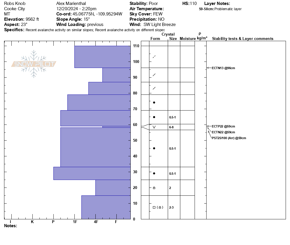
We dug a pit on a north-northeast facing slope below Fisher Mtn. (on Rob's Knob). Snowpack was just over 3 feet deep with a stripe of surface hoar in the middle. Generally 1F to Pencil hard slab above the SH. Facets near the ground were 2-3mm and rounding. We had ECTP22 on the surface hoar and ECTN22 and PST 25/100arr.
Despite the generally hard and rounded facets near the ground, recent avalanches are a sign that those are a problem in addition to the surface hoar.
Clear and mostly calm today. A few rollerballs on southwest aspects.
Overall, the recent avalanche activity is a sign that the early season weak layers are a problem to watch going forward. Danger and likelihood of avalanches may decrease in the immediate future with a break from loading, but we need to be thinking about these layers when future storms add up.
Full Snow Observation ReportFrom email: "Maiden Voyage to Goose Lake for the season today. Lots of wind drifted snow everywhere and challenging riding conditions. Performed Stability test on shoulder of Mount Fox NE facing slope at 10,300'. HS 180cm. ECTP2 40cm down on Buried Surface Hoar. ECTP 23 90cm down on MFcr with 1-2mm Facets. Saw several recent wind slab avalanches in steeper windloaded terrrain around Goose Lake, but limited activity was seen on Henderson. Lots of co/cr while touring on Mount Fox. D2 avalanche on east facing Mount Fox that appears to be on the SH layer, triggered by a cornice drop."
Full Snow Observation ReportQuite a few natural avalanches observed north of Cooke City today. Photos attached of:
1: NE facing, 10,000, Miller Ridge
2: E facing, 9900', Bull of the Woods Pass
3: NE facing, 9700', Miller Ridge
4: E facing, 10,200' Scotch Bonnet Mtn.
5: E facing, 10,000 Mt. Henderson
6-8: NE- N facing, 10,000' Mt. Henderson
9: NE facing, 10,000' Sheep Creek.
There was also a large avalanche event on the E aspect of Fisher Mtn, which I didn't photograph. But there were some other skiers nearby who likely had a good view of it.
Also, we had 4 large collapses today. One on a southerly aspect, and the other 3 on NE aspects. All around 9800'.
Full Snow Observation Report
Lots of wind slabs south of Cooke today. Strong wind all day and lots of blowing snow.
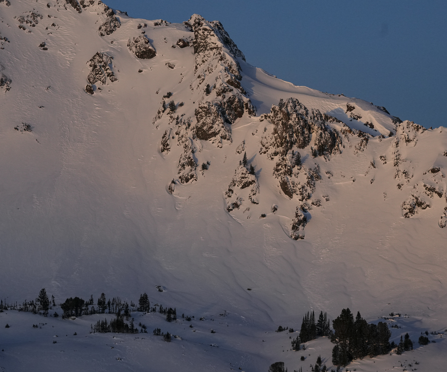
Full Snow Observation ReportThe clouds broke briefly around noon today in Cooke City. It looks like the Fin slide naturally in the past day or so. It looks like two sections of the face slid, one from the top, and one lower and to the right in the photo.
Full Snow Observation ReportAround 5" of fresh snow lay on top of the snowmobiles this morning in Cooke City. We rode up to Daisy Pass to visualize terrain and got eyes on Crown Butte. On the north side, we noted the crown of a wind slab avalanche (R1 D1) that broke during the storm cycle. We then rode back down and toured up Henderson Mountain along its SW flank. Skies cleared throughout the day and allowed for great visualization of terrain north of Cooke. We got eyes on Miller Ridge, Crown Butte, Henderson Bench, Scotch Bonnet and Sheep Mountain; we did not note any other avalanches outside of the small one up on Crown Butte. We saw extensive cross-loading in the bowl of Henderson Mountain and on Miller Ridge.
We dug snowpits on SW and S aspects on Henderson. We noted buried facets a little over a foot deep on our pit on the SW and we got an unstable test result in our snowpit on the S aspect (ECTP 25) on a facet/melt freeze crust sandwich.
Most notably, as we entered non wind-effected, upper-elevation terrain on Henderson, we consistently triggered many localized collapses and heard audible whumpfs, indicating persistent slab instability.
Full Snow Observation ReportIn the absence of additional information or loading, it feels reasonable to drop to CONSIDERABLE on wind-loaded, and MODERATE on non-wind-loaded slopes. Moderate confidence in this with a low threshold to hold full CONSIDERABLE.
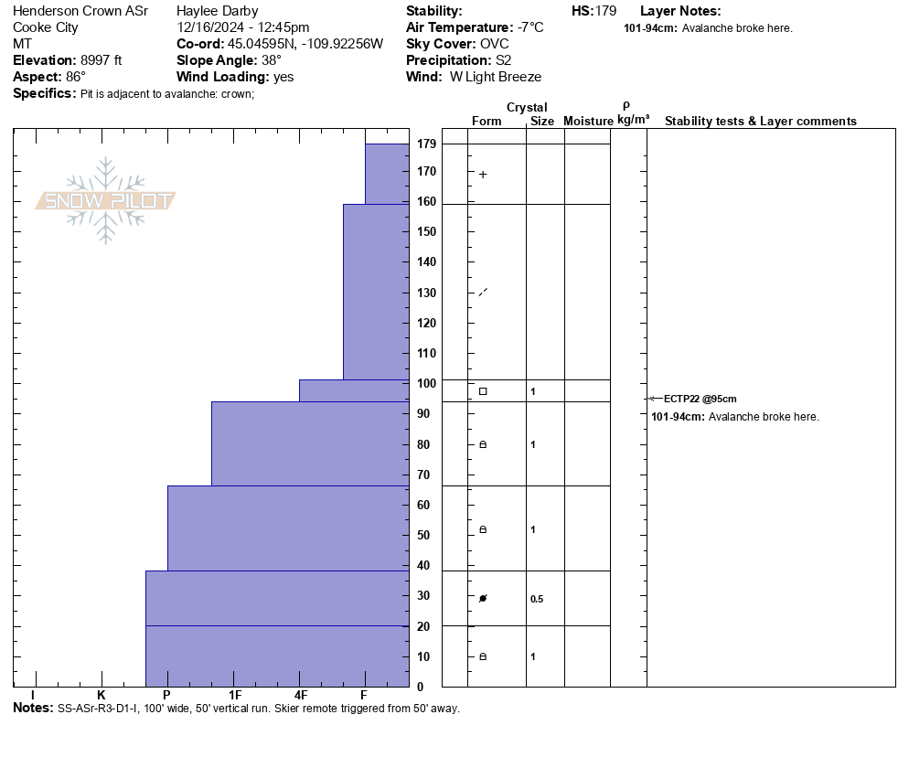
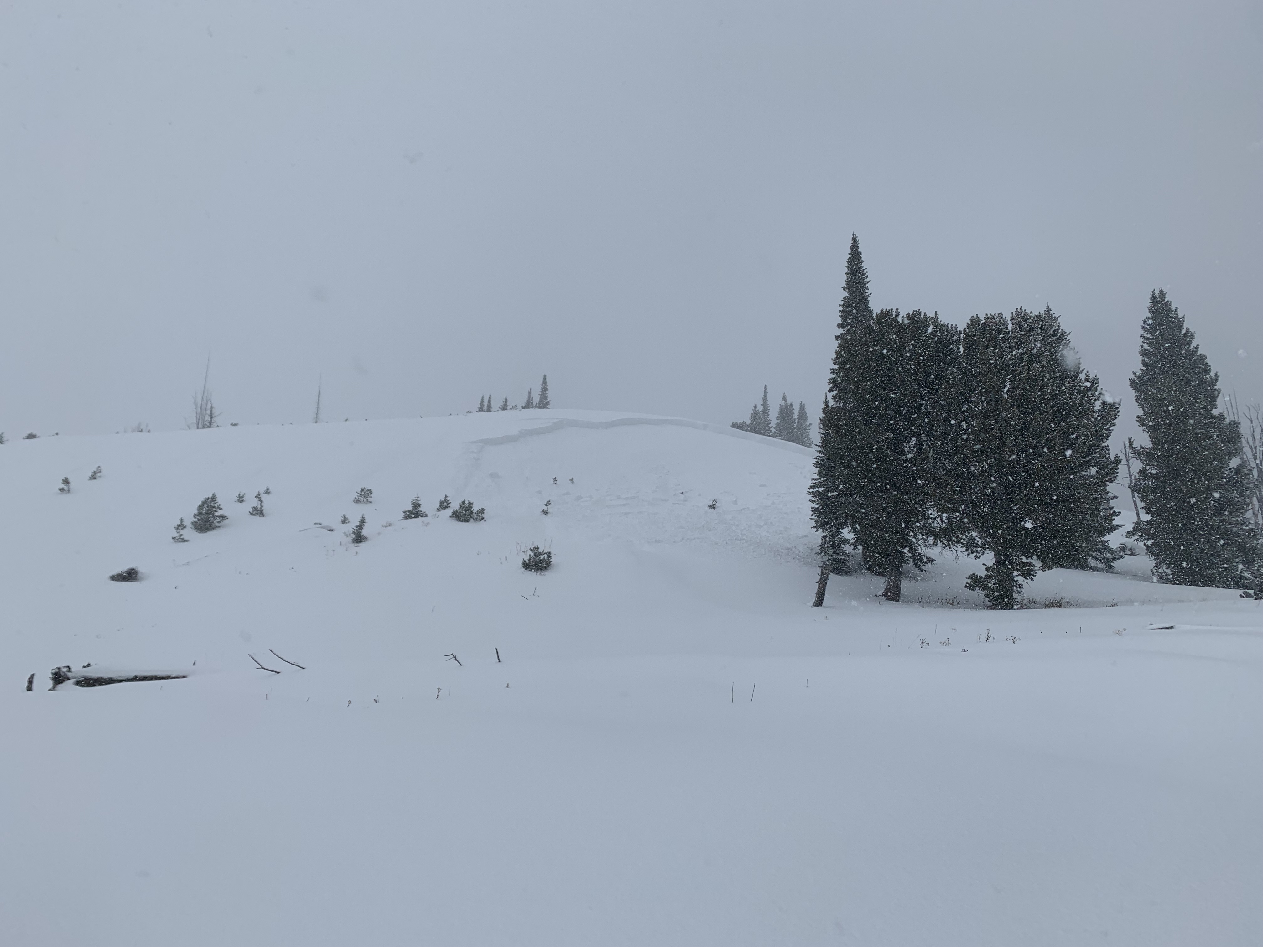
Today, we rode up to the base of Henderson and toured up to the bench to check out the crown of an avalanche that occurred yesterday. The avalanche was remotely triggered by a skier from 50' away. It was about 100' wide, ran 50' vertical, and the max depth of the crown was 2.5'. It fractured on the interface between the new storm snow and faceted grains. This was a heavily wind loaded area with an HS of 179cm. Strong westerly gusts and heavy snowfall had nearly refilled the crown by the time we left.
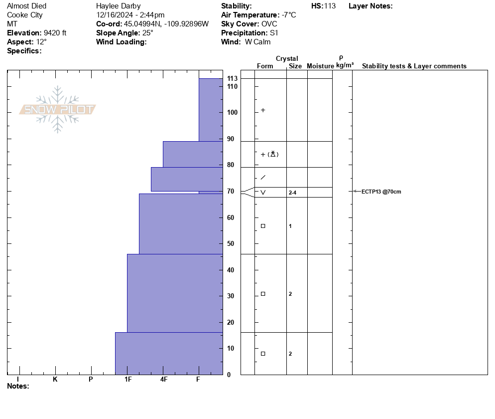
We then traveled further up the bench to a north facing aspect and dug again. Here we got an unstable test result, ECTP 13, on a layer of buried surface hoar. Faceted snow exists at the base of the snowpack but our main concern on non-wind loaded slopes is layers of surface hoar and near-surface facets buried about 50cm deep. It was snowing and blowing throughout the day, and with continued loading, we expect to see collapsing, cracking and signs of instability tomorrow.
Full Snow Observation ReportWent out north of Cooke City today for some skiing. Dug a pit at 9980' on a southwest facing, windloaded slope with a slope angle of about 15 degrees. We found 105cm of snow. Our ECT gave us an ECTP29 55cm up from the ground on what seemed to be the buried surface hoar layer. It was snowing and blowing all day out there.
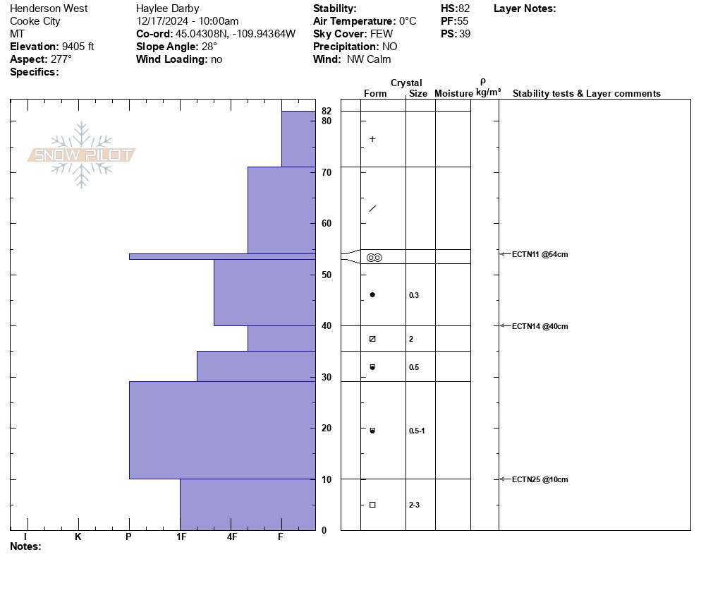
Full Snow Observation ReportFrom email: "Steve Harvey and I did a quick pit yesterday (12/16/2024) S. of Cooke in Republic Creek. E. aspect; 9.085'; 30° slope; HS 80 c; 12:30PM, Calm/cool (teens), Lt snow.
ECTN21; ECTP24 at 50 cm on buried facets. We declined to continue on slope.
We didn't perform a detailed profile, but generally, fist (new snow) and 4-finger above buried facets and progressively 2-finger to 1-finger below.
Noticeable Issues:
(1) Low and variable snowpack, 30cm or less under/near trees and on wind-scoured aspects and loading in fetch zones. Something to keep in mind as season progresses with potential sweet spots in predictable places.
(2) Buried 50 cm facets/hoar that is essentially everywhere in Cooke City zone.
(3) We did not observe buried deep facets at the base of the snowpack."
Full Snow Observation Report
Sunday morning 12/15 we were skiing just Southwest of Henderson Mountain between the road cuts. The first skier in our party remotely triggered this slide from a slightly lower angle aspect about 50 ft to the skiers left of the slide where the snowpack was shallower. It broke on a convex rollover about 100 ft wide and ran about 80 ft. downslope. The crown averaged 30 inches and broke on sugary facets about 18 inches from the ground. No one was caught.
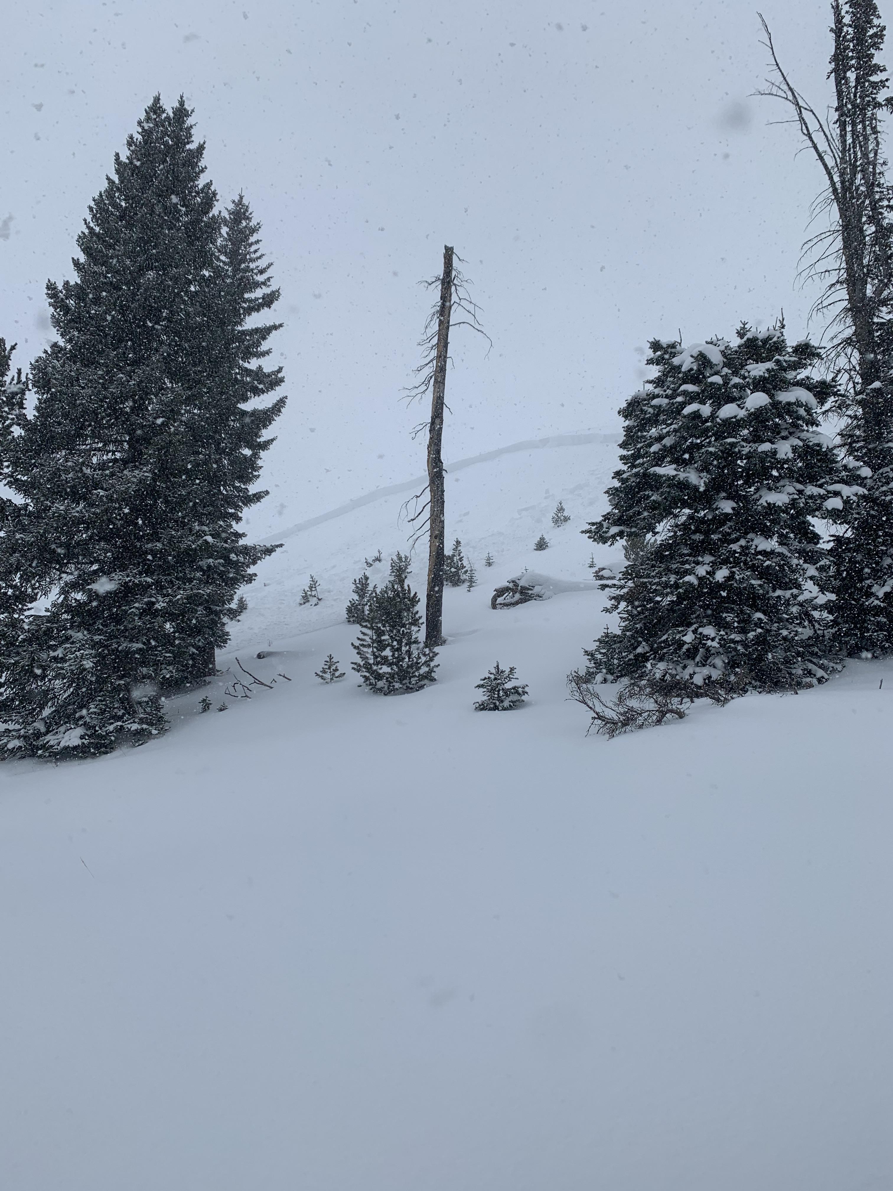
Full Snow Observation ReportWe skied east and west aspects of Woody Ridge today. It was snowing most of the day, with periods of heavy snowfall, which accumulated to about 4-5" of fresh throughout the day.
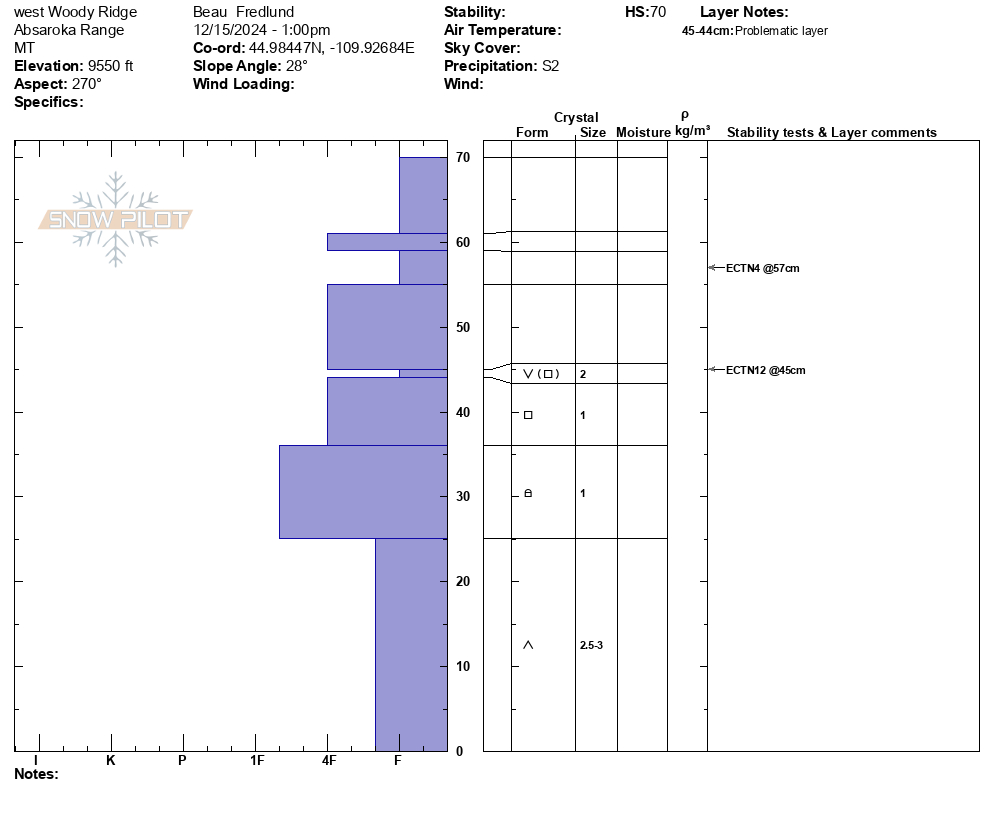
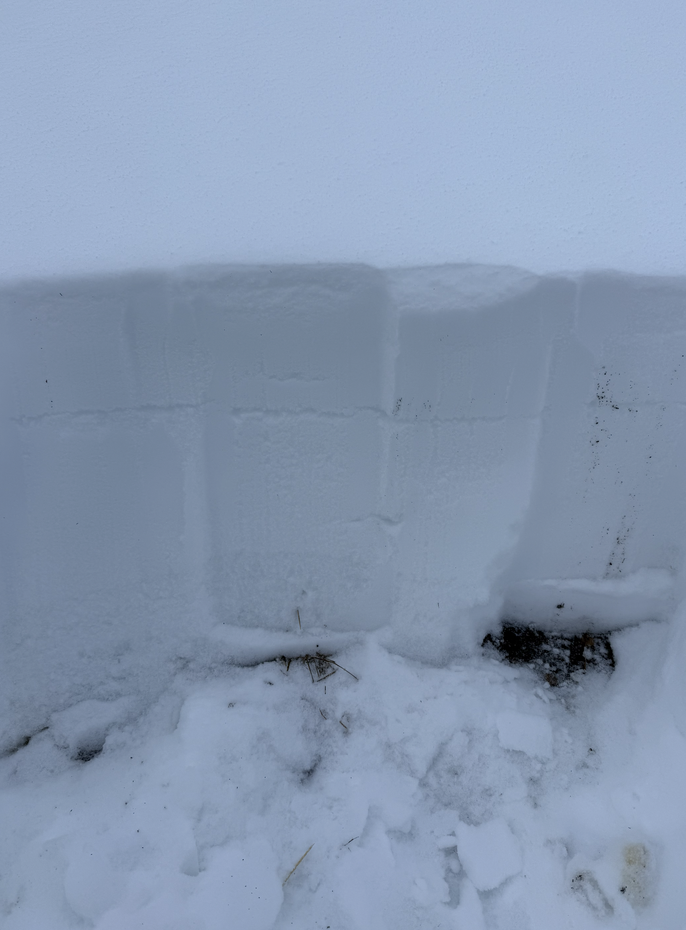
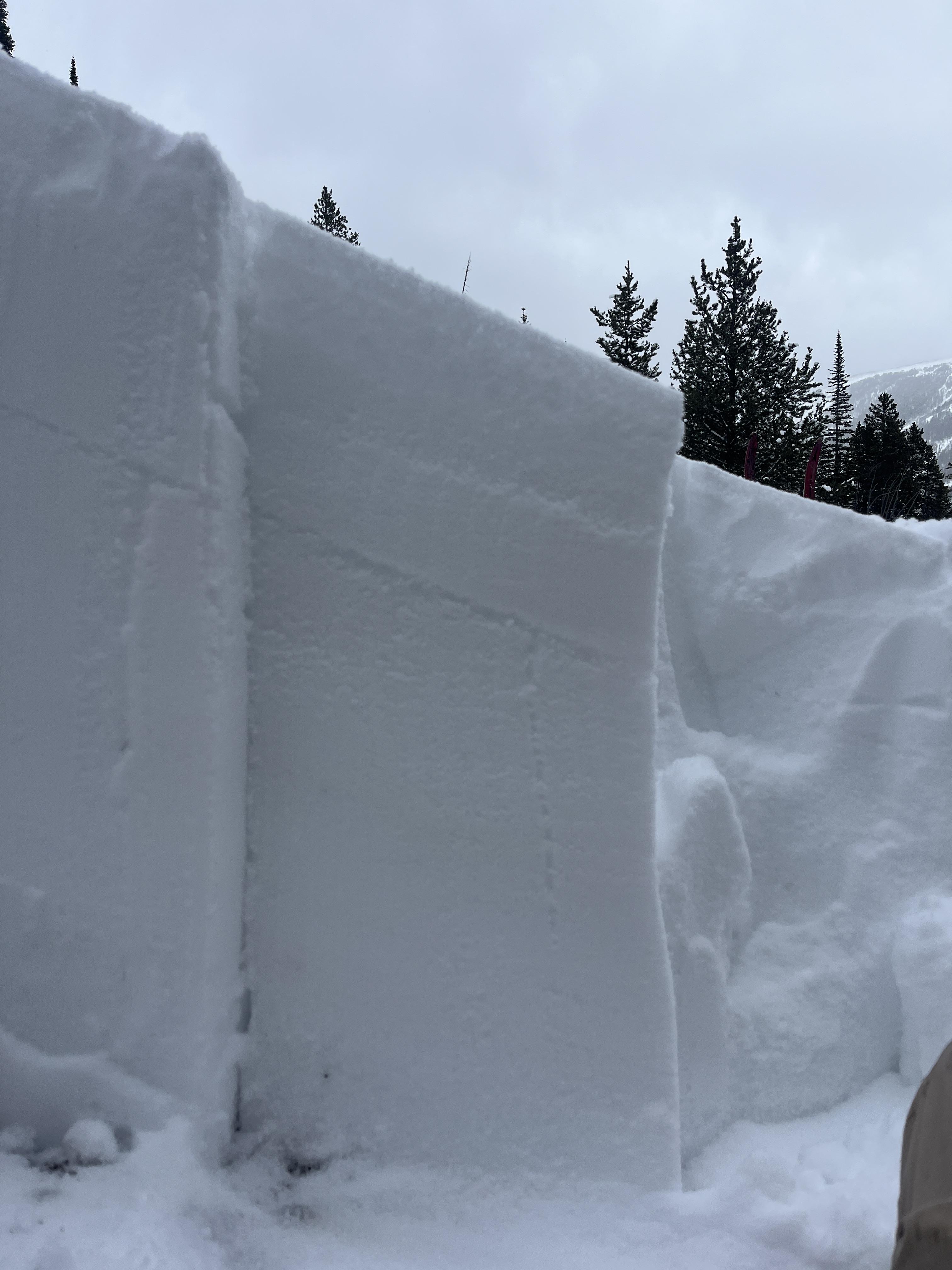
We found buried surface hoar in 3 different snowpits, on east and west aspects, between 9300-9700'. In each place the SH was buried under about 25cms of new snow, and I would describe it as somewhat irregular/ inconsistent, and mixed with some other faceted snow types. The SH crystals were generally about 2mm in size.
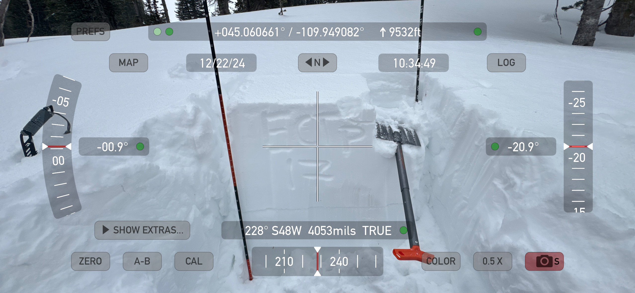
In our snowpit (file attached) at 9550', west aspect, HS 70, we had an ECTN12 at 45cms. (on that surface hoar layer).
No collapsing, no cracking. No avalanche activity observed (low vis).
One additional note was that slopes exposed to the SW wind had a thin rime crust that appears to have formed last night. The ridgeline was also noticeably rimed. In areas this rime crust was up to 1cm thick and 1F hardness. We were not finding this rime crust on leeward or sheltered slopes.
Full Snow Observation Report
Dug a pit at 8650ft on a SE facing slope just a few miles west of Cooke City. ECTP15. Failed and propagated on facets underneath the most recent storm snow about 20cm down, didn't feel like a wind slab but presumably was partially wind loaded from the winds the past few days. Pretty much the entire snowpack under this recent layer is facets separated by crusts, with varying levels of crystal thickness, ranging from larger near the ground to finer higher up. HS 65cm.
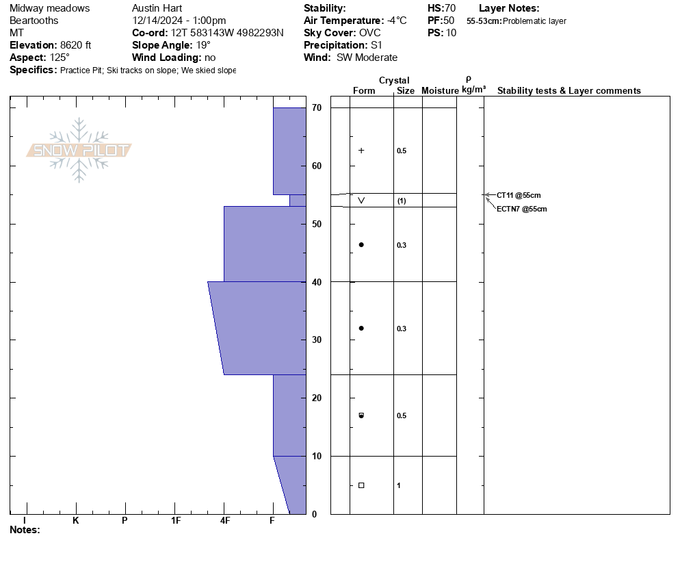
Full Snow Observation ReportToured up to Midway meadows, observed no cracking or collapsing. We found no propagation in our ECT at 8600' on a E aspect with HS 70cm. Found preserved buried surface hoar approximately 15-20cms below the snow surface. Low tide in tree exit, but fun skiing!
Full Snow Observation Report

