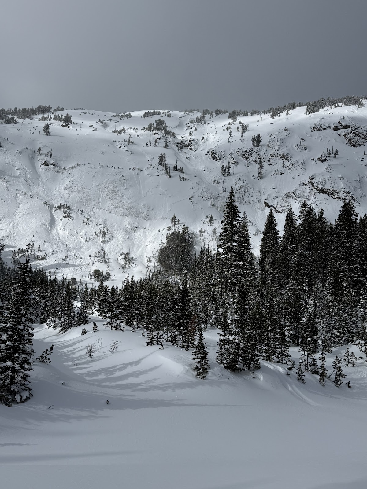
Snow Observations List
Today I saw a very small wind slab on Republic Peak. Crown was 10 feet wide. No other avalanches observed
Full Snow Observation ReportObserved a snowmobile triggered avalanche today. East facing slope, approx 9700', between Fischer Peak and LuLu pass. Rider was not caught. HS-AMu-D1-R1-I. Observed lots of wind transport and loading from strong w/sw winds today.
Full Snow Observation Report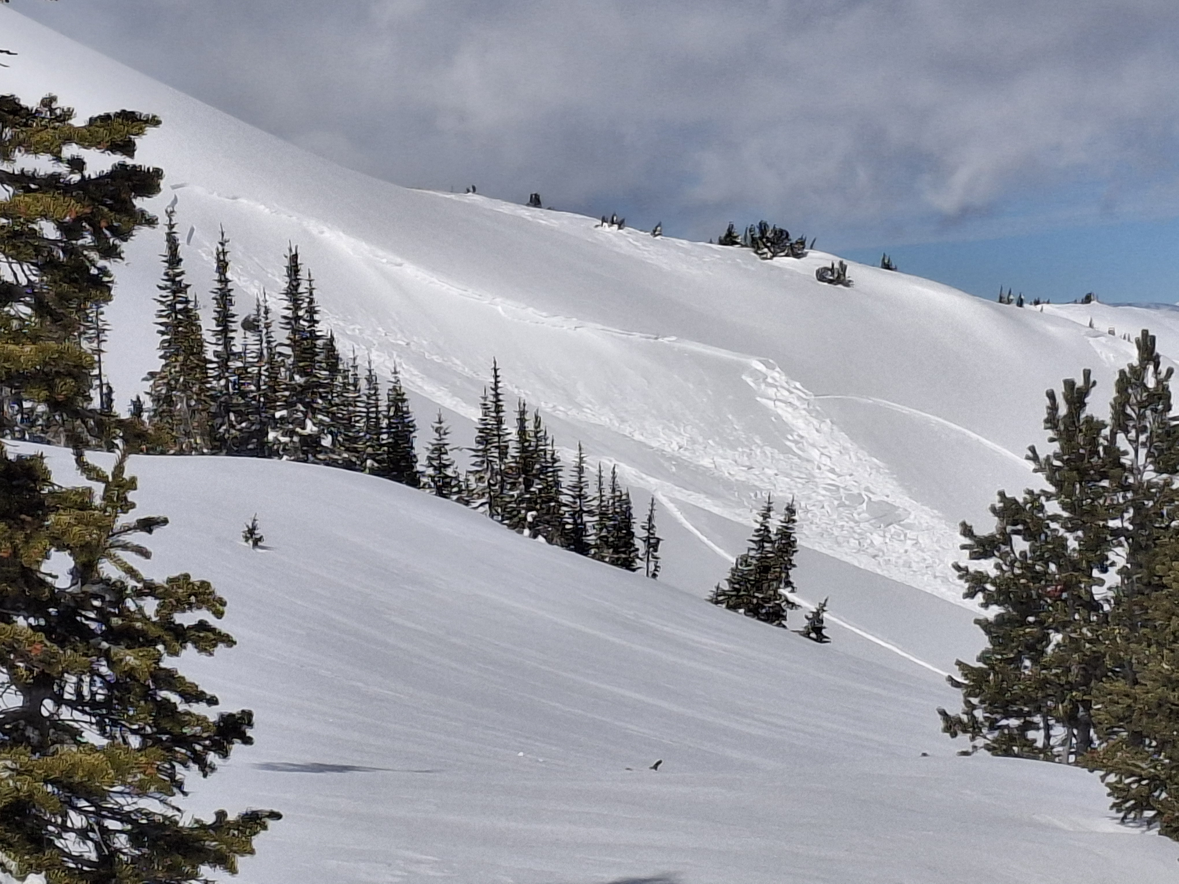
8761ft
43 NE
13 degree slope
HST 125
ECTP 12 50 down
Soft snow ski pen 30 cm
supportable pow
clear skis tell 11:20
11:20 few
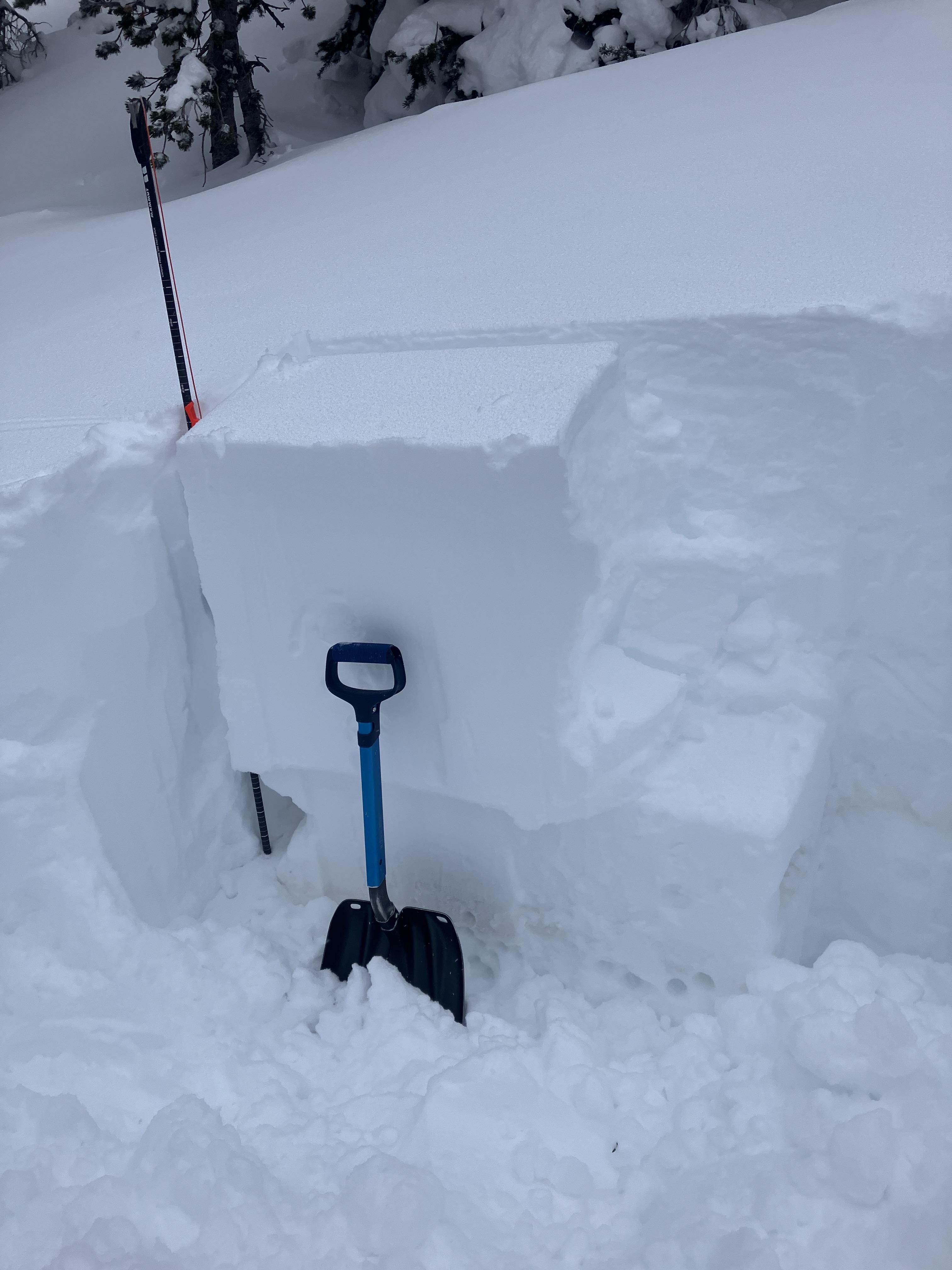
Full Snow Observation ReportWe went up Republic Creek to look at the stability of snow that has fallen over the last 2-3 weeks. Skies were overcast with light snow falling most of the day and winds were moderate with strong gusts.
We found a thin layer buried 2’ deep that showed potential to propagate and slide. We dug down 4 feet, just below the dirt layer that was deposited earlier this month. We got an ECTP30 that broke about 8" above that dirt layer. This was either on a thin layer of facets or preserved lower density dendrites.
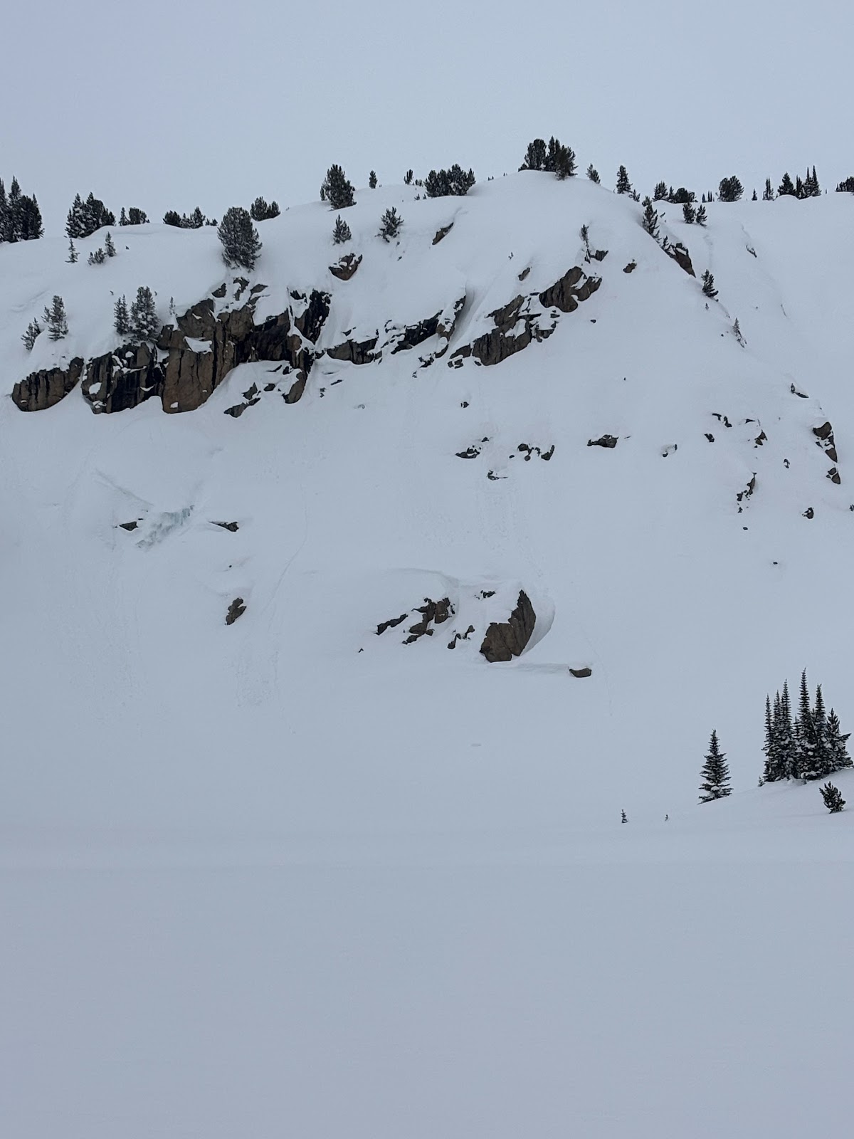
We heard of an avalanche that was triggered yesterday which broke 2’ deep and 250’ wide, possibly on this same layer, on an east facing slope by Mt. Abundance.
The wind was blowing new snow into fresh wind slabs. We were able to easily to trigger a couple wind slab avalanches on test slopes. More snow is expected tonight and tomorrow which will increase the likelihood and size of wind slab avalanches, and the added weight could cause a 2-3’ deep avalanche to break a couple hundred feet wide. Be cautious of steep slopes as new snow and wind build slabs over the next couple days.
Full Snow Observation Report

A rider triggered a slide on Saturday (2/22) on a bench below the east face of Mt. Abundance... Trigger point was from the top while driving by. 2' deep, 250' wide??
Full Snow Observation ReportToday we observed a couple day old wind slabs in steep SW facing terrain on Mt Zimmer. Also, a wet loose occurred sometime today between 11-2 pm on S facing terrain nearby
Full Snow Observation Report
Very deep snow past Round Lake today. New snow ranged from 2-4’ deep. My elbows and shouldered were touching the trenches of my sled track as I rode through Star Lake toward the wilderness boundary. New snow was very low density. No natural avalanches observed and ski cuts were non reactive on test slopes.
Full Snow Observation ReportTraveled up Republic Creek, ascending to ridge separating Wyoming and Republic Creeks. Trailbreaking was arduous, ski pen ~ 60-80cm depending on travel under canopy or in more open terrain. Did not formally evaluate HST, suffice to say it was significant. HS 260cm at 9600ft. Skies obscured all day with varying snowfall rates, S1-3. Moderate W/SW winds and PLENTY of transport. Observed a D2 natural (wind/storm slab? Hard to say from my vantage) on E aspect at ~9200ft. A member of our party intentionally triggered a 30-40cm storm slab on a small convexity in treed terrain in Wyoming Creek. No other natural or skier triggered activity observed, though visibility limited our view to the more complex terrain further up Republic. Ended the day with a Woody Ridge lap and encountered no cracking/slabbing of new snow in this zone. Snowfall was intensifying as we left the drainage around 1700.
Full Snow Observation Report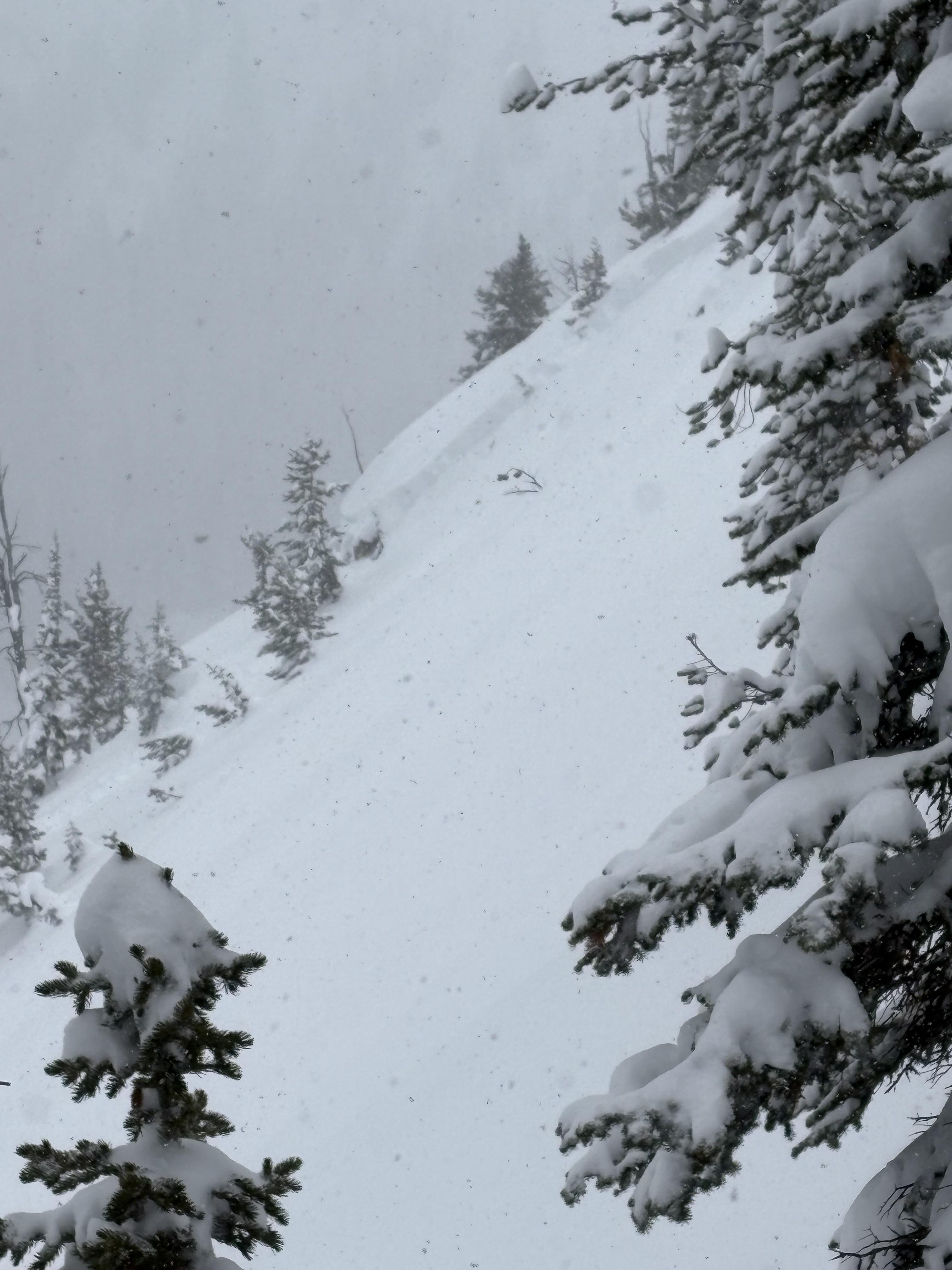
After taking a heavy landing on top of a pillow just off the highway past lolo pass road, I looked back up and could visibly see some layer distinction about 8-12” deep. This is the same weakish layer we found in our column test, where we got ect16 just below robs knob. This was on a north facing aspect.
Full Snow Observation Report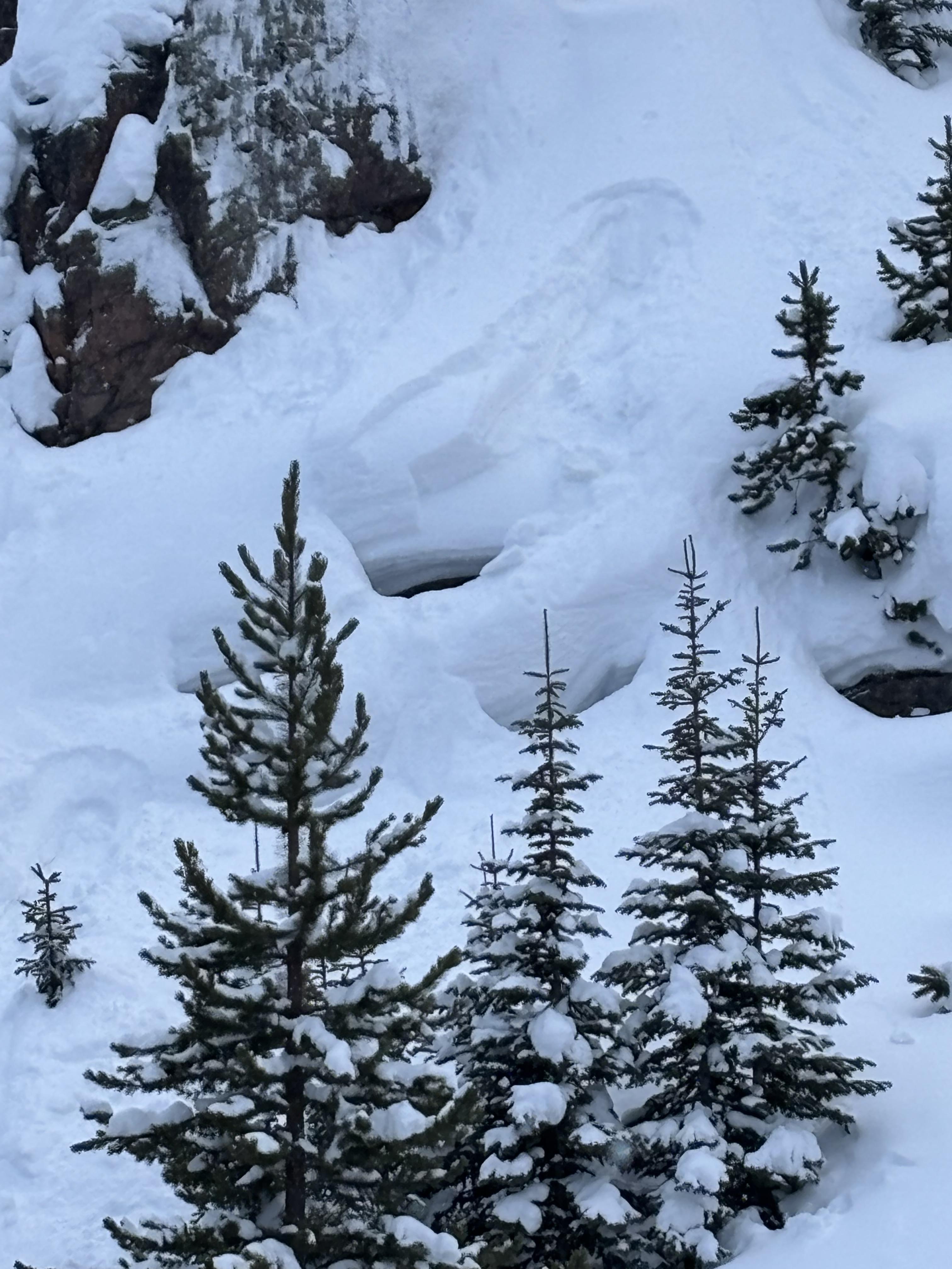
In Hayden Creek, we saw many D1-D1.5 wind slab avalanches seen on leeward slopes- east and northeast slopes at and above treeline. We observed cracking in wind loaded areas above treeline. Dug a pit and did a quick ECT on E facing terrain at 9750ft. HS 190-210. ECTN6 30cm deep. No dirt layer.
Full Snow Observation Report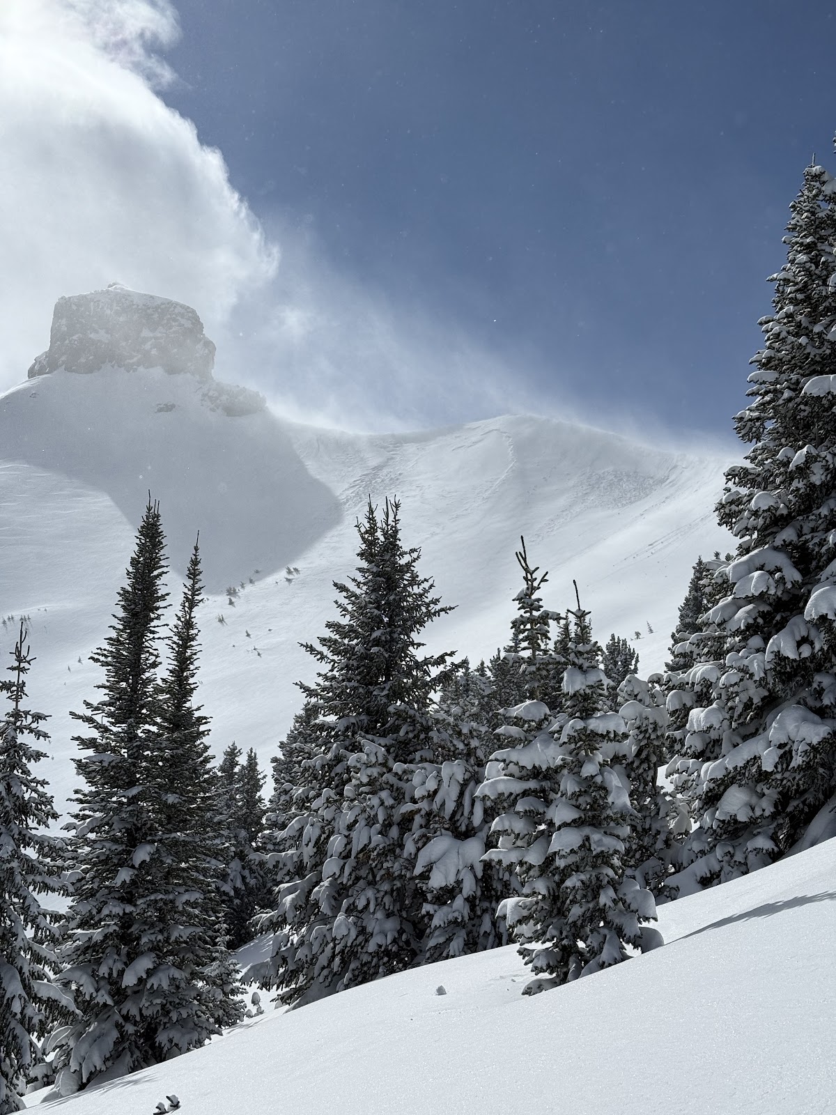
Today we saw a D1 dry loose in the Ghost Couloir. It ran 200 feet. We also felt one small collapse on a south facing slope. No other avalanches observed.
Full Snow Observation Report4-6’’ wind slabs cracking on test slopes on W aspects at upper elevations today
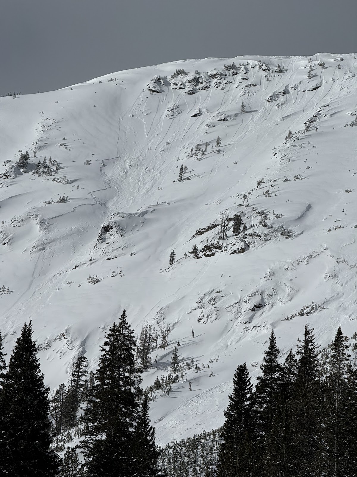
Full Snow Observation ReportRecent snowpits attached from mid elevation E, and SE aspects near Cooke City.
Of note, it appears that the Feb. 3 dust layer, perhaps has become weaker/ more faceted with the recent below 0F temps of the last 4 days. Will continue to monitor this layer of concern as the weekend storm progresses.
Full Snow Observation Report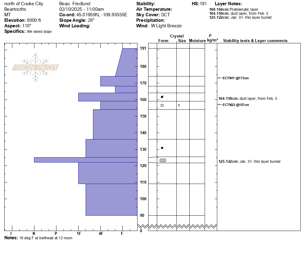

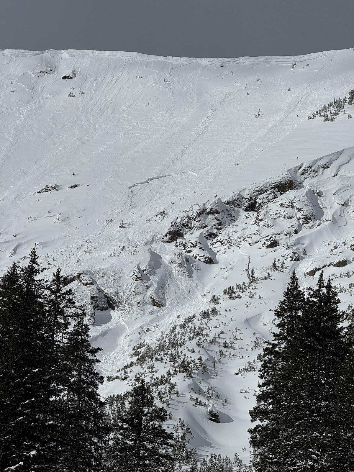
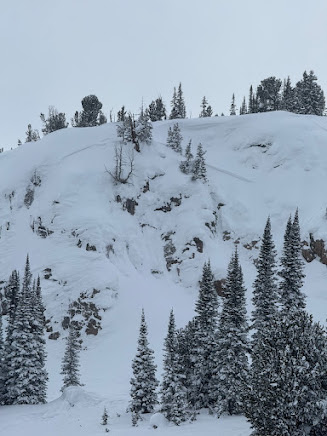
Noticed a large cornice triggered avalanche on Mineral Mtn today. Likely broke on 2/12 or early am 2/13. E aspect ran almost to the valley floor. Active Loading today with Strong Gusts from N-S. There were some other small cornice avalanches to the north of this slide that did not trigger larger avalanches.
Full Snow Observation Report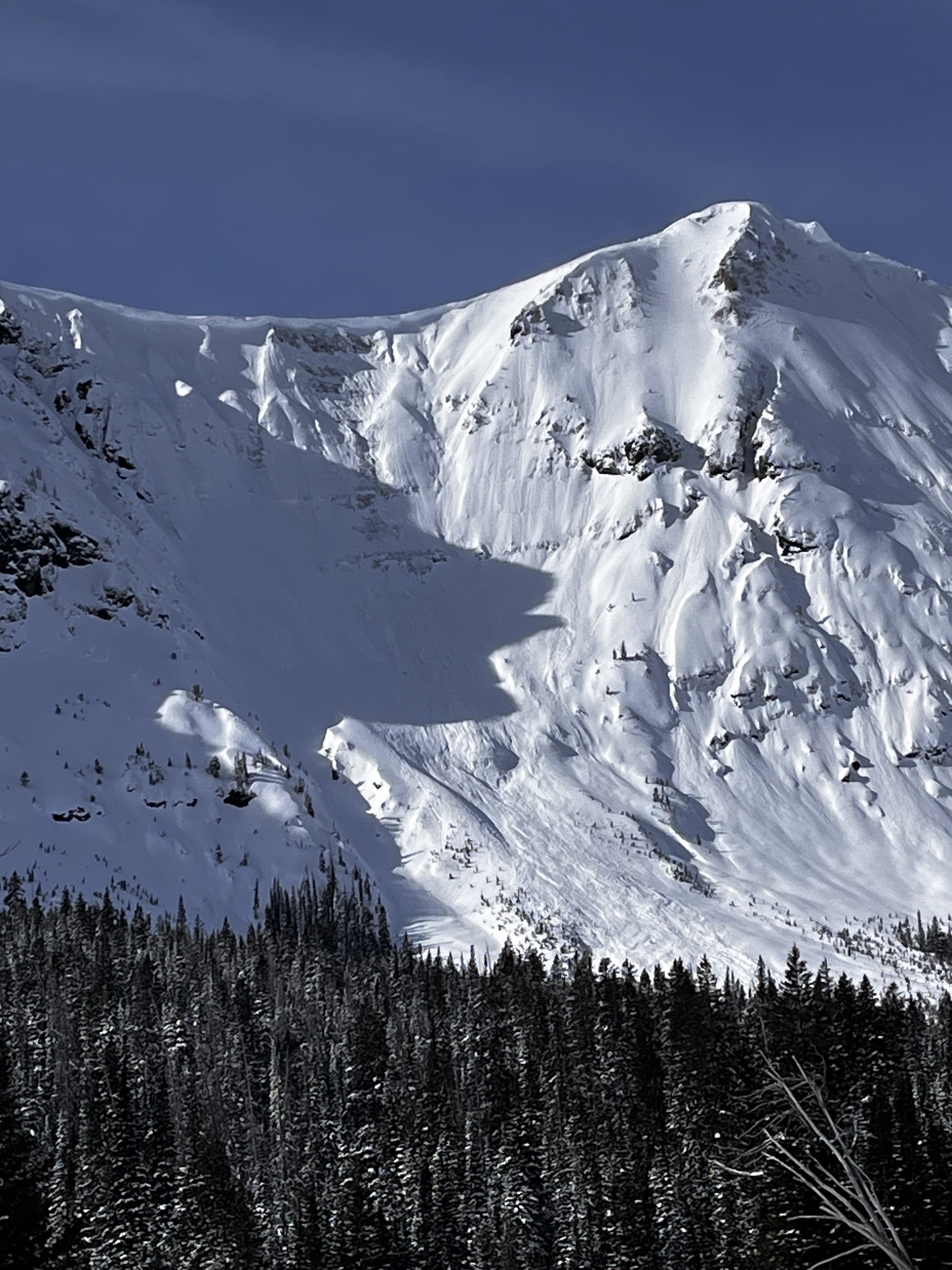
Lots of snow transport above treeline today south of Cooke City. Wind gusts were strong.
Full Snow Observation ReportDug a pit and did an ECT near the NE entrance to Yellowstone. I dug at 9500ft, W aspect, on a 29 degree slope. HS 275cm. I got an ECTP12 55cm down, right above the obvious layer of dirt. Moderate winds from the west.
Full Snow Observation ReportModerate winds today north of Cooke City. Stronger winds than forecasted and lots of snow is being transported. Couple hand pits showed planar breaks on a crust on SW aspect around 9600 ft.
Full Snow Observation ReportWent skiing south of Cooke City today near Hayden Creek. No avalanches seen and no signs of instability. Cold temps and light winds from the NW and W all day.
Full Snow Observation ReportWent skiing north of Cooke City today near Zimmer Creek. I saw a few wind slabs. Some appeared to be skier triggered, some were natural. No other avalanches seen. Moderate to strong wind from the west all day. I saw shooting cracks in obviously windloaded areas.
Full Snow Observation Report
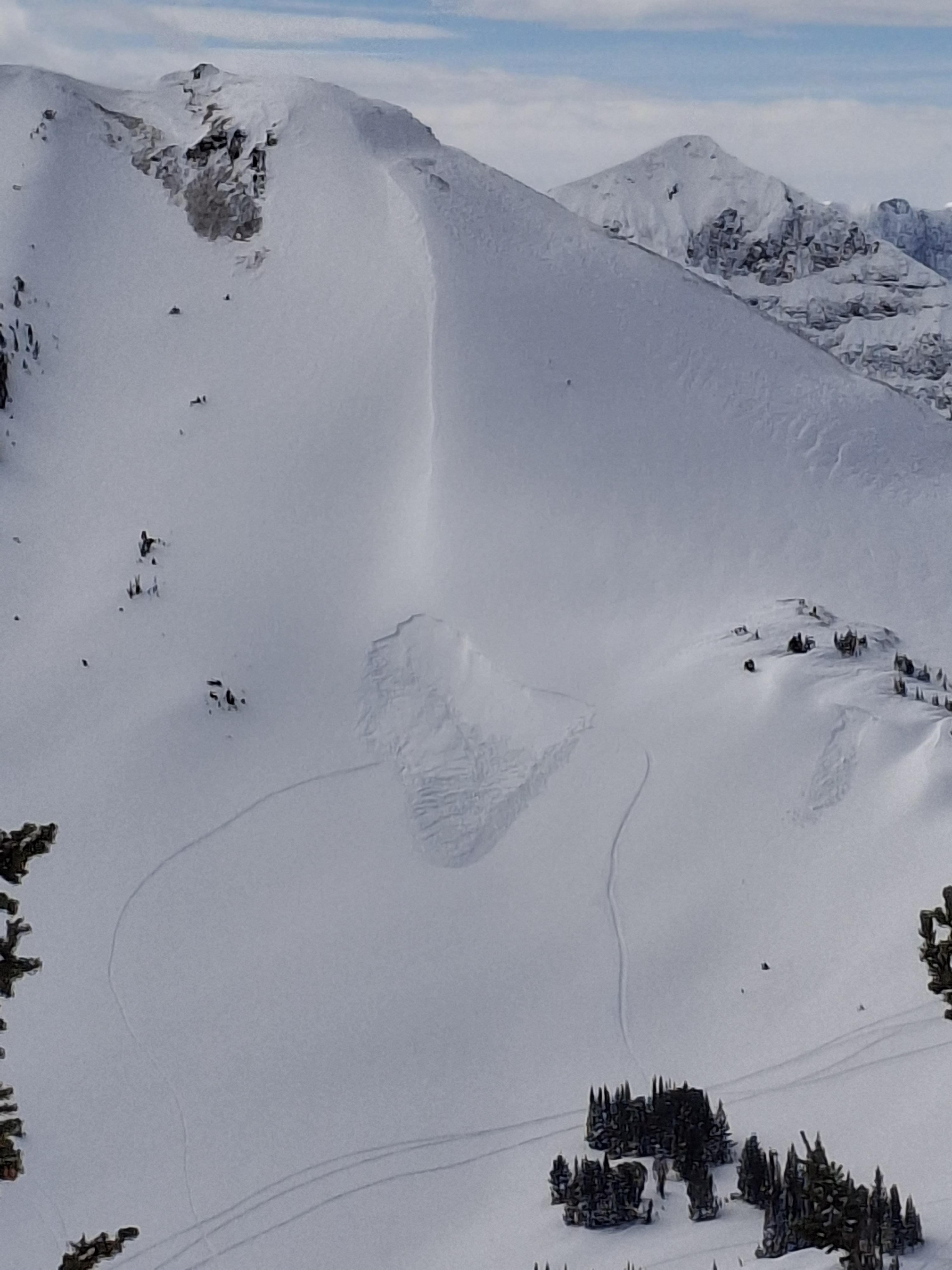
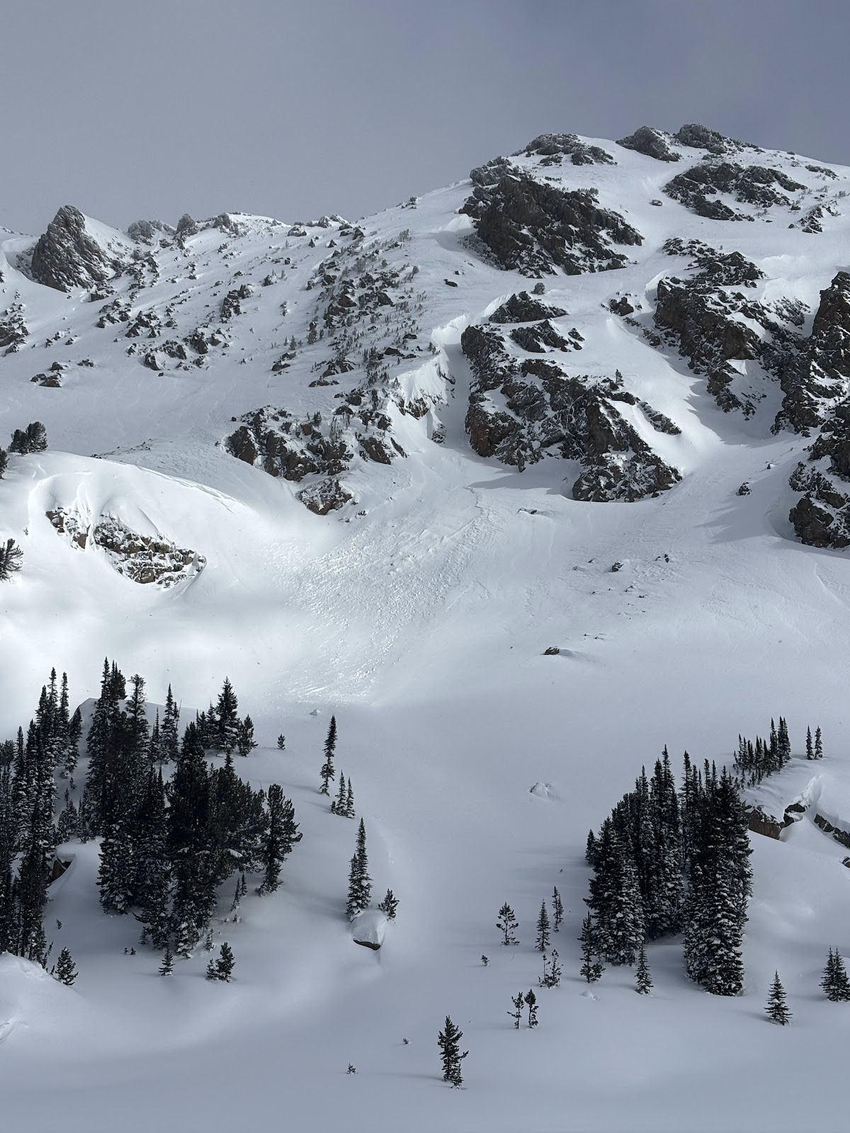
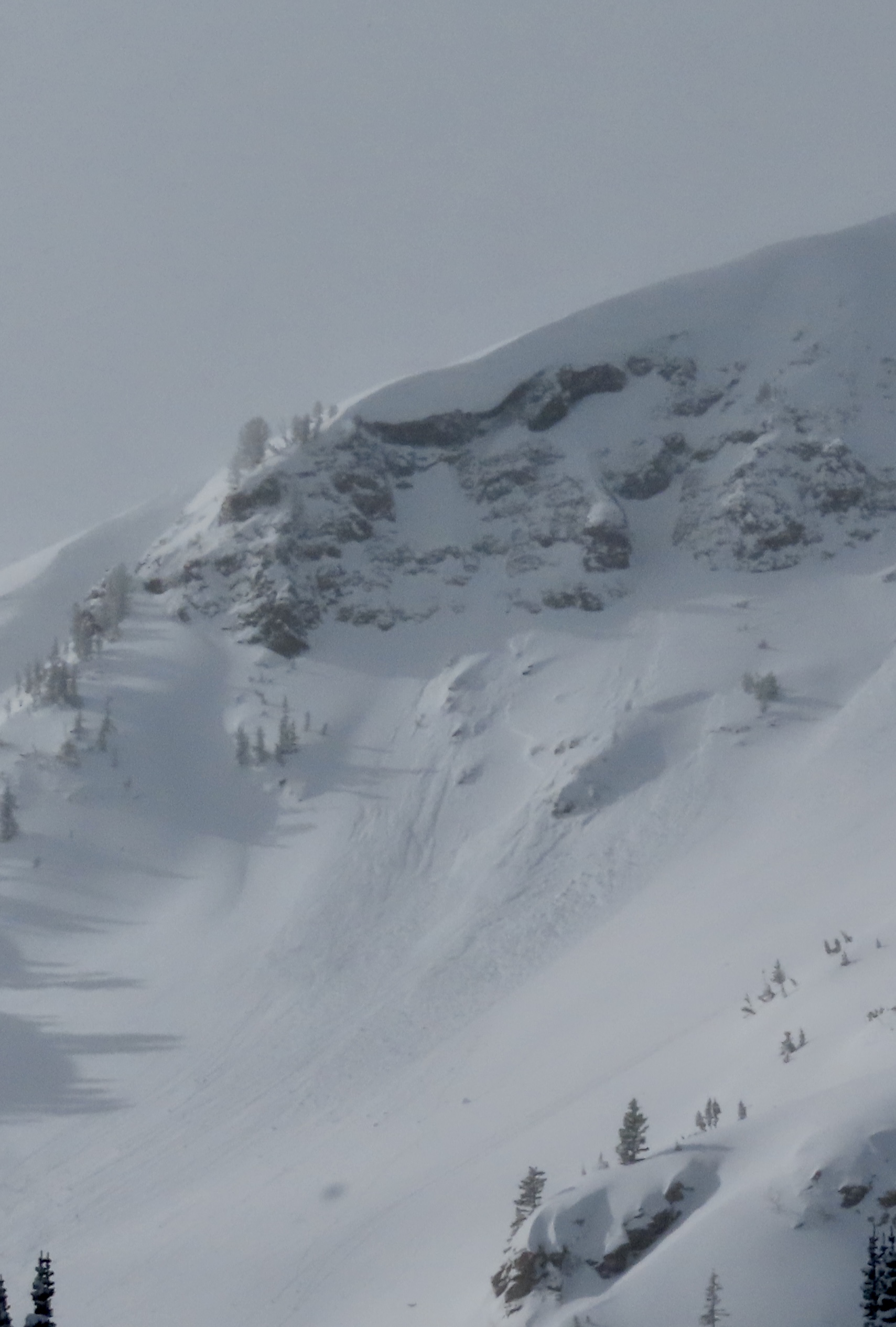
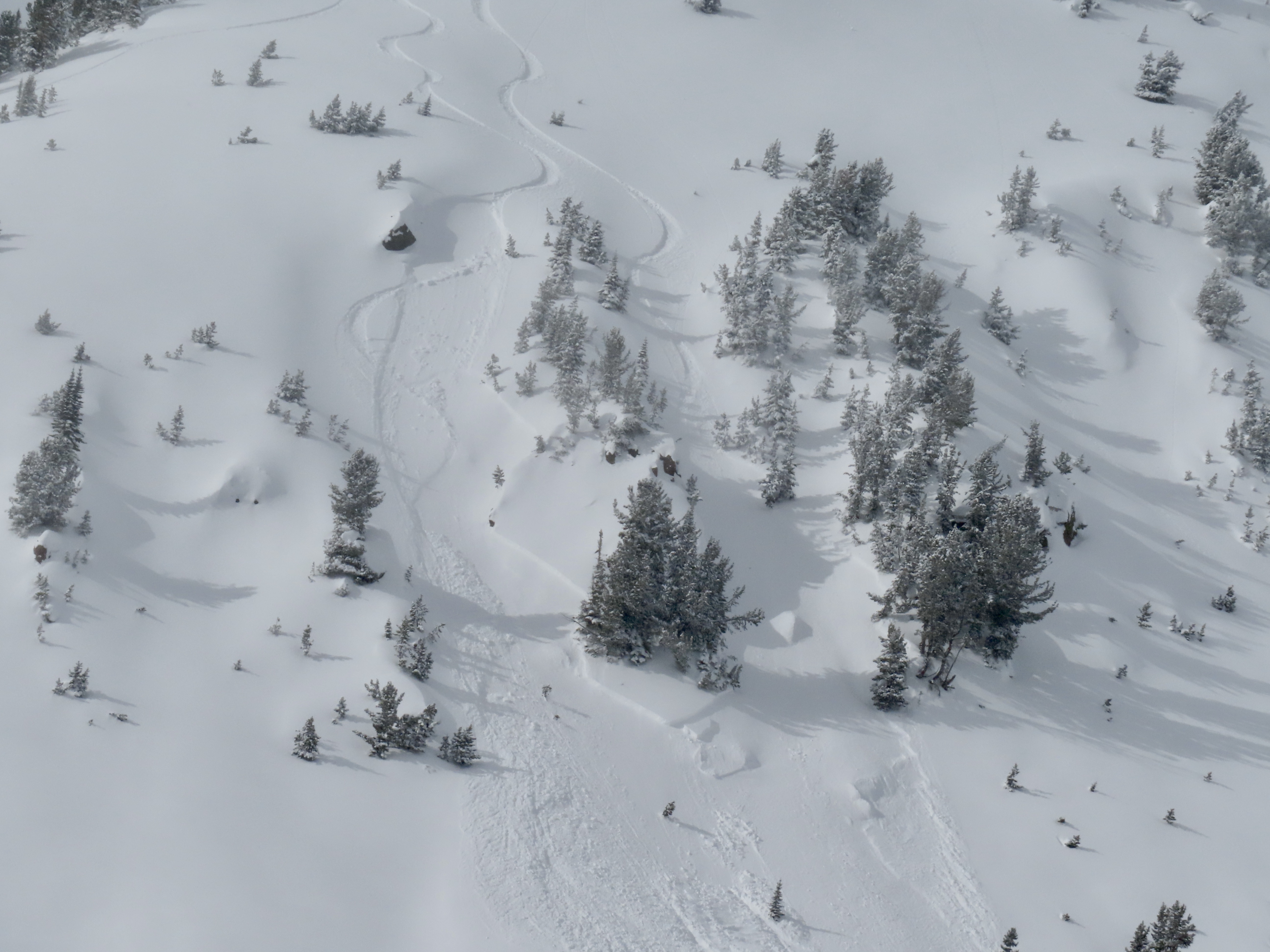
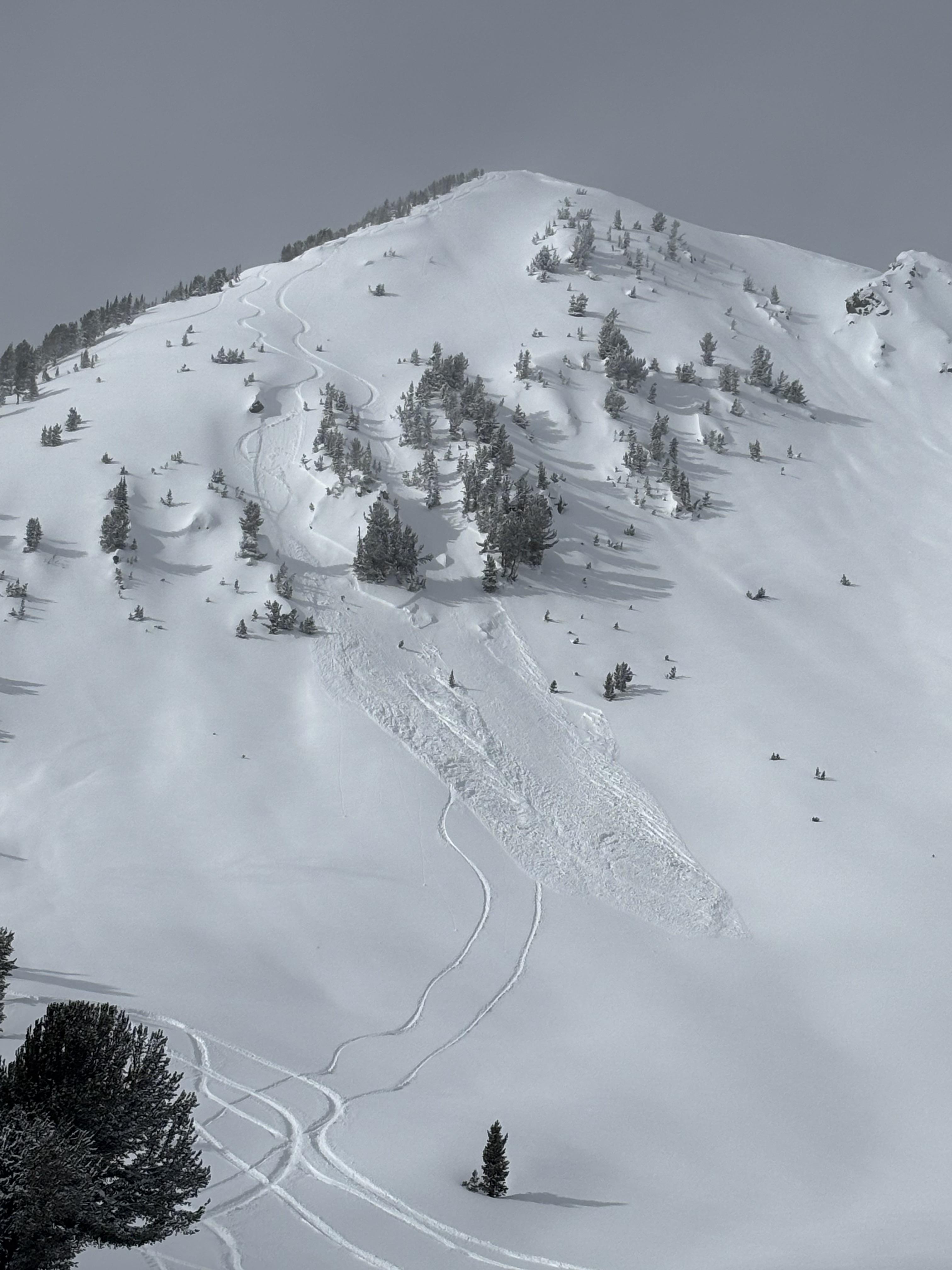
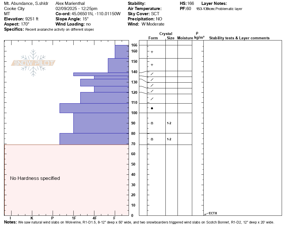
We rode over Daisy Pass out to Mt. Abundance, then behind Fisher and around Scotch Bonnet back to Lulu Road. Snowed light this morning with partly sunny skies mid-day. Wind was moderate and gusty out of the west. We were able to see most terrain north of the passes. Clouds obstructed great views of east Henderson and east Miller.
We saw a fresh natural wind slab near Wolverine, R1-D1.5 (photo attached). We watched two snowboarders trigger separate wind slabs, while riding one at a time in avalanche terrain, on the south side of Scotch Bonnet (photos attached). They rode away safely. These looked 12" deep and 20' wide, and entrained snow to run a good distance, R1-D2.
We dug a pit on the south shoulder of Mt. Abundance and had an ECTX. There were some density changes in the recent snow that might contribute to wind slabs or storm slabs breaking easier for another day or two, but they seemed more stubborn than yesterday.
Wind slab avalanches were the primary concern today, and I expect they will continue to grow tonight and with any more wind tomorrow. They will remain likely and easy to trigger for at least another day.
We have not seen any persistent slab avalanches breaking below last week's snow or deeper over the last few days. This is a good sign, but I am not ready to write off the possibility quite yet. It is worth continuing to dig and test for buried weak layers for now. The avalanche on east Henderson last Tuesday and the avalanche on Crown Butte last Monday were deep and possibly broke on persistent weak layers, and were on heavily wind loaded slopes. These types of areas are worth avoiding and where a bigger avalanche may be possible to trigger.
Full Snow Observation Report
Felt like CONSIDERABLE on wind-loaded and MODERATE otherwise.
