Snow Observations List
This wet loose avalanche is a great example of where they often occur. Rocks absorb extra heat from the sun and can quickly melt and destabilize the snow. Either move under areas like this early in the morning (as we did), or if you have to travel under them later in the day, move quickly.
Full Snow Observation Report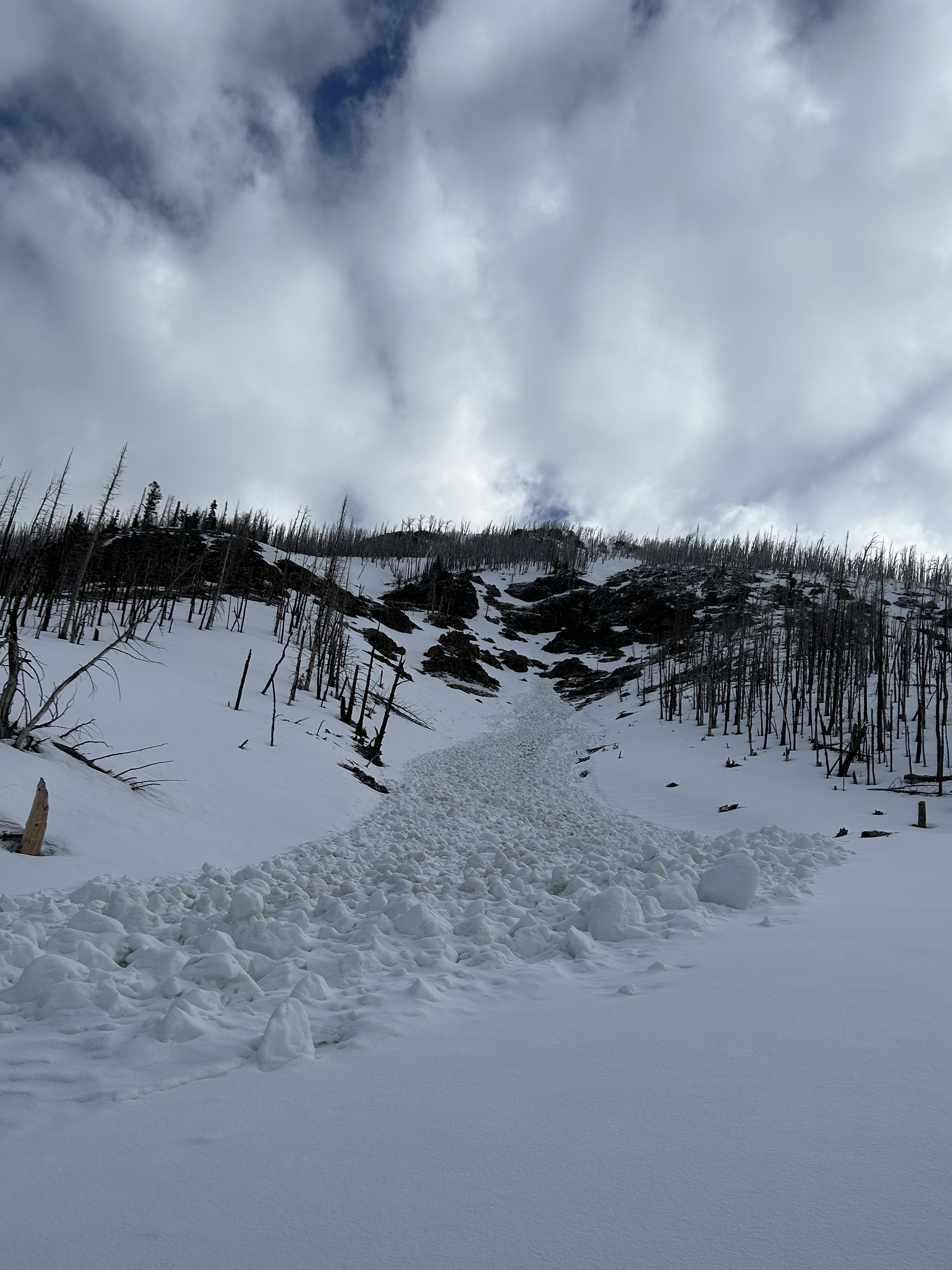
Near Cooke City on 4/19 skiers triggered a dry loose avalanche and a small wind slab avalanche. The wind slab broke in a drifted pocket near the base of cliffs, 3-6" deep x 10' wide. Northeast aspect, 10,200'.
Full Snow Observation Report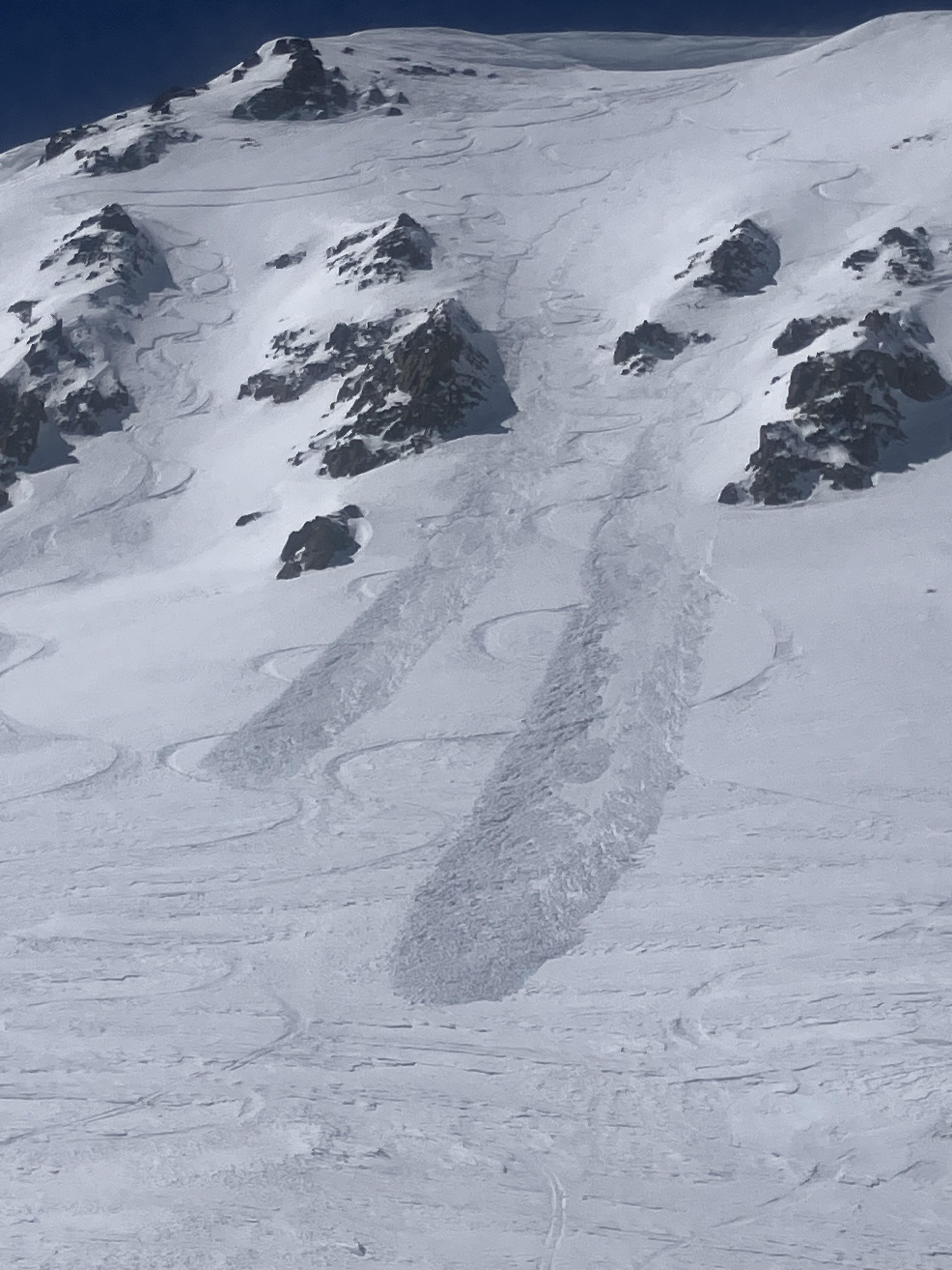
I rode the motorized zone and noticed natural wind slab avalanches running pretty far on: East Henderson, SE Scotch Bonnet, East Miller, NE Crown Butte. D1.5-2.0
Loose wet debris from yesterday were also present in many places.
Full Snow Observation ReportScreenshot of winds from Lulu Pass wind station during the storm.
Full Snow Observation Report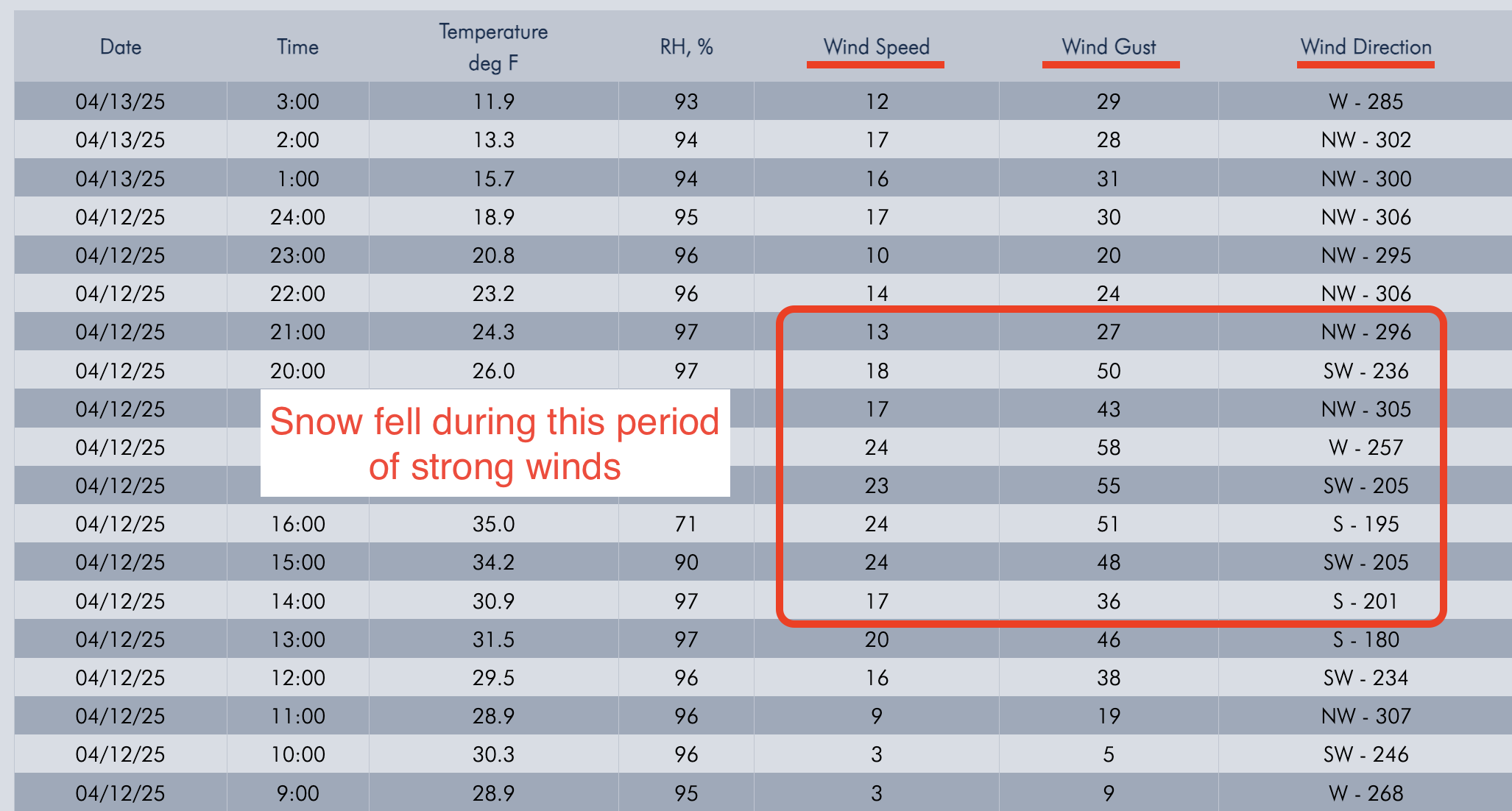
Today I was skiing in East Hayden Creek. I witnessed a cornice fall around 1230pm. Also I triggered multiple wet loose avalanches on several aspects including a north facing slope 9400 ft. None bigger than D1
Full Snow Observation Report
Roaring wind, graupal, low to no visibility. 3-5'' of mixed snow forms. Skiing was surprisingly good and wind slabs generally unreactive, but I was just on lower Fisher, right below Lulu. Picture is South East on Scotch Bonnet
Full Snow Observation Report
Today A Skier triggered a 6”x20’ wide wind slab on a N aspect at 9,800’.
Skiers triggered D1-D1.5 wet loose on SE aspect at 10,000’.
There were also natural small wet loose slides today and yesterday. Long running, but narrow, in steep terrain. Typically initiated near rock outcrops.
Today was hotter than yesterday and the top of the snowpack got pretty wet before clouds built in the afternoon. Snow stayed dry on due north up high.
Full Snow Observation Report
Busy weekend in Cooke. A lot of sled and ski tracks in all types of terrain. Avalanches were minimal. Small wet loose or wind slabs involving top 1”-8”. We skied in and around a lot of avalanche terrain.
While touring south of town today, we observed two D1 wet loose avalanches on an east aspect at 10000’. Both occurred at 11am and were triggered by a small cornice fall due to rapid warming.
Full Snow Observation ReportWe skied near Henderson Mtn. and Lulu Pass. Skies were clear with a light breeze near the ridgelines. Temperatures stayed below or just barely above freezing.
We saw a couple 3-6" deep natural wind slab avalanches and a few dry loose slides that looked to have happened within the last 24 hours. On southerly slopes below 9,000' there were some wet loose slides from yesterday afternoon.
Wind slabs were still reactive today. We triggered 3 small, 3-8" deep x 5-15' wide, hard wind (1F+) slabs on convex test slopes well below the main ridgelines. 9,800', NE aspects. Also triggered one softer (4F) wind slab just below the high ridgeline, 10,200', NE aspect. 10-15' wide x 6-8" deep.
Snow stayed dry on northerly/shady slopes. Any sunny slopes got moist and had a crust formed by late this afternoon. We did not notice any fresh wet loose slides or roller balls on southerly slopes above 9,000'.
Stay alert for unstable drifts of snow, wind slabs formed last week are still breaking. Anticipate wet snow hazards to increase in size and distribution as the days get hotter this week.
Full Snow Observation Report


Wind slab near Cooke City from yesterday. Intentionally triggered. North aspect, 10,100'. 1' deep, 20' wide.
Full Snow Observation Report
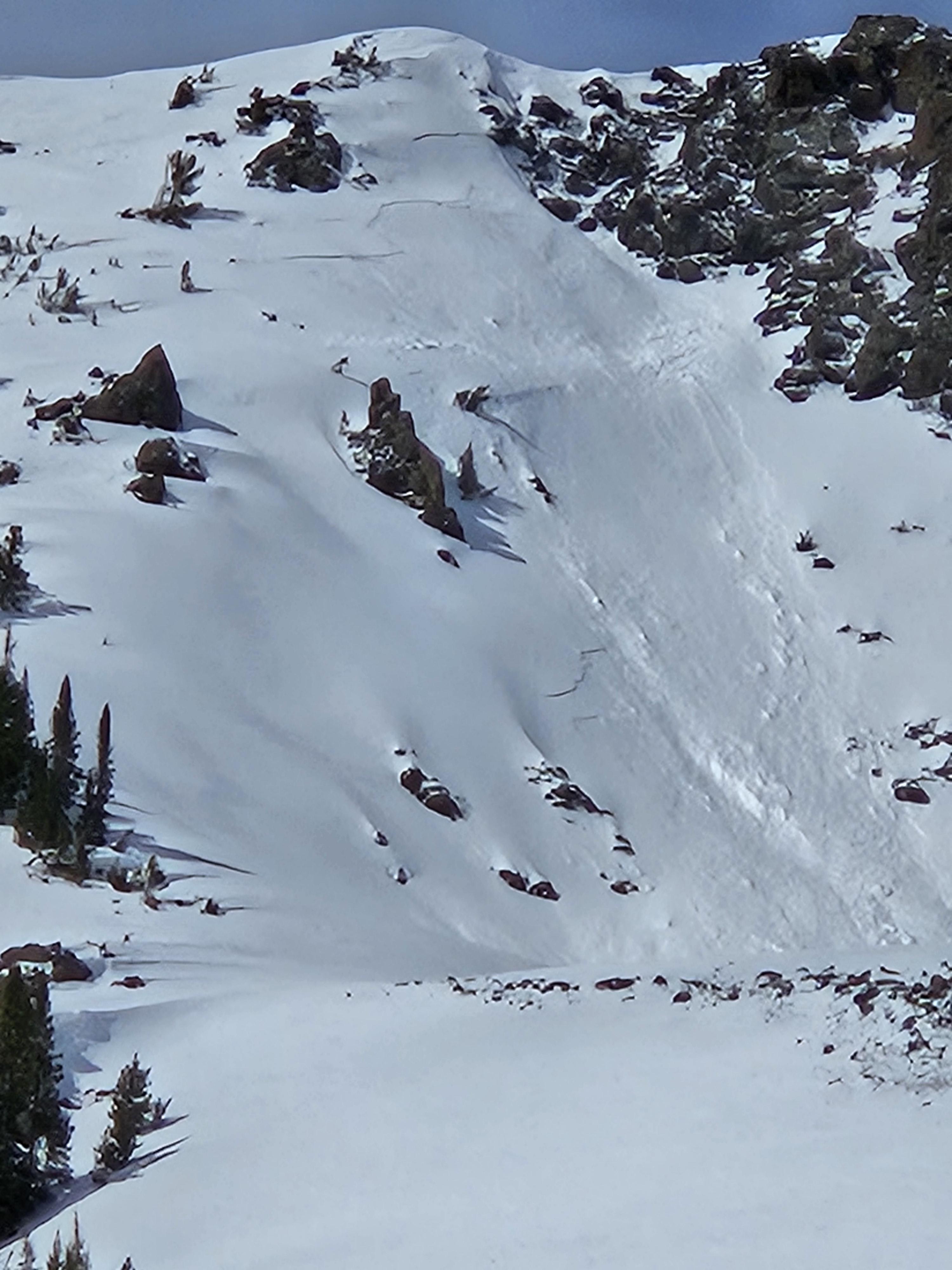
Ice Cream Scoop on Skiers Left Side in Gully, North Aspect, 9280'
SS-ASu-R1-D1-S
One of the few spots on the gully where there are no trees as a wind block on the skiers left (south) side. Noticed a few cornices on south side of gully where it is exposed to W/SW/S winds. Skier took a left turn under cornices to scrub speed and released a 6-10" windslab 40' wide which ran 10' at most. Super soft and easy to ski through.
Full Snow Observation Report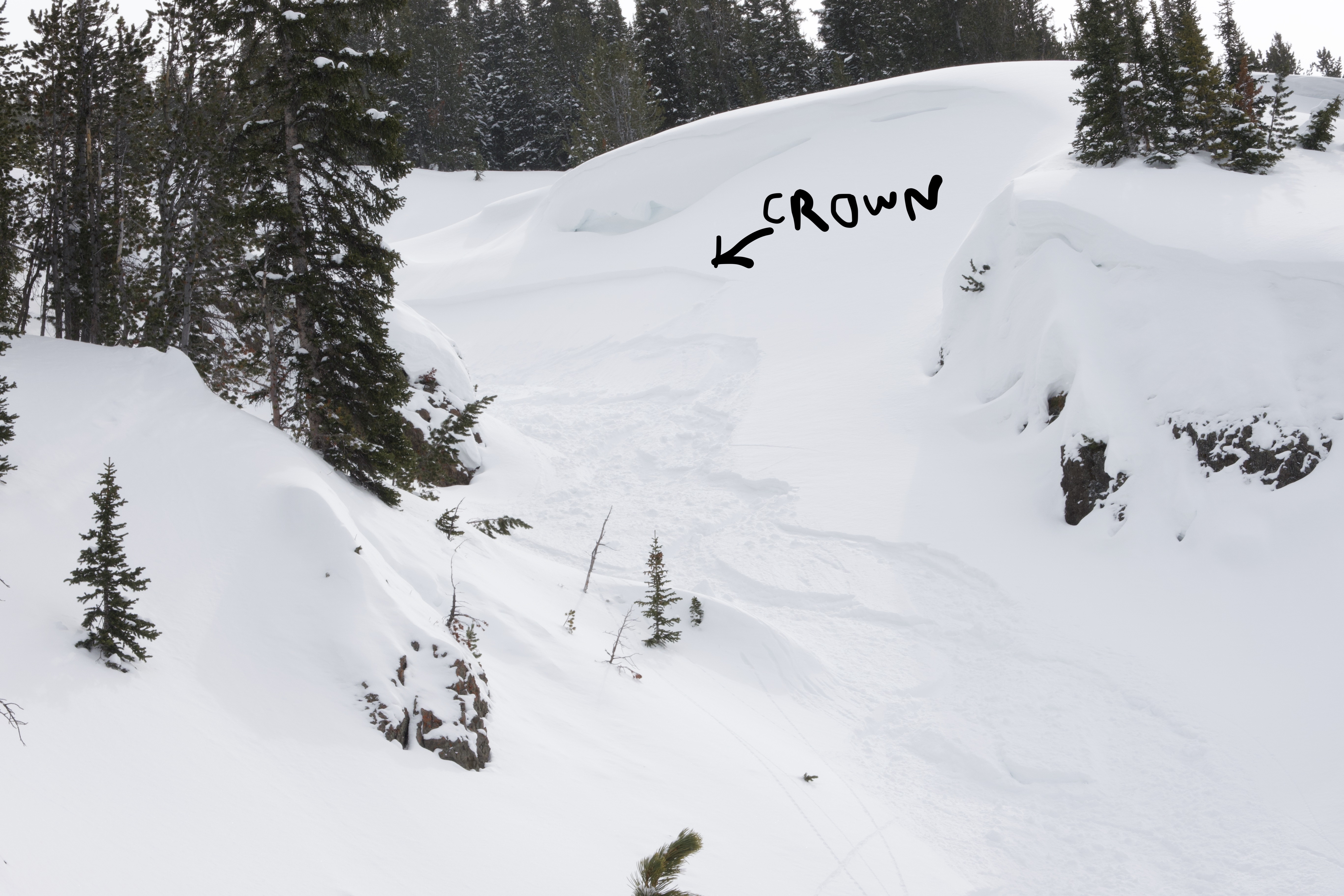
From email: "Ski touring near Cooke City today we intentionally triggered a storm slab/ wind slab on a steep north aspect around 9600'. It was about 6" deep, and 30' wide."
Full Snow Observation Report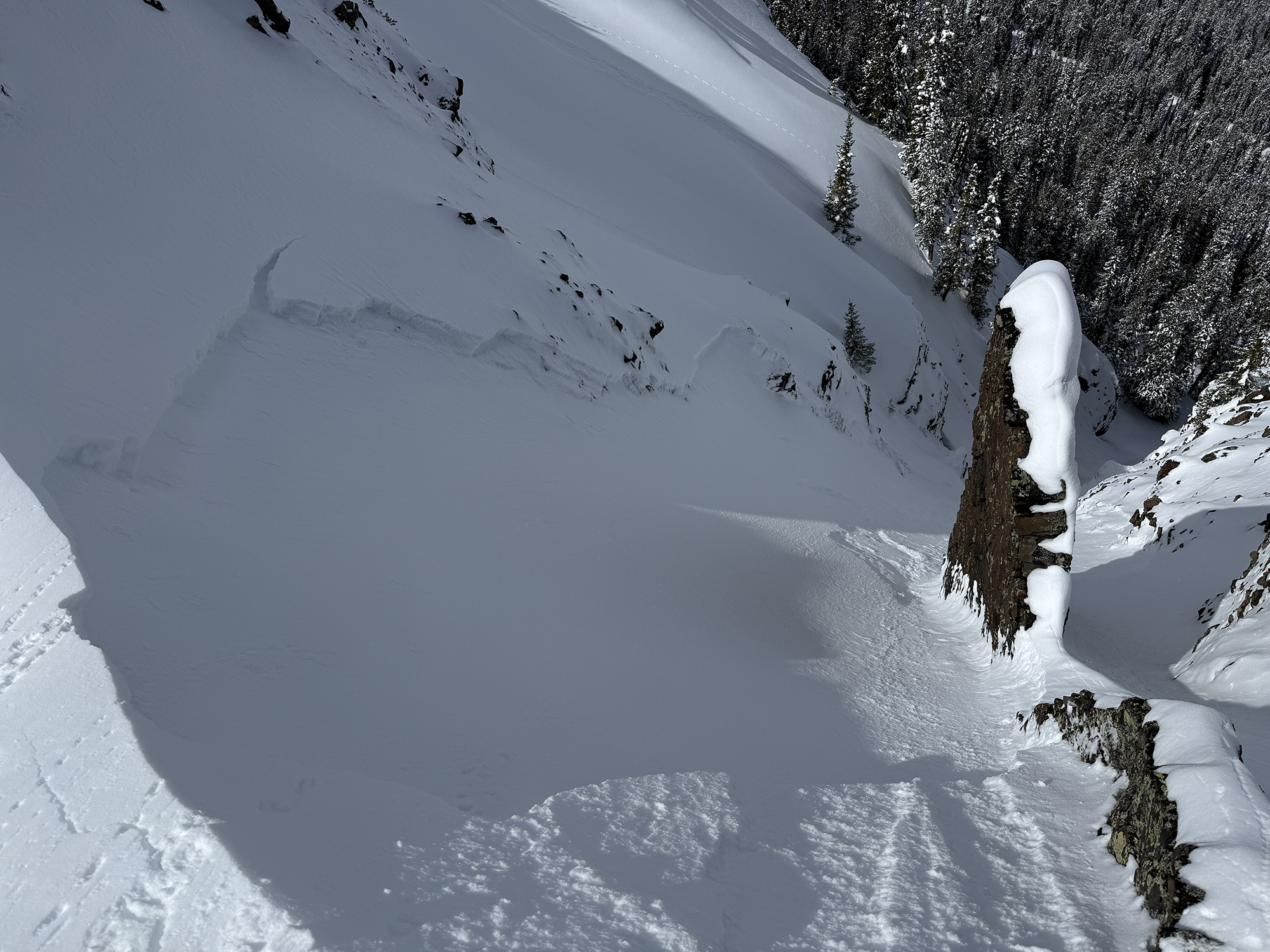
Shooting cracks in wind drifted snow on the northwest side of Miller Ridge, and wet loose slides on the southeast side. Very variable out there.
Full Snow Observation ReportToday we noticed these natural small wind slabs on Mt Henderson.
We also observed active wet loose in Zimmer Creek today on rocky terrain.
Full Snow Observation Report
Today, Dave and I did the full mechanized boundary tour north of Cooke City. We rode up and over Daisy Pass towards Wolverine Pass and Mount Abundance, up Lulu Pass, to the Goose Lake boundary, and back out through Round Lake.
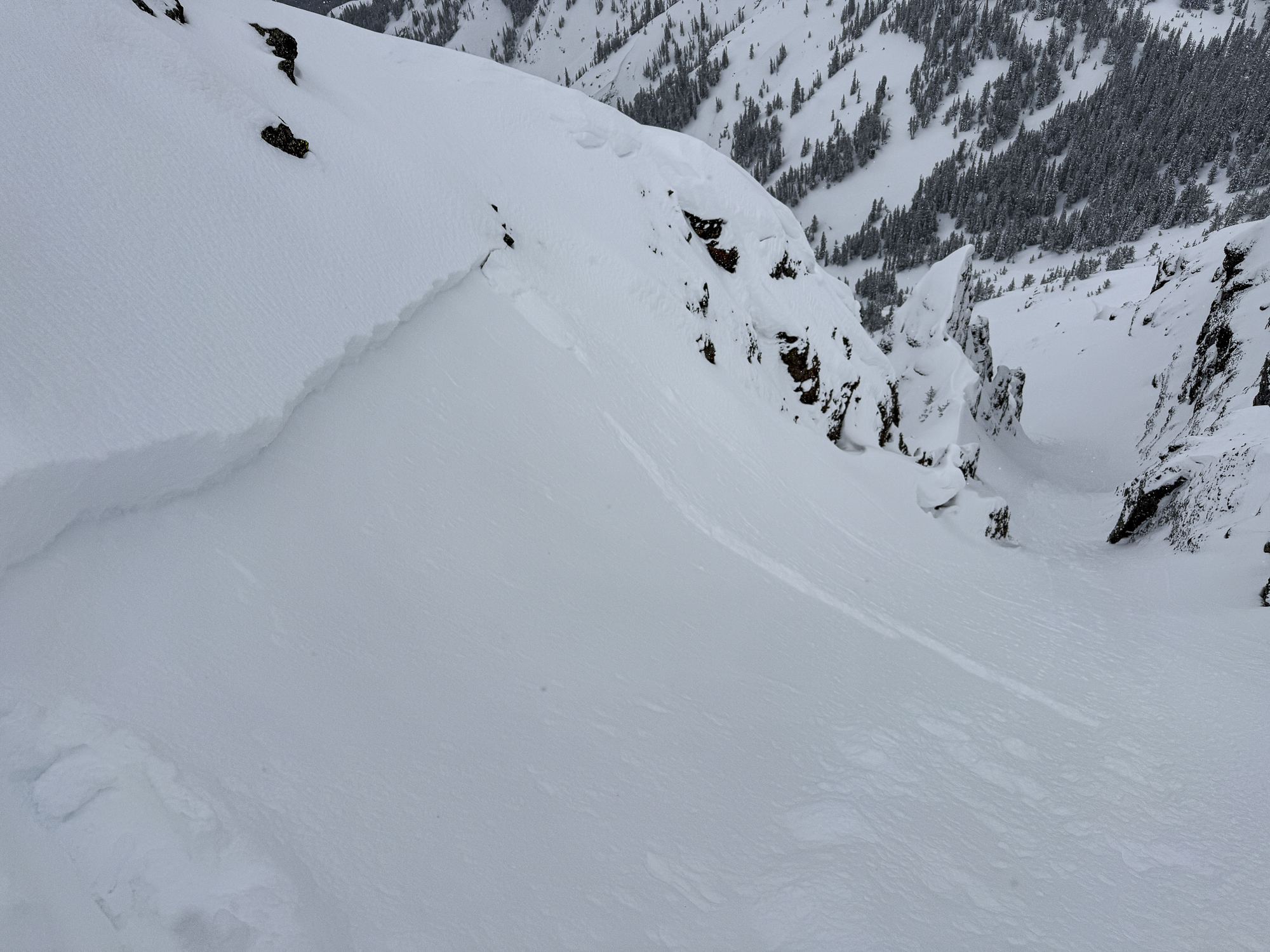
In thirty miles of riding, we noted one avalanche on the Fin that likely occurred yesterday or early this morning from a wind slab or cornice fall. That being said, low cloud cover obscured views and the light was relatively flat all day. What was visible were strong winds transporting snow, especially at high elevations. We chose to stay out of steep upper elevation bowls that are regularly wind loaded and out from under corniced ridgelines.
As we rode, we dug a few snowpits looking for the weak layer that we found yesterday buried about 2 feet deep. While we were able to find this layer, we only got propagation in one of three tests (ECTP 26, E aspect, 9070').
Throughout the day, the snow surface became denser and denser. The little precipitation that fell was noticeably rimed and when we rode back into Cooke City around 1pm it was nearly 40 degrees in town. Driving out of Cooke and into the Lamar Valley, we saw a good number of wet loose avalanches breaking in steep, cliffy terrain just south of the road.
Looking ahead, we are preparing for a sudden shift in the weather with above-freezing temperatures into the alpine and direct sunshine. We are keeping an eye on wind slab avalanches at upper elevations, but will start to shift our focus towards the potential for wet snow avalanche problems in the coming days.
Full Snow Observation Report


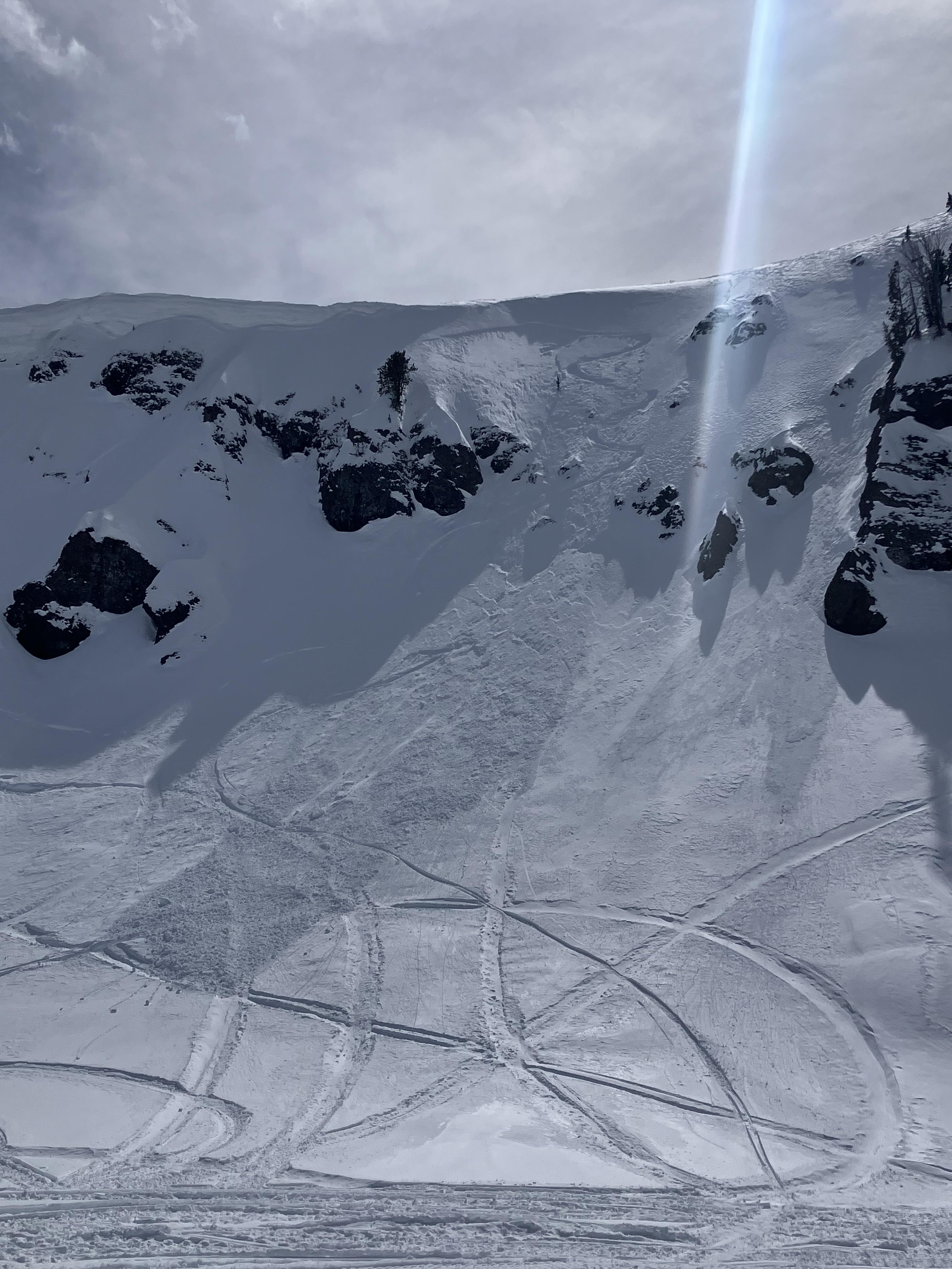
Fin had a slide on it today. I was too cloudy to tell if it was released naturally or not.
Full Snow Observation Report
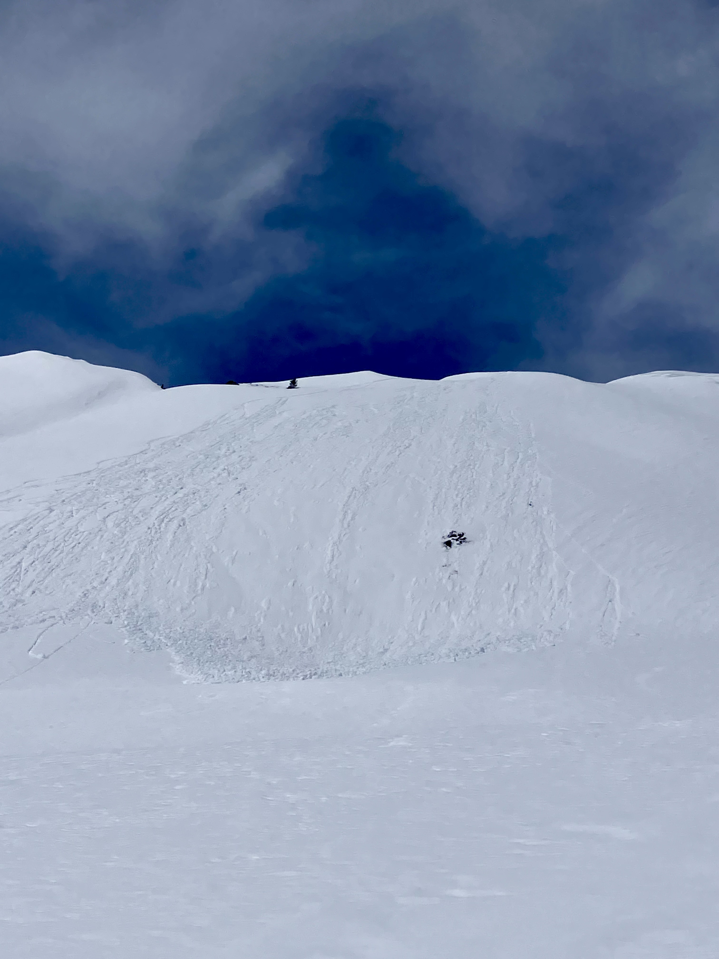
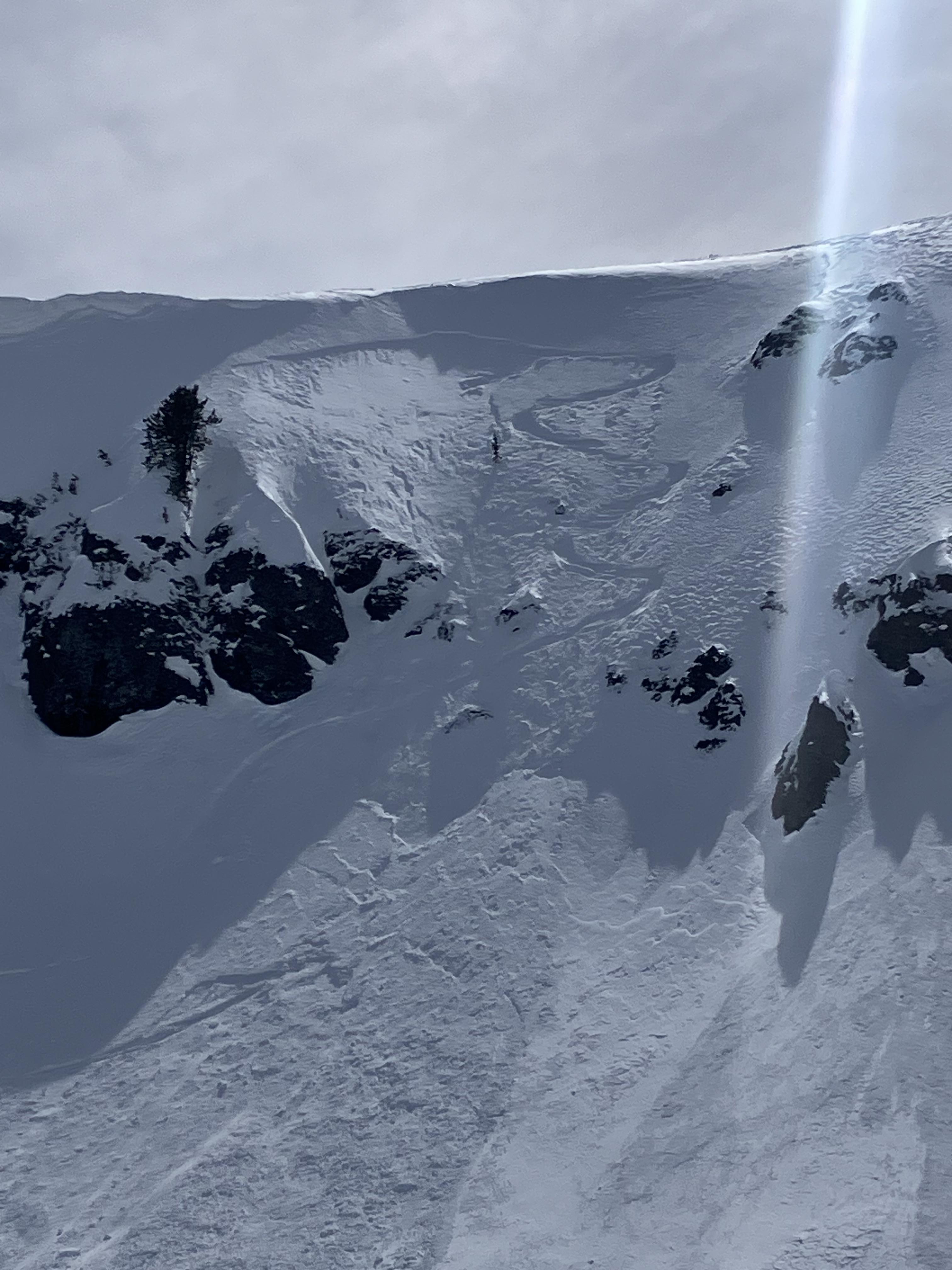
Photo of a recent natural avalanche north of Cooke City, observed today. A S, SE aspect in Sheep Creek at about 9000'. Seems like it likely occurred yesterday.
Estimated to be about 2' deep at 250' wide.
Full Snow Observation Report

We rode up to the east Henderson Bench and back around to Scotch Bonnet and the Rasta Chutes. There was 5" of low-density new snow throughout the day and strong winds were actively drifting snow. Instability in the upper few inches was evident, with shooting cracks and small avalanches on steep drifts. In terrain unaffected by the wind, loose snow avalanches in the top few inches slid easily.
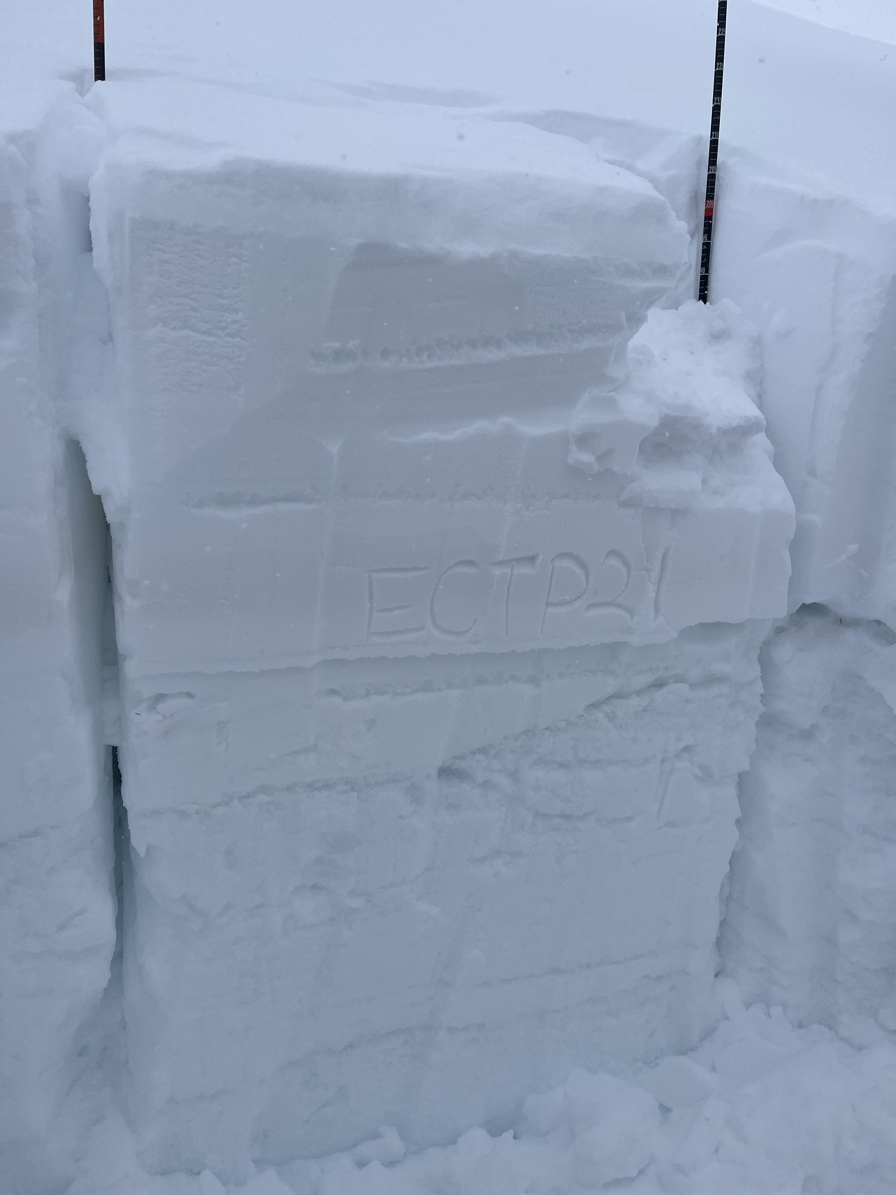
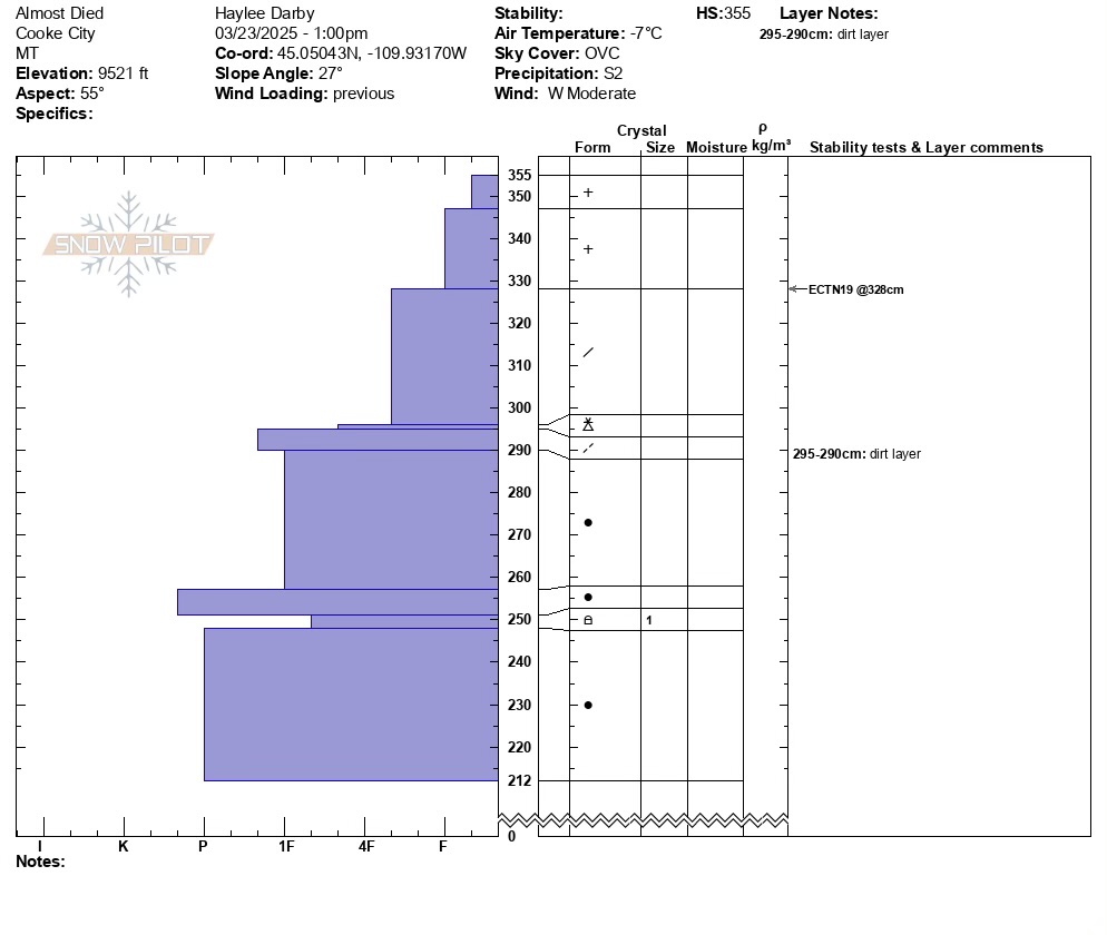
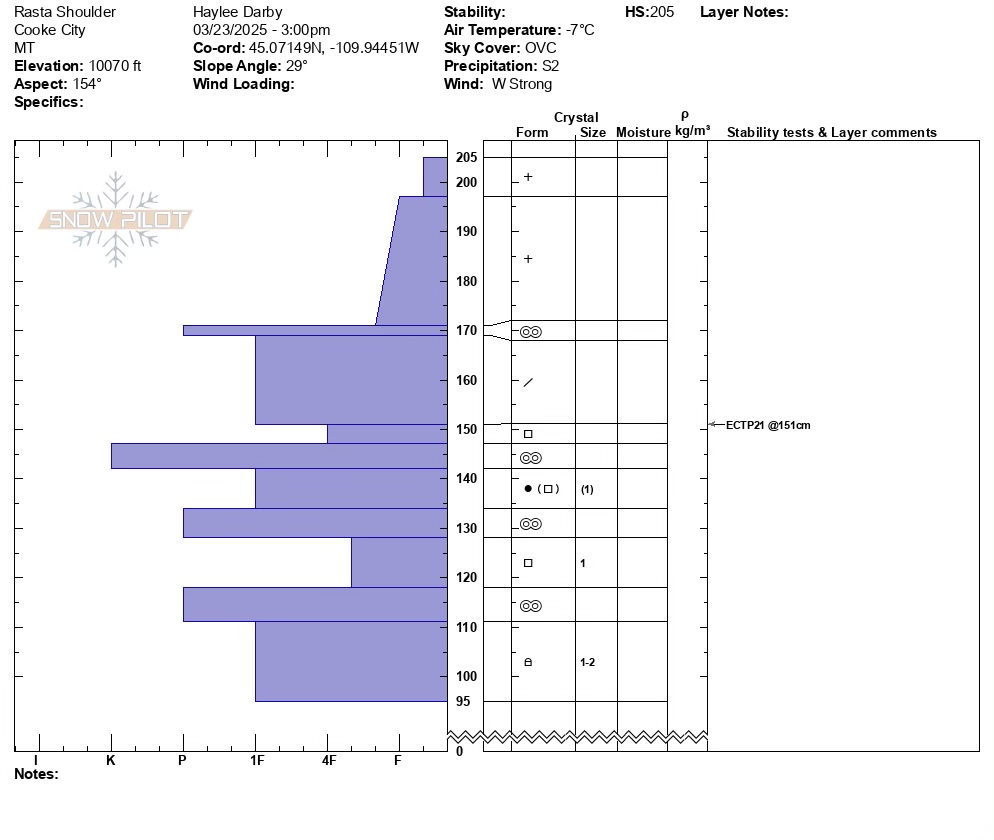
We dug on a northeast-facing slope ("Almost Died"), and two on southeast-facing slopes at two elevations in the Rasta Chutes. There was a recently buried weak layer 20-30 inches deep in all the pits that failed and propagated in two out of three--both the SE Rasta Pits (ECTP21 & ECTP25). I don't think we'll see a widespread avalanche cycle on this layer, but it is worth digging for and assessing before considering steep terrain. We saw Beau Fredlund at dinner and he came across an avalanche in Sheep Creek that broke 2-3 feet deep and 300 feet wide. I suspect it was this layer; however, the slope that avalanched was different in that it was a thin snowpack with some grass poking out. Our pits were 250-350cm DEEP!
The bottom line:
- Significant amounts of recent snow and strong wind this afternoon, and more snow forecast for tonight. Avalanches on wind-loaded slopes are likely to very likely. Currently, I would avoid all the big, heavily wind-loaded terrain in Cooke City. This is were you'll trigger a slide and it has the potential to break a few feet deep.
- Dig down three feet to test for instability before skiing or riding steeper non-wind-loaded terrain.
Full Snow Observation Report
Unless it becomes calm overnight and stops snowing, the danger should rise to at least CONSIDERABLE/MODERATE. If the snow really stacks up, a HIGH/ CONSIDERABLE split would be reasonable.

We got an ECTP18 result on a north aspect at 8600’ in the absarokas. It propagated on a small layer of facets 30cm down. We did not get any collapsing nor see signs of naturals or other activity on this layer, but we stuck to non-wind loaded slopes in the trees.
Full Snow Observation Report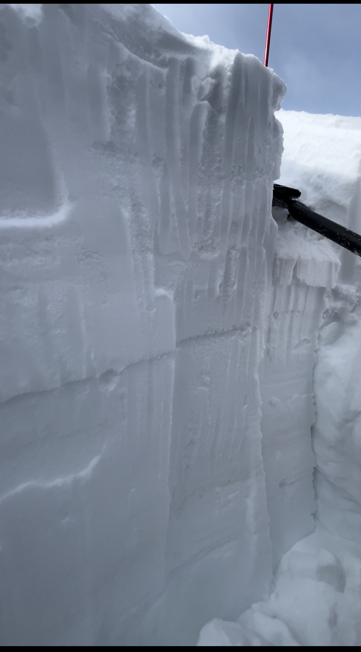
Skied south of Cooke today. Got an ECTP28 down 80cm on small facets above a MF crust that was buried on March 14. West aspect at 9500'. While filling in the snowpit I got a large collapse. This is the same layer we were getting ECTP results on earlier this week north of town.
Full Snow Observation Report