Photos
|
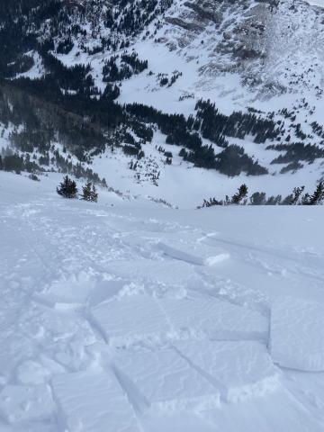
Northern Gallatin, 2025-02-13 Triggered a small wind slab avalanche on the east face of mt Blackmore today at 9850 ft elevation. Around 5 inches thick, ~ 20 ft wide, and ran for 100 ft. Photo: I Masi Link to Avalanche Details |
|
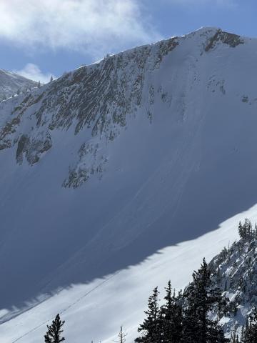
Bridger Range, 2025-02-13 On a cold day we rode to Frazier Basin and quickly answered the question, “Are wind slab avalanches still possible or have they stabilized?” We saw a natural avalanche (R2, D1.5) that released on a steep headwall just to the south (I believe I’ve heard this referred to as October Bowl). Photo: GNFAC Link to Avalanche Details |
|
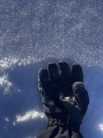
Northern Gallatin, 2025-02-12 Cold temps and sunny days starting to create some surface hoar forming seen on the primary ridge of big Ellis. Surface hoar was less widely distributed on the primary ski zone but was present all along the top of the ridge. Photo: K Gordon |
|
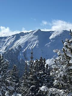
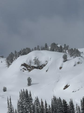
Cooke City, 2025-02-11 Saw what looked to be a small wind slab or cornice fall on South Siren in Republic Creek. SE facing, 10100 ft. Photo: BPG Link to Avalanche Details |
|
Cooke City, 2025-02-10 Saw a few wind slabs. Some appeared to be skier triggered, some were natural. Photo: BPG Link to Avalanche Details |

|
Cooke City, 2025-02-10 Saw a few wind slabs. Some appeared to be skier triggered, some were natural. Photo: BPG Link to Avalanche Details |

|
Out of Advisory Area, 2025-02-10 From FB message: "Two snowmobiler triggered avalanches in Southern Madison. Riders did not have beacons or rescue equipment. Riders made it out safe luckily." Link to Avalanche Details |

|
Out of Advisory Area, 2025-02-10 From FB message: "Two snowmobiler triggered avalanches in Gravelly Range. Riders did not have beacons or rescue equipment. Riders made it out safe luckily." Link to Avalanche Details |

|
Lionhead Range, 2025-02-10 From obs: "We saw this today after it happened. Looked like a snowmobile triggered it. I believe it is mostly south facing." Photo: D. Haluptzok Link to Avalanche Details |

|
Cooke City, 2025-02-10 On Feb 9 we watched two snowboarders trigger separate wind slabs, while riding one at a time in avalanche terrain, on the south side of Scotch Bonnet. Photo: J. Mancey Link to Avalanche Details |

|
Cooke City, 2025-02-10 On Feb 9 we watched two snowboarders trigger separate wind slabs, while riding one at a time in avalanche terrain, on the south side of Scotch Bonnet. Photo: GNFAC Link to Avalanche Details |

|
Cooke City, 2025-02-10 On Feb 9 we saw a fresh natural wind slab near Wolverine, R1-D1.5. Photo: GNFAC Link to Avalanche Details |

|
Lionhead Range, 2025-02-09 We saw two recent shallow wind slab avalanches. No recent slides breaking deeper. |

|
Cooke City, 2025-02-08 Saw this small soft slab above Round Lake today. SE facing, 9500 ft. Likely skier triggered, there were lots of ski tracks on that hill. Photo: J Mundt Link to Avalanche Details |

|
Northern Gallatin, 2025-02-08 I went skate skiing up Sourdough Canyon today. The trail intersects many south and southwest-facing avalanche terrains that generally do not have much snow coverage due to their exposure to the sun. However, the snowpack is much deeper than normal in the Gallatin Valley and in the low-elevation mountains around the Valley, and these slopes make me nervous, especially because they would impact a trail that sees heavy use by people who do not intend to expose themselves to avalanches and who are not prepared for avalanche rescue. Currently, 2.5 to 4 feet of snow is in the terrain near the trail. Photo: GNFAC
|

|
Northern Gallatin, 2025-02-08 I went skate skiing up Sourdough Canyon today. The trail intersects many south and southwest-facing avalanche terrains that generally do not have much snow coverage due to their exposure to the sun. However, the snowpack is much deeper than normal in the Gallatin Valley and in the low-elevation mountains around the Valley, and these slopes make me nervous, especially because they would impact a trail that sees heavy use by people who do not intend to expose themselves to avalanches and who are not prepared for avalanche rescue. Photo: GNFAC
|

|
Bridger Range, 2025-02-07 Feb 7 We saw a couple storm slabs that broke in today's snow 4-6" deep, 10-30' wide, and we triggered one 3-4" deep wind slab, "remotely", from a few feet back on a small ridgeline. R2-D1. These slabs were very soft, F- to F hard. Photo: GNFAC Link to Avalanche Details |

|
Bridger Range, 2025-02-07 Feb 7 We saw a couple storm slabs that broke in today's snow 4-6" deep, 10-30' wide, and we triggered one 3-4" deep wind slab, "remotely", from a few feet back on a small ridgeline. R2-D1. These slabs were very soft, F- to F hard. Photo: GNFAC Link to Avalanche Details |

|
Northern Gallatin, 2025-02-07 At the base of G2 I triggered a 3 inch x 100 foot soft slab. Photo: D Chabot Link to Avalanche Details |

|
Northern Gallatin, 2025-02-06 Most notable test result was ECTP16 down 35 cm on a layer of surface hoar. Photo: E Heiman |
