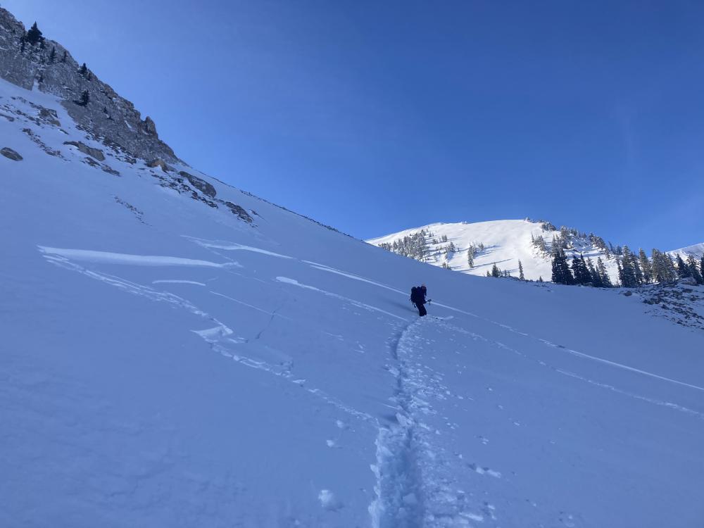
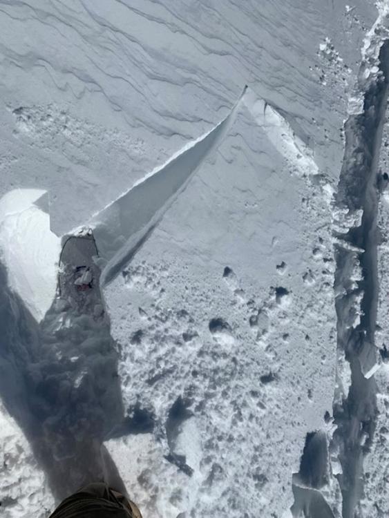
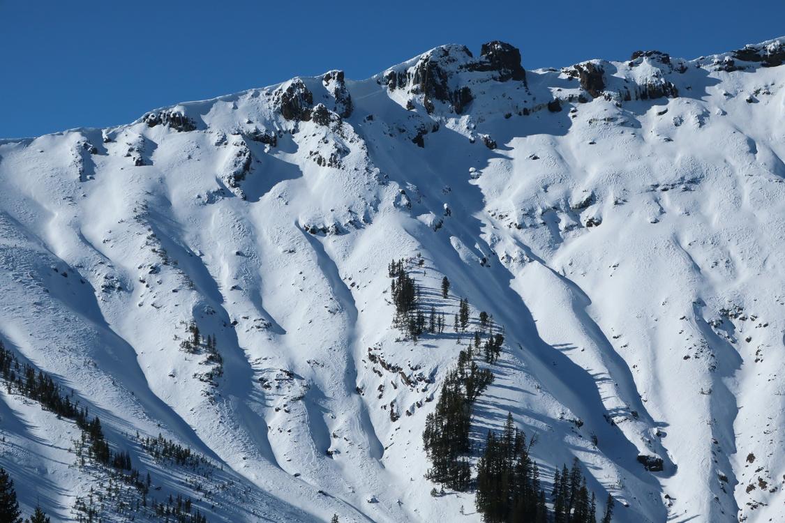
Photos
|
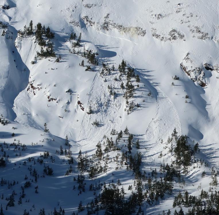
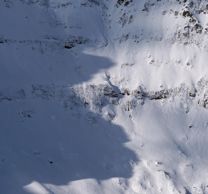
Cooke City, 2020-11-29 Small slab avalanche observed on 11/28 near Cooke City. East aspect, 9,000' elevation. Photo: B. Fredlund Link to Avalanche Details |
|
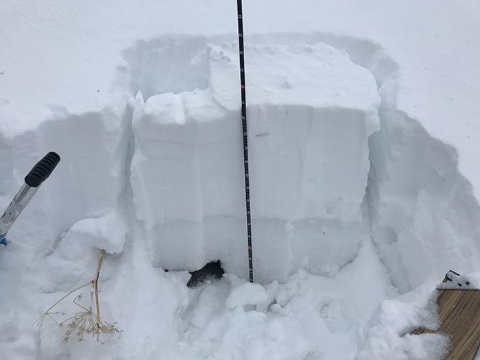
Lionhead Range, 2020-11-24 We found a thick layer of surface hoar (1-2cm) on top of the snowpack at Lionhead Ridge on 11/24/20. Below that layer the snowpack was faceted and weak. This will be an unstable foundation for future storms. Photo: GNFAC |
|
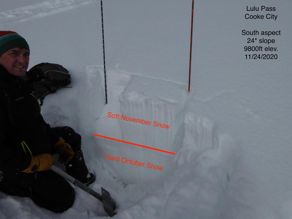
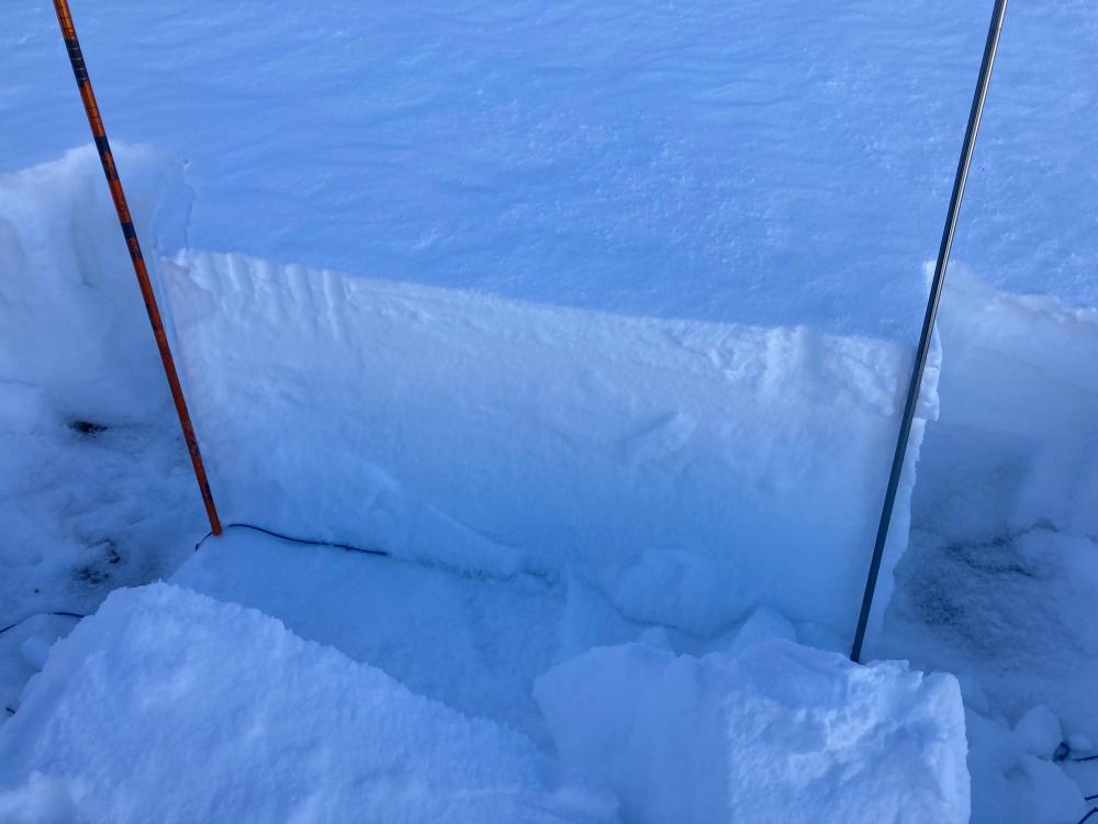
Cooke City, 2020-11-24 A south facing snow profile near Lulu Pass in Cooke City. The bottom half of the snowpack is hard October snow. The top half of the snowpack is soft November snow. No propagation in an Extended Column Test. Photo: GNFAC |
|
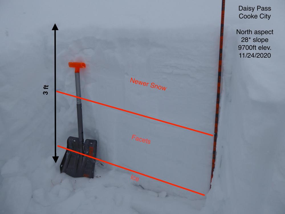
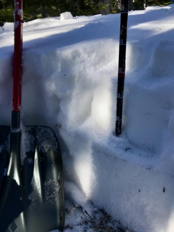
Cooke City, 2020-11-24 A north facing snow profile near Daisy Pass in Cooke City. There is an ice layer on the ground. Above the ice, half the snowpack is faceted October snow and half is November snow. No propagation in an Extended Column Test. Photo: GNFAC |
|
Cooke City, 2020-11-23 |
|
Southern Madison, 2020-11-23 From obs: "Yesterday my partner and I attempted to ski the notch couloir off Koch Peak in the Hilgards. There was a strong western wind that picked up throughout the day, but we didn't notice any recent avalanche activity from the new snow. The snow seemed very consolidated underneath the new 6" or so that had fallen, but once we started skinning up the apron we noticed significant and variable wind-loading, so we dug a pit. Our pit was at the base of the couloir at approximately 10,400 and was directly east-facing. Here is a summary of our pit results: 25cm of large sugary facets at the ground (fist), 5cm ice crust on top of these facets (pencil), a 30cm very consolidated and well bonded layer (1 finger), a 1-2 cm light surface hoar layer, and a 5cm wind-crust ontop of that. We were worried about the deeper, consolidated layer that was sitting on top of the sugary facets propagating so we performed an ECT test and it failed on ETCP-17 on that layer with a Q3 sheer." Photo: L. Ippolito |
|
Bridger Range, 2020-11-23 From obs: "NW of Elf Lake. Lower Pitch in Trees, 2 well defined weak layers present primarily at surface (30cm) and just below at (20cm). 7785FT, Clear, 25F. 10 degree Slope Facing Easterly in forest below steeps." Photo: J Budreski |
|
Cooke City, 2020-11-19 "... from a mid elevation, due south aspect [on November 15 near Cooke City]. It sums up the structure around here pretty well. Knife hard melt/ freeze snow at the bottom (from the late Oct/ early Nov. warm up). Then about 40cms of F to 4F powder, on top..." Photo: B. Fredlund |
|
Bridger Range, 2020-11-13 From obs: "while I was skinning up to the rollover I popped off a wind slab approximately 50 X 50’ with a 6” crown. The slab itself was only about 4” thick and only slid about 5” down the slope before stopping, and I was able to stop and then turn around and ski off of the slab without it moving any further. The 4” of dry slab was sitting on about 3” of sugary snow that was on a very firm icy bed surface." Photo: Anonymous Link to Avalanche Details |
|
Bridger Range, 2020-11-12 From IG message: Northern Bridgers is seeing a lot of avalanche hazard. Deep wind slabs where I was on Hardscrabble (SE aspect and NE). On my skin out I saw two avalanche crowns on the NE side of Pomp Pk. One had a party of two that triggered it and they were starting to descend away from avy terrain. Asked some other skiers up there what they saw and similar findings throughout the area. Dug one pit that showed facets on the ground covered by hard, icy snow with wind loaded snow on top of that. On my descent of Hardscrabble i picked my way thru the exposed rock and when I got into deeper snow it propagated about 60% of the time but did not slide really. Photo: D. Britt Link to Avalanche Details |
|
, 2020-11-11 Watch the video HERE! |
|
Cooke City, 2020-11-07 After the storm from Oct 13-24, a strong southwest wind event on Oct 30 drifted the recent snow into slabs that avalanched naturally. Activity was mostly on NE aspects. Photo: B. Fredlund Link to Avalanche Details |

|
Cooke City, 2020-11-07 After the storm from Oct 13-24, a strong southwest wind event on Oct 30 drifted the recent snow into slabs that avalanched naturally. Activity was mostly on NE aspects. Photo: B. Fredlund Link to Avalanche Details |
|
Cooke City, 2020-11-07 After the storm from Oct 13-24, a strong southwest wind event on Oct 30 drifted the recent snow into slabs that avalanched naturally. Activity was mostly on NE aspects. Photo: B. Fredlund Link to Avalanche Details |
|
Northern Madison, 2020-11-03 The Big Sky Community Organization and Friends of GNFAC upgraded the beacon checker at Beehive Basin to be solar powered. This allowed the checker to be moved up the trail where it intercepts users from both parking lots, rather than just the one parking lot where it was previously located. Photo: Jeff MacPherson/BSCO |
|
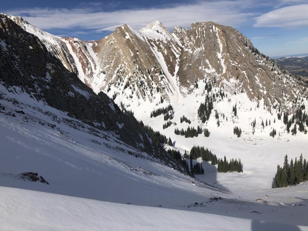
Bridger Range, 2020-11-02 "High winds this week really stripped a lot of terrain, and the snow pack was exceptionally thin in many places. This is looking into Frazier Basin..." Photo: M. Standal |
|
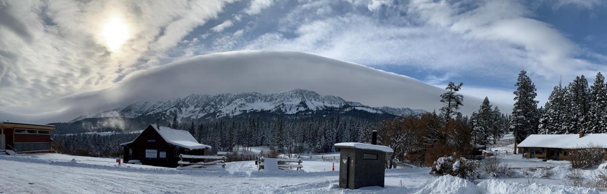
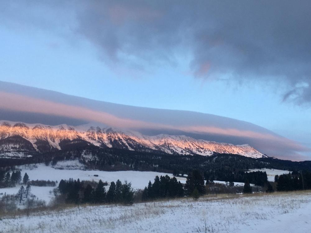
Bridger Range, 2020-10-29 The BBWC (Bridger Bowl Wind Cloud). Strong winds drifted recent snow into slabs that could avalanche on steep slopes. Early season snow means we need to be thinking about and managing avalanche hazard when we travel in the mountains. Photo: B. Rode |
|
Bridger Range, 2020-10-29 The BBWC (Bridger Bowl Wind Cloud) on Tuesday 10/27 accompanied 50-60 mph gusts. This strong wind drifted recent snow into slabs that could avalanche on steep slopes. Early season snow means we need to be thinking about and managing avalanche hazard when we travel in the mountains. Photo: GNFAC |
|
Bridger Range, 2020-10-28 Skier triggered slide on 10/26 at Bridger Bowl near the top of Pierre's Knob lift. Photo: @taitbigmoneyswan Link to Avalanche Details |
|
Bridger Range, 2020-10-28 Skier triggered slide on 10/26 at Bridger Bowl near the top of Pierre's Knob lift. Photo: @taitbigmoneyswan Link to Avalanche Details |