|
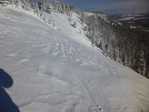
Southern Madison, 2016-12-18 This wind slab near the top of Sunlight Basin cracked as I walked across it. This is a sign of instability and I went no further. Photo: GNFAC
|
|
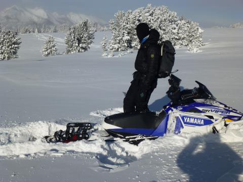
Southern Madison, 2016-12-18 Alex looks away in shame after getting the snowmobile stuck in Taylor Fork. Facets at the ground are unsupportable in spots. Speed and momentum are your friend in these situations. Photo: GNFAC
|
|
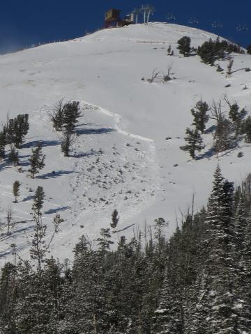
Northern Madison, 2016-12-18 This avalanche was triggered with explosives during control work on 12/15. 3' crown, HS, R3D2. This slide initiated in an area where there is no ice crust on the ground. Photo: BSSP
|
|
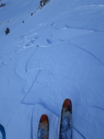
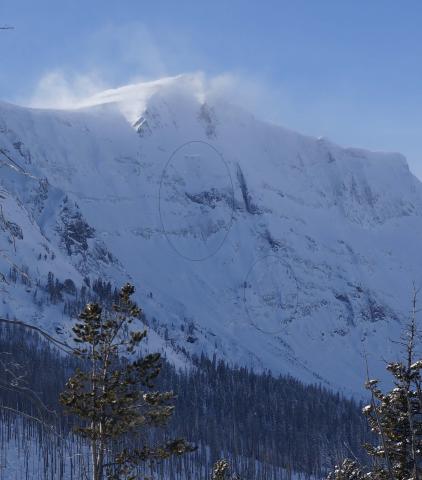
Northern Madison, 2016-12-18 |
|
Cooke City, 2016-12-18 |
|
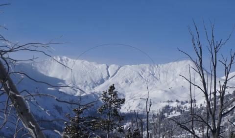
Cooke City, 2016-12-18 These slides are on E-SE aspects in Sheep Creek near Cooke City. Observed on 12/17. Photo: F. Madsen
|
|
Cooke City, 2016-12-18 |
|
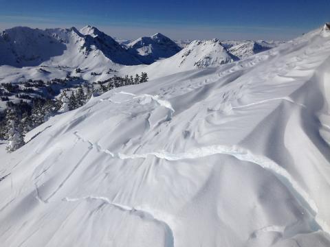
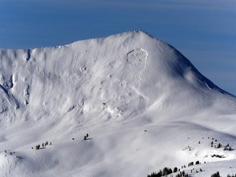
Cooke City, 2016-12-18 Large avalanche on SE aspect of Sunset Peak near Cooke City, about 10,000'. Observed on 12/17. Photo: B. Fredlund
|
|
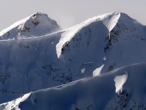
Cooke City, 2016-12-18 This slide happened naturally over the weekend (12/16) on the east aspect of Mineral Mountain near Cooke City. Photo: B. Fredlund
|
|
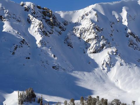
Cooke City, 2016-12-18 These avalanches were observed on 12/17 on the N-NE aspects of Miller Ridge near Cooke City. Photo: B. Fredlund
|
|
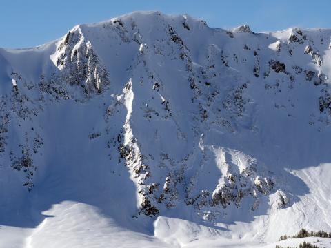
Cooke City, 2016-12-18 These slides happened between 12/16 and 12/17 on the NE aspect of Miller ridge just below 10,000'. They failed on faces near the ground. Photo: B. Fredlund
|
|
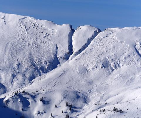
Cooke City, 2016-12-18 These slides happened over the weekend (12/16-12/17) and broke on weak facets near the ground. The crowns are about 10,000' on E-SE aspects. Photo: B. Fredlund
|
|
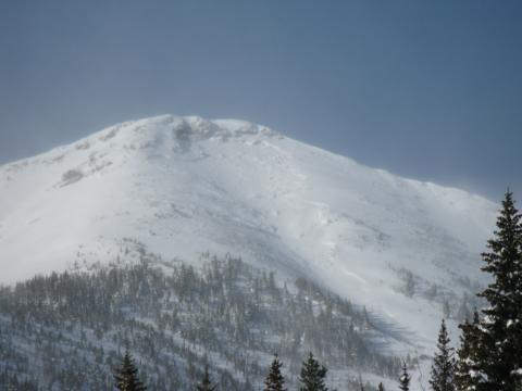
, 2016-12-18 Although a ways from our advisory area, this avalanche shows similar instability as what we have in our area. It broke on facets above a crust on the ground and was triggered with explosives. Photo: C. Hlavac
|
|
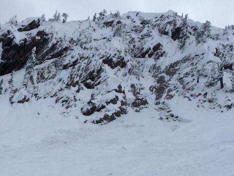
Bridger Range, 2016-12-14 On Monday, December 12, a cornice was kicked off the ridge at Bridger Bowl and it triggered the slope below. The van-sized cornice broke easily and pulled away farther back than expected. Cornices need to be given a wide berth. Photo: Bridger Ski Patrol
|
|
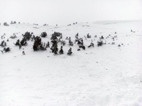
Northern Madison, 2016-12-14 On Saturday, December 11, a snowmobiler was completely buried in the 2nd Yellowmule of Buck Ridge. From am email:
Snowmobile's handle bar was sticking out of the snow and the rider was located about 15-20 ft from the snowmobile. He was buried about 2-3 under the snow. It took roughly 8 minutes to locate and extract from the avalanche. Once we located and uncovered the rider we removed his helmet and he was unconscious but had a pulse and was breathing. We were able to revive him and once awake we examined for any broke bones or trauma, which there was none. We then brought him down to a fire to warm him up. The debris field was about 8 to 10 ft deep in spots. The run out of the avalanche was roughly 350 to 450 ft. It ran down the first hill collected at a shelf which is were the burial occurred and then run into the trees below.
Photo: C. Shover
|
|
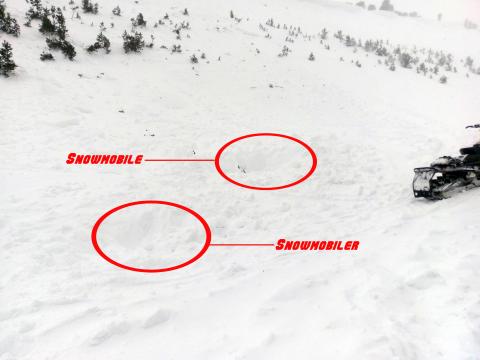
Northern Madison, 2016-12-14 On Saturday, December 11 a snowmobiler was completely buried in the 2nd Yellowmulke of Buck Ridge. From am email:
Snowmobile's handle bar was sticking out of the snow and the rider was located about 15-20 ft from the snowmobile. He was buried about 2-3 under the snow. It took roughly 8 minutes to locate and extract from the avalanche. Once we located and uncovered the rider we removed his helmet and he was unconscious but had a pulse and was breathing. We were able to revive him and once awake we examined for any broke bones or trauma, which there was none. We then brought him down to a fire to warm him up. The debris field was about 8 to 10 ft deep in spots. The run out of the avalanche was roughly 350 to 450 ft. It ran down the first hill collected at a shelf which is were the burial occurred and then run into the trees below.
Photo: C. Shover
|
|
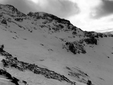
Northern Gallatin, 2016-12-14 The north face of Mt. Blackmore avalanched on Dec 10 or 11. It likely failed on the layer of facets on the ground, like all the other instabilities in the areas. Photo: G. Antonioli
|
|
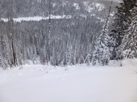
Cooke City, 2016-12-13 Looking down the path from the crown gives an idea of it's steepness and runout zone. The slope averaged 40 degrees with it's steepest part measured at 43 degrees. The victim was found in the trees marked by the red X. Photo: GNFAC
|
|
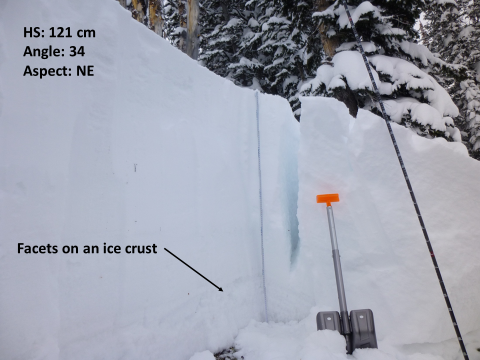
Cooke City, 2016-12-13 The avalanche broke on a layer of well-developed facets that are sitting on an ice crust. The crack in the snowpit wall is a remnant slab that cracked, but did not slide down the hill in the avalanche. Photo: GNFAC
|
|
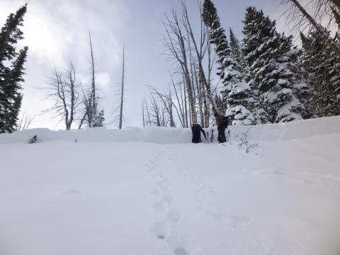
Cooke City, 2016-12-13 To the left of the people are ski tracks in the crown. This is where the skiers entered the slope. The angle was 34 degrees here, but quickly steepened to 40 degrees. Photo: GNFAC
|