Photos
|
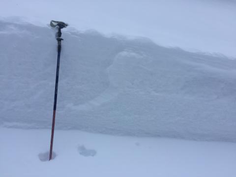
Bridger Range, 2017-02-26 Deeper part of the crown of skier triggered avalanche on Saturday. Photo: J. Magajna |
|
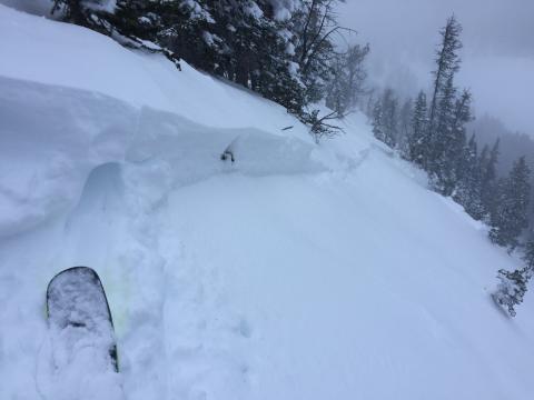
Bridger Range, 2017-02-26 A skier intentionally triggered this avalanche in the new snow on Saturday near Fairy Lake. Strtong winds rapidly loaded the slope with low density new snow. It was up to 36" deep and 150' wide Photo: J. Magajna |
|
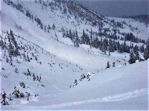
Bridger Range, 2017-02-25 A group of skiers on the Throne in the northern Bridgers captured this natural avalanche in action. It broke approximately 100 ft wide and ran over 700 vertical feet. It was likely the result of heavy wind loading. Photo: J. Mancey |
|
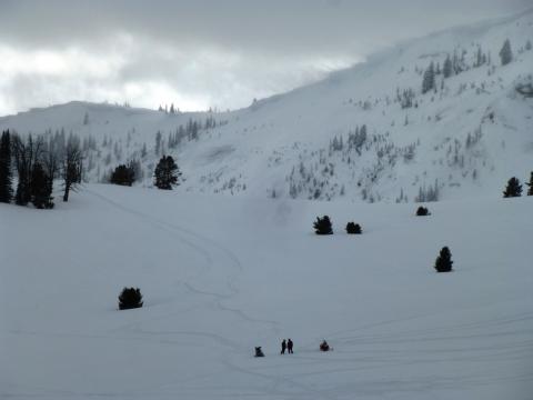
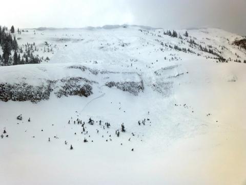
Lionhead Range, 2017-02-21 Eric Knoff talks to a snowmobiler about the dangers of highmarking during a HIGH danger as winds rip and move lots of snow at the ridgeline. Photo: GNFAC |
|
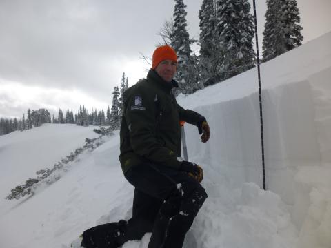
Lionhead Range, 2017-02-21 There were many avalanches on wind-loaded slopes in the Lionhead area. Lots of new snow (2.5" SWE) and very strong winds created a HIGH avalanche danger. Photo: GNFAC |
|
Southern Madison, 2017-02-21 Eric Knoff investigates an avalanche in Lionhead on a wind-loaded slope that was likely triggered when the tree behind him fell from the epic winds. The avalanche was small (1.5' deep, 75' wide, 100' vertical) and failed on a layer of facets on top of an ice crust. Photo: GNFAC |
|
|
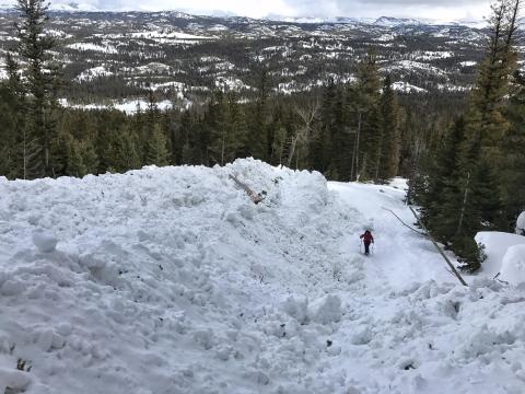
, 2017-02-21 Emily Stifler-Wolfe works a double burial problem at the Beacon Park in Bozeman (Beal Park). Her daughter cheers her on! |
|
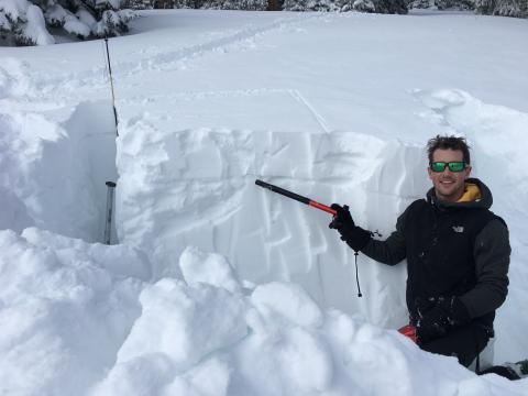
Cooke City, 2017-02-21 This large avalanche, near the parking lot of Pilot Creek, released over the weekend. This slope also avalanched during the Avalanche Warning about 9 days ago. These slides buried the bottom 40 feet of an ice climb. The parking area is located in Wyoming to the east of Cooke City. Photo: A. Mulkey |
|
Southern Madison, 2017-02-20 Skiers found a weak layer on an ice crust about a foot under the surface at Bacon Rind on Saturday. This is not a widespread issue, but it worth looking for since an ice crust would be easy to feel with a simple poke of a ski pole or swipe of your hand. Photo: H. Morrical |
|
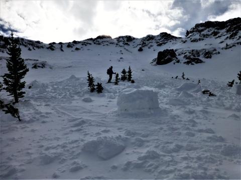
Northern Gallatin, 2017-02-16 Alex Marienthal of the GNFAC stands on fresh debris on the north Face of Mt Blackmore. This slide originated near the ridgeline and appeared to be triggered by a cornice drop. Photo GNFAC |
|
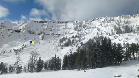
, 2017-02-15 This avalanche in Trespass Creek of the Crazies was triggered by a snowmobiler on Sunday (2/12). The dots are where two of the part were stopped when the slide roared by...about 30' away. Photo: J. Works |
|
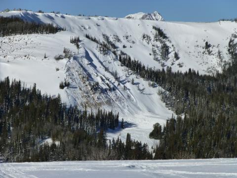
Southern Madison, 2017-02-14 This human triggered avalanche occurred in Sunlight Basin in the southern Madison Range. The slope has an east-northeast aspect and was heavily wind loaded. The slide was triggered from low on the slope and it propagated a few hundred feet uphill. The rider who triggered the slide was not caught, but another rider in the run out zone was partially buried near the toe of the debris. Fortunately nobody was injured in this incident. Photo GNFAC |
|
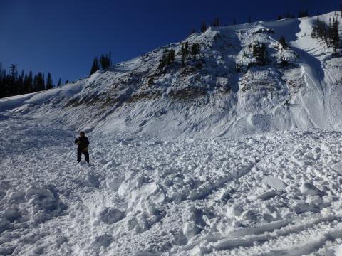
Southern Madison, 2017-02-14 A snowmobiler triggered this avalanche from low on the slope. The rider who triggered the slide was not caught, but another rider parked in the run out zone was partially buried. The slide failed at the ground and deposited up to 15' of debris in the run out. Fortunately nobody was injured in this incident. Photo GNFAC |
|
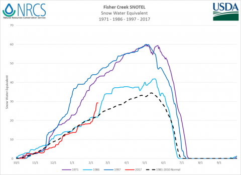
Cooke City, 2017-02-14 From Lucas Zukiewicz, SNOTEL guru. A history of big storm events at Fisher Creek site. 1971 – From 11/23/70 to 12/5/71 SWE at Fisher increased from 7.2” to 15.5”. 8.8” 14 day storm total. The unique part of 1971 was the consistency of the snowfall throughout the winter. 30 day totals for each month were substantial. From 1/6/71 to 2/4/71 the SNOTEL site received 16.2” of SWE. This 30 day period saw continuous snowfall with the average daily snowfall rate being 0.5”. Certain days exceeded 1.9” of SWE. In terms of total snow water equivalent, 1971 is the most SWE on record at Fisher Creek. The peak matches 1997, but the additional snowfall after the beginning of melt brings total SWE into record category. 1986 – From 2/10 to 2/25 SWE at Fisher increased from 21.8” to 33.9”. 12.1” 14 day storm total 1997- From 12/23/96 to 1/4/97 SWE at Fisher increased from 23.4” to 36.8”. 13.4” 14 day storm total 1997 – The monthly total SWE from 12/1/1996 to 1/1/1997 was 18.8” of SWE. All-time Record. I think what’s notable about 1997 is the consistent and considerable snowfall from mid-November until around the 1st of the year. AND it kept snowing until May. Not a lot of time between storms to develop weak layers…just TONS (literally) of snow. Amazing fun fact, from 11/14/96 to 1/14/97 Fisher Creek picked up 34.6” of SWE. The normal peak SWE value for the entire year is 34.4”. That’s a whole winter’s worth of water in 2 months… 2017 – From 1/30/2017 to 2/11/2017 SWE at Fisher increased from 18.3” to 29.2”. 10.9” storm total. So while the snow we just had wasn’t record breaking, it was pretty close. 3rd highest 14 day total on record at Fisher. 1986 and 2017 are similar in that they occurred in February with time between storms…plenty of time for things to change and setup in the snowpack. |
|
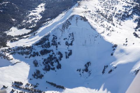
Cooke City, 2017-02-14 This avalanche was triggered late Sunday on the backside of Daisy Pass underneath Chimney Rock. Snowboarders were returning to town on their sleds when they hit this slope. Noone was caught. Although the skies are clear and winds are calm, this avalanche reminds us that it is still dangerous out there! Photo: K. Birkeland |
|
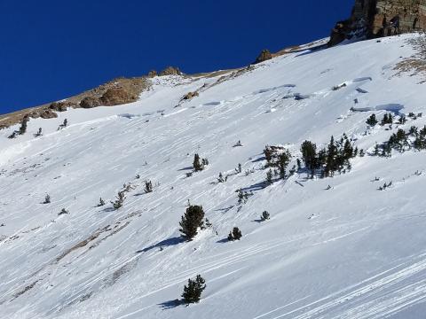
Cooke City, 2017-02-14 This avalanche was triggered late Sunday afternoon. This slope has slid earlier in the winter. It was large and broke trees. Photo: S. Abelseth |
|
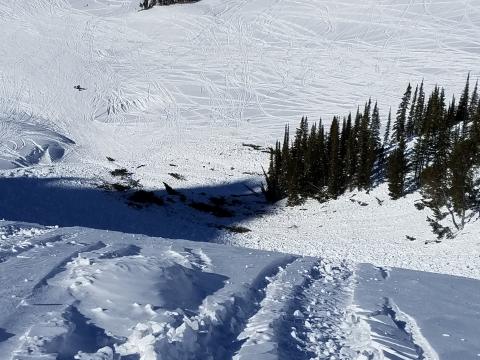
Cooke City, 2017-02-14 The avalanche was large enough to take out a few trees. Photo: S. Abelseth |
|
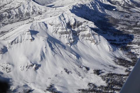
Cooke City, 2017-02-13 Avalanches on Wolverine Peak were large and took out mature trees. Photo: K. Birkeland |
|
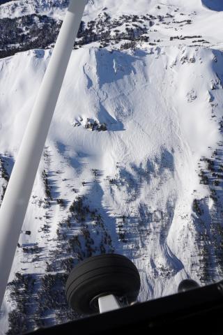
Cooke City, 2017-02-13 This a a good view of the crown, starting zone and upper path. Photo: K. Birkeland |
|
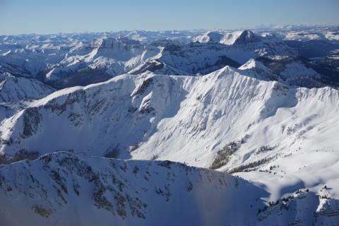
Cooke City, 2017-02-13 Many avalanches occured up Sheep Creek. Photo: K. Birkeland |
