Photos
|
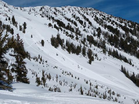
Cooke City, 2020-02-23 From obs: "Seemed stability was getting better, but did see this minor slide that pulled out on Scotch Bonnet Mountain. Evidently triggered by a snowmobile sometime mid-day Saturday (2/22)." Photo: R. Larson Link to Avalanche Details |
|
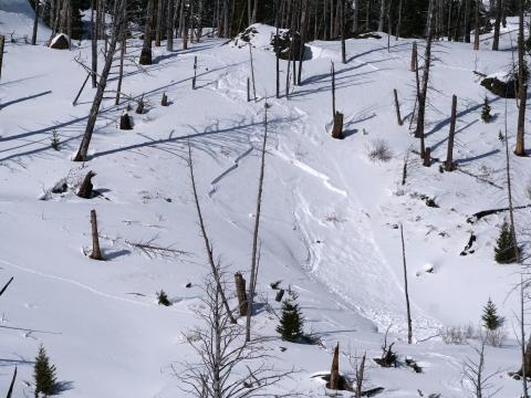
Cooke City, 2020-02-22 From email on 2/21/20: "...observed today from the highway. It appears like it was probably triggered by a skier yesterday (on Feb. 20). It was on a south aspect around 8,000', and estimated to be 1-2' deep and about 30' wide." Photo: B. Fredlund Link to Avalanche Details |
|
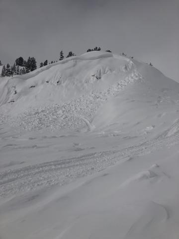
Cooke City, 2020-02-19 "A small slide approx 100 ft wide ran about 40 vertical feet. Crown was 3-4 feet deep. Aspect, SE. Trigger unknown however tracks indicate it was likely a snowmobile trigger." Photo: Reed Youngbar Link to Avalanche Details |
|
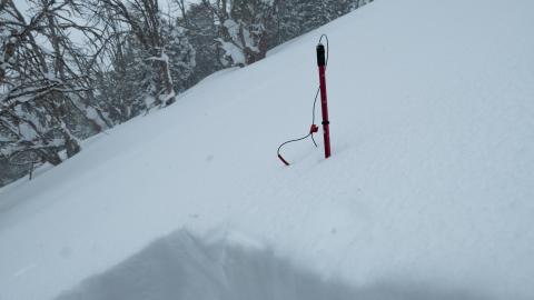
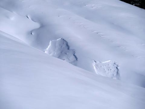
Cooke City, 2020-02-16 Cooke City is getting deep! The total snow height is 315 cm. Our pit results on Scotch Bonnet were a variety of ECTNs in the upper layers of the snowpack. When placing our probe for stability tests we could feel the weak snow near the ground as our probes just dropped through the lower 60 cm of the snowpack. I am still worried about the deep layers, but it has been a while since they performed and it seems like it will take a big trigger (i.e. a cornice drop), a big storm to add weight, or some really bad luck to trigger one of the monster avalanches on the basal facets. Photo: GNFAC |
|
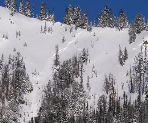
Cooke City, 2020-02-11 Natural avalanches on a west aspect at about 8300' a few miles west of Cooke City. These slides are about 2' deep and 30-50' wide. Photo: B Fredlund |
|
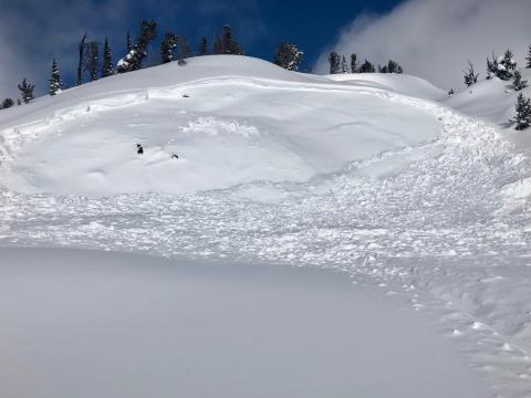
Cooke City, 2020-02-10 "...a fresh avalanche observed out there today. A south aspect around 9400', estimated to be 2-3' deep and 75' wide." Photo: B. Fredlund Link to Avalanche Details |
|
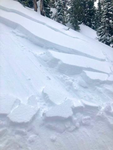
Cooke City, 2020-02-10 "S facing slope, not sure how it was triggered, a foot deep crown at most." Photo: S. Strenge |
|
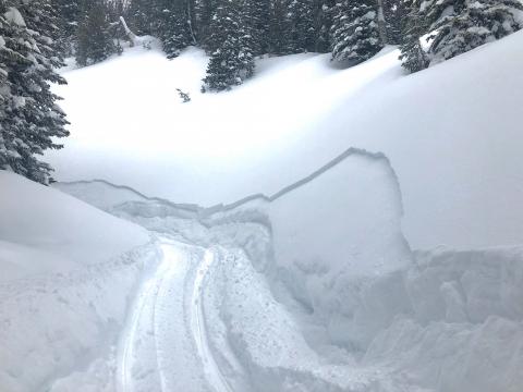
Cooke City, 2020-02-10 "We’ve seen many instances of cracking and wind slab breaks the past two days riding in Cooke, most happened as we sledded past or down the slope." This slide is 4" deep. Photo: S. Strenge Link to Avalanche Details |
|
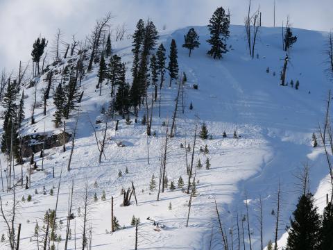
Cooke City, 2020-02-10 "We’ve seen many instances of cracking and wind slab breaks the past two days riding in Cooke, most happened as we sledded past or down the slope." This slide is 4" deep. Photo: S. Strenge Link to Avalanche Details |
|
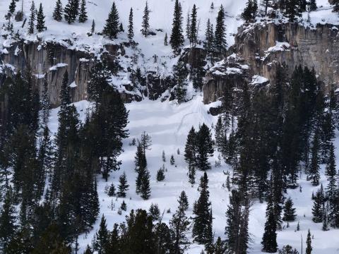
Cooke City, 2020-02-04 The Nose of Town Hill avalanched on Feb. 1 due to the strong SWerly winds and looked to be triggered by a cornice fall (estimated 2-3' crown, about 75-100' wide). Photo: B Fredlund Link to Avalanche Details |
|
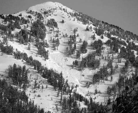
Cooke City, 2020-02-03 SEerly aspect around 8600'. A thinner, smaller storm slab, triggered by dry loose from above. Photo: B. Fredlund Link to Avalanche Details |
|
Cooke City, 2020-02-03 SWerly aspect around 9500'. Deep slab, mid-slope. I'd estimate that crown to be about 4-6' deep. Photo: B. Fredlund Link to Avalanche Details |
|
|
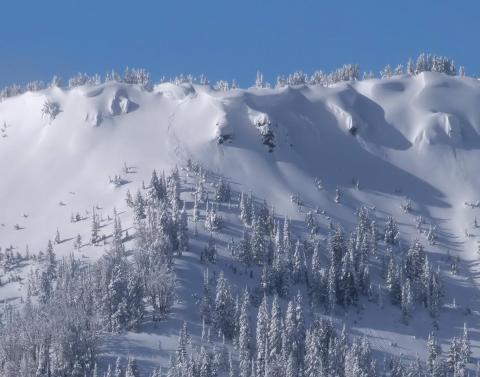
Cooke City, 2020-02-02 Winds Friday night transported snow creating fresh drifts that avalanched naturally over the weekend. This one on the east side of Woody Ridge appears to be 2-3' deep and 50' wide. Photo: GNFAC Link to Avalanche Details |
|
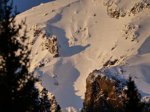
Cooke City, 2020-01-31 From email (1/30/2020): "2 natural avalanches that ran last night, just west of Cooke City. Both slides were on easterly aspects around 9500'." Link to Avalanche Details |
|
Cooke City, 2020-01-31 From email (1/30/2020): "2 natural avalanches that ran last night, just west of Cooke City. Both slides were on easterly aspects around 9500'." Link to Avalanche Details |
|
|
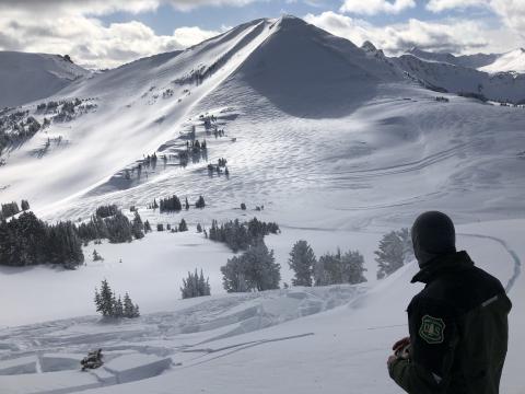
Cooke City, 2020-01-30 We triggered this avalanche of wind-drifted snow as we approached very carefully from a low angle slope above, on 1/30/2020. This is near Lulu Pass outside Cooke City on a south facing slope at 10,000'. It broke within recently drifted snow, but these slabs could be enough weight to break deeper and wider on sugary layers deep in the snowpack. Photo: GNFAC Link to Avalanche Details |
|
|
Cooke City, 2020-01-30 We triggered this avalanche of wind-drifted snow as we approached very carefully from a low angle slope above, on 1/30/2020. This is near Lulu Pass outside Cooke City on a south facing slope at 10,000'. It broke within recently drifted snow, but these slabs could be enough weight to break deeper and wider on sugary layers deep in the snowpack. Photo: GNFAC Link to Avalanche Details |
|
Cooke City, 2020-01-30 We triggered this avalanche of wind-drifted snow as we approached very carefully from a low angle slope above, on 1/30/2020. Triggered from where Alex is standing. Near Lulu Pass outside Cooke City on a south facing slope at 10,000'. It broke within recently drifted snow, but these slabs could be enough weight to break deeper and wider on sugary layers deep in the snowpack. Photo: L. Browning Link to Avalanche Details |
|
|
Cooke City, 2020-01-30 We triggered an avalanche of wind-drifted snow as we approached very carefully from a low angle slope above, on 1/30/2020. It broke within recently drifted snow, but these slides could be enough weight to break deeper and wider on sugary layers deep in the snowpack. Photo: GNFAC Link to Avalanche Details |
