|
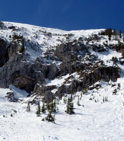
Bridger Range, 2012-03-21 The slide that occurred on the Football Field sent debris soaring over these large cliffs. It's important to remember what's below you when skiing on the Football Field and surrounding terrain. Photo GNFAC
|
|
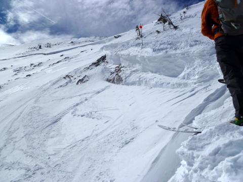
Bridger Range, 2012-03-21 The slide that occurred on the Football Field just outside of the ski area boundary took out the entire seasons snowpack. The slide also took out countless ski tracks that have been put down throughout the winter. This is a great reminder that sidecountry is backcountry, and even slopes just outside the ski area boundary are prone to avalanches. Photo GNFAC
|
|
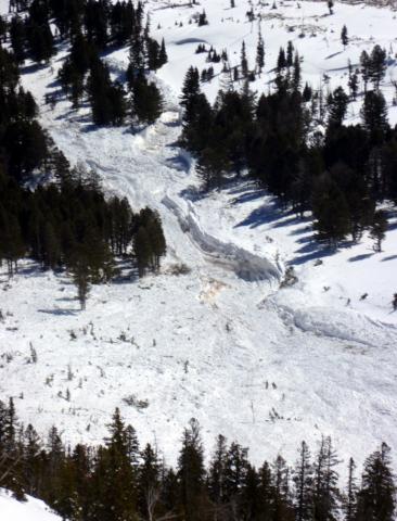
Bridger Range, 2012-03-21 The debris from the slide in Argentina Bowl broke mature trees and gouged the landscape. This slide propagated hundreds of yards wide and ran nearly full track. Photo GNFAC
|
|
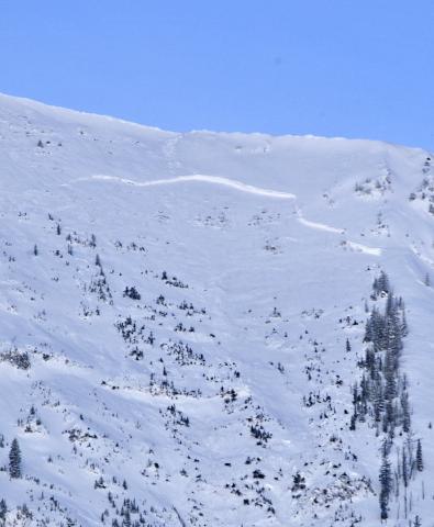
Bridger Range, 2012-03-20 |
|
Bridger Range, 2012-03-20 |
|
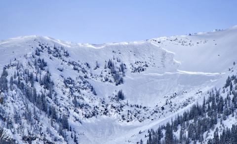
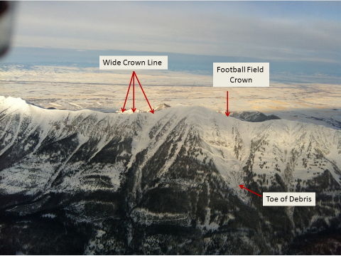
Bridger Range, 2012-03-20 Numerous large and destructive hard slab avalanches released naturally overnight. The Football Field to the north of Saddle Peak was at least 4-5 feet deep. These avalanches broke near the ground on facets. Photo: N. Hillenbrand
|
|
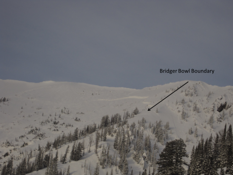
Bridger Range, 2012-03-20 The crown of the football field avalanche stopped right at the south boundary of the Bridger Bowl Ski Area. This slope has traditionally been very popular becuase it is next to the boundary and seems safe when the reality is that it is drastically different. Photo: A. Marienthal
|
|
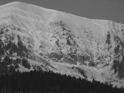
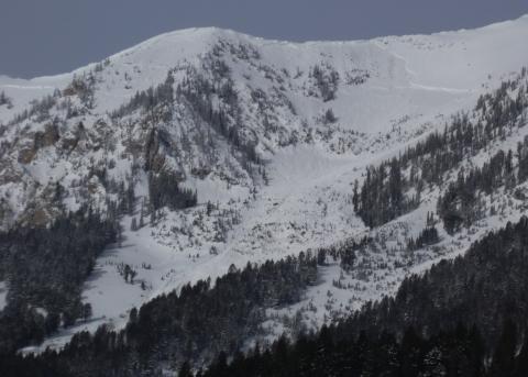
Bridger Range, 2012-03-20 This avalanche happened sometime Monday (3/19) night or very early Tuesday (3/20) morning. The debris ran far into the relatively flat terrain below the cliffs. The powder cloud/air blast shook large mature trees and blew the snow off their limbs. Photo: GNFAC
|
|
Bridger Range, 2012-03-20 |
|
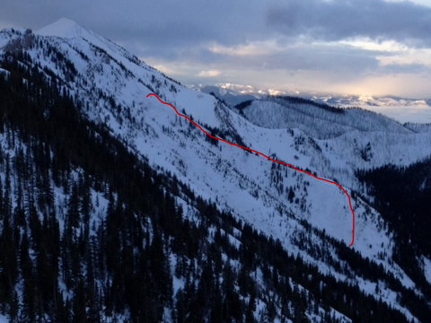
Bridger Range, 2012-03-18 This avalanche was on the west side of the Bridger Range on a path called Saint Lawrence. It broke at the ground and ran over 1,000 vertical feet. Photo: P. Carse
|
|
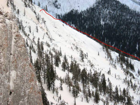
Bridger Range, 2012-03-18 This avalanche happened last night (Sat, 3/17). Starting point in upper left of red line which denotes the crown. It broke at the ground. Photo: L. Watson
|
|
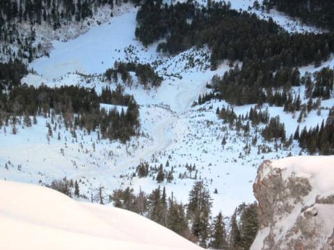
Bridger Range, 2012-03-18 The debris ran almost full track. It measures over 1,000 feet vertical. Photo: L. Watson
|
|
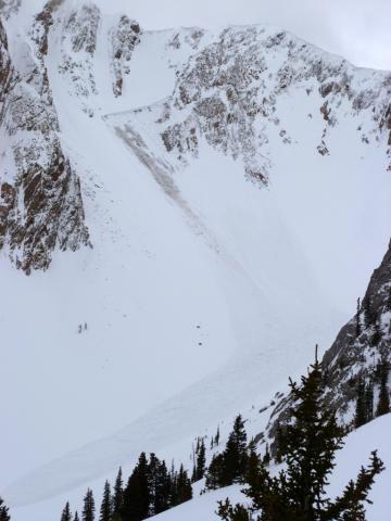
Bridger Range, 2012-03-16 This natural occurred on the north side of Hardscrabble Peak in the northern Bridgers. The slide was likely triggered by a cornice drop. Photo GNFAC
|
|
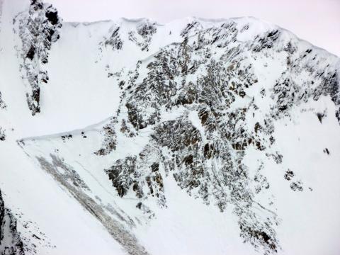
Bridger Range, 2012-03-16 Strong southwest winds on Tuesday March 12th, heavily loaded north and east facing slopes in the Bridger Range. This slide is likely the result of that wind event. The slide appears to have initiated in the steep rocks directely below the ridge, but pulled out the entier seasons snowpack lower on the slope. Depth hoar near the ground exists on many slopes in the Bridger Range and contiues to demonstrate its ability to propagate fractures with the proper trigger. This slide occurred on the north side of Hardscrabble Peak. Photo GNFAC
|
|
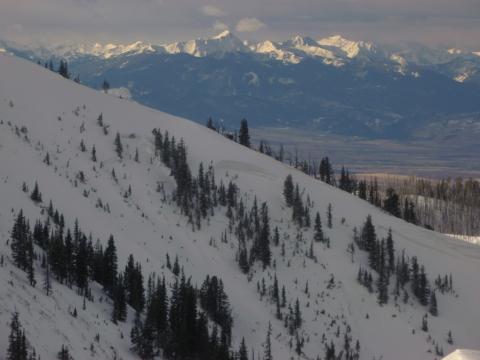
Bridger Range, 2012-03-15 Strong south/southwest winds heavily loaded east and north facing slopes in the Bridger Range on Tuesday (3-13-12). This slide occurred naturally in the Y Coulior on the west side of Saddle Peak either Tuesday night or Wednesday morning. Photo GNFAC
|
|
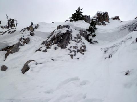
Bridger Range, 2012-03-15 The Bridger Bowl Ski Patrol triggered multiple multiple slide during control work today (3-15-12). Most were triggered below the ridgelines in steep, rocky terrain. Strong south/soutwest winds loaded east and north facing slopes over the past few days. Fresh drifts are resting over weak and in some places isothermal facets, which are providing a weak foundation for any type of load. Photo GNFAC
|
|
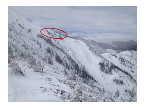
Bridger Range, 2012-03-14 The Y couloir on the west side of Saddle Peak area avalanched naturally. Ski Patrol took this picture from the ridge this morning. Strong south winds loaded this slope with a hard slab. Red circle indicates crown line. Photo: P. Maleski
|
|
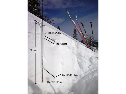
Bridger Range, 2012-03-13 We dug this snowpit on an east facing slope at 8200 fet in the Bridger Range. The depth hoar at the ground was quite large and took a lot of force to break, but is still a concern and likely will be for the rest of the season. Photo: GNFAC
|
|
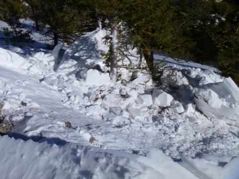
Bridger Range, 2012-03-11 A large cornice, well below treeline on the Baldy Trail, broke free as skiers toured past. The cornice was dripping with water, a strong sign that it's losing internal strength. Although this was low consequence terrain, it illustrates the problems we'll encounter at higher elevations with warmer, spring weather. Photo: C. Kautz
|

|
Bridger Range, 2012-03-04 These raised foot prints on the hike to Saddle Peak are evidence of serious wind scouring. There's no need for an anemometer when you see these; the winds have been ripping and loading leeward slopes. Photo: GNFAC
|