Photos
|
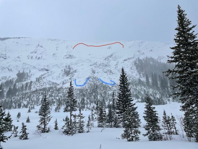
Cooke City, 2023-02-21 From email, "At 12:45 I saw Climax run naturally. SS-N-R2-D2-I. The low visibility and distance made it hard to tell how deep the crown was, but based on there not being much volume of debris and it not running very far, I’m guessing it was within the new snow/storm interface and didn’t step down to any buried PWL. |
|
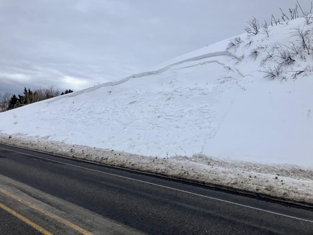
Bridger Range, 2023-02-21 Drove up to Bridger at noon and saw a large avalanche on along the road north of the fire station. It was 75’ wide, 1-1.5’ deep and 25’ vertical. HS-N-R4-D1.5/2. It was on an east facing slope, south of the long slope that has cornices. Photo: GNFAC Link to Avalanche Details |
|
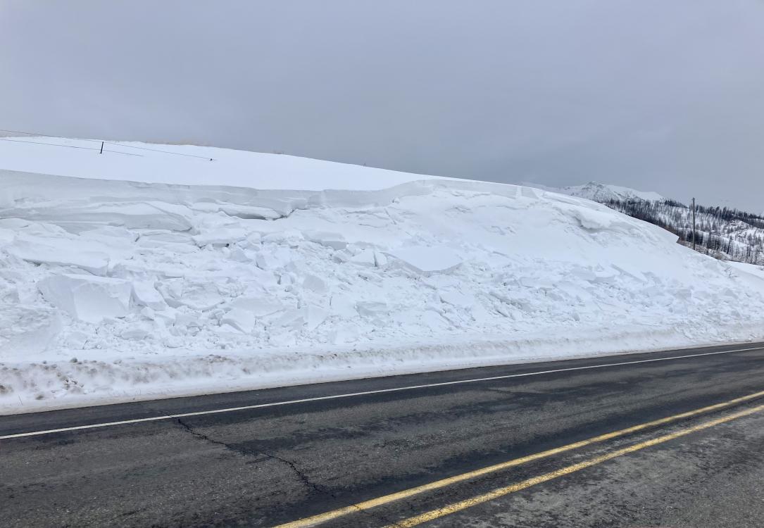
Bridger Range, 2023-02-21 Drove up to Bridger at noon and saw a large avalanche on along the road north of the fire station... The slope with cornices hadn’t slid at this point. On the way home at 3:30 the larger slope with cornices had slid. It was very big, possibly R5. 1.5-2’ deep, 200’ wide, huge chunks of hard slab and cornice. Looks like new wind-loaded snow with some gouges into older snow. Photo: GNFAC Link to Avalanche Details |
|
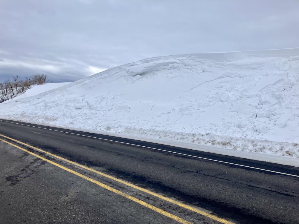
Northern Madison, 2023-02-20 We saw a natural avalanche that occurred overnight or the morning of February 20, in 2nd Yellowmule. It appeared to be ~200' wide and broke 1-3' deep. Photo: GNFAC Link to Avalanche Details |

|
Bridger Range, 2023-02-17 About 34 degree rollover, 14 inch crown. Photo: E. Volk Link to Avalanche Details |
|
Cooke City, 2023-02-17 Small rider/skier triggered wind slabs North of Cooke City. Photo: Z. Peterson |
|
Cooke City, 2023-02-17 Rider triggered avalanche on crown butte. Saw and heard reports of small rider/skier triggered wind slabs North of Cooke City. Photo. Z. Peterson |
|
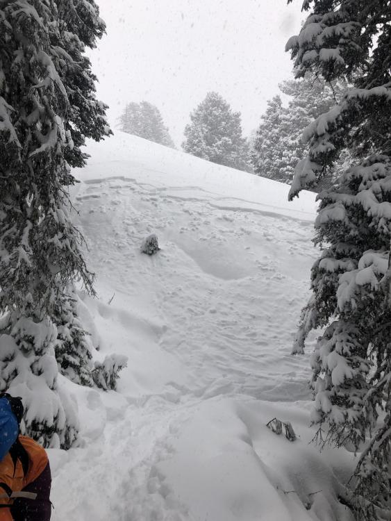
Cooke City, 2023-02-17 Riders north of Cooke City on 2/16/23 saw an avalanche that appeared to be recently snowmobile triggered. Photo C. Richards Link to Avalanche Details |
|
Northern Madison, 2023-02-16 Small storm slab released on a small piece of terrain. East aspect around 9200. Link to Avalanche Details |
|
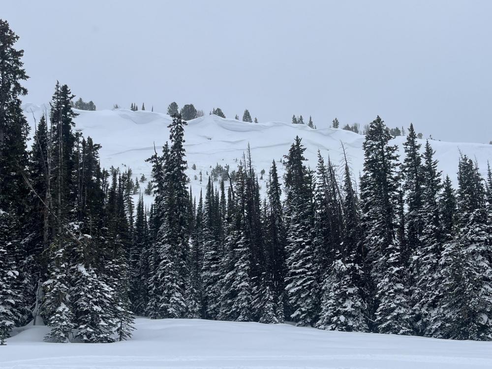
Lionhead Range, 2023-02-16 |
|
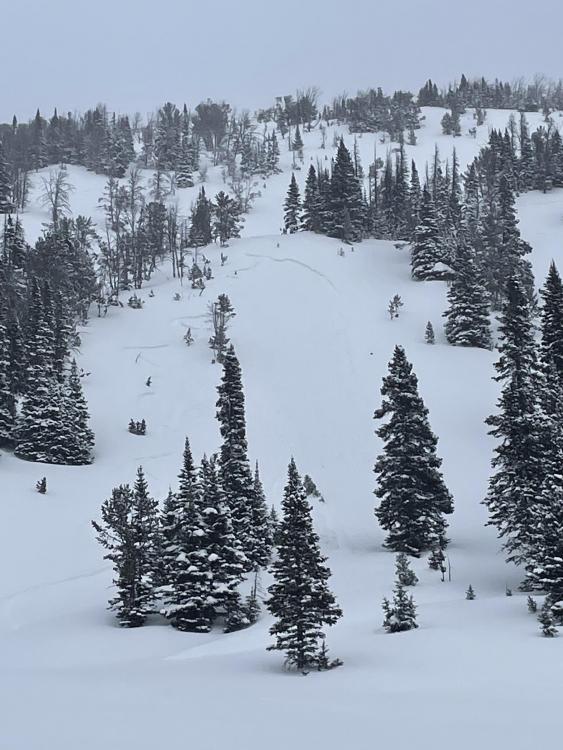
Northern Gallatin, 2023-02-15 Low winds/no snow transport when I was up there and the east face had little to no wind effect, probably 16-18in new snow. Saw this slide with about a 8-12in crown and 100ft wide on the north face, didn’t see any other activity aside from some small point releases on really steep east aspects. From another party: Saw a sizable avalanche on the north east face of Blackmore, likely broke mid storm and was partly filled in already - estimated 20" deep, 100' wide. Had shooting cracks and collapsing while ascending northeast ridge. Hand pits showed planar results on an 8" harder slab beneath all the blower on top. Link to Avalanche Details |
|
Northern Gallatin, 2023-02-15 We observed a few small crowns on steeper road cuts in Sourdough today, NW and W aspects. 4-8" at crown, 20-40' wide, ~10' vertical. They looked like storm slabs that had run overnight, maybe on a density change in the storm snow. Debris piles were small and covered with 2-3" of new snow. Low consequence, but maybe enough to surprise a kid or a dog. Photos were taken shortly above the 2 mile marker. Link to Avalanche Details |
|
Northern Gallatin, 2023-02-15 Was about 80% of the way up to the top of the middle meadow on history rock this morning when we remotely triggered a small avalanche from the skin track. Slide was just new snow that had fallen within prior 24hrs. Crown of about 8 inches, 20ish feet wide by 20 feet long. Face that slid was east facing. We took this as a sign to reconsider skiing something even as low key as history rock and decided to ski the skin track back. [Dropped the pin for this observation exactly where I believe the observation to have occurred. Took an OnX waypoint while out there to help too.] Link to Avalanche Details |
|
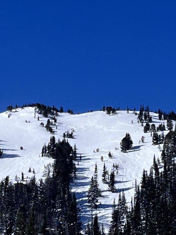
Northern Madison, 2023-02-15 |
|
Northern Gallatin, 2023-02-15 Went for a ski up the Flanders drainage in Hyalite today. The day was punctuated by light winds and heavy snowfall.
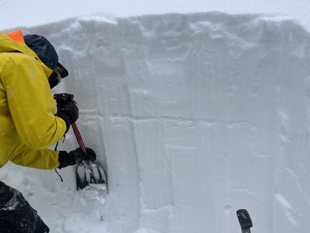
On the skin in, we noted numerous D1 storm slab avalanches about 15cm down in the new snow on many aspects and elevations. Approaching a ridgeline, we experienced a shooting crack that propagated a very small slide in slightly wind affected snow. We dug an ECT on a SE facing aspect at 9000ft. We were unable to get propagation. Snow totals appeared to be higher than forecasted, with 60cm of new snow as of about 12:30. By the time we ripped skins, the area had received an additional 10cm of snow, putting totals around 60-70cm of low density snow on top of a stout melt freeze crust on the aspect we were skiing. we did not observe any cracking collapsing or wumphing in buried weak layers, nor signs of avalanches on those layers. The new snow had very low SWE. Link to Avalanche Details |
|
Lionhead Range, 2023-02-14 "Seemed to be a decent sized slide runoff was pretty deep where it stopped in the trees figured it was probably two days old. Southwest facing. Roughly 44.86695° N, 111.24123° W" Link to Avalanche Details |
|
Northern Gallatin, 2023-02-14 I sunk to the ground on Mt Ellis when I stepped out of my skis. A poor, unsupportable structure is not everywhere, but it certainly was on the ridge. Photo: GNFAC |
|
Northern Gallatin, 2023-02-12 "Found widespread surface hoar up storm castle creek on all sheltered slopes above 7500’." Photo: JR Mooney |
|
Northern Gallatin, 2023-02-12 2/11/23: "..we noticed a few old crowns that released before the most recent snow, hard to say if they were natural or not. We also observed a most likely remote triggered small wind slab (not our tracks next to it). Solar aspects were hot. Top of snowpack was relatively stable in our 4 foot pit, some collapse but no propagation (E aspect, 8400 feet). " Photo: Tommy S. Link to Avalanche Details |