Photos
|
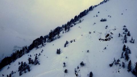
Cooke City, 2021-12-29 |
|
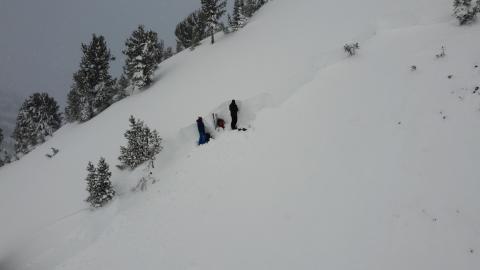
Cooke City, 2021-12-29 GNFAC Forecasters Ian Hoyer and Doug Chabot at the crown of the fatal avalanche on Scotch Bonnet. 12/28/21 Photo: GNFAC Link to Avalanche Details |

|
Dillon Area, 2021-12-28 Snowmobiled up to 9000ft, skinned up West face of Comet to 10K ft and skied low angle trees back to sled. Heavy windload with cross loading common on this slope. Dug a pit at 9200 ft, W aspect, 28 degree slope. Height of snow was 110 cm, about 3 and a half feet deep. Photo shows hand hardness profile in snowpit with faceted weak layers of concern in mid and lower snowpack. Extended column test had propagation on 18 (ECTP 18) on large facets (see photo) around a crust about 40 cm up from ground. No cracking or collapsing observed on tour. Good coverage for this time of year on this slope. |
|
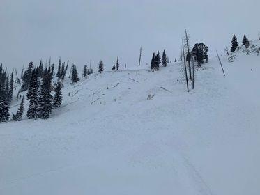
Cooke City, 2021-12-28 Snowmobilers riding near Mount Abundance north of Cooke City triggered two avalanches on Dec. 27th. No one was caught or injured. Photo: Anonymous Link to Avalanche Details |
|
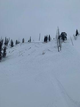
Cooke City, 2021-12-28 Snowmobilers riding near Mount Abundance north of Cooke City triggered two avalanches on Dec. 27th. No one was caught or injured. Photo: Anonymous Link to Avalanche Details |
|
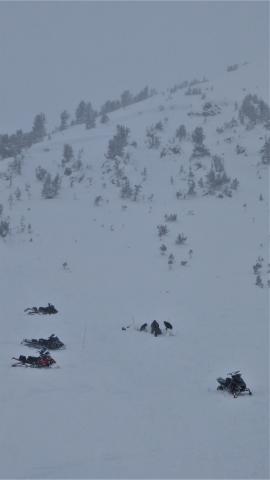
Cooke City, 2021-12-28 A sled was recovered uphill of the 2 avalanche victims in the same area it was stuck. The sled was found with a probe line and is buried 3-4 feet deep. The avalanche crown can be seen in the upper slopes above them. Photo: GNFAC Link to Avalanche Details |
|
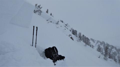
Cooke City, 2021-12-28 The crown of the avalanche that killed two snowmobilers on December 27, 2021 was 300 feet wide and 4-5 feet deep. Photo: GNFAC |
|
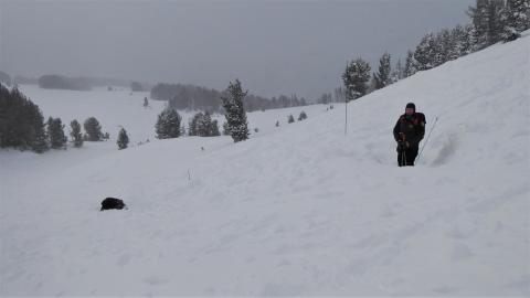
Cooke City, 2021-12-28 These are the two sites where the 2 snowmobilers were recovered. They were buried 4-5 feet deep in debris piles that measured 9 feet deep. Photo: GNFAC |
|
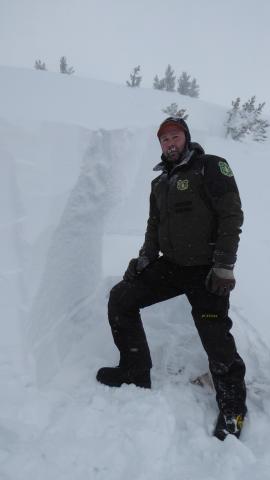
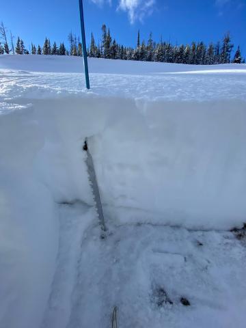
Cooke City, 2021-12-28 Ian Hoyer stands next to the crown where we dug a snowpit and investigated the snow structure. The crown averaged 4-5 feet deep. Near his right knee is the layer of weak faceted snow that broke 40 cm above the ground. Above this layer was a thick slab of windblown snow. Photo: GNFAC Link to Avalanche Details |
|
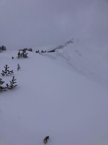
Dillon Area, 2021-12-28 Tour up Maverick Mountain before they open for the season to check how the snowpack is shaping up in the Pioneers; snowpack representative of backcountry. Got a Christmas eve gift when 6-8 inches of maverick 'white thunder' (+/- 5% density) fell overnight adding 30-50% to the total depth of snow. Dug quick pit on SE aspect 8100 feet and there is about 12-16 inches of low density snow with poles and skis going to ground. Dug a little higher on NE aspect 8200 feet where the snowpack is about twice as deep; about 2 feet plus and has a soft-ish slab in the mid-pack. We performed stability tests. ECTP12 10cm off ground. Softer slab on top of loose faceted snow on top of a hard crust made for propagation in the extended column test results. Surprisingly no collapsing and minimal, very localized cracking right around the skis. Ski quality greatly exceeded expectations! |
|
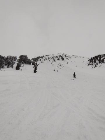
Cooke City, 2021-12-27 Skiers reported this natural avalanche on a wind-loaded slope on Henderson Mountain. They estimated the maximum crown depth to be 4-6' likely triggered by a cornice fall. Photo: W. Miller Link to Avalanche Details |
|
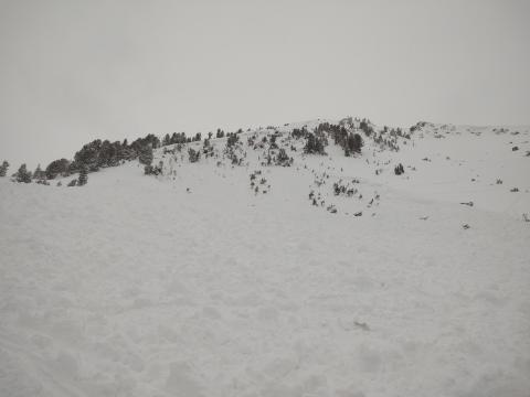
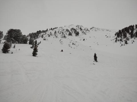
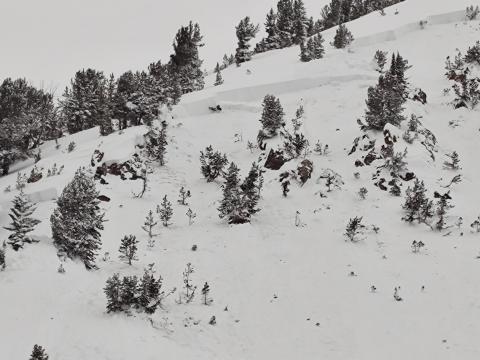
Cooke City, 2021-12-27 We are sad to report that on December 27th, two snowmobilers were caught and killed in an avalanche on Scotch Bonnet Mountain to the north of Cooke City. The avalanche broke 5’ deep and approximately 300’ wide on a southeast-facing slope. Members of Park County Sheriff Search and Rescue arrived to assist with rescue and recovery efforts. Our deepest condolences go out to the victim’s friends and family, members of the group, and the search and rescue community. We will release further details as they become available. Photo: B. Zavora |
|
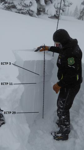
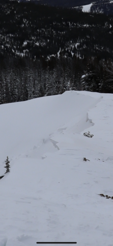
Lionhead Range, 2021-12-26 Dave Zinn of the GNFAC gets 3 layers breaking in his Extended Column Test. About 3 feet of snow fell in the last 4 days which got blown into wind slabs. The weight of the new snow is also creating instability on a weak layer of sugary facets near the ground. Photo: GNFAC |
|
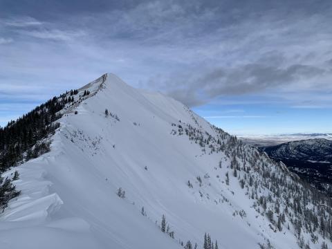
Northern Madison, 2021-12-26 From obs (12/25/21): "Cornice failure on beehive / bear basin ridge, ~9,200 ft. West side of ridge stripped clean, east side looked pretty loaded" |
|
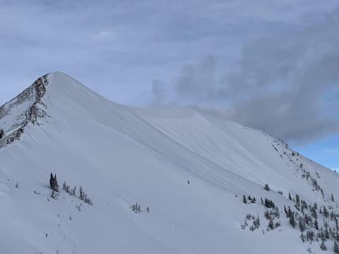
Bridger Range, 2021-12-25 A natural avalanche of wind-loaded snow released in the "Between the Peaks" area of Saddle Peak in the Bridger Range on Christmas Eve or early Christmas morning. Photo: D Wienstein Link to Avalanche Details |
|
Bridger Range, 2021-12-25 A natural avalanche of wind-loaded snow released in the "Between the Peaks" area of Saddle Peak in the Bridger Range on Christmas Eve or early Christmas morning. Photo: D Wienstein Link to Avalanche Details |
|
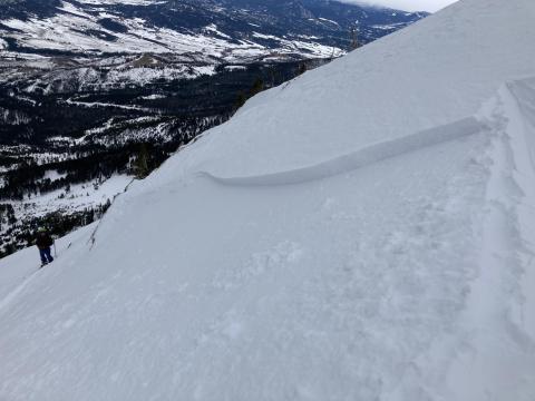
Bridger Range, 2021-12-23 We intentionally triggered this 6-8" deep wind slab on Saddle Peak on December 23, 2021, E aspect at 9,000'. It showed us that recently formed wind slabs were still reactive. This hard slab formed over low density new snow which made it unstable. While not large, these slides will easily push you down and can be harmful if they push you into hazardous obstacles or terrain traps. Photo: GNFAC Link to Avalanche Details |
