Good Morning. This is Alex Marienthal with the Gallatin National Forest Avalanche Advisory issued on Sunday, November 26th at 7:15 a.m. Today’s advisory is sponsored by Highline Partners and Alpine Orthopedics. This advisory does not apply to operating ski areas.
Temperatures this morning are in the high 30s to low 40s F. The only new snow is a trace to 1” near Big Sky and West Yellowstone. Wind is west to southwest at 10-25 mph with gusts to 40 mph. Temperatures will reach high 40s F today and up to mid-50s F in the Bridger Range. Wind will be southwest at 10-20 mph, and a welcome cold front late tonight will bring 40-50 mph winds, some rain, and then snow through Monday morning. The mountains will get 3-6” of snow tomorrow with up to 8” possible near West Yellowstone, Cooke City, and Hyalite.
Below freezing temperatures and moderate wind the last couple days kept the snowpack frozen and stable. Today is different. Temperatures at 4 a.m. are above freezing up to 9,000’, and the snowpack will become wet, non-cohesive and lose strength.
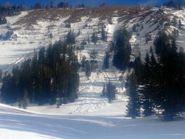
Wet snow avalanches are possible today and could be triggered on all steep slopes except high elevation, northerly aspects. Recent freezing temperatures formed a thick crust on the snow surface, which will be supportable this morning then melt and soften today. Slopes that allow supportable, easy travel this morning will likely become wet and weak by the afternoon.
Be cautious of terrain overhead such as steep, rocky slopes that hold snow and could avalanche naturally as they warm through the day. If you sink past your boot in wet snow or see obvious signs of instability like pinwheels, roller balls, or natural avalanches, then avoid steep slopes and minimize exposure to runout zones. Wet snow avalanches are possible today and the avalanche danger is MODERATE.
A frozen, stable snowpack one day followed by wet, weak snow the next is more typical of April than November. Unusual weather creates unusual avalanches and calls for extra caution. Don’t hesitate to bail early or change plans before obvious signs of wet snow instability are present.
If you get out and have any avalanche or snowpack observations to share, drop a line via our website, email (mtavalanche@gmail.com), phone (406-587-6984), or Instagram (#gnfacobs).
Get Avalanche Smart Video Series
Some days the big lines will go, but other days they won't. It's up to you to decide, because the best days are the ones when you return home safely. Three skiers walk through the decision making process in Get Avalanche Smart - Episode 3: The Great One.
Upcoming Avalanche Education and Events
BOZEMAN
Nov. 28, Avalanche Awareness, 6-7:30 p.m. at Play it Again Sports
Nov. 29, 30 and Dec. 2, 3 or 9, Introduction to Avalanches w/ Field Day, Info and Register Here
Dec. 6, Avalanche Awareness, 6-7:30 p.m. at REI Bozeman
Dec. 7, Avalanche Awareness and Beacon Practice, 6-8 p.m. at Beall Park, Bozeman
Dec. 13, Avalanche Awareness, 6:30-8 p.m. at Gallatin Valley Snowmobile Association, 4-Corners
Jan. 12 and 13, Companion Rescue Clinic, Info and Register
Jan. 17, 18 and 20 or 21, Introduction to Avalanches w/ Field Day, Info and Register Here
Jan. 24, 25 and 27, Advanced Avalanche Workshop w. Field Day, Info and Register Here
Feb. 9 and 10, Companion Rescue Clinic, Info and Register
HELENA
7 December, Avalanche Awareness, 6-7:30 p.m. at Basecamp, Helena
WEST YELLOWSTONE
Dec. 14 and 15, Snowmobiler Introduction to Avalanches with Field Course, Info and Register Here
COOKE CITY
1 and 2 December, Current Conditions and Avalanche Rescue, 6:30-7:30 p.m. Friday @ the Super 8, and anytime between 10-2 on Saturday 2 Lulu Pass road.
A frozen, stable snowpack one day followed by wet, weak snow the next is more typical of April than November. Unusual weather creates unusual avalanches and calls for extra caution. Don’t hesitate to bail early or change plans before obvious signs of wet snow instability are present.


