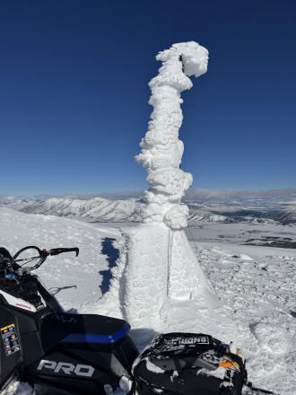
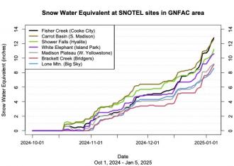
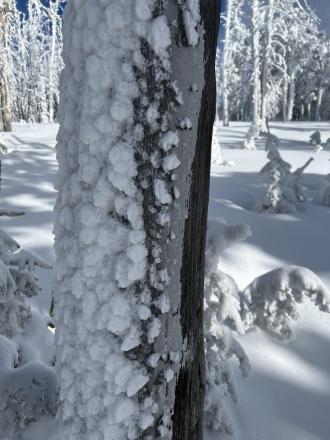
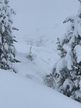
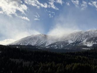
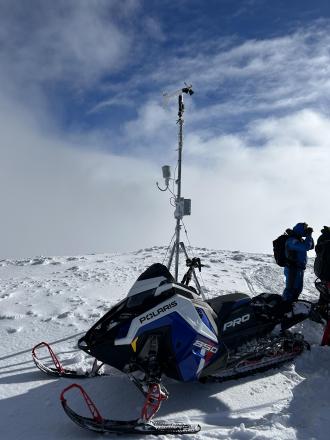
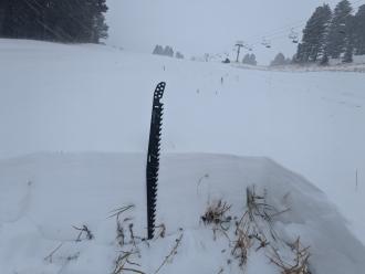
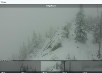
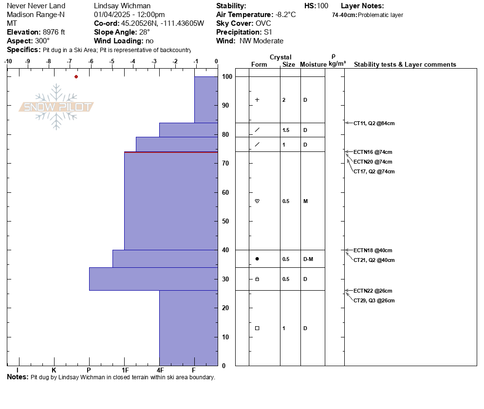
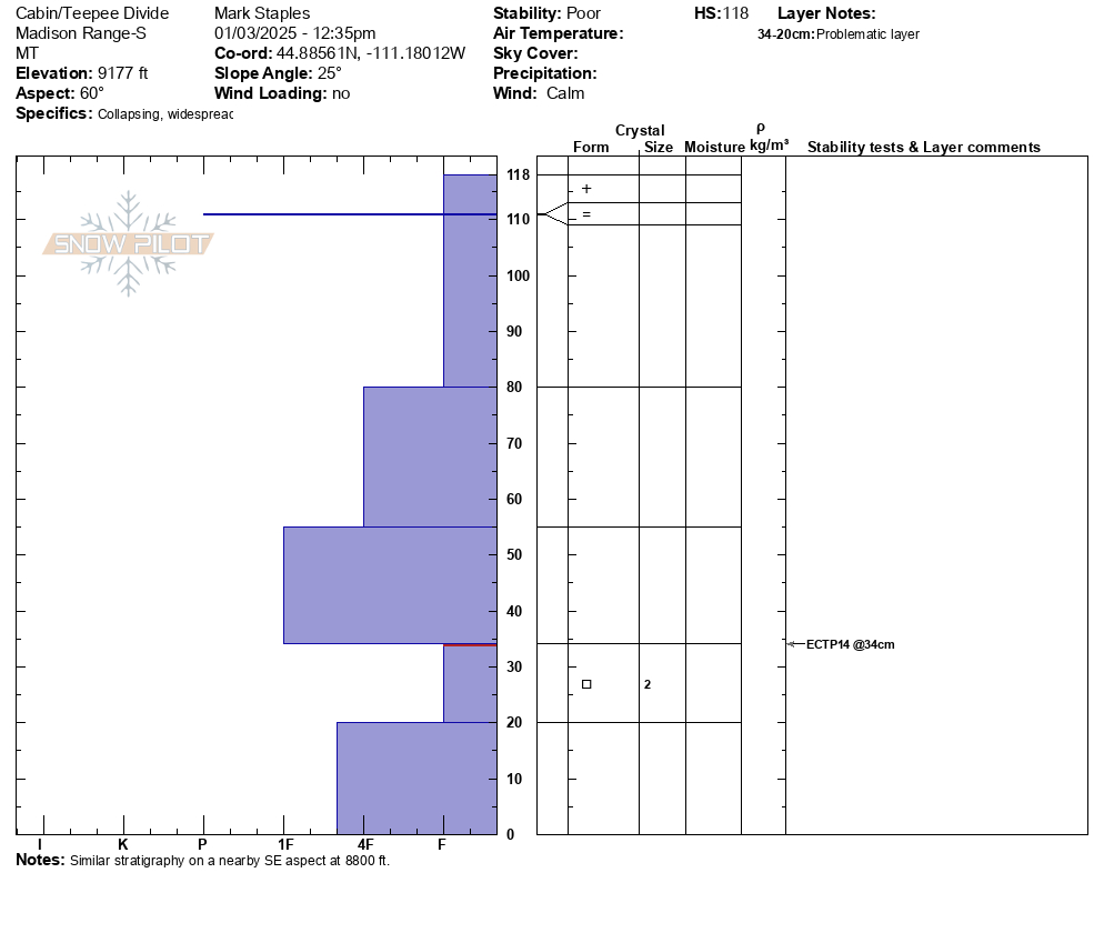
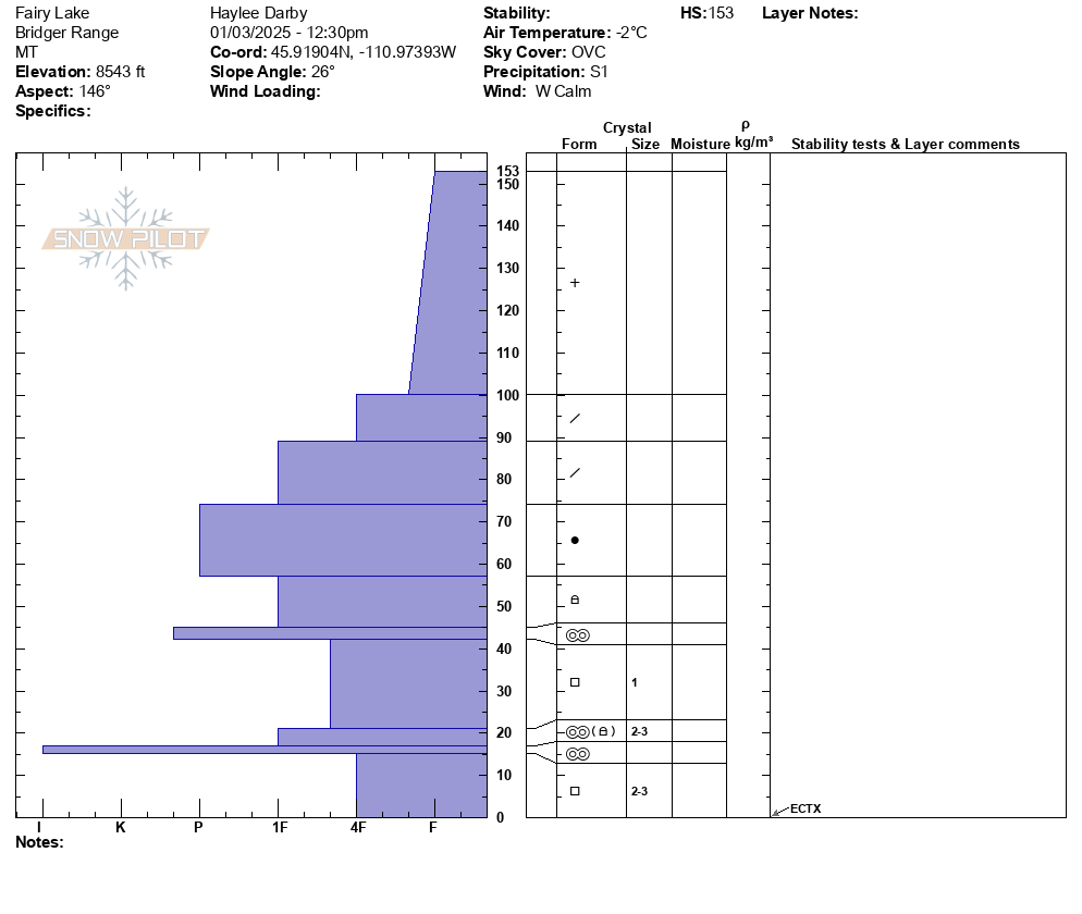
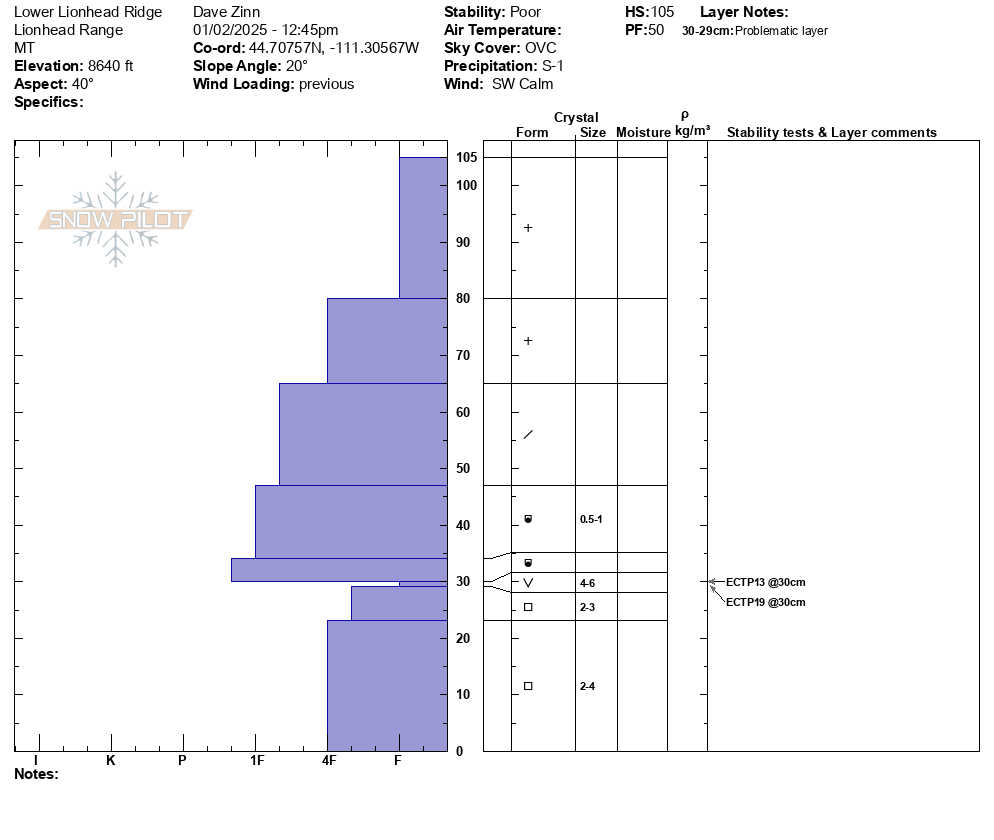
The GNFAC weather station at the top of Sawtelle provides wind, temperature and relative humidity information for forecasting (when it's not covered in a foot of rime ice. Photo: GNFAC
Trip Planning for Island Park
Past 5 Days

Moderate

Considerable

Considerable

Moderate

Moderate
Relevant Avalanche Activity
N-R2-D2
Elevation: 9,500
Aspect: NE
Coordinates: 44.5591, -111.4830
Caught: 0 ; Buried: 0
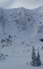
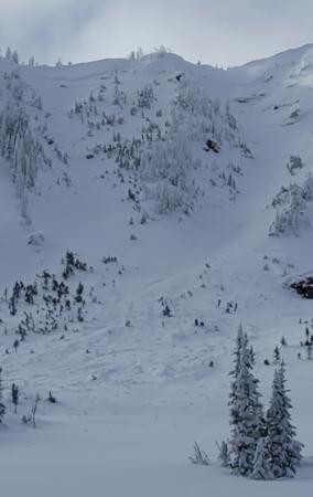
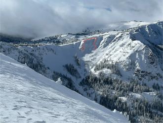
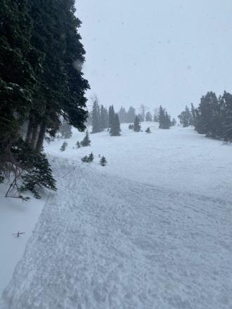
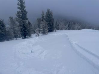
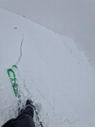
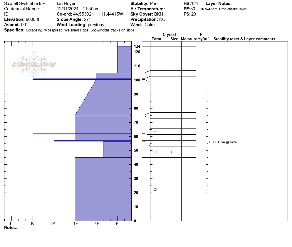
Almost constant Whumphing at higher elevation. I saw a couple of days old avalanche on a wind-loaded east northeast facing slope. This area in known as Yahoo.
More Avalanche Details
Relevant Photos
-
-
Photo: GNFAC
-
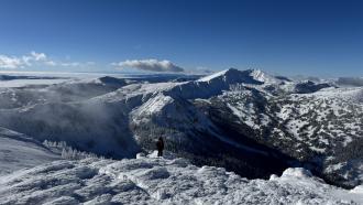
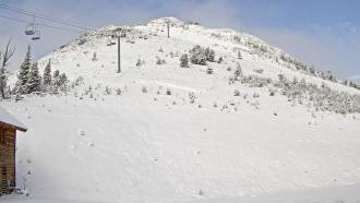
From the top of Sawtelle. Photo: GNFAC
-
Riders in the Centennial Mountains experienced almost constant whumphing at higher elevation and saw a couple of days old avalanche on a windl-oaded east north east facing slope. Photo: R. Gravett
-
-
Ice crust on trees from freezing rain last Saturday Dec 28 now covered by rime ice.
-
From obs on 12/29: "On our way out near the cabin I cut a line close to a creek to see if I could trigger something."
-
From obs on 12/29: "On our way out near the cabin I cut a line close to a creek to see if I could trigger something."
-
Thick and robust ice crust layer widespread above white elephant. Photo: Ride Rasmussen Style
-
-
Plumes of drifting snow in the Bridger Range as strong winds blasted the mountains. Photo: GNFAC
-
De-rimed Sawtell anemometer
-
Rock Creek natural avalanche
-
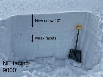
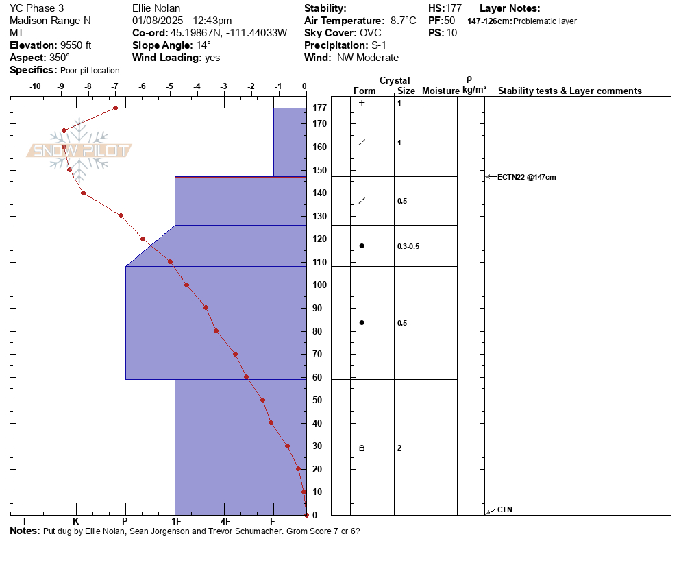
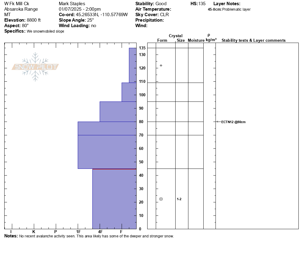
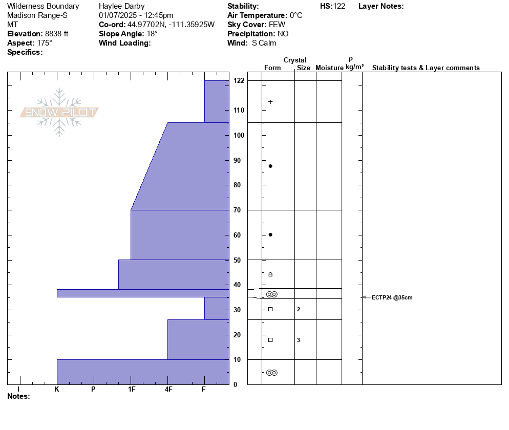
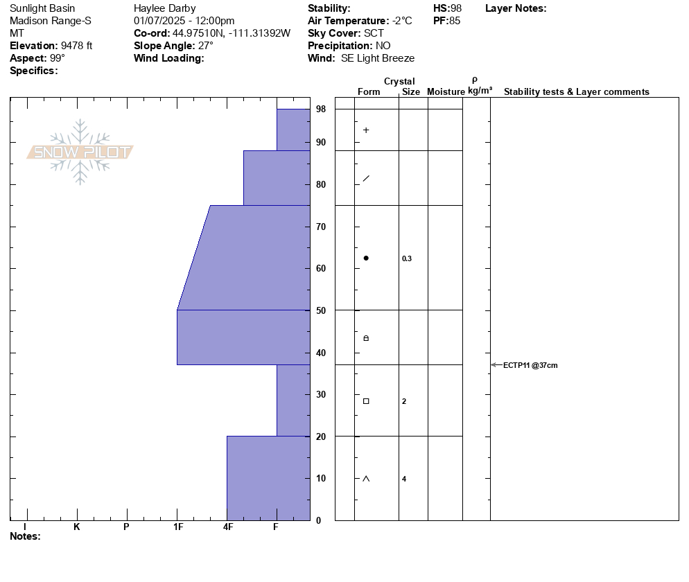
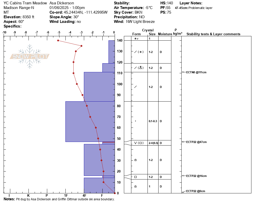
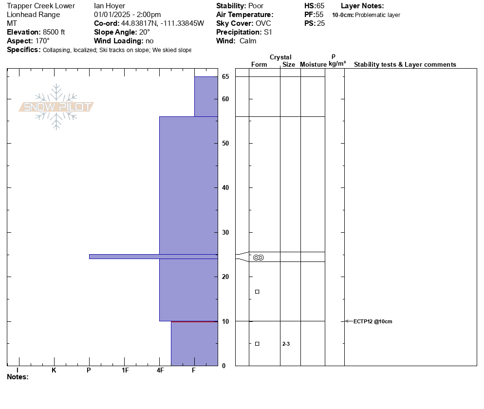
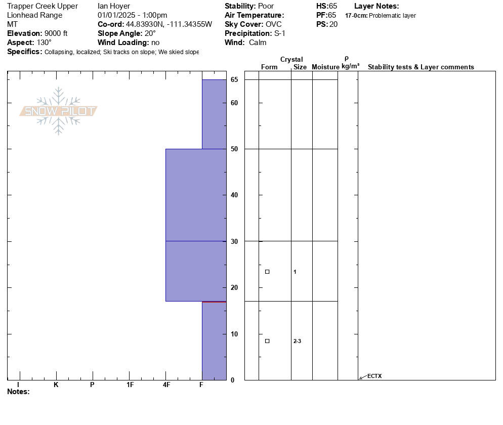
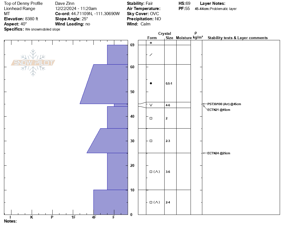
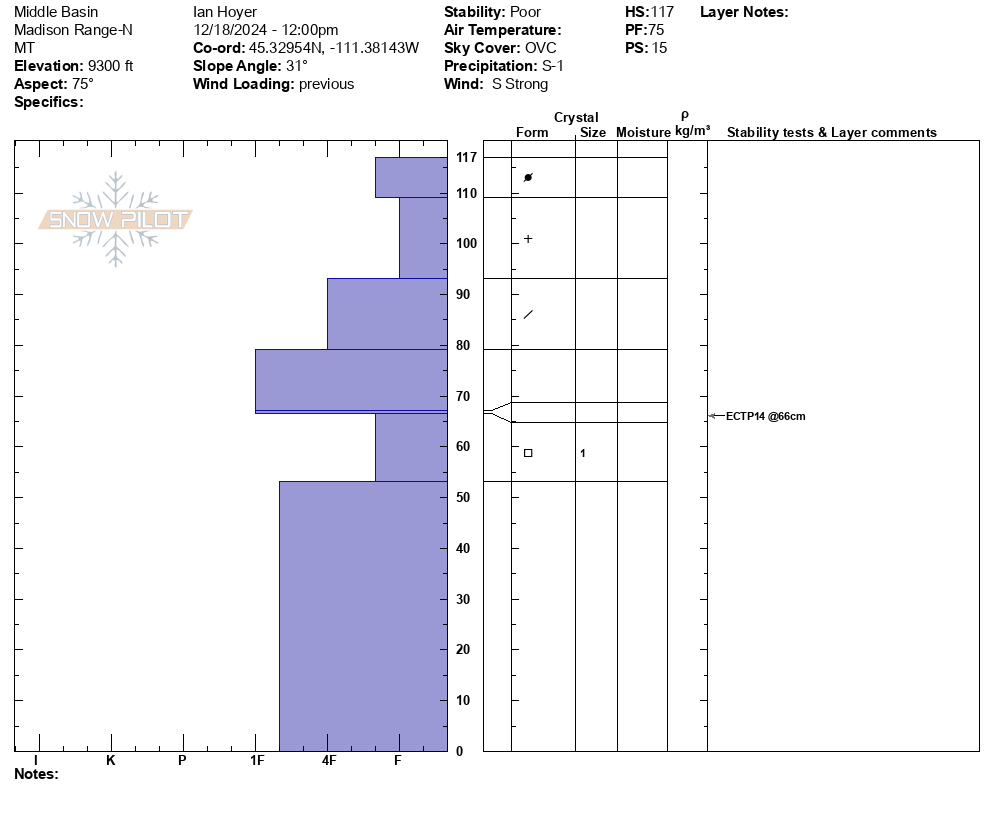
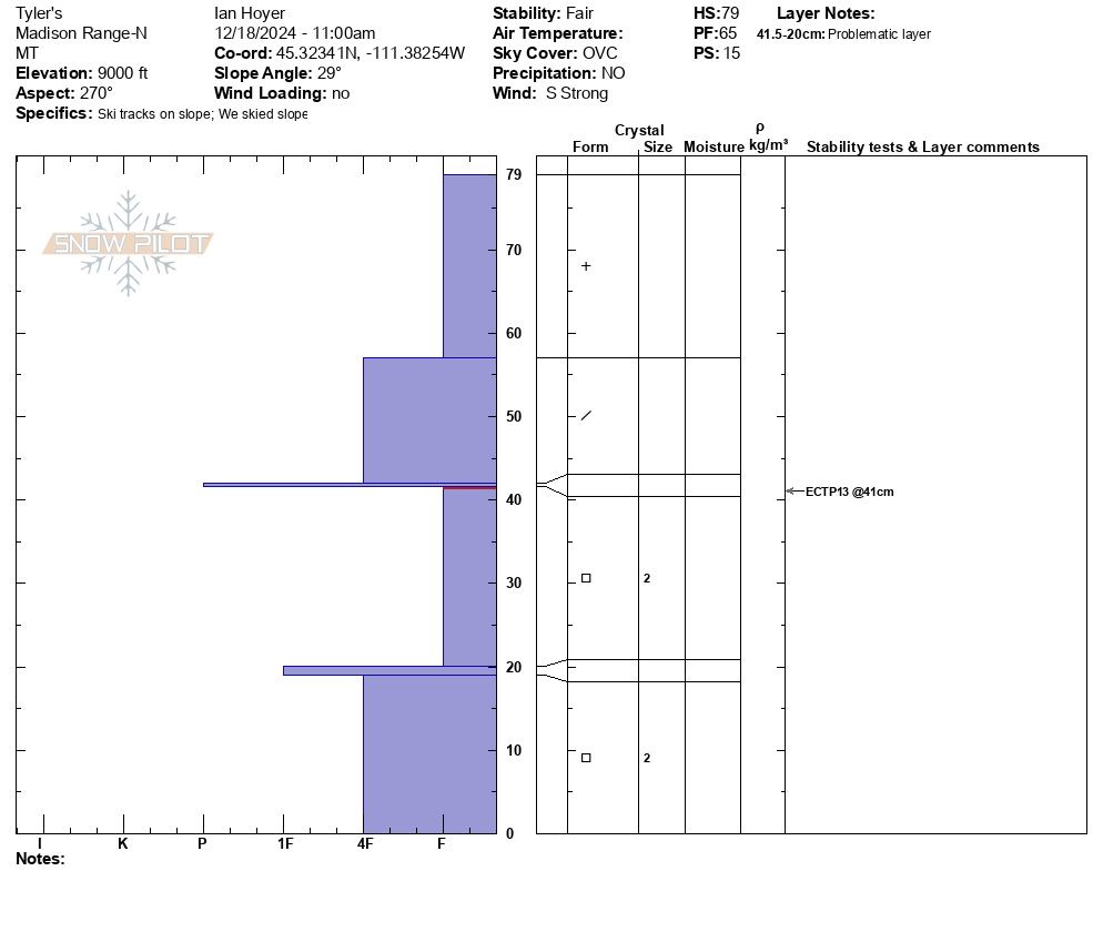
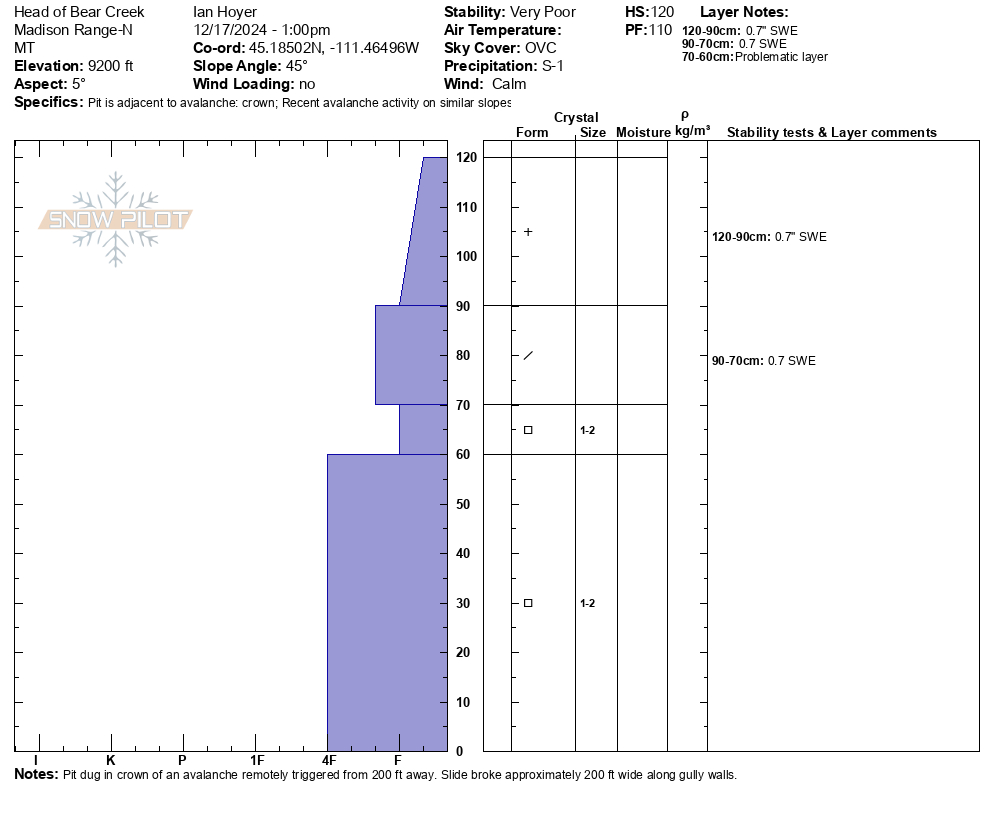
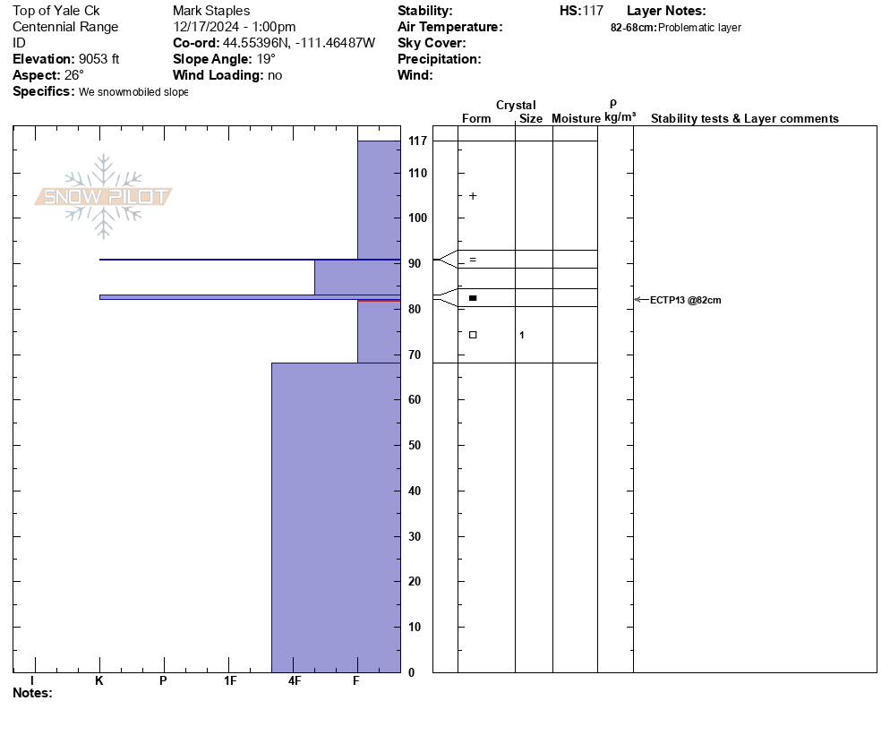
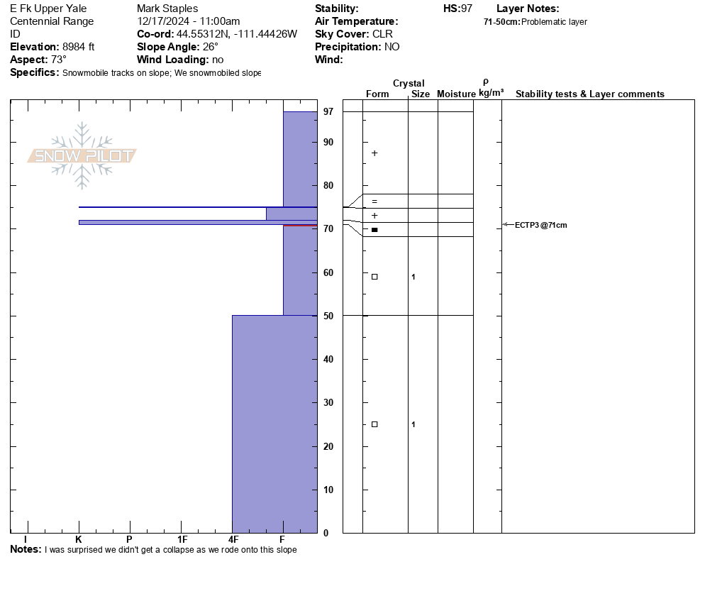
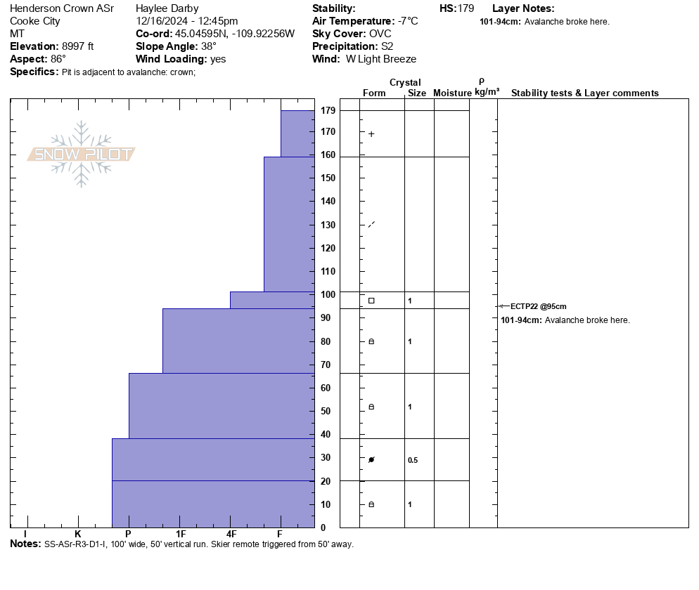
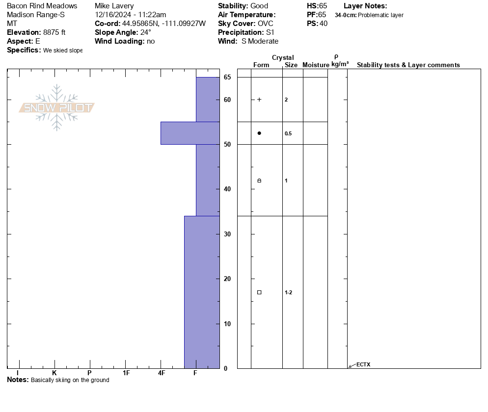
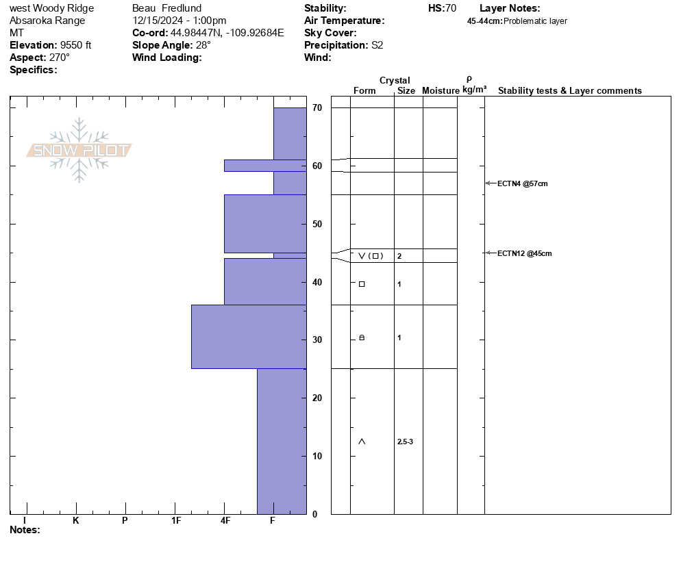
NE facing IP snowpit
-
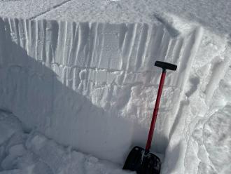
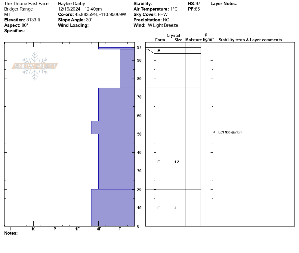
E facing IP snowpit
-
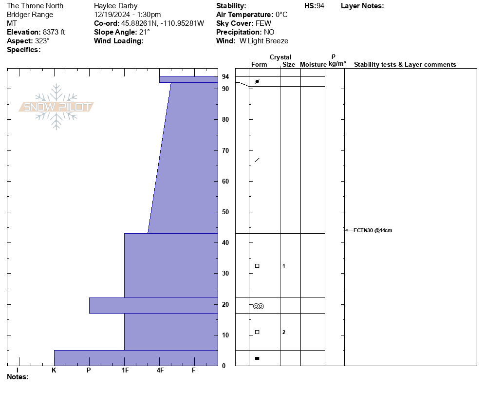
From IG: On 12/15 "Storm slab broke about 200’ above us as skinning up the hallway coming from the north side on the throne." Photo: Anonymous
-
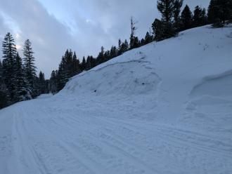
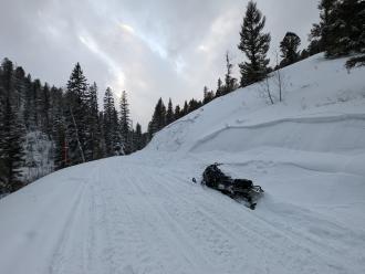
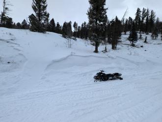
Small windslab triggered on approach for inspection. Failure interface had 5 mm Surface Hoar. Soft slab, remote propagation onto the adjacent slope. Debris covered about half of the road bed.
Photo: J Hambelton
-
Small windslab triggered on approach for inspection. Failure interface had 5 mm Surface Hoar. Soft slab, remote propagation onto the adjacent slope. Debris covered about half of the road bed.
Photo: J Hambelton
-
Small windslab triggered on approach for inspection. Failure interface had 5 mm Surface Hoar. Soft slab, remote propagation onto the adjacent slope. Debris covered about half of the road bed.
Photo: J Hambelton
-
Gusty winds transporting snow in Taylor Fork on Saturday. Triggered a 4-5 inch deep wind slab that propagated about 50 ft at the top of a north east facing slope at 9,500 ft.
Photo: JP
-
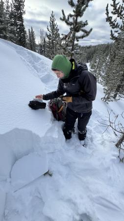
We are grateful for our partnership with the Friends of the Gallatin National Forest Avalanche Center. It is always a good time to get out in the field with our education coordinator, Shannon. Photo: GNFAC
-
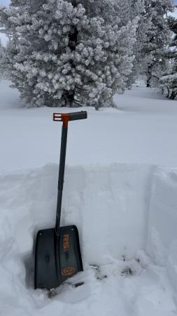
The snow depth was 60-70 cm (2-2.5 feet) at the upper elevations of the Big Springs Loop around the Black Canyon area in Island Park. Photo: GNFAC
-
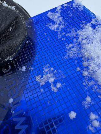
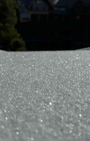
Surface hoar and near surface facets are now capped by this weekend's snow. The layers are buried 2-4" deep in the Black Canyon area of Island Park. Photo: GNFAC
-
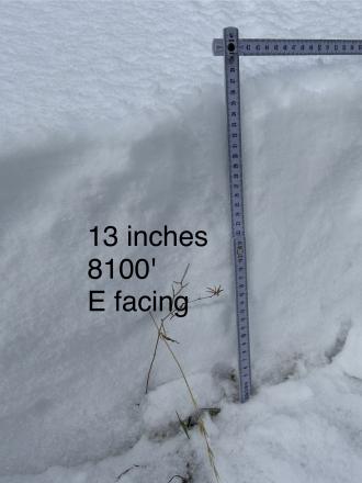
WE facing snow at 8100 ft Cabin Ck
-
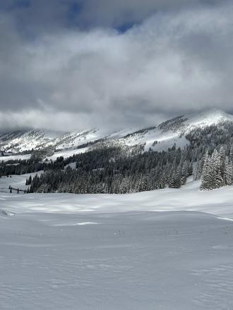
Cabin Creek snow cover
-
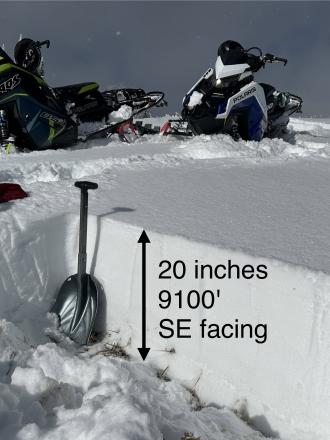
SE facing snow Cabin Creek
-
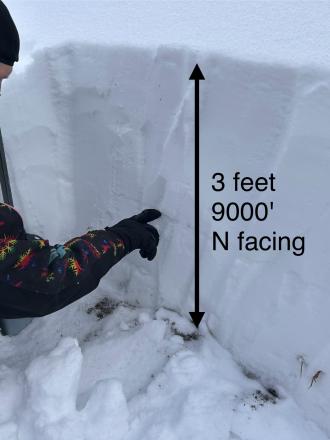
N facing snow Cabin Creek, 9000 ft
-
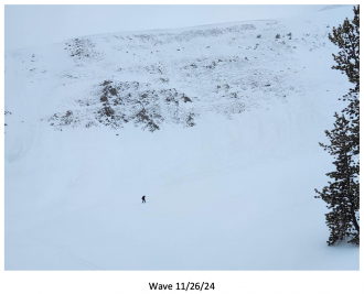
Big Sky Ski Patrol triggered this avalanche during mitigation work in The Wave on 11/26/24... "2-3' deep on an ice crust just above the ground with a 2# shot in the Upper rodeo. Volume was limited as most of the snow was loaded just underneath the cornice, but still produced a sizeable size 2... Other paths in the Lenin region ran meaty wind slabs, full track with no significant step downs." Photo: BSSP
-
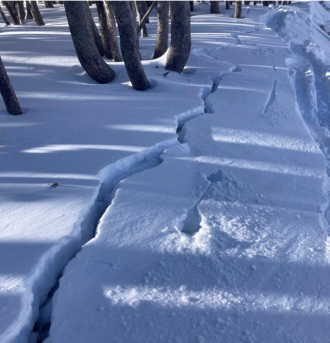
Cracking on old, faceted, October snow hundreds of feet long. North facing near treeline. Photo: BSSP
-
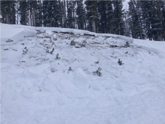
Intentional, human-triggered avalanche by a ski patrol breaking at the ground on a north facing slope near treeline. Photo: BSSP
-
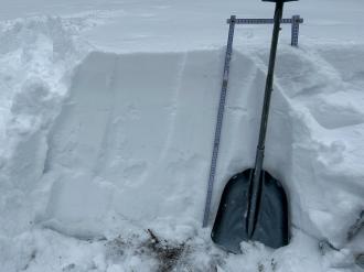
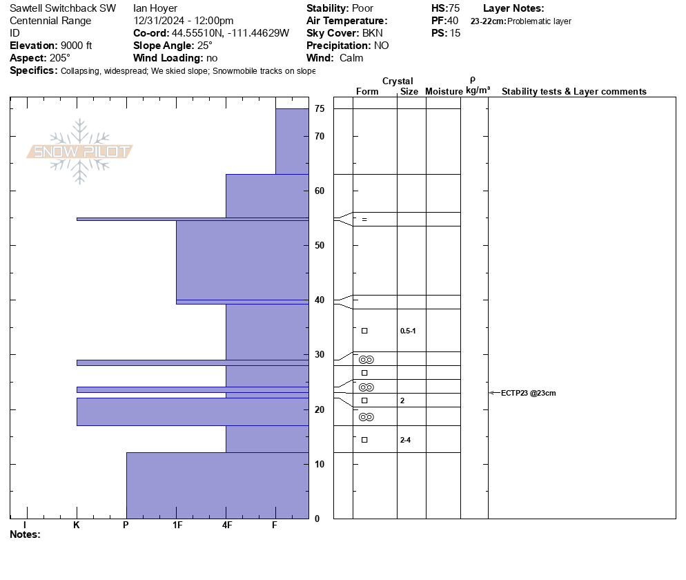
Sawtelle snowpack. Photo: GNFAC
-
Snowpit at Bridger Bowl on 11/5. Photo: B. VandenBos
-
From e-mail: "Photo attached from near top of hyalite peak, 11/2. Cracking in recent hard wind slab, I had to really jump hard to make this. Walked on many other hard slabs that were well bonded. Highly variable snowpack. I think you'd be most likely to get into trouble by popping out a small hard slab pocket like this and getting magic carpeted into some thinly covered terrain." Photo: B. VandenBos
-
From obs: "1-3 mm faceting in front of the Montage. Clear skys and mid 20 temps"
-
On October 17, rain turned to snow and blanketed the mountains of southwest Montana with a fresh coat of snow. Photo: Yellowstone Club Webcam
-
On October 17, rain turned to snow and blanketed the mountains of southwest Montana with a fresh coat of snow. Photo: Bridger Bowl Webcams
-
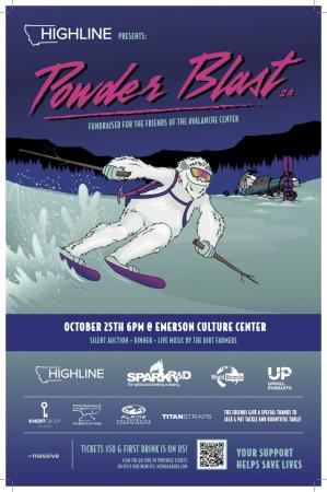
The 26th annual fundraiser for the Friends of the GNFAC is October 25 at the Emerson Cultural Center. More info and tickets at: https://events.eventgroove.com/event/Powder-Blast-2024-101627
Videos- Island Park
Weather Stations- Island Park
Weather Forecast Island Park
Extended Forecast for10 Miles ESE Lakeview MT
Today

High: 16 °F
Mostly Sunny
Tonight

Low: 7 °F
Partly Cloudy
Wednesday

High: 21 °F
Mostly Sunny
Wednesday Night

Low: 10 °F
Partly Cloudy
Thursday

High: 23 °F
Mostly Sunny
Thursday Night

Low: 12 °F
Chance Snow
Friday

High: 19 °F
Snow
Friday Night

Low: -7 °F
Chance Snow
Saturday

High: 4 °F
Chance Snow
The Last Word
Thank you for sharing observations. Please let us know about avalanches, weather or signs of instability via the form on our website, or you can email us at mtavalanche@gmail.com, or call the office phone at 406-587-6984.


