Trip Planning for Cooke City Area
Past 5 Days

High

Considerable

Considerable

Considerable

Considerable
Relevant Avalanche Activity
SS-N-R2-D2.5-O
Coordinates: 44.9855, -109.9410
Caught: 0 ; Buried: 0
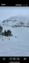
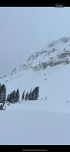
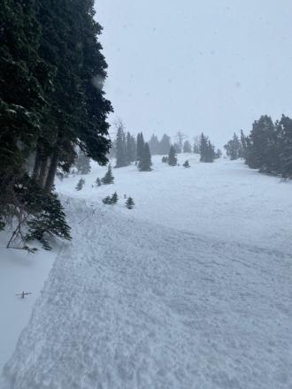
Skied south of Cooke today and noticed a large natural avalanche just north of the South Siren. N-R2-D2.5-O. It wasn't fresh and likely ran during the last storm cycle.
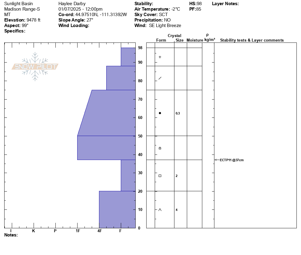
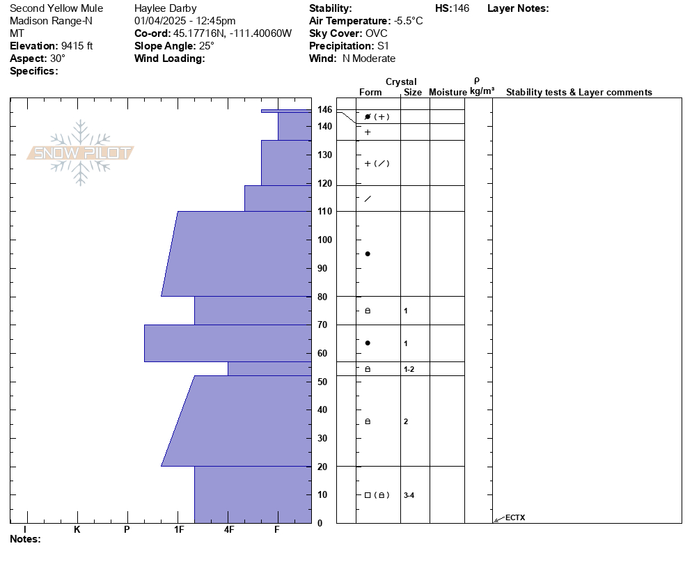
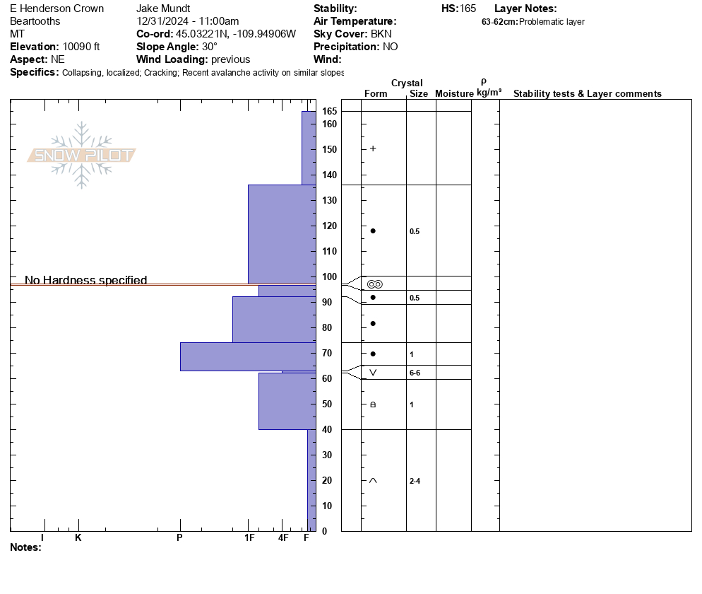
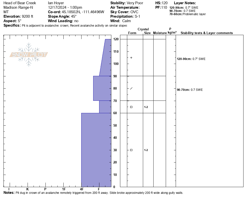
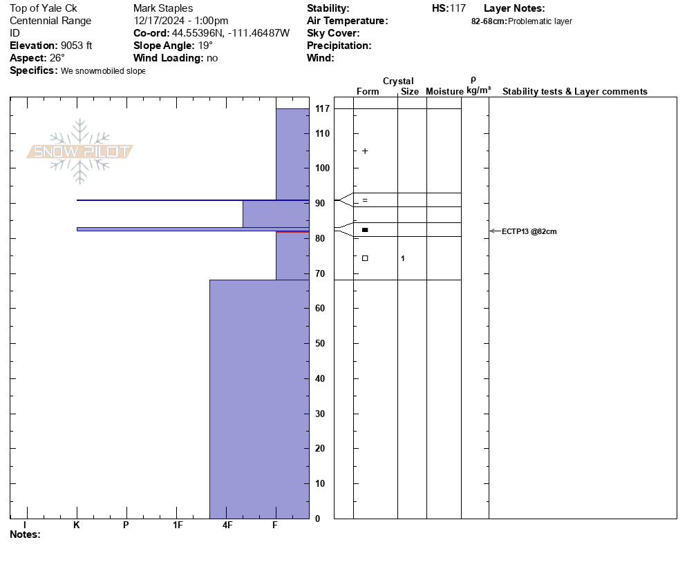
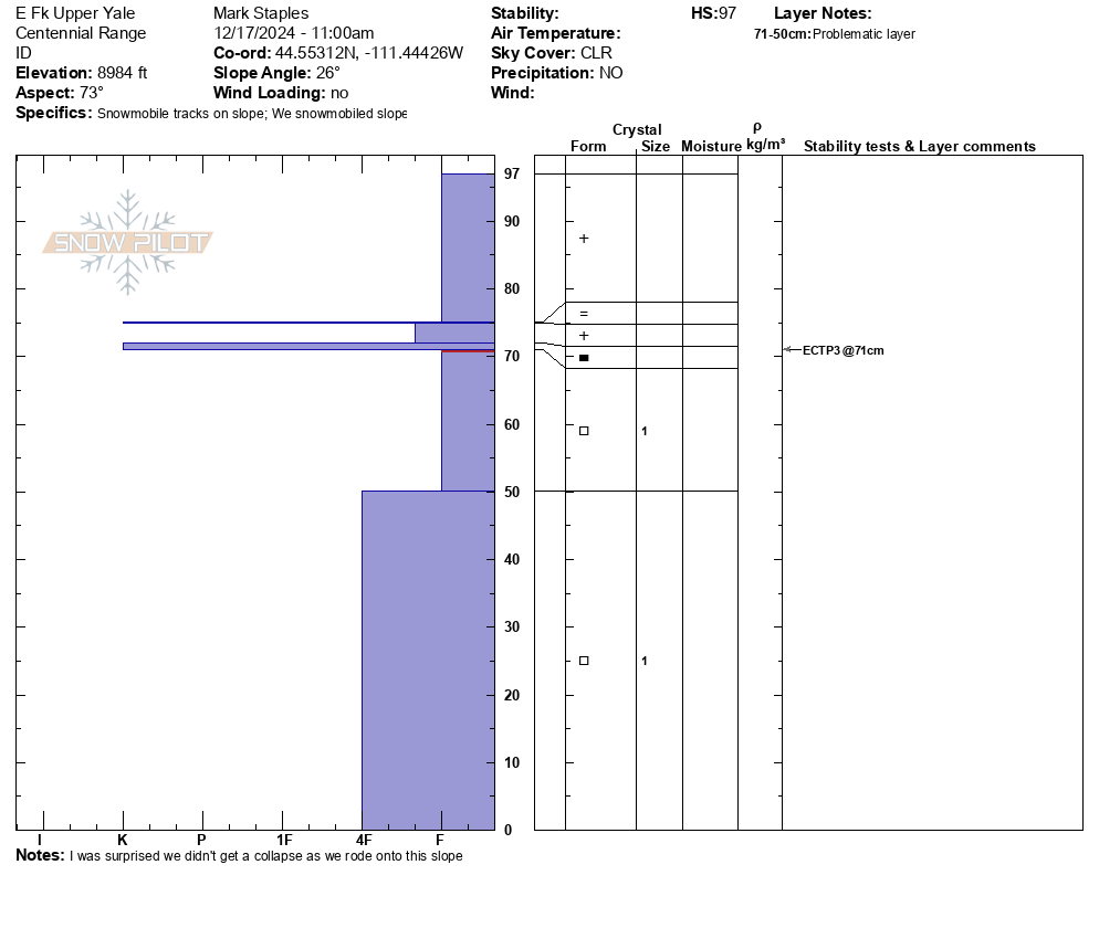
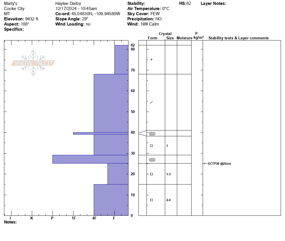
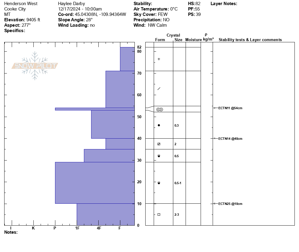
We dug on an east aspect at 9800', ECTX, HS150. No cr, co.
More Avalanche Details
SS-N-R2-D2-G
Aspect: E
Coordinates: 45.0722, -109.9280
Caught: 0 ; Buried: 0
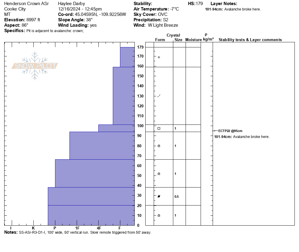
3-4 foot crown about 100 yards wide on East face of sheep mountain.
More Avalanche Details
N
Coordinates: 45.0423, -109.9650
Caught: 0 ; Buried: 0
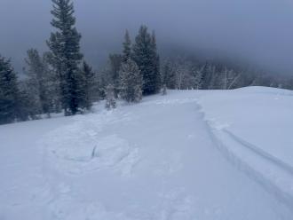
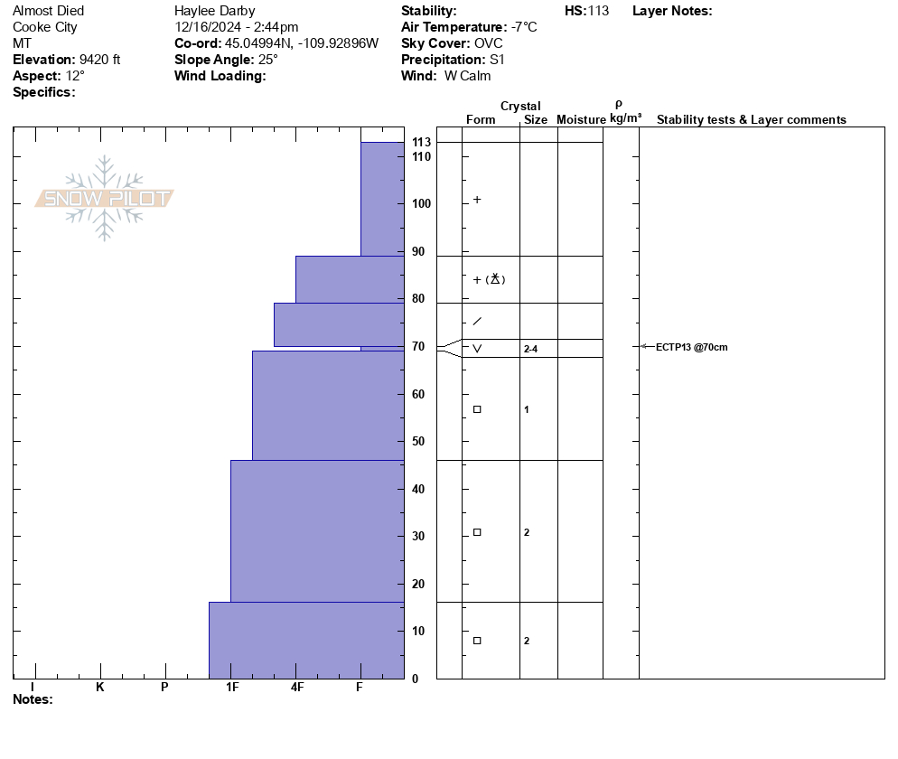
Skied north of Cooke today. The light wasn't great, but I think there is an older avalanche on the east face of Miller Ridge in steep terrain. Could barely make out a crown line near the ridge and old debris on the apron. Maybe it ran 3-5 days ago? No cr, co and the winds were light out of the W-NW, moderate at ridge tops. We picked up 8cm of low density new snow overnight, plus an additional 1cm throughout the day today.
More Avalanche Details
Relevant Photos
-
-
3-4 foot crown about 100 yards wide on East face of sheep mountain. Photo: Mike F
-
3-4 foot crown about 100 yards wide on East face of sheep mountain. Photo: Mike F
-
On Jan 2, 2025 we saw three avalanches just north of Daisy Pass and one on Henderson Mtn. The one on Henderson was difficult to see the crown, but we could see the debris. Two of the slides north of Daisy were 2-3' deep and 100-150' wide and ran into thick stands of trees, looked like thick soft slabs/drifts of recent snowfall. There were a lot of tracks from previous days nearby, but trigger in unknown. The other slide was 1-2' deep and 300-500' wide, soft slab of recent snow. Photo: GNFAC
-
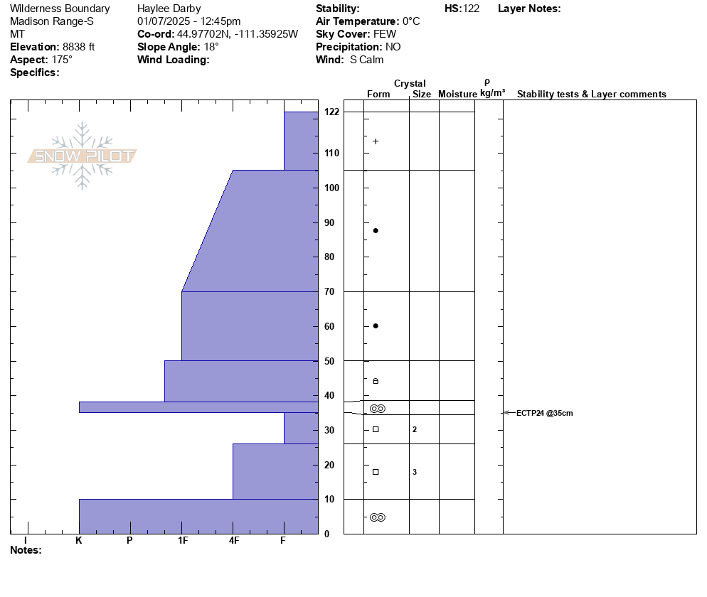
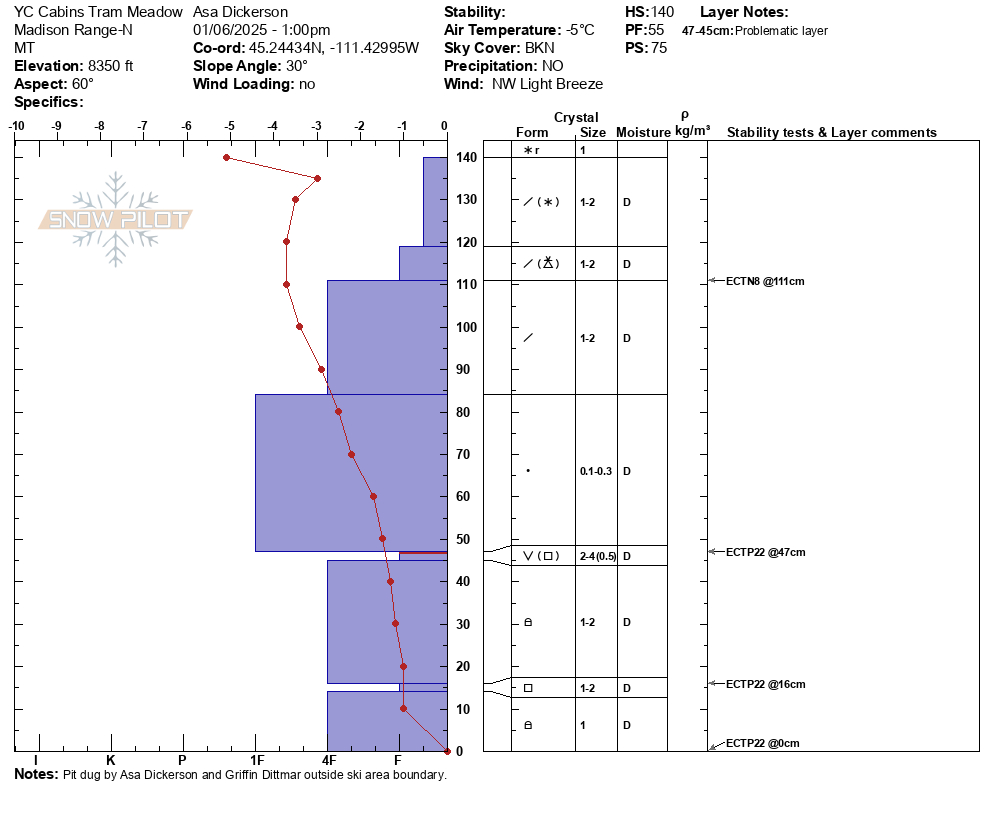
Jan 2, 2025 We dug a pit between Scotch Bonnet and Sheep Mtn. on a sw facing slope at 9,800'. HS was 135cm (4feet). We had ECTP12 and ECTP26, both on a layer at similar height as the surface hoar has been found (1.5-2 feet above the ground). The weak layer was mostly 2-3mm facets w/ small cups and some signs of surface hoar on top of a melt-freeze crust. Photo: GNFAC
-
Rode out to Wolverine Pass on New Years Eve. Daisy pass is a little spicy for novices still. On approach to wolverine pass/YNP boundary we found HS 160cm on NE facing slope at 9200'. Found 3-4mm SH in tact at 110 cm deep. Found 1-2mm FC at 60cm deep. Ectn27 at storm interface layer 60 cm deep. No results on SH layer, but many collapses during the day assumed to be on this layer. Large D2-3 deep Slab avalanche seen on NW facing slope of Sunset Peak. Picture attached. Generally stable condions, but big avalanches on N,NE,NW facing slopes are a real concern for sure.
-
We were ski touring on the SW side of Mt. Henderson today, and noticed a large (natural?) avalanche on the NE aspect of Henderson. First observed at around 1:15pm. It appeared to be very fresh, possibly from a remote trigger this morning.
2 photos attached. A NE aspect, around 10,000'.
It looked to be 4-6' deep and about 500' wide. And it failed on snow at/ near the ground.
Photo: B Fredlund
-
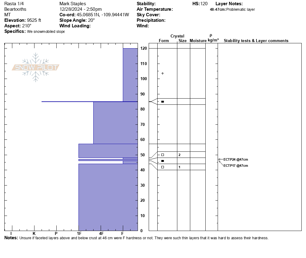
Scotch Bonnet Depth to Weak Layer 28 Dec 2024
-
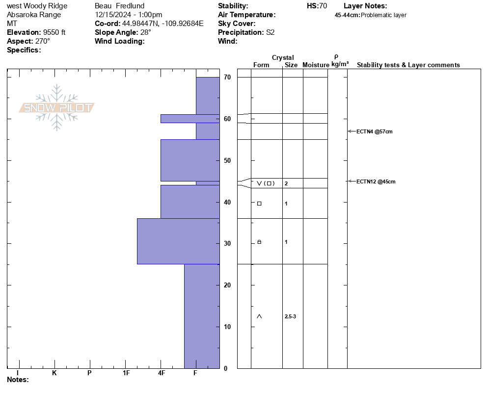
A group on the "Rip Curl" area of Woody Ridge south of Cooke City report ECTP1 test results failing on buried weak layers. Photo: B. Henry
-
We ski toured in Sheep Creek today, north of Cooke City. Of note, a thin (4mm) rime crust was forming due to the high humidity/ quasi rain. Remarkably the rime crust skied very well. Photo: B. Fredlund
-
We experienced several collapses and had propagation in multiple ECTs performed. HS varies between 85-105cm. Photo from 9940
Photo: BMG
-
Photo: BMG
-
I saw a wide slab avalanche up on west Woody Ridge from town. It happened late on Wednesday or overnight during or after the strong winds and snowfall. Photo: GNFAC
-
Wind slab avalanche near Lulu Pass. Photo: GNFAC
-
Large persistant slab avalanche on Henderson. Photo: GNFAC
-
Persistant slab avalanche on Fisher that broke near the ground. Photo: GNFAC
-
D2 avalanche on east facing Mount Fox that appears to be on the SH layer, triggered by a cornice drop.
Photo: B Zavora
-
NE facing, 10,000' Sheep Creek.
Photo: B Fredlund
-
NE- N facing, 10,000' Mt. Henderson
Photo: B Fredlund
-
NE- N facing, 10,000' Mt. Henderson
Photo: B Fredlund
-
NE- N facing, 10,000' Mt. Henderson
Photo: B Fredlund
-
E facing, 10,000 Mt. Henderson
Photo: B Fredlund
-
E facing, 10,200' Scotch Bonnet Mtn.
Photo: B Fredlund
-
NE facing, 9700', Miller Ridge
Photo: B Fredlund
-
E facing, 9900', Bull of the Woods Pass
Photo: B Fredlund
-
Natural avalanche, NE facing, 10,000, Miller Ridge
Photo: B Fredlund
-
Lots of wind slabs south of Cooke today. Strong wind all day and lots of blowing snow. Photo: N Mattes
-
Plumes of drifting snow in the Bridger Range as strong winds blasted the mountains. Photo: GNFAC
-
The clouds broke briefly around noon on Tuesday in Cooke City. Two sections of the face on the Fin slid, one from the top, and one lower and to the right. Photo: N. Mattes
-
Winds drifted snow below cornices and into gullies on Miller Ridge north of Cooke City. Photo: GNFAC
-
Winds drifted snow below cornices and along ridgelines on Henderson Mountain in Cooke City. Photo: GNFAC
-
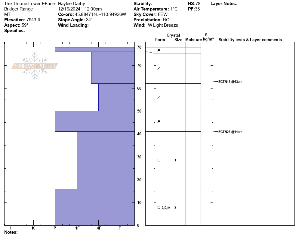
From IG: On 12/15 "Storm slab broke about 200’ above us as skinning up the hallway coming from the north side on the throne." Photo: Anonymous
-
It broke on a convex rollover about 100 ft wide and ran about 80 ft. downslope. The crown averaged 30 inches and broke on sugary facets about 18 inches from the ground. Photo: Anonymous
-
It broke on a convex rollover about 100 ft wide and ran about 80 ft. downslope. The crown averaged 30 inches and broke on sugary facets about 18 inches from the ground. Photo: Anonymous
-
Found preserved buried surface hoar approximately 15-20cms below the snow surface.
Photo: Beartooth Mountain Guides
-
Gusty winds transporting snow in Taylor Fork on Saturday. Triggered a 4-5 inch deep wind slab that propagated about 50 ft at the top of a north east facing slope at 9,500 ft.
Photo: JP
-
Photo: Anonymous
-
Surface hoar stripe in snowpit near Cooke.
Photo: GNFAC
-
We skied near Lulu Pass and dug a pit on a northeast facing slope at 9,500'. There was 6-8" of low density new snow on top of a thick layer of surface hoar (10-16mm, photos attached). Photo: GNFAC
Videos- Cooke City Area
Weather Stations- Cooke City Area
Weather Forecast Cooke City Area
Extended Forecast for2 Miles NNE Cooke City MT
Overnight

Low: 6 °F
Mostly Cloudy
Wednesday

High: 23 °F
Chance Snow
Showers and
Patchy
Blowing SnowWednesday Night
Low: 9 °F
Snow Showers
then Chance
Snow ShowersThursday
High: 21 °F
Slight Chance
Snow then
SunnyThursday Night

Low: 5 °F
Mostly Clear
Friday

High: 24 °F
Chance Snow
Friday Night

Low: 14 °F
Snow
Saturday

High: 20 °F
Snow
Saturday Night

Low: 8 °F
Chance Snow
The Last Word
Tragically, a skier was killed, and a second sustained injuries in an avalanche in western Wyoming on Sunday (preliminary information). This is the fifth avalanche fatality this season. Our hearts go out to the skiers’ friends and family, backcountry partners, and the rescue teams.


