
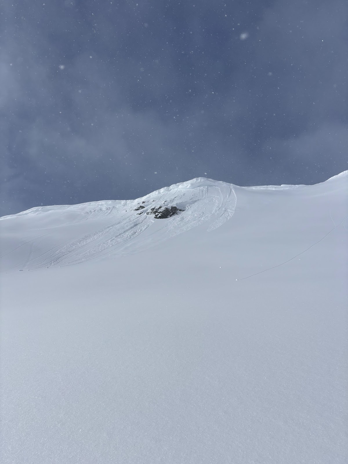
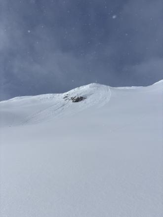
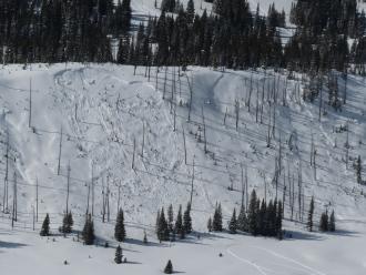
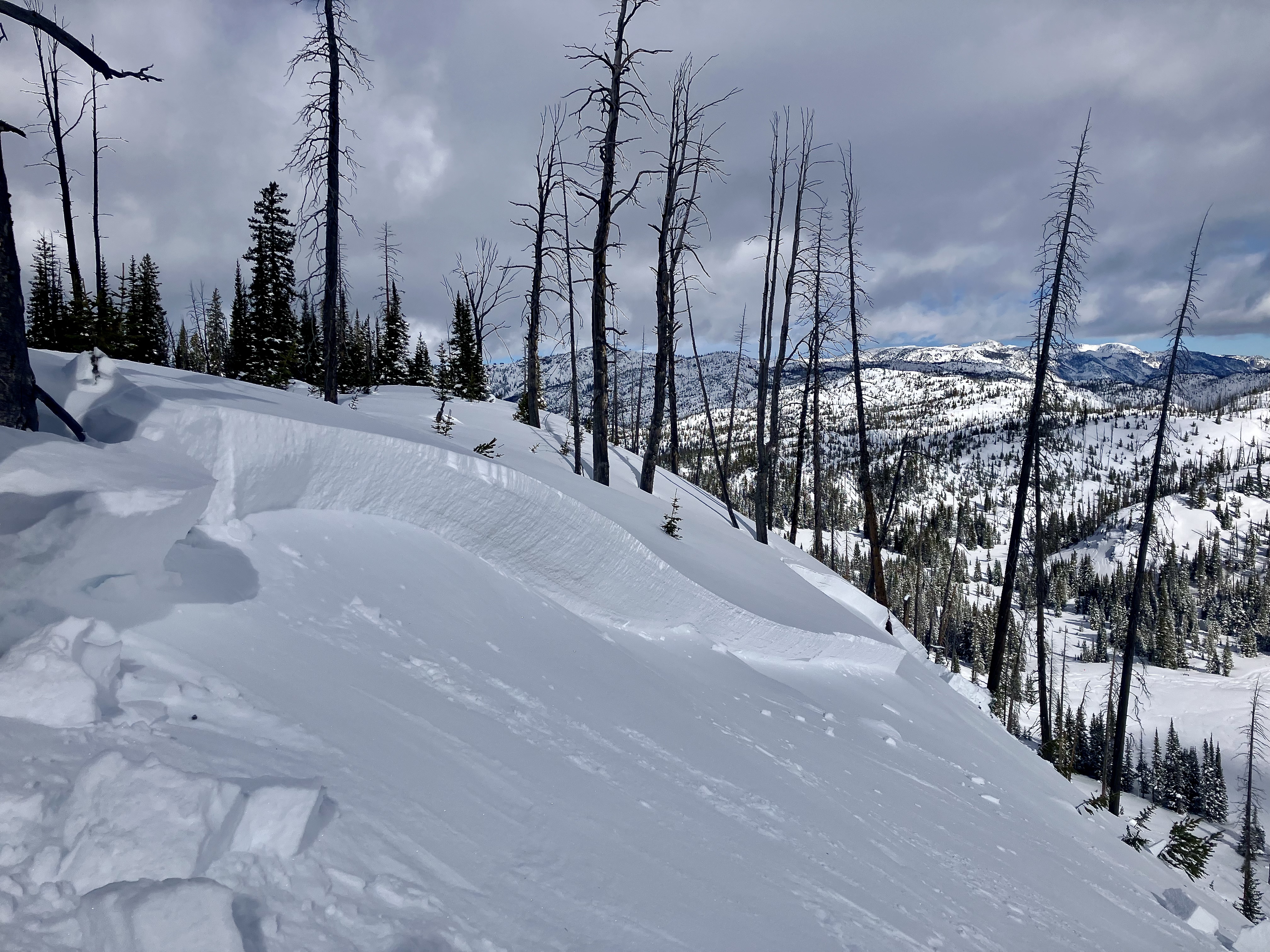
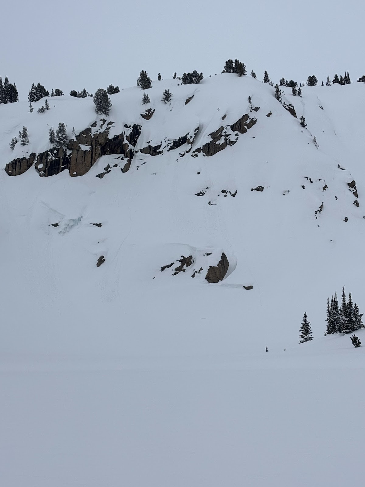
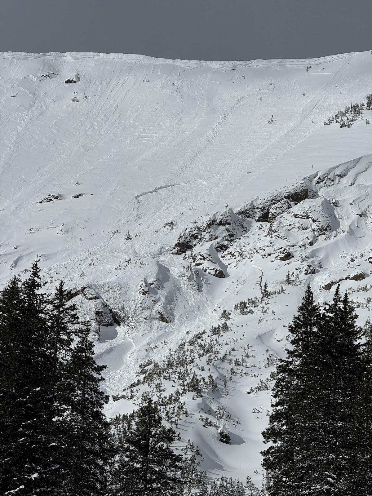
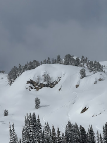
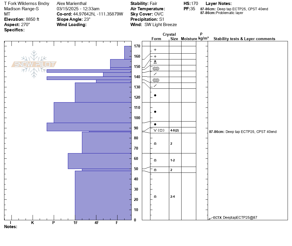
"Today I triggered a D1 dry loose avalanche on a E facing 35 degree slope, 9300 ft on Mt Henderson. The new snow is very low density and is not bonding well to the old interface. I also observed some more dry loose activity/small wind slabs on Sheep Mt, NE facing, 10400 ft."
Trip Planning for Cooke City Area

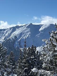
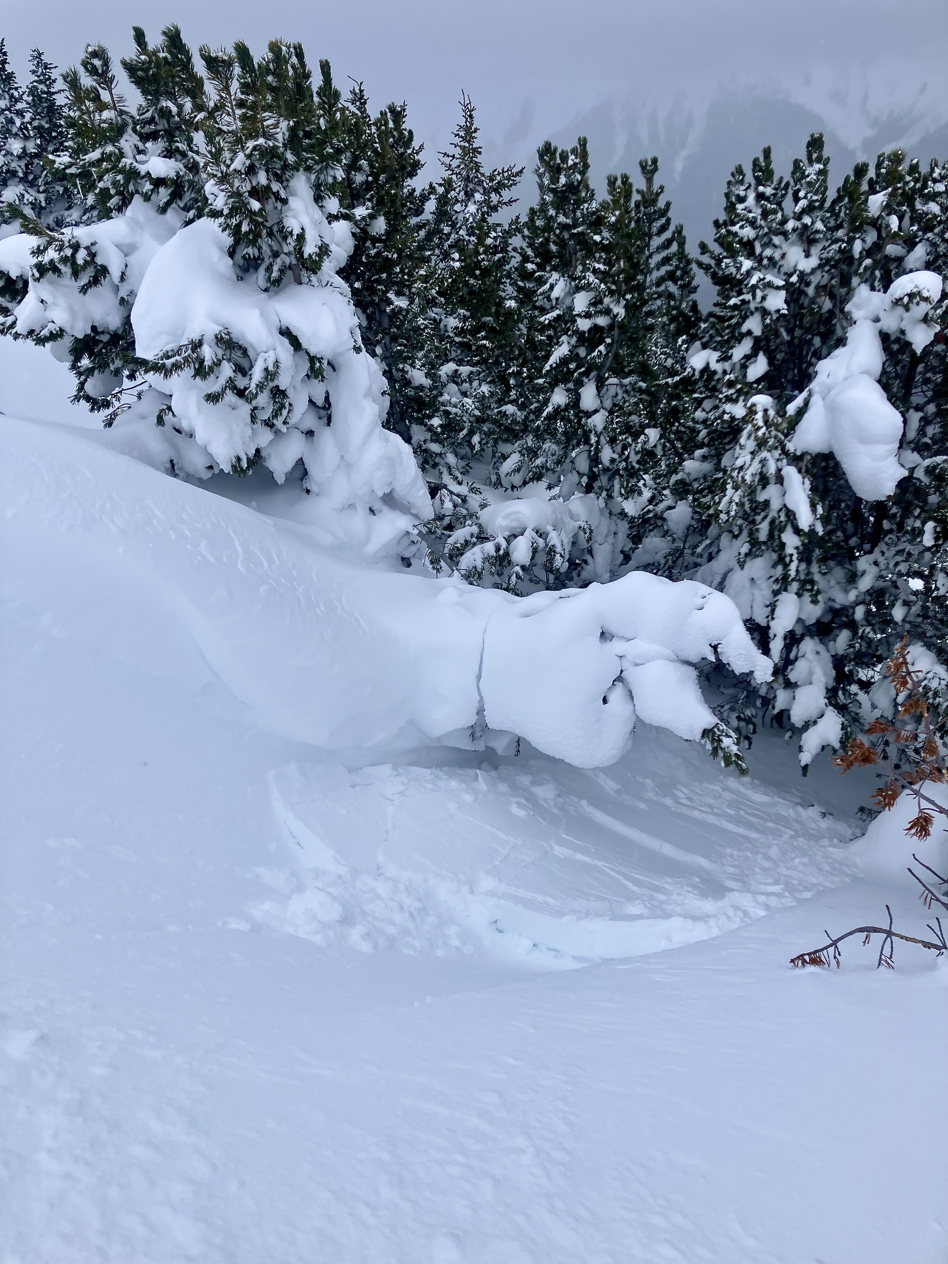
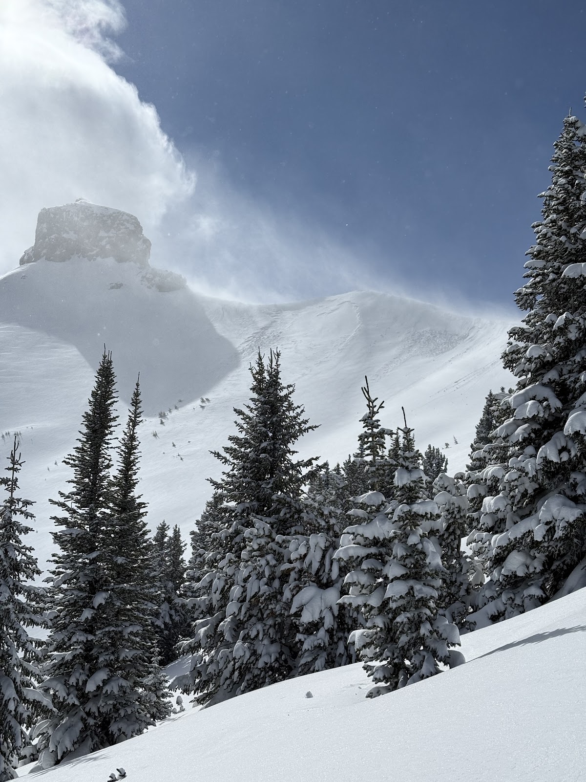
Primary Problem: Wind Slab
Bottom Line: Heavy snowfall since late last week combined with hurricane force winds on Sunday night make wind slabs and deeper persistent slab avalanches a major concern on wind loaded slopes. The new snow has bonded well to itself, but with so much of it, even on non-wind loaded slopes there may be places with a relatively shallower snowpack where avalanches could break into older snow.Past 5 Days
Sat Mar 15

Moderate
Moderate
Sun Mar 16

Considerable
Considerable
Mon Mar 17

High
High
Tue Mar 18
High
High
Today
Considerable
Considerable
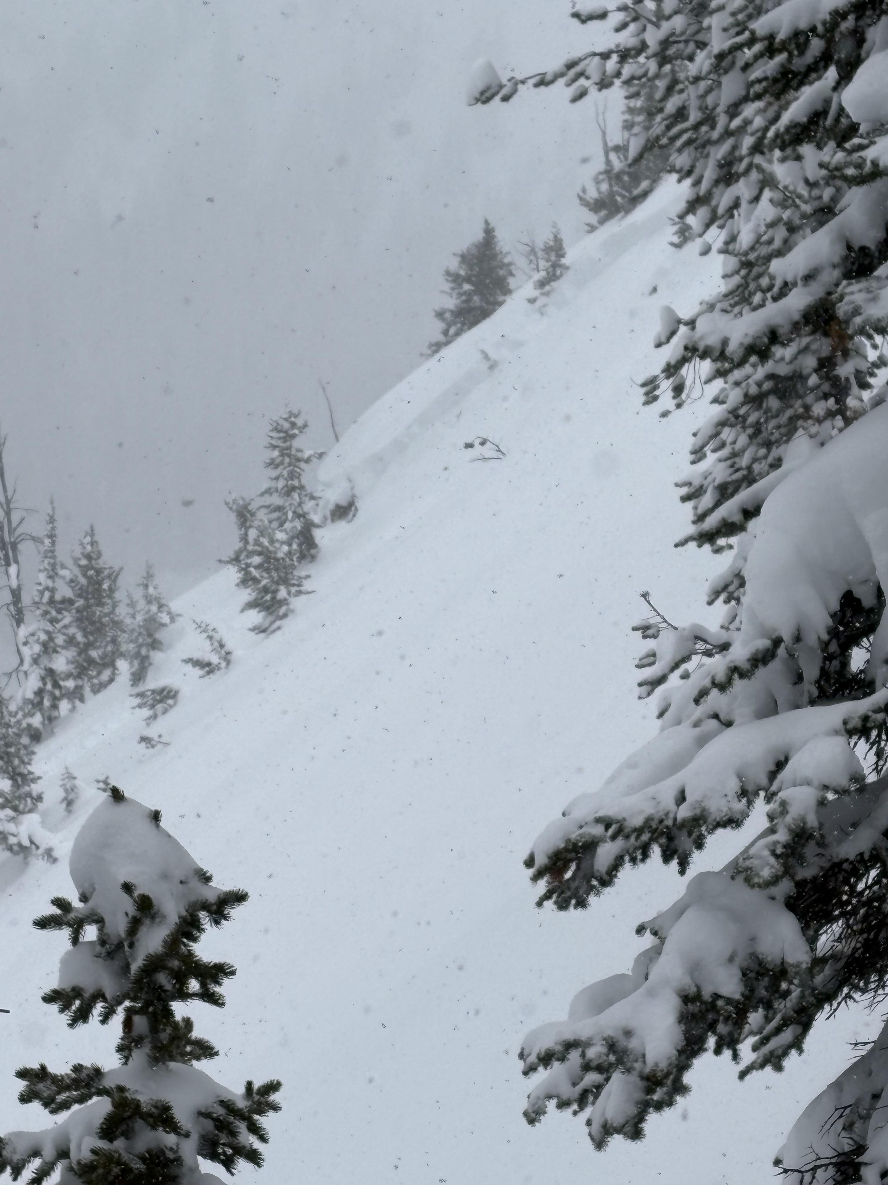
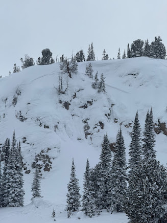
Relevant Avalanche Activity
Cooke City
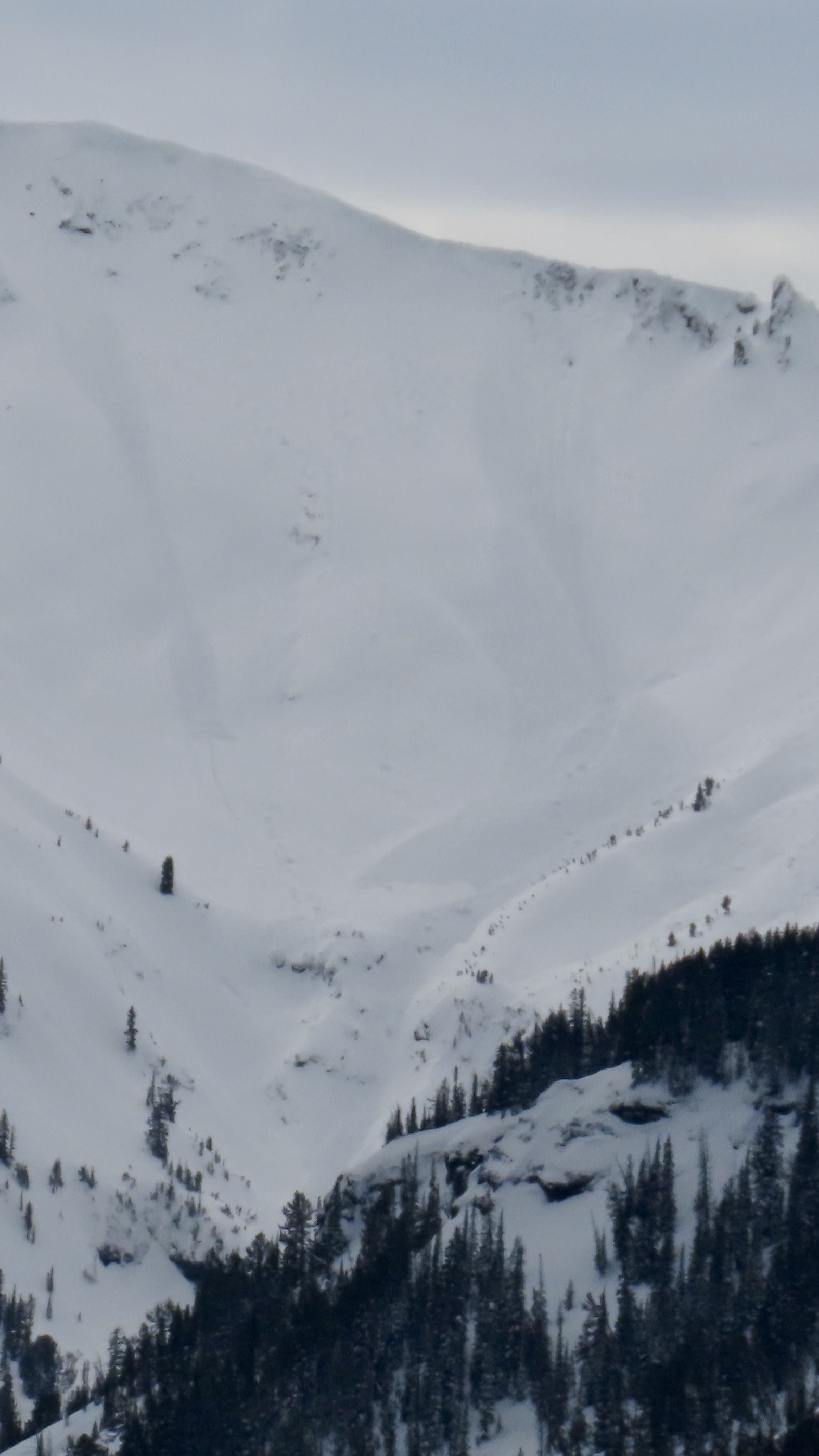
Henderson Mountain
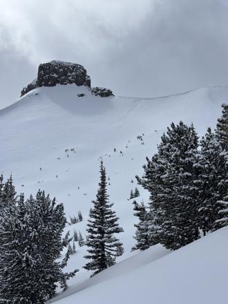
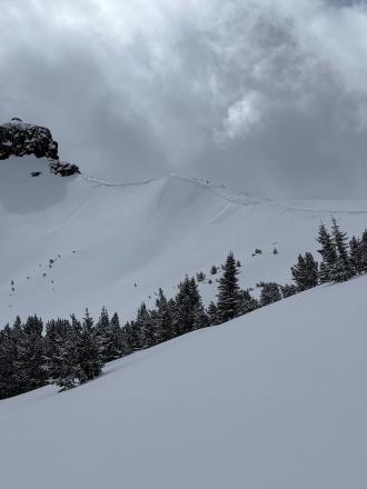
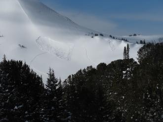
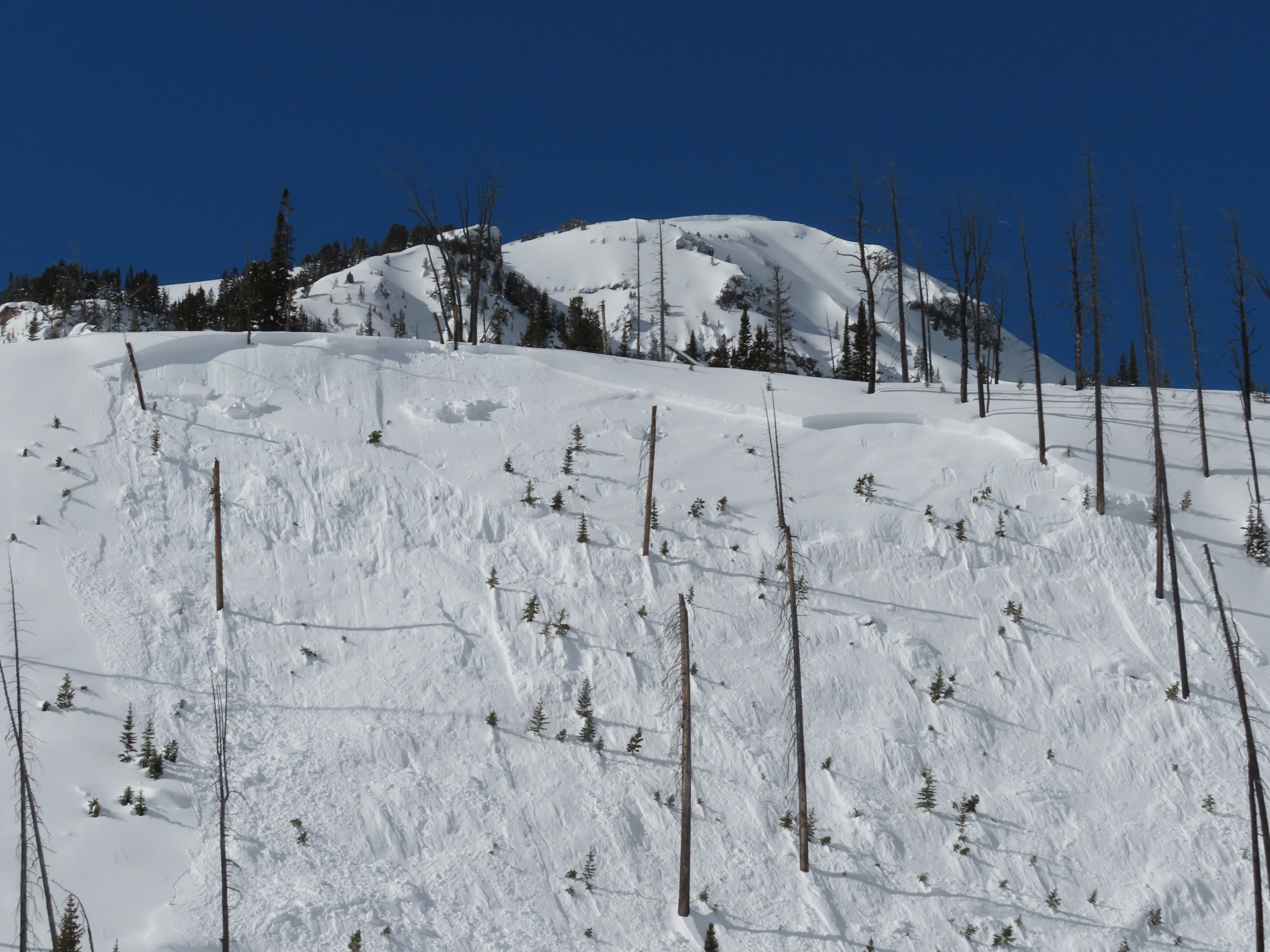
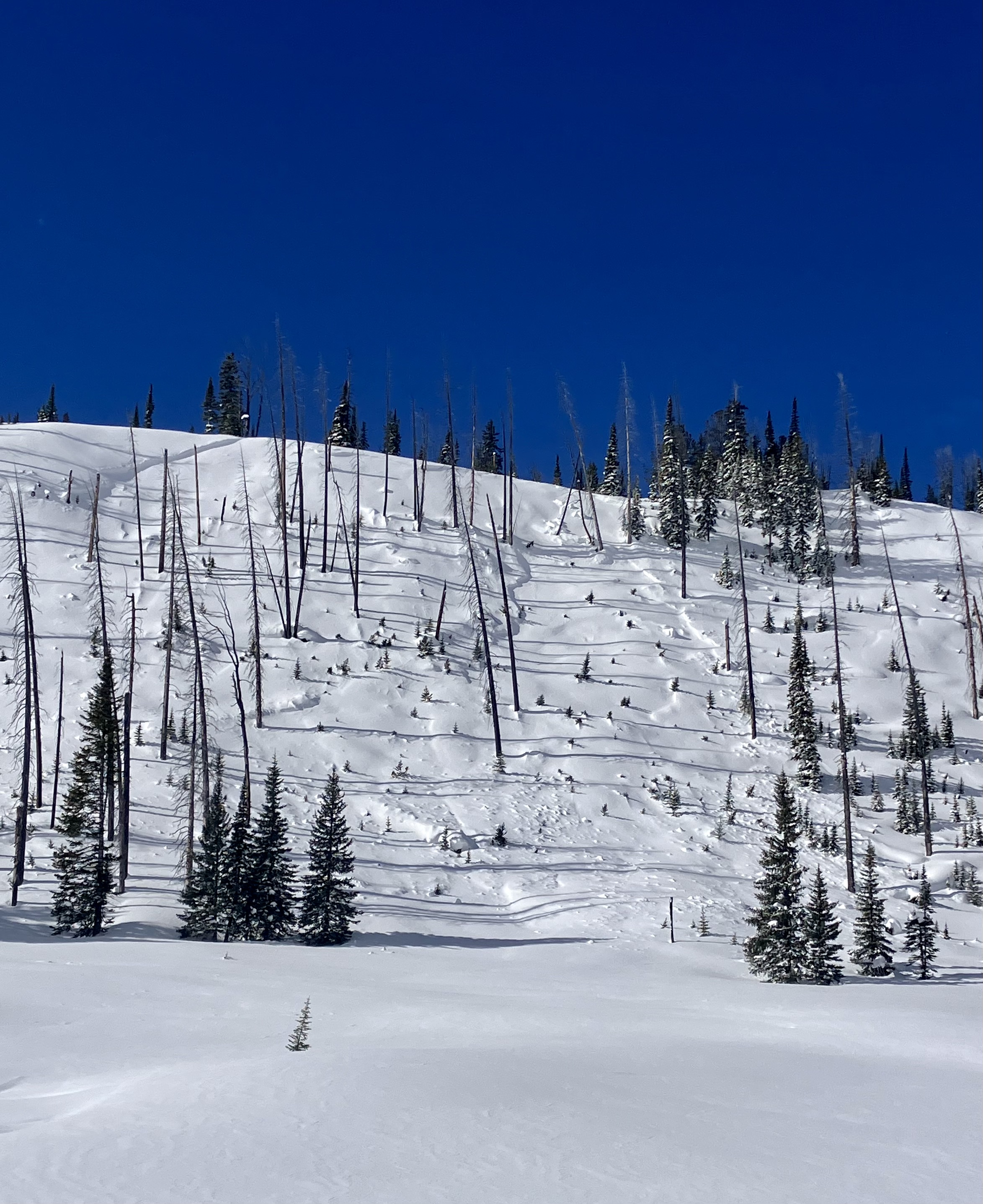
Dry Loose avalanches near Cooke
Henderson Mountain
L-AS-D1
Elevation: 9,300
Aspect: E
Coordinates: 45.0524, -109.9450
Caught: 0 ; Buried: 0
More Avalanche Details
L-AS-D1
Elevation: 9,300
Aspect: E
Coordinates: 45.0524, -109.9450
Caught: 0 ; Buried: 0
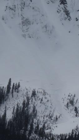
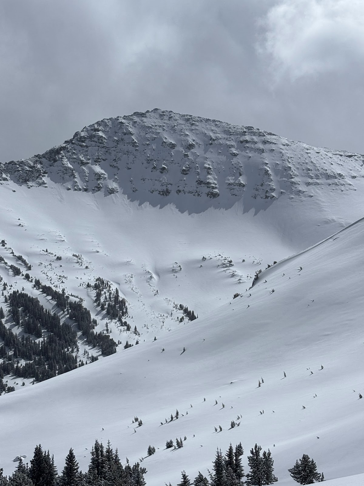
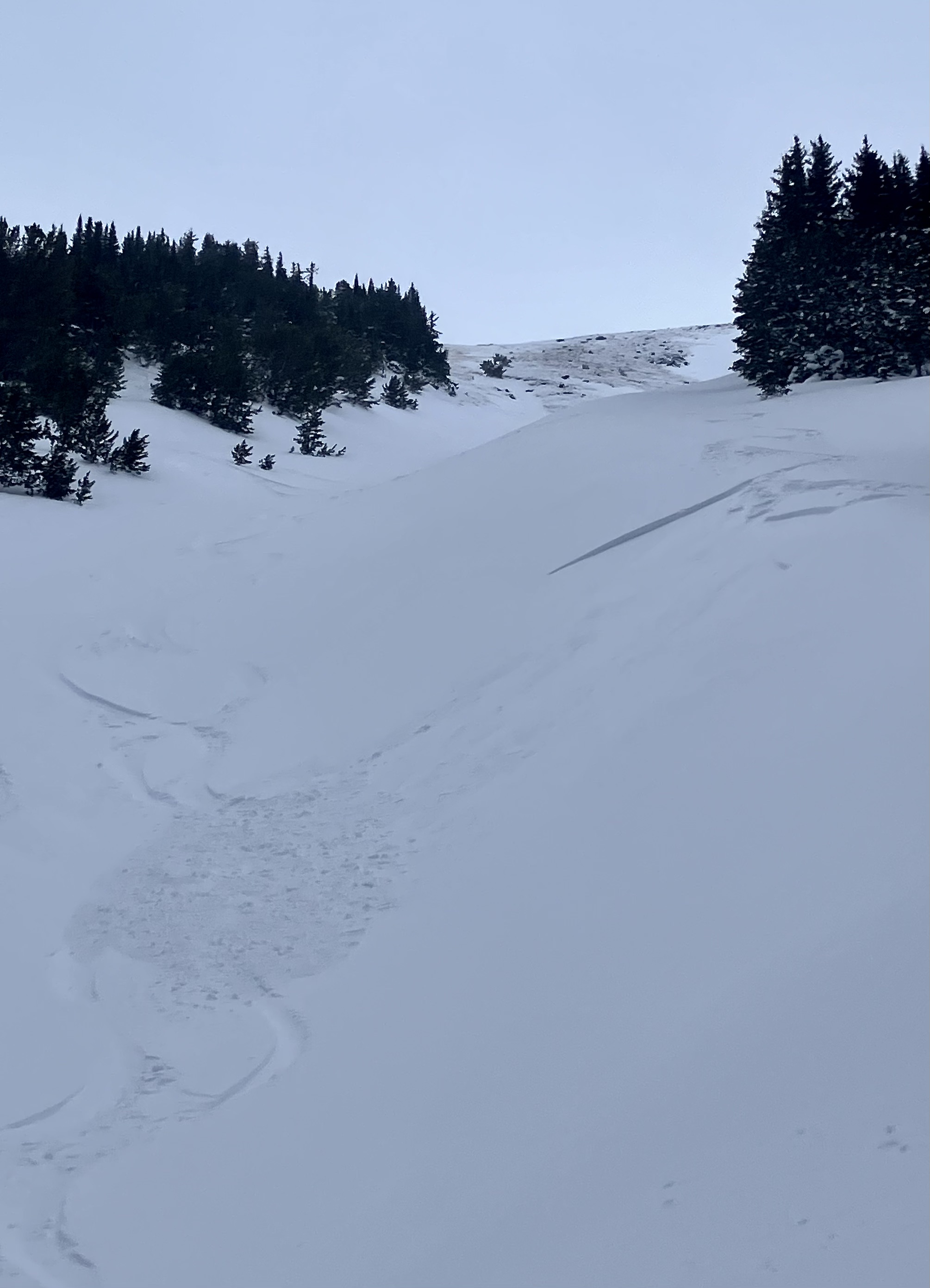
Today I triggered a D1 dry loose avalanche on a E facing 35 degree slope, 9300 ft on Mt Henderson. The new snow is very low density and is not bonding well to the old interface. I also observed some more dry loose activity/small wind slabs on Sheep Mt, NE facing, 10400 ft.
More Avalanche Details
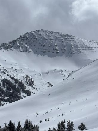
Cooke City
Abiathar Peak
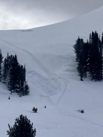
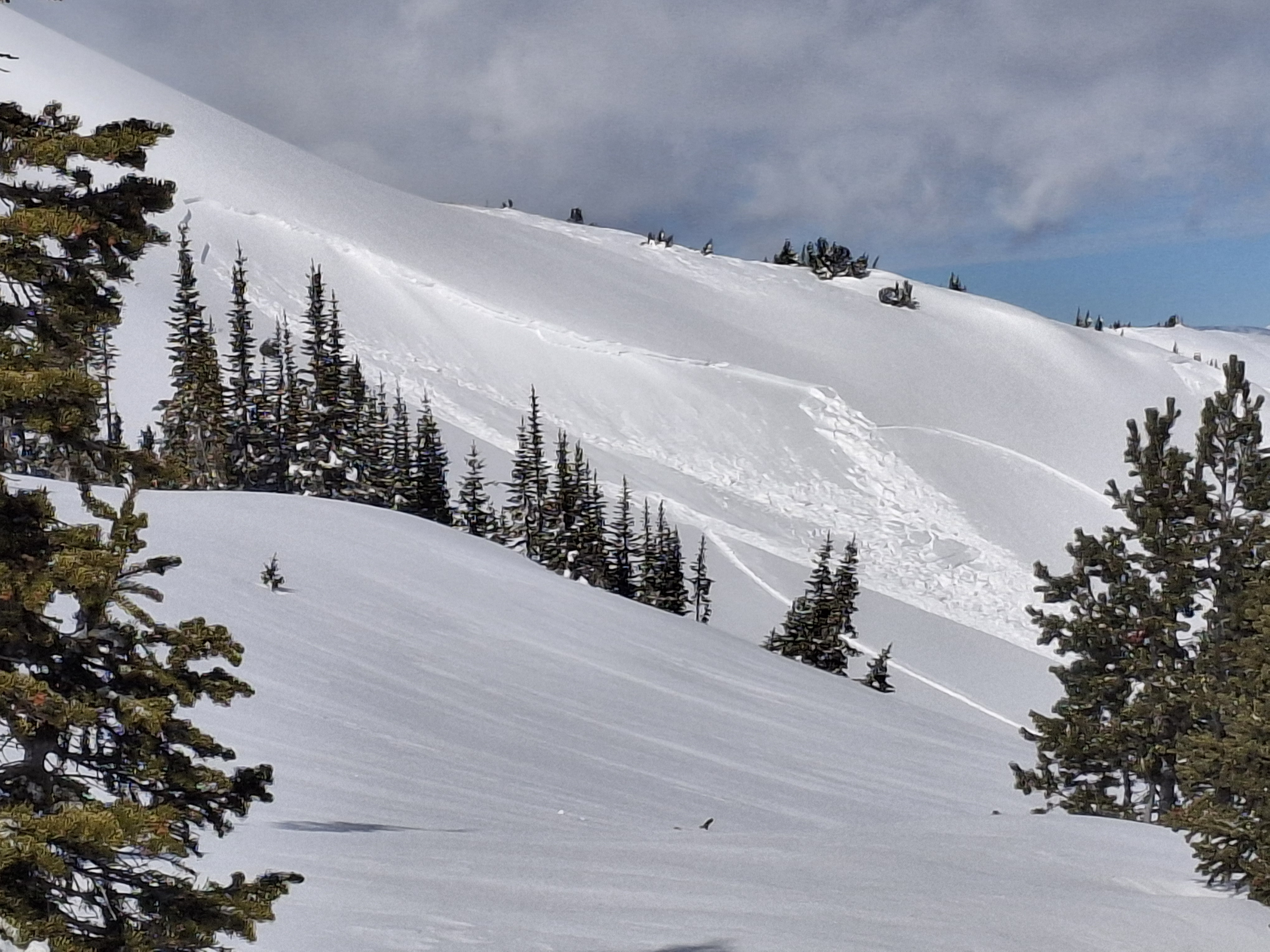
Small storm slabs and dry loose in Cooke
Abiathar Peak
SS-AS
Coordinates: 44.9756, -110.0310
Caught: 0 ; Buried: 0
More Avalanche Details
SS-AS
Coordinates: 44.9756, -110.0310
Caught: 0 ; Buried: 0
Found 5-8” of fresh low-medium density snow. Triggered multiple small soft storm slabs/sluff which occurred on steeper slopes (40+ degrees).
More Avalanche Details
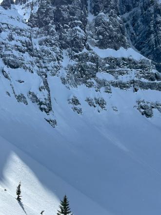
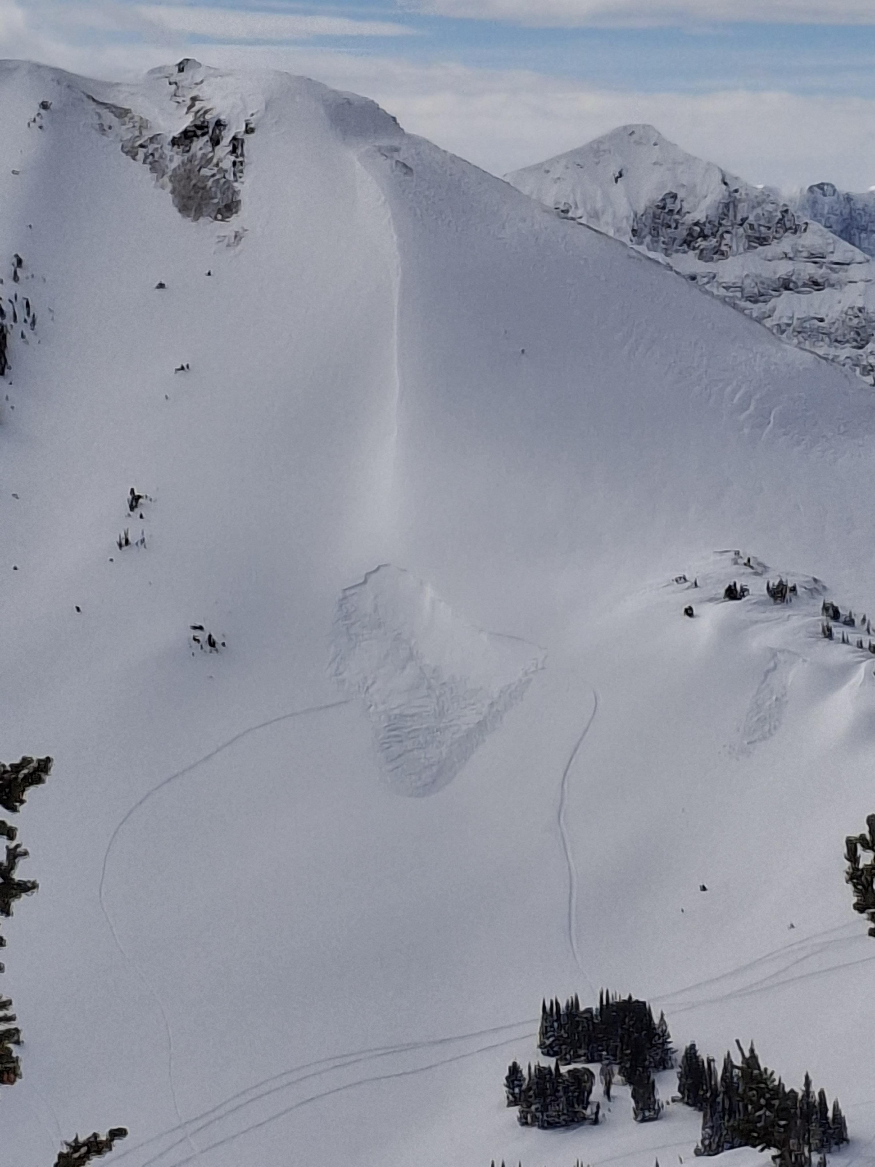
Cooke City
Crown Butte
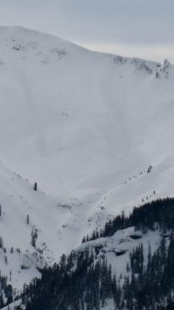
small dry loose slides north of Cooke
Crown Butte
L-N-R1-D1-S
Elevation: 9,500
Aspect: S
Coordinates: 45.0525, -109.9620
Caught: 0 ; Buried: 0
More Avalanche Details
L-N-R1-D1-S
Elevation: 9,500
Aspect: S
Coordinates: 45.0525, -109.9620
Caught: 0 ; Buried: 0
There was a small natural dry loose on south face of Crown Butte and I triggered a dry loose slide on a test slope near the ridge on Miller ridge (video).
More Avalanche Details
Relevant Photos
Displaying 1 - 40
-
-
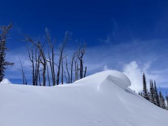
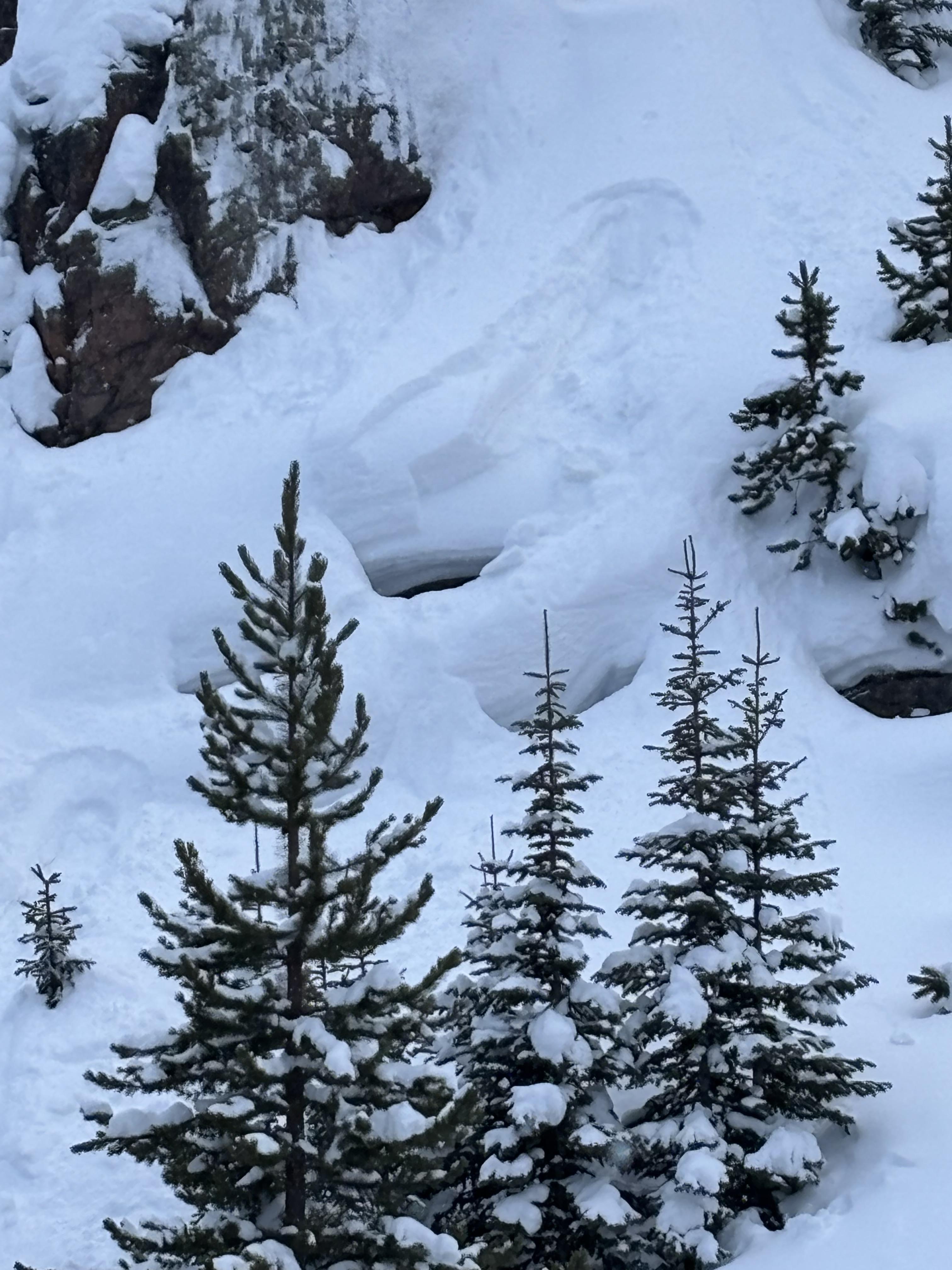
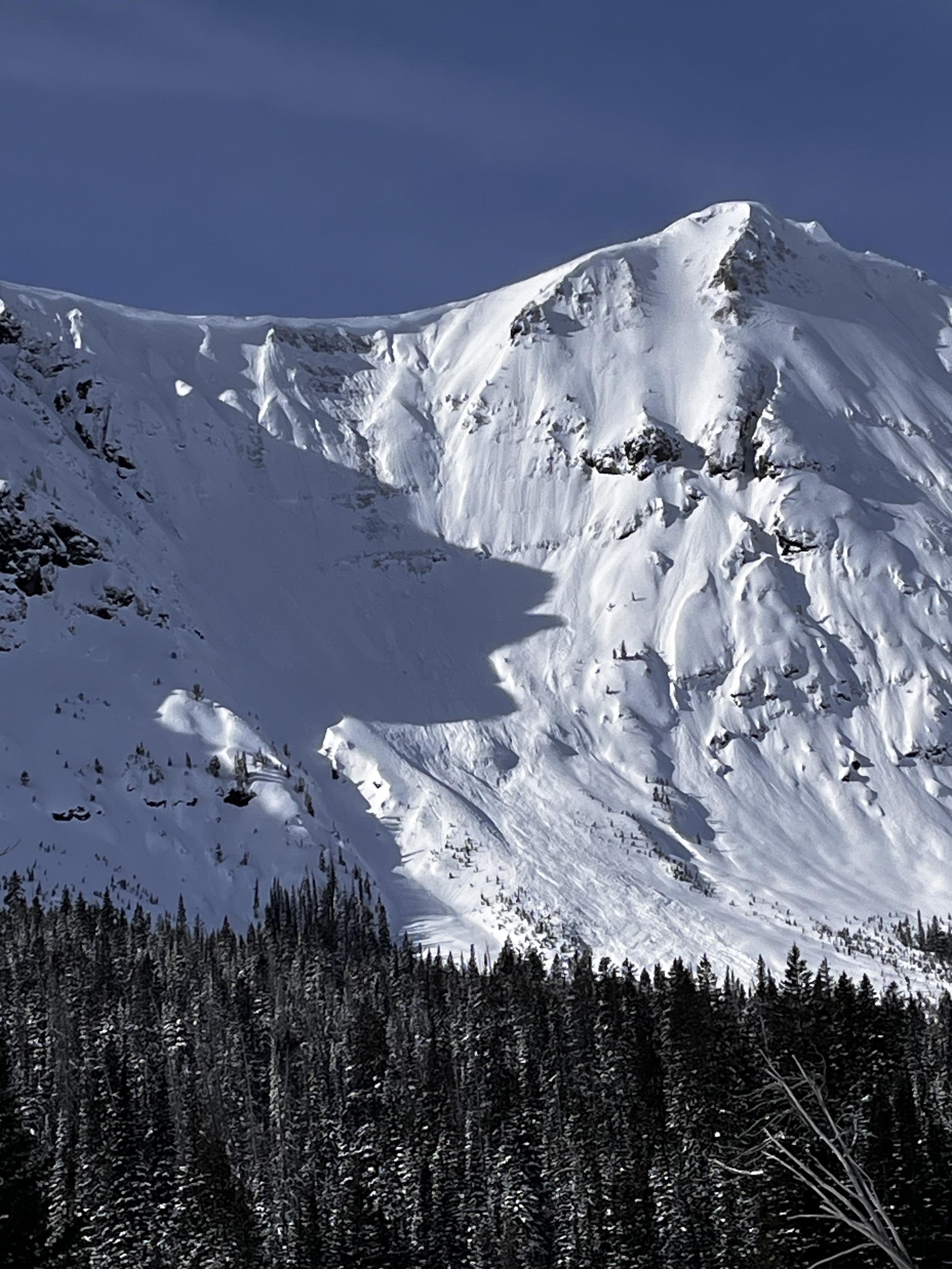
Near Cooke City on Mar 14 there was 6" of new snow and wind was calm, even along the ridge near regularly wind-loaded slopes, and there was no snow blowing off ridgelines. The photo shows a slope that normally receives a lot of wind effect, but the new snow is unaffected indicating the wind has been calm. Photo: GNFAC
-
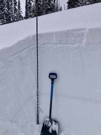
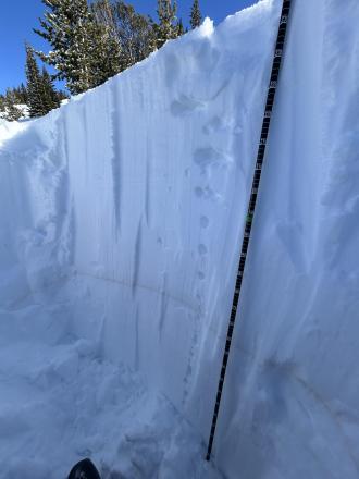
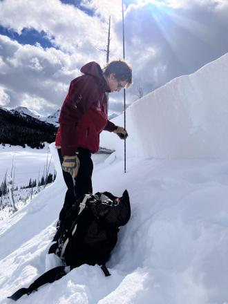
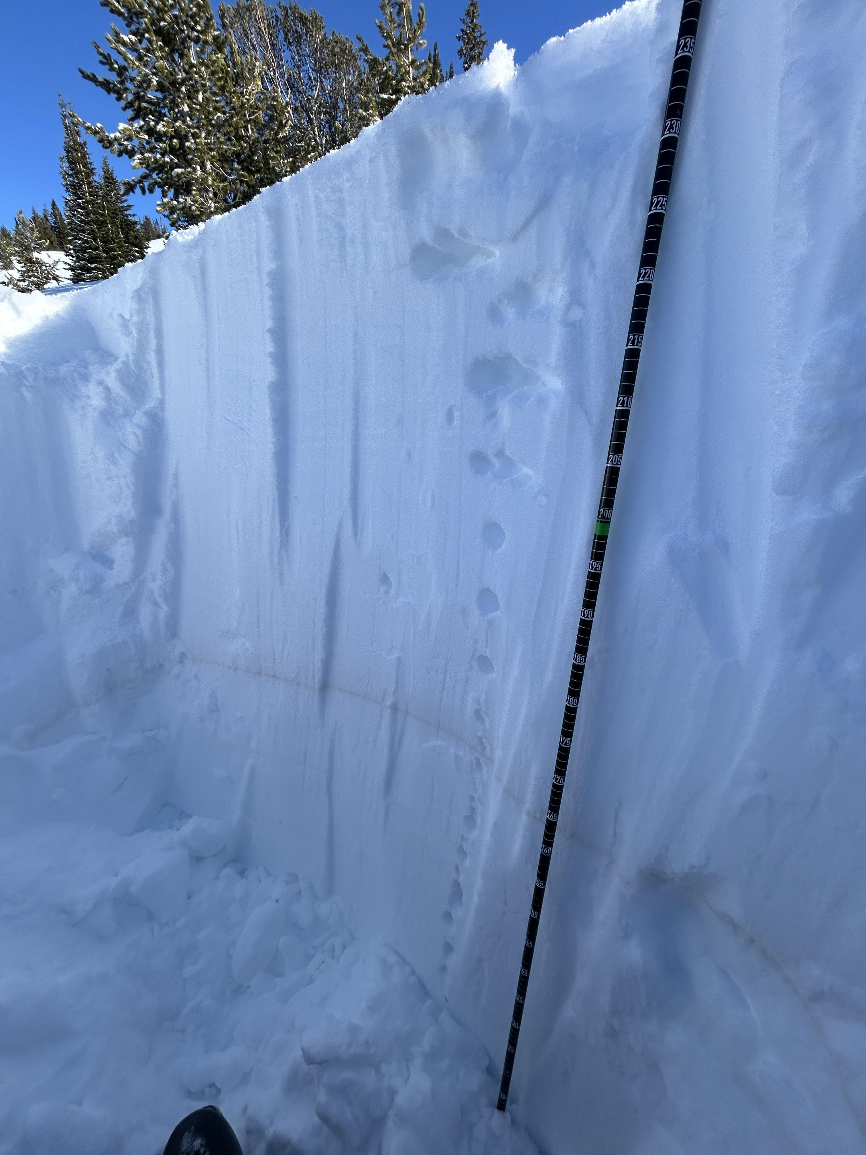
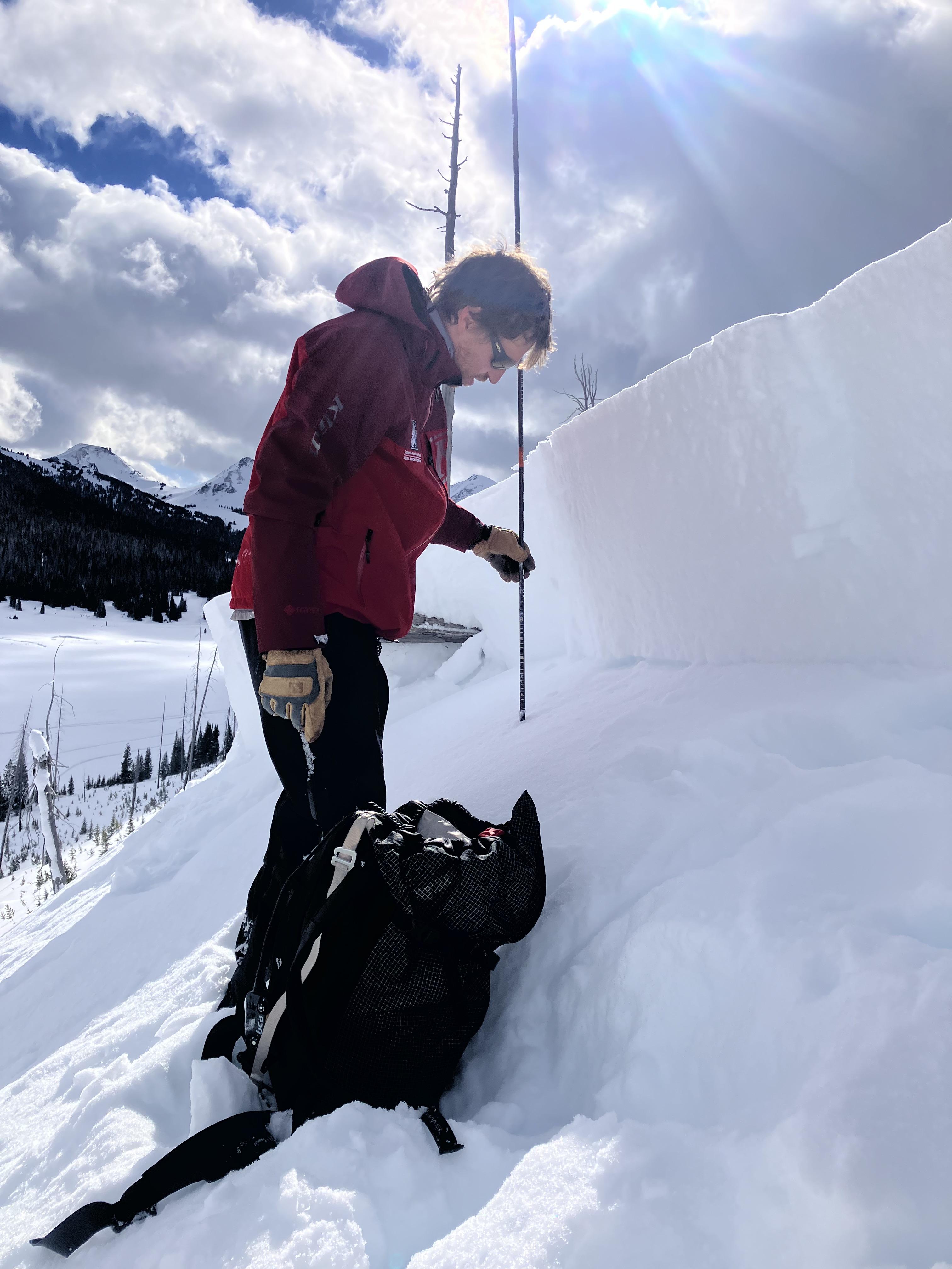
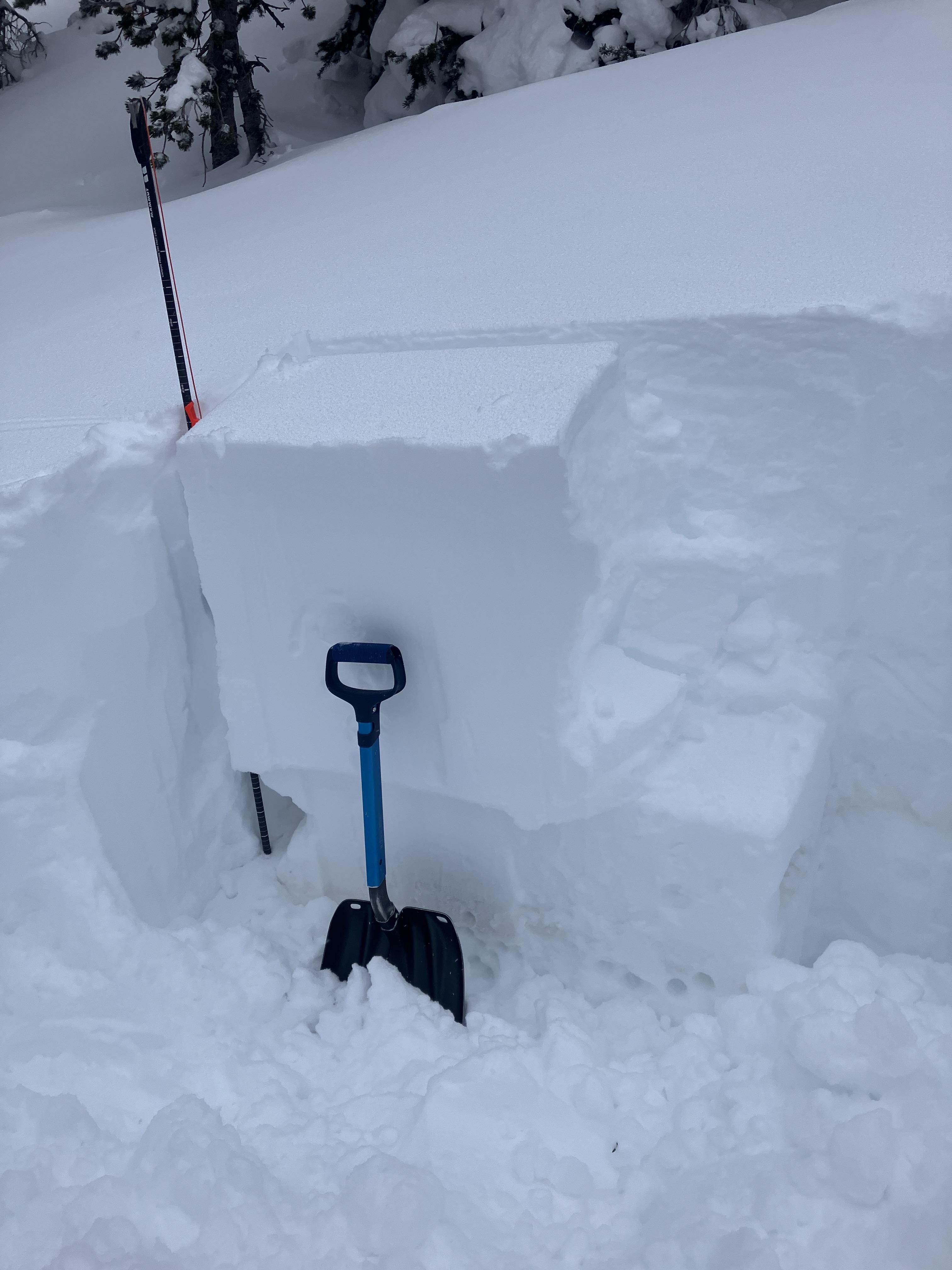
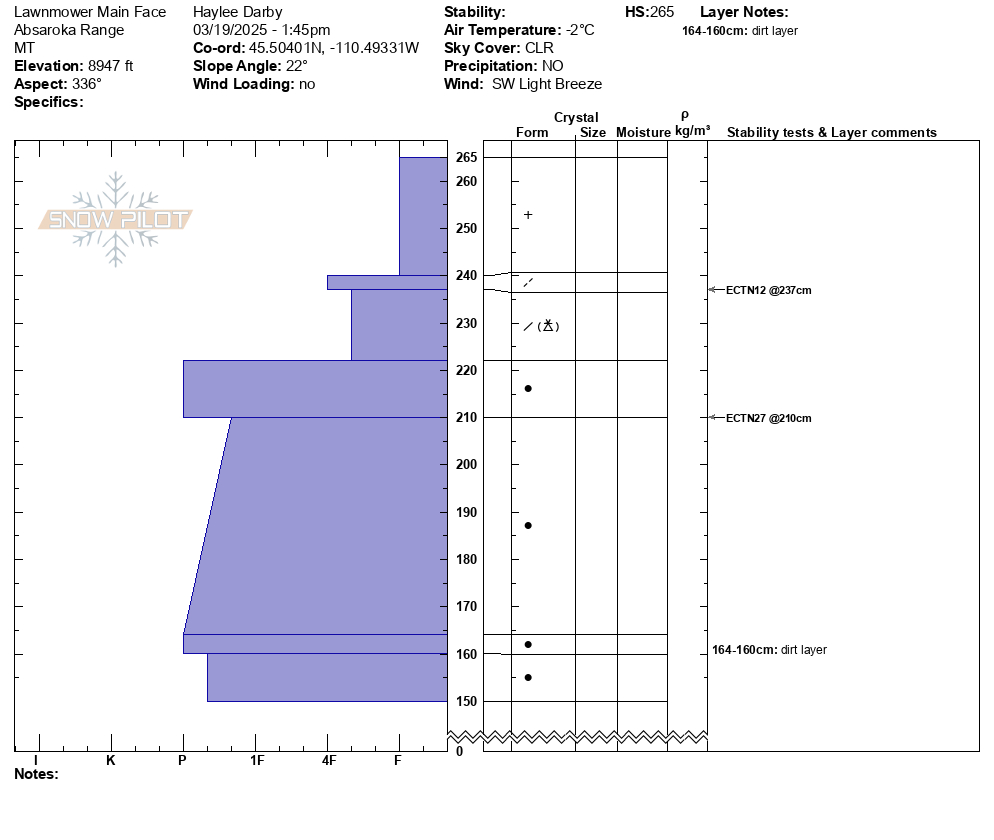
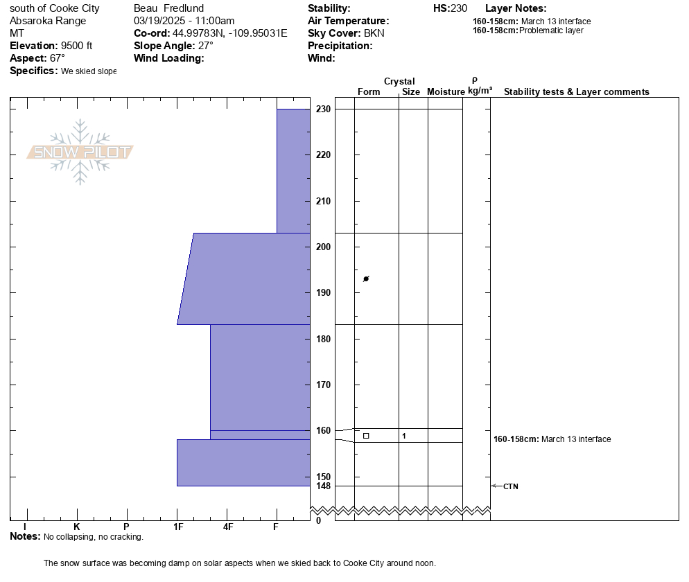
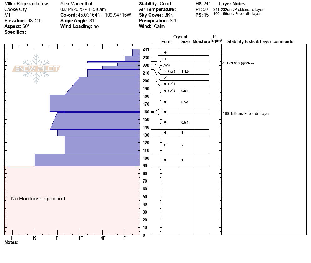
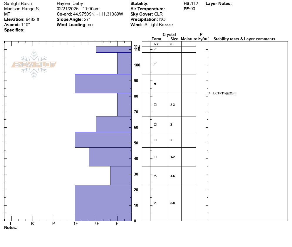
Dug a pit on a northeast facing slope, 9300' (profile and pic attached) near Cooke City. Snow depth was 7-8 feet. 6" of new snow was right side up. Below the new snow was a soft (1F-) melt-freeze crust with soft decomposing and slightly faceted particles below. ECTN13 broke below the crust. Below that the snowpack was 1F to P+ hard and lacked weak layers. The Feb 4 dirt layer was clearly visible. Photo: GNFAC
-
Today I observed multiple small wind slab avalanches off Woody Ridge. NE and E facing, 10000 ft. Max size D1. Photo: BPG
-
Today I observed multiple small wind slab avalanches off Woody Ridge. NE and E facing, 10000 ft. Max size D1. Photo: BPG
-
Many dry loose slides on Cooke Peak in Hayden Creek. Photo: BPG
-
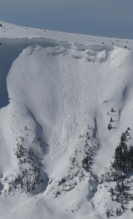
We also witnessed a falling cornice today that washed some snow through rocks. Be aware of what's above you.
-
Above Goose Creek -hard, dense, strong, and deep snow. Facets from late January are 1F+ hardness
-

Fresh wind slab avalanche seen this afternoon, possibly rider triggered. Photo: N. Meyers
-
On Feb 24 we saw at least 3 rider triggered wind slabs, 4-5 natural wind slab avalanches, and a couple large cornice falls. Strong wid had affected almost every piece of terrain, scouring some slopes, loading others, just stiffening the slab in many areas, and forming fresh drifts on every convex roll and along the edges of trails. Riding was still soft and fairly consistent in many areas. Photo GNFAC
-
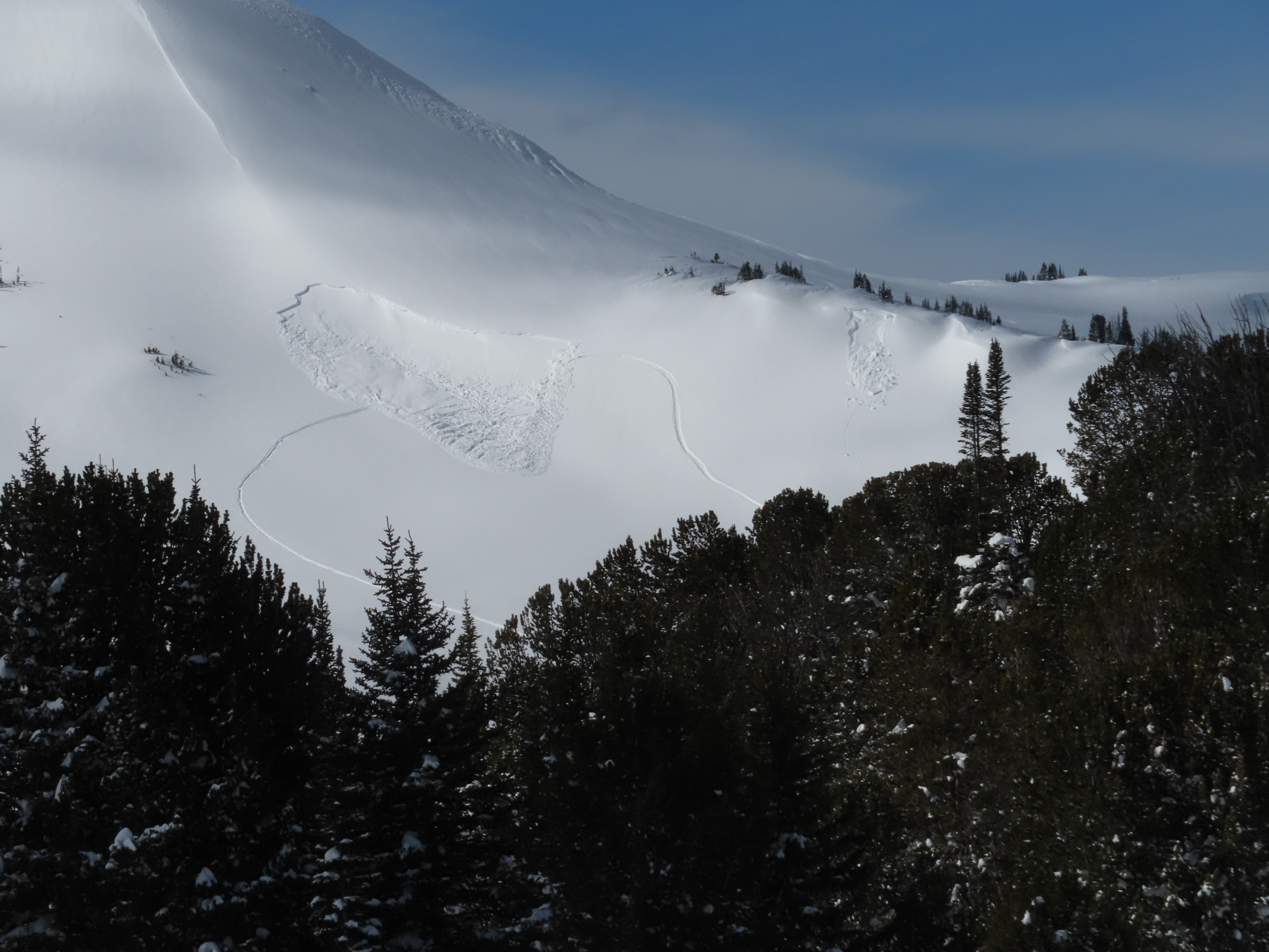
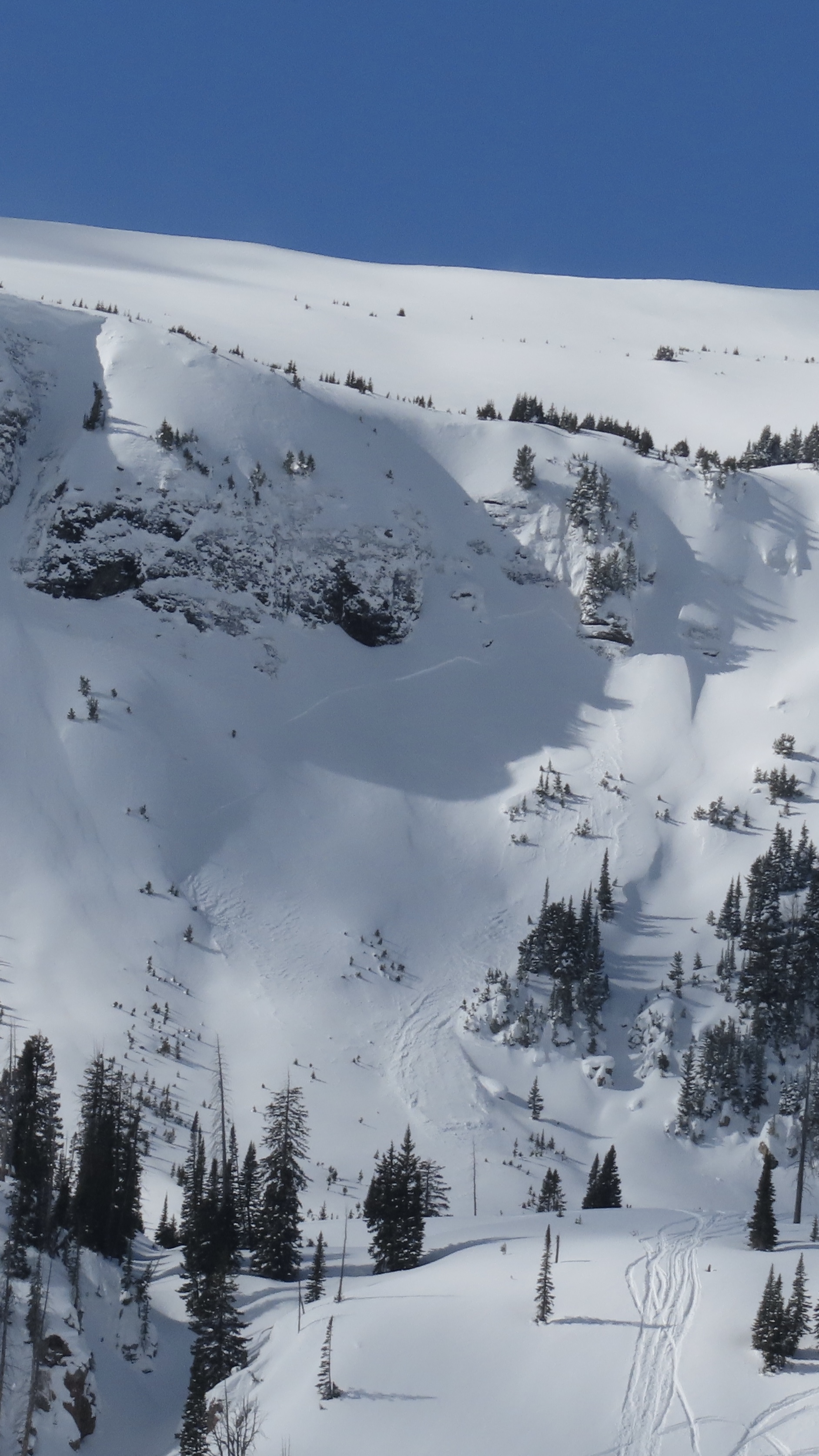
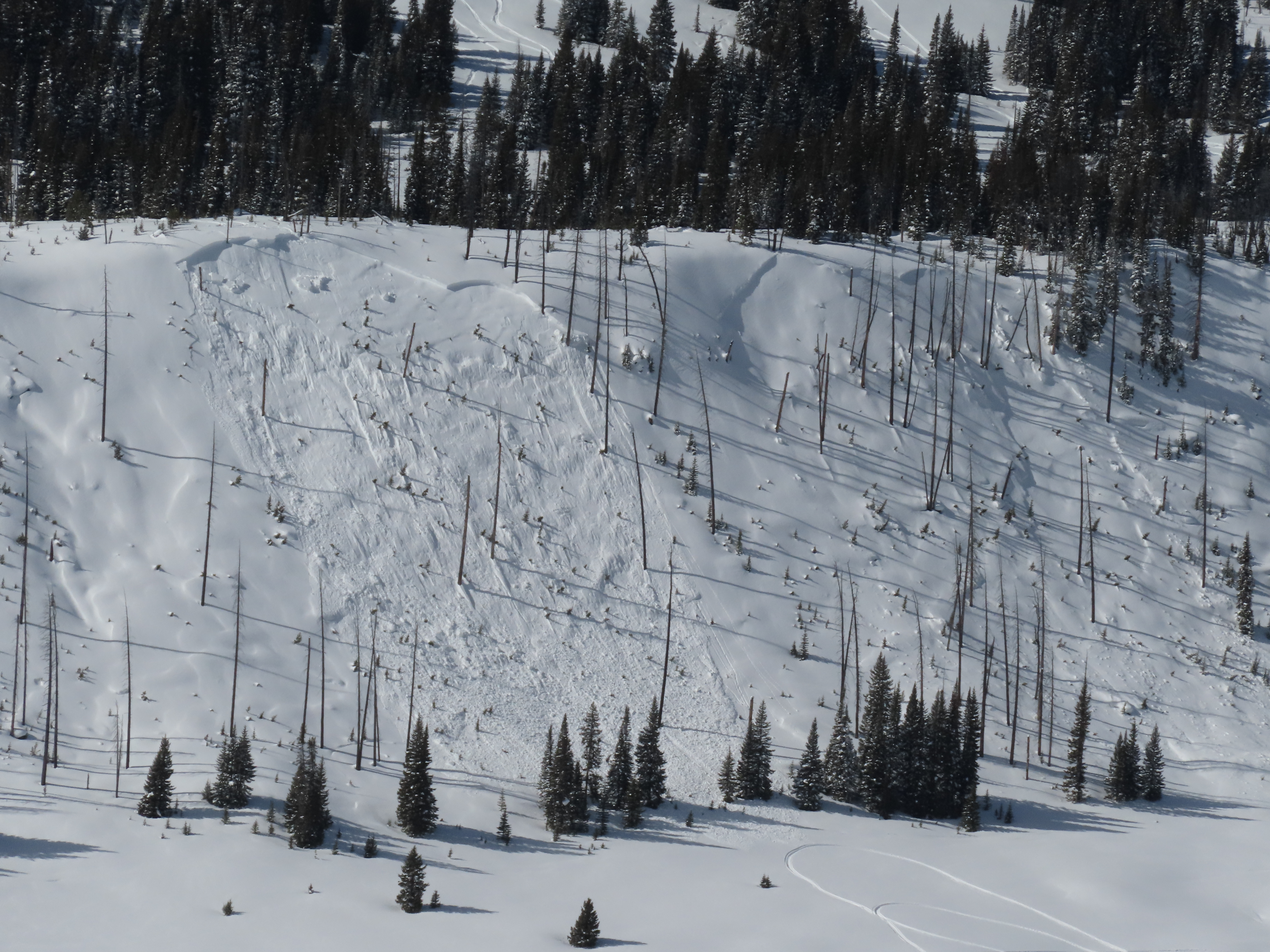
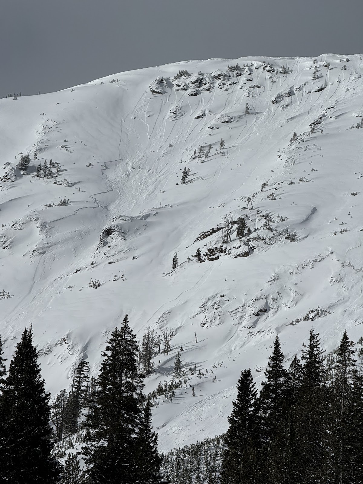
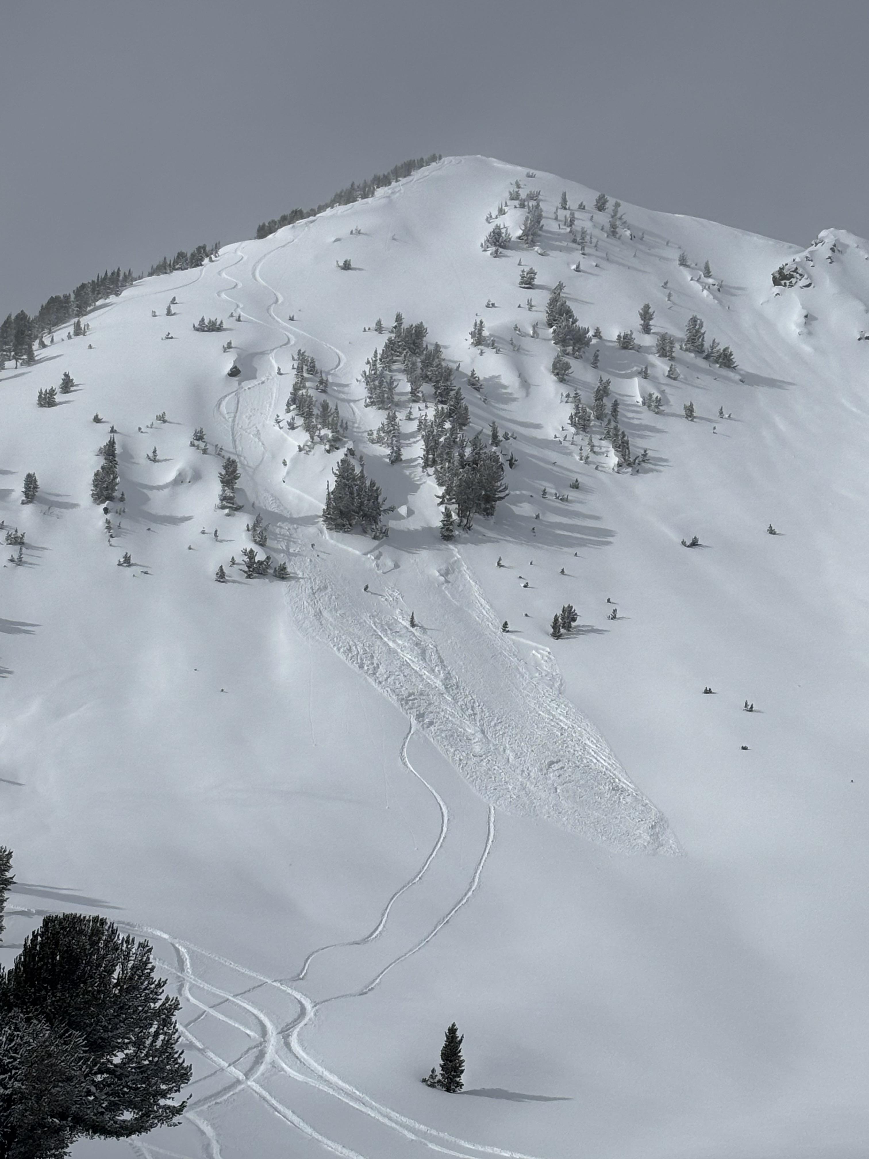
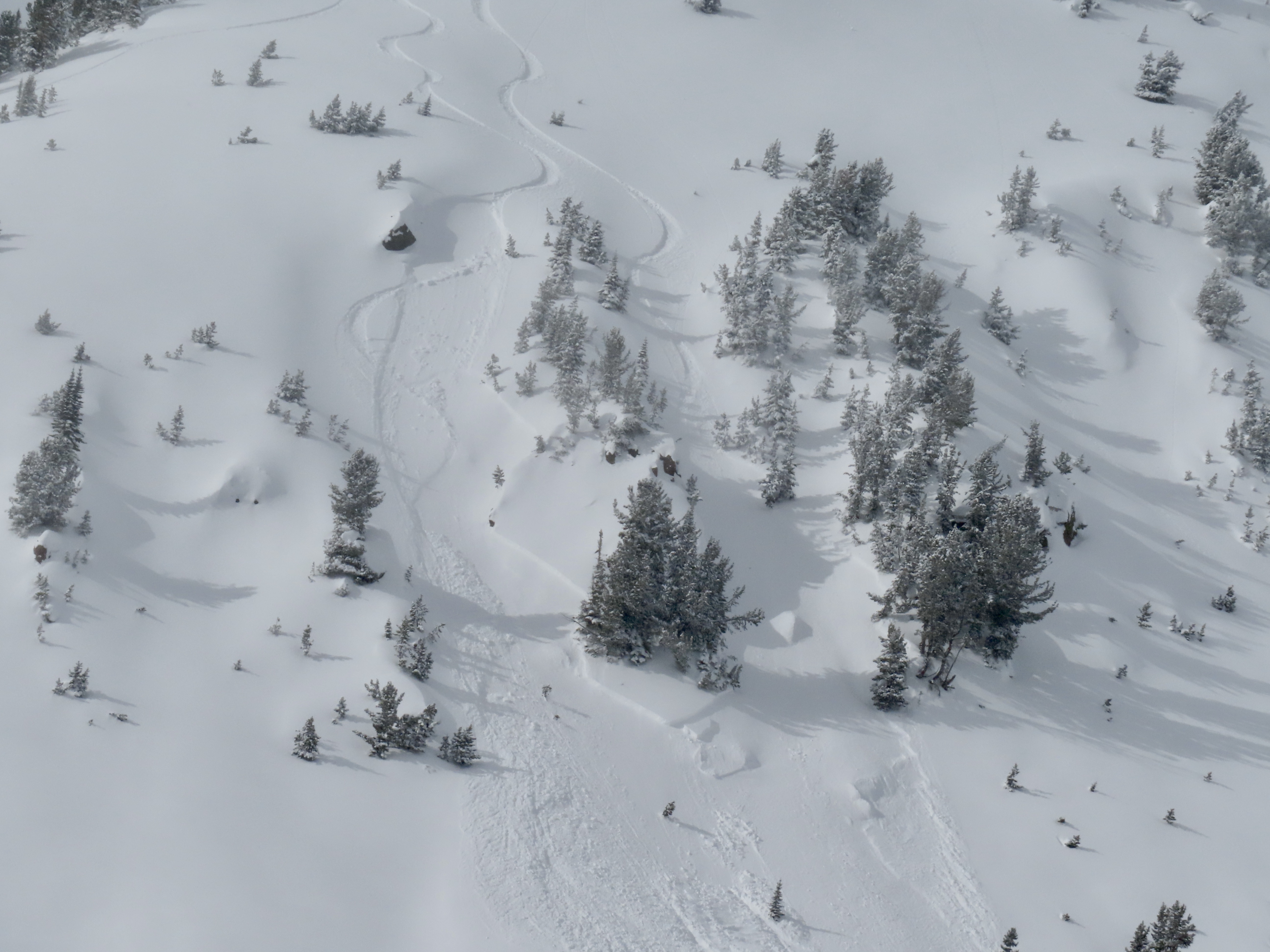
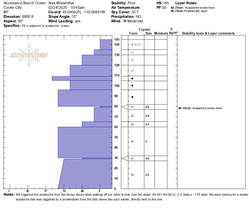
While looking for a recent avalanche from the flat bench above we triggered a similar sized slide directly adjacent to the previous slide. They broke on weak layers of facets and surface hoar that formed at the end of January. 2-3 feet deep and 150-200' wide. Photo: GNFAC
-
While looking for a recent avalanche from the flat bench above we triggered a similar sized slide directly adjacent to the previous slide. They broke on weak layers of facets and surface hoar that formed at the end of January. 2-3 feet deep and 150-200' wide. Observing the snowpack that caused the avalanche. Photo: GNFAC
-

While looking for a recent avalanche from the flat bench above we triggered a similar sized slide directly adjacent to the previous slide. They broke on weak layers of facets and surface hoar that formed at the end of January. 2-3 feet deep and 150-200' wide. Photo: GNFAC
-
While looking for a recent avalanche from the flat bench above we triggered a similar sized slide directly adjacent to the previous slide. They broke on weak layers of facets and surface hoar that formed at the end of January. 2-3 feet deep and 150-200' wide. Photo: GNFAC
-

While looking for a recent avalanche from the flat bench above we triggered a similar sized slide directly adjacent to the previous slide. They broke on weak layers of facets and surface hoar that formed at the end of January. 2-3 feet deep and 150-200' wide. Photo: GNFAC
-

An avalanche that was triggered two days ago (Feb 22), remotely from flat terrain above a steep slope, on the northeast end of Mt. Abundance. Photo: GNFAC
-

A rider triggered a small avalanche near Lulu Pass. No one was caught in the slide. Photo: N. Gaddy
-

A rider triggered a small avalanche near Lulu Pass. No one was caught in the slide. Photo: N. Gaddy
-

On Feb 23 We went up Republic Creek to look at the stability of snow that has fallen over the last 2-3 weeks. We were able to easily to trigger a couple wind slab avalanches on test slopes. Photo: GNFAC
-

On Feb 23 We went up Republic Creek to look at the stability of snow that has fallen over the last 2-3 weeks. We were able to easily to trigger a couple wind slab avalanches on test slopes. Photo: GNFAC
-

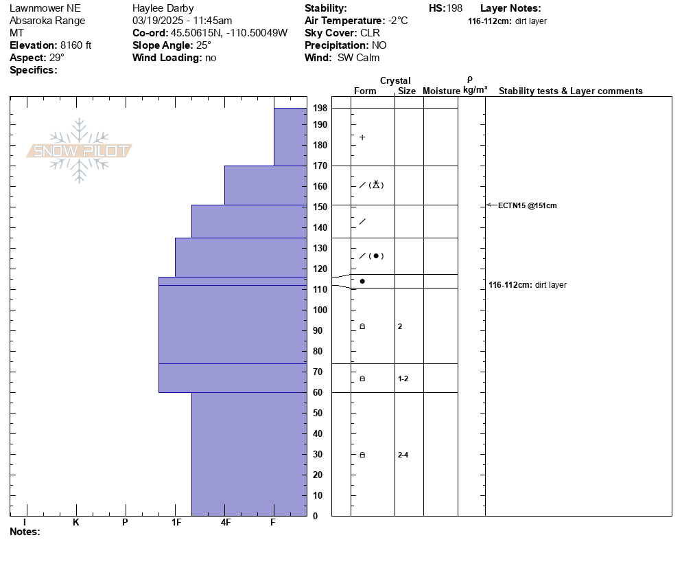
On Feb 23 We went up Republic Creek to look at the stability of snow that has fallen over the last 2-3 weeks. We found a thin layer buried 2’ deep that showed potential to propagate and slide. We dug down 4 feet, just below the dirt layer that was deposited earlier this month. We got an ECTP30 that broke about 8" above that dirt layer. This was either on a thin layer of facets or preserved lower density dendrites. Photo: GNFAC
-

Today we observed a couple day old wind slabs in steep SW facing terrain on Mt Zimmer. Photo: BPG
-

Wet loose occurred sometime today between 11-2 pm on S facing terrain nearby. Photo: BPG
-

Skier in Republic Creek observed a natural (wind/storm slab) avalanche on an east aspect at ~9200ft. Photo: R. Minton
-

I could visibly see some layer distinction about 8-12” deep. This is the same weakish layer we found in our column test, where we got ect16 just below robs knob. This was on a north facing aspect. Photo: I Tuttle
-

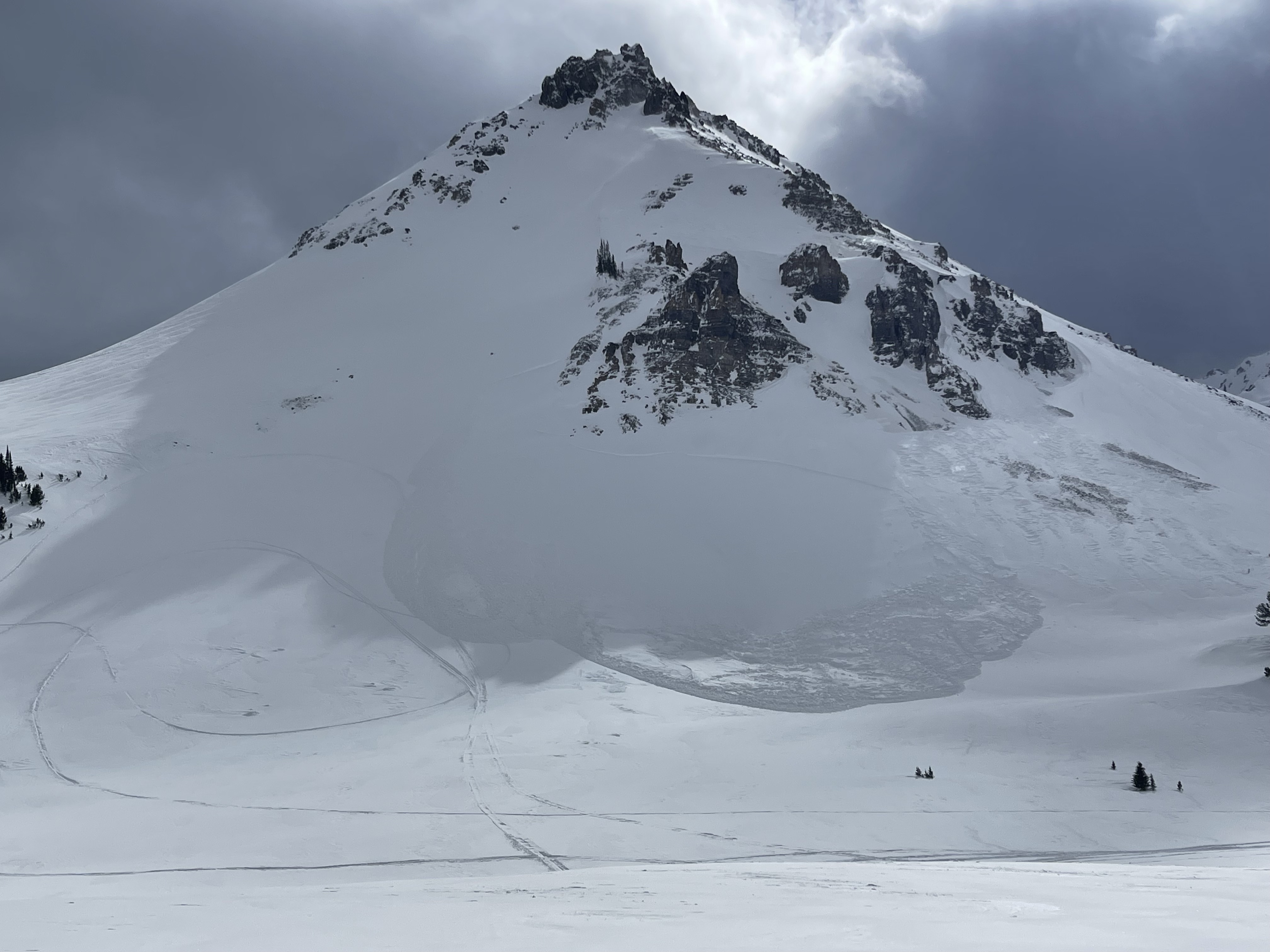
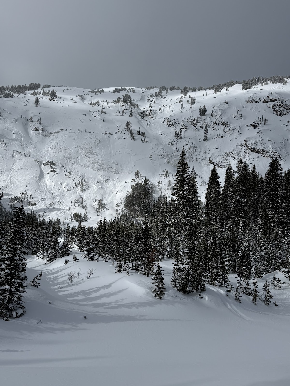
In Hayden Creek, we saw many D1-D1.5 wind slab avalanches seen on leeward slopes- east and northeast slopes at and above treeline. Photo: N. Mattes (Beartooth Powder Guides)
-

In Hayden Creek, we saw many D1-D1.5 wind slab avalanches seen on leeward slopes- east and northeast slopes at and above treeline. Photo: N. Mattes (Beartooth Powder Guides)
-

In Hayden Creek, we saw many D1-D1.5 wind slab avalanches seen on leeward slopes- east and northeast slopes at and above treeline. Photo: N. Mattes (Beartooth Powder Guides)
-

In Hayden Creek, we saw many D1-D1.5 wind slab avalanches seen on leeward slopes- east and northeast slopes at and above treeline. Photo: N. Mattes (Beartooth Powder Guides)
-

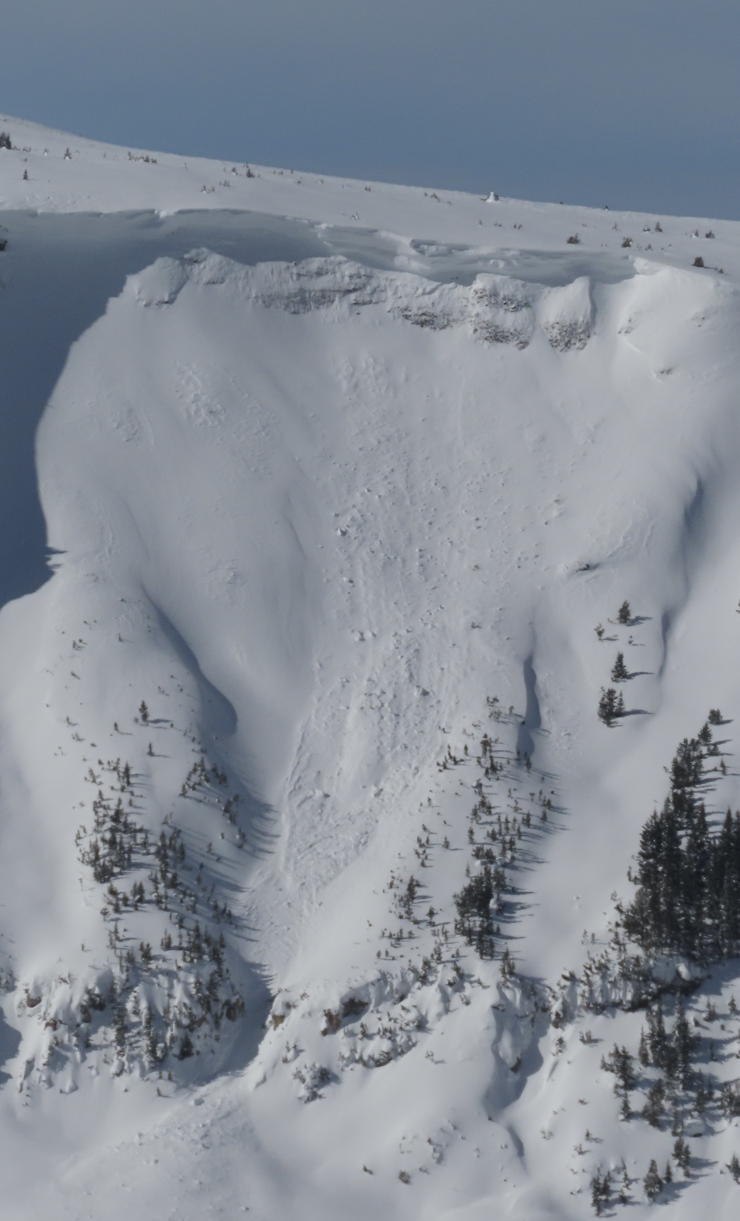
Noticed a large cornice triggered avalanche on Mineral Mtn today. Likely broke on 2/12 or early am 2/13. E aspect ran almost to the valley floor. Photo: BPG
-
Saw what looked to be a small wind slab or cornice fall on South Siren in Republic Creek. SE facing, 10100 ft. Photo: BPG
-

Saw a few wind slabs. Some appeared to be skier triggered, some were natural. Photo: BPG
-

Saw a few wind slabs. Some appeared to be skier triggered, some were natural. Photo: BPG
-

On Feb 9 we watched two snowboarders trigger separate wind slabs, while riding one at a time in avalanche terrain, on the south side of Scotch Bonnet. Photo: J. Mancey
-

On Feb 9 we watched two snowboarders trigger separate wind slabs, while riding one at a time in avalanche terrain, on the south side of Scotch Bonnet. Photo: GNFAC


Videos- Cooke City Area
WebCams
Soda Butte Lodge, looking West
Soda Butte Lodge, looking East


Weather Stations- Cooke City Area
Weather Forecast Cooke City Area
Extended Forecast for2 Miles NNE Cooke City MT
Tonight

Low: 12 °F
Mostly Cloudy
Thursday
High: 25 °F
Heavy Snow
and Patchy
Blowing SnowThursday Night

Low: 13 °F
Chance Snow
Showers and
Patchy
Blowing SnowFriday

High: 30 °F
Mostly Cloudy
Friday Night
Low: 22 °F
Slight Chance
Snow Showers
then Snow
Showers
LikelySaturday

High: 28 °F⇓
Snow Showers
Saturday Night
Low: 10 °F
Slight Chance
Snow Showers
then Partly
CloudySunday
High: 31 °F
Partly Sunny
then Slight
Chance Snow
ShowersSunday Night
Low: 30 °F
Chance Snow
Showers