This is Alex Marienthal with the avalanche forecast for Monday, February 3rd, at 7:00 a.m. sponsored by Polaris and Avalanche Alliance. This forecast does not apply to operating ski areas.
An AVALANCHE WARNING has been issued for the mountains near Cooke City, West Yellowstone and Island Park. Heavy snowfall and strong wind are rapidly adding weight to weak layers in the snowpack and creating very dangerous avalanche conditions. Human-triggered and natural avalanches are likely. Avoid travel on and underneath slopes steeper than 30 degrees. The avalanche danger is HIGH on all slopes.
This warning will expire or be updated by 6:00 a.m. on Tuesday, February 4th, 2025.
New snow totals this morning are 6-8” most places with 3” in the Taylor Fork. Wind has been moderate to strong, out of the southwest and west at 10-25 mph with gusts of 25-60 mph. Temperatures are single digits to teens F near Bozeman and Big Sky and high 20s F elsewhere. Temperatures will remain colder in the north half of our forecast area and reach high 20s and low 30s in the southern half of the area.
Snowfall will continue today. Wind will be moderate out of the west and southwest, with stronger speeds and gusts in the southern half of our area. By this evening the mountains could have up to 12” of new snow near Cooke City, 5-9” near Island Park and West Yellowstone, and 3-6” elsewhere.
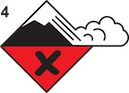
Avalanche Warning
Since Friday, near Cooke City, West Yellowstone and Island Park got 14-24” of snow equal to 1.8-2.2” snow water equivalent (SWE) with 3.4” SWE at Black Bear SNOTEL near Island Park. Strong southwest winds have been drifting this snow into thicker slabs, and on many slopes the prior snow surface is a weak layer of sugary snow (observation). We received reports of a few small wind slab avalanches over the weekend near Cooke City, but visibility was very limited (avalanche log).
Persistent slab avalanches will break wide on weak layers buried below the new snow, especially on wind-loaded slopes. There is a chance a slide could break 4-6 feet or deeper on weak layers at the bottom of the snowpack. Steady snowfall and strong wind will continue today making large to very large human-triggered and natural avalanches likely. Avoid travel on and underneath slopes steeper than 30 degrees. The avalanche danger is HIGH on all slopes.

Near Big Sky, Hyalite and Taylor Fork got 10-17” of snow equal to 1.0-1.3” of SWE since Friday. This snow was drifted into slabs that will be easy for a person to trigger today. Yesterday Mark and I rode into Taylor Fork and saw cracks shooting 10-50 feet out from our sleds, and all of our stability tests propagated with little force on weak layers below the new snow (photos and observation, video).
On wind-loaded slopes human-triggered persistent slab avalanches are likely. These avalanches could break wide, be triggered from flatter terrain connected to steep slopes, and remain easy to trigger for multiple days. Where the snow is not drifted, avalanches are still possible. Avoid steep, wind-loaded slopes, and before travelling on any steep slope carefully assess the stability of the new snow. Danger is CONSIDERABLE on wind-loaded slopes and MODERATE on other slopes in the Madison and Gallatin Ranges.

The Bridger Range got 8” of snow equal to 0.7” SWE since Friday and a few more inches will fall today. The new snow is being drifted into thicker slabs that make wind slab avalanches possible to trigger today.
The Bridgers had more wind and warm temperatures compared to other parts of our area during the recent high pressure which interrupted weak layer formation. Weak layers still probably formed on some slopes, just not as widespread as the rest of the forecast area.
If you plan to travel on slopes steeper than 30 degrees watch out for fresh drifts, and dig down below the new snow and drifts to assess for potential instability. If you see cracking across the snow surface, assume fresh drifts will slide on steeper slopes. Also stay alert for dry-loose avalanches on sustained steep slopes, especially where they could push you over a cliff or into rocks or trees. Human-triggered avalanches are possible and avalanche danger is MODERATE in the Bridger Range.
KING AND QUEEN OF THE RIDGE RESULTS
On Saturday We closed out King and Queen of the Ridge with nearly $30,000 raised! We will post final numbers here after we confirm totals. Thank you to all who participated and raised funds for The Friends of the GNFAC.
Thank you to all who participated and raised funds for The Friends of the GNFAC, and a special shoutout to our top fundraising individuals and teams, many of them show up to raise thousands of dollars year after year! Dash Rodman ($4470), Matt Sebren ($3915), Ron June ($3220), Matt Pellmann ($1887), and Doug Child ($1110). Teams: Cooke City Exxon ($13056), Science Saves Lives ($4659), The Mountain Project ($3906), MAP Brewing ($1695), and BSF Skimo ($965) (more event details below).
Thank you to the Bridger Bowl Events team for all their work, Weston Boards, Bozeman Hot Springs and Blue Ice for donating prizes!
The King and Queen were Drake Fricke with 29 hikes and Jennifer Pierce with 24 hikes. Full Event Results.
Upcoming Avalanche Education and Events
Our education calendar is full of awareness lectures and field courses. Check it out: Events and Education Calendar
February 6, 6-8 p.m. & February 8, 10 a.m - 2 p.m. Companion Rescue Clinic. Evening lecture at REI in Bozeman. Field session at History Rock. Details and signup here.
February 20, 4-7 p.m. Beacon BBQ at Uphill Pursuits in Bozeman. Come try out different brands of avalanche transceivers (or practice with your own!) with coaching from Friends of GNFAC instructors and free hotdogs.
Every weekend in Cooke City: Friday at The Antlers at 7 p.m., Free Avalanche Awareness and Current Conditions talk, and Saturday from 10 a.m.-2 p.m. at Round Lake Warming Hut, Free Rescue Practice.
Thank you for sharing observations. Please let us know about avalanches, weather or signs of instability via the form on our website, or you can email us at mtavalanche@gmail.com, or call the office phone at 406-587-6984.