Good morning. This is Dave Zinn with the Gallatin National Forest Avalanche Forecast on Monday, December 19th at 7:00 a.m. This information is sponsored by Archer Construction and Cooke City Super 8/Bearclaw Bob’s. This forecast does not apply to operating ski areas.
This morning, temperatures are in the single digits above 0 F, winds are 10-25 mph from the west to the southwest and there is 1” of new snow in the mountains near Cooke City. Today, temperatures will be in the low teens F with 15-25 mph winds from the west to the southwest. The mountains around Cooke City will receive 2-3” of new snow by tomorrow morning, with 1-2” near West Yellowstone.

The mountains south of Big Sky and near West Yellowstone and Cooke City have a weak layer of sugary facets buried 2-4 feet deep on most slopes. This weak layer resulted in large, natural and human-triggered avalanches during recent snowstorms (avalanche activity list). With time to adjust to the weight of recent snow, triggering an avalanche on this layer has become less likely. However, the consequences of getting caught in an avalanche breaking 2-5 feet deep are significant even when there is a good outcome, like in the last avalanche incident near Cooke City (observation).
Given the presence of persistent weak layers, the safest management strategy is minimizing your exposure to avalanche terrain. Today, avoid wind-loaded slopes and dig down to look for this weak layer if you decide to flirt with steeper terrain.
Large, human triggered avalanches are possible, and the danger is rated MODERATE.
In the mountains around Bozeman and Big Sky, winds transported last week’s 1 to 2 feet of snow into drifts that avalanched 1-4 feet deep. Last Friday, a skier on Saddle Peak was caught and carried 500 vertical feet by an avalanche in wind-drifted snow (details and photo). Yesterday, skiers in the northern Bridger Range saw recent natural avalanches near the ridgeline that broke 18 to 24 inches deep (details and photos). See a more comprehensive list of recent activity in the Weather and Avalanche Log.
Slopes with the highest probability of instability are those with active wind-loading followed by slopes with signs of recent drifting such as the hardening of the snow surface, a drummy, hollow feel, or slopes below cornices. Recent avalanches or shooting cracks are a dead giveaway that you found instability. Heed the warning.
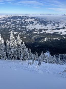
Yesterday, we toured Beehive Basin and found that the snowpack had weakened since our last trip to the area (video). This is similar to the other ranges near Bozeman and Big Sky, where we found buried weak layers (Bridger Range video, Buck Ridge video, Mt. Ellis video). For now, make the differentiation between “weak” (a snowpack that has layers of sugary facets) and “unstable” (one with heavy slabs of snow sitting on top of those weak layers). We will quickly reevaluate this balance with the next snowstorm.
Today, avoid slopes with active or recent wind-loading and test for instabilities related to weak layers buried 1-3 feet deep before considering climbing, riding or skiing in avalanche terrain. The avalanche danger is MODERATE.
If you get out, please share avalanche, snowpack or weather observations via our website, email (mtavalanche@gmail.com), phone (406-587-6984), or Instagram (#gnfacobs).

The mountains in Island Park have a weak layer of sugary facets buried 2-4 feet deep on many slopes. Triggering a slide on this weak layer has become less likely, but the consequences are significant. Additionally, the wind on Sawtelle Peak is gusting to 60 mph from the west and building drifts on slopes where a rider could trigger an avalanche. Today, avoid wind-loaded slopes and dig down to look for this weak layer before deciding to flirt with steeper terrain.
Upcoming Avalanche Education and Events
Our education calendar is full of awareness lectures and field courses. Check it out: Events and Education Calendar.
TODAY! Monday, December 19, 5:30 p.m., Women in the Backcountry at MAP Brewing. Free.
January 4 + field day on January 7 or 8, Avalanche Fundamentals for Snowmobilers, Information and pre-registration HERE.
January 4 + field day, Avalanche Fundamentals for Skiers and Snowboarders, Information and pre-registration HERE.
Every Saturday, 10 a.m - 2:00 p.m. Avalanche Rescue Training, drop in for any amount of time. Round Lake Warming Hut, Cooke City. Free.
Please consider donating to the Friends of GNFAC Annual Fundraiser.
Send us your observations. They do not have to be fancy, just a few sentences. Did you see any avalanches? How much new snow? Is the wind blowing and drifting snow? Pictures, snowpits and stability test scores are also welcome, but not necessary. You can help us fill in the gaps of our field work.