Good morning. This is Ian Hoyer with the Gallatin National Forest Avalanche Forecast on Saturday, December 10th at 7:00 a.m. This information is sponsored by Blitz Motorsports and Yamaha and Montana State Parks. This forecast does not apply to operating ski areas.
Please consider donating to the Friends of GNFAC Annual Fundraiser.
There are 2” inches of new snow in Hyalite, 3-5” in the Bridger Range and around Big Sky, 6-7” near Cooke City and in the Taylor Fork, and 10” at Lionhead. Winds picked up overnight and are now blowing 15-30 mph with gusts up to 50 mph out of the southwest. Temperatures this morning are in the single digits and teens F. High temperatures today will be in the 20s F under cloudy skies. Moderate southwest winds with stronger gusts will continue today. Snowfall will start near West Yellowstone this afternoon with 1-3” possible by tomorrow morning while the rest of the area stays dry. A stronger round of snowfall tomorrow will again favor the southern areas.

6-10” of new snow and southwest winds redepositing that new snow are stressing buried weak layers and make for dangerous avalanche conditions today. Yesterday, Alex and his partner triggered an avalanche that broke 3-6 ft deep while crossing beneath a steep slope near Lulu Pass, outside Cooke City (video). The slide broke 500 ft above them. It caught and carried his partner, but luckily did not bury him. This was only the latest in a string of large natural and human triggered avalanches over the last week (Daisy Pass video, Lionhead avalanche video, Henderson photo and details). Avoid steep slopes today and give them a wide berth if you’re crossing beneath them. The weak snow buried 2-3 ft deep is widespread and won’t handle this loading well. Today is not the day to try and outsmart the avalanche hazard. Stick to low angle slopes and enjoy the fresh snow. Human triggered avalanches are likely and the avalanche danger is CONSIDERABLE.

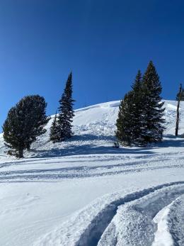
There is less new snow around Bozeman and Big Sky and wind loaded slopes are the primary concern today. Yesterday, Doug dug in a gully in Hyalite and found a 10” deep wind slab sitting over a thin weak layer (Hyalite gullies video). Not every slope will have this combination, but be on the lookout for wind drifts and check to see how they are bonded before getting onto steep slopes. Cracks shooting out in front of you mean you’ve found one of these unstable drifts and should back out of avalanche terrain. The avalanche on Ross Peak earlier this week that broke 6” deep and caught and carried two skiers 600 vertical feet is a good reminder of the power of even a relatively shallow slide (photos and details). The avalanche danger is MODERATE.
If you get out, please share avalanche, snowpack or weather observations via our website, email (mtavalanche@gmail.com), phone (406-587-6984), or Instagram (#gnfacobs).

Heavy snowfall and strong winds redepositing that new snow make for dangerous avalanche conditions today. Yesterday, Dave and I found up to 18” of new snow while riding in Yale Creek and drifts up to 4 ft deep (field video). We also confirmed that the weak layers we’ve been seeing in Lionhead are also present here (our field observations). Avoid steep slopes today and give them a wide berth if you’re crossing beneath them. Today is not the day to try and outsmart the avalanche hazard. Stick to low angle slopes and enjoy the fresh snow. Human triggered avalanches are likely.
Upcoming Avalanche Education and Events
Our education calendar is full of awareness lectures and field courses. Check it out: Events and Education Calendar.
Monday, December 12, 5-8 p.m. @MAP Brewing, Movie Night.
Tuesday, December 13, 6 p.m., Avalanche Awareness + Beacons at Story Mill Park. Free
Watch our playlist of YouTube videos to get caught up on our avalanche concerns this season.