Good Morning. This is Alex Marienthal with the Gallatin National Forest Avalanche Forecast on Monday, December 16th at 7:00 a.m. Today’s forecast is sponsored by Highline Partners and Yellowstone Club Community Foundation. This forecast does not apply to operating ski areas.
Since yesterday morning the Bridger Range got 2-3” of low density snow, Hyalite and Big Sky got 1”, and elsewhere got none. This morning temperatures are single digits to low teens F, and wind is westerly at 15-25 mph with gusts to 30-40 mph. Today temperatures will reach low to mid-teens F and wind will be westerly at 15-30 mph. The next few days are mostly clear with moderate to strong wind, then a chance for snow at the end of the week.

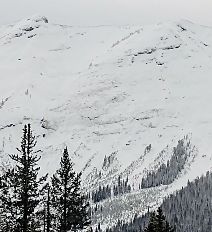
Over the weekend we received reports from Cooke City of multiple snowmobile triggered avalanches, including one very close call (photos and details), and a few natural avalanches (photo, photo). Last week the mountains near Cooke City received 2 feet of snow equal to 2.5” of snow water equivalent (SWE) on top of buried weak layers (video, photo). This combination created an unstable snowpack which resulted in large avalanches. The last few days without snow gave the snowpack time to gain stability. The chances of triggering a large avalanche have decreased, but it remains possible with high consequences. Steep slopes should only be approached with extra caution and very careful snowpack assessment. Today avalanche danger is MODERATE.
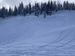
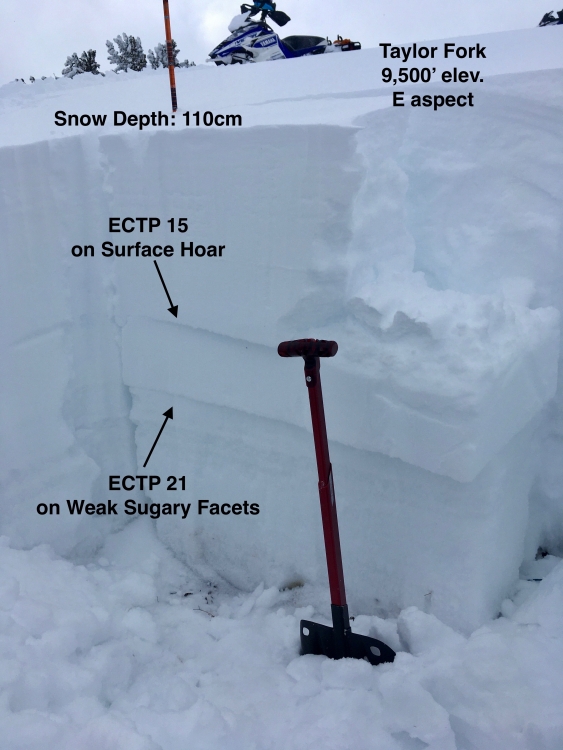
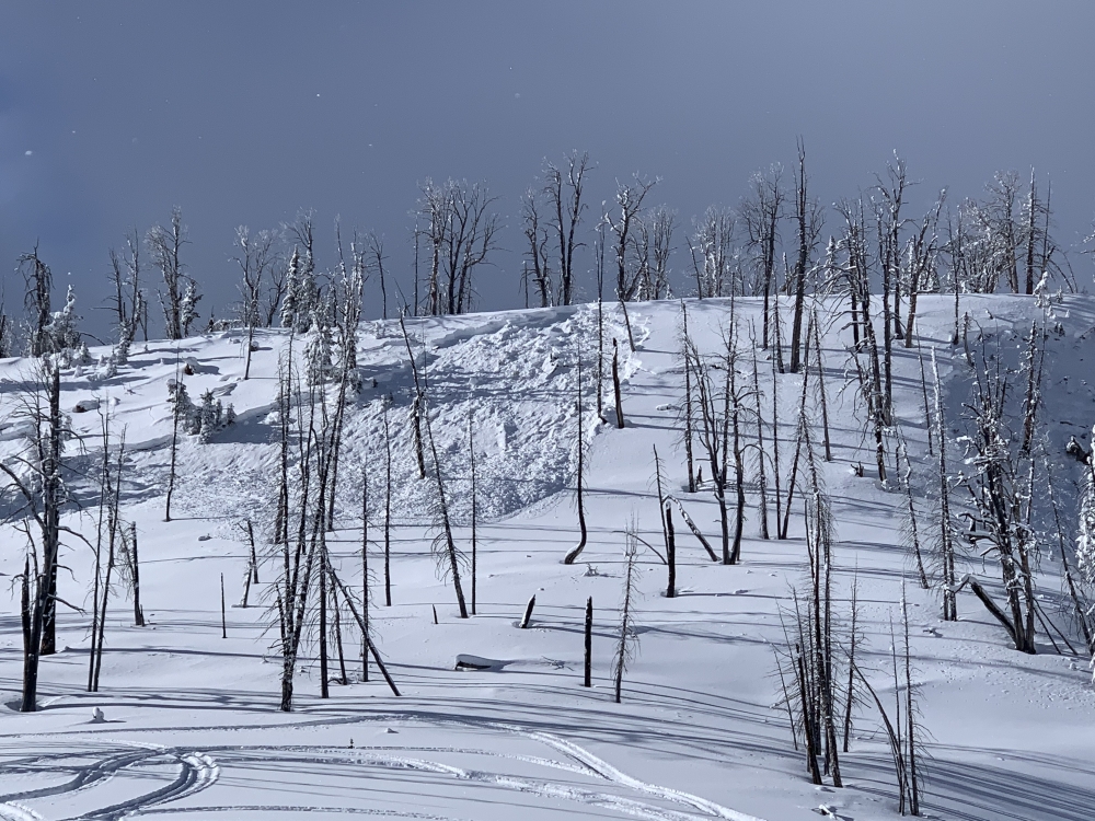
The snowpack near West Yellowstone and Big Sky has multiple buried weak layers that make large avalanches possible to trigger. Sugary snow on the ground creates a weak foundation for the snowpack, and a thin layer of surface hoar buried 1-2’ deep contributes to instability (photo). Last week we visited Buck Ridge (video), Taylor Fork (video) and Lionhead (video) where we found this poor snowpack structure and saw natural and snowmobile triggered avalanches. Yesterday in Taylor Fork riders saw similar recent slides (photo, photo).
The chances of triggering large avalanches on these weak layers are decreasing, but it remains possible with high consequences. Only approach steep slopes after very careful snowpack and terrain assessment. Large avalanches are possible to trigger and danger is MODERATE.
The Bridger Range and Hyalite got 4-6” of low density snow (.4” SWE) the last couple days. Today moderate to strong wind will create fresh drifts that are possible to trigger. These drifts are found near ridgelines and along edges of steep gullies (video). Watch for cracking of the snow surface as a sign these drifts are unstable and should be avoided. Look for non wind-loaded terrain to ride, and reduce the consequences of even a small slide by avoiding slopes above trees, rocks or cliffs.
Yesterday we toured on the Ramp north of Bridger Bowl and found a mostly stable snowpack without weak layers breaking in our stability tests. In the mountains near Bozeman the snowpack has some buried weak layers (video), but these layers are not widespread and have not produced recent avalanches. Avalanches deeper than the new snow are unlikely, but it is still important to diligently assess the snowpack before riding each slope. Today fresh wind slabs are possible to trigger. Danger is MODERATE on wind loaded slopes and LOW on all other slopes.
If you get out, please send us your observations no matter how brief. You can fill out an observation form, email us (mtavalanche@gmail.com), leave a VM at 406-587-6984, or Instagram (#gnfacobs).
Upcoming Avalanche Education and Events
Our education calendar is full of awareness lectures and field courses. Check it out and plan to attend one or two: Events and Education Calendar.
BOZEMAN
December 18, 1-hr Avalanche Awareness, 6-7 p.m. at Uphill Pursuits.
COOKE CITY
Every Friday and Saturday, Snowpack Update and Rescue Training. Friday, 6:30-7:30 p.m. at the Soda Butte Lodge. Saturday anytime between 10-2 @ Round Lake.
BILLINGS
December 17, 1-hr Avalanche Awareness, 6-7 p.m. Elevated Powersports.
CHOTEAU
December 19, 1-hr Avalanche Awareness, 7-8 p.m. at Choteau High School.
Sadly, yesterday a skier was killed in an avalanche in the backcountry near Canyons Resort in Utah. See the UAC preliminary report HERE.