This is Alex Marienthal with pre-season avalanche, weather and event information for the Gallatin National Forest Avalanche Center on Monday, November 25th. This update is sponsored by Community Food Co-op and Knoff Group Real Estate. Our next bulletin will be issued on Thursday.
*Note: Bridger Bowl Ski Area is closed and there is no avalanche control or ski patrol services. Backcountry conditions exist. Workers are setting up for the season and making snow. Please stay clear of work areas, snow guns, chair lifts and other equipment.
Last night the mountains near Big Sky got 2” of snow, near Cooke City got a trace, and elsewhere received no snow over the weekend. The last couple days wind was 20-40 mph with gusts of 50-60 mph, and temperatures reached high 30s F. This morning temperatures are teens F, and wind is 10-20 mph out of the west-northwest. Today will be the warmest of the week with temperatures in the 20s F, then temperatures will be mid-teens and single digits F through Thanksgiving. Today there is a chance for 1-2” of snow. More snow is expected Wednesday night through Thursday with 3-5” possible near Bozeman, Big Sky and Cooke City, and up to a foot near West Yellowstone.
We will update our Weather Log and Regional Conditions every morning with snowfall totals, and our Avalanche Activity list if we get a report.

All Regions
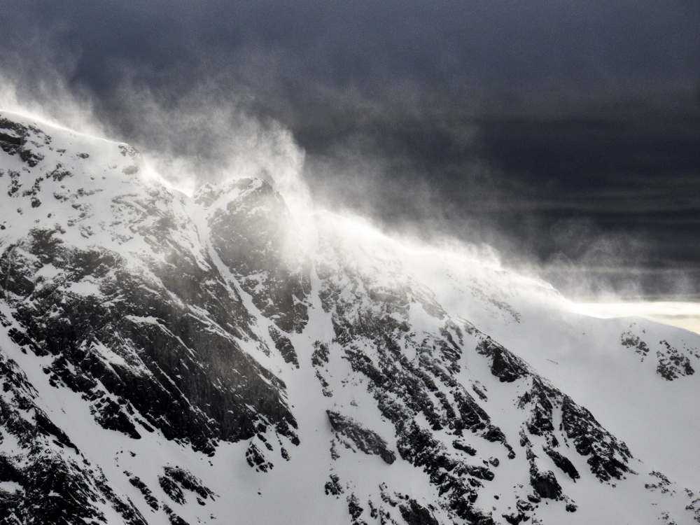
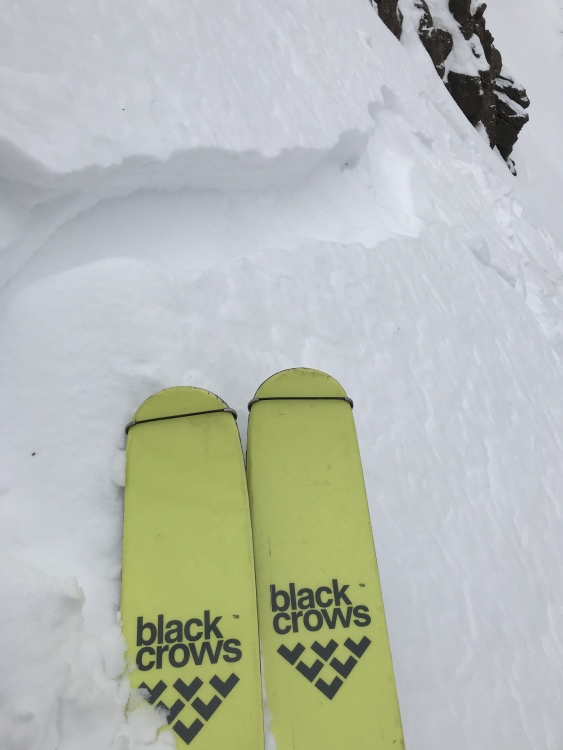
Snow depth is 1-3 feet throughout the advisory area. There is minimal evidence of widespread buried weak layers (snowpits), and avalanche activity has been mostly small slides confined to new snow (avalanche log). Aside from the couple inches of snow in Big Sky last night, the last snowfall was 4-6” five days ago (weather log). Over the last couple days strong winds drifted recent snow into fresh slabs along ridgelines (photo). Skiers in Hyalite found these fresh wind slabs which cracked easily under their skis, and they adjusted their plans to avoid terrain with big consequences (photo). Avoid steep slopes with evidence of fresh wind-loading and be extra cautious of terrain where a slide can carry you into rocks, trees or over cliffs.
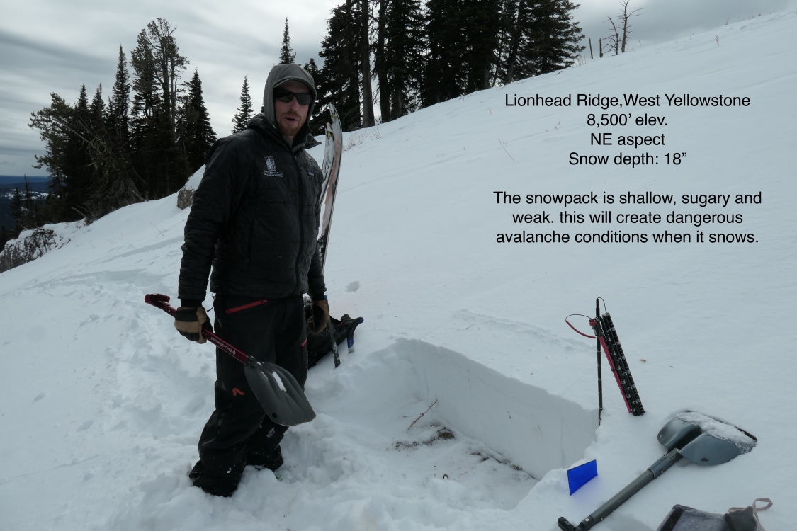
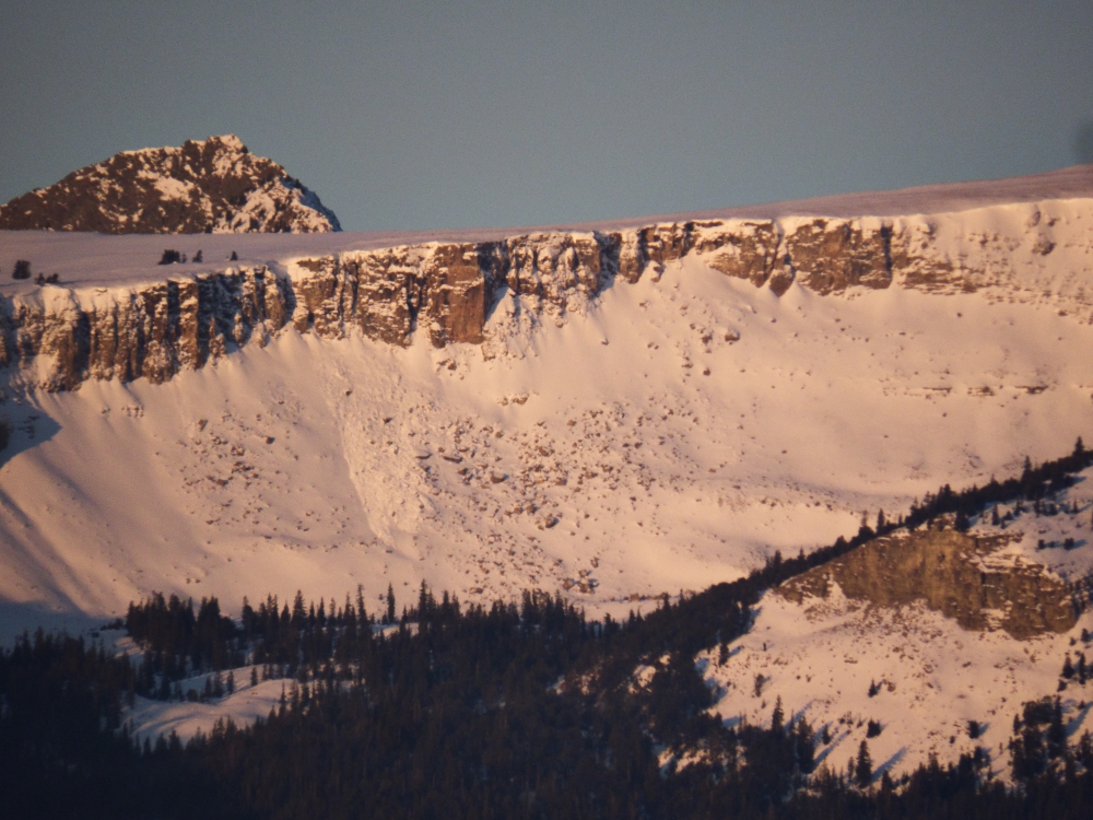
Where the snowpack is shallower, such as the mountains near West Yellowstone and the southern Madison and Gallatin ranges, there are weak layers of sugary facets on the ground (video, photo). For now, these weak layers make larger avalanches a concern only on heavily wind-loaded, shady high elevation slopes (photos, photo). When these mountains receive more snowfall, possibly later this week, the snowpack could become very unstable on all steep slopes.
Check out our regional conditions pages, snowpits, and weather log for detailed information specific to where you plan to travel. We are seeking more field data (and snowfall) before we issue daily danger ratings. If you'd like to help us you can quickly fill out an observation form and attach a picture or two. You can also email us (mtavalanche@gmail.com), leave a message on our phone (406-587-6984) or Instagram (#gnfacobs).
Upcoming Avalanche Education and Events
Our education calendar is full of awareness lectures and field courses. Check it out and plan to attend one or two: Events and Education Calendar.
BOZEMAN
4 & 5 December, Introduction to Avalanche w/ Field Course, Evenings of December 4 & 5 plus one field day either December 7, 8 or 14. Snowmobile specific field day offered December 14. More info and Register Here.
WEST YELLOWSTONE
9 & 10 December, Snowmobile/Ski Introduction to Avalanche w/ Field Course, 12-5p Dec 9 and field day Dec 10. More info and Register Here.
Next week is our first Introduction to Avalanches course with field sessions. Pre-register today!