Good morning. This is Ian Hoyer with the Gallatin National Forest Avalanche Forecast issued on Tuesday, February 5th at 7:10 a.m. Today’s forecast is sponsored by Grizzly Outfitters in partnership with the Friends of the Avalanche Center. This forecast does not apply to operating ski areas.
Since yesterday morning, 3-4” of new snow fell near West Yellowstone and Cooke City, 2-3” near Big Sky, and 1-2” near Bozeman. The inversion continues near Bozeman, with valley temperatures near or below 0 F. Above the inversion and elsewhere, temperatures are high teens to low 20s F and will rise into the mid-20s F by this afternoon. Moderate south and west winds will continue today. With more snowfall this morning, and another round tonight, expect 4-7” of new snow by tomorrow morning.
Snowfall has slowed down and yesterday’s avalanche warning has expired. However, conditions remain very unstable, especially on wind loaded slopes. Over the last 48 hours, more than a foot of heavy snow (1.3-1.9” of snow water equivalent) fell in the southern ranges. South and southwest winds have created even thicker slabs (2-3’ deep) on windloaded slopes.
On Sunday, I found a layer of surface hoar underneath the new snow in the southern Madison Range (video). Yesterday, Snow Rangers found it in the Lionhead area, now buried by 1.5’ of new snow (photo). New snow falling on surface hoar makes for touchy conditions, you can trigger avalanches from below or on lower angled slopes. In addition, you can’t forget about the weak snow lower in the snowpack. Deep and wide avalanches could break on these weak layers (photo, photo). Give the snowpack time to adjust to the weight of new snow by avoiding avalanche terrain today. On wind-loaded slopes, large natural avalanches are likely and the avalanche danger is HIGH. On other slopes, human triggered avalanches are likely and the avalanche danger is CONSIDERABLE.

Near Cooke City and Big Sky, storm snowfall totals are 10-13” (1.0-1.2” of SWE). The combination of new snow and moderate south-southwest winds formed 1-2’ thick drifts and make avalanches easy to trigger. On some slopes, the new snow fell onto a strong snowpack and avalanches within the new snow are the primary concern. On other slopes, the new snow fell onto a weak, shallow, snowpack, and avalanches could break 2-3’ deep, propagating across the whole slope. Careful snowpack assessment is required to determine which situation you are dealing with. Eric’s video from yesterday in the northern Madison Range highlights the big variations that exist over small distances (video). While the snowpack is working to accommodate the new load, steer clear of new wind drifts and any slope with weak snow near the ground. If in doubt, keep it simple by sticking to low angled slopes. The avalanche danger is CONSIDERABLE.

The mountains near Bozeman have only received 4-6” out of this storm so far. On Sunday, Alex found small fresh drifts of snow were easy to trigger in the northern Bridger Range (video). You could trigger similar avalanches today. A less likely, but higher consequence possibility is triggering an avalanche on weak layers buried deeper in the pack. These weak layers are most prevalent in shallower areas, such as Mt. Ellis (video, avalanche incident) and the West side of the Bridgers, but it’s worth your time to dig down to look for and assess these layers before committing to any steep slope. The avalanche danger is MODERATE.
If you get out and have any avalanche or snowpack observations to share, contact us via our website, email (mtavalanche@gmail.com), phone (406-587-6984), or Instagram (#gnfacobs).

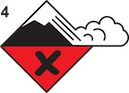
Avalanche Warning
The Backcountry Avalanche Warning continues today for the Centennial Range of Idaho. Heavy snow and wind are loading a weak snowpack. Natural and human triggered avalanches are likely. Avalanche terrain and avalanche runout zones should be avoided. Very dangerous avalanche conditions exist and avalanche danger is HIGH on all slopes.
Upcoming Avalanche Education and Events
Our education calendar is full of awareness lectures and field courses. Check it out: Events and Education Calendar.
BOZEMAN
TONIGHT!, Sidecountry Specific Avalanche Awareness for Friends and Family, 6-7p.m. at Story Mill Community Park.
February 6, 1-hr Women’s Avalanche Awareness, 6-7p.m. at REI Bozeman.
February 8 and 9, Companion Rescue Clinic, 6-8 p.m. Friday at REI, 10-4 Saturday in the field. More Info and Register.
February 22 and 23, Women’s Companion Rescue Clinic, 6-8 p.m. Friday at REI, 10-4 Saturday in the field. More Info and Register.
WEST YELLOWSTONE
February 9, 16 and 23, 1-hr Avalanche Awareness for Snowmobilers, 7-8 p.m. Holiday Inn West Yellowstone.
HELENA
February 13, 1-hr Avalanche Awareness, 6-7 p.m. at Carroll College.
COOKE CITY
Every Friday and Saturday, Rescue Training and Snowpack Update. Friday 6:30-7:30 p.m. at the Soda Butte Lodge. Saturday anytime between 10-2 @ Round Lake.
