Good morning. This is Eric Knoff with the Gallatin National Forest Avalanche Forecast issued on Friday, February 1st at 6:30 a.m. Today’s forecast is sponsored by Gallatin Valley Snowmobile Association and Cooke City Motorsports. This forecast does not apply to operating ski areas.
At 5 a.m. temps range from the teens to mid-20’s F and west-southwest winds are blowing 15-35 mph. Today, temps remain above average with highs warming into the 20’s to upper 30’s F under mostly cloudy skies. Winds will continue to blow 15-35 out of the west-southwest. No snow is expected today or tonight, but a good storm is forecasted to impact the area starting tomorrow and lasting into Monday.

All Regions
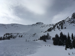
The snowpack across our forecast area is highly variable. Some slopes are strong and stable while others have a poor structure capable of producing avalanches (video, photos). Yesterday, Alex experienced a large collapse on a southwest facing slope near Lulu Pass outside of Cooke City. The snowpack on this slope was only 3’ deep. As Alex describes in his video, “shallow equals weak”. On a neighboring slope, Alex found a snowpack that was much deeper and stronger. I found similar conditions in Tepee Basin yesterday.
As the snowpack takes a break from last week’s consistent snowfall, avalanches are becoming harder to trigger. Although the likelihood of triggering an avalanche has decreased, the consequences have not. If a slide is triggered, it will likely break 2-4’ deep and propagate wider than you might expect (video, photo). Slopes where hard wind drifted snow rest over a weak-faceted foundation will be the most likely to produce slides. Be especially cautious on steep rocky slopes where impacting the weak layer may be easier.
Although the avalanche danger is gradually decreasing, it is still possible to get surprised. The avalanche fatality in the Tobacco Roots a week ago today is a sobering reminder that being caught off guard can have severe consequences (video, report). To reduce risk and stack the deck in your favor, talk with your partners, make a plan, dig and test the snow, and be wise about terrain selection. Remember if stability is the question, terrain is the answer.
Today, human triggered avalanches are possible and the avalanche danger is rated MODERATE.
If you get out and have any avalanche or snowpack observations to share, contact us via our website, email (mtavalanche@gmail.com), phone (406-587-6984), or Instagram (#gnfacobs).
King and Queen of the Ridge
This Saturday, February 2, at Bridger Bowl. This is the Friends of the Avalanche Center’s second biggest fundraiser of the year. Come on out and help us raise some money by hiking and skiing some laps on the ridge. Prizes, camaraderie and a good time is guaranteed. Register with Bridger to hike in the event, and create a pledge page to raise funds with your Ridge laps.
Avalanche Education
Our education calendar is full of awareness lectures and field courses. Check it out: Events and Education Calendar.