Good morning. This is Alex Marienthal with the Gallatin National Forest Avalanche Forecast issued on Sunday, December 30th at 7:15 a.m. Today’s forecast is sponsored by Grizzly Outfitters and The Friends of the Avalanche Center. This forecast does not apply to operating ski areas.
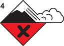
AVALANCHE WARNING
ISSUED ON DECEMBER 30 2018 at 5:00 a.m.
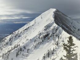
The Gallatin National Forest Avalanche Center is issuing a Backcountry Avalanche Warning for the Lionhead area near west Yellowstone, southern Gallatin Range, southern Madison Range and the Centennial Range. New snow and strong wind are forming unstable drifts on a weak snowpack. Up to a foot of snow has fallen with more expected today. The avalanche danger is rated HIGH on all slopes. Natural and human triggered avalanches are likely. Avalanche terrain and avalanche runout zones should be avoided.
This warning will either expire or be updated by 6:00 a.m. on December 31, 2018.
Since yesterday morning, 11” of low density snow fell at Lionhead Ridge near West Yellowstone and 3-6” fell elsewhere. Wind has been out of the west to southwest at 15-25 mph with gust of 40-50 mph. This morning, temperatures range from the single digits to mid-20s F. Today, a cold front will decrease temperatures into the teens and single digits F. Wind will be 30-40 mph and shift northwest this afternoon. By this evening, the mountains will get 6-10” of low density snow with over a foot possible near West Yellowstone and Cooke City.
Avalanche Warning
The mountains near West Yellowstone, the southern Gallatin Range and southern Madison Range have a weak and unstable snowpack. On Friday, we toured near Hebgen Lake and found two feet of unsupportive, sugary snow on the ground (video, photo). New snow and strong wind today will form unstable slabs on this weak snowpack. Natural and human triggered avalanches are likely. Large and dangerous avalanches can be triggered from flat terrain below steep slopes. Small, steep terrain can be especially deadly, like confined gullies where avalanches can pile debris many feet deep. Today, avalanche danger is rated HIGH on all slopes. Avoid all steep slopes and low angle terrain below (avalanche runout zones).

Since Friday, the mountains near Bozeman and Big Sky got 8-12” of low density snow equal to .4-.6” of snow water equivalent (SWE). Yesterday, strong wind drifted this snow into slabs that easily collapsed and cracked under the weight of skiers (photo). More snow and wind today will increase the size of these slabs and they remain easy to trigger. This new and wind-drifted snow will not add a lot of weight to a generally strong snowpack, and avalanches breaking deeper than the new snow are unlikely. Today, avalanches are easy to trigger on wind loaded slopes which have a CONSIDERABLE avalanche danger. On non-wind loaded slopes, avalanches of new snow are possible and avalanche danger is MODERATE.
The mountains near Cooke City got less snow than the rest of the area, but the snowpack has buried weak layers and more snow is expected today. A layer of facets 1-1.5’ below the surface is capable of producing avalanches. Doug found this layer last week (video, photo), and on Friday a snowmobiler triggered an avalanche that broke on this layer (photo). On slopes with less than three feet of snow, the snowpack is weak and sugary to the ground (video). Today, avalanches are easy to trigger where new snow is drifted into fresh slabs on this weak snowpack. Avoid travel on steep wind loaded slopes today, which have a CONSIDERABLE avalanche danger. On non-wind loaded slopes avalanches are possible to trigger and avalanche danger is MODERATE. Danger will rise to CONSIDERABLE on all slopes if snowfall is heavy today.
If you get out and have any avalanche or snowpack observations to share, contact us via our website, email (mtavalanche@gmail.com), phone (406-587-6984), or Instagram (#gnfacobs).
New webpage dedicated to the Centennial Range in Idaho and Montana
After last season's two snowmobiler avalanche fatalities on Reas Peak in the Centennial Range we created a webpage so riders could get good, relevant information regarding snowpack and avalanches. Although the Centennial Range is not part of the Gallatin National Forest Avalanche Center's forecast area, we are the closest avalanche center and have valuable information to share. More…
Upcoming Avalanche Education and Events
Our education calendar is full of awareness lectures and field courses. Check it out: Events and Education Calendar.
BOZEMAN
January 2, Avalanche Awareness, 6-7:30 p.m. at REI, Bozeman. Pre-register at https://www.rei.com/events.
January 8, Women’s Specific Avalanche Awareness, 6:30-8 p.m. Story Mill Park, Bozeman.
January 9, 1-hr Avalanche Awareness, 7-8 p.m. Spire Climbing Center, Bozeman.
January 16, 17 and 19 or 20, Intro to Avalanches w/ Field Day, Info and Register Here.
January 23, 24 and 26, Advanced Avalanche Workshop w/ Field Day, Info and Register Here.
WEST YELLOWSTONE
January 12 and 26, 1-hr Avalanche Awareness for Snowmobilers, 7-8 p.m. Holiday Inn West Yellowstone.
DILLON
January 22, 1-hr Avalanche Awareness, 6:30-7:30 p.m. U.M. Western Library.
BILLINGS
January 22, 1-hr Avalanche Awareness, 6-7 p.m. The Base Camp, Billings
COOKE CITY
Every Friday and Saturday, Rescue Training and Snowpack Update. Friday 6:30-7:30 p.m. at the Soda Butte Lodge. Saturday anytime between 10-2 @ Round Lake.
See Alex’s recent article about the Lift-accessed Backcountry of Saddle Peak. Be prepared with the necessary knowledge and skills before leaving the ski area into this complex and deadly terrain.